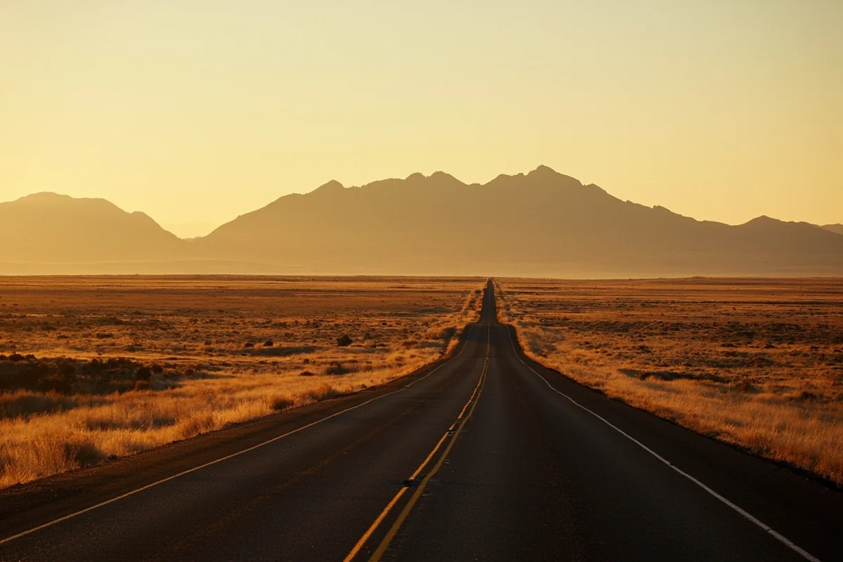
Last winter, I watched a rental car from California slide sideways down a hill in Whitefish because the driver didn’t know Montana gas stations sell tire chains—and that you actually need them.
That moment crystallized something I’ve learned over eight years of exploring this state: getting around Montana isn’t hard, but it does require a game plan most travel guides don’t give you.
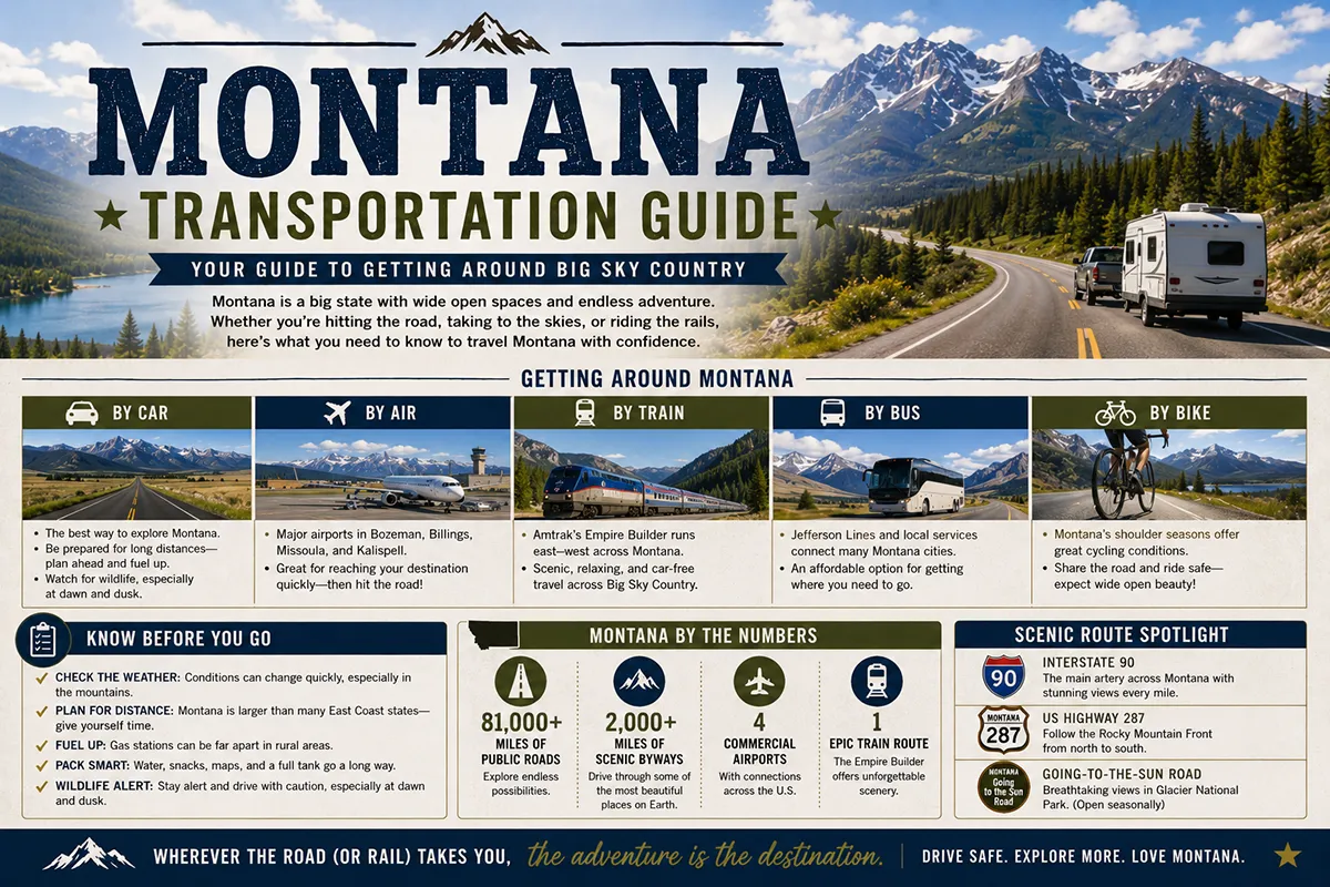
- Rent a car—period. Montana’s size and limited public transit make personal vehicles essential for 95% of visitors.
- Fly into Bozeman (BZN), Missoula (MSO), or Kalispell (FCA) depending on your destination; smaller airports often have better rental rates.
- Budget 30-50% more driving time than GPS estimates, especially in winter or construction season.
- Winter driving requires genuine preparation: AWD/4WD, chains, and checking road conditions before every drive.
- Glacier and Yellowstone parks have free shuttles that can save you parking headaches during peak season.
- Gas stations can be 60+ miles apart in eastern Montana—fill up religiously.
Understanding Montana’s Scale: Why Transportation Planning Matters
Here’s the number that changes everything about Montana trip planning: 147,040 square miles. That makes Montana larger than Germany, and it’s home to just over a million people—most of whom live in a handful of cities along the I-90 corridor.
During my first Montana road trip back in 2016, I casually planned to drive from Glacier National Park to Yellowstone “after lunch.”
Google Maps said 6 hours. What Google didn’t mention was that I’d want to stop every twenty minutes to photograph something stunning, that the two-lane highways require patience behind RVs, and that I’d lose an hour searching for coffee in a town whose only café closed at 2 PM.
That drive took me nine hours. It was one of the best days of my life, but I arrived at my Yellowstone cabin in pitch darkness, white-knuckling through the park’s wildlife-dense roads.
The lesson? Montana rewards those who embrace the journey rather than fight against it. But embracing the journey requires understanding your options.
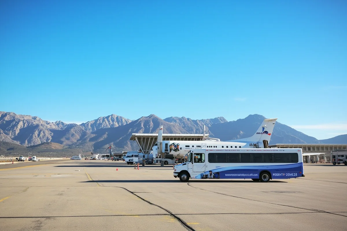
Flying Into Montana: Choosing the Right Airport
Montana has eight commercial airports, which sounds like a lot until you realize how far apart they are. Choosing the right one can save you hours of driving and hundreds of dollars.
Bozeman Yellowstone International (BZN)
This is Montana’s busiest airport, and for good reason. It serves both Yellowstone’s north entrance (90 miles south) and Big Sky Resort (45 miles south), making it the obvious choice for most visitors.
I fly through Bozeman several times a year. The airport expanded significantly in 2021, and while it handles crowds better now, summer Fridays can still mean 45-minute rental car lines.
My trick: book with Enterprise’s off-airport location and take their shuttle. It adds 10 minutes but often saves me half an hour.
Direct flights arrive from most major hubs: Denver, Seattle, Salt Lake City, Minneapolis, Dallas, Phoenix, and Los Angeles on Alaska, Delta, United, American, Southwest, and Allegiant.
Missoula Montana Airport (MSO)
Missoula is my personal favorite Montana airport. It’s smaller, calmer, and the rental car counters are literally 100 feet from baggage claim.
For accessing Glacier National Park’s west side, the Bitterroot Valley, or Flathead Lake, Missoula is often the smarter choice.
On a trip last fall, I compared prices and found Missoula rental cars running $40/day cheaper than Bozeman for the same vehicle class.
The airport also serves as a gateway to some of Montana’s most underrated areas: the Seeley-Swan valley, the wild Selway-Bitterroot wilderness, and the quirky college-town charm of Missoula itself.
Glacier Park International (FCA)
Located in Kalispell, this airport is your best bet for Glacier National Park’s west side and Whitefish Mountain Resort. It’s 30 minutes from the park entrance versus 4+ hours from Bozeman.
Fair warning: FCA has fewer flights and higher prices than Bozeman or Missoula. During my December ski trip, the only direct option from Seattle was a 6 AM departure.
Sometimes connecting through Denver to Bozeman and driving three hours north is genuinely easier—run the numbers both ways.
Other Regional Airports Worth Knowing
| Airport | Code | Best For | Notes |
|---|---|---|---|
| Helena Regional | HLN | State capital, Gates of the Mountains | Limited flights but very low-stress |
| Great Falls International | GTF | Glacier’s east side, Hi-Line region | Underrated gateway to less-crowded Glacier entrances |
| Billings Logan | BIL | Eastern Montana, Little Bighorn, Beartooth Highway | Montana’s largest city; good rental selection |
| Butte/Helena (Bert Mooney) | BTM | Southwest Montana, Anaconda-Pintler Wilderness | Tiny but can have surprisingly good United deals |
Renting a Car in Montana: What You Actually Need to Know
Let me be direct: you need a car in Montana. I’ve met travelers who planned to Uber around Bozeman or take buses to Yellowstone.
It doesn’t work. Uber exists only in Bozeman, Missoula, and sporadically in a few other towns. Bus service is minimal. Taxis outside airports are nearly nonexistent.
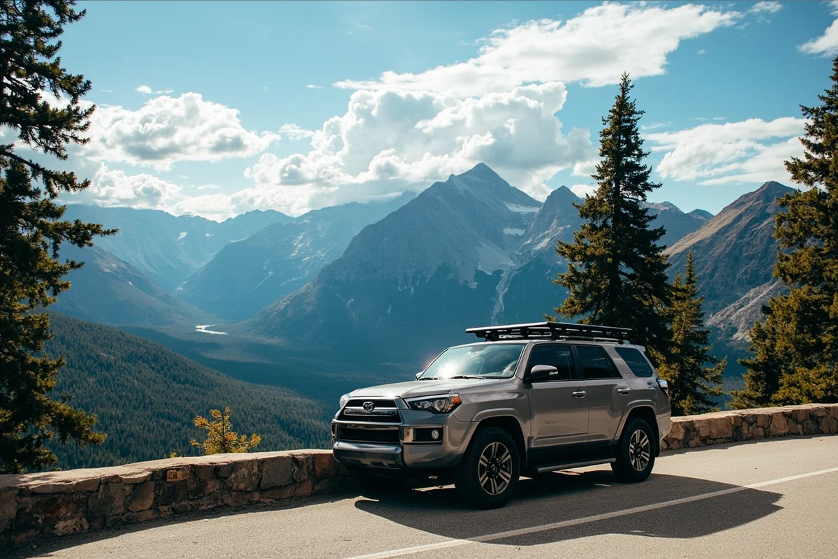
Vehicle Type Recommendations
For summer travel on paved roads, any vehicle works fine. I’ve taken a Nissan Versa through Glacier and Yellowstone without issues. The Going-to-the-Sun Road is paved. The Beartooth Highway is paved. Most scenic drives are paved.
However, I recommend AWD or 4WD if:
- You’re visiting between October and May (winter conditions are real and unpredictable)
- You plan to access trailheads on forest roads
- You want to explore the backcountry or visit guest ranches on unpaved roads
- You’re heading to Yellowstone’s Lamar Valley for wildlife viewing at dawn (the road gets icy)
Last summer, I rented a Jeep Wrangler specifically to access a remote hot spring near Anaconda. The forest road required high clearance and genuine 4WD capability. I could not have reached it in a sedan. Know your itinerary and plan accordingly.
Rental Car Costs and Tips
Montana rental prices swing wildly by season. Here’s what I’ve tracked over multiple trips:
- Peak summer (June-August): $80-150/day for a standard SUV
- Shoulder season (May, September): $50-90/day
- Winter (November-March): $35-60/day, except ski holidays
Book early—like, two months early for summer. Last July, a friend waited until two weeks before her trip and found exactly three vehicles available at Bozeman, all luxury SUVs over $200/day.
I always check Costco Travel, AutoSlash, and direct airline partnerships. Alaska Airlines’ Avis partnership has saved me 20% multiple times.
The Gas Station Reality
This is crucial, especially for visitors from densely populated states: gas stations in rural Montana can be 50, 60, even 80 miles apart. Eastern Montana along Highway 200 is particularly sparse.
My rule: never pass a gas station with less than half a tank. On a trip through the Hi-Line (Highway 2 across northern Montana), I miscalculated once and spent an anxious 40 miles watching my gauge drop toward empty. I made it, barely. Don’t be me.
Gas prices in Montana are generally reasonable—usually below the national average. But remote stations charge premiums. Expect to pay $0.30-0.50 more per gallon in small towns versus cities.
Driving Montana’s Major Routes
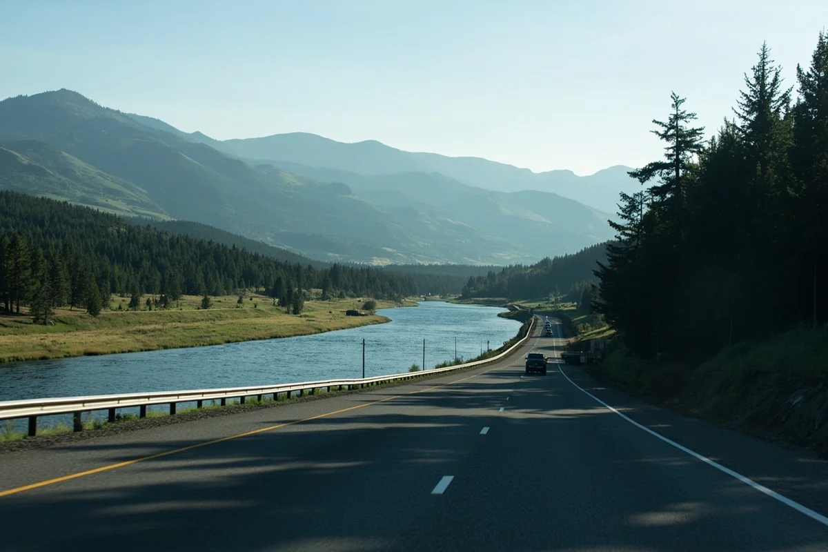
Interstate 90: The East-West Lifeline
I-90 crosses southern Montana from Idaho to Wyoming, connecting Missoula, Butte, Bozeman, Livingston, and Billings. It’s the fastest way across the state, but “fast” is relative—Missoula to Billings is still 340 miles and nearly 5 hours.
The stretch between Butte and Bozeman includes the Continental Divide and some stunning scenery you’ll miss if you’re racing through. I always stop at the rest area near Pipestone just to breathe in the mountain air.
Interstate 15: North-South Corridor
I-15 runs from the Canadian border through Great Falls, Helena, and Butte before continuing into Idaho. It’s essential for reaching Helena and Great Falls, and it provides access to Glacier’s less-crowded east side via Highway 89.
Highway 93: The Scenic Alternative
When I have time, Highway 93 is my preferred north-south route. It runs through the Bitterroot Valley, past Flathead Lake, and into Whitefish and the Glacier area. The views are spectacular, and the small towns—Hamilton, Stevensville, Polson—offer far more character than interstate pit stops.
Highway 2: The Hi-Line Adventure
Highway 2 follows the old Great Northern Railway route across Montana’s northern tier. I drove it last spring and fell in love with its stark, lonely beauty. This is big sky country at its most extreme—endless wheat fields, distant buttes, and genuine frontier towns.
Plan for minimal services. Between Havre and Malta, there’s essentially nothing for 100 miles. Pack snacks, full water bottles, and a genuine sense of adventure.
Winter Driving: Serious Considerations
I won’t sugarcoat this: winter driving in Montana requires respect and preparation. I’ve seen visitors from Arizona and California genuinely terrified on roads that Montanans consider routine.
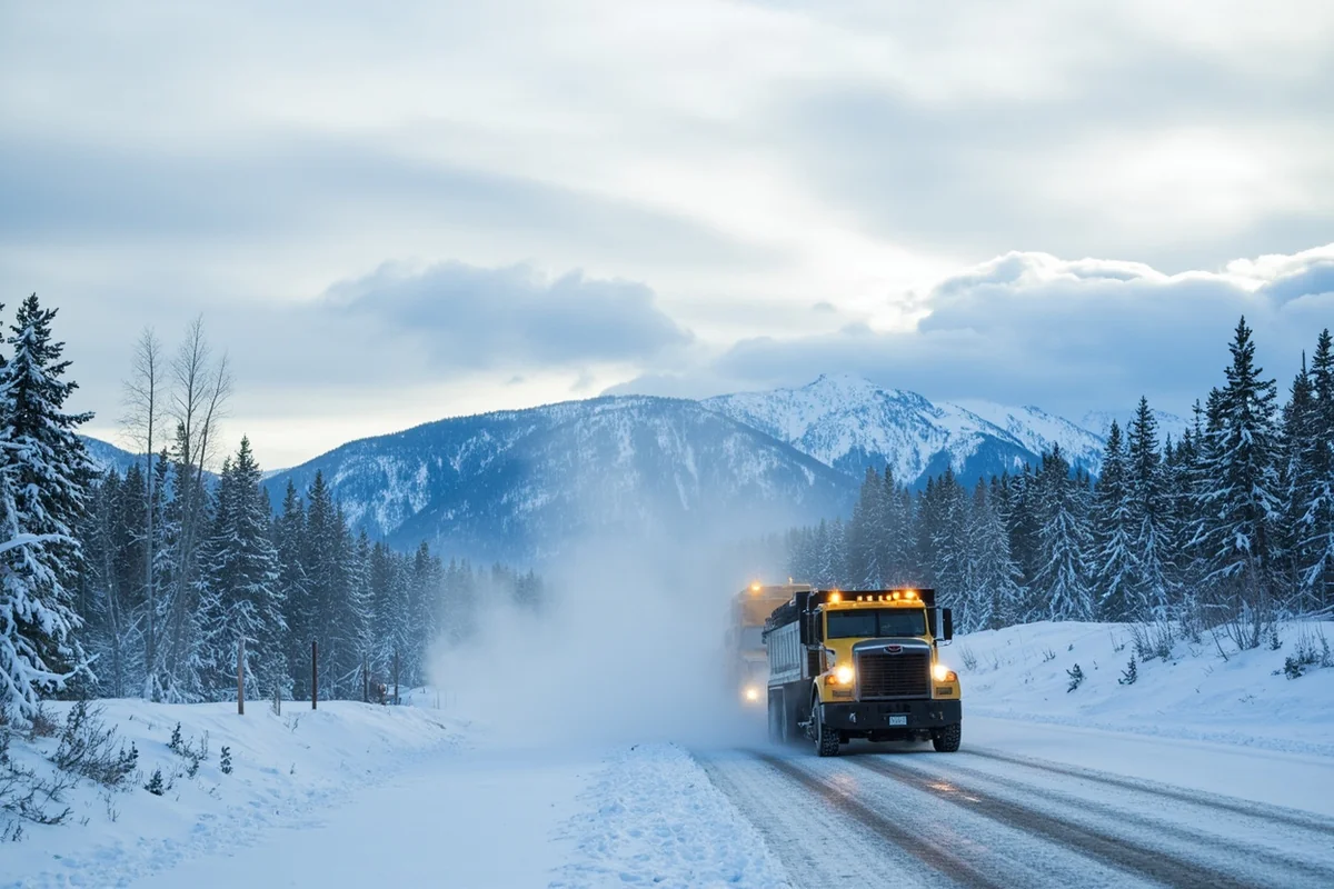
Essential Winter Preparations
- AWD/4WD vehicle: Not optional from November through April in most of the state
- Tire chains: Required for some mountain passes; available at gas stations and hardware stores
- Emergency kit: Blankets, snacks, water, flashlight, phone charger, small shovel
- Full tank of gas: If you slide off the road, you need to keep the engine running for heat
- Check conditions before every drive: Montana 511 (511mt.net or call 511) provides real-time road conditions
Mountain Passes to Watch
Several passes close regularly in winter due to avalanche danger or extreme conditions:
- Going-to-the-Sun Road (Glacier): Closed mid-October through late June typically
- Beartooth Highway: Closed mid-October through late May
- Lolo Pass (Highway 12): Open but treacherous in storms
- MacDonald Pass (Highway 12 near Helena): Open but often icy
During my February trip to Big Sky, I hit a sudden whiteout on Highway 191 through Gallatin Canyon. Visibility dropped to maybe 20 feet. I pulled over and waited 45 minutes for conditions to improve. That patience probably saved my life.
Black Ice Reality Check
Montana roads can be bone-dry and clear, then suddenly coated in invisible black ice around the next bend. Shaded curves, bridges, and areas near rivers are especially dangerous. I drive significantly slower than posted limits during winter, and I’ve never regretted it.
Public Transportation Options (Limited but Existing)
Public transit in Montana is sparse, but some options exist for visitors willing to plan carefully.
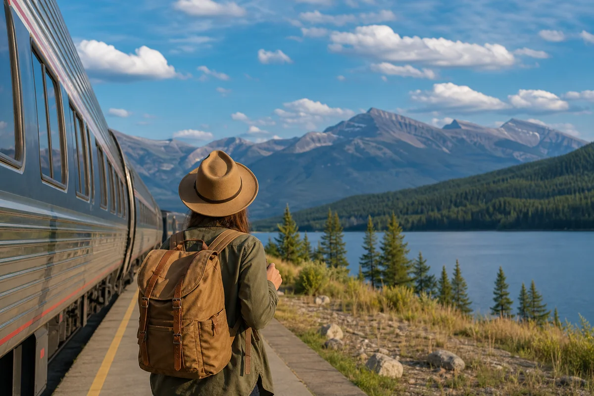
Amtrak’s Empire Builder
Amtrak’s Empire Builder route crosses northern Montana with stops in Whitefish, West Glacier, Essex, East Glacier, Browning, Cut Bank, Shelby, Havre, Malta, Glasgow, and Wolf Point.
I took this train from Seattle to Whitefish last October. The journey was genuinely magical—watching Montana’s landscape unfold through the observation car, meeting fellow travelers, and arriving rested instead of road-weary.
The catch: one train daily in each direction, often arriving at inconvenient hours (Whitefish’s eastbound departure is around 7:30 AM, westbound around 9:30 PM). You’ll still need ground transportation at your destination.
Greyhound and Jefferson Lines
Limited bus service exists along the I-90 corridor, connecting Montana cities to Spokane, Minneapolis, and other regional hubs. It’s functional but slow—Missoula to Billings takes about 9 hours by bus versus 5 by car.
Local Transit in Major Cities
- Missoula: Mountain Line buses (free!) cover the city reasonably well
- Bozeman: Streamline provides free service around Bozeman and to Big Sky
- Billings: MET Transit covers city routes
National Park Transportation

Glacier National Park Shuttles
Glacier operates a free shuttle system along Going-to-the-Sun Road from early July through early September. I cannot overstate how useful this is.
Last summer, I arrived at Apgar Visitor Center at 7 AM, took the shuttle to Logan Pass, hiked the Highline Trail, and caught another shuttle back. Zero parking stress, zero backtracking with my car, and I got to enjoy the scenery instead of watching the road.
The shuttles run every 15-30 minutes between major stops. Download the app or check the schedule boards—timing does require attention.
Yellowstone Options
Yellowstone doesn’t have a park-operated shuttle, but several private companies offer tours from gateway communities:
- Yellowstone Forever: Educational guided tours
- Various outfitters from West Yellowstone, Gardiner, and Cooke City: Full-day and half-day tours
- Karst Stage: Shuttle service from Bozeman to West Yellowstone and Mammoth
For most visitors, a personal vehicle remains the best way to explore Yellowstone at your own pace. But if winter driving intimidates you, guided snowcoach tours (December-March) offer incredible park access without the stress.
Getting to and Around Ski Resorts
Montana’s major ski areas all offer some form of shuttle service, which can simplify winter travel significantly.
Big Sky Resort
The Skyline bus provides free service from Bozeman to Big Sky multiple times daily during ski season. I’ve used it several times—it eliminates the Gallatin Canyon drive, which can be genuinely hairy in bad weather.
Whitefish Mountain Resort
The SNOW Bus runs between downtown Whitefish and the mountain for $5. It’s convenient, reliable, and means you can enjoy après-ski beers without worrying about driving.
Bridger Bowl
Free Streamline buses connect Bozeman to Bridger Bowl during ski season. Local knowledge that many visitors miss entirely.
Practical Tips I’ve Learned the Hard Way
Time Estimates Are Suggestions
Google Maps doesn’t account for Montana’s reality. Add 30-50% to any drive time for:
- Wildlife stops (you’ll see bison, deer, elk, maybe bears)
- Photo opportunities (Montana is obscenely photogenic)
- Slow vehicles on two-lane highways (RVs and farm equipment are common)
- Construction season (May-October; every major road seems affected)
Cell Service Is Not Universal
Large portions of Montana have no cell coverage. Download offline maps before you leave. Tell someone your itinerary. Don’t rely on phone navigation in remote areas.
Wildlife on Roads Is Real
I’ve had close calls with deer, elk, and once a moose that emerged from the trees like a hallucination. Dawn and dusk are highest risk. Drive slowly, stay alert, and understand that hitting a moose can total your car—and you.
Road Conditions Change Fast
A sunny morning in Bozeman doesn’t mean anything about conditions at Homestake Pass an hour later. Check road cameras on 511mt.net before mountain drives, especially in shoulder seasons.
Sample Transportation Itineraries
Week in Glacier (Flying into Kalispell)
- Rent a car at FCA airport
- Drive to Whitefish (15 minutes) or West Glacier (30 minutes)
- Use park shuttles for Going-to-the-Sun Road exploration
- Drive to Many Glacier for east-side hiking (2.5 hours from West Glacier via Highway 2)
- Consider one car-free day using shuttles exclusively
Yellowstone and Bozeman Loop (Flying into Bozeman)
- Rent AWD vehicle at BZN
- Day 1-2: Explore Bozeman area, Museum of the Rockies, Gallatin Valley
- Day 3-5: Drive to Yellowstone north entrance via Paradise Valley (1.5 hours); base in Gardiner or park lodges
- Day 6: Return via West Yellowstone and Hebgen Lake (scenic loop)
- Day 7: Buffer day for weather delays or bonus activities
Big Picture Montana Road Trip (One-way rental, 10-14 days)
- Fly into Bozeman, out of Kalispell (or reverse)
- Bozeman → Livingston → Paradise Valley → Yellowstone (3 nights)
- Yellowstone → Beartooth Highway (if open) → Red Lodge → Billings
- Billings → Great Falls via Highway 87 (Lewis & Clark territory)
- Great Falls → Glacier east side → Going-to-the-Sun Road → Whitefish
- Total driving: approximately 900 miles over 10-14 days

Final Thoughts on Getting Around Montana
Transportation in Montana comes down to one core truth: the state rewards flexibility, patience, and preparation. The distances are real. The conditions can be challenging. The infrastructure is limited compared to more populated states.
But here’s what I’ve discovered over dozens of Montana trips: the act of getting around becomes part of the experience. That long drive through the Gallatin Canyon? It’s where I spotted my first wild wolf. The slow two-lane highway across the Hi-Line? It’s where I found a tiny café in Malta that made the best pie I’ve ever tasted.
Rent a reliable car. Check conditions before you drive. Build buffer time into every day. And let yourself fall in love with the journey as much as the destination.
Montana’s not trying to be convenient. It’s trying to be itself—wild, vast, and deeply beautiful. Meet it where it is, and it will give you everything.
Frequently Asked Questions
Do I need a car to get around Montana?
Yes, I highly recommend renting a car to explore Montana, as public transportation is extremely limited outside of a few urban areas. The state covers over 147,000 square miles with attractions spread far apart—Glacier National Park to Yellowstone alone is about 340 miles. Having your own vehicle gives you the flexibility to explore scenic byways, small towns, and trailheads at your own pace.
How much does it cost to rent a car in Montana?
Car rentals in Montana typically range from $50-$100 per day for a standard vehicle, though prices spike during peak summer months (June-August) when demand is highest. I suggest booking at least 2-3 months in advance for summer trips to secure better rates. For winter travel or accessing remote areas, budget an extra $20-$40 daily for an SUV or 4WD vehicle.
What are the best airports to fly into for visiting Montana?
The most convenient airports depend on your destination: Bozeman Yellowstone International (BZN) is ideal for Yellowstone access, while Glacier Park International (FCA) in Kalispell serves Glacier National Park visitors. Missoula and Billings also offer regional airports with decent flight options. I’ve found that comparing fares across all four airports can save you $100 or more, especially if you’re flexible on your starting point.
Is there public transportation between Montana’s national parks?
There’s no direct public transit connecting Glacier and Yellowstone National Parks, which are roughly 340 miles apart. However, Glacier does offer a free shuttle system within the park during summer months, and Yellowstone has limited shuttle services in some areas. For travel between parks or major towns, you’ll need to rent a car, join a guided tour, or use services like Groome Transportation for airport connections.
How long does it take to drive across Montana?
Driving across Montana on Interstate 90 from the eastern border to Missoula takes approximately 9-10 hours covering about 550 miles without stops. The northern route along Highway 2 is more scenic but adds several hours to your journey. I always recommend breaking up long Montana drives with overnight stops, as wildlife on roads and driver fatigue are real concerns, especially at dawn and dusk.
What should I know about driving in Montana during winter?
Winter driving in Montana requires serious preparation—I always pack an emergency kit with blankets, snacks, a flashlight, and a phone charger. Mountain passes like Lookout Pass and Bozeman Pass frequently close during storms, so check the Montana Department of Transportation road conditions at 511mt.net before heading out. Snow tires or chains are essential from October through April, and many rental companies offer winter-equipped vehicles for an additional fee.
Are there Uber or Lyft services available in Montana cities?
Uber and Lyft operate in larger Montana cities like Bozeman, Missoula, and Billings, but availability is inconsistent and wait times can be long, especially late at night. In smaller towns and near national park gateways like Whitefish or West Yellowstone, rideshare options are nearly nonexistent. I recommend having a backup plan like local taxi services or pre-arranged hotel shuttles if you’re not renting a car.
Sources