I was standing waist-deep in the crystal-clear waters of the Flathead River last August when a fellow traveler from California asked me the question I’ve heard dozens of times: “Wait, Montana doesn’t have an ocean?” She’d been so captivated by the endless blue of Flathead Lake that she genuinely wondered if we were near the coast.
That moment perfectly captures why understanding where Montana is located matters so much for trip planning—and why the answer to whether Montana is landlocked reveals far more than simple geography.
- Montana is 100% landlocked—no ocean coastline whatsoever
- Despite this, Montana has over 3,000 named lakes and 170,000+ miles of rivers and streams
- Flathead Lake is the largest natural freshwater lake west of the Mississippi
- The state offers world-class fishing, kayaking, whitewater rafting, and swimming
- Montana’s waters drain into three different oceans via the Continental Divide
- You won’t miss the ocean—I promise
The Simple Answer: Yes, Montana is Completely Landlocked
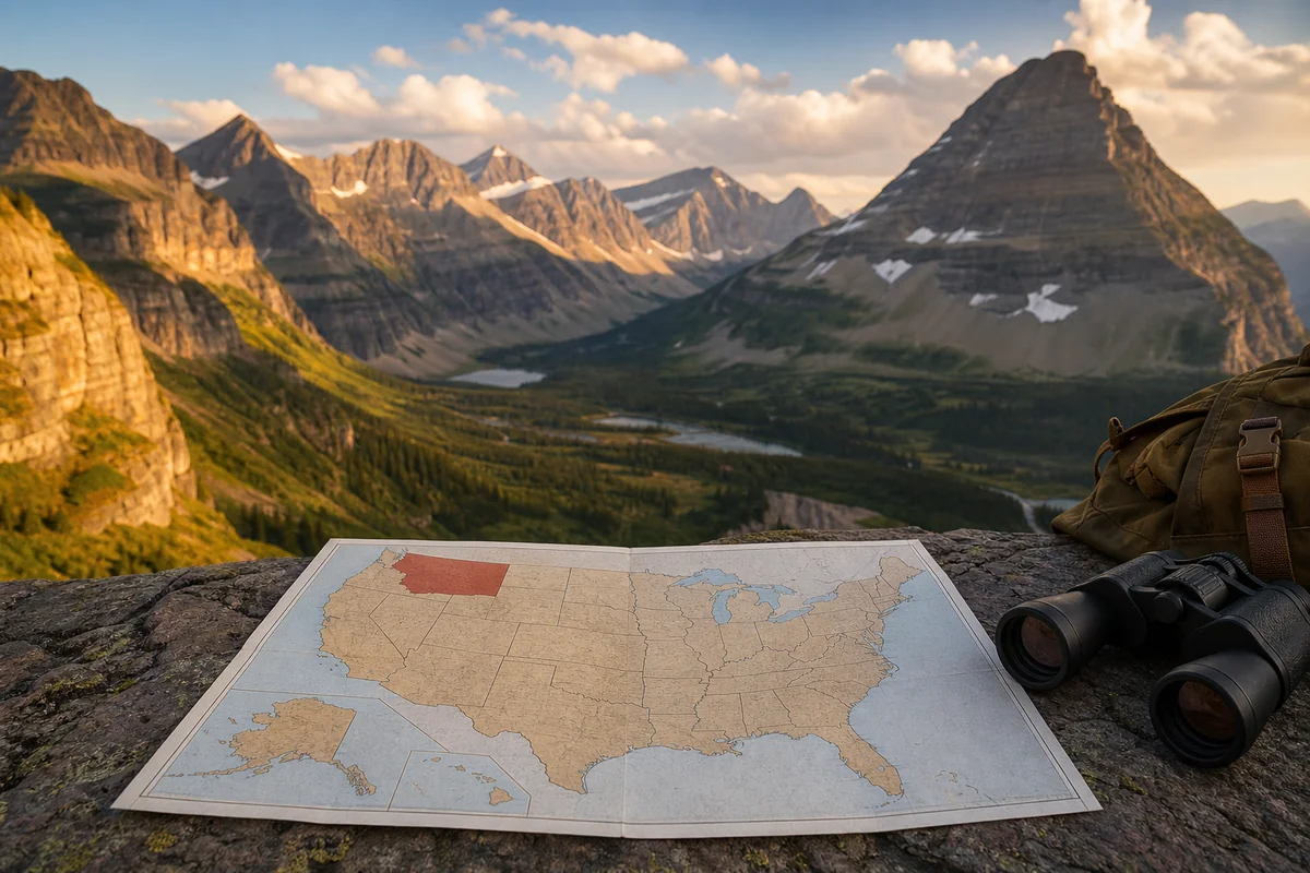
Let me be direct with you: Montana has zero miles of ocean coastline. The state sits firmly in the interior of North America, separated from the Pacific Ocean by Idaho, Washington, and Oregon to the west.
To the east, you’d need to cross the Dakotas, Minnesota, and several more states before reaching the Atlantic. The Gulf of Mexico? That’s a solid 1,500+ miles south through Wyoming, Colorado, and Texas.
When I first moved to Montana from coastal Maine eight years ago, I thought I’d desperately miss the ocean. I was wrong—spectacularly wrong.
Understanding Montana’s Geographic Position
Montana occupies a fascinating position in the American landscape. It’s the fourth-largest state by area, covering 147,040 square miles, yet it shares no borders with any body of saltwater.
The state is bordered by seven neighboring states and provinces: North Dakota, South Dakota, Wyoming, Idaho, and three Canadian provinces—British Columbia, Alberta, and Saskatchewan. If you’re curious about Montana’s relationship with the Canadian border, that northern boundary stretches for 545 miles.
This landlocked position places Montana firmly in what geographers call the Northern Rocky Mountain region. Some people mistakenly assume Montana is part of the West Coast, but that’s geographically impossible given our position.
Why Being Landlocked Doesn’t Mean Water-Deprived
Here’s what surprises most visitors: Montana might be landlocked, but it’s absolutely drowning in freshwater opportunities. During my years exploring this state, I’ve discovered water experiences that rival anything I enjoyed on the coast.
The numbers speak for themselves. Montana contains over 3,000 named lakes and reservoirs. The state claims more than 170,000 miles of rivers and streams—enough to wrap around the Earth nearly seven times.
When I take friends rafting on the Gallatin River near Bozeman or fishing on the Missouri below Holter Dam, they always say the same thing: “This doesn’t feel landlocked at all.”
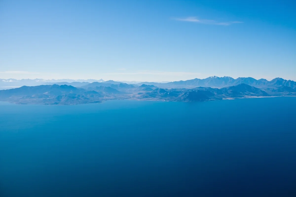
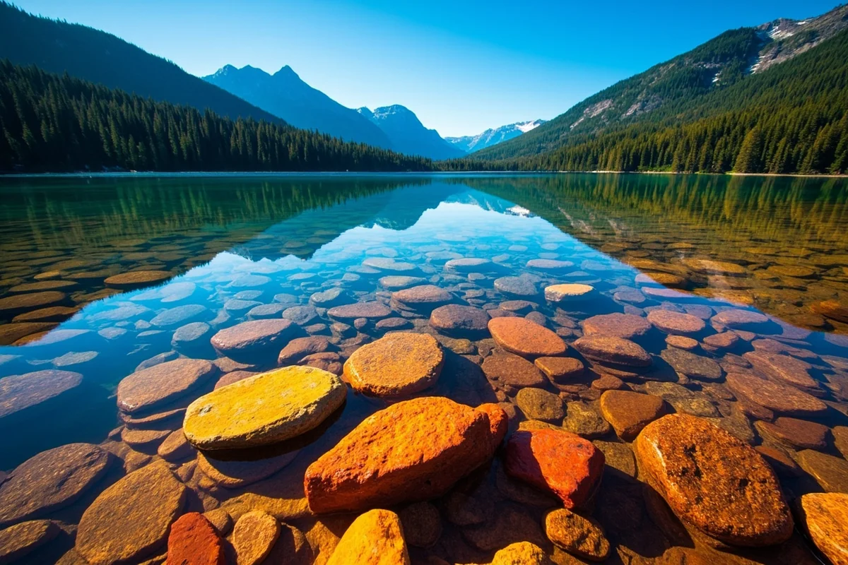
Flathead Lake: Montana’s Freshwater Ocean
If you want to understand why landlocked Montana doesn’t feel landlocked, you need to visit Flathead Lake. I’ve spent countless summer days on its shores, and it genuinely feels like a small ocean.
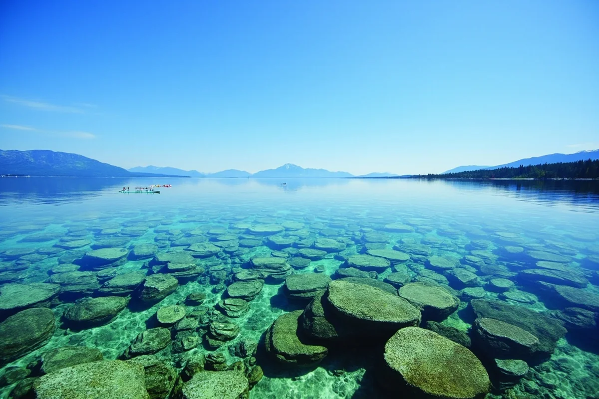
Flathead Lake covers nearly 200 square miles and reaches depths of 370 feet. It’s the largest natural freshwater lake west of the Mississippi River—a fact that shocks most visitors.
The water clarity here rivals Caribbean destinations. On my last visit in July, I could see the rocky bottom 30 feet below my kayak. The lake maintains this clarity because it’s fed primarily by glacial streams and snowmelt from the surrounding Mission Mountains.
What You Can Do at Flathead Lake
I’ve personally experienced nearly every water activity Flathead Lake offers, and here’s my honest assessment:
Swimming is exceptional from June through August. The water temperature typically reaches 68-72°F by mid-July—cold enough to be refreshing but warm enough for extended swims. Wayfarers State Park on the west shore has my favorite beach.
Kayaking and paddleboarding are perfect here because the lake often stays glassy calm in the morning hours. I recommend launching from Somers Bay before 10 AM to catch the best conditions.
Sailing attracts enthusiasts from across the Northwest. The afternoon thermals create consistent winds that experienced sailors love.
Fishing for lake trout, yellow perch, and whitefish keeps anglers busy year-round. Wild Horse Island, accessible only by boat, offers incredible opportunities.
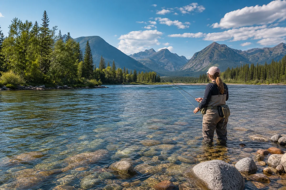
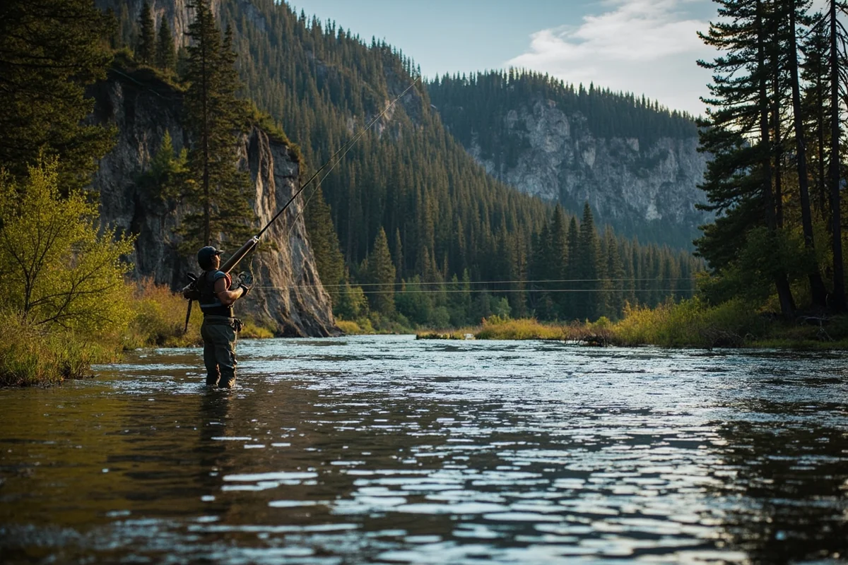
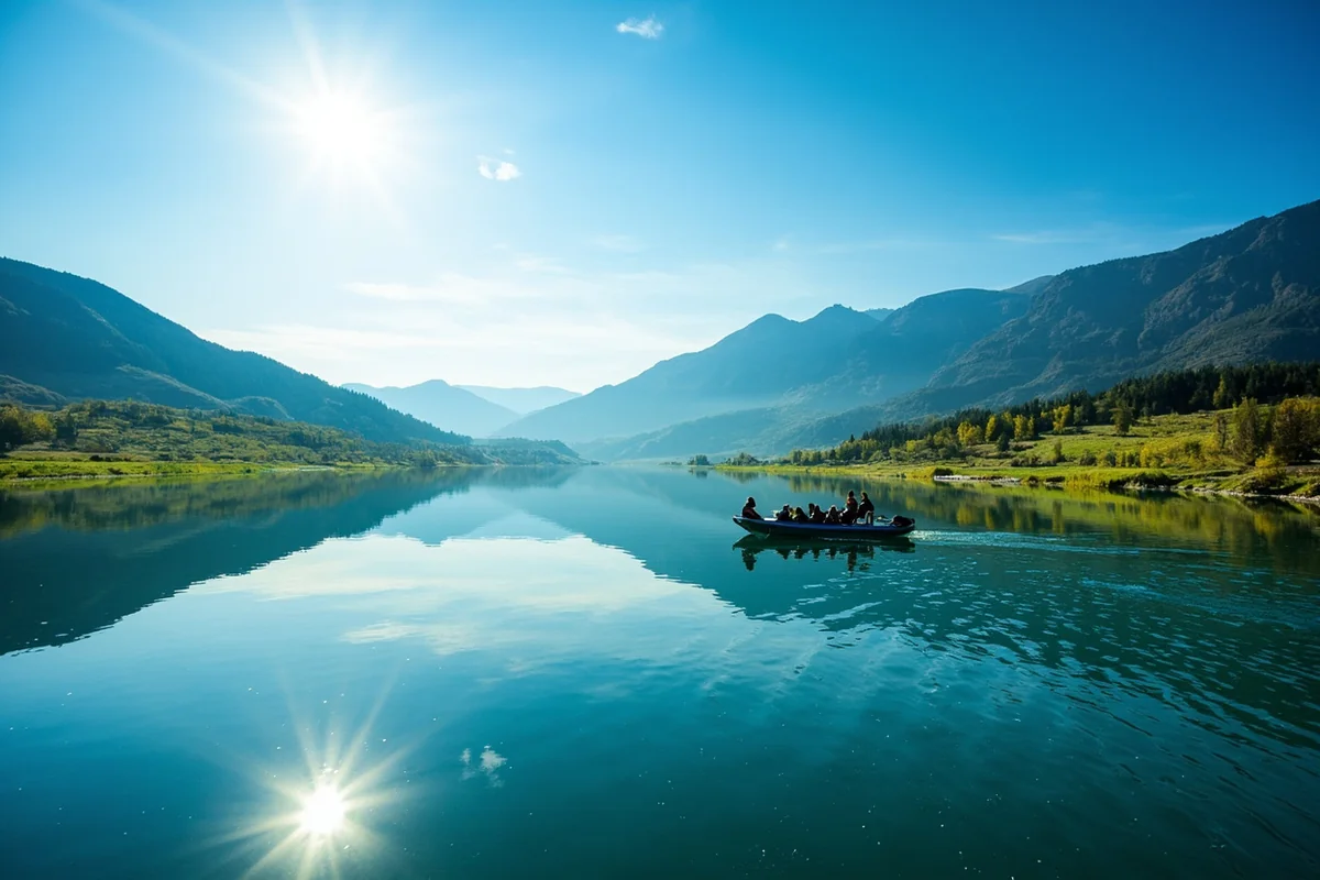
Montana’s World-Famous Rivers
Being landlocked has a hidden advantage: Montana’s rivers are the lifeblood of the American fishing and rafting scenes. Three of the country’s most legendary trout rivers flow through this state.
The Missouri River
The Missouri begins at Three Forks, Montana, where the Jefferson, Madison, and Gallatin rivers converge. I’ve floated this stretch at least twenty times, and it never gets old.
Below Holter Dam, the Missouri transforms into one of the world’s premier trout fisheries. The cold, nutrient-rich water released from the dam creates ideal conditions for rainbow and brown trout.
During my trip last September, I landed a 22-inch brown trout just below Craig—my personal best on that river. The fall caddis hatch was in full swing, and the fish were aggressive.
The Yellowstone River
The Yellowstone is the longest undammed river in the lower 48 states. It flows 692 miles from Yellowstone National Park through Montana before joining the Missouri in North Dakota.
Paradise Valley, the stretch between Livingston and Gardiner, offers my favorite fishing on the planet. The river braids through cottonwood forests with the Absaroka Mountains as a backdrop.
I recommend floating this section with a guide your first time. Armstrong Spring Creek and DePuy Spring Creek nearby require reservations but offer technical dry-fly fishing that’s second to none.
The Blackfoot River
Norman Maclean made the Blackfoot famous in “A River Runs Through It,” and it lives up to the hype. I’ve waded this river countless times near Missoula, and the combination of scenery and fishing is unmatched.
The Blackfoot suffered environmental damage from mining decades ago but has made a remarkable recovery. Native westslope cutthroat trout now thrive in its headwaters.
The Continental Divide: Where Montana’s Waters Decide Their Fate
Montana’s landlocked position creates one of the most fascinating hydrological features in North America: Triple Divide Peak in Glacier National Park.
This single mountain peak is the only point in North America where waters divide toward three different oceans. Rain falling on Triple Divide flows to the Pacific Ocean, the Atlantic Ocean (via Hudson Bay), or the Gulf of Mexico.
When I hiked to Triple Divide Pass on a backpacking trip two summers ago, I spent an hour just contemplating this geographic wonder. Standing there, I realized that Montana’s landlocked status doesn’t isolate it from the world’s oceans—it connects the state to three of them.
The elevation changes across Montana drive this water flow. From peaks over 12,000 feet to valleys below 2,000 feet, gravity moves Montana’s water toward distant seas.
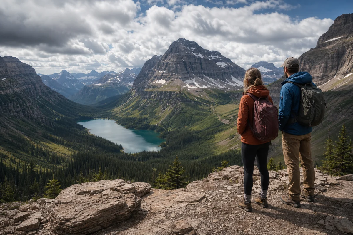
Glacier National Park: Landlocked Water Paradise
Glacier National Park deserves its own section because it contradicts every assumption people make about landlocked states.
The park contains 762 lakes larger than one acre and over 175 named peaks. Many lakes sit in glacially carved basins called cirques, creating the impossibly blue waters you’ve seen in photographs.
Lake McDonald
Lake McDonald is the largest lake in Glacier National Park, stretching 10 miles long and reaching 472 feet deep. The famous colorful rocks visible through the clear water have become an Instagram sensation.
I’ve rented kayaks from Apgar Village multiple times and paddled out into the lake’s center. On calm mornings, the reflection of the surrounding peaks creates a mirror image so perfect that you can’t tell which way is up.
Swimming is possible but bracing—the water rarely exceeds 55°F even in August. I’ve done it, and I recommend keeping it brief.
Two Medicine and Many Glacier
These areas offer boat tours on historic wooden launches dating back to the 1920s. The Two Medicine Lake tour includes a short hike to Twin Falls, which became one of my favorite experiences in the park.
Many Glacier’s Swiftcurrent Lake sits beneath the dramatic peaks of the Continental Divide. Red boat tours here are iconic, and the Grinnell Glacier hike from the boat dock is bucket-list worthy.
Understanding Montana’s Diverse Landscape
Montana’s landlocked geography creates remarkable diversity that ocean-adjacent states simply can’t match. The ecological diversity across Montana’s biomes ranges from alpine tundra to prairie grassland.
The western third of Montana features the Rocky Mountains, dense forests, and most of the state’s lakes and streams. This region receives significant precipitation—up to 100 inches of snow annually in the mountains.
The eastern two-thirds of Montana transitions into the Great Plains region. This isn’t waterless prairie, though. The Missouri River and its tributaries cut through the plains, and Fort Peck Lake (a massive reservoir) provides water recreation opportunities.
Some visitors ask if Montana is high desert, and while certain southwestern valleys have semi-arid characteristics, the state as a whole receives adequate precipitation.
Practical Water Activities for Visitors
Let me give you concrete recommendations based on my personal experiences throughout Montana’s waterways.
| Activity | Best Location | Best Season | Skill Level |
|---|---|---|---|
| Whitewater Rafting | Alberton Gorge, Clark Fork River | May-July | All levels (Class II-IV) |
| Fly Fishing | Missouri River below Craig | Year-round, peak July-October | Intermediate to Advanced |
| Lake Kayaking | Flathead Lake | June-September | Beginner to Intermediate |
| Swimming | Seeley Lake or Salmon Lake | July-August | All levels |
| Paddleboarding | Whitefish Lake | June-September | Beginner |
| Scenic Float | Smith River (permitted) | May-June | Intermediate |
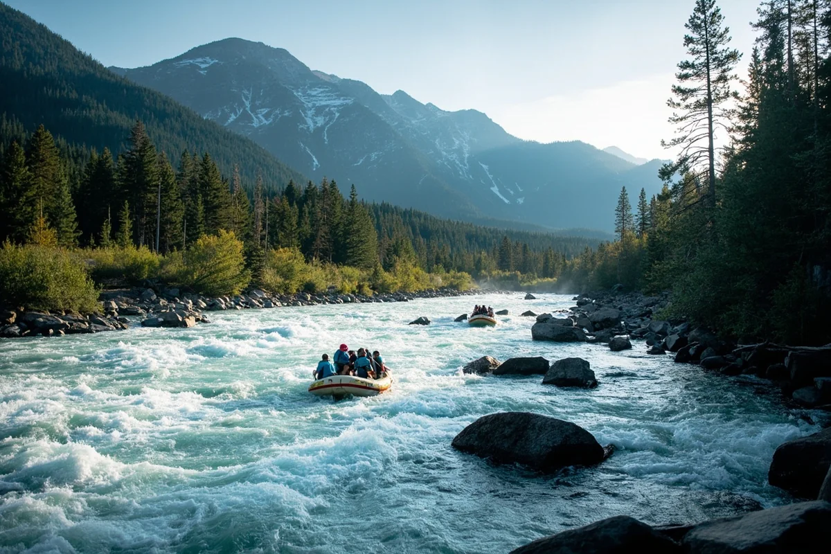
Whitewater Rafting Options
Montana offers world-class whitewater despite being nowhere near an ocean. I’ve rafted most of the major runs and can offer specific guidance.
The Alberton Gorge on the Clark Fork River west of Missoula provides the most accessible Class III whitewater in the state. Multiple outfitters run half-day and full-day trips from May through July when water levels are optimal.
The Gallatin River’s “Mad Mile” near Big Sky delivers consistent Class IV rapids that challenge experienced rafters. I recommend this only if you’re comfortable with aggressive whitewater.
For families, the lower Flathead River near Polson offers mellow Class II floats through gorgeous canyon scenery. I took my nephews here last summer, and they talked about it for months.
Hot Springs: Montana’s Geothermal Waters
Landlocked Montana compensates for its lack of ocean with abundant geothermal activity. Natural hot springs dot the western portion of the state, creating unique soaking experiences.
My Favorite Hot Springs
Chico Hot Springs near Pray has been operating since 1900. The historic lodge atmosphere combined with mountain views makes it my top recommendation. The outdoor pool stays at 96°F year-round.
Bozeman Hot Springs offers a more modern experience with multiple pools at varying temperatures. It’s convenient to Bozeman and less crowded on weekday mornings.
Norris Hot Springs south of Bozeman features a natural wooden pool with live music on weekends. I’ve spent several winter evenings soaking under the stars here while snow fell gently around the pool.
Quinn’s Hot Springs near Paradise combines excellent dining with natural soaking pools. The riverside setting is particularly beautiful in autumn.
Sleeping Buffalo Hot Springs near Malta proves that eastern Montana has geothermal features too. If you’re exploring the rural eastern portions of the state, this is worth a stop.
Winter Water Activities
Montana’s landlocked waters don’t disappear in winter—they transform. Ice fishing becomes a major activity from December through March across the state.
Ice Fishing Essentials
Canyon Ferry Lake near Helena is Montana’s most popular ice fishing destination. When I fished there last February, the ice reached 18 inches thick, and anglers dotted the frozen surface for miles.
Rainbow trout, perch, and walleye provide consistent action through the ice. Most anglers use small ice fishing shelters, and you’ll see everything from simple pop-up tents to elaborate heated huts.
If you’re new to ice fishing, I strongly recommend going with an experienced local or hiring a guide. Ice conditions vary dramatically, and safety should be your priority.
Fort Peck Reservoir in eastern Montana offers excellent walleye and northern pike ice fishing. The vast frozen expanse feels otherworldly—like fishing on another planet.
The Regional Context of Montana’s Landlocked Status
Understanding what type of region Montana truly is helps explain why being landlocked shapes the state’s character.
Montana sits at the intersection of multiple geographic regions. The Rocky Mountains define the western third, while the Great Plains dominate the east. Some geographers debate whether Montana belongs to the Midwest, but most classify it firmly in the Mountain West.
The question of whether Montana is part of the Northwest generates similar debate. Western Montana shares characteristics with the Pacific Northwest—dense forests, abundant precipitation, and a similar outdoor culture—but the lack of coastal access places it in a distinct category.
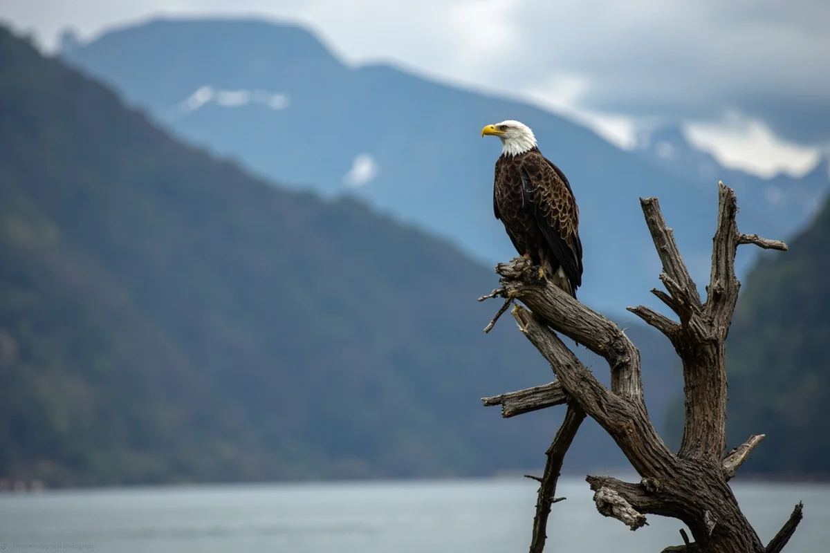
Wildlife You’ll Encounter on Montana Waters
Montana’s freshwater ecosystems support wildlife that rivals any coastal environment. During my time exploring the state’s waterways, I’ve had incredible wildlife encounters.
Bald eagles nest along nearly every major river and lake. On the Missouri River below Holter Dam, I’ve counted over 20 eagles on a single float trip during fall salmon spawning season.
Ospreys dive for trout throughout the summer months. Watching an osprey hit the water at full speed and emerge with a fish never gets old.
Moose frequent marshy areas and lakeshores, particularly in the Seeley-Swan Valley. I’ve encountered moose while kayaking multiple times—always from a respectful distance.
River otters play in streams across western Montana. Last spring, I watched a family of four otters fishing near Milltown State Park for nearly an hour.
Planning Your Montana Water Adventure
Based on my extensive experience, here’s how I’d structure a trip focused on Montana’s waterways.
If You Have Three Days
Fly into Missoula and spend your time exploring the Blackfoot River, Seeley Lake, and a day trip to Flathead Lake. This gives you river, small lake, and big lake experiences in a compact area.
If You Have One Week
Add Glacier National Park to the itinerary above. Spend at least two nights in the park to properly experience Lake McDonald, Many Glacier, and the boat tours.
If You Have Two Weeks
Now you can include the Missouri River, Yellowstone River, and potentially the Smith River (if you won the permit lottery or hire an outfitter with allocations). This comprehensive tour will convince you that being landlocked means nothing.
Essential Gear for Montana Waters
Montana’s freshwater requires specific preparation that differs from coastal destinations.
Water temperatures run cold year-round. Even in August, rivers fed by snowmelt rarely exceed 55-60°F. I always bring a wetsuit or drysuit for extended water activities, even in summer.
Sun protection matters more than you’d expect. The combination of high elevation, reflective water surfaces, and thin atmosphere creates intense UV exposure. I’ve gotten my worst sunburns while fishing Montana rivers.
Bug spray becomes essential near lakes and slow-moving water from June through August. Mosquitoes can be aggressive, particularly at dawn and dusk.
Wading boots with felt or rubber soles are necessary for river fishing. The rocks are slippery, and a fall in cold water can quickly become dangerous.
The Honest Truth About Being Landlocked
After eight years of exploring Montana’s waters, I can tell you with complete confidence: the landlocked label is technically accurate but practically meaningless.
I’ve kayaked in Maine, surfed in California, and sailed in the Florida Keys. Montana’s freshwater experiences hold their own against any of them.
The clarity of a glacial lake, the power of a free-flowing river, the peace of a backcountry fishing spot where you don’t see another person all day—these experiences don’t require an ocean.
Montana’s landlocked status simply means the salt is missing. Everything else that makes water destinations magical exists here in abundance.
When that California visitor asked me about Montana’s missing ocean last August, I smiled and handed her my spare fishing rod. Three hours later, after she’d landed her first wild trout and watched an osprey dive inches from our drift boat, she understood completely.
Montana doesn’t need an ocean. It has something better: waters so pure you can drink from them, rivers so wild they’ve never seen a dam, and lakes so clear you can see your future reflected in them.
Come see for yourself. Just don’t expect to miss the coast.
Frequently Asked Questions
Is Montana a landlocked state with no ocean access?
Yes, Montana is completely landlocked with no coastline or ocean access. The state is bordered by North Dakota, South Dakota, Wyoming, and Idaho, plus the Canadian provinces of British Columbia, Alberta, and Saskatchewan. Despite being landlocked, Montana offers over 3,000 miles of rivers and countless pristine mountain lakes for water activities.
What bodies of water can I visit in landlocked Montana?
While Montana lacks ocean beaches, you’ll find incredible freshwater destinations like Flathead Lake (the largest natural freshwater lake west of the Mississippi), Glacier National Park’s stunning alpine lakes, and the Missouri and Yellowstone Rivers. I’ve found these crystal-clear mountain lakes often rival any coastal destination for sheer beauty and recreation opportunities.
How far is Montana from the nearest ocean or beach?
From central Montana, the Pacific Ocean near Seattle is approximately 550-600 miles west, while the Gulf of Mexico is about 1,500 miles south. If you’re craving ocean access during your Montana trip, a scenic drive to the Washington or Oregon coast takes roughly 9-10 hours from Missoula.
What is the best time to visit Montana’s lakes and rivers?
The ideal time for water activities in Montana is June through August when temperatures reach 70-85°F and mountain lakes warm up enough for swimming. I recommend July for the best combination of warm weather, full river flows, and accessible high-alpine lakes that may still be frozen in early summer.
What water activities can I do in a landlocked state like Montana?
Montana offers world-class fly fishing on rivers like the Madison and Gallatin, whitewater rafting near Missoula, kayaking on Flathead Lake, and swimming at numerous state park beaches. Expect to pay $75-150 for guided fishing trips and $50-100 for half-day rafting excursions. Don’t forget to bring reef-safe sunscreen and quick-dry clothing.
Do I need to pack differently for landlocked Montana versus a coastal trip?
Absolutely—Montana’s high elevation and dry climate require different gear than coastal destinations. Pack layers since temperatures can swing 30-40 degrees in a single day, bring SPF 30+ sunscreen (UV rays are stronger at elevation), and include a quality water bottle since the dry air dehydrates you faster. I always recommend waterproof hiking boots over sandals for lake access since most shorelines are rocky.
Are there any beaches in Montana despite being landlocked?
Yes, Montana has several freshwater beaches perfect for summer relaxation. Flathead Lake features sandy shores at Wayfarers and Big Arm State Parks, while Whitefish Lake and Seeley Lake offer family-friendly beach areas with picnic facilities. Day-use fees typically run $6-8 per vehicle at state park beaches.