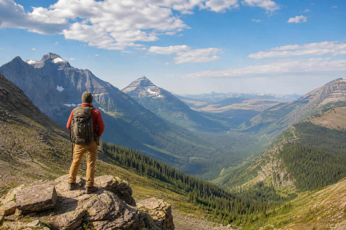
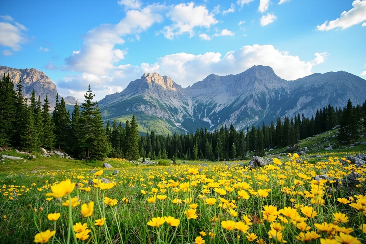
Standing at the summit of Granite Peak last August, gasping for breath at 12,799 feet while staring down at valleys nearly two miles below, I finally understood why Montana’s nickname “Big Sky Country” barely scratches the surface of this state’s vertical drama.
Most visitors arrive expecting mountains—and yes, they’re spectacular—but few anticipate the profound elevation differences that can take you from prairie flatlands at 1,800 feet to oxygen-thin alpine zones in just a few hours of driving.
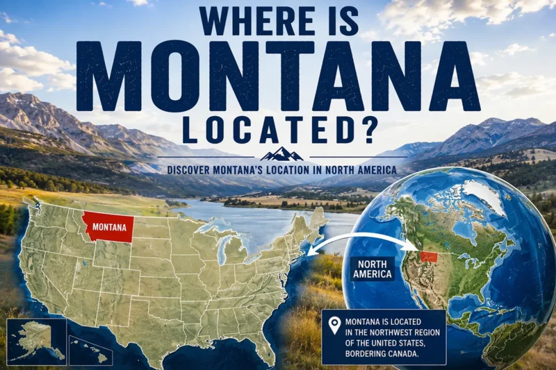
Understanding where Montana is located geographically helps explain why this state offers such an extraordinary range of elevations, spanning the transition zone between the Rocky Mountains and the Great Plains.
- Montana’s elevation ranges from 1,804 feet (Kootenai River) to 12,799 feet (Granite Peak)
- Average state elevation is 3,400 feet—higher than most visitors expect
- Major cities sit between 3,200-5,500 feet; altitude sickness can affect sensitive travelers
- Western Montana averages 2,000+ feet higher than eastern Montana
- Allow 24-48 hours for altitude adjustment before strenuous hiking
- Best time for high-elevation activities: July through mid-September
Understanding Montana’s Dramatic Elevation Profile
During my countless drives across Montana over the past decade, I’ve watched my car’s altimeter swing wildly—sometimes changing by 3,000 feet in under an hour. This isn’t a state you can summarize with a single elevation number.
Montana’s lowest point sits at 1,804 feet where the Kootenai River crosses into Idaho near Troy. The highest point, Granite Peak in the Beartooth Mountains, towers at 12,799 feet. That’s nearly an 11,000-foot difference within a single state’s borders.
The average elevation across Montana is approximately 3,400 feet above sea level. But averages can be deceiving here. The state essentially operates as two distinct elevation zones split roughly down the middle.
Western Montana: The Mountain Zone
When I first drove into Missoula from the east, climbing through the valleys, I was struck by how the elevation gradually builds. Western Montana averages between 4,000 and 6,000 feet in the valleys, with peaks regularly exceeding 9,000 feet.
The major mountain ranges here—the Bitterroots, Cabinet Mountains, Swan Range, and Mission Mountains—create a landscape where you’re constantly looking up. Valley floors in places like the Flathead Valley sit around 2,900 feet, which feels almost sea-level compared to surrounding terrain.
Glacier National Park, which I visit at least twice yearly, contains elevations ranging from about 3,150 feet at Lake McDonald to 10,466 feet at Mount Cleveland. This diversity means you can experience multiple climate zones in a single day hike.
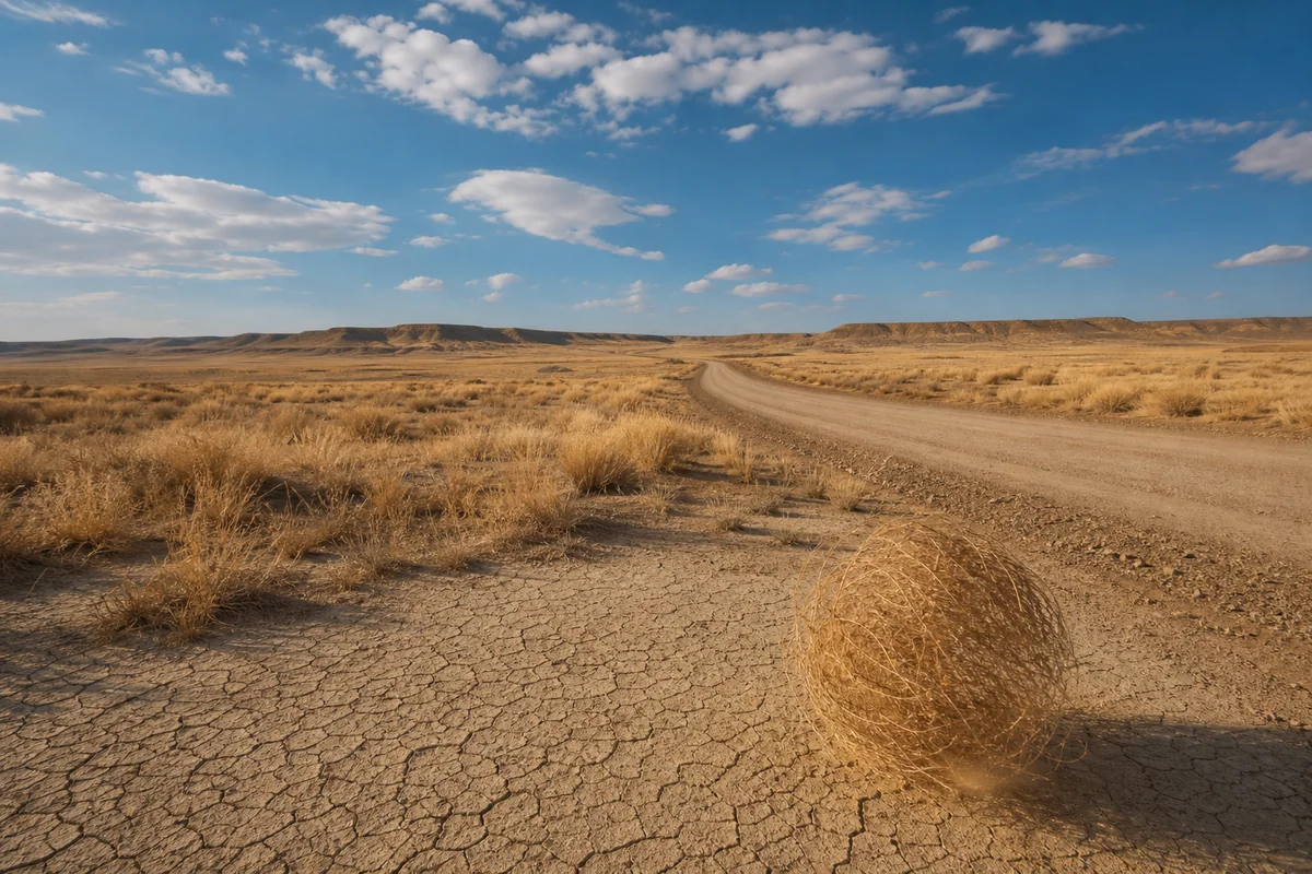
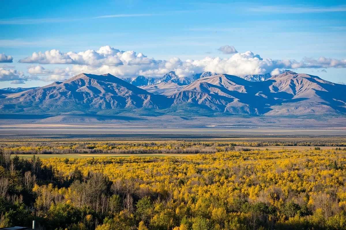
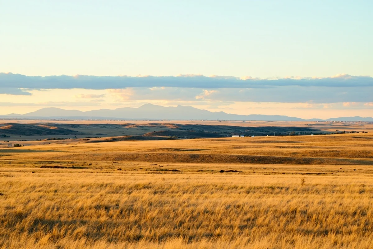
Eastern Montana: The High Plains
Cross the Continental Divide heading east, and the landscape transforms dramatically. Many travelers mistakenly assume eastern Montana sits at low elevation because it’s flat. They’re wrong.
Eastern Montana’s seemingly endless plains actually sit between 2,000 and 4,500 feet above sea level. When I drove through Miles City last summer, my altimeter read 2,369 feet—higher than Denver’s suburbs. If you’re curious about whether Montana belongs to the Great Plains, the answer reveals itself in these wide-open eastern landscapes.
The high plains gradually descend toward the state’s eastern border, where towns like Sidney sit at around 1,900 feet. But even here, isolated mountain ranges like the Bearpaws and Sweetgrass Hills punctuate the horizon, some peaks reaching over 6,000 feet.
City-by-City Elevation Breakdown
Knowing city elevations matters for practical planning—whether you’re managing altitude-sensitive health conditions or simply wondering why you’re more winded than usual on your morning jog.
| City | Elevation (feet) | Region |
|---|---|---|
| Butte | 5,538 | Southwest |
| Helena (Capital) | 4,047 | Southwest |
| Bozeman | 4,820 | Southwest |
| Missoula | 3,209 | Northwest |
| Great Falls | 3,330 | North Central |
| Billings | 3,123 | South Central |
| Kalispell | 2,956 | Northwest |
| Whitefish | 3,028 | Northwest |
| Havre | 2,494 | North Central |
| Miles City | 2,369 | Southeast |
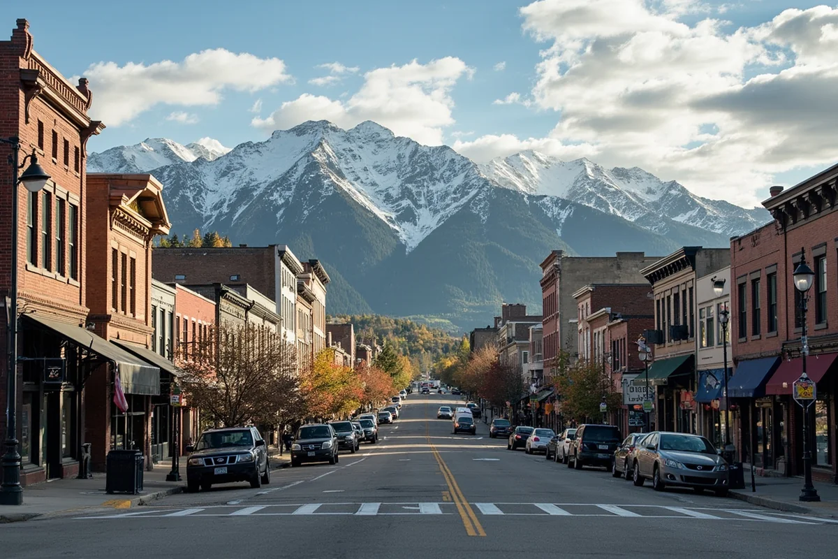
Butte stands as Montana’s highest city, and walking its streets, you feel it. During my winter visit there, I noticed my breathing was labored just climbing the stairs to breakfast at the M&M Cigar Store. Locals barely notice anymore, but visitors from coastal areas often comment on the thin air.
Missoula and Kalispell sit in the state’s lowest major valleys, making them comfortable transition points for altitude-sensitive travelers. I often recommend spending your first night in one of these lower-elevation cities before heading to higher terrain.
How Elevation Affects Your Montana Experience
I’ve guided friends from Florida and California through Montana, and the elevation consistently catches them off guard. Understanding how altitude impacts your body helps you plan a more enjoyable trip.
Physical Effects of Montana’s Elevation
At 5,000 feet, there’s roughly 17% less oxygen than at sea level. At 10,000 feet—where many popular hiking destinations sit—that drops to about 30% less oxygen. Your body notices.
During my first hiking season in Montana years ago, I made the rookie mistake of tackling a 12-mile trail at 8,500 feet the day after flying in from the East Coast. I bonked hard at mile six, dizzy and nauseated. Now I know better.
Common altitude effects I’ve experienced and witnessed include:
- Shortness of breath during mild exertion
- Faster heart rate than normal
- Mild headaches, especially at night
- Disrupted sleep patterns
- Increased urination (your body adjusting fluid levels)
- Decreased appetite initially
Most healthy adults adjust within 24-48 hours at moderate elevations (under 6,000 feet). But if you’re planning high-elevation activities, give yourself more time.
Altitude Sickness: What to Watch For
Acute Mountain Sickness (AMS) typically doesn’t become a serious concern until above 8,000 feet, but I’ve seen sensitive individuals struggle at lower elevations. Risk factors include rapid ascent, dehydration, alcohol consumption, and poor cardiovascular fitness.
Warning signs beyond normal adjustment include:
- Severe, persistent headache
- Extreme fatigue and weakness
- Nausea and vomiting
- Difficulty sleeping despite exhaustion
- Loss of coordination
If these symptoms appear, the solution is straightforward: descend. On a trek to Iceberg Lake in Glacier National Park two summers ago, I watched rangers assist a visitor showing early AMS symptoms back down the trail. Within an hour at lower elevation, she felt dramatically better.
Montana’s Major Elevation Zones Explained
Montana’s diverse biomes and ecological zones directly correspond to elevation bands. Understanding these helps you know what to expect in different areas.
Low Valleys and River Bottoms (1,800-3,500 feet)
The lowest elevations in Montana follow river corridors—the Kootenai, Clark Fork, Flathead, and Yellowstone rivers. These areas feature the mildest climates, longest growing seasons, and most comfortable conditions for altitude-sensitive visitors.
When I’m showing Montana to first-time visitors, I usually start in these zones. The Flathead Valley around Kalispell and Whitefish, the Missoula area, and the Yellowstone Valley near Billings all offer this gentler introduction.
Temperatures here can actually get quite hot in summer—Missoula regularly hits 95°F in July and August. These valleys also tend to experience temperature inversions in winter, trapping cold air and fog.
Mountain Valleys and Foothills (3,500-5,500 feet)
This zone encompasses most of Montana’s towns and cities, including Bozeman, Helena, and Butte. The landscape mixes open grasslands with scattered forests, and the air starts feeling noticeably thinner to visitors.
Bozeman sits at the sweet spot in this range at 4,820 feet. The town has exploded in popularity, and during my frequent visits, I’ve noticed sea-level residents often underestimate how the elevation affects their first few days. That run along Peets Hill that looks easy? It’s not.
This elevation band features significant temperature swings. I’ve experienced 40-degree differences between morning lows and afternoon highs during September visits to Helena. Layer your clothing.
Montane Forest Zone (5,500-8,500 feet)
Driving up into Montana’s mountain forests, you enter a world of lodgepole pine, Douglas fir, and stunning meadows. Most ski resorts’ base areas sit in this zone, as do many campgrounds and trailheads.
Big Sky Resort’s base village sits at 7,500 feet, while Whitefish Mountain Resort starts around 4,817 feet at the base. That 2,700-foot difference dramatically affects snow conditions and your body’s response to activity.
I remember my first ski day at Big Sky after a red-eye flight. By noon, I was completely exhausted—not from the skiing, but from the altitude. Now I always arrive a day early and stay hydrated.
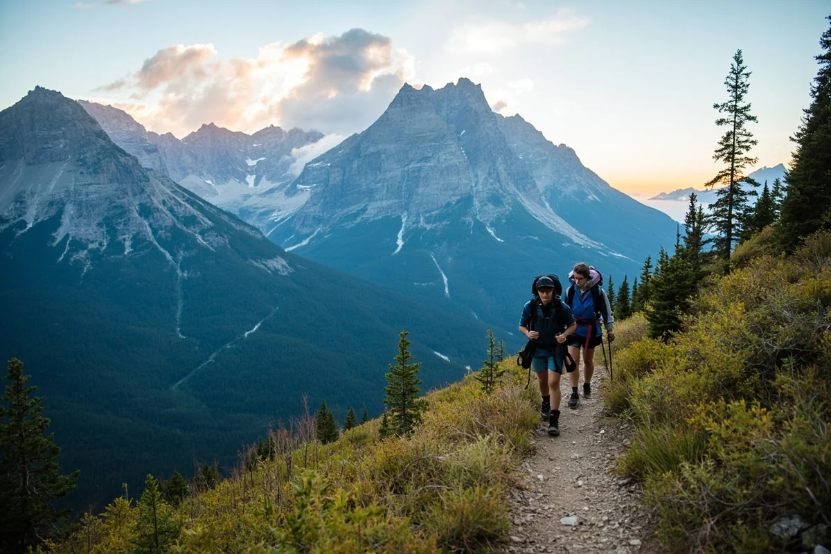
Subalpine Zone (8,500-10,000 feet)
This is where Montana’s high country magic happens. Trees become shorter and more gnarled, meadows burst with wildflowers in summer, and views extend for miles. Most alpine lakes and many iconic hiking destinations sit in this zone.
Hidden Lake in Glacier National Park, one of my favorite spots, sits at 6,377 feet at the overlook, with the trail climbing to about 7,000 feet. That’s accessible subalpine terrain. More challenging destinations like Avalanche Lake require more effort but remain achievable for most fit visitors.
The weather becomes highly unpredictable here. I’ve been caught in snow squalls in July at these elevations. Always pack layers and rain gear regardless of the forecast.
Alpine Zone (Above 10,000 feet)
True alpine terrain in Montana means no trees, exposed rock, and genuinely challenging conditions. Only the most adventurous visitors reach these elevations, which require serious preparation.
Granite Peak, Montana’s highest point at 12,799 feet, demands technical climbing skills and typically requires an overnight expedition. When I finally summited after years of building up to it, the thin air made every step feel like ten.
But you don’t need to be a mountaineer to experience Montana’s alpine zone. The Beartooth Highway, which I drive every summer, climbs to 10,947 feet at Beartooth Pass. You can stand in alpine tundra without hiking a step—just pull over at the designated viewpoints.
Practical Tips for Managing Montana’s Elevation
After years of exploring Montana’s vertical terrain, I’ve developed strategies that help visitors acclimate successfully.
Before You Arrive
Start hydrating heavily two days before your trip. I drink a gallon of water daily starting 48 hours out. Dehydration exacerbates altitude symptoms dramatically.
If you’re flying in from sea level, consider routing through Salt Lake City or Denver to begin acclimating during a layover. Even a few hours at moderate elevation helps.
Avoid alcohol the night before you arrive. I know it’s tempting to celebrate the start of vacation, but alcohol intensifies altitude effects and disrupts sleep.
Your First 24-48 Hours
Plan easy activities for your first day. A gentle walk around downtown Missoula or a scenic drive through the Flathead Valley works perfectly. Save the strenuous hikes for day two or three.
Drink water constantly—more than you think you need. I keep a water bottle in hand all day during the adjustment period. Coffee and alcohol don’t count; they’re diuretics that work against you.
Eat lighter meals initially. Heavy, fatty foods require more oxygen to digest. I stick to salads, grains, and lean proteins the first couple days.
Sleep may be disrupted the first night or two. This is normal. I sometimes take melatonin to help, though I’ve found simply accepting that I’ll wake up a few times reduces anxiety about it.
During High-Elevation Activities
Ascend gradually when possible. If you’re hiking from Bozeman (4,820 feet) to a 10,000-foot peak, don’t do it all in one day unless you’re fully acclimated.
Recognize when to turn back. On a hike to Lone Peak last summer, I watched a stubborn visitor ignore obvious AMS symptoms because he’d driven so far. Pride and determination can be dangerous at altitude.
Take breaks more frequently than you would at lower elevations. What feels like laziness is actually smart physiology. I stop every 30 minutes on steep terrain above 8,000 feet.
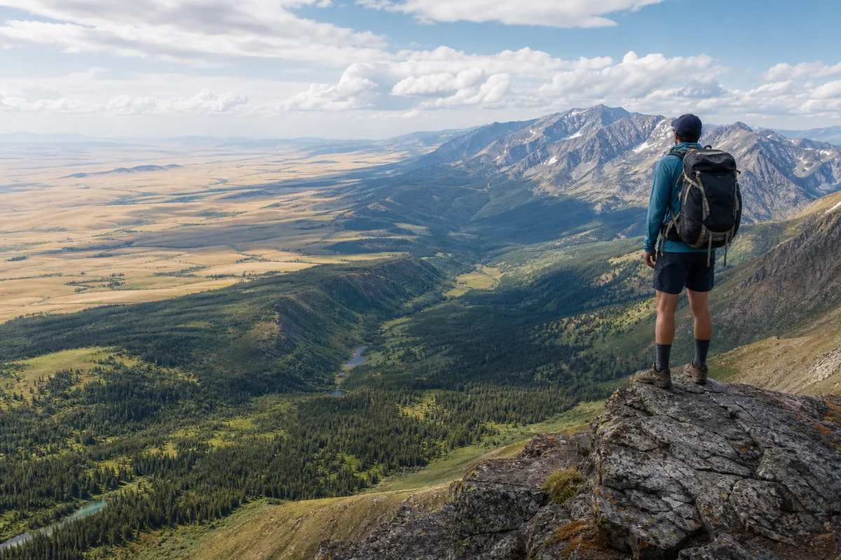
Elevation and Montana’s Diverse Geography
Montana’s elevation variations create remarkably diverse landscapes within a single state. The contrast continually amazes me.
The Continental Divide’s Influence
The Continental Divide snakes through western Montana, and it profoundly shapes everything from weather patterns to wildlife. West of the divide, Pacific moisture keeps things relatively lush. East of it, the landscape dries considerably.
When I drive from Missoula to Great Falls, crossing the divide at MacDonald Pass (6,325 feet), the transformation happens almost instantly. Green forests give way to golden grasslands within just a few miles.
Understanding this helps with trip planning. If you want dense forests and rushing rivers, stay west. If you prefer Montana’s high desert and sagebrush landscapes, the southeastern portion delivers exactly that.
Mountain Ranges and Their Elevations
Montana contains dozens of distinct mountain ranges, each with its own character and elevation profile. Some highlights from my explorations:
The Beartooth Mountains south of Billings contain Montana’s highest peaks. Twenty-nine summits exceed 12,000 feet here, and the scenery rivals anything in Colorado. The Beartooth Highway that traverses this range is the most spectacular mountain drive I’ve ever experienced.
The Mission Mountains east of Flathead Lake rise dramatically from the valley floor. McDonald Peak reaches 9,820 feet, and the range’s verticality—climbing nearly 7,000 feet in just a few miles—creates stunning visual impact.
The Bitterroot Range along the Idaho border features peaks averaging 8,000-9,000 feet with notably rugged terrain. The Anaconda-Pintler Wilderness here offers some of Montana’s most remote backcountry.
How Elevation Shapes Weather
Montana’s weather varies dramatically with elevation, and understanding this relationship improves trip planning enormously.
Valley floors experience the temperature extremes—hottest summers, coldest winters. My thermometer in Missoula has read 105°F in July and -25°F in January. Meanwhile, mid-elevation mountain slopes often stay more moderate.
Snow accumulation increases dramatically with elevation. Bridger Bowl ski area near Bozeman receives about 350 inches of snow annually at its upper elevations, while Bozeman itself sees roughly 80 inches. That difference matters for timing your visit.
Summer afternoon thunderstorms almost always develop first at higher elevations. When I’m planning a peak climb, I always aim to summit by noon to avoid the afternoon lightning risk.
Best Experiences at Different Elevations
Montana offers distinct experiences at each elevation band. Here’s what I recommend based on altitude:
Valley Floor Experiences (Under 3,500 feet)
The lower valleys offer Montana’s most accessible experiences, perfect for all fitness levels and altitude sensitivities.
Flathead Lake, the largest natural freshwater lake west of the Mississippi, sits at 2,893 feet. Kayaking here in late June, I was struck by how comfortable the climate felt—warm but not oppressive, with clear mountain views in every direction.
The Clark Fork River corridor through Missoula provides excellent fishing access and easy riverside trails. Montana Trout Outfitters guided me through this water last season, and the combination of gentle terrain and abundant fish made for an ideal first-day activity.
Downtown exploration in Missoula, Kalispell, and Billings lets you soak up local culture without elevation stress. The breweries, restaurants, and shops don’t care about your oxygen intake.
Mid-Elevation Experiences (3,500-6,500 feet)
This sweet spot offers Montana’s signature experiences for most visitors.
Yellowstone National Park’s northern entrance near Gardiner sits at about 5,300 feet, and most of the park’s thermal features and wildlife viewing areas remain below 8,000 feet. This makes the park surprisingly accessible despite its mountain location.
The ski towns—Big Sky, Whitefish, and Red Lodge—base their operations in this zone. Even non-skiers enjoy these communities’ restaurants, shops, and summer activities at comfortable elevations.
Highway 89 from Livingston to White Sulphur Springs traverses spectacular mid-elevation terrain—rolling grasslands punctuated by forested mountains. I’ve driven this route at sunset, watching elk graze against golden light, and it ranks among Montana’s most underrated drives.
High-Elevation Experiences (Above 6,500 feet)
Montana’s high country rewards those who prepare properly with experiences found nowhere else.
Going-to-the-Sun Road in Glacier National Park climbs to 6,646 feet at Logan Pass. When I visit during peak wildflower season in mid-July, the alpine meadows burst with color. The visitor center there offers ranger-led programs that help interpret the unique high-elevation ecosystem.
The Beartooth Highway reaches Montana’s highest drivable point at nearly 11,000 feet. Even on a recent August trip, snow patches lined the road. The views of the Absaroka-Beartooth Wilderness make this America’s most beautiful drive, in my opinion.
Backcountry camping in places like the Bob Marshall Wilderness or Lee Metcalf Wilderness puts you into genuine high country. These experiences require fitness, preparation, and respect for the terrain, but they deliver Montana at its most pristine.
Seasonal Considerations for Montana’s Elevations
Elevation and season interact powerfully in Montana. Timing your visit requires understanding both factors.
Spring (April-June)
Spring comes late to Montana’s high country. When Missoula celebrates tulips in April, the mountains remain firmly locked in winter. Snow typically persists above 7,000 feet through May, and many high-elevation roads don’t open until late June.
This creates opportunity, though. The lower valleys green up beautifully in May, and river fishing peaks as runoff subsides. I love late May in the Bitterroot Valley—wildflowers blooming, snow-capped peaks in the distance, and almost no crowds.
Summer (July-September)
Peak season for high-elevation activities runs mid-July through mid-September. This window provides the best chance of snow-free trails, passable mountain roads, and (relatively) stable weather.
Even in summer, prepare for all conditions above 8,000 feet. I’ve worn shorts and encountered snow on the same hike. Pack layers, rain gear, and emergency supplies regardless of forecast.
Afternoon thunderstorms become almost daily occurrences in July and August. Start high-elevation hikes early, aiming to be below treeline by early afternoon.
Fall (October-November)
Fall brings stunning colors to Montana’s mid-elevations—larch trees turning gold, aspens blazing yellow against evergreen forests. Early October offers perhaps my favorite Montana hiking conditions: crisp air, brilliant colors, and solitude.
But windows close quickly. Snow can arrive at higher elevations as early as late September. Going-to-the-Sun Road closes at Logan Pass typically by mid-October, sometimes earlier.
Winter (December-March)
Winter transforms Montana’s elevation zones dramatically. Valley cities function normally while mountain passes become impassable without specialized equipment.
Skiing naturally dominates winter activities, with Montana’s ski areas typically operating December through April. If you’re not skiing, stick to lower-elevation towns and embrace winter activities like cross-country skiing, snowshoeing on groomed trails, and soaking in natural hot springs.
Regional Elevation Considerations
Understanding Montana’s different regions helps with trip planning. The state’s geography varies considerably, and its position creates interesting dynamics. Many visitors wonder whether Montana belongs to the Northwest region, while others ask if Montana is truly in the Midwest. The elevation differences help explain why the state defies easy regional classification.
Northwest Montana
The Flathead Valley and Glacier National Park region features Montana’s most moderate elevations. Valley floors sit around 3,000 feet, making this area comfortable for altitude-sensitive visitors while still providing access to stunning mountain scenery.
Being a landlocked state, Montana doesn’t have ocean access to moderate temperatures, but northwest Montana’s valley positions create microclimates that feel surprisingly mild.
Southwest Montana
This region contains the highest average elevations. Butte, Anaconda, and Dillon all sit above 5,000 feet, and the surrounding mountains regularly exceed 10,000 feet.
If you’re driving from southwest Montana toward the Canadian border, you’ll experience a fascinating elevation progression—climbing passes, dropping into valleys, climbing again.
Eastern Montana
The high plains might look flat, but they sit at respectable elevation—mostly 2,000-4,000 feet. Montana’s rural character shows most clearly here, where small towns dot the prairie between significant topographic features.
Despite being far from the West Coast, eastern Montana has its own beauty. The badlands near Makoshika State Park and the isolated mountain ranges create surprising vertical relief in seemingly flat terrain.
Exploring what type of region Montana truly is reveals a state that spans multiple geographic and climatic zones—and elevation explains much of that diversity. With seven neighboring states and Canadian provinces around its borders, Montana serves as a geographical crossroads where elevation variations create remarkable diversity.
Special Considerations for Specific Travelers
Different travelers need different elevation guidance. Here’s targeted advice based on my observations:
Travelers with Health Conditions
Anyone with heart conditions, respiratory issues, or anemia should consult their physician before visiting Montana’s higher elevations. I’ve seen visitors with well-controlled conditions suddenly struggle at altitude.
Bring extra medication—altitude can affect absorption rates and efficacy. Some blood pressure medications, for example, work differently above 6,000 feet.
Consider portable oxygen for high-elevation excursions. Recreational oxygen canisters available at pharmacies can provide relief during adjustment periods.
Families with Children
Children often adjust to altitude more readily than adults, but they’re also less able to articulate symptoms. Watch for unusual fatigue, loss of appetite, or crankiness beyond normal travel stress.
Keep high-elevation activities shorter for kids. That ten-mile hike you’d tackle alone should become a four-mile family version at altitude.
Athletes and Fitness Enthusiasts
Serious athletes should expect significantly reduced performance at Montana elevations. I’ve trained with marathon runners who found themselves walking on trails they’d normally jog.
Heart rate monitors help gauge effort accurately. What feels like moderate exertion might actually be near maximum at altitude.
Plan recovery time between strenuous activities. Back-to-back big days at elevation deplete you faster than at sea level.
Photographers and Creatives
Higher elevations offer clearer air and more dramatic light—but physical demands can compromise your creative energy. I plan my most ambitious photo expeditions for mid-trip after acclimatization.
Battery life decreases in cold high-altitude conditions. Bring extras and keep them warm in your pockets.
Planning Your Montana Trip Around Elevation
After years of exploring this state, I’ve developed an approach to trip planning that accounts for elevation:
Start in lower-elevation areas—Missoula, Kalispell, or Billings—for your first day or two. Let your body adjust while enjoying accessible attractions.
Gradually work upward. If Glacier National Park is your main destination, spend a night in Whitefish (3,028 feet) before tackling Logan Pass (6,646 feet).
Build rest days into high-elevation itineraries. That recovery day in a mountain town isn’t wasted time—it’s smart physiology that will make your active days more enjoyable.
End your trip at lower elevations when possible. Flying out of Missoula after a high-country adventure feels noticeably easier than rushing from mountain to airport.
Track how you feel and adjust accordingly. Montana rewards flexibility, and there’s no shame in swapping a planned peak climb for a valley hike if your body requests it.
Montana’s elevation diversity—from prairie to peak—creates a state unlike any other. Understanding and respecting that vertical dimension transforms your trip from a visit into a genuine experience with Big Sky Country’s most defining feature: the land itself rising to meet that endless sky.
Frequently Asked Questions
What is the average elevation in Montana and how might it affect my trip?
Montana’s average elevation sits around 3,400 feet above sea level, with many popular destinations like Big Sky and Glacier National Park reaching 6,000-10,000 feet. If you’re coming from sea level, you may experience mild altitude sickness symptoms like headaches or shortness of breath during hikes. I recommend staying hydrated, taking it easy the first day, and packing aspirin just in case.
What is the highest elevation point in Montana that tourists can visit?
Granite Peak stands at 12,799 feet as Montana’s highest point, but it’s a technical climb only suited for experienced mountaineers. For most travelers, Logan Pass in Glacier National Park at 6,646 feet offers the most accessible high-elevation experience with stunning views and well-maintained trails. The Going-to-the-Sun Road typically opens from late June through mid-October depending on snowfall.
How does Montana’s elevation change from east to west across the state?
Montana’s elevation dramatically shifts from the western Rocky Mountains averaging 5,000-10,000 feet to the eastern Great Plains dropping to around 2,000-4,000 feet. Cities like Missoula sit at 3,200 feet while eastern towns like Miles City rest at just 2,369 feet. This means you’ll experience vastly different climates and terrain driving the roughly 550 miles across the state.
What should I pack for high elevation travel in Montana?
For Montana’s higher elevations, I always pack layers since temperatures can drop 20-30 degrees from base to summit, plus SPF 30+ sunscreen since UV exposure increases 4% every 1,000 feet. Bring a refillable water bottle to combat dehydration, lip balm with SPF, and moisture-wicking clothing. Even summer trips to areas above 7,000 feet may require a light jacket or fleece.
What is the elevation of popular Montana ski resorts compared to Colorado?
Montana ski resorts generally sit lower than Colorado’s, with Big Sky’s base at 7,500 feet and summit at 11,166 feet, while Whitefish Mountain ranges from 4,464 to 6,817 feet. This actually makes Montana skiing more comfortable for many visitors since the lower elevations reduce altitude sickness risk. Lift tickets typically run $120-180 per day, often $30-50 cheaper than comparable Colorado resorts.
Which Montana cities have the lowest elevation for travelers sensitive to altitude?
If you’re altitude-sensitive, stick to eastern Montana cities like Glendive at 2,069 feet or Sidney at 1,931 feet along the Yellowstone River valley. Even Billings, Montana’s largest city, sits at a comfortable 3,123 feet. These lower-elevation areas offer excellent dinosaur trail museums, fishing, and authentic cowboy culture without the altitude adjustment period.
Does Yellowstone National Park’s Montana entrance have different elevation than Wyoming entrances?
The Montana entrances to Yellowstone through Gardiner (5,314 feet) and West Yellowstone (6,667 feet) offer slightly lower starting elevations than some Wyoming approaches. However, once inside the park, you’ll reach elevations over 8,000 feet at locations like Dunraven Pass at 8,859 feet. Plan for a 2-3 hour drive covering about 100 miles between these Montana gateway towns.
Sources:
- https://en.wikipedia.org/wiki/Geography_of_Montana
- https://en.wikipedia.org/wiki/Montana
- https://montanakids.com/facts_and_figures/geography/Highest_and_Lowest_Points.htm
- https://grokipedia.com/page/List_of_U.S._states_and_territories_by_elevation
- https://thefactfile.org/50-states-elevation/
- https://www.netstate.com/states/tables/state_elevation_mean.htm
- https://www.nps.gov/articles/rockies.htm
- https://en.wikipedia.org/wiki/Beartooth_Mountains
- https://en.wikipedia.org/wiki/Lewis_Range
- https://earthathome.org/hoe/sw/topography-gp/
- https://mbmg.mtech.edu/pdf/geologyvolume/Lageson.pdf
- https://www.reddit.com/r/geology/comments/1donwrd/why_are_the_great_plains_of_the_us_which_are/
- https://www.britannica.com/place/Absaroka-Range
- https://www.umt.edu/this-is-montana/short-notes/stories/montanas-beartooth-range.php
- https://www.umt.edu/this-is-montana/columns/stories/absaroka-beartooth-mountains.php
- https://www.usgs.gov/educational-resources/highest-and-lowest-elevations
- https://yellowstonian.org/yellowstone-highest-summits-of-wyoming-montana/
- https://www.lemkeclimbs.com/beartooth-mountains.html
- https://wilderness.net/visit-wilderness/?ID=1
- https://en.wikipedia.org/wiki/List_of_mountain_peaks_of_Montana
- https://msl.mt.gov/geoinfo/geography/geography_facts/montanaxs_300_tallest_peaks
- https://msl.mt.gov/geoinfo/geography/geography_facts/montanaxs_tallest_peaks_by_mountain_range
- https://en.wikipedia.org/wiki/Absaroka_Range
- https://en.wikipedia.org/wiki/Francs_Peak
- https://en.wikipedia.org/wiki/Mount_Cowen
- https://outsidebozeman.com/activities/running/cowen-around
- https://peakvisor.com/range/absaroka-range.html
- https://en.wikipedia.org/wiki/Mount_Cleveland_(Montana)
- https://www.britannica.com/place/Bitterroot-Range
- https://bitterroot.info/the-bitterroot-mountains/
- https://en.wikipedia.org/wiki/Bitterroot_Mountains
- https://en.wikipedia.org/wiki/Cabinet_Mountains
- https://www.umt.edu/this-is-montana/photos/stories/cabinet-mountains.php
- https://wilderness.net/visit-wilderness/?ID=91
- https://www.visitbigsky.com/articles/post/the-highest-peaks-in-the-madison-range/
- https://discoverbigsky.com/blog/what-is-the-highest-mountain-in-the-madison-range
- https://en.wikipedia.org/wiki/Madison_Range
- https://peakvisor.com/range/madison-range.html
- https://www.umt.edu/this-is-montana/columns/stories/montana_regions_1of3.php
- https://fwp.mt.gov/binaries/content/assets/fwp/fish/statewide-fisheries-management-plan/part-ii—a.pdf
- https://www.nwrfc.noaa.gov/river/station/flowplot/flowplot.cgi?LEOI1
- https://en.wikipedia.org/wiki/High_Plains_(United_States)
- https://msl.mt.gov/geoinfo/geography/geography_facts/elevation_of_montana_cities
- https://z100missoula.com/elevation-montana-cities/
- https://www.weather.gov/tfx/NewZonesAnnouncement
- https://en.wikipedia.org/wiki/Billings_Logan_International_Airport
- https://www.airnav.com/airport/KBIL
- https://en.wikipedia.org/wiki/Great_Falls_International_Airport
- https://www.aopa.org/destinations/airports/KGTF
- https://adip.faa.gov/agis/public/#/airportData/BZN
- https://en.wikipedia.org/wiki/Bozeman_Yellowstone_International_Airport
- https://en.wikipedia.org/wiki/Missoula_Montana_Airport
- https://www.airnav.com/airport/KMSO
- https://en.wikipedia.org/wiki/Helena_Regional_Airport
- https://www.airnav.com/airport/KHLN
- https://fieldguide.mt.gov/displayES_Detail.aspx?ES=5426
- https://www.nps.gov/glac/learn/nature/mountains.htm