I was standing at a coffee shop in Seattle last fall when a fellow traveler asked me about my Montana road trip plans. “Oh nice, keeping it local on the West Coast then?” she said casually.
I nearly choked on my latte. After spending seven years exploring every corner of Montana, I’ve lost count of how many times I’ve heard this geographic misconception — and honestly, it makes planning your trip there a whole lot more complicated if you’re operating under false assumptions.
Understanding where Montana is located isn’t just trivia — it fundamentally shapes everything from your flight bookings to your packing list to your expectations about the landscape you’ll encounter.
- Montana is definitively NOT a West Coast state — it’s completely landlocked with no ocean access
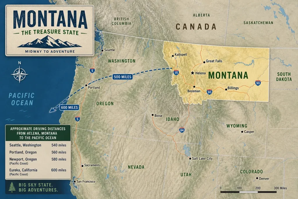
- Located in the northern Rocky Mountain region, Montana sits 400-600 miles from the Pacific Ocean
- The state is classified as part of the Mountain West or Northern Rockies region
- Western Montana shares some Pacific Northwest characteristics due to moisture patterns
- This geographic reality affects your travel planning: different airports, climate, and experiences than coastal states
- Montana borders Canada, not the ocean, spanning 545 miles along the northern boundary
The Definitive Answer: Montana Is Not West Coast
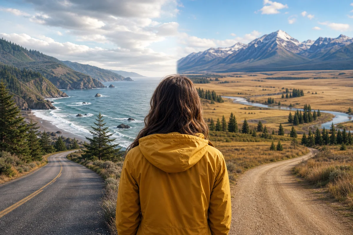
Let me be absolutely clear from the start: Montana is not a West Coast state. Not even close.
The West Coast of the United States consists of exactly three states: California, Oregon, and Washington. These are the only states whose western borders touch the Pacific Ocean.
Montana, meanwhile, is completely landlocked. In fact, as I detail in my guide about whether Montana is landlocked, the state sits between 400 and 600 miles from the nearest saltwater, depending on where you’re standing.
During my first drive from Portland to Missoula several years ago, I remember thinking “this is taking forever” as I crossed through the entirety of Washington State and into Idaho before finally reaching Montana. That six-hour journey through two states really hammers home just how far Montana sits from the coast.
So Where Exactly Is Montana Located?
Montana occupies the northern Rocky Mountain region of the United States. When I pull out a map for first-time visitors, I always point to the same landmark: look for the state that shares the longest undefended border with Canada in the continental U.S.
The state spans a massive 147,040 square miles, making it the fourth-largest state by area. Yet despite this enormous footprint, Montana touches zero coastline.
Here’s what Montana actually borders:
| Direction | Bordering Region | Notable Details |
|---|---|---|
| North | Canada (British Columbia, Alberta, Saskatchewan) | 545 miles of international border |
| East | North Dakota, South Dakota | Great Plains transition zone |
| South | Wyoming, Idaho | Yellowstone access via Wyoming |
| West | Idaho | Bitterroot Mountains form natural boundary |
I’ve written extensively about Montana’s neighboring states because understanding these borders genuinely helps with trip planning. Many visitors combine Montana with visits to Yellowstone (via Wyoming) or Glacier-Waterton (via Canada).
Speaking of that northern border, Montana’s position along the Canadian border defines much of its character — from the wildlife corridors to the weather patterns to the cultural influences you’ll encounter.
Why People Confuse Montana With the West Coast
I get why this confusion happens. When I tell people I’m heading “out West,” Montana fits that mental category for most Americans.
The confusion stems from several factors I’ve observed over years of conversations with fellow travelers.
The “Western United States” Umbrella
Montana absolutely belongs to the Western United States — that broad regional classification that encompasses everything west of the Great Plains. But “Western” and “West Coast” aren’t synonyms.
The Western U.S. includes coastal states, mountain states, desert states, and plains states. Montana falls squarely into the mountain state category, specifically the Northern Rockies subregion.
Time Zone Misconceptions
Montana operates on Mountain Time, which sits between Pacific Time (West Coast) and Central Time (Midwest). I’ve noticed people subconsciously associate Mountain Time states with the coast because they’re “close enough” in time difference.
In reality, when it’s noon in Los Angeles, it’s 1 PM in Missoula. That hour difference represents hundreds of miles of separation.
The Pacific Northwest Connection
Here’s where things get genuinely interesting, and where I can understand the geographic confusion most.
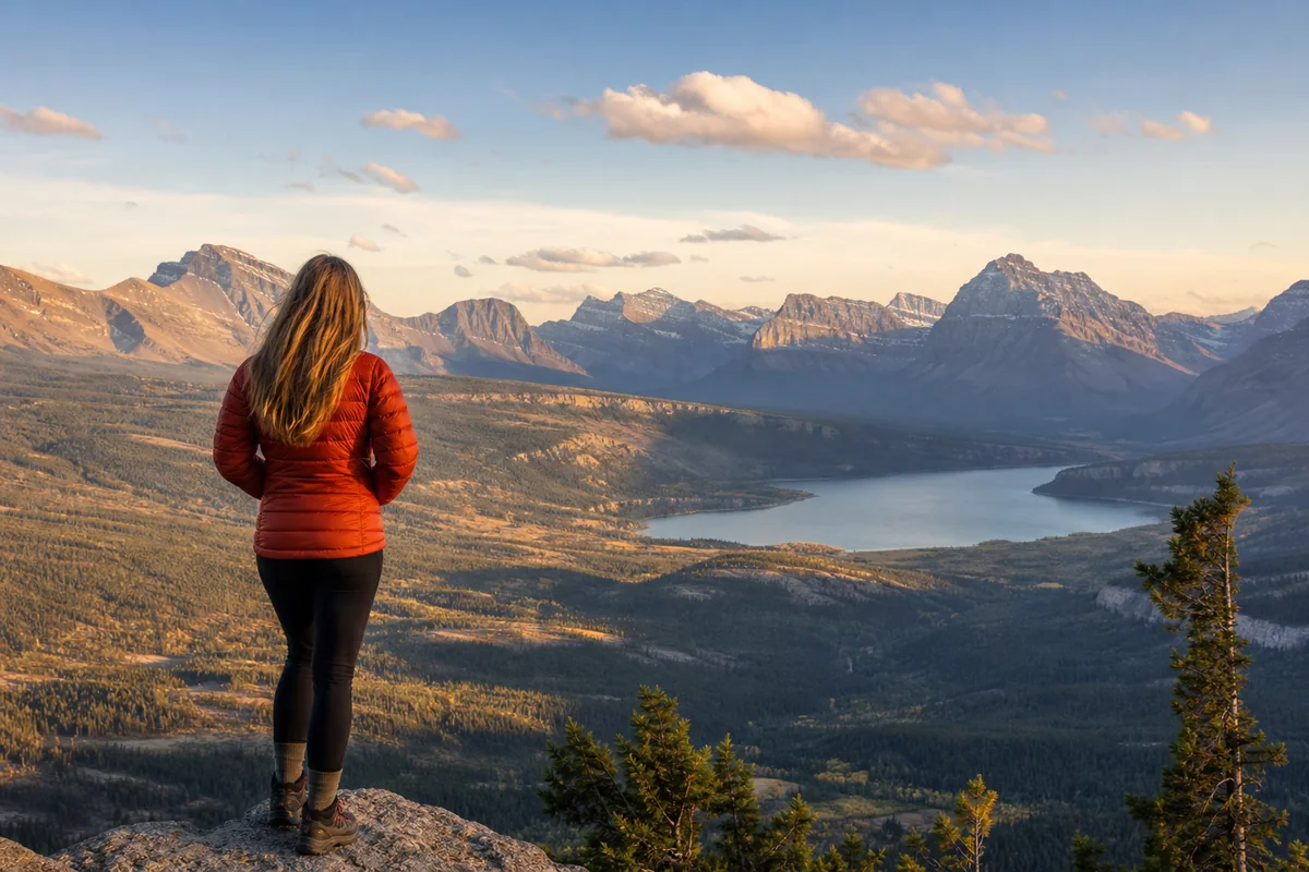
Western Montana — places like Missoula, Kalispell, and the areas around Glacier National Park — shares certain characteristics with the Pacific Northwest. During my many visits to the western valleys, I’ve noticed the vegetation looks different from eastern Montana: more evergreens, lusher undergrowth, even some moss on rocks near streams.
This happens because weather systems from the Pacific Ocean do reach western Montana, albeit weakened after crossing Washington and Idaho. The moisture creates what locals call a “modified Pacific climate.”
But sharing some weather patterns doesn’t make Montana part of the West Coast any more than sharing Atlantic weather makes Vermont an East Coast state.
What Regional Classification Does Montana Actually Fit?
This question comes up constantly when I’m helping people plan Montana trips, and honestly, the answer depends on who’s doing the classifying.
Government Classifications
The U.S. Census Bureau places Montana in the “Mountain” division of the “West” region. This groups Montana with Arizona, Colorado, Idaho, Nevada, New Mexico, Utah, and Wyoming.
The Bureau of Economic Analysis uses similar classifications. Neither considers Montana part of any coastal region.
Geographic Reality
I’ve explored this topic thoroughly in my article about what type of region Montana truly is, but here’s the quick version: Montana is a transition state.
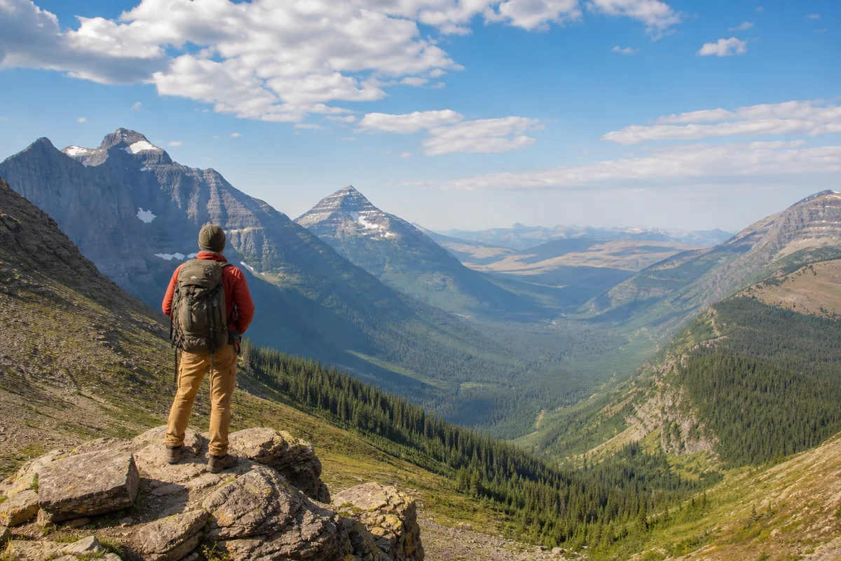
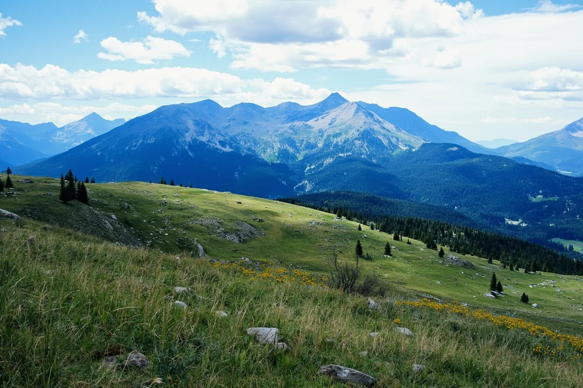
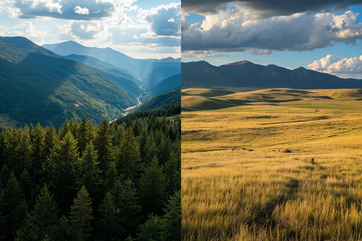
The western third features dramatic Rocky Mountain terrain — think Glacier National Park, the Bitterroot Range, and the Mission Mountains. This is alpine country with peaks exceeding 10,000 feet.
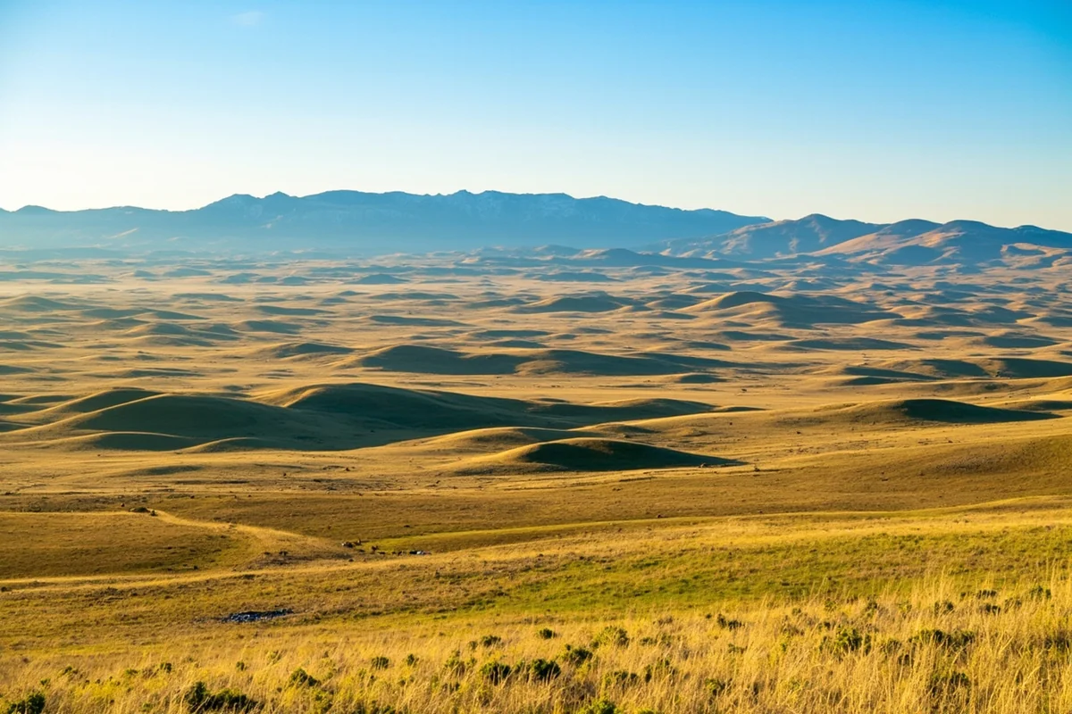
The eastern two-thirds? That’s Great Plains territory. Rolling grasslands, agricultural land, and an entirely different ecosystem. I’ve written specifically about whether Montana belongs to the Great Plains because this eastern identity often gets overlooked by visitors focused on mountain destinations.
The Northwest Question
Some geographers and locals consider Montana part of the “Inland Northwest” or “Northern Rockies Northwest.” I’ve spent considerable time examining whether Montana is located in the Northwest, and the answer is nuanced.
Culturally and economically, western Montana cities like Missoula maintain strong ties to Spokane, Seattle, and Portland. Interstate 90 creates a direct corridor, and you’ll find plenty of University of Montana graduates working in Seattle tech companies.
But geographically, calling Montana “Northwest” stretches the traditional definition, which typically means Pacific Northwest — again, those coastal states.
Why This Geographic Distinction Matters for Your Trip
I’m not being pedantic about geography just for fun. Understanding that Montana isn’t West Coast fundamentally changes how you should plan your visit.
Flight Planning Implications
If you’re flying from the East Coast expecting a typical “flight to the West Coast,” you might be surprised. Montana’s major airports — Bozeman (BZN), Missoula (MSO), Billings (BIL), and Great Falls (GTF) — don’t have the same flight volume or direct routes as Seattle, Portland, or San Francisco.
Last summer, I helped a friend from Boston plan her Montana trip. She initially assumed she’d have the same flight options as her previous Seattle visits. Instead, she ended up connecting through Denver, which actually makes geographic sense given Montana’s position.
Direct flights to Montana primarily come from regional hubs: Denver, Salt Lake City, Minneapolis, and Seattle. Budget accordingly — these routes often cost more than comparable distances to coastal cities.
Climate Expectations
West Coast weather and Montana weather share almost nothing in common. I learned this the hard way during an October trip years ago.
Seattle in October means mild temperatures and drizzle. Montana in October means potential blizzards, temperatures dropping into the 20s overnight, and roads that can close without warning.
The elevation plays a huge role here. As I discuss in my Montana elevation guide, much of the state sits above 3,000 feet, with many popular destinations exceeding 5,000 feet. Higher elevation means colder temperatures, stronger sun, and more dramatic weather swings.
Landscape Preparation
If you’re expecting coastal scenery — ocean views, temperate rainforests, sea-level hikes — Montana will confuse you.
Instead, prepare for:
- Alpine lakes fed by glacial melt
- Vast prairie horizons stretching endlessly
- Mountain passes that close seasonally
- Rivers cutting through valleys instead of meeting ocean
- Wildlife adapted to continental climates
The ecological diversity of Montana’s biomes actually rivals coastal states in variety — you’ll just find subalpine forests and grassland prairies instead of coastal redwoods and tidal zones.
Montana’s Relationship With Water (It’s Not the Ocean)
One detail that highlights Montana’s non-coastal status: water in Montana flows away from the Pacific, not toward it.
Montana contains the headwaters of major river systems. The Missouri River begins near Three Forks. The Clark Fork eventually reaches the Pacific via the Columbia River system, but travels through Idaho and Washington first.
I’ve floated several of Montana’s famous rivers — the Blackfoot, the Madison, the Yellowstone — and there’s something profound about knowing this water has thousands of miles yet to travel before reaching any ocean.
The “Triple Divide Peak” in Glacier National Park always fascinates visitors I guide there. Water falling on this single mountain flows to three different watersheds: the Pacific, the Atlantic (via the Gulf of Mexico), and Hudson Bay. Standing there last summer, I reflected on how this geographic reality encapsulates Montana’s position as a continental state, not a coastal one.
Some visitors wonder about Montana’s aridity given its inland position. I’ve addressed this question directly in my piece exploring whether Montana is high desert. Short answer: parts of it show semi-arid characteristics, but it’s not desert like Nevada or Arizona.
Comparing Montana to Actual West Coast States
Let me draw some concrete comparisons from my travels to both regions.
Population Density
West Coast states bustle with people. California has nearly 40 million residents. Washington exceeds 7.5 million. Oregon tops 4 million.
Montana? Just over 1.1 million people spread across the fourth-largest state. As I explore in my article about whether Montana is considered rural, this state defines sparse population.
During my drives through eastern Montana, I’ve gone hours without seeing another vehicle. Try that on Interstate 5 through California.
Urban Development
West Coast urban areas — Los Angeles, San Francisco, Seattle, Portland — offer world-class dining, extensive public transit, and dense downtown cores.
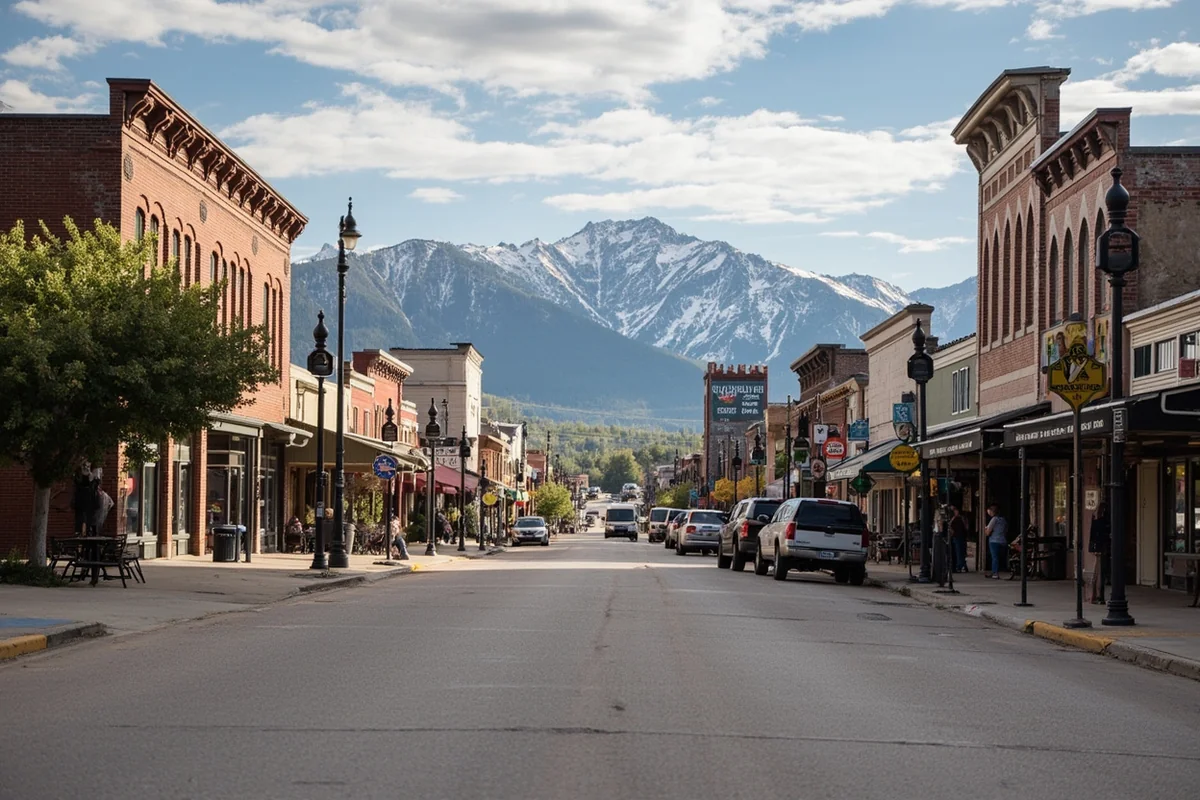
Montana’s largest city, Billings, has roughly 120,000 people. Missoula and Great Falls hover around 75,000 each. These are genuinely small cities compared to coastal metros.
This isn’t a criticism — the small-town character defines Montana’s appeal. But expecting West Coast urban amenities leads to disappointment.
Tourism Infrastructure
Coastal destinations developed extensive tourism infrastructure over more than a century. Montana’s tourism industry, while growing rapidly, remains more rustic.
Outside major parks and ski resorts, you’ll find fewer hotels, restaurants, and services. Last winter, I drove two hours between gas stations in northeastern Montana — something unimaginable on any West Coast route.
The Midwest Confusion (Another Common Mistake)
While we’re clearing up geographic misconceptions, let me address another one I hear frequently: “Isn’t Montana in the Midwest?”
No, though the confusion makes slightly more sense than the West Coast question.
I’ve written extensively about whether Montana is truly in the Midwest, but here’s the short version: the Midwest traditionally refers to states like Ohio, Indiana, Illinois, Michigan, Wisconsin, Minnesota, Iowa, Missouri, Kansas, Nebraska, and the Dakotas.
Montana sits too far west and too mountainous to fit Midwest definitions. The Rocky Mountains create a clear geographic and cultural dividing line.
That said, eastern Montana shares characteristics with the western Midwest: agricultural economies, sparse population, and prairie landscapes. I’ve met ranchers near Miles City who felt more kinship with their North Dakota neighbors than with folks in Missoula.
How This Geography Shapes Montana’s Character
Montana’s inland, mountain-and-plains position creates the experiences you’ll actually have when visiting.
The “Big Sky” Reality
That famous nickname exists because of geography. Without ocean horizons or coastal fog, Montana’s interior position means unobstructed sky views in every direction.
I’ve watched thunderstorms build from 50 miles away across the eastern plains. I’ve seen sunrise paint the entire Rocky Mountain Front in alpenglow. These experiences require the continental position Montana occupies.
Wildlife Encounters
Montana’s wildlife adapted to continental conditions, not coastal ones. You won’t see sea lions or tide-pool creatures.
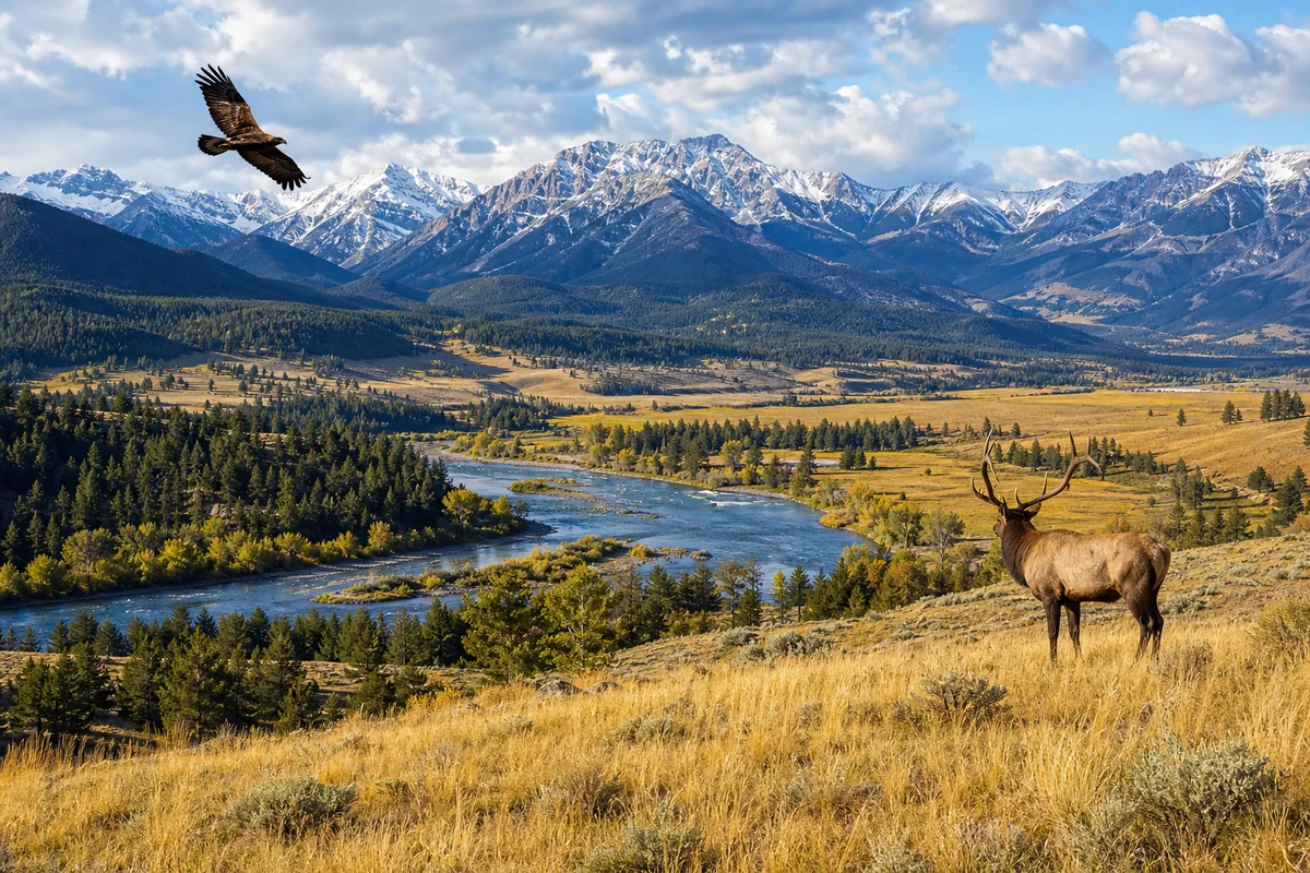
Instead, prepare for grizzly bears, wolves, mountain lions, elk herds, pronghorn antelope, and bison. The ecosystem here evolved around mountain and prairie environments.
My most memorable wildlife encounter happened outside Gardiner when a small herd of bison decided my parked car made a convenient scratching post. Distinctly non-coastal wildlife behavior.
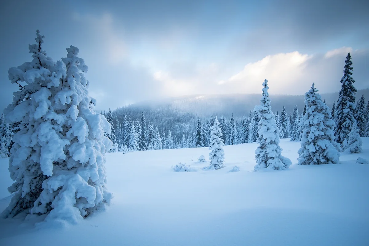
Seasonal Extremes
Continental climates swing between extremes — cold winters, warm summers, dramatic temperature shifts. Coastal climates, moderated by ocean temperatures, stay milder.
Montana recorded the coldest temperature ever measured in the Lower 48: -70°F at Rogers Pass. Yet summer days routinely hit the 90s. This 160-degree annual range simply doesn’t occur in coastal locations.
Planning Your Trip With Accurate Geography in Mind
Now that we’ve established Montana’s actual location, let me share practical planning advice based on this geographic reality.
Best Arrival Strategies
From the West Coast: If you’re coming from Seattle, Portland, or Northern California, Interstate 90 provides the most direct driving route through Washington and Idaho. Expect 8-12 hours of driving to reach western Montana destinations.
Flying often means connecting through Seattle, Portland, or Denver. Direct flights from West Coast cities to Montana exist but run limited schedules.
From the East: Denver serves as the main hub. Salt Lake City also offers good connections. Minneapolis works well for reaching eastern Montana.
From the South: Salt Lake City or Denver connections work best. Some visitors combine Montana with Yellowstone trips entering through Jackson, Wyoming.
Packing Differences
Forget the light layers that work for West Coast visits. Montana demands:
- Warmer insulation (even in summer, mountain elevations turn cold)
- Sun protection (high elevation means stronger UV exposure)
- Versatile footwear for varied terrain
- More emergency supplies in vehicles (distances between services are greater)
- Winter-specific gear if visiting October through May
Time Allocation
Montana’s vastness surprises visitors expecting West Coast driving scales. The state stretches 550 miles east to west — roughly equivalent to driving from San Francisco to Los Angeles.
I always advise first-time visitors to either focus on western Montana (Glacier, Missoula, Flathead Lake) or eastern Montana (Billings, Little Bighorn, Missouri Breaks), not both. Trying to “see everything” in one trip means spending your vacation in a car.
Seasonal Considerations
Unlike the year-round accessibility of West Coast destinations, Montana’s seasons dramatically affect what’s possible:
June-September: Prime season. Most roads open, longest days, warmest weather. Crowds peak July and August.
October-November: Shoulder season. Some high-elevation roads close. Fall colors stunning. Weather increasingly unpredictable.
December-March: Winter season. Many mountain roads close. Ski resorts operate. Extreme cold possible. Plan for potential delays.
April-May: Mud season. Roads slowly reopen. Wildlife active. Weather highly variable. Many services not yet operating.
What Montana’s Location Actually Offers
Rather than lamenting what Montana isn’t (coastal), let’s celebrate what its actual geography provides.
Uncrowded Wilderness
Montana’s inland position kept development limited compared to accessible coastal regions. The Bob Marshall Wilderness Complex encompasses over 1.5 million acres with zero roads.
I backpacked the Chinese Wall area two summers ago and didn’t see another person for three days. Name a West Coast wilderness where that’s still possible.
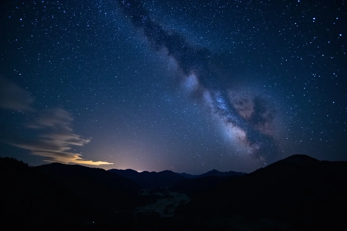
Dark Skies
Without coastal light pollution, Montana offers some of North America’s darkest skies. Big Sky Country isn’t just a nickname — it’s an invitation to stargazing impossible near population centers.
Glacier National Park was designated an International Dark Sky Park. I’ve photographed the Milky Way there with clarity unmatched by any coastal location I’ve visited.
Continental Weather Drama
While extreme temperatures challenge visitors, the meteorological drama creates unforgettable experiences. Afternoon thunderstorms rolling across the plains, chinook winds warming January days by 50 degrees, northern lights visible from prairie vantage points — these require Montana’s continental position.
Wildlife Density
The lower human population and continental ecosystem support wildlife densities uncommon in more developed regions. Greater Yellowstone Ecosystem, partially in Montana, hosts the most diverse large mammal population in the Lower 48.
Final Thoughts on Montana’s Place in American Geography
After years of exploring Montana and explaining its location to curious travelers, I’ve come to appreciate how the state defies easy categorization.
Montana isn’t West Coast, isn’t Midwest, isn’t quite Pacific Northwest, and isn’t purely Mountain West either. It occupies a unique position where the Great Plains meet the Rocky Mountains along the Canadian border.
This geographic complexity creates the state’s character: prairies and peaks, ranching and recreation, extreme cold and glorious summers, sparse population and abundant wildlife.
When planning your Montana trip, embrace this reality. You’re not heading to the coast. You’re heading somewhere entirely different — a landlocked, mountainous, prairie-spanning state with its own distinct identity.
That’s not a consolation prize. It’s the whole point.
The West Coast offers wonderful experiences. But Montana offers something the coast cannot: the feeling of continental vastness, of standing in genuinely remote wilderness, of experiencing weather and landscape unmoderated by ocean influence.
I’ll keep correcting people in coffee shops who think Montana borders the Pacific. But I’ll also keep returning to Big Sky Country precisely because it isn’t coastal. The differences make all the difference.
Frequently Asked Questions
Is Montana considered West Coast or Mountain West?
Montana is definitely not West Coast – it’s part of the Mountain West or Northern Rockies region. While it sits in the western half of the US, Montana is landlocked and roughly 500-600 miles from the Pacific Ocean. I’d classify it alongside states like Wyoming and Idaho rather than coastal states like California, Oregon, or Washington.
How far is Montana from the West Coast?
Montana sits approximately 500-700 miles from the nearest West Coast cities, depending on where you’re traveling from. For example, driving from Seattle to Missoula takes about 7 hours (470 miles), while Los Angeles to Billings is roughly 1,200 miles and a 17-hour drive. Most travelers fly into Bozeman, Missoula, or Billings when coming from coastal destinations.
What US region does Montana belong to for travel planning?
Montana belongs to the Northern Rockies region, which includes Idaho, Wyoming, and parts of the Dakotas. When planning your trip, think mountain time zone, high elevation terrain, and continental climate rather than coastal weather patterns. This distinction matters for packing – Montana experiences harsh winters and dry summers unlike the mild, rainy West Coast.
Is Montana weather similar to West Coast states like Oregon or Washington?
Not at all – Montana’s climate is dramatically different from the Pacific Northwest. While Seattle averages 37 inches of rain annually, much of Montana receives only 15 inches and experiences temperature extremes from -20°F winters to 90°F summers. I always tell visitors to pack layers and expect dry, sunny conditions rather than the overcast, humid weather common on the West Coast.
Can I do a road trip from California to Montana and what should I budget?
A California to Montana road trip is absolutely doable and covers stunning terrain through Nevada and Idaho. Budget around $150-200 daily for gas, food, and lodging, with the drive from San Francisco to Glacier National Park spanning roughly 1,100 miles over 2-3 days. I recommend breaking it up with stops in Boise or Reno to avoid fatigue on these long Western distances.
What time zone is Montana in compared to West Coast states?
Montana operates on Mountain Time, which is one hour ahead of Pacific Time used by West Coast states. This means when it’s 9 AM in Los Angeles or Seattle, it’s already 10 AM in Bozeman or Missoula. Keep this in mind when booking tours, making dinner reservations, or coordinating with friends back home on the coast.
Should I fly or drive to Montana from the West Coast?
For trips from Pacific Northwest cities like Seattle or Portland, driving makes sense at 7-9 hours and lets you enjoy scenic routes through Idaho. From Southern California, I’d recommend flying into Bozeman or Missoula – flights run $200-400 roundtrip and save you 15+ hours of driving. Direct flights from major West Coast hubs have increased significantly, making Montana more accessible than ever for coastal travelers.
Sources:
- https://www.cdc.gov/nchs/hus/sources-definitions/geographic-region.htm
- https://www.census.gov/programs-surveys/economic-census/guidance-geographies/levels.html
- https://en.wikipedia.org/wiki/United_States_Court_of_Appeals_for_the_Ninth_Circuit
- https://www.ca9.uscourts.gov/judicial-council/what-is-the-ninth-circuit/
- https://www.fjc.gov/history/administration/federal-judicial-circuits-ninth-circuit-0
- https://www.uscourts.gov/file/document/us-federal-courts-circuit-map
- https://en.wikipedia.org/wiki/Northwestern_United_States
- https://en.wikipedia.org/wiki/List_of_regions_of_the_United_States
- https://www.fema.gov/locations/contact/montana
- https://www.fema.gov/locations/montana
- https://content.naic.org/sites/default/files/inline-files/FEMA%20Region%208_9_10%20Day%20One%20Slides%20_2.pdf
- https://www.ncei.noaa.gov/access/monitoring/reference-maps/us-census-divisions
- https://mhs.mt.gov/education/Elementary/Chap1.pdf
- https://en.wikipedia.org/wiki/Columbia_River
- https://dnrc.mt.gov/_docs/water/Hydro_science_data/rivermileindex_-columbia.pdf
- https://www.ijc.org/en/watersheds/columbia
- https://hub.arcgis.com/datasets/PSMFC::columbia-basin-watershed-boundary/about
- https://cascadiabioregion.org/nine-regions-of-cascadia
- https://cascadiabioregion.org/cascadia
- https://www.worldatlas.com/articles/which-states-are-on-the-west-coast.html
- https://www.montananaturalist.org/blog-post/traversing-the-interior-rainforest-and-snow-forest-of-cascadia/
- https://pnwis.org/inland-northwest/
- https://southwestmt.com/specialfeatures/this-is-montana/bannack/montana-territory-the-birth-of-montana/
- https://en.wikipedia.org/wiki/Oregon_Country
- https://en.wikipedia.org/wiki/Oregon_Territory
- https://www.umt.edu/this-is-montana/columns/stories/montana-statehood-part1.php
- https://www.familysearch.org/en/wiki/Oregon_Territory
- https://www.nps.gov/glac/learn/education/intro-to-native-american.htm
- https://en.wikipedia.org/wiki/Confederated_Salish_and_Kootenai_Tribes
- https://en.wikipedia.org/wiki/Coast_Salish_peoples
- https://opi.mt.gov/Portals/182/Page%20Files/Indian%20Education/Indian%20Education%20101/Montana%20Indians%20Their%20History%20and%20Location.pdf
- https://cskt.org/
- https://ers.usda.gov/data-products/charts-of-note/chart-detail?chartId=105869
- https://prosperportland.us/wp-content/uploads/2016/08/Grain-Flour-and-Ships-The-Wheat-Trade-in-Portland-Oregon.pdf
- https://leg.wa.gov/jlarc/taxReports/2023/interstate/docs/AppendixC_Leachman_Export.pdf
- https://www.agmanager.info/sites/default/files/pdf/Allen_Exports_01-17-25.pdf
- https://www.ams.usda.gov/sites/default/files/media/GTR01022025.pdf
- https://en.wikipedia.org/wiki/Inland_Northwest
- https://foundation.providence.org/wa/eastern
- https://maps.redcross.org/website/Maps/Images/Idaho/RCIDMT_REG_CO.pdf
- https://give.multicare.org/our-foundations/multicare-inland-northwest-foundation/
- https://www.uwmedicine.org/school-of-medicine/md-program/wwami/montana
- https://www.mus.edu/psep/
- https://education.uwmedicine.org/montana-wwami/
- https://ruralmtc.org/program/montana-wwami-trust-program/
- https://www.reddit.com/r/nfl/comments/4gh9fv/montana_nfl_market/
- https://www.reddit.com/r/missoula/comments/mdfpxx/what_professional_sports_teams_do_missoulans/
- https://www.mlb.com/mariners/schedule/broadcast-affiliates
- https://www.sportsmediawatch.com/nba-market-size-nfl-mlb-nhl-nielsen-ratings/
- https://community.apic.org/inlandnorthwest/home
- https://montanafreepress.org/2025/11/21/what-states-are-people-moving-to-montana-from/
- https://montanafreepress.org/2024/09/27/new-montanans-more-red-than-blue/
- https://montanafreepress.org/2025/11/20/those-movin-blues/
- https://z100missoula.com/migration-myth-californians-montana/
- https://www.reddit.com/r/Montana/comments/zqm9u7/the_difference_between_east_and_west_montana/
- https://www.historylink.org/File/20546
- https://factandfictionbooks.com/list/read-more-montana
- https://www.northwestmuseum.org/exhibitions/past-exhibitions/savages-and-princesses-the-persistence-of-native-american-stereotypes/
- https://www.powells.com/book/last-best-place-montana-anthology-9781560441557
- https://www.clmp.org/news/pacific-northwest-a-regional-spotlight-on-independent-publishing/