Standing at the edge of a wind-swept prairie near Malta last September, I watched a golden eagle dive toward the grasslands while snow-capped peaks shimmered on the western horizon—a single moment that captured why Montana’s ecological diversity is unlike anywhere else in America.
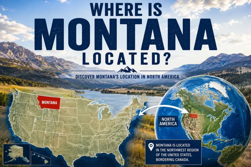
Understanding where Montana is located explains everything: this massive state straddles the Continental Divide, creating a collision of ecosystems that transforms dramatically from east to west.
I’ve spent the better part of three years exploring Montana’s biomes, from the alpine tundra above the treeline in Glacier National Park to the shortgrass prairies that seem to stretch into infinity.
What I’ve learned is that most travelers only scratch the surface, visiting one or two iconic spots without realizing they’re missing entire worlds just a few hours’ drive away.
- Montana contains 5 distinct biomes: montane forest, alpine tundra, grassland/prairie, riparian zones, and sagebrush steppe
- The Continental Divide creates dramatically different ecosystems between east and west Montana
- Best wildlife viewing varies by biome—spring for prairies, fall for mountains, winter for river valleys
- Each biome offers unique experiences: grizzlies in forests, pronghorn on prairies, bighorn sheep in alpine zones
- Plan at least 7-10 days to experience Montana’s full ecological range
Why Montana’s Biome Diversity Matters for Travelers
Most visitors come to Montana expecting mountains. They’re not wrong—the Rocky Mountain cordillera dominates the western third of the state—but they’re missing the bigger picture.
Montana is the fourth-largest state by area, covering 147,040 square miles. That’s larger than Germany. And within that expanse, you’ll find ecosystems ranging from near-desert conditions to temperate rainforests to Arctic-like tundra.
I remember my first trip here in 2019. I flew into Bozeman, visited Yellowstone, and thought I’d “done” Montana. It took three more visits before I understood that I’d experienced maybe 15% of what the state offers ecologically.
The diversity stems from three factors: the Continental Divide’s rain shadow effect, dramatic elevation changes throughout the state, and Montana’s position at the confluence of multiple North American ecological regions. When people ask if Montana is truly in the Midwest, I explain that it defies simple categorization—it’s simultaneously Northern Rockies, Great Plains, and Pacific Northwest, depending on where you’re standing.
The Five Major Biomes of Montana
Let me break down each biome based on where I’ve hiked, camped, photographed, and simply sat in wonder.
Montane Forest Biome: The Iconic Mountain Wilderness
When people picture Montana, they’re usually imagining the montane forest biome. These are the dense coniferous forests that carpet the western mountains, filled with lodgepole pine, Douglas fir, Engelmann spruce, and western larch.
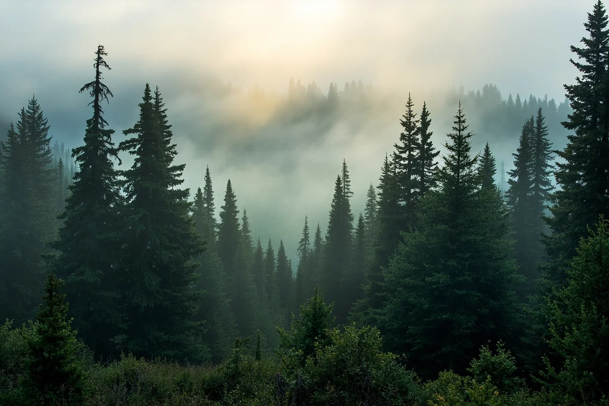
During my extended stay near Whitefish last summer, I spent weeks hiking through these forests. The smell alone is worth the trip—that clean, resinous scent of pine mixed with damp earth after a rain.
The montane forests exist roughly between 4,000 and 9,000 feet elevation, though this varies by latitude. In the Flathead National Forest, I noticed the transition happening lower on north-facing slopes where less sun means cooler, moister conditions.
What you’ll experience: Towering conifers, rushing mountain streams, abundant wildlife including black bears, elk, and moose. The understory features huckleberry bushes (which peak in late July through August—mark your calendar), wildflowers, and fallen logs covered in moss.
My honest observation: These forests can feel claustrophobic if you’re not prepared for limited sightlines. The dense canopy blocks GPS signals in many areas. I always carry a physical map and compass when venturing off main trails.
The best montane forest experiences I’ve had were in the Swan Valley between the Mission and Swan mountain ranges, the Seeley Lake area, and the forests surrounding Glacier National Park’s lower elevations.
Alpine Tundra: Montana’s Arctic Islands
Above the treeline, typically starting around 9,500 feet in Montana, you enter a completely different world. The alpine tundra feels like stepping onto another planet—or perhaps into the far north Arctic without leaving the Lower 48.
I hiked to Hidden Lake Overlook in Glacier National Park during late August last year, and the alpine tundra was in full autumn color. The tiny plants—no more than a few inches tall—had turned brilliant shades of crimson and gold.
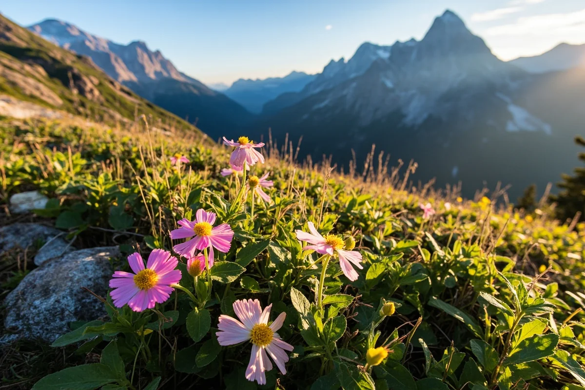
These ecosystems are surprisingly fragile. The growing season lasts just 6-8 weeks, and a single footprint off-trail can kill plants that took decades to establish. I’ve seen the damage thoughtless visitors cause, and it genuinely hurts.
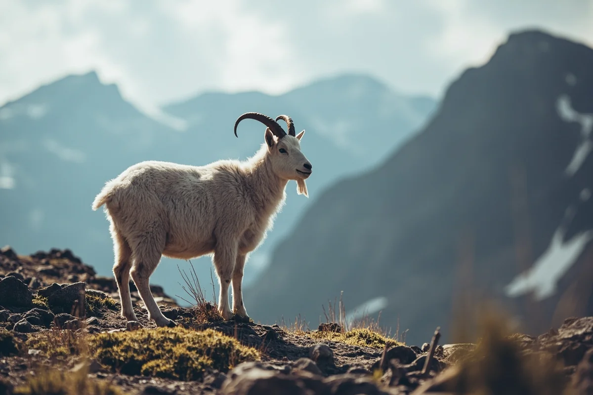
What you’ll experience: Low-growing cushion plants, alpine forget-me-nots, moss campion, and hardy grasses. Wildlife includes mountain goats, bighorn sheep, pikas, and marmots. The views, obviously, are extraordinary.
Practical tip: Alpine tundra is accessible via vehicle at Logan Pass (Going-to-the-Sun Road) in Glacier and at Beartooth Pass near Red Lodge. Both typically open in early June and close by mid-October depending on snowfall.
I’ve learned to arrive at Logan Pass before 7 AM during July and August. By 9 AM, the parking lot is full and you’ll be turned away. The early wake-up is worth it—I once had the Hidden Lake trail nearly to myself at sunrise.
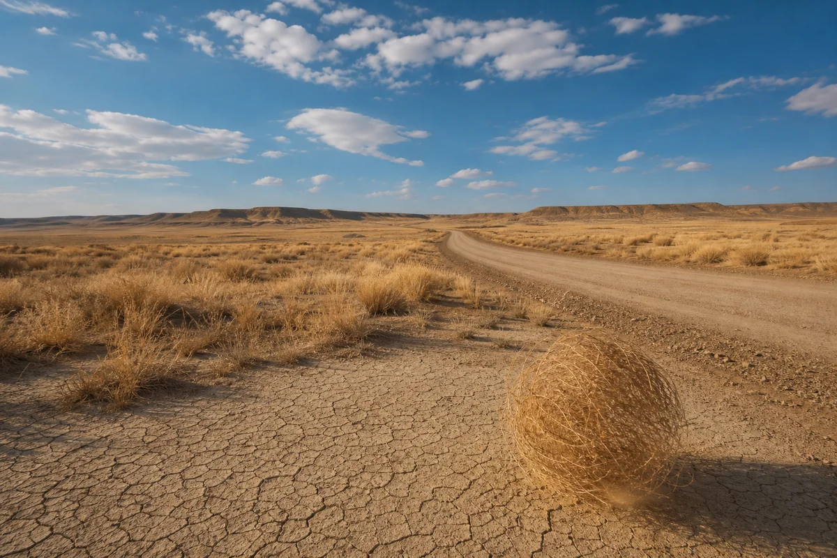
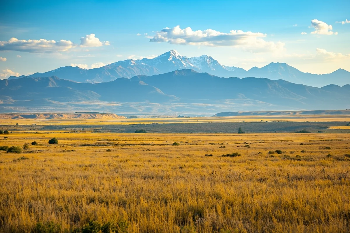
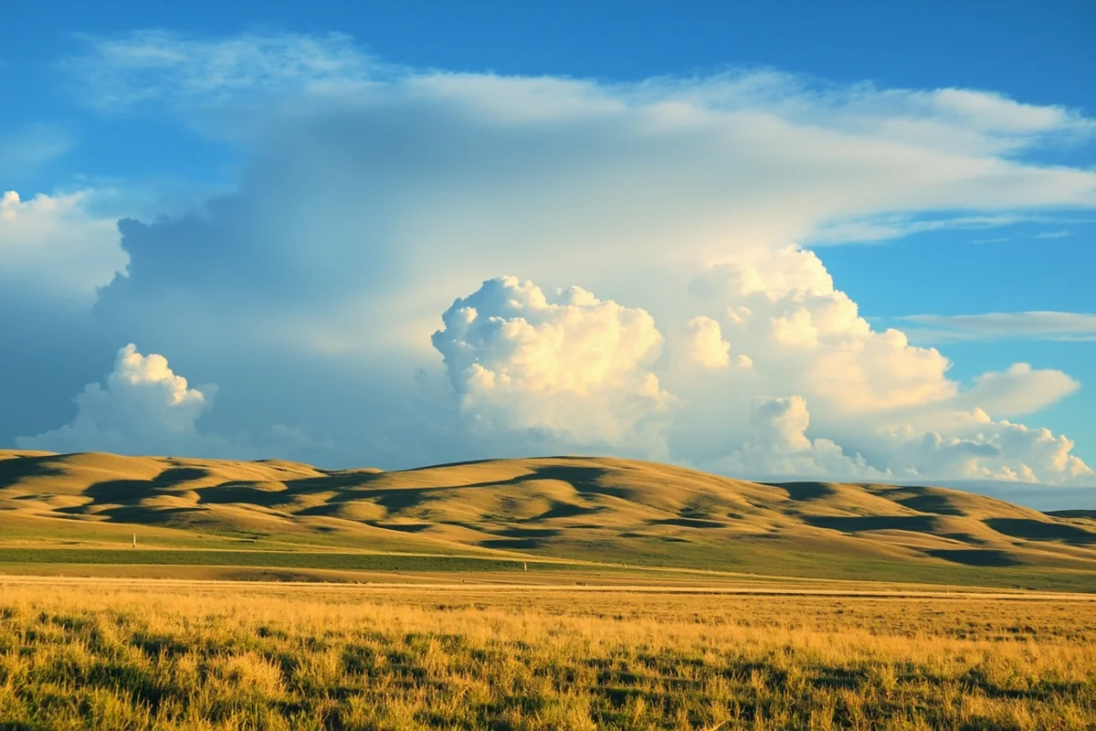
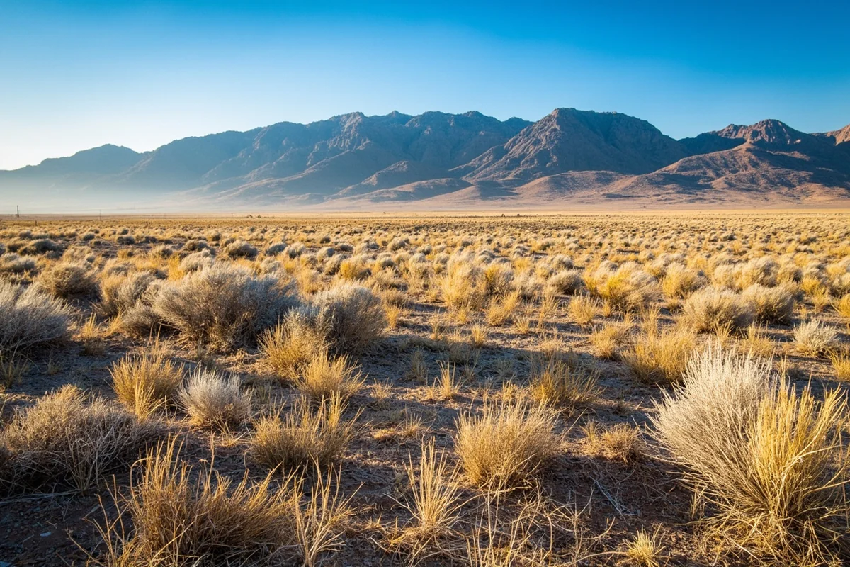
Grassland and Prairie Biome: The Forgotten Montana
This is where I need to challenge your preconceptions. The eastern two-thirds of Montana—yes, two-thirds—consists of grassland and prairie biomes. Most travelers drive through quickly or avoid this region entirely.
That’s a mistake.
The question of whether Montana belongs to the Great Plains has a definitive answer when you’re standing in the Charles M. Russell National Wildlife Refuge. The endless horizon, the big sky, the wind that never stops—this is quintessential American prairie.
I spent five days exploring the prairie biome around Malta and the CMR refuge last September. It changed how I think about Montana entirely.
The grasslands here are classified as mixed-grass prairie, transitioning from shortgrass in the southeast to mixed-grass in the central region. You’ll find blue grama, buffalo grass, western wheatgrass, and needle-and-thread grass dominating the landscape.
What you’ll experience: Pronghorn antelope (I counted over 200 in a single afternoon), prairie dog towns, burrowing owls, golden eagles, and if you’re incredibly lucky, black-footed ferrets. The silence is profound—I remember sitting on a hillside near the Missouri River Breaks and realizing I could hear my own heartbeat.
My honest take: The prairie isn’t for everyone. If you need constant visual stimulation or defined “attractions,” you’ll be bored. But if you can slow down and observe—really observe—you’ll discover an ecosystem teeming with life that most tourists completely overlook.
The best prairie experiences require either a high-clearance vehicle or willingness to walk. The Upper Missouri River Breaks National Monument, accessible from Fort Benton, offers primitive roads and camping that put you deep into undeveloped grassland.
Sagebrush Steppe: Montana’s High Desert
People often wonder if Montana is high desert, and the answer is nuanced. While Montana doesn’t have classic hot desert, the southwestern portion contains extensive sagebrush steppe—a semi-arid biome that feels decidedly desert-like.
I drove through the Centennial Valley near the Idaho border during a June trip, and the landscape could have been mistaken for Nevada or eastern Oregon. Gray-green sagebrush stretched to distant mountains, punctuated by rabbitbrush and bitterroot plants.
The sagebrush steppe biome occurs where annual precipitation drops below 12 inches. This happens in rain shadow areas east of major mountain ranges and in lower valleys throughout southwestern Montana.
What you’ll experience: Big sagebrush dominates the visual landscape, but look closer for prickly pear cactus, various bunchgrasses, and surprisingly diverse wildflowers in spring. Wildlife includes sage-grouse (if you’re very patient), pronghorn, coyotes, and jackrabbits.
Best locations: The Centennial Valley (accessed via gravel road from Monida), Big Hole Valley, Ruby Valley, and portions of the Madison Valley all contain significant sagebrush steppe ecosystems.
This biome faces serious conservation challenges. Invasive cheatgrass alters fire patterns, and sage-grouse populations have declined dramatically. When I visited the Red Rock Lakes National Wildlife Refuge, I learned about ongoing restoration efforts worth supporting.
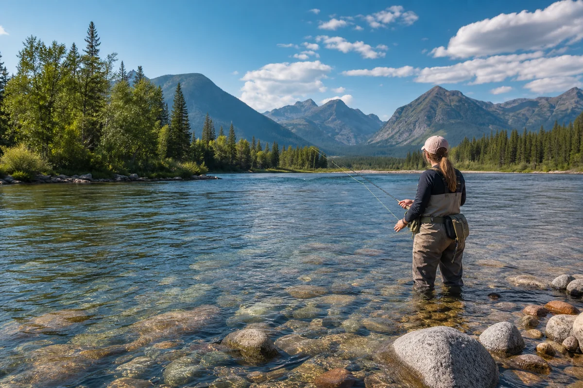
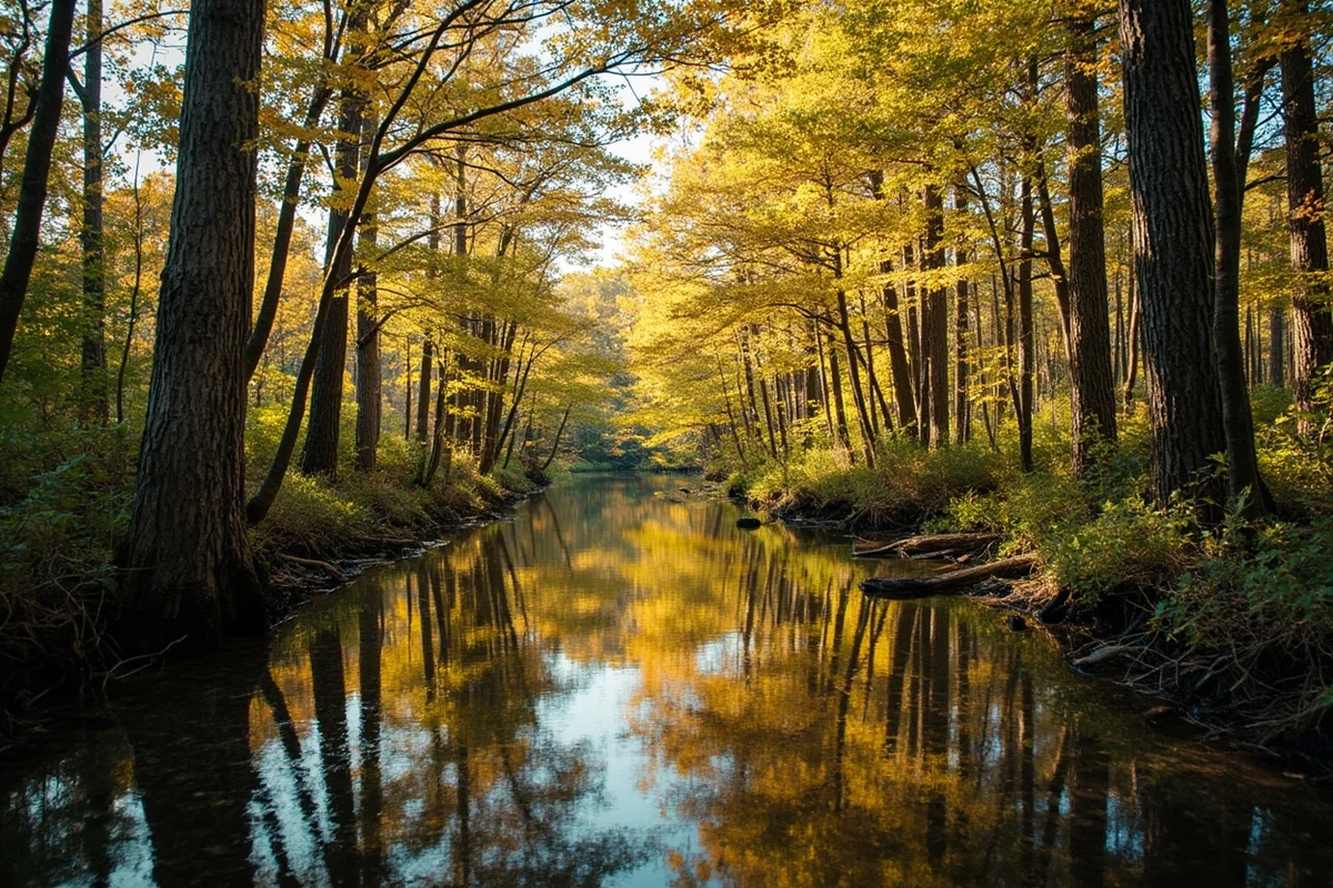
Riparian Zones: The Lifelines Connecting Everything
Montana’s rivers and their surrounding riparian corridors deserve recognition as distinct ecological communities. While technically not a standalone biome, these transitional zones support disproportionate biodiversity and offer some of the best wildlife viewing.
I’ve floated the Smith River, fished the Madison, and camped along the Yellowstone. Each river creates a green ribbon of cottonwoods, willows, and diverse vegetation cutting through whatever surrounding biome it traverses.
The contrast is dramatic on the prairies. While driving through dry grassland near Miles City, the Yellowstone River suddenly appears with its lush gallery forest—a completely different microclimate supporting species that couldn’t survive a hundred yards away.
What you’ll experience: Cottonwood groves, willow thickets, abundant birdlife including bald eagles and great blue herons, beaver activity, and seasonal congregations of elk and deer. Fishing, obviously, is world-class.
Practical tip: River access in Montana is exceptional due to stream access laws. You can legally wade and fish any river below the high-water mark. However, respect private land when accessing rivers—use designated fishing access sites maintained by Montana Fish, Wildlife & Parks.
How the Continental Divide Shapes Everything
You cannot understand Montana’s ecological diversity without understanding the Continental Divide. This geological feature—the literal spine of North America—runs through western Montana and creates fundamentally different conditions on each side.
West of the Divide, Pacific weather systems bring moisture. Annual precipitation in the Flathead Valley averages 16-20 inches, with some mountain areas receiving over 100 inches of snow annually.
East of the Divide, you’re in the rain shadow. Miles City averages just 13 inches of precipitation, and some areas receive less than 10 inches—approaching true semi-arid conditions.
This explains why Montana is a landlocked state that somehow supports both lush forests and near-desert conditions within its borders.
I drove from Kalispell to Great Falls in a single day last October, crossing the Divide at Marias Pass. The transformation was striking—dense forests gave way to open parkland, then to grassland, in the span of maybe 50 miles.
Seasonal Considerations for Each Biome
When you visit matters as much as where you visit. Let me share what I’ve learned about timing.
| Biome | Best Season | Why | Avoid |
|---|---|---|---|
| Montane Forest | June-September | Trails accessible, wildflowers peak July | Late October-May (deep snow) |
| Alpine Tundra | Mid-July to mid-September | Brief growing season, roads open | October-June (inaccessible) |
| Prairie/Grassland | May-June, September | Wildflowers spring, wildlife active fall | July-August (hot, dry, fewer animals visible) |
| Sagebrush Steppe | Late May-June | Spring wildflowers, comfortable temperatures | August (hot), January-February (cold, wind) |
| Riparian Zones | Year-round, varies | Fishing June-October, eagles November-March | Late May-early June (peak runoff, dangerous) |
Wildlife Viewing by Biome
Montana’s wildlife is directly tied to its ecological diversity. Different species have adapted to specific biomes, so knowing where to look dramatically increases your chances of memorable encounters.
Montane Forest Wildlife
The montane forests harbor Montana’s most iconic megafauna. Grizzly bears, black bears, moose, elk, and mountain lions all call these forests home.
During my week in the North Fork of the Flathead, I saw black bears on three separate occasions—always at distance, always by being patient and observant rather than actively seeking them.
Best strategy: Dawn and dusk near forest edges and meadows. Bring binoculars. Stay quiet. I’ve had more wildlife encounters by sitting still for 30 minutes than by hiking 10 miles.
Alpine Tundra Wildlife
Mountain goats and bighorn sheep are the headliners here. I watched a herd of mountain goats near Hidden Lake for over an hour, completely unbothered by my presence as long as I maintained distance.
Pikas—those adorable rock rabbits—are everywhere in talus fields. Listen for their distinctive “eek” call. They’re gathering food constantly during summer, preparing for winter.
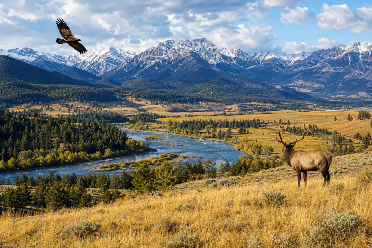
Prairie Wildlife
The prairies surprised me with their wildlife abundance. Pronghorn are everywhere—America’s fastest land mammal, capable of sustained speeds over 55 mph.
Prairie dogs create “towns” that support entire communities of other species. During my visit to a prairie dog town near Havre, I saw burrowing owls (who nest in abandoned prairie dog burrows), rattlesnakes, badgers, and a ferruginous hawk hunting overhead—all within a single afternoon.
Sagebrush Steppe Wildlife
Greater sage-grouse are the iconic species here, though they’re increasingly rare. If you want to witness their bizarre mating displays (called “lekking”), you’ll need to visit in early spring, arrive before dawn, and remain very still.
More commonly seen are pronghorn, mule deer, and various raptors including golden eagles and prairie falcons.
Planning Your Multi-Biome Montana Trip
If you want to experience Montana’s full ecological range, you need strategic planning. Here’s my recommended approach based on multiple cross-state trips.
7-Day Itinerary Covering All Five Biomes
Days 1-2: Glacier National Park (Montane Forest + Alpine Tundra)
Base yourself in Whitefish or West Glacier. Drive Going-to-the-Sun Road early morning for alpine tundra at Logan Pass, then explore lower elevation forests via trails like Trail of the Cedars or Avalanche Lake.
Day 3: Drive to Great Falls via Highway 2
This route crosses the Continental Divide at Marias Pass and descends into the prairie. Stop at the Blackfeet Reservation viewpoints. The ecological transition is visible in real-time.
Days 4-5: Charles M. Russell National Wildlife Refuge
From Great Falls, drive north to Malta or Lewistown. Spend two days exploring the CMR for prairie and riparian ecosystems. The Missouri River Breaks offer both.
Day 6: Drive to Dillon via scenic route
Head southwest through varied terrain. The drive alone showcases multiple ecological transitions.
Day 7: Centennial Valley and Sagebrush Steppe
Explore the sagebrush steppe around Red Rock Lakes National Wildlife Refuge. This remote area feels like stepping back in time.
This itinerary covers significant distances—Montana is massive. If you’re asking whether Montana is considered rural, the answer becomes obvious when you’re driving for hours without seeing another town.
Practical Considerations for Biome Exploration
Vehicle Requirements
You can experience montane forests and alpine tundra with a standard vehicle on paved roads. However, the prairie, sagebrush steppe, and many riparian access points require high-clearance vehicles, preferably 4WD.
The CMR refuge, for example, has gravel roads that become impassable after rain. I’ve seen rental sedans stuck miles from help. Either rent an appropriate vehicle or accept that some areas will be inaccessible.
Cell Coverage
Be prepared for extended periods without cell service. The prairie regions especially have spotty coverage. Download offline maps, tell someone your itinerary, and carry emergency supplies.
Weather Variability
Montana’s diverse biomes mean diverse weather, sometimes in the same day. Last August, I experienced 90°F in the prairie, then 45°F and rain at Logan Pass—within eight hours.
Layer clothing. Bring rain gear even if the forecast looks clear. Mountain weather changes rapidly and unpredictably.
Wildlife Safety
Bear country protocols apply throughout the montane forests and parts of the prairie near river corridors. Carry bear spray, know how to use it, and make noise on trails.
Rattlesnakes are present in prairie and sagebrush steppe biomes. Watch where you step and place your hands, especially around rocks.
Conservation and Responsible Tourism
Montana’s ecological diversity faces real threats: climate change, invasive species, habitat fragmentation, and increasing visitor pressure. As travelers, we have responsibility.
Stay on designated trails in alpine tundra—those tiny plants can take 50 years to recover from trampling. Maintain distance from wildlife (at least 100 yards from bears, 25 yards from other large animals). Pack out all trash, including food waste.
Consider supporting organizations like the Montana Wilderness Association, Montana Land Trust, or The Nature Conservancy of Montana. Your tourism dollars help, but direct conservation contributions make a meaningful difference.
Regional Geography and Montana’s Neighbors
Montana’s biome diversity is partly explained by its unique geographic position. The state shares its northern boundary with Canada—in fact, Montana’s location on the Canadian border influences weather patterns and wildlife migration corridors significantly.
Looking at Montana’s neighboring states helps contextualize the biomes. Idaho to the west shares similar montane forests. Wyoming to the south connects via continuous Greater Yellowstone ecosystems. The Dakotas to the east share prairie biomes.
Some visitors wonder if Montana is located in the Northwest or if it’s West Coast. The ecological evidence supports a more complex picture: western Montana has Pacific Northwest characteristics, eastern Montana is distinctly Great Plains, and the transitional areas blend multiple influences.
This geographic complexity is precisely why discovering what type of region Montana truly is requires experiencing it firsthand rather than relying on simple categories.
Beyond the Obvious: Hidden Ecological Gems
Let me share a few spots that most visitors miss entirely.
Pine Butte Swamp Preserve: Along the Rocky Mountain Front near Choteau, this Nature Conservancy property protects wetlands where prairie meets mountains. Grizzly bears descend from the peaks to forage in the fen—one of the few places where you might see grizzlies on the plains.
Pryor Mountains: South of Billings, this small mountain range contains wild horse herds and juniper woodlands that feel like the American Southwest. The ice caves here were used by Native Americans for thousands of years.
Big Sheep Creek Area: Near Dell in southwestern Montana, this drainage contains old-growth limber pine forests that few people ever see. The solitude is remarkable.
Missouri Headwaters State Park: Where the Jefferson, Madison, and Gallatin rivers merge to form the Missouri. The riparian ecosystem here supports incredible bird diversity, and the historical significance (Lewis and Clark passed through) adds depth to the visit.
Final Thoughts on Montana’s Ecological Tapestry
After years of exploring Montana’s biomes, I’m still discovering new dimensions. The state rewards patience and curiosity in ways that flashier destinations don’t.
The alpine tundra will leave you breathless—literally, given the elevation. The prairies will teach you to see differently, to find beauty in subtlety rather than grandeur. The forests will humble you with their scale. The sagebrush steppe will make you appreciate moisture.
Plan your trip to include multiple biomes if at all possible. The contrasts sharpen your appreciation for each ecosystem. A week on the prairie makes the mountains more magnificent; time in the mountains makes the prairie’s vastness more profound.
Montana’s ecological diversity isn’t just a talking point for travel writers. It’s the reason this state continues to draw me back, season after season, discovery after discovery.
Come prepared to cover ground, to be patient, and to pay attention. Montana’s biomes will reward you for the effort.
Frequently Asked Questions
What are the main biomes and ecosystems I can explore in Montana?
Montana features five distinct biomes including alpine tundra in Glacier National Park, grassland prairies in the eastern plains, montane forests throughout the Rockies, riparian wetlands along rivers, and sagebrush steppe ecosystems. I’ve found you can experience dramatically different landscapes within a single day’s drive, from the 10,000-foot peaks to rolling shortgrass prairies stretching 200+ miles east.
When is the best time to visit Montana to see diverse wildlife and ecosystems?
Late May through early October offers the best access to Montana’s ecological diversity, with July and August being peak season for alpine meadows and high-elevation trails. I recommend September for fewer crowds, fall colors in the deciduous zones, and excellent wildlife viewing as animals prepare for winter. Spring visitors in May can witness prairie wildflower blooms and bird migrations across the grassland biomes.
What should I pack for exploring different Montana biomes in one trip?
Layer everything since temperatures can swing 40°F between prairie lowlands and mountain peaks in a single day. I always bring sturdy hiking boots, bear spray ($40-50 at local outfitters), binoculars for wildlife spotting, and rain gear regardless of forecast. Sun protection is critical at higher elevations where UV intensity increases significantly in alpine zones.
How much does a Montana ecology-focused trip cost for a week?
Budget $150-250 per day for mid-range accommodations, park entrance fees, and meals when exploring Montana’s diverse ecosystems. Glacier National Park charges $35 per vehicle for a 7-day pass, while state parks average $6-8 daily. I’ve found camping cuts costs dramatically at $20-35 per night, and many prairie and forest areas on BLM land offer free dispersed camping opportunities.
Can I see Montana’s grassland prairies and mountain ecosystems without extensive hiking?
Absolutely, the Going-to-the-Sun Road in Glacier lets you experience alpine tundra from your car, while Highway 200 crosses miles of pristine prairie biome with wildlife viewing pullouts. The National Bison Range near Missoula offers a 19-mile auto tour through grassland ecosystems where I’ve spotted bison, pronghorn, and elk without leaving my vehicle. Many ecological interpretive centers also provide accessible exhibits on local biomes.
Where can I find guided ecological tours of Montana’s diverse biomes?
Glacier National Park offers ranger-led programs covering alpine and forest ecology, while outfitters in Bozeman and Missoula run multi-day trips spanning multiple ecosystems for $200-400 per day. The Montana Natural History Center in Missoula and the Montana Wilderness Association lead affordable group excursions focusing on specific biomes. I recommend booking 2-3 weeks ahead during summer months as popular ecology tours fill quickly.
What unique plants and animals can I see across Montana’s different ecological zones?
Montana’s alpine tundra hosts rare species like pikas and mountain goats, while the prairies support black-footed ferrets, prairie dogs, and swift foxes. I’ve encountered grizzly bears in montane forests, watched sandhill cranes in wetland biomes, and spotted greater sage-grouse performing mating dances in sagebrush steppe. The ecological diversity means serious wildlife enthusiasts can realistically observe 50+ mammal species and 200+ bird species across different habitats.
Sources:
- https://en.wikipedia.org/wiki/Ecology_of_the_Rocky_Mountains
- https://montanaclimate.org/chapter/executive-summary
- https://www.nps.gov/glac/learn/nature/plants.htm
- https://montanaclimate.org/chapter/climate-change
- https://montanaclimate.org/chapter/forests
- https://www.fs.usda.gov/rm/pubs_int/int_rp218.pdf
- https://mhs.mt.gov/education/Elementary/Chap1.pdf
- https://www.nationalacademies.org/read/10962/chapter/4
- https://en.wikipedia.org/wiki/Columbia_River
- https://www.usgs.gov/publications/distributions-small-nongame-fishes-lower-yellowstone-river
- https://fwp.mt.gov/binaries/content/assets/fwp/conservation/fisheries-management/statewide-fisheries-management-plan-2023-2026/2.36_middle-yellowstone-river-drainage.pdf
- https://www.epa.gov/eco-research/level-iii-and-iv-ecoregions-epa-region
- https://www.epa.gov/eco-research/level-iii-and-iv-ecoregions-state
- https://mslservices.mt.gov/Geographic_Information/Data/DataList/datalist_Details.aspx?did={D0E259C7-189C-4B83-8520-FB22EEC1B3F9}
- https://catalog.data.gov/dataset/level-iii-ecoregions-of-montana12
- https://pubs.usgs.gov/pp/1794/a/chapters/pp1794a_chapter07.pdf
- https://bplant.org/region/74
- https://www.conservationgateway.org/ConservationPlanning/SettingPriorities/EcoregionalReports/Documents/ngps_final_feb99.pdf
- https://explorer.natureserve.org/Taxon/ELEMENT_GLOBAL.2.722984/Northwestern_Great_Plains_Mixedgrass_Prairie
- https://www.nps.gov/glac/learn/education/life_zones.htm
- https://fieldguide.mt.gov/displayES_Detail.aspx?ES=7117
- https://www.montananaturalist.org/blog-post/tenacious-beauty-in-awe-of-alpine-wildflowers/
- https://plantsciences.montana.edu/alpinemushrooms/alpine-habitat.html
- https://fieldguide.mt.gov/displayES_Detail.aspx?ES=7116
- https://www.montananaturalist.org/exhibits/explore-montana-ecosystems/
- https://www.nps.gov/glac/learn/education/plants-and-animals.htm
- https://fieldguide.mt.gov/displayes_detail.aspx?es=4232#:~:text=Douglas%2Dfir%20is%20the%20dominant,pine%20is%20the%20co%2Ddominant.
- https://fieldguide.mt.gov/displayes_detail.aspx?es=4232
- https://www.nature.org/en-us/about-us/where-we-work/united-states/montana/stories-in-montana/montana-high-divide/
- https://greateryellowstone.org/high-divide
- https://www.ebsco.com/research-starters/environmental-sciences/montana-valley-and-foothill-grasslands
- https://www.nature.org/en-us/get-involved/how-to-help/places-we-protect/montana-sagebrush-grasslands/
- https://www.toposandanthros.com/blog/2017/2/21/the-high-divide
- https://fieldguide.mt.gov/displayES_Detail.aspx?ES=7114
- https://core.ac.uk/download/pdf/77941896.pdf
- https://fieldguide.mt.gov/displayES_Detail.aspx?ES=5454
- https://americanprairie.org/bison-restoration/
- https://fieldguide.mt.gov/displayes_detail.aspx?es=3114
- https://www.usgs.gov/geology-and-ecology-of-national-parks/ecology-badlands-national-park
- https://mtaudubon.org/birds-and-riparian-habitat/
- https://fieldguide.mt.gov/displayES_Detail.aspx?ES=9156
- https://fieldguide.mt.gov/displayES_Detail.aspx?ES=9326
- https://fwp.mt.gov/binaries/content/assets/fwp/conservation/fisheries-management/cutthroat-trout/yellowstone-cutthroat/8–6.6-clarks-fork-of-the-yellowstone-subbasinyctstrategyfinal8_5_13-21.pdf
- https://fwp.mt.gov/binaries/content/assets/fwp/fish/statewide-fisheries-management-plan/part-ii—b.pdf
- https://westernmtwaters.com/our-work-and-projects/aquatic-invasive-species/
- https://www.usgs.gov/news/innovation-addressing-invasive-species-and-disease-montana-waters
- https://westernregionalpanel.org/wp-content/uploads/2022/07/Montana_ANSPlan_2002.pdf
- https://fwp.mt.gov/binaries/content/assets/fwp/conservation/ais/reports/2024-fwp_early_detection_monitoring_control_report.pdf
- https://fwp.mt.gov/binaries/content/assets/fwp/news/public-notices/2025/statewide/mt_ais_plan_v8.pdf
- https://defenders.org/regions/rocky-mountains-and-great-plains
- https://americanprairie.org/the-latest/healthy-bison/
- https://americanprairie.org/the-latest/american-prairie-partners-with-native-nations-to-further-bison-conservation/
- https://archive.legmt.gov/content/Committees/Interim/2017-2018/Water-Policy/Meetings/MontanaClimateAssess-ExecSummary.pdf
- https://archive.legmt.gov/content/Committees/Interim/2019-2020/Water-Policy/Meetings/Sept-2019/MontanaClimateAssessment-Water.pdf