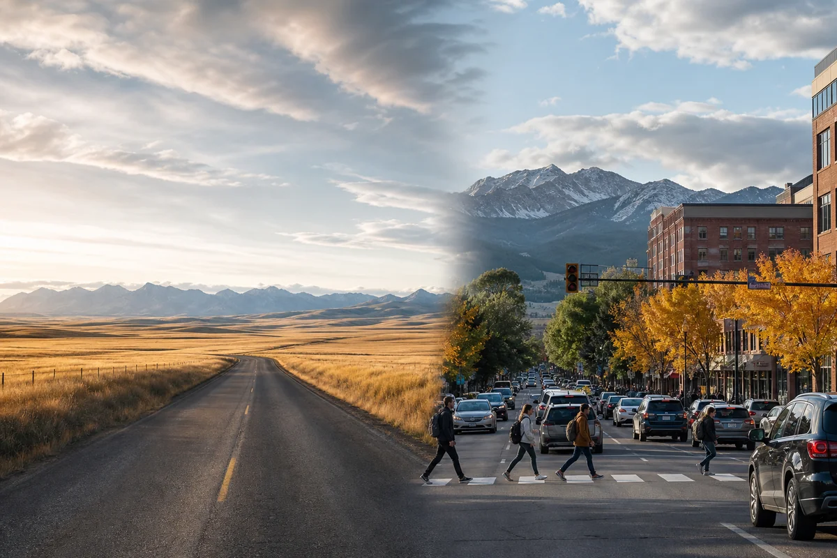
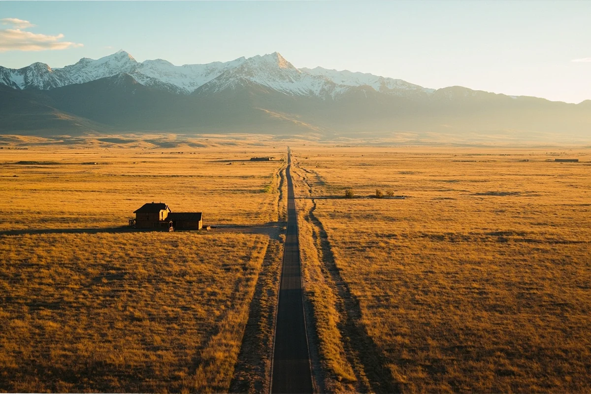
I pulled off Highway 200 somewhere between Great Falls and Lewistown last fall, and for fifteen minutes, I didn’t see another car, person, or even a fence post—just golden prairie stretching to the horizon in every direction.
Then, three days later, I was stuck in actual traffic in downtown Missoula, waiting for a light while college students crossed to grab coffee. That’s Montana’s identity crisis in a nutshell, and it’s exactly why the question “Is Montana rural?” doesn’t have a simple yes-or-no answer.
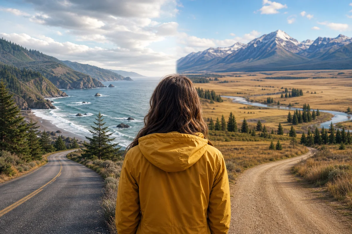
Understanding where Montana is located geographically helps explain this fascinating duality—a state that’s simultaneously one of America’s most remote and one of its fastest-growing destinations.
- Montana is predominantly rural—the 4th largest state with only 1.1 million people and an average of just 7.5 people per square mile
- However, cities like Billings, Missoula, and Bozeman offer surprisingly urban amenities, dining, and culture
- Your experience depends entirely on WHERE in Montana you visit—western mountain towns feel different from eastern prairie communities
- Travelers should prepare for both: enjoy craft breweries and live music in cities, but carry extra water and gas for vast rural stretches
- The “rural” label misses Montana’s nuance—it’s better described as a patchwork of wilderness, ranching country, college towns, and emerging small cities
The Numbers Don’t Lie: Montana’s Population Reality
Let me give you the raw statistics first, because they’re genuinely staggering. Montana covers 147,040 square miles—making it larger than Germany—but holds only about 1.1 million residents. That’s fewer people than live in San Jose, California, alone.
The population density works out to roughly 7.5 people per square mile. Compare that to New Jersey’s 1,263 people per square mile, and you start to understand why I could drive for an hour outside Helena without seeing another soul.
But here’s where it gets interesting. Nearly half of Montana’s population clusters in just seven cities. Billings alone holds about 120,000 people, while the greater Yellowstone region around Bozeman has exploded with growth over the past decade.
What “Rural” Actually Means by Definition
The U.S. Census Bureau defines rural as any area outside an urbanized area (50,000+ people) or urban cluster (2,500-50,000 people). By this measure, approximately 44% of Montana’s land area is considered urban or urban cluster, but those areas hold the majority of the population.
So technically, most Montanans live in or near urban areas. But most of Montana’s land is decidedly rural—and that’s what you’ll encounter driving between destinations.
This distinction matters for trip planning. If you’re staying in Bozeman and day-tripping to Yellowstone, you’ll experience Montana very differently than someone driving the Hi-Line from Havre to Wolf Point. The state’s diverse ecological biomes also contribute to this varied experience, from alpine forests to open grasslands.
My First Encounter with Rural Montana: A Reality Check
I remember my first solo drive through central Montana like it was yesterday—because nothing quite prepares you for that scale of emptiness when you’re used to East Coast travel.
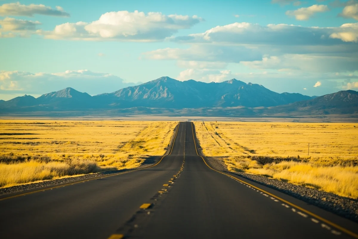
I’d filled up in Great Falls, confident my rental car’s range would handle the 106-mile stretch to Lewistown. What I didn’t anticipate was the complete absence of services for nearly two hours. No gas stations. No cell signal. No rest stops. Just me, the road, and approximately ten thousand antelope.
When I finally rolled into Lewistown—population around 6,000—the Eddie’s Corner gas station felt like a metropolis. I grabbed a coffee, used actual Wi-Fi, and chatted with a rancher who’d driven 45 minutes “to town” for supplies. That’s his weekly commute for groceries.
The 70-Mile Coffee Problem
Here’s a practical reality many travelers don’t consider: in eastern Montana, you might drive 70+ miles between coffee shops. Not Starbucks—any coffee shop at all.
During my trip through the Great Plains region of Montana last summer, I started mapping services between stops. The gaps were eye-opening:
| Route | Distance | Services Available |
|---|---|---|
| Malta to Glasgow | 89 miles | None |
| Jordan to Circle | 72 miles | None |
| Broadus to Miles City | 80 miles | None |
| Missoula to Bozeman | 200 miles | Multiple towns with full services |
Notice that last row? The western corridor tells a completely different story.
The Two Montanas: East vs. West
Ask any Montanan, and they’ll tell you there are really two states sharing one border. The Continental Divide doesn’t just separate watersheds—it separates lifestyles, economies, and degrees of development.
Eastern Montana: The Rural Heartland
Everything east of Billings falls into what I call “deep rural” territory. This is working ranch country, wheat farms spanning thousands of acres, and communities where everyone knows everyone because there simply aren’t many people to know.
When I spent a week around Malta for a story on Montana’s Canadian border communities, I stayed at a motel where the owner left the key under the mat because she had to drive to Havre for a doctor’s appointment. That’s 95 miles each way for basic medical care.

The towns here—places like Terry, Scobey, Ekalaka—often have populations under 500. Schools consolidate across counties. Kids ride buses for over an hour each direction. The nearest Walmart might be a three-hour round trip.
This is genuine, unvarnished rural America. And it’s beautiful in its starkness, its self-reliance, its wide-open silence.
Western Montana: The Growing Exception
Now let’s talk about the Montana most tourists actually visit.
Missoula has craft breweries I’d stack against Portland’s best—Bayern Brewing, Draught Works, and Imagine Nation have all poured me excellent beers. The city has a thriving arts scene, a major university, an international airport, and traffic problems during rush hour.
Bozeman has transformed so dramatically in the past 15 years that longtime residents joke (bitterly) about “Boze Angeles.” Tech workers relocated during COVID, wealthy second-homeowners discovered its proximity to Yellowstone, and suddenly a brewery town became a boomtown. Home prices rival coastal cities in certain neighborhoods.
Even smaller western towns like Whitefish, Helena, and Kalispell offer amenities that feel decidedly non-rural: excellent restaurants, boutique shopping, multiple hotel options, Uber availability.
What This Means for Your Trip Planning
Understanding Montana’s rural-urban divide directly impacts how you should plan your visit. I’ve made enough mistakes to offer some hard-won advice.
If You’re Staying in the Western Corridor
The I-90 and I-15 corridors between Bozeman, Butte, Helena, and Missoula offer conventional travel infrastructure. You’ll find:
- Hotels and vacation rentals at various price points
- Restaurants beyond fast food—genuine farm-to-table dining, international cuisine, vegetarian options
- Grocery stores with normal selections (Costco exists in Missoula and Kalispell)
- Reliable cell service in towns, spotty but present between them
- Gas stations every 20-30 miles at most
The elevation changes in western Montana are significant but well-serviced. You won’t feel isolated unless you venture into the backcountry intentionally.
If You’re Venturing East or Into the Backcountry
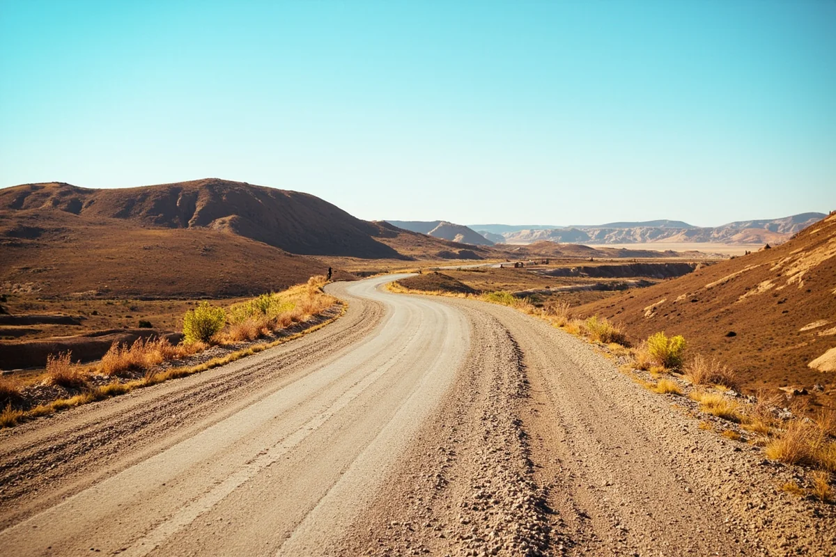
Different rules apply. On a recent trip to photograph the Missouri Breaks, I packed my vehicle like I was crossing a desert—because functionally, I was.
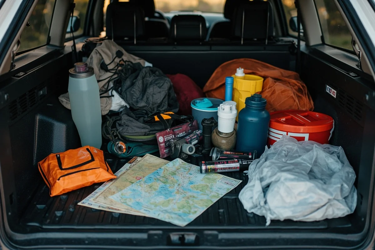
Essential preparations for rural Montana travel:
- Fill your tank whenever you see a station, even if it’s half full
- Carry at least 2 gallons of water per person
- Download offline maps (Google Maps allows this—do it before you lose signal)
- Tell someone your itinerary and expected return
- Pack food beyond snacks—actual meals in case of delays
- Bring a physical road atlas as backup
- Check your spare tire before departure
I’m not being dramatic. During my Missouri Breaks trip, I had zero cell service for nearly eight hours. If something had gone wrong on those gravel roads, help wasn’t coming quickly.
The Communities Between: Montana’s Small Towns
Between the urban centers and the truly remote ranches exists a fascinating middle ground—Montana’s small towns. These communities, typically ranging from 1,000 to 10,000 residents, offer a rural character with essential services.
I’ve grown genuinely fond of places like Livingston, Red Lodge, and Hamilton. They’re small enough to feel intimate, large enough to have a good restaurant and reliable gas.
Livingston: The Writer’s Town
Livingston sits just 30 minutes from Bozeman but feels worlds away from that city’s growth pressures. On my last visit, I walked the entire downtown in fifteen minutes, popped into Elk River Books for an hour of browsing, and ate one of the best burgers of my life at Gil’s Goods.
The town has attracted writers and artists for decades—Jim Harrison lived here, Thomas McGuane still does. There’s a creative energy that feels distinctly non-corporate, distinctly Montana.
Is Livingston rural? By coastal standards, absolutely. By Montana standards, it’s practically metropolitan.
Red Lodge: Adventure Town
Red Lodge, gateway to the Beartooth Highway, has transformed into an adventure tourism hub while maintaining its mining-town bones. The main street offers gear shops, breweries, and restaurants alongside century-old brick buildings.
I spent three days there last September, using it as a base for Beartooth explorations. Each morning I walked to coffee at Red Lodge Ales, each evening I had options for dinner ranging from Mexican to upscale American. That’s not a rural experience in any meaningful sense—though twenty minutes in any direction returns you to complete wilderness.
Understanding Montana’s Regional Identity
The question of whether Montana is rural connects to larger questions about the state’s regional identity. People often misclassify Montana, which affects their expectations.
Montana is decidedly not part of the Midwest, despite what some maps suggest. It’s also not West Coast, though it shares some Pacific Northwest cultural influences in its western regions.
Most geographers place Montana in the Northern Rockies or Mountain West—a classification that captures both its mountainous character and its high-plains reality. The state touches the Pacific Northwest region culturally while also extending into Great Plains territory.
This regional ambiguity directly affects the rural question. Western Montana shares characteristics with Oregon and Washington—outdoor recreation focus, progressive pockets, environmental consciousness. Eastern Montana aligns more with the Dakotas—agricultural economy, conservative values, sparse population.
The Ranching Culture: Rural Montana’s Backbone
You cannot understand Montana’s rural character without understanding ranching. This isn’t nostalgic tourism—it’s the living, working reality for thousands of families.
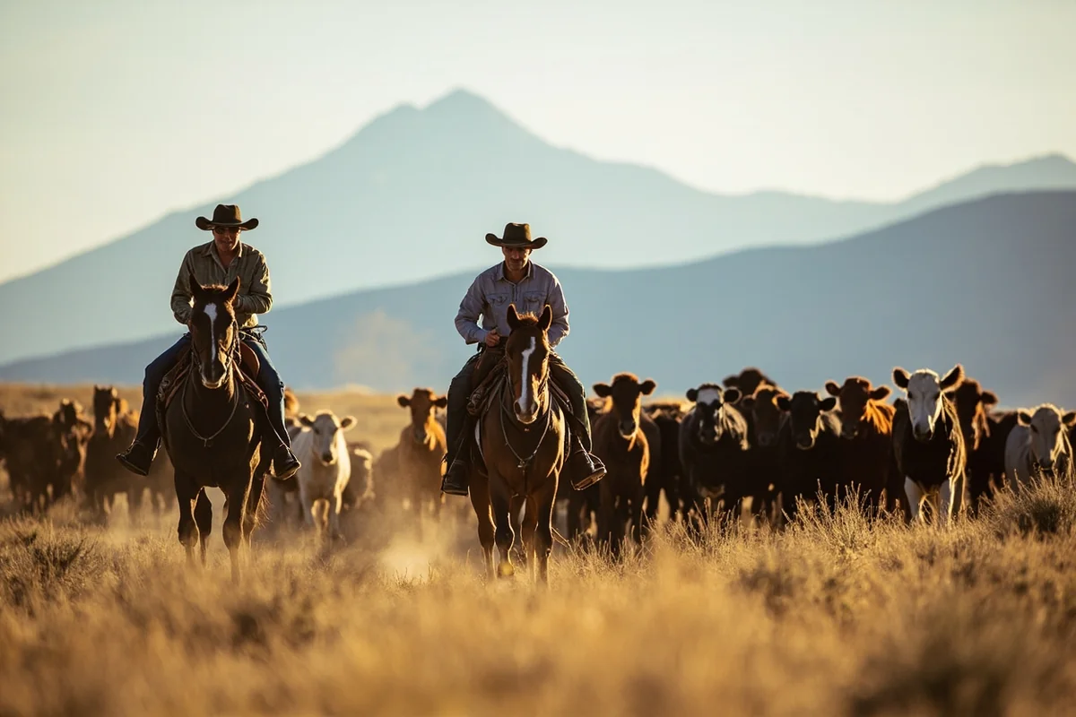
During a week-long assignment photographing ranch life near Miles City, I shadowed a family that runs 400 head of cattle on 12,000 acres. Their nearest neighbor is eight miles away. Their kids ride the school bus for 75 minutes each direction. When a cow needs veterinary care, the vet drives from 60 miles away.
This is functional rural living, not aesthetic rural living. The internet works via satellite and lags during storms. Groceries require planning. Medical emergencies mean helicopter transport to Billings.
Yet the family I stayed with wouldn’t trade it for anything. The father told me, “I’ve seen the cities. Got plenty of room for everyone else there. I’ll take the quiet.”
Guest Ranches: The Tourist Interface
For travelers wanting to experience rural Montana without roughing it completely, guest ranches offer a curated window. I’ve stayed at three now, ranging from rustic to borderline luxurious.
The experience taught me that “rural Montana” and “primitive Montana” aren’t synonymous. Some guest ranches have gourmet chefs, high-thread-count sheets, and surprisingly fast Wi-Fi—they just happen to sit on 20,000 acres of wilderness.
This represents another dimension of Montana’s complexity. You can have an authentically rural experience while still enjoying comfortable beds and good wine.
Modern Rural: Starlink, Remote Work, and Changing Towns
Something fascinating is happening in Montana’s rural communities, and I’ve watched it accelerate over my years visiting.
Remote workers discovered that video calls work from Ennis as well as San Francisco—and Ennis has better fly fishing. Starlink satellite internet now reaches places that had dial-up until 2020. Coffee shops have appeared in towns that previously had only bars.
During my most recent trip through the Gallatin Valley, I stopped in Manhattan, Montana (population 1,800). A craft brewery had opened since my last visit. A small coworking space operated above a feed store. Young professionals typed on laptops while actual ranchers grabbed morning coffee.
Is Manhattan rural? The setting certainly is—you’re surrounded by working agricultural land. But the amenities increasingly aren’t.
This transformation creates tension. Long-time residents see housing costs rise as remote workers move in. The character of towns shifts. What was affordable ranch-adjacent living becomes expensive rural lifestyle.
The Affordability Question
Related to the rural question is the practical matter of cost. Travelers assume rural means cheap. Montana complicates this assumption.
In genuinely remote areas—let’s say Ekalaka or Plentywood—accommodations are both limited and affordable. You might find a motel room for $70 that feels straight from 1985. Restaurants charge reasonable prices because that’s what locals can pay.
But in places like Bozeman, Big Sky, or Whitefish, prices rival or exceed major cities. I paid $18 for a breakfast sandwich in Big Sky last winter. Hotels routinely exceed $300/night during peak season.
Montana is a tale of two economies: the struggling rural economy of agricultural communities and the booming economy of tourist destinations.
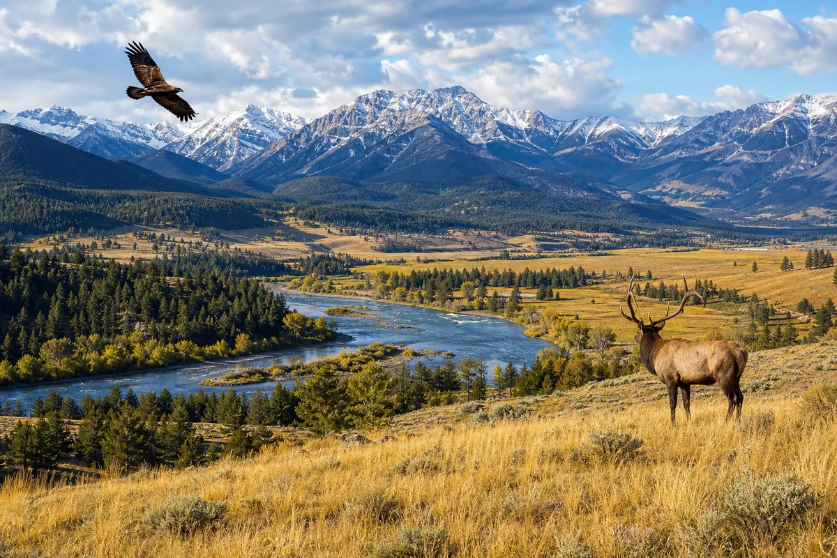
Wildlife and Wilderness: The Unbuilt Montana
Beyond the human geography lies Montana’s truly wild character—and this, more than anything, defines its rural nature.
Montana contains more wilderness area than any state outside Alaska. Grizzly bears wander within miles of city limits. Wolves have returned to landscapes they’d been absent from for nearly a century. On any given drive, you’re likely to see deer, antelope, elk, or moose.

Last fall, I was driving from Gardiner toward Mammoth Hot Springs when traffic stopped. The reason? A grizzly sow and two cubs crossing the road, utterly unconcerned with the line of vehicles. We waited fifteen minutes while they ambled through.
This is peak tourism season on a main road to Yellowstone—and wildlife still dictates the schedule. That dynamic doesn’t exist in truly urbanized areas.
I’ve also learned that Montana’s wilderness penetrates its towns more than most visitors expect. Black bears raid garbage in Missoula neighborhoods. Mountain lions occasionally appear in Bozeman backyards. The boundary between wild and settled remains thin.
Climate and Seasons: Rural Weather Reality
Montana’s climate adds another dimension to the rural question. Weather here can isolate communities in ways that more developed regions have engineered around.
Some Montana roads close entirely during winter. The Beartooth Highway shuts from mid-October through late May. Going-to-the-Sun Road in Glacier typically closes from October to June. Numerous forest service roads become impassable with snow.
Even main highways can close during blizzards. I’ve been stuck in Great Falls for an extra day when I-15 shut down due to whiteout conditions. Interstate closures aren’t hypothetical—they’re seasonal reality.
Given Montana’s northern position and dramatic terrain ranging from high desert to mountain peaks, weather volatility comes standard. As a landlocked state far from any ocean’s moderating influence, temperature swings can be extreme.
This matters for travelers. Winter visits require flexibility. Shoulder season trips may encounter unexpected road closures. The infrastructure to keep everything plowed and passable simply doesn’t exist like it does in more densely populated states.
Infrastructure Realities: Hospitals, Airports, and Services
Here’s something I always emphasize to travelers: Montana’s rural character has practical implications beyond scenery.
Medical Care Access
Montana has just three Level I trauma centers: Billings Clinic, St. Vincent Healthcare (also Billings), and Providence St. Patrick in Missoula. If you’re injured in the eastern half of the state, you’re likely facing a helicopter ride.
I don’t share this to frighten anyone—millions visit safely each year. But understanding the medical landscape affects decisions about activities and preparation. Backcountry hiking in Montana carries different risk than hiking in Vermont, where help is rarely far.
Airport Options
Montana has eight airports with commercial service, but only a few offer substantial options:
- Bozeman Yellowstone International—busiest in the state, many direct flights
- Missoula International—good regional options
- Billings Logan International—gateway to eastern Montana
- Glacier Park International (Kalispell)—seasonal peaks for park access
- Great Falls, Helena, Butte, and West Yellowstone—limited service
Connecting flights are common. Direct flights from East Coast cities often route through Denver, Minneapolis, or Salt Lake City. This connectivity challenge speaks to Montana’s position: desirable enough to warrant substantial air service, but not quite connected enough for seamless travel.
The Neighboring States Context
Montana’s character also makes more sense when you consider its neighbors. The state borders North Dakota, South Dakota, Wyoming, and Idaho—all sharing varying degrees of rural character—plus Canadian provinces Alberta and Saskatchewan.
This region collectively forms one of the least densely populated areas in North America. The “rural Montana” experience extends seamlessly into similarly sparse areas across these borders. When I’ve crossed into North Dakota on Highway 2 or dropped into Wyoming via Beartooth Pass, the change feels minimal. Same big sky, same open roads, same vast scale.
Understanding what type of region Montana truly occupies means recognizing this broader context. It’s not an isolated rural island—it’s part of a rural continent stretching from the Canadian prairies to Wyoming’s basins.
Practical Guidance: Preparing for Montana’s Duality
After years of traveling this state, I’ve developed a hybrid approach that accounts for both Montanas—the surprisingly developed and the genuinely remote.
My Standard Montana Packing Additions
Even when staying in Missoula or Bozeman hotels, I keep certain items in my vehicle:
- A small cooler with snacks and water (day trips can go long)
- Paper maps of regions I’ll explore
- A portable phone charger
- Basic first aid kit
- Layers regardless of season (weather changes fast)
- Sunscreen and sunglasses (elevation intensifies UV)
For trips into genuinely rural areas, I add:
- Full tank of gas and extra fuel if space allows
- Two gallons of water minimum
- Non-perishable food for 24 hours
- Satellite communicator (I use a Garmin inReach)
- Physical cash (some rural businesses don’t take cards)
- Emergency blankets
Is this excessive for a day trip? Maybe. But I’ve used every item on this list at some point.
Mindset Adjustment
More than gear, Montana requires a mindset shift for travelers accustomed to constant connectivity and abundant services.
I’ve learned to embrace the gaps in coverage as features, not bugs. Those hours without cell service become genuine rest from digital intrusion. The requirement to plan ahead for gas and food creates intentionality that rushed travel lacks.
This is part of what makes Montana special, rural and urban alike. The scale demands attention. You can’t passive-travel through Montana—it requires engagement.
My Honest Answer: Is Montana Rural?
After nearly a decade of exploring this state, my answer is nuanced but definitive.
Montana is fundamentally rural in character, infrastructure, and geography. The vast majority of its land area fits any definition of rural. Its economy outside tourism and universities remains tied to agriculture and extraction. Its population density ranks among the lowest in the nation.
However, Montana’s urban pockets—particularly along the western corridor—offer experiences that feel anything but rural. You can have an excellent urban vacation in Bozeman, Missoula, or even Kalispell without ever confronting Montana’s rural reality.
The question isn’t really whether Montana is rural. It’s whether YOUR Montana trip will be rural. That’s entirely within your control.
If you want city amenities with mountain backdrops, Montana delivers. If you want solitude so complete it becomes almost disorienting, Montana offers that too. And if you want a mix—morning coffee in a real town, afternoon adventure in the backcountry—Montana accommodates perfectly.
Final Thoughts for the Curious Traveler
I keep returning to Montana because no other state occupies this particular position: wild enough to humble me, developed enough to comfort me, varied enough to surprise me every trip.
The rural question matters because expectations shape experiences. Travelers who expect only wilderness will be surprised by Bozeman’s sophistication. Travelers who expect Western cities will be surprised by the miles between Malta and Glasgow.
Prepare for both Montanas. Embrace the contrast. And give yourself enough time to experience the full spectrum—the craft brewery in town and the complete silence of the prairie. Both are authentically Montana.
That’s what I’ve learned after years on these roads: Montana isn’t rural OR urban. It’s both, often within the same day, sometimes within the same hour. And that contradiction is exactly what makes it unforgettable.
Frequently Asked Questions
Is Montana considered a rural state for travelers?
Yes, Montana is one of the most rural states in the US, ranking 48th in population density with just 7 people per square mile. When I drive through Montana, I often go 50+ miles between small towns, so planning fuel stops and accommodations in advance is essential for any road trip.
How far apart are cities and towns in rural Montana?
Major cities like Billings, Missoula, and Great Falls can be 200-350 miles apart, with small towns scattered every 30-60 miles along main highways. In eastern Montana especially, you’ll encounter vast stretches of open prairie where services are extremely limited, so I always recommend filling up your gas tank whenever you see a station.
What should I pack for traveling through rural Montana?
Pack emergency supplies including extra water, snacks, a first-aid kit, blankets, and a portable phone charger since cell service is spotty in remote areas. I also bring a physical road map because GPS can be unreliable when you’re miles from the nearest cell tower in Montana’s backcountry.
Is it safe to travel alone through Montana’s rural areas?
Montana is generally very safe for solo travelers, but the remoteness requires extra preparation. I always tell someone my route and expected arrival times, carry emergency supplies, and avoid driving unfamiliar dirt roads after dark since wildlife collisions with deer and elk are common.
What is the best time to visit rural Montana for sightseeing?
Late June through early September offers the best weather and road conditions for exploring rural Montana, with temperatures ranging from 70-85°F. I prefer September when crowds thin out, fall colors emerge, and you can still access most scenic byways before winter closures begin in October.
How much does a road trip through rural Montana cost per day?
Budget around $150-250 per day for a comfortable rural Montana road trip, including gas ($50-80 for long driving days), lodging ($80-150 at small-town motels), and meals ($30-50). Costs increase significantly near Glacier and Yellowstone National Parks, where summer rates can double.
Are there urban areas in Montana worth visiting?
While Montana is predominantly rural, cities like Bozeman, Missoula, and Billings offer excellent restaurants, craft breweries, museums, and shopping as base camps between wilderness adventures. I use these urban hubs to restock supplies, enjoy reliable WiFi, and experience Montana’s growing food and arts scene before heading back into the backcountry.
Sources:
- Montana – Wikipedia, accessed on December 9, 2025, https://en.wikipedia.org/wiki/Montana
- III.B. Overview of the State – Montana – 2024, accessed on December 9, 2025, https://mchb.tvisdata.hrsa.gov/Narratives/Overview/9a5f96d0-a5bd-4671-859f-f15a6cb89294
- List of U.S. states and territories by population density – Wikipedia, accessed on December 9, 2025, https://en.wikipedia.org/wiki/List_of_U.S._states_and_territories_by_population_density
- “Frontier*” Counties, accessed on December 9, 2025, https://archive.legmt.gov/content/publications/services/legislative_council/1999_legcouncil/99denmap.pdf
- Economic Growth in Rural Montana, accessed on December 9, 2025, https://lmi.mt.gov/_docs/Publications/EAG-Articles/1217-RuralEconomy.pdf
- Montana: One State with Three Changing Regions (Part 2 of 3), accessed on December 9, 2025, https://www.umt.edu/this-is-montana/columns/stories/montana_regions_2of3.php
- Are Zoom Towns the Future of Cities? – NBBJ, accessed on December 9, 2025, https://www.nbbj.com/ideas/are-zoom-towns-the-future-of-cities
- Rural Definitions Used for Eligibility Requirements in USDA Rural Development Programs, accessed on December 9, 2025, https://www.congress.gov/crs-product/R47510
- 2025 USDA Eligibility Map & Rural Property Requirements – Neighbors Bank, accessed on December 9, 2025, https://www.neighborsbank.com/usda-loans/property-eligibility-map/
- U.S. Census Bureau redefines the meaning of urban areas in America | PBS News, accessed on December 9, 2025, https://www.pbs.org/newshour/politics/u-s-census-bureau-redefines-the-meaning-of-urban-areas-in-america
- 2020 census urban-rural classification fact sheet, accessed on December 9, 2025, https://www.census.gov/content/dam/Census/library/factsheets/2022/dec/2020-census-urban-rural-fact-sheet.pdf
- How We Define Rural – HRSA, accessed on December 9, 2025, https://www.hrsa.gov/rural-health/about-us/what-is-rural
- 1. Defining “Rural” Areas – U.S. Census Bureau, accessed on December 9, 2025, https://www.census.gov/content/dam/Census/library/publications/2019/acs/ACS_rural_handbook_2019_ch01.pdf
- Urban Percentage of the Population for States, Historical, accessed on December 9, 2025, https://www.icip.iastate.edu/tables/population/urban-pct-states
- List of municipalities in Montana – Wikipedia, accessed on December 9, 2025, https://en.wikipedia.org/wiki/List_of_municipalities_in_Montana
- Every City/Town in Montana Listed By Population – Newstalk KGVO, accessed on December 9, 2025, https://newstalkkgvo.com/every-citytown-in-montana-listed-by-population/
- Rural Classifications – What is Rural? | Economic Research Service – ERS.USDA.gov, accessed on December 9, 2025, https://www.ers.usda.gov/topics/rural-economy-population/rural-classifications/what-is-rural
- May 2023 Metropolitan and Nonmetropolitan Area Definitions – Bureau of Labor Statistics, accessed on December 9, 2025, https://www.bls.gov/oes/2023/may/msa_def.htm
- Rural-Urban Commuting Area Codes | Economic Research Service – ERS.USDA.gov, accessed on December 9, 2025, https://www.ers.usda.gov/data-products/rural-urban-commuting-area-codes
- Montana statistical areas – Wikipedia, accessed on December 9, 2025, https://en.wikipedia.org/wiki/Montana_statistical_areas
- Census releases detailed 2020 counts — with an asterisk – Montana Free Press, accessed on December 9, 2025, https://montanafreepress.org/2021/08/12/census-releases-detailed-montana-population-data/
- Rural-Urban Continuum Codes | Economic Research Service – ERS.USDA.gov, accessed on December 9, 2025, https://www.ers.usda.gov/data-products/rural-urban-continuum-codes
- Defining Rural | University of Montana, accessed on December 9, 2025, https://www.umt.edu/rural-disability-research/focus-areas/rural_disability/defining-rural.php
- Rural Urban Continuum Codes – SEER, accessed on December 9, 2025, https://seer.cancer.gov/seerstat/variables/countyattribs/Rural.Urban.Continuum.Codes.1974.1983.1993.2003.2013.2023.pdf
- Definition of Frontier – National Rural Health Association, accessed on December 9, 2025, https://www.ruralhealth.us/getmedia/132306e1-1643-4b40-818a-4d743317dc7e/NRHAFrontierDefPolicyPaperFeb2016.pdf
- CSCT Frontier and Non-Frontier Counties – dphhs, accessed on December 9, 2025, https://dphhs.mt.gov/assets/BHDD/CMB/CSCT/FrontierandNonFrontierCounties.pdf
- Montana population growth slows, though some hot spots remain, accessed on December 9, 2025, https://montanafreepress.org/2025/06/04/montana-population-growth-slows-though-some-hot-spots-remain/
- Frontier and Remote Area Codes – Documentation | Economic Research Service, accessed on December 9, 2025, https://www.ers.usda.gov/data-products/frontier-and-remote-area-codes/documentation
- MONTANA: 2020 Census, accessed on December 9, 2025, https://www.census.gov/library/stories/state-by-state/montana.html
- Montana’s Changing Demographics: 2024 Update, accessed on December 9, 2025, https://archive.legmt.gov/content/Publications/fiscal/2025-Biennium/MARA/Demographic-Report-Update-MARA-2024.pdf
- Remote work is changing American geography: inside the rise of Zoom towns – Twingate, accessed on December 9, 2025, https://www.twingate.com/research/zoom-towns
- The rise of ‘Zoom Towns’ in the rural west – S.J. Quinney College of Law, accessed on December 9, 2025, https://www.law.utah.edu/resgestae-issue/the-rise-of-zoom-towns-in-the-rural-west/
- Examining the disparity of urban and rural growth – High Country News, accessed on December 9, 2025, https://www.hcn.org/articles/the-montana-gap-examining-the-disparity-of-urban-and-rural-growth/
- Single Family Housing Direct Home Loans in Montana – USDA Rural Development, accessed on December 9, 2025, https://www.rd.usda.gov/programs-services/single-family-housing-programs/single-family-housing-direct-home-loans/mt
- Rural Development Single Family Housing Guaranteed Loan Program, accessed on December 9, 2025, https://www.rd.usda.gov/files/rd-grhlimitmap.pdf
- Behavioral health commission proposes $2.5 million for rural and frontier Montana counties, accessed on December 9, 2025, https://www.catalystforchange.org/mental-health-blog/behavioral-health-commission-proposes-25-million-for-rural-and-frontier-montana-counties
- Census 2020 – Montana State Legislature, accessed on December 9, 2025, https://archive.legmt.gov/information-legislators/census-2020/
- Montana – Three rural definitions based on Census Places – USDA ERS, accessed on December 9, 2025, https://ers.usda.gov/sites/default/files/_laserfiche/DataFiles/53180/25581_MT.pdf