Standing on a windswept ridge near Lewistown last September, I watched golden wheat fields stretch to the horizon in every direction—and I finally understood why the Great Plains question matters so much.
The landscape before me could have been Kansas or Nebraska, yet I’d driven through Glacier National Park’s towering peaks just two days earlier.
If you’re wondering where Montana is located and whether it truly belongs to the Great Plains, the answer fundamentally changes how you should plan your trip.
- Montana is split roughly 60/40 between Great Plains (eastern two-thirds) and Rocky Mountains (western third)
- The Continental Divide creates a dramatic geographic boundary you can actually experience while driving
- Eastern Montana offers authentic Great Plains travel—wide-open prairies, cattle ranches, and sparse population
- Western Montana features mountain wilderness, forests, and alpine lakes
- Understanding this split helps you plan realistic driving times and set proper expectations
- The transition zone around Great Falls offers the best of both worlds
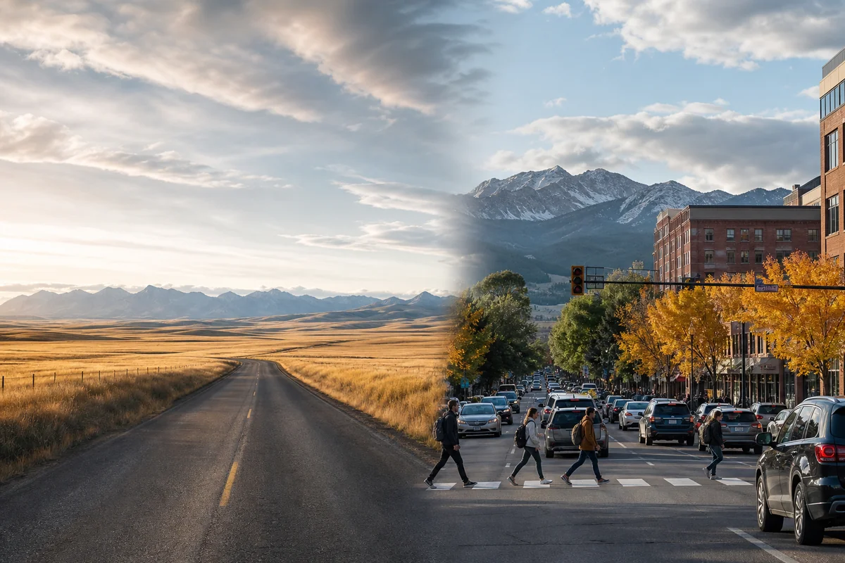
The Geographic Truth: Montana’s Split Personality
I’ve spent over five years exploring Montana’s backroads, and nothing prepared me for how dramatically different the state’s two halves feel. When people ask me if Montana is truly in the Midwest, I tell them it’s complicated—because Montana genuinely straddles two completely distinct American landscapes.
The state’s eastern two-thirds belongs definitively to the Great Plains physiographic region. This isn’t my opinion—it’s geological fact confirmed by decades of scientific classification.
But here’s what the textbooks don’t tell you: experiencing that transition firsthand is one of Montana’s most underrated travel experiences.
Understanding the Great Plains Definition
Before we dive deeper, let’s clarify what “Great Plains” actually means. The Great Plains is a massive region stretching from Canada to Texas, characterized by relatively flat terrain, semi-arid climate, and grassland ecosystems.
The region covers approximately 500,000 square miles across ten states. Montana contributes roughly 60,000 square miles to this total—making it one of the largest Great Plains states by area.
When I drove from Miles City to Billings during my first Montana road trip, I remember thinking I’d accidentally crossed into Wyoming. The landscape felt endless, empty, and profoundly western in a way that had nothing to do with mountains.
What Defines Great Plains Geography
The Great Plains share several defining characteristics that I’ve observed across eastern Montana. Elevation typically ranges from 2,000 to 6,000 feet, with gentle rolling hills rather than dramatic peaks.
Annual rainfall stays below 20 inches in most areas, creating that classic short-grass prairie ecosystem. When you check out the Montana biome ecological diversity guide, you’ll see how this shapes the entire region.
The soil is generally fertile but dry, supporting cattle ranching and wheat farming rather than dense forests. This explains why eastern Montana feels so different from the postcard images most people associate with the state.
Where Exactly the Great Plains Exist in Montana
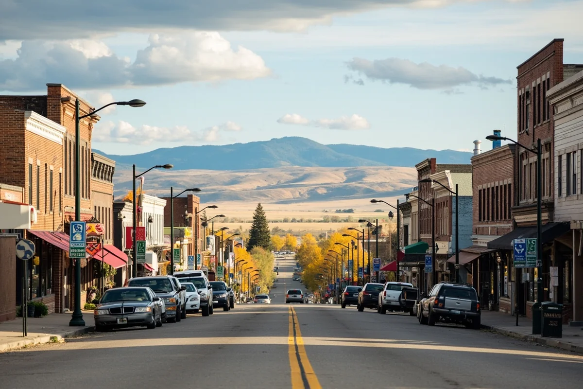
Let me give you the specific boundaries I’ve observed through years of travel. The Great Plains begin roughly at a line running from Glacier National Park’s eastern edge down through Great Falls, Helena, and continuing to the Wyoming border.
Everything east of this line—including cities like Billings, Miles City, Glendive, Havre, and Glasgow—sits squarely within Great Plains territory.
I remember my first drive into Jordan, Montana, which claims to be the most isolated town in the lower 48 states. The emptiness wasn’t scary—it was exhilarating. Miles of sage-covered prairie without another vehicle in sight.
Key Great Plains Cities in Montana
| City | Population | Great Plains Character | Must-Do Experience |
|---|---|---|---|
| Billings | ~120,000 | Gateway city, rimrocks | Sunset at Swords Park |
| Miles City | ~8,500 | Authentic cowboy culture | Bucking Horse Sale (May) |
| Havre | ~9,800 | Hi-Line railroad town | Underground Havre tour |
| Glasgow | ~3,300 | Remote prairie outpost | Fort Peck Lake |
| Glendive | ~5,000 | Badlands gateway | Makoshika State Park |
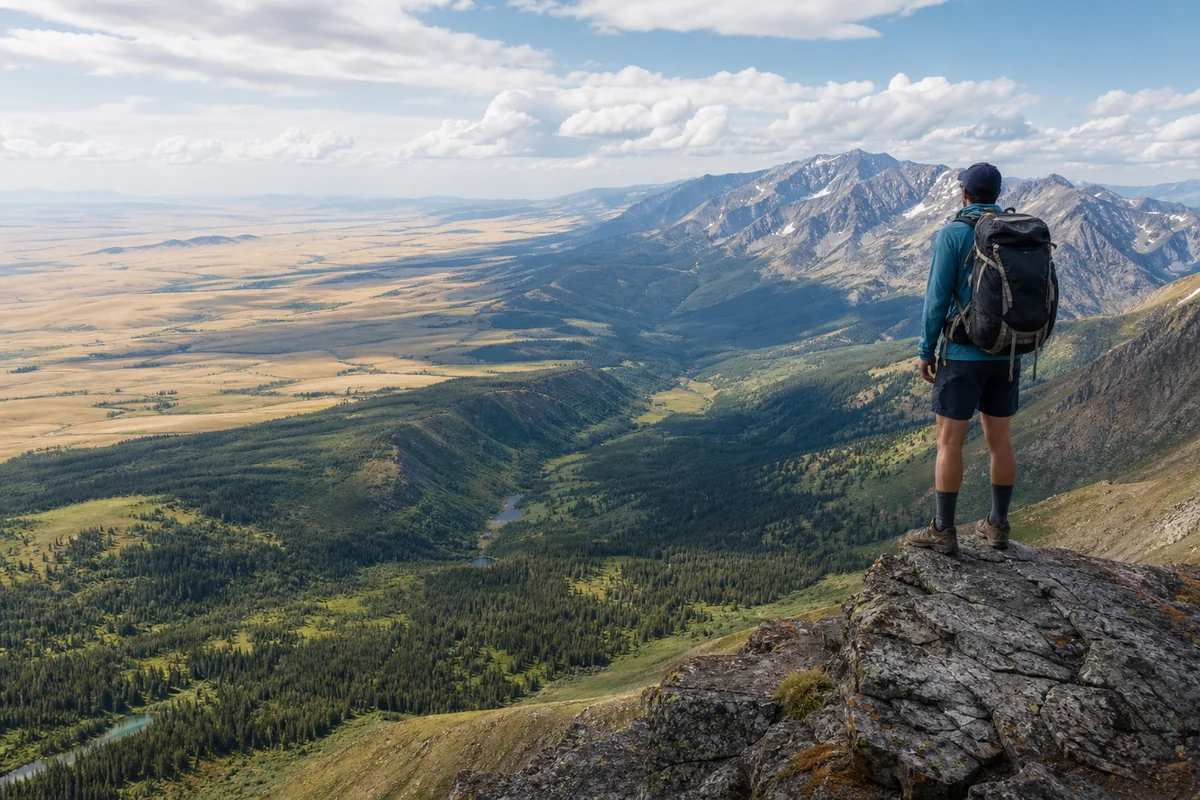
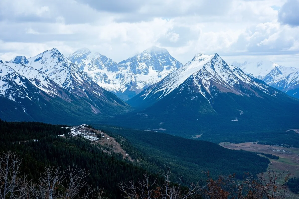
The Rocky Mountain Western Third
Now let’s address the other Montana—the one that fills Instagram feeds and draws millions of visitors annually. The western third of Montana belongs to the Rocky Mountain region, not the Great Plains.
This distinction matters enormously for trip planning. Understanding the Montana elevation guide reveals why western Montana feels like an entirely different state.
During my last visit to Whitefish in February, I experienced 8 feet of snowpack at Big Mountain while friends in Miles City were dealing with brown, wind-scoured prairies. Same state, completely different worlds.
The Continental Divide: Montana’s True Boundary
The Continental Divide runs through western Montana like a spine, creating the definitive boundary between Great Plains and Rocky Mountain regions. Everything east drains to the Mississippi River system and eventually the Gulf of Mexico.
I hiked to Triple Divide Peak in Glacier National Park last August—one of only two spots in North America where water flows to three different oceans. Standing there, I finally grasped how the Continental Divide shapes Montana’s identity.
West of the divide, rivers flow toward the Pacific. This creates different ecosystems, weather patterns, and ultimately, different travel experiences.
How This Geographic Split Affects Your Trip
Understanding Montana’s Great Plains connection isn’t just academic—it fundamentally changes how you should plan your visit. I’ve made the mistake of underestimating driving distances based on map appearances.
Montana is the fourth-largest state by area. When you realize Montana is a landlocked state covering 147,000 square miles, those “short” distances start making sense.
The Great Plains portion of Montana requires a completely different mindset than the mountainous west. Services are sparse, cell coverage is unreliable, and attractions are subtle rather than dramatic.
Driving Time Realities
Let me share specific examples from my own trips:
- Missoula to Billings: 340 miles, roughly 5 hours. You’ll cross from mountains to plains around Butte.
- Billings to Miles City: 145 miles, about 2 hours of pure Great Plains driving.
- Great Falls to Havre: 115 miles through rolling wheat country—mesmerizing but empty.
- Glasgow to anything: Plan for at least 2 hours regardless of direction.
I once drove from Glacier National Park to Makoshika State Park near Glendive—a journey that took over 8 hours and covered the full spectrum of Montana geography.
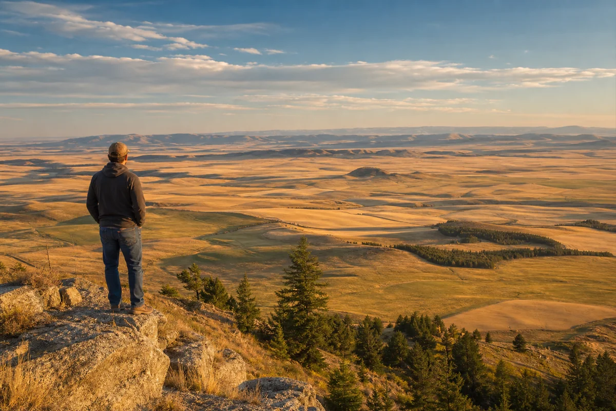
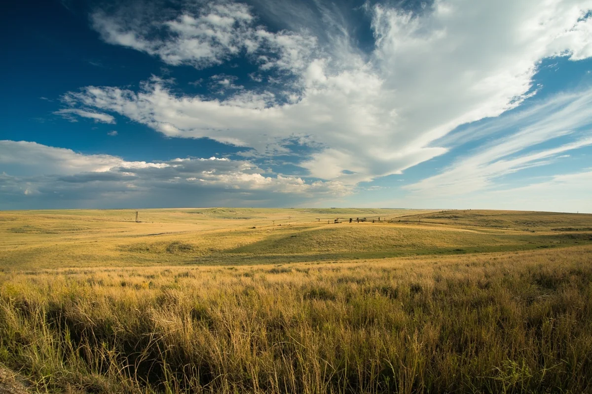
What Great Plains Montana Actually Looks Like
Forget everything you think you know about Montana if your mental image only includes mountains. Eastern Montana delivers a raw, untamed beauty that requires patience to appreciate.
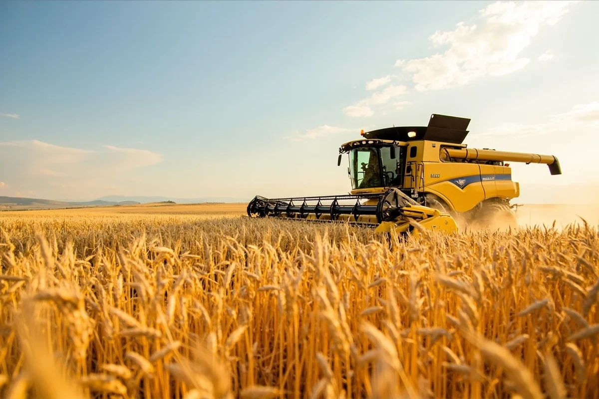
The grass seas stretching toward every horizon create a profound sense of space I haven’t experienced anywhere else in America. During harvest season last October, I watched combine harvesters working wheat fields that seemed to extend into infinity.
Landscape Features You’ll Encounter
The Great Plains in Montana aren’t uniformly flat—that’s a common misconception. You’ll find:
- Coulees: Deep ravines carved by ancient rivers, perfect for hiding cattle and wildlife
- Buttes: Isolated flat-topped hills rising dramatically from the prairie
- Badlands: Eroded formations creating otherworldly scenery at Makoshika and near Terry
- River breaks: Dramatic cliffs along the Missouri River, especially near Fort Benton
When people ask if Montana is high desert, I point them toward these eastern landscapes. Some areas do qualify, particularly the southeastern corner near Ekalaka.
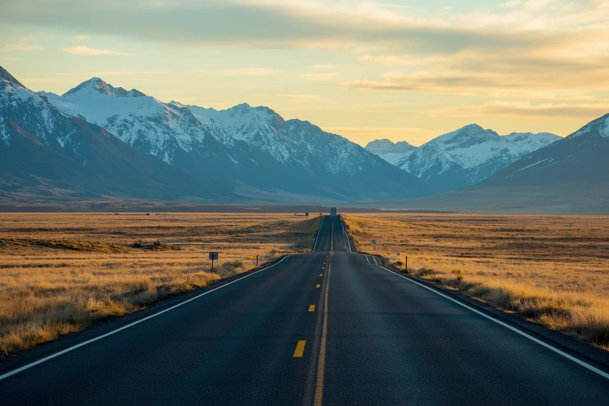
The Transition Zone Experience
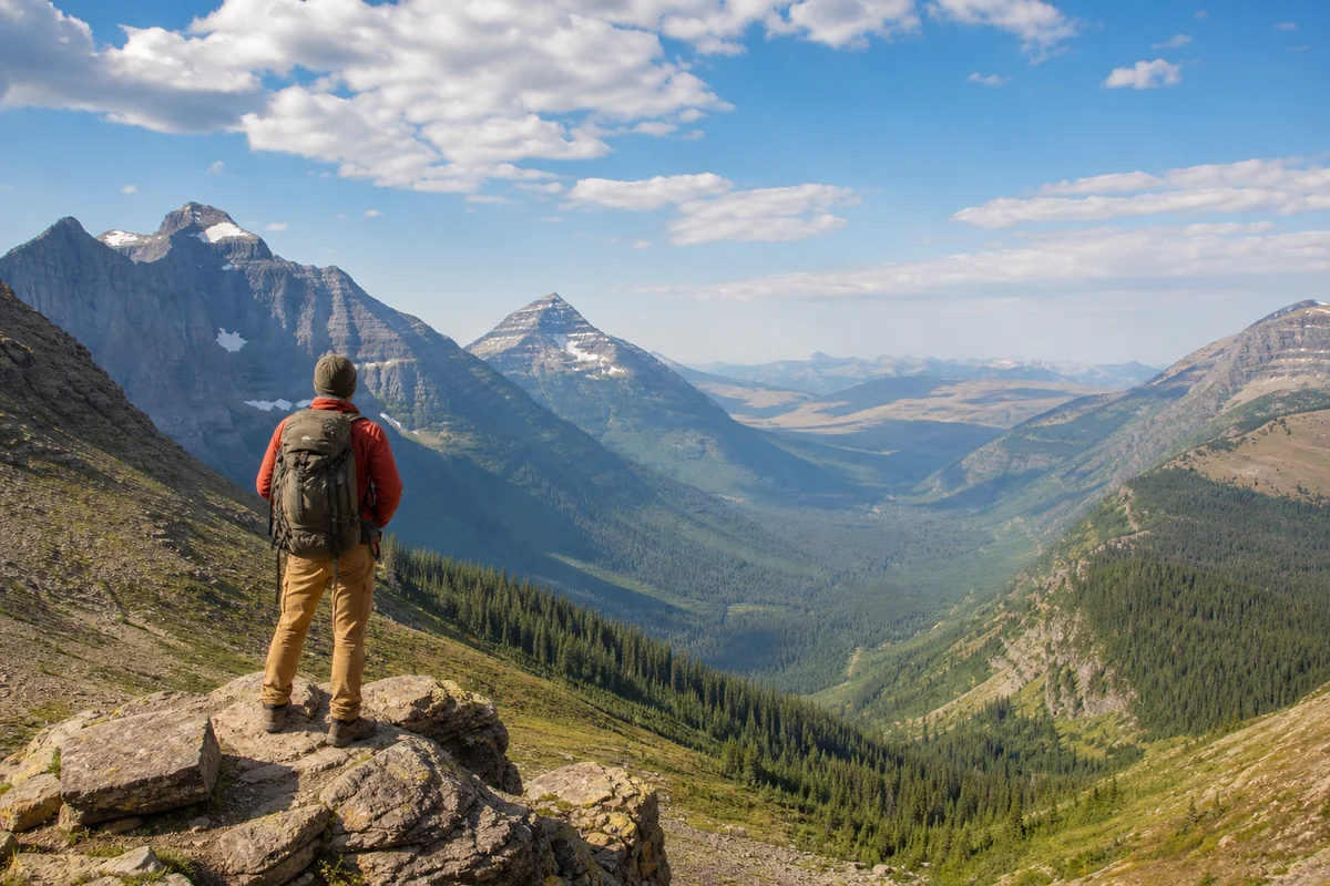
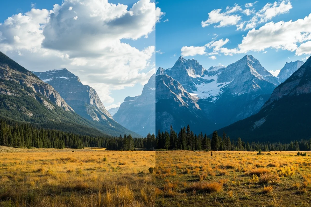
My favorite Montana secret? The transition zone where Great Plains meet Rocky Mountains creates some of the state’s most spectacular scenery.
Great Falls sits perfectly in this zone. From downtown, you can see the Rocky Mountain Front—a dramatic wall of mountains rising abruptly from the plains. I spent three days there last spring watching this collision of landscapes change color with the shifting light.
The Rocky Mountain Front stretches from Glacier National Park to Helena, offering a visual boundary you can actually photograph. Some of my best Montana memories come from this narrow strip.
Best Transition Zone Experiences
After dozens of trips, here are my personal recommendations:
- Freezout Lake: During spring migration (March), snow geese gather against a mountain backdrop
- Two Medicine area: Where Glacier’s peaks tumble toward prairie grasslands
- Highway 89 south of Browning: The most dramatic mountain-meets-plains drive in Montana
- Sun River Canyon: Watch the landscape transform within 20 miles
Wildlife of Montana’s Great Plains
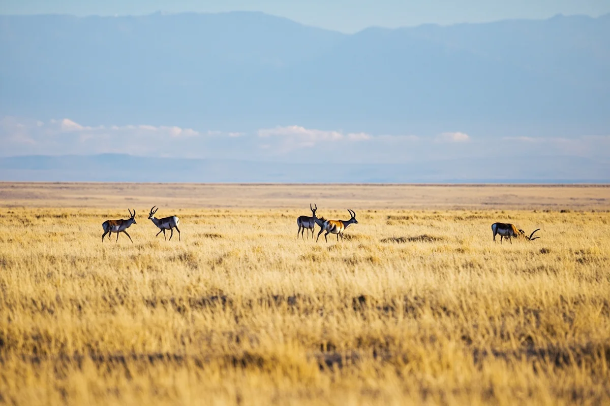
The Great Plains portion of Montana supports wildlife you won’t encounter in the mountainous west. During my visits to Charles M. Russell National Wildlife Refuge, I’ve seen species that define prairie ecosystems.
Pronghorn antelope are everywhere in eastern Montana—I’ve counted over 200 during single drives between Jordan and Circle. These animals evolved specifically for Great Plains grasslands.
Prairie dog towns dot the landscape, supporting ecosystems that include burrowing owls, black-footed ferrets, and rattlesnakes. I once spent an entire afternoon photographing a prairie dog colony near Malta.
Great Plains Wildlife Highlights
- American Bison: National Bison Range near Missoula, plus wild herds in the CMR Refuge
- Sage Grouse: Endemic to sagebrush prairies, best seen during spring mating displays
- Golden Eagles: More common on the plains than in mountain forests
- Mule Deer: Abundant throughout eastern Montana’s coulees and breaks
Understanding what type of region Montana truly is helps explain why wildlife varies so dramatically across the state.
Historical Significance of Montana’s Great Plains
The Great Plains shaped Montana’s history in ways the mountains never could. Indigenous peoples followed bison herds across these grasslands for thousands of years.
When I visited the Little Bighorn Battlefield National Monument outside Hardin, the landscape told the story. Rolling hills and coulees created the tactical conditions for the famous battle.
The cattle drives, homesteader waves, and railroad expansion all focused on Great Plains Montana. Towns like Miles City and Havre exist because of their plains locations, not despite them.
Must-Visit Historical Sites
- Little Bighorn Battlefield: Walk the same ground where Custer made his last stand
- Fort Benton: The birthplace of Montana, a steamboat port on the Missouri
- Range Riders Museum (Miles City): Outstanding collection of cowboy and homesteader artifacts
- Frontier Gateway Museum (Glendive): Regional history with dinosaur fossils
Montana’s proximity to the Canadian border also influenced Great Plains settlement patterns, particularly along the Hi-Line railroad route.
Weather and Climate Considerations
Great Plains Montana experiences significantly different weather than the mountainous west. This matters enormously for trip planning.
I learned this lesson personally when I packed for mild September weather based on Missoula forecasts, then froze in Malta when temperatures dropped to 28°F overnight. The plains have their own rules.
Winter storms sweep across from Canada without mountain barriers to slow them down. Summer temperatures routinely exceed 100°F in Jordan and Miles City.
Seasonal Planning Tips
- Spring (April-May): Muddy roads, dramatic weather swings, but spectacular wildflower blooms
- Summer (June-August): Hot and dry, best for photography and camping
- Fall (September-October): Golden harvest colors, hunting season begins, cooler nights
- Winter (November-March): Extreme cold possible, limited services, but incredible isolation
Why Most Tourists Miss Eastern Montana
Let’s be honest: the Great Plains portion of Montana doesn’t market itself effectively. Glacier and Yellowstone dominate tourism promotion while eastern Montana remains relatively undiscovered.
This creates opportunity. During my visits to Makoshika State Park—Montana’s largest state park—I’ve had entire trails to myself. The same formations that draw thousands to Badlands National Park sit here without crowds.
Many visitors associate Montana with the Northwest, expecting lush forests and coastal influences. The Great Plains reality surprises them.
Hidden Gems of Plains Montana
- Medicine Rocks State Park: Sandstone formations used by indigenous peoples for vision quests
- Pirogue Island State Park: Missouri River island accessible only by boat
- Bitter Creek Wilderness Study Area: True wilderness without the permit hassles
- Terry Badlands: Colorful formations rivaling any in the American West
Practical Planning for Great Plains Montana
If you’re convinced to explore Montana’s Great Plains connection, here’s what I’ve learned through trial and error.
Fuel up at every opportunity. I once drove 90 miles in northeastern Montana without seeing a single gas station. The gauge got uncomfortably close to empty before Malta appeared on the horizon.
Cell service disappears in much of eastern Montana. Download offline maps, inform someone of your itinerary, and carry paper maps as backup.
Essential Packing List
- Extra water—at least 1 gallon per person beyond normal needs
- Emergency blanket (weather changes fast)
- Sunscreen and hat (no shade on the prairie)
- Binoculars for wildlife viewing
- Paper maps of the region
- Snacks and non-perishable food
The rural character of Montana becomes most apparent in the Great Plains region, where services truly are sparse.
Comparing Montana’s Regions
Understanding that Montana straddles both Great Plains and Rocky Mountain regions helps set realistic expectations. Here’s how I’d characterize each:
Great Plains Eastern Montana
- Flat to rolling terrain with occasional buttes and badlands
- Sparse population (often under 1 person per square mile)
- Agriculture-based economy: wheat, cattle, sheep
- Extreme temperature variations
- Wide-open skies and dramatic sunsets
- Native American reservation lands covering large areas
Rocky Mountain Western Montana
- Dramatic peaks, alpine lakes, dense forests
- Higher population density, more tourist infrastructure
- Recreation-based economy: skiing, hiking, fishing
- More moderate temperatures with heavier snowfall
- Limited horizons but spectacular vertical scenery
Neither region is objectively better—they simply offer completely different experiences. I love both equally but for entirely different reasons.
Neighboring States and Regional Context
Montana’s Great Plains connection makes more sense when you consider its neighbors. The seven states bordering Montana all share portions of either the Great Plains or Rocky Mountain region.
North Dakota and South Dakota continue the Great Plains eastward. Wyoming shares both mountainous and plains characteristics. Idaho represents the transition toward Pacific Northwest ecosystems.
When people ask if Montana is West Coast, I laugh—but I understand the confusion. Montana’s western half feels nothing like the eastern Great Plains.
My Personal Verdict on the Great Plains Question
After years of exploring every corner of Montana, here’s my honest assessment: Montana doesn’t just “belong” to the Great Plains—the Great Plains are fundamental to Montana’s identity.
Ignoring eastern Montana means missing more than half the state’s geography and much of its authentic character. The cowboy culture, the agricultural heritage, the indigenous history—all of this ties to Great Plains landscapes.
Yet I’d never tell someone Montana is only a Great Plains state. That would ignore Glacier National Park, the Mission Mountains, the Bitterroot Valley, and countless other western treasures.
Montana is both, and that duality makes it one of America’s most geographically fascinating states.
Final Recommendations for Your Trip
If you’re planning a Montana visit and want to experience the Great Plains reality, here’s my suggested approach:
For first-time visitors: Start in the mountains (Glacier or Yellowstone gateway communities), then drive east to experience the transition. Highway 2 across the Hi-Line offers a true Great Plains immersion.
For repeat visitors: Dedicate an entire trip to eastern Montana. Stay in Miles City during the Bucking Horse Sale, explore Makoshika State Park, drive the empty roads around Jordan.
For photographers: The Great Plains deliver sunrises and sunsets that mountain locations simply cannot match. Big sky isn’t just a slogan—it’s the literal truth of eastern Montana light.
Montana absolutely belongs to the Great Plains, but it also transcends that single classification. Plan accordingly, pack appropriately, and prepare to have your assumptions about Big Sky Country completely rewritten.
The Great Plains shaped Montana’s past and continue defining much of its present. Understanding this geography transforms you from a casual visitor into someone who truly comprehends what makes Montana extraordinary.
Frequently Asked Questions
Does Montana belong to the Great Plains region?
Yes, eastern Montana is definitely part of the Great Plains, covering roughly 60% of the state with vast prairies, rolling grasslands, and big sky views. However, western Montana belongs to the Rocky Mountain region, giving the state a unique split geography that surprises many first-time visitors.
What is the best time to visit Montana’s Great Plains region?
I recommend visiting Montana’s Great Plains from late May through September when temperatures are pleasant and wildlife is most active. Summer brings warm days in the 70s-80s°F, perfect for exploring places like the C.M. Russell Wildlife Refuge or driving the Hi-Line along Highway 2.
What should I pack for a trip to Montana’s Great Plains?
Pack layers since Great Plains Montana can swing 40°F between day and night, even in summer. Bring sunscreen, a wide-brimmed hat, binoculars for wildlife viewing, and a good camera—the endless horizons and dramatic sunsets are photographer’s gold.
How far is Montana’s Great Plains region from major US cities?
Eastern Montana’s Great Plains are about 550 miles from Denver, 600 miles from Minneapolis, and roughly 450 miles from Billings to the North Dakota border. Most travelers fly into Billings or Great Falls and rent a car, as distances between towns can stretch 50-100 miles.
What is there to do in the Great Plains part of Montana?
Montana’s Great Plains offer dinosaur fossil hunting in the Missouri Breaks, touring historic Fort Peck, and exploring the massive Charles M. Russell National Wildlife Refuge. You can also visit Native American cultural sites, drive scenic Highway 200, and experience authentic small-town Western hospitality in places like Malta and Glasgow.
How much does it cost to travel through Montana’s Great Plains region?
Traveling Montana’s Great Plains is budget-friendly compared to the touristy western areas—expect $60-100/night for motels, $10-20 for meals, and free or low-cost attractions. Gas stations can be sparse, so budget for extra fuel costs and fill up whenever you see a pump, especially on remote routes.
Is Montana’s Great Plains region worth visiting compared to Glacier National Park?
While Glacier gets all the fame, Montana’s Great Plains offer uncrowded authenticity, stargazing without light pollution, and genuine cowboy culture you won’t find elsewhere. I’d say it’s absolutely worth adding 2-3 days to experience the ‘real’ Montana that most tourists completely miss.
Sources:
- Great Plains | Map, Facts, Definition, Climate, & Cities | Britannica, accessed on December 9, 2025, https://www.britannica.com/place/Great-Plains
- Montana – Wikipedia, accessed on December 9, 2025, https://en.wikipedia.org/wiki/Montana
- Montana: One State with Three Changing Regions (Part 1 of 3), accessed on December 9, 2025, https://www.umt.edu/this-is-montana/columns/stories/montana_regions_1of3.php
- Montana | Geography, History, Capital, Population, Climate, Map, & Facts | Britannica, accessed on December 9, 2025, https://www.britannica.com/place/Montana-state
- Montana East of the Mountains: An Uncommon Landscape, accessed on December 9, 2025, https://www.umt.edu/this-is-montana/columns/stories/montanaeastofthemountains.php
- Blackfeet Nation – Wikipedia, accessed on December 9, 2025, https://en.wikipedia.org/wiki/Blackfeet_Nation
- Great Plains – Wikipedia, accessed on December 9, 2025, https://en.wikipedia.org/wiki/Great_Plains
- Montana’s Economy at a Glance | Montana Business Quarterly – Knoff Group Real Estate, accessed on December 9, 2025, https://www.knoffgroup.com/montanas-economy-at-a-glance-montana-business-quarterly/
- 2015 Ag Commodity Map.indd – Agriculture, accessed on December 9, 2025, https://agr.mt.gov/_docs/aginclass-docs/MDAPublications/2014MT_AgrCommodityMap.pdf
- Great Plains Cliff and Outcrop – Montana Field Guide, accessed on December 9, 2025, https://fieldguide.mt.gov/displayES_Detail.aspx?ES=3142
- Can parts of Montana be considered part of the Great Plains States? – Reddit, accessed on December 9, 2025, https://www.reddit.com/r/Montana/comments/paa6b3/can_parts_of_montana_be_considered_part_of_the/
- Geography of Montana – Wikipedia, accessed on December 9, 2025, https://en.wikipedia.org/wiki/Geography_of_Montana
- WRCC: Montana Climate, accessed on December 9, 2025, https://wrcc.dri.edu/Climate/narrative_mt.php
- A Guide to the Weather in Montana – Big Sky Fishing.Com, accessed on December 9, 2025, https://www.bigskyfishing.com/Montana-Info/montana_weather.shtm
- The Geography of Montana – Blue Green Atlas, accessed on December 9, 2025, https://bluegreenatlas.com/usa_montana.html
- Montana – State Climate Summaries 2022, accessed on December 9, 2025, https://statesummaries.ncics.org/chapter/mt/
- This is Montana, accessed on December 9, 2025, https://mhs.mt.gov/education/Elementary/Chap1.pdf
- Rocky Mountains and Great Plains | Defenders of Wildlife, accessed on December 9, 2025, https://defenders.org/regions/rocky-mountains-and-great-plains
- Explore Montana Ecosystems, accessed on December 9, 2025, https://www.montananaturalist.org/exhibits/explore-montana-ecosystems/
- Northern Rocky Mountain Lower Montane Riparian Woodland and Shrubland – Montana Field Guide, accessed on December 9, 2025, https://fieldguide.mt.gov/displayES_Detail.aspx?ES=9155
- Key Trends in Growth and Change in Montana, accessed on December 9, 2025, https://archive.legmt.gov/content/committees/interim/2007_2008/rev_trans/meeting_documents/Swanson%20Demo%202007.pdf
- The difference between East and West Montana. – Reddit, accessed on December 9, 2025, https://www.reddit.com/r/Montana/comments/zqm9u7/the_difference_between_east_and_west_montana/
- Montana’s Industrious Economy – Labor Market Information, accessed on December 9, 2025, https://lmi.mt.gov/_docs/Publications/EAG-Articles/EAG-0523_Final.pdf
- LOLO REGIONAL PLAN – Missoula County, accessed on December 9, 2025, https://www.missoulacounty.gov/media/e3gb02kn/lolo-regional-plan-2002.pdf
- Montana Maps & Facts – World Atlas, accessed on December 9, 2025, https://www.worldatlas.com/maps/united-states/montana
- 2023 Montana Economic Report, accessed on December 9, 2025, https://www.bber.umt.edu/pubs/Seminars/2023/EconRpt2023.pdf
- Montana Department of Agriculture – NASDA, accessed on December 9, 2025, https://www.nasda.org/state-department/montana-department-of-agriculture/
- AGRICULTURAL FACTS 2022 – Montana State Legislature, accessed on December 9, 2025, https://archive.legmt.gov/content/Committees/Interim/2023-2024/Economic-Affairs/Meetings/January-2024/2.1-Montana-Agriculture-Facts-2022.pdf
- USDA/NASS 2024 State Agriculture Overview for Montana, accessed on December 9, 2025, https://www.nass.usda.gov/Quick_Stats/Ag_Overview/stateOverview.php?state=MONTANA
- Montana still has more cows than people, but the cows’ lead is narrowing, accessed on December 9, 2025, https://montanafreepress.org/2025/07/18/montana-still-has-more-cows-than-people-but-the-cows-lead-is-narrowing/
- Even with power shift, public lands still sacrosanct in Mont. – POLITICO Pro, accessed on December 9, 2025, http://subscriber.politicopro.com/article/eenews/1060052323
- Two Montanas? New maps highlight state’s split personality | AP News, accessed on December 9, 2025, https://apnews.com/article/montana-redistricting-missoula-political-parties-bozeman-d8b17606280d9ebdfdbcf785b2054c79
- Montana commission finalizes congressional district lines | Explore Big Sky, accessed on December 9, 2025, https://www.explorebigsky.com/montana-commission-finalizes-congressional-district-lines/41555
- Official 2024 Presidential General Election Results – FEC, accessed on December 9, 2025, https://www.fec.gov/documents/5644/2024presgeresults.pdf
- 2024 United States presidential election in Montana – Wikipedia, accessed on December 9, 2025, https://en.wikipedia.org/wiki/2024_United_States_presidential_election_in_Montana
- Where Montana voted red and blue in 2022, precinct by precinct, accessed on December 9, 2025, https://montanafreepress.org/2022/11/28/where-montana-voted-red-and-blue-in-2022-precinct-by-precin/
- Montana’s 2024 general election results, accessed on December 9, 2025, https://montanafreepress.org/2024/11/05/montana-2024-general-election-results/
- The Changing Landscape of Eastern Montana: Trends and Insights 2024, accessed on December 9, 2025, https://scholarworks.umt.edu/cgi/viewcontent.cgi?article=1495&context=itrr_pubs
- Brief History – Montana.gov, accessed on December 9, 2025, https://mt.gov/discover/brief_history
- Introduction to Native American Units – National Park Service, accessed on December 9, 2025, https://www.nps.gov/glac/learn/education/intro-to-native-american.htm
- Geology and Physiography of the Crow Reservation – SERC (Carleton), accessed on December 9, 2025, https://serc.carleton.edu/research_education/nativelands/crow/geology.html
- Northern Cheyenne Reservation | University of Montana, accessed on December 9, 2025, https://www.umt.edu/native-garden/circles/northern-cheyenne.php
- Fort Peck Assiniboine & Sioux Tribal History, accessed on December 9, 2025, https://fortpecktribes.org/visitor-opportunities/tribal-history/
- Fort Peck Indian Reservation – Wikipedia, accessed on December 9, 2025, https://en.wikipedia.org/wiki/Fort_Peck_Indian_Reservation
- The Blackfeet Nation Has Long, Epic History | University of Montana, accessed on December 9, 2025, https://www.umt.edu/this-is-montana/columns/stories/blackfeet.php
- Crow people – Wikipedia, accessed on December 9, 2025, https://en.wikipedia.org/wiki/Crow_people
- Tourism Report: Flathead County Records Highest Annual Nonresident Spending in Montana, accessed on December 9, 2025, https://flatheadbeacon.com/2024/10/29/tourism-report-flathead-county-records-highest-annual-nonresident-spending-in-montana/
- Eastern Montana is emerging as a stronger tourism player, even without the marquee national parks that define the western experience. | MATR, accessed on December 9, 2025, https://matr.net/news/eastern-montana-is-emerging-as-a-stronger-tourism-player-even-without-the-marquee-national-parks-that-define-the-western-experience/
- 2024 – Montana Secretary of State, accessed on December 9, 2025, https://electionresults.mt.gov/resultsSW.aspx?type=FED&map=CTY