I was standing at the Four Corners junction near Glacier National Park when it hit me—within a day’s drive, I could be fishing in Wyoming, hiking in Idaho, exploring North Dakota’s badlands, or sipping coffee in a Calgary café.
Montana’s borders don’t just define lines on a map; they open doors to some of North America’s most spectacular adventures.
If you’ve ever wondered where is Montana located in relation to the rest of the country, understanding its neighboring states is the key to unlocking incredible multi-state road trips.
Over my years of exploring Big Sky Country, I’ve crossed every one of Montana’s borders dozens of times, and each crossing reveals something new.
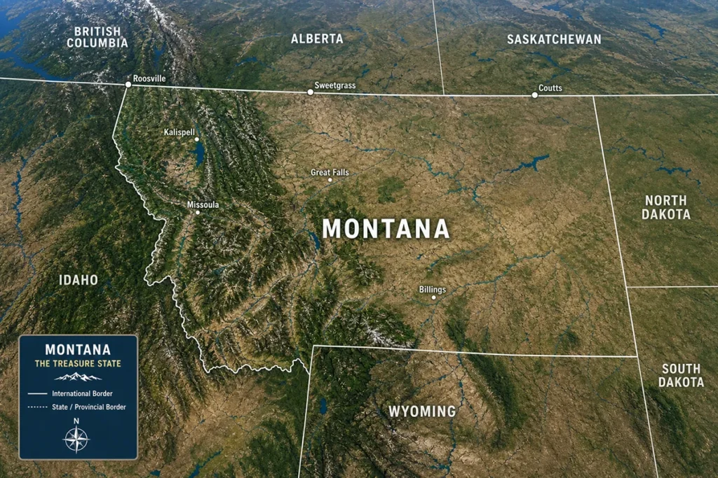
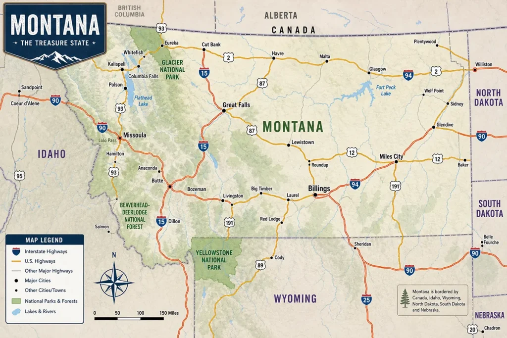
- Montana shares borders with four US states: North Dakota, South Dakota, Wyoming, and Idaho
- Canada’s provinces of British Columbia, Alberta, and Saskatchewan form Montana’s 545-mile northern border
- Each border region offers distinct landscapes, attractions, and road trip opportunities
- The Idaho border provides access to some of the most remote wilderness in the Lower 48
- Wyoming’s border connects Yellowstone to Glacier via one of America’s greatest driving routes
- Border crossings to Canada are straightforward with proper documentation
Understanding Montana’s Geographic Position
Montana sits in the northern Rocky Mountain region of the United States, making it a geographic crossroads between the Pacific Northwest, the Northern Great Plains, and Canada. This positioning creates an interesting debate about regional identity—some wonder is Montana truly in the Midwest, while others argue it belongs to the West.
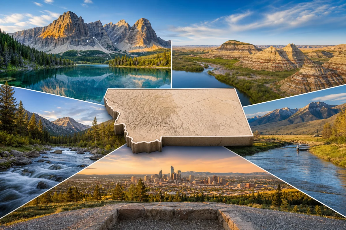
The state covers a massive 147,040 square miles, making it the fourth-largest state by area. All that territory means extensive borders with multiple neighbors, each offering distinct experiences.
During my first comprehensive Montana road trip back in 2018, I underestimated how these borders would shape my journey. I quickly learned that planning routes around border crossings and understanding what each neighboring region offers makes for much smarter travel.
Montana’s Four US Neighboring States
Let me break down each of Montana’s domestic neighbors based on my extensive travels through these regions. Understanding these connections will transform how you plan your Montana adventure.
Idaho: The Western Wilderness Border
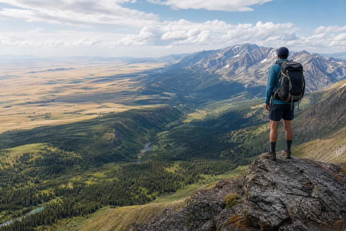
The Montana-Idaho border stretches approximately 470 miles along Montana’s western edge, and I consider it one of the most dramatic state boundaries in America. This border runs through some genuinely wild country.
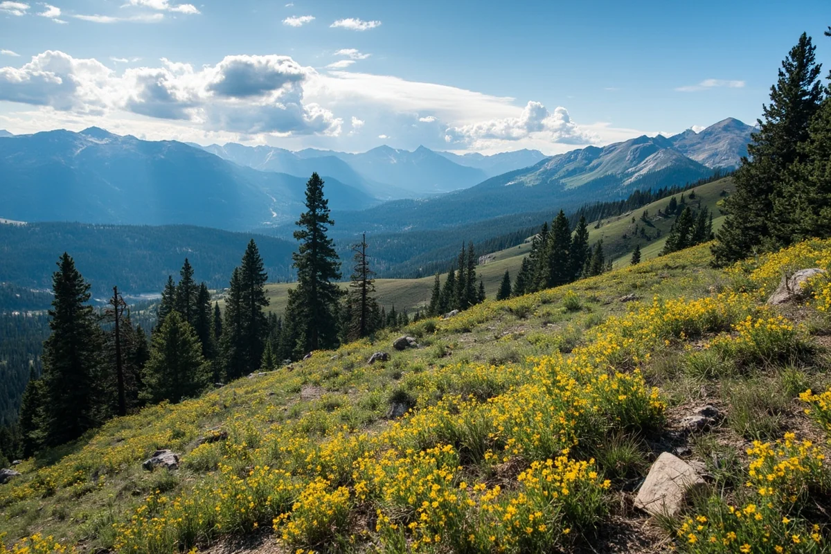
Last summer, I drove the entire length of this border from the Canadian crossing at Eastport down to Yellowstone. The journey took three days, and I encountered everything from dense cedar forests to alpine meadows to the rugged Bitterroot Mountains.
The Lolo Pass crossing on Highway 12 remains my favorite route between these states. When I was there in late September, the larch trees had turned golden, creating a landscape that looked almost surreal. The Lolo Motorway, an old Nez Perce trail that Lewis and Clark followed, parallels this route and offers incredible backcountry exploration for those with high-clearance vehicles.
Key border crossing points include:
- Lookout Pass (I-90) – The main interstate crossing, excellent year-round but watch for winter closures
- Lolo Pass (Highway 12) – Following the Lochsa River through pristine wilderness
- Lost Trail Pass (Highway 93) – Where Lewis and Clark crossed the Continental Divide
- Monida Pass (I-15) – The southern route connecting to Idaho Falls and beyond
What surprised me most about this border region is how quickly the landscape changes. Montana’s side tends to be drier, with open valleys and sagebrush-covered foothills. Cross into Idaho, and you’re suddenly in dense Pacific Northwest-style forests. This transition relates to the fascinating Montana biome ecological diversity that makes the state so unique.
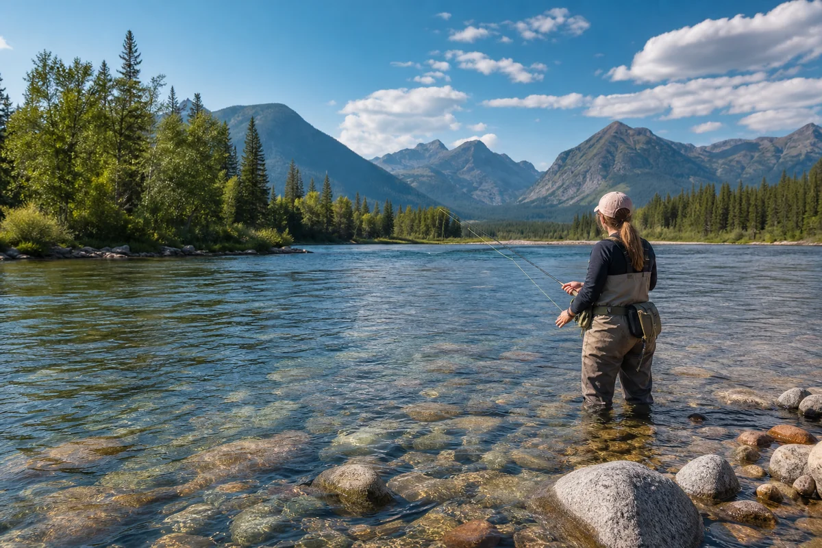
Wyoming: The Yellowstone Connection
Montana’s southern border with Wyoming runs about 340 miles, and this is arguably the most famous state boundary in the Northern Rockies. Why? Because it cuts right through Yellowstone National Park.
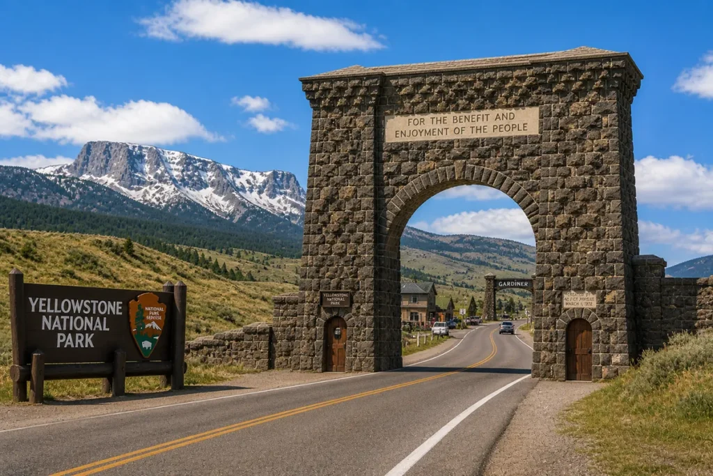
I’ve crossed this border more times than I can count, but my most memorable crossing came during a winter trip when I entered Yellowstone through the North Entrance at Gardiner, Montana, then exited through the South Entrance into Wyoming. The contrast between Montana’s snowy valleys and Wyoming’s geyser basins felt like traveling between different planets.
The Wyoming border also connects to Grand Teton National Park, making it possible to string together two of America’s most iconic parks in a single trip. On a recent visit, I spent a week doing exactly this—three days in Yellowstone’s Montana section, two days in the Wyoming portion, then two days exploring the Tetons.
Here’s what you need to know about the Montana-Wyoming border:
| Crossing Point | Highway | Best For | My Notes |
|---|---|---|---|
| Chief Joseph Highway | Highway 296 | Scenic drives | One of America’s most underrated roads |
| Beartooth Pass | Highway 212 | Alpine scenery | Closes in winter; absolutely stunning |
| Yellowstone North | Highway 89 | Year-round access | Only entrance open all winter |
| West Yellowstone | Highway 20/191 | Geyser access | Closest to Old Faithful from Montana |
The Beartooth Highway deserves special attention. When I drove it last July, the combination of switchbacks, alpine lakes, and 10,000-foot elevation views left me speechless. Charles Kuralt called it “the most beautiful drive in America,” and after experiencing it myself, I can’t argue. For more on Montana’s dramatic elevation changes, check out this Montana elevation guide.
North Dakota: The Prairie Connection
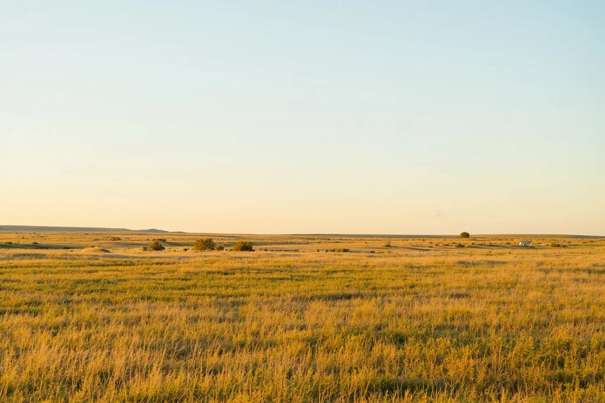
Montana’s eastern border with North Dakota extends approximately 213 miles through rolling prairie country. This border region gets overlooked by most tourists, but I’ve found it fascinating in its own subtle way.
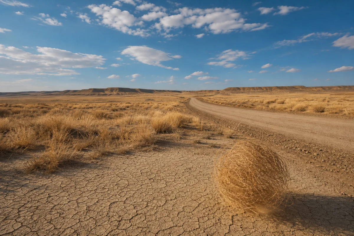
The landscape here relates to questions many travelers ask—like does Montana belong to the Great Plains? Standing at the border near Fairview, looking across endless grasslands that stretch into both states, the answer feels obvious. This is quintessential Great Plains country.
During my drive along Highway 200 through this region, I stopped in Sidney, Montana, just before the border. The town serves as a gateway to Theodore Roosevelt National Park in North Dakota, which I discovered is severely underrated. The badlands formations there rival anything I’ve seen in South Dakota.
Key crossing points between Montana and North Dakota:
- Highway 200 – The main route connecting to Theodore Roosevelt National Park
- Highway 2 – A more northern crossing through Fort Union Trading Post
- Highway 16 – Lesser-known route through quiet agricultural communities
Fort Union Trading Post National Historic Site straddles the border and offers incredible insight into the region’s fur trade history. When I visited, a ranger explained how this location was chosen precisely because it sat at the confluence of the Missouri and Yellowstone Rivers—a natural gathering point for traders and Native American tribes.
South Dakota: The Black Hills Gateway
Montana’s border with South Dakota is the shortest of its US boundaries, running only about 14 miles in the state’s southeastern corner. Despite its brevity, this connection opens access to some spectacular destinations.
I’ll be honest—I initially dismissed this border region during my planning. That was a mistake. When I finally explored it during a trip two years ago, I discovered that the route from Montana through South Dakota to the Black Hills creates one of the most diverse road trips in the northern United States.
The border sits in extremely rural country. The nearest Montana town of any size is Ekalaka, population around 300. But what this region lacks in services, it makes up for in authentic prairie atmosphere. People ask is Montana rural, and driving through this corner answers that question definitively—yes, gloriously so.
From this border area, you’re positioned for visits to:
- Mount Rushmore (approximately 130 miles from the border)
- Crazy Horse Memorial
- Badlands National Park
- Deadwood and its historic mining district
- Custer State Park
The remoteness of this corner means you’ll need to plan fuel stops carefully. During my drive, I didn’t pass a single gas station for nearly 80 miles.
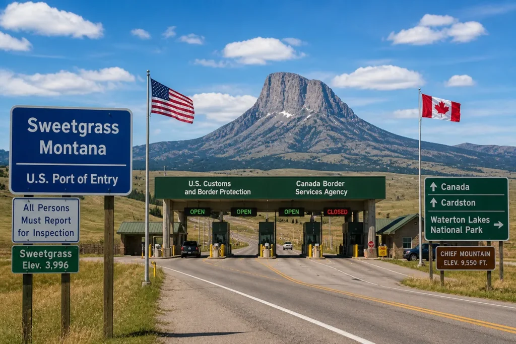
Montana’s International Border: Canada
Here’s where Montana truly distinguishes itself—it shares a 545-mile border with Canada, the longest international boundary of any US state except Alaska. This border touches three Canadian provinces: British Columbia, Alberta, and Saskatchewan. For more details about this northern boundary, see is Montana located on the Canadian border.
British Columbia Crossings
The westernmost portion of Montana’s Canadian border connects to British Columbia. I’ve used the Roosville crossing near Eureka multiple times, and it remains my preferred route when heading to Fernie or the Canadian Rockies beyond.
What I appreciate about this crossing is how quickly you enter stunning mountain country on both sides. The drive from Whitefish, Montana, to Fernie, BC, takes about two hours and passes through some of the most beautiful terrain in North America.
Alberta Crossings
The Alberta border crossings are perhaps the most popular among Montana visitors because they provide access to Waterton-Glacier International Peace Park. The Chief Mountain crossing, open seasonally from mid-May to mid-September, creates a direct route between Glacier National Park and Waterton Lakes.
On my most recent Glacier trip, I crossed at Chief Mountain specifically to have lunch in Waterton townsite. The Prince of Wales Hotel, perched dramatically above Waterton Lake, offers afternoon tea with views that rival anything in the Swiss Alps. The whole detour took about four hours and was absolutely worth it.
The Carway/Piegan crossing stays open year-round and sits closer to Cardston, Alberta. I’ve used this route when visiting during shoulder seasons when Chief Mountain is closed.
Saskatchewan Crossings
Eastern Montana’s border with Saskatchewan sees less tourist traffic, but it serves important agricultural and commercial purposes. The Port of Morgan crossing connects to the Canadian prairies and offers access to Regina and Saskatoon.
This region demonstrates why some question is Montana high desert—the eastern prairies have a distinctly different character from the mountainous west, though they’re not technically desert.
Border Crossing Practicalities
Based on dozens of personal crossings, here’s what you need to know:
Required Documentation:
- US Passport (required for all crossings)
- NEXUS card (speeds crossing significantly for frequent travelers)
- Vehicle registration and proof of insurance
Tips from Experience:
- Download the CanBorder app to check wait times at crossings
- Don’t bring fresh fruits, vegetables, or meats across the border
- Declare everything you’re carrying—Canadian border agents are thorough
- Chief Mountain crossing has no services nearby; fuel up in Babb or St. Mary
- Keep cash in both US and Canadian currency for small purchases
Wait times vary dramatically by season. During my July Glacier visit, I waited 45 minutes at Chief Mountain. In early September the following year, I drove right through in under five minutes.
Planning Multi-State Road Trips from Montana
Understanding Montana’s borders allows you to plan epic multi-state adventures. Here are itineraries I’ve personally driven and can recommend.
The National Parks Grand Loop
Duration: 10-14 days
States: Montana, Wyoming, Idaho
This route connects Glacier National Park, Yellowstone, Grand Teton, and optionally Craters of the Moon in Idaho. I drove this loop over 12 days and covered approximately 1,200 miles.
Start in Kalispell, Montana, and spend 3-4 days exploring Glacier. Head south through the Flathead Valley, passing through Missoula and continuing to Butte. From there, drop into West Yellowstone and enter the park.
After Yellowstone, continue south into Grand Teton National Park in Wyoming. The drive from Yellowstone’s South Entrance to Jackson takes about an hour and passes through incredible scenery.
Return to Montana via Idaho, taking Highway 20 west from Idaho Falls, then north through the Bitterroot Valley on Highway 93.
The Northern Great Plains Circuit
Duration: 7-10 days
States: Montana, North Dakota, South Dakota
This often-overlooked route showcases the prairie landscapes that define eastern Montana and its neighbors. Understanding what type of region Montana occupies helps appreciate this journey.
Begin in Billings and head east on Highway 200 through the agricultural heartland. Cross into North Dakota and explore Theodore Roosevelt National Park—both the North and South Units deserve attention.
Continue south into South Dakota, visiting the Black Hills before looping back through Wyoming and returning to Montana via the Beartooth Highway.
The International Mountain Route
Duration: 7-9 days
Countries: USA (Montana), Canada (British Columbia, Alberta)
This border-hopping adventure maximizes mountain scenery. Start in Missoula, drive north to Glacier National Park, cross into Canada at Chief Mountain, explore Waterton Lakes, continue to Banff and Lake Louise, then return to Montana via the Roosville crossing.
During my version of this trip, I added a detour to Fernie, BC, for mountain biking and found it to be one of the best trail systems I’ve ever ridden.
Practical Considerations for Border Crossings
Timing Your Crossings
Based on my experience, the busiest border times are:
- Weekends: Expect longer waits, especially in summer
- Holidays: US and Canadian holidays create significant backups
- Morning rush: 8-10 AM sees commercial traffic; try earlier or later
- Glacier season: July-August creates the longest waits at Chief Mountain
I’ve found that crossing early morning (before 7 AM) or late afternoon (after 5 PM) dramatically reduces wait times.
Cell Phone Coverage
Something I learned the hard way—cell coverage becomes extremely spotty in Montana’s border regions. Before crossing into remote areas near Idaho or North Dakota, download offline maps. When I was near the Idaho border last fall, I went nearly three hours without any signal.
International roaming in Canada can get expensive. Check with your carrier about plans before crossing. Most major US carriers offer reasonable Canadian roaming packages these days.
Fuel and Services
Border regions tend to have fewer services than you might expect. Here’s my advice:
- Idaho border: Fill up in Missoula, Hamilton, or Butte before heading into the mountains
- Wyoming border: West Yellowstone, Gardiner, and Red Lodge all have full services
- North Dakota border: Sidney and Glendive are your last major service points
- South Dakota border: Ekalaka has limited services; Baker is more reliable
- Canada border: St. Mary and Babb on the east side, Eureka on the west
Understanding Montana’s Regional Identity Through Its Borders
Montana’s borders illuminate something important about the state’s identity. It’s not easily categorized, which frustrates some visitors but delights those who appreciate complexity.
The western border with Idaho places Montana in the Pacific Northwest’s influence zone. Dense forests, abundant rivers, and a similar outdoor culture spill across the state line. Yet many wonder is Montana located in the Northwest—the answer depends on where in Montana you’re standing.
The eastern borders with North and South Dakota firmly establish Montana’s Great Plains credentials. Vast prairies, agricultural communities, and that distinctive high plains light define this region.
The southern border with Wyoming connects Montana to the broader Rocky Mountain West. This is where cowboy culture, national park grandeur, and mountain recreation dominate.
And the Canadian border? It gives Montana an international character that most states lack entirely. The cultural exchange along this boundary has shaped Montana’s northern communities for generations.
This geographic diversity explains why Montana resists simple classification. Questions like is Montana West Coast or is Montana a landlocked state reveal how the state defies typical categories.
Seasonal Considerations for Border Travel
When you can cross Montana’s borders depends heavily on the season. Here’s what I’ve learned through years of visits:
Spring (April-May)
Many mountain passes remain closed or require chains. The Going-to-the-Sun Road in Glacier typically doesn’t fully open until late June. The Beartooth Highway usually opens Memorial Day weekend, weather permitting.
I’ve found spring excellent for the eastern borders, where prairie landscapes begin greening up and wildlife becomes active.
Summer (June-August)
All crossings are open, but this is peak season. Expect crowds at Yellowstone entrances and Canadian border crossings near Glacier. Book accommodations well in advance for any border regions.
Last summer, I couldn’t find lodging within 50 miles of the Wyoming border near Yellowstone without booking two months ahead.
Fall (September-October)
My personal favorite season for border exploration. Crowds thin dramatically after Labor Day, fall colors peak in late September through early October, and most passes remain open through mid-October.
The Chief Mountain crossing closes mid-September, so plan Canada trips accordingly.
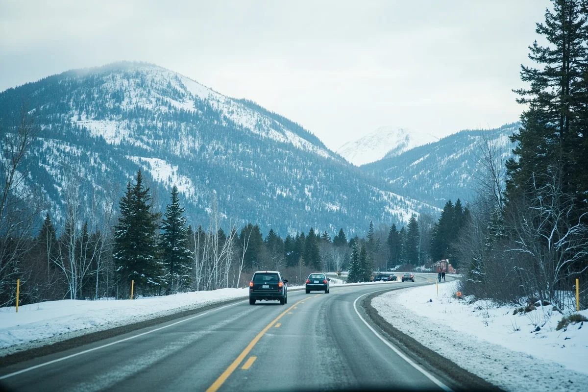
Winter (November-March)
Many border crossings become challenging or impossible. The Idaho border via Lolo Pass requires winter driving skills. The Beartooth Highway closes entirely. Only Yellowstone’s North Entrance near Gardiner stays open year-round.
The Canadian border at Sweetgrass/Coutts remains open all winter and sees significant traffic.
Why Montana’s Borders Matter for Your Trip
After years of exploring Montana and its neighboring states, I’ve come to see these borders not as limitations but as opportunities. Each boundary represents a transition zone where landscapes, cultures, and experiences shift.
Planning a Montana trip without considering the borders means missing incredible nearby destinations. Theodore Roosevelt National Park, just across the North Dakota line, receives a fraction of Glacier’s visitors despite offering spectacular scenery. Waterton Lakes in Canada provides a different perspective on the same mountains visible from Glacier.
The borders also shape practical planning. Understanding that Montana sits at the intersection of multiple regions helps you prepare for dramatic elevation changes, variable weather, and remote stretches without services.
Whether you’re crossing into Wyoming for Yellowstone geysers, dipping into Idaho for pristine wilderness, or heading north to experience Canadian hospitality, Montana’s borders open doors to adventures that extend far beyond the state’s official boundaries.
My advice? Don’t limit your Montana trip to Montana alone. The borders are invitations, not barriers. Cross them, explore what lies beyond, and discover how Montana’s neighbors contribute to making this corner of North America so exceptional.
The next time you’re planning a Montana adventure, spread that map a little wider. Include the neighboring states and provinces. You’ll find that Big Sky Country is even bigger than you imagined—and the experiences waiting just across the border might become the highlights of your entire trip.
Frequently Asked Questions
What states border Montana and how do I plan a multi-state road trip?
Montana shares borders with four US states: North Dakota and South Dakota to the east, Wyoming to the south, and Idaho to the west. I recommend planning a loop through Yellowstone (Wyoming), Glacier National Park (Montana), and the Idaho Panhandle for an epic 7-10 day Rocky Mountain road trip covering approximately 800-1,200 miles.
How far is it to drive from Montana to Yellowstone National Park in Wyoming?
From Bozeman, Montana, you can reach Yellowstone’s north entrance in just 90 miles (about 1.5 hours), making it one of the most convenient gateway cities. If you’re coming from Billings, expect a 130-mile drive to the park’s northeast entrance through the stunning Beartooth Highway, which I consider one of America’s most scenic drives.
Can I visit Montana and North Dakota together on one trip?
Absolutely, and I highly recommend combining Montana’s Glacier National Park with North Dakota’s Theodore Roosevelt National Park for a unique Northern Great Plains adventure. The drive from Billings to Theodore Roosevelt’s South Unit is about 265 miles (4 hours), and you’ll experience dramatic landscape changes from Rocky Mountain foothills to rugged badlands.
What is the best time to visit Montana and its neighboring states?
June through September offers the best weather for exploring Montana and surrounding states, with most mountain passes and park roads fully open. I’ve found late June to early July ideal for wildflowers in Glacier, while September brings fewer crowds and stunning fall colors along the Idaho and Wyoming borders.
How much does a road trip through Montana and neighboring states typically cost?
Budget approximately $150-250 per day for a comfortable Montana multi-state road trip, covering gas ($50-80), lodging ($80-150), and food ($40-60). The America the Beautiful Pass ($80 annually) is essential since it covers entrance fees to Glacier, Yellowstone, Grand Teton, and Theodore Roosevelt National Parks across these neighboring states.
What should I pack for traveling between Montana, Idaho, and Wyoming?
Pack layers regardless of season since mountain weather changes rapidly across all three states—I always bring a rain jacket, fleece, and sun protection even in summer. Don’t forget bear spray ($40-50) if you’re hiking in Glacier or Yellowstone, plus a paper road atlas since cell service is unreliable in remote areas of Idaho and eastern Montana.
Is it worth crossing into Canada from Montana during my trip?
Montana also borders three Canadian provinces (British Columbia, Alberta, and Saskatchewan), and Waterton-Glacier International Peace Park makes crossing into Alberta incredibly worthwhile. The drive from Glacier’s Many Glacier area to Waterton Lakes is only 45 miles, but you’ll need a valid passport and should check current border crossing wait times at the Chief Mountain port of entry.
Sources:
- https://www.canadaduientrylaw.com/border-crossings.php
- https://en.wikipedia.org/wiki/International_border_states_of_the_United_States
- https://en.wikipedia.org/wiki/Montana
- https://en.wikipedia.org/wiki/Geography_of_Montana
- https://en.wikipedia.org/wiki/Territorial_evolution_of_Montana
- https://en.wikipedia.org/wiki/Continental_Divide_of_the_Americas
- https://www.worldatlas.com/articles/which-states-border-montana.html
- https://www.internationalboundarycommission.org/en/the-boundary-and-you/interesting-facts.php
- https://rosap.ntl.bts.gov/view/dot/53748/dot_53748_DS1.pdf
- https://www.quora.com/Where-is-the-United-States-Canada-border-in-Montana
- https://www.ezbordercrossing.com/list-of-border-crossings/montana/
- https://www.worldatlas.com/geography/us-states-that-border-canada.html
- https://www.britannica.com/place/Montana-state
- https://www.reddit.com/r/explainlikeimfive/comments/2hvcr2/eli5_whats_the_deal_with_idahos_northern_border/
- https://mtbeyond.com/history/how-montana-got-its-shape/
- https://history.idaho.gov/wp-content/uploads/0156.pdf
- https://mythsoftheamericanwest.wordpress.com/2015/11/13/the-myth-behind-the-montana-idaho-border/
- https://en.wikipedia.org/wiki/Wyoming
- https://www.nationsonline.org/oneworld/map/USA/montana_map.htm
- https://www.dmr.nd.gov/dmr/ndgs/boundaries
- https://weekendroady.com/2012/01/19/most-remote-state-borders/
- https://kxrb.com/the-south-dakota-border-that-almost-no-one-has-crossed/
- https://www.census.gov/geographies/reference-files/2010/geo/state-local-geo-guides-2010/montana.html