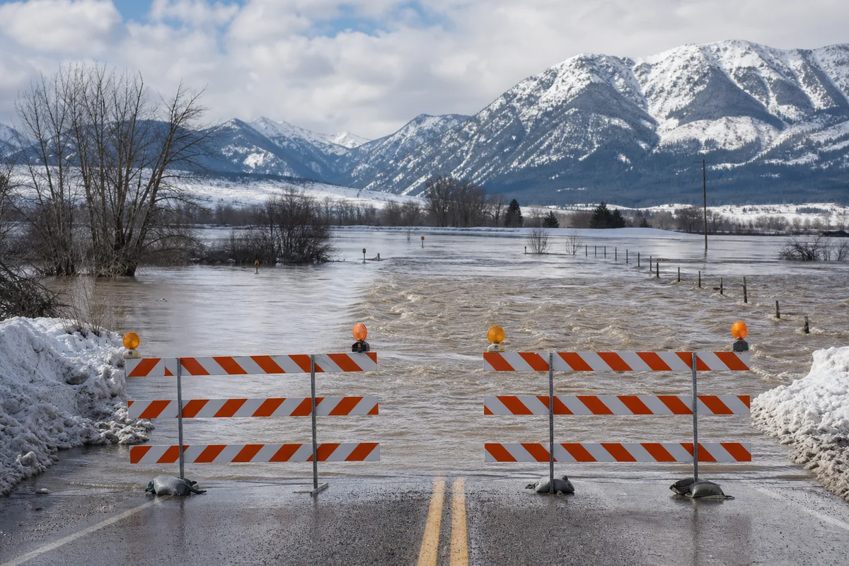
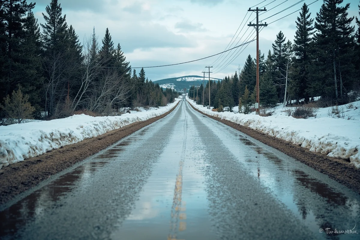
I was driving through the Flathead Valley last February when I encountered something that genuinely surprised me—a road completely submerged under two feet of muddy water, with orange barricades blocking any passage forward.
My GPS insisted I could continue straight, but the churning brown current told a very different story. That’s when I truly understood that winter flooding in Montana isn’t just a springtime problem—it can happen in the heart of winter when conditions align just right.
Understanding Montana’s weather patterns became essential for the rest of my trip, and I’ve since made it a priority to check flood conditions before any winter journey through Big Sky Country.
- Montana winter flooding typically occurs from December through March, caused by ice jams, rapid snowmelt during chinook winds, and rain-on-snow events
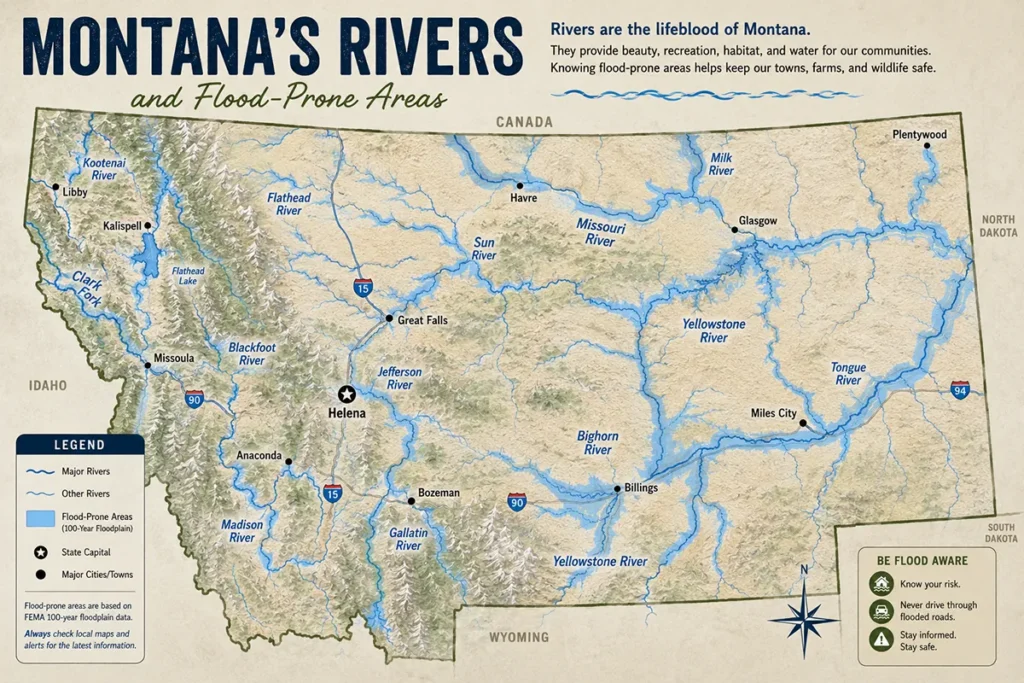
- The most flood-prone areas include the Flathead Valley, Yellowstone River corridor, Missouri River basin, and creek drainages near mountain ranges
- Ice jam flooding is the most dangerous winter flood type—it can happen with little warning and create flash flood conditions
- Always check Montana DOT road conditions, USGS water levels, and local alerts before traveling in winter
- Having an alternate route planned and carrying emergency supplies is essential for winter travel in flood-prone regions
Why Winter Flooding Happens in Montana
When most people think about flooding, they imagine spring snowmelt or summer thunderstorms. But Montana experiences a unique set of conditions that create winter flooding events that catch visitors completely off-guard.
I’ve learned through years of traveling across this state that winter flooding here operates on its own rules. The mechanisms are different from what you’d expect, and understanding them can literally save your trip—or your life.
Ice Jam Flooding: The Most Dangerous Type
During my time exploring the Missouri River breaks near Great Falls, I witnessed firsthand how quickly an ice jam can change the landscape. One morning, the river flowed normally within its banks. By afternoon, massive chunks of ice had piled up at a narrow bend, creating a natural dam that backed water up across adjacent farmland.
Ice jams form when temperatures fluctuate between freezing and thawing. The ice on rivers breaks apart but doesn’t have enough flow to push downstream, so it stacks up like a frozen traffic jam.
When these jams finally release—and they can release with explosive force—the surge of water and ice downstream is terrifyingly powerful. I’ve spoken with ranchers along the Milk River who’ve lost livestock and equipment to sudden ice jam releases that gave them mere minutes of warning.
Chinook Winds and Rapid Snowmelt
Montana’s famous chinook winds are a double-edged sword for winter travelers. These warm, dry winds can raise temperatures by 40-50 degrees in just a few hours, and I’ve experienced this temperature whiplash myself near Browning on the Blackfeet Reservation.
One January day, I woke up to -15°F and went to bed in shirt-sleeve weather at 42°F. The snow that had accumulated over weeks began melting so rapidly that every ditch and culvert became a rushing stream.
This rapid snowmelt creates immediate flooding conditions because the ground is still frozen solid. The water has nowhere to go except across roads, into basements, and over riverbanks. If you’re wondering why Montana gets so cold to begin with, it helps explain why these dramatic temperature swings have such an impact.
Rain-on-Snow Events
The third major cause of winter flooding in Montana is what meteorologists call a rain-on-snow event. Last December, I was caught in exactly this scenario near Missoula.
Warm, moist air from the Pacific pushed over the mountains and dropped rain on top of the existing snowpack. The rain accelerated melting while adding its own volume to the runoff.
Within 24 hours, the Clark Fork River rose dramatically, and several roads along the river corridor became impassable. These events are particularly common in western Montana, where Pacific weather systems can penetrate during winter.
Where Winter Flooding Occurs Most Often
Not all of Montana faces equal flooding risk during winter. Through extensive travel across the state, I’ve identified the regions where you need to exercise the most caution.
Flathead Valley and Glacier Region
The Flathead Valley, including Kalispell, Whitefish, and Columbia Falls, sits in a geographic bowl that collects runoff from surrounding mountains. During my winter visits to this area, I’ve noticed that even moderate warming events create significant water accumulation.
The Flathead River and its tributaries can rise rapidly, affecting roads like US Highway 2 and Montana Highway 35. The Whitefish Lake area is particularly susceptible to localized flooding during ice breakup.
If you’re planning a ski trip to Whitefish Mountain Resort, be aware that access roads can occasionally flood during warm spells. I always check conditions with the resort before driving up from Kalispell during potentially warm winter days.
Yellowstone River Corridor
The Yellowstone River, which runs from Gardiner through Livingston, Big Timber, and Billings to the North Dakota border, is ice jam territory. The river’s winding course and variable width create perfect conditions for ice to pile up.
I’ve been stranded in Livingston during an ice jam event that closed Interstate 90 at the river crossings. The local hotels filled up quickly with travelers who hadn’t anticipated being stuck.
The stretch between Billings and Miles City is particularly prone to winter flooding. The river flows through flat agricultural land, and when it spreads, it spreads wide.
Missouri River Basin
Great Falls earned its name honestly—the series of waterfalls on the Missouri created natural barriers that now host several dams. But the river upstream and downstream from the city can still experience significant ice jam flooding.
Near Fort Benton, where I spent a memorable winter weekend exploring this historic steamboat town, the river has a long history of dramatic ice jam events. The Missouri River breaks area between Fort Benton and the Fort Peck Dam sees flooding regularly.
Mountain Creek Drainages
Some of the most dangerous winter flooding I’ve encountered wasn’t on major rivers but on small creeks that drain mountain areas. These creeks can transform from frozen trickles to raging torrents within hours.
Near Bozeman, creeks like Sourdough and Hyalite can flash flood during rapid warming. In Helena, Prickly Pear Creek has flooded downtown areas during winter warm spells. The lesson I’ve learned is that Montana’s substantial snowfall has to go somewhere when it melts, and creeks are the first to show it.
| Region | Primary Flood Cause | Peak Risk Period | Roads Commonly Affected |
|---|---|---|---|
| Flathead Valley | Rain-on-snow, ice jams | January-February | US 2, MT 35, MT 206 |
| Yellowstone Corridor | Ice jams | February-March | I-90, US 89, MT 78 |
| Missouri Basin | Ice jams, chinook melt | January-March | US 87, MT 80, US 191 |
| Western Montana | Rain-on-snow | December-February | I-90, US 93, MT 200 |
| Central Montana | Chinook melt | January-February | US 87, US 191, MT 3 |
How to Check Flood Conditions Before You Travel
Before any winter trip to Montana, I go through a specific checklist of resources. This habit has saved me from headaches—and potentially dangerous situations—more times than I can count.
Montana Department of Transportation (MDT) 511
The MDT’s 511 system is my first stop, every time. You can access it online at 511mt.net or by dialing 511 from any phone in Montana.
The site shows real-time road conditions, including flood-related closures. During my last winter trip from Missoula to Bozeman, I checked 511 and discovered that a section of I-90 near Garrison was closed due to water over the roadway. That single check saved me a four-hour detour.
The system also shows webcams at key locations. I’ve used these to visually confirm conditions before committing to a route.
USGS Water Resources
For more detailed information about river levels, I use the USGS Water Resources website (waterdata.usgs.gov). This site shows real-time streamflow data from gauging stations across Montana.
During ice jam flooding situations, I look for rapid rises in water levels at upstream stations. If I see a gauge showing a sudden spike, I know flooding could be heading downstream.
The USGS also provides flood stage information, so you can tell at a glance whether a river is at normal levels, in flood stage, or at major flood stage.
National Weather Service Alerts
The NWS offices in Great Falls, Missoula, Billings, and Glasgow issue winter flood watches and warnings. I keep the NWS app on my phone with alerts enabled for the counties I’ll be traveling through.
A Flood Watch means conditions are favorable for flooding. A Flood Warning means flooding is occurring or imminent. I take both seriously and adjust my plans accordingly.
Local News and Social Media
Montana’s local TV stations and newspapers provide excellent real-time flood coverage. I follow stations like KTVH in Helena, KRTV in Great Falls, and KPAX in Missoula on social media for breaking updates.
Local Facebook groups for Montana travelers and residents often post conditions before official sources catch up. The “Montana Road Conditions” Facebook group has been invaluable during my travels.
What to Do If You Encounter Flooding
Despite all my preparation, I’ve still found myself facing unexpected flooding situations. Here’s what I’ve learned about handling them safely.
Never Drive Through Flooded Roads
This sounds obvious, but every winter in Montana, vehicles get swept away by floodwaters. Just six inches of moving water can knock you off your feet, and twelve inches can float a car.
During my trip through the Yellowstone corridor last winter, I saw multiple vehicles stuck in floodwater that didn’t look deep from a distance. What they didn’t see was that the road underneath had been scoured away, creating a hole that swallowed their wheels.
The mantra “turn around, don’t drown” exists for good reason. I’ve added hours to trips by finding alternate routes, but I’ve never regretted that decision.
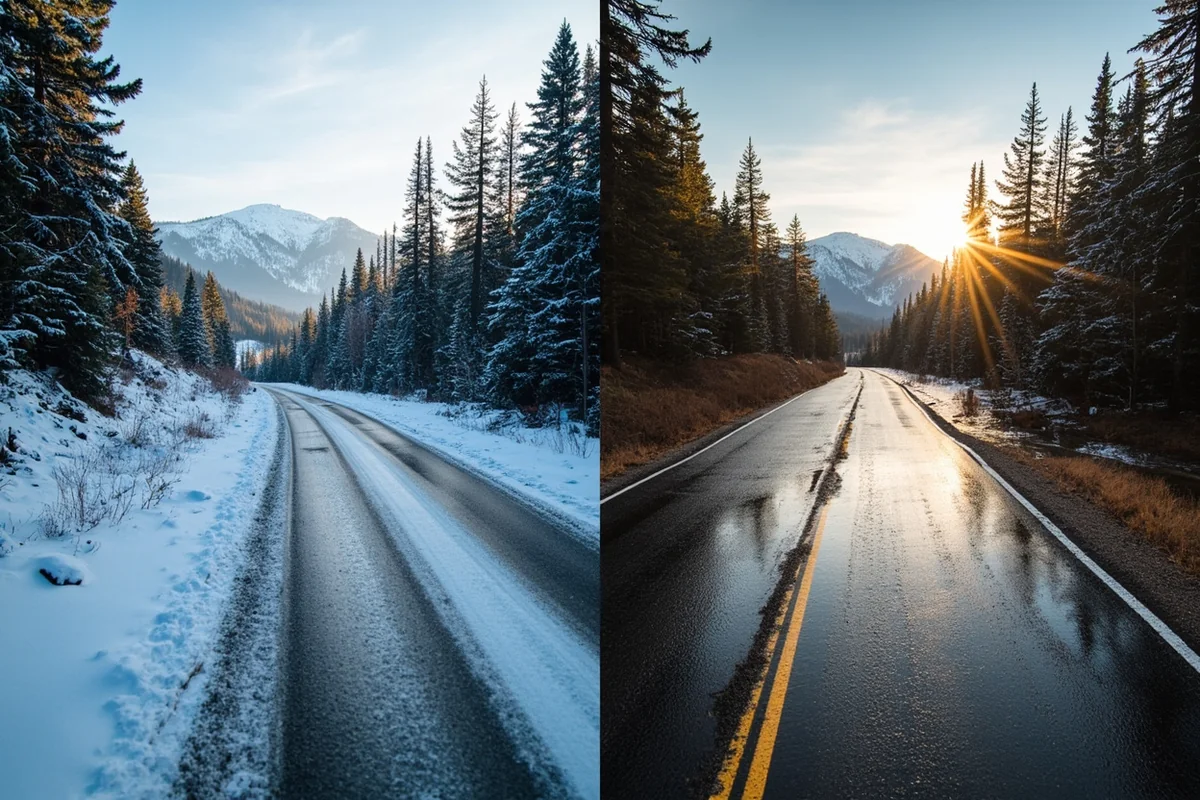
Watch for Ice on Flooded Roads
Here’s something specific to winter flooding that many visitors don’t consider: the water can freeze as temperatures drop. I once approached what looked like a normal wet road only to realize it was actually a sheet of ice covered with a thin layer of flowing water.
This combination is incredibly dangerous because you have zero traction on ice while water obscures where the ice ends and dry pavement begins. Having proper winter tires is essential, and I recommend checking our Montana winter driving guide before any cold-weather trip.
Know Your Vehicle’s Capabilities
I drive a 4WD SUV with good ground clearance, but even this setup has limitations in flood conditions. Four-wheel drive helps with traction, not flotation.
If you’re in a rental car or a low-clearance vehicle, be even more conservative about water depth. Water ingestion through the air intake can destroy an engine instantly.
Have Communication and Emergency Supplies
Cell service in rural Montana can be spotty, so I always carry a backup communication method. A satellite communicator like a Garmin inReach has proven worthwhile during remote winter travel.
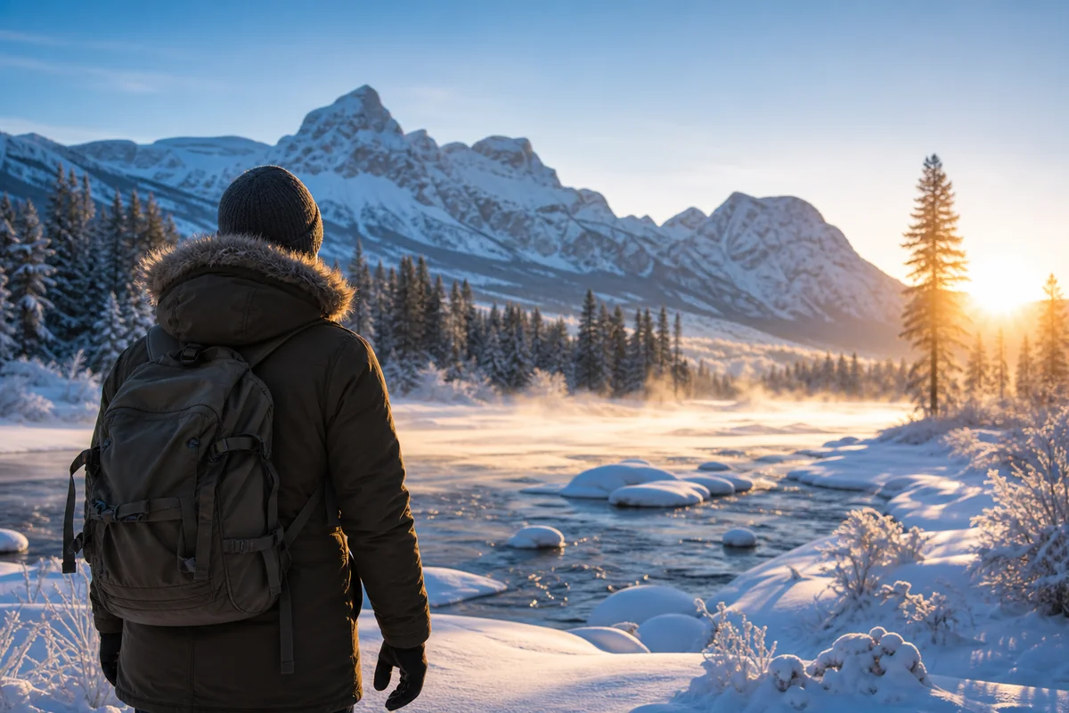
My emergency kit includes blankets, water, food, a flashlight, and extra warm clothing. If flooding strands you, you might be waiting hours for help to arrive. Proper preparation means having the right winter clothing and quality winter boots with you at all times.
Planning Your Trip Around Winter Flood Risk
Smart trip planning can minimize your exposure to winter flooding while still allowing you to experience Montana’s incredible winter landscape.
Choose Your Route Carefully
Interstate highways are generally cleared and reopened faster than secondary roads after flooding. When I plan winter trips, I stick to I-90 and I-15 as my primary routes whenever possible.
If I’m traveling to remote areas, I identify multiple potential routes in advance. On a trip to Havre last February, my primary route via US 87 was flooded near Big Sandy, but I’d already mapped an alternate via Great Falls that added just 45 minutes.
Mountain passes like Rogers Pass, Marias Pass, and Lookout Pass can flood at their base approaches during rapid melt events. Check conditions specifically for these areas before committing.
Build Flexibility Into Your Schedule
Winter travel in Montana requires schedule flexibility. I never book non-refundable reservations during peak flood risk periods, and I always allow buffer days for potential delays.
During a trip to Glacier Country last January, flooding closed US 2 for two days. Because I had flexible lodging arrangements, I simply extended my stay in Whitefish and enjoyed extra ski days instead of stressing about missed reservations.
Consider Timing Within the Winter Season
December typically sees the most stable winter conditions, with cold temperatures keeping snow in place and rivers frozen solid. This is when I prefer to visit if I’m concerned about flooding.
Late January through February brings the highest risk of chinook events and ice jams. If you’re visiting during this period, monitor conditions daily and be prepared for rapid changes.
March transitions to spring melt patterns, which can bring prolonged flooding but also more predictable conditions. For reference, you might want to read about Montana’s record-breaking winters to understand how variable conditions can be.
Choose Lodging Strategically
When I’m traveling during flood-risk periods, I choose lodging based on flood zone maps. Hotels on higher ground or away from river corridors give me peace of mind.
In Missoula, I stay near the university area rather than downtown along the Clark Fork. In Great Falls, I choose hotels on the south side rather than near the Missouri River. These small choices can make a big difference if flooding occurs overnight.
What Montana’s Winter Flooding Means for Outdoor Activities
Flooding doesn’t just affect roads—it impacts the outdoor activities that draw many visitors to Montana in winter.
Cross-Country Skiing and Snowshoeing
Flood events can damage trail systems and create dangerous ice formations. After a flooding episode near Seeley Lake, I found that groomed cross-country trails along the Clearwater River were destroyed by ice flows and debris.
Always check with local ranger stations about trail conditions after flood events. The debris and ice left behind can persist for weeks.
Ice Fishing
Winter flooding dramatically affects ice stability on lakes and rivers. Ice that was safe before a flood event can become dangerously unstable as water levels change.
I once planned an ice fishing trip on Canyon Ferry Reservoir that I had to cancel when fluctuating water levels from upstream runoff caused the ice to crack and shift. Local bait shops and fish and game offices can advise on current ice safety.
Hot Springs Visits
Montana’s hot springs are popular winter destinations, but some are located near rivers that flood. The Lolo Hot Springs area west of Missoula can become difficult to access during Clark Fork flooding.
When planning hot springs visits, check road conditions specifically for access routes. Having a backup hot springs destination in mind is smart planning.
Wildlife Watching
Interestingly, flooding can create excellent wildlife watching opportunities. Animals concentrate on higher ground, and I’ve had some of my best winter wildlife sightings immediately after flood events.
Near the Madison River during an ice jam flood, I spotted elk, deer, and even wolves congregating on hillsides above the flooded valley. Just ensure you’re watching from safe, accessible locations.
Historical Winter Floods to Know About
Understanding Montana’s flooding history helps contextualize current risks. Several historic events demonstrate what’s possible.
The Great January Chinook of 1943
In January 1943, a massive chinook event raised temperatures from -16°F to 53°F in Great Falls within hours. The resulting flood caused extensive damage along the Missouri and Sun Rivers.
This event shaped modern flood management in the region and demonstrates why chinooks remain a serious concern. If you’re curious about how cold Montana typically gets, you’ll understand why such dramatic warming causes problems.
The February 1996 Ice Jam Floods
February 1996 brought devastating ice jam floods to the Yellowstone and Milk River systems. Homes were destroyed, livestock lost, and roads damaged across eastern Montana.
During recent travels through this region, older residents still reference the ’96 floods as a benchmark for winter flood risk.
The January 2017 Flathead Flooding
More recently, January 2017 brought significant flooding to the Flathead Valley during a rain-on-snow event. US Highway 2 closed in multiple locations, and Kalispell saw urban flooding.
I was in Montana during this event, though fortunately on the east side of the divide. Friends in Whitefish described roads becoming rivers and normally calm creeks turning into dangerous torrents.
Comparing Winter Flood Risk to Other Montana Weather Hazards
Visitors often ask how winter flooding compares to other weather risks in Montana. Based on my experience, here’s my honest assessment.
Winter flooding is more common than many visitors realize but generally more predictable than summer severe weather. Unlike tornadoes in Montana, which can form with little warning, flood conditions typically develop over hours or days.
Montana doesn’t get hurricanes—if you’re wondering, you can read about whether Montana gets hurricanes—but winter flooding can cause comparable damage in concentrated areas.
Earthquakes do happen in Montana, though they’re relatively rare compared to flooding. The seismic activity along the Yellowstone system creates occasional tremors, but flooding affects travelers far more frequently.
For context on overall winter conditions, our guides on Montana winter weather and whether Montana is the coldest state provide helpful background.
Local Resources for Winter Flood Information
Over the years, I’ve compiled a list of local resources that provide the most accurate and timely flood information.
County Emergency Management Offices
Each Montana county has an emergency management office that coordinates flood response. These offices often have the most detailed local information about which specific roads and areas are affected.
I’ve called county offices directly when traveling through flood-prone areas. They’re usually helpful and can provide information not yet available through state systems.
US Army Corps of Engineers
The Corps manages flood control structures across Montana, including the Fort Peck Dam on the Missouri. Their website provides reservoir levels and release schedules that affect downstream flooding.
When ice jam flooding threatens areas below dams, the Corps may adjust releases. Understanding these dynamics helps predict conditions.
Local Radio Stations
Montana’s local radio stations provide excellent emergency information. I program local stations into my car radio for any region I’m traveling through.
Stations like KGVO in Missoula, KMON in Great Falls, and KGHL in Billings break into regular programming for flood warnings and road closures.
Final Thoughts on Montana Winter Flooding
After years of winter travel across Montana, I’ve developed a healthy respect for winter flooding. It’s not something to fear, but it absolutely demands attention and preparation.
The same conditions that create Montana’s stunning winter beauty—the heavy snows, the dramatic mountains, the powerful rivers—also create flooding potential. Understanding this connection has made me a better, safer traveler.
My advice to visitors is simple: check conditions before you go, build flexibility into your plans, and never underestimate moving water. Montana rewards those who respect its weather.
If you’re visiting during winter, don’t let flood concerns keep you away. With proper preparation, you can experience incredible winter landscapes safely. Just remember that Montana’s weather operates on its own schedule, and the wisest travelers are those who adapt rather than fight it.
For those looking to escape the coldest conditions, consider checking out the warmest places in Montana. And if you want to explore during less challenging weather, our Montana summer guide offers excellent alternatives.
The key to enjoying Montana in winter is balancing adventure with awareness. Winter flooding is part of the package—understanding it helps you experience Big Sky Country at its most spectacular, without unnecessary risk.
Whether you’re skiing at Big Mountain, exploring Yellowstone’s winter wonderland, or simply driving the incredible scenic routes, knowing about winter flooding makes you a more prepared and confident traveler. And in Montana, that preparation translates directly into better experiences and safer journeys.
Montana’s winters are magnificent, flooding and all. Come prepared, stay informed, and you’ll discover why this season might just be the best time to visit. Also consider how windy Montana really is and whether Montana is humid—both factors that affect winter conditions and your overall comfort.
Frequently Asked Questions
When does winter flooding typically occur in Montana and which areas are most affected?
Winter flooding in Montana most commonly occurs from January through March, particularly during rapid temperature swings or rain-on-snow events. The areas most susceptible include river valleys along the Yellowstone, Clark Fork, and Flathead Rivers, as well as low-lying communities near Missoula, Great Falls, and Billings. I always recommend checking current conditions before traveling through these corridors during winter months.
Can winter flooding in Montana affect my travel plans to Yellowstone or Glacier National Park?
Yes, winter flooding can significantly impact road access to both Yellowstone and Glacier National Parks, with temporary closures on highways like US-89 and US-191. During flood events, detours can add 50-100+ miles to your route, so I suggest building extra time into your itinerary. Always check the Montana Department of Transportation road conditions at 511mt.net before departing.
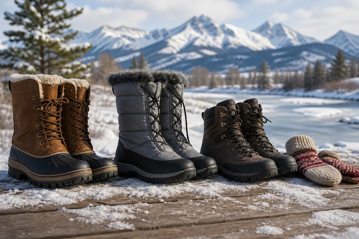
What should I pack for a Montana winter trip during potential flooding conditions?
Pack waterproof boots with good traction, multiple layers of moisture-wicking clothing, and a quality rain jacket even in winter. I also recommend keeping emergency supplies in your vehicle including blankets, water, snacks, a flashlight, and a portable phone charger. Tire chains or a 4WD vehicle are essential if you’re driving through flood-prone mountain passes.
Is it safe to drive through Montana during winter flood warnings?
Driving during active flood warnings in Montana can be extremely dangerous, as even 6 inches of moving water can sweep away a vehicle. I strongly advise avoiding flooded roadways entirely and never attempting to cross water covering the pavement. If you encounter flooding, turn around and use the Montana 511 app to find alternate routes or wait until conditions improve.
How much does trip insurance cost for Montana winter travel and does it cover flood-related cancellations?
Comprehensive trip insurance for Montana winter travel typically costs $50-$150 for a week-long trip, depending on your total trip cost and coverage level. Most policies cover flood-related cancellations and delays if you purchase before flood warnings are issued. I always read the fine print and look for policies specifically mentioning weather-related disruptions and road closures.
What are the best Montana winter travel tips to avoid flood-related disruptions?
Book accommodations with flexible cancellation policies and plan your route with multiple alternatives in case primary roads close due to flooding. I recommend scheduling your trip for mid-December or late February when extreme temperature swings are less common. Signing up for Montana emergency alerts and following local news stations on social media will give you real-time updates on developing flood conditions.
Where can I find real-time Montana winter flood updates and road closure information?
The best resources are the Montana Department of Transportation’s 511 website and app, which provide real-time road conditions and closure alerts. I also check the National Weather Service Missoula and Great Falls pages for flood watches and warnings. For national park-specific updates, the NPS websites for Yellowstone and Glacier post current road conditions daily during winter months.
Sources
- https://www.weather.gov/safety/flood-states-mt
- https://www.weather.gov/safety/flood-before
- https://www.weather.gov/safety/flood-during
- https://www.weather.gov/safety/flood-after
- https://murrow.wsu.edu/the-blackfeet-flood/
- https://leg.mt.gov/content/Committees/Interim/2019-2020/Water-Policy/Meetings/Sept-2019/MontanaClimateAssessment-Water.pdf