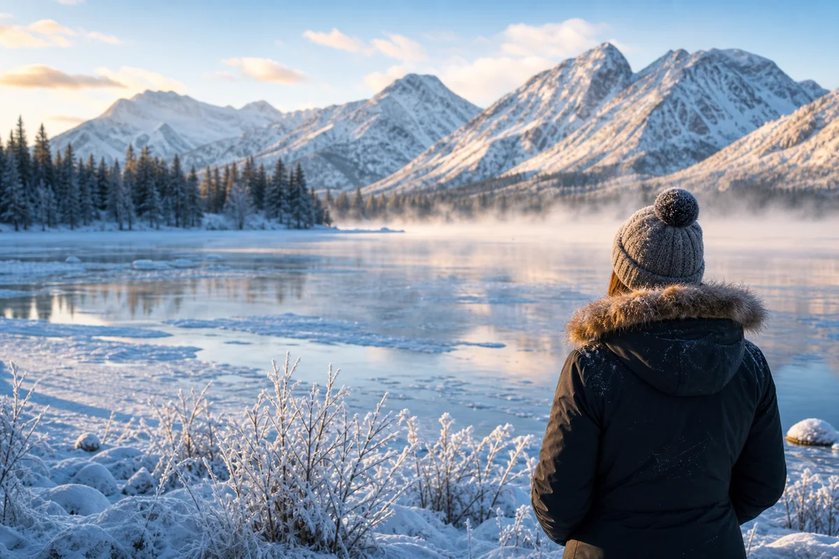
I was sitting in a cozy cabin near Hebgen Lake last August when the coffee mug on my nightstand started rattling against the wood—my first Montana earthquake, a gentle 3.2 magnitude reminder that I was camping above one of the most seismically active regions in the entire Rocky Mountain West.
That brief tremor fundamentally changed how I understood this wild state, and it’s something every visitor should know about before planning their trip.
Montana isn’t just about unpredictable Montana weather patterns, dramatic snowstorms, or the occasional severe thunderstorm—it’s also earthquake country, home to thousands of seismic events each year and the site of one of the most devastating earthquakes in American history.
- Montana experiences 1,000-2,000+ earthquakes annually, though most are too small to feel
- The western third of the state sits in a highly active seismic zone, particularly around Yellowstone and Hebgen Lake
- The 1959 Hebgen Lake earthquake (magnitude 7.3) killed 28 people and remains the deadliest in Rocky Mountain history
- Most earthquakes travelers might experience are minor and pose no danger
- Yellowstone’s supervolcano creates constant seismic activity, with thousands of small quakes yearly
- Simple preparation steps can help you feel confident during your Montana adventure
The Surprising Truth About Montana’s Seismic Activity
When most travelers think about natural hazards in Montana, they picture blizzards, wildlife encounters, or perhaps tornado activity in the eastern plains. Earthquakes rarely make the list of concerns, which is exactly why I’m writing this piece.
The reality is that Montana ranks as one of the most seismically active states in the nation, consistently placing in the top five for earthquake frequency. During my conversations with geologists at the Montana Bureau of Mines and Geology in Butte last fall, I learned that the state typically records between 1,000 and 2,000 earthquakes annually.
Most of these tremors are so small that sophisticated instruments are the only way to detect them. But several dozen each year reach magnitudes that people can actually feel, and every few years, one comes along strong enough to make the news.
Why Montana Has So Many Earthquakes
Understanding why Montana shakes so frequently helped me appreciate the landscape I was hiking through in a completely new way. The geology here is anything but boring.
The Intermountain Seismic Belt
Montana sits directly along the Intermountain Seismic Belt, a zone of earthquake activity stretching from northern Arizona through Utah, Idaho, Wyoming, and into Montana. This belt represents one of the most active seismic regions in the interior United States.
The Rocky Mountains in western Montana aren’t ancient, stable formations like the Appalachians. They’re still being shaped by active geological forces, with faults constantly adjusting and releasing energy.
During a guided geology tour near Helena last June, our guide pointed out visible fault scarps—those telltale ridges where the earth has shifted—that were younger than some of the trees growing beside them. It was a humbling reminder that the mountains I was admiring are very much works in progress.
The Basin and Range Province
Western Montana’s distinctive landscape of parallel mountain ranges separated by broad valleys isn’t just beautiful—it’s the result of the earth’s crust literally pulling apart. This extension creates normal faults where one block of rock drops relative to another.
These faults are responsible for creating the stunning valleys that make places like Missoula, Helena, and Bozeman so picturesque. They’re also the reason those same areas experience regular seismic activity.
I remember standing in the Bitterroot Valley during a fall visit, looking at the sharp eastern face of the Bitterroot Range, and realizing I was looking at an active fault system that could produce significant earthquakes.
Yellowstone’s Volcanic Influence
No discussion of Montana earthquakes is complete without addressing the elephant—or rather, the supervolcano—in the room. While Yellowstone National Park lies primarily in Wyoming, its massive volcanic system extends into Montana and drives tremendous seismic activity in the region.
The Yellowstone Caldera produces between 1,500 and 2,500 earthquakes annually, with most clustering in swarms that can include hundreds of small tremors over days or weeks. When I visited the Yellowstone area last summer, park rangers mentioned that a small earthquake swarm had occurred just the week before.
The magma chamber beneath Yellowstone is constantly moving and shifting, creating the geothermal features that draw millions of visitors while also generating the seismic activity that keeps geologists on their toes.
The 1959 Hebgen Lake Earthquake: Montana’s Deadliest
On August 17, 1959, at 11:37 PM, the largest earthquake in Rocky Mountain recorded history struck just outside Yellowstone National Park. I’ve visited the site multiple times, and it never fails to leave me speechless.
What Happened That Night
The magnitude 7.3 earthquake struck when the Madison River Canyon was filled with campers enjoying the late summer weather. Within seconds, 80 million tons of rock broke loose from the canyon wall and roared down the mountainside at over 100 miles per hour.
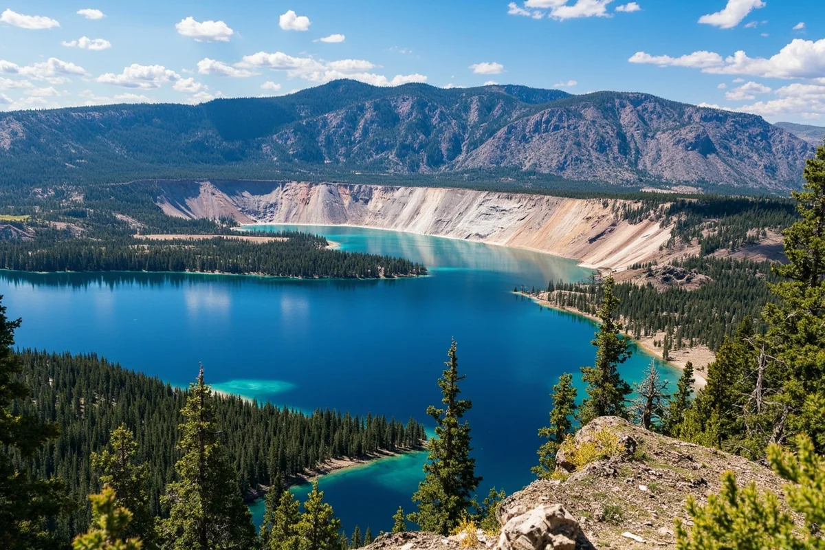
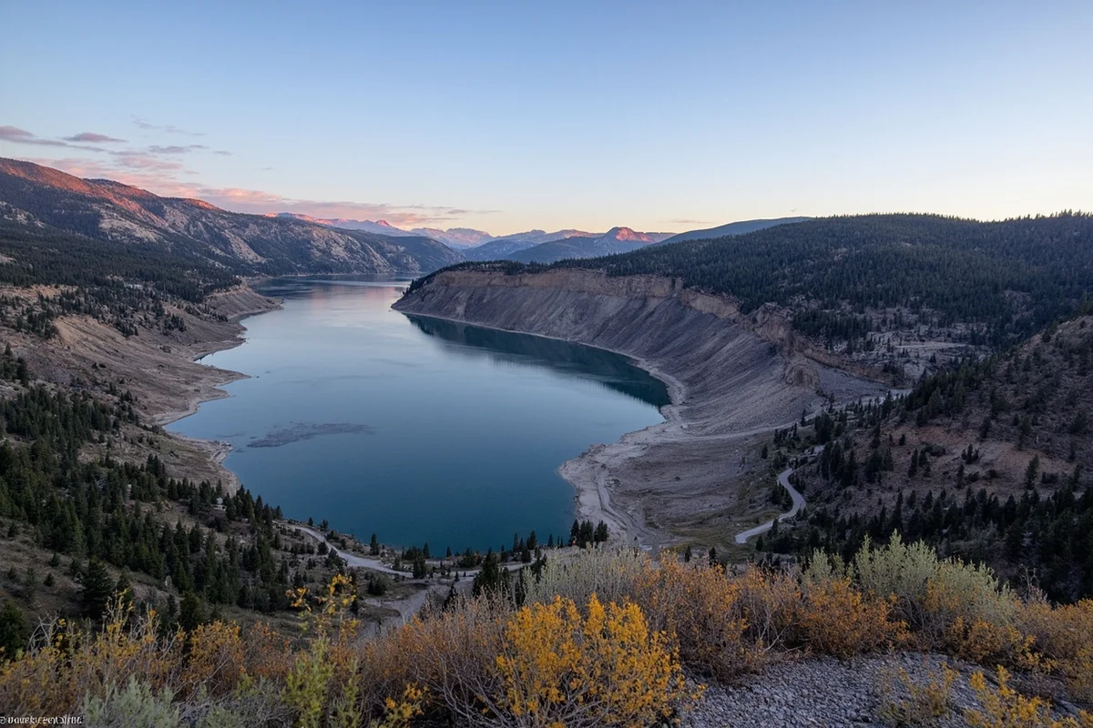
The landslide buried the Rock Creek Campground completely, killing campers in their tents and sleeping bags. It dammed the Madison River, creating what we now call Earthquake Lake—a 6-mile-long body of water that formed in just weeks.
Twenty-eight people died that night, and many bodies were never recovered. The landslide scar remains visible today, a massive wound on the mountainside that’s slowly being reclaimed by vegetation more than six decades later.
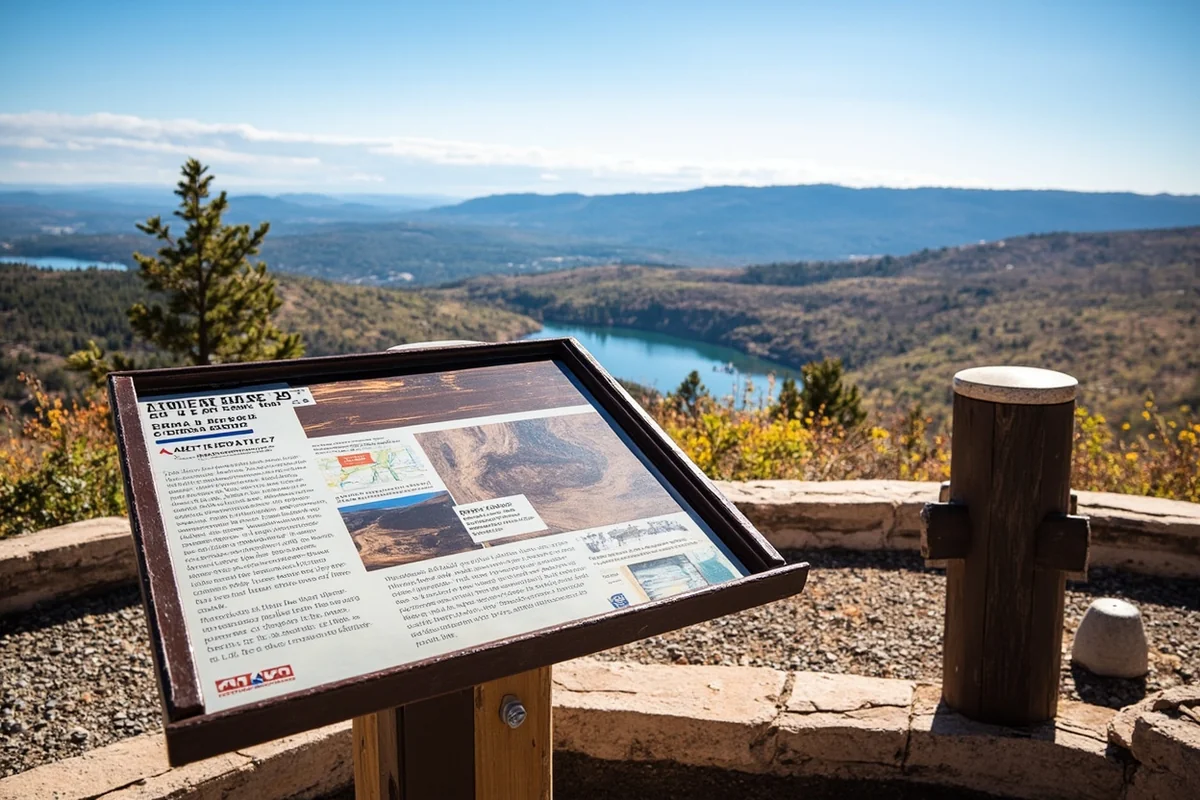
Visiting the Earthquake Lake Visitor Center
I strongly recommend that any traveler passing through this area stop at the Earthquake Lake Visitor Center, operated by the U.S. Forest Service. When I visited on a quiet Tuesday afternoon last September, I had the place nearly to myself and spent over two hours absorbing the exhibits.
The center sits directly atop the landslide debris, and the views from the observation deck are sobering. You can see the ghost trees—the skeletal remains of a forest drowned when the lake formed—standing in the water like silent monuments.
Inside, exhibits tell the stories of survivors and victims alike. I found myself particularly moved by the account of a family whose children survived by floating on their mattress when their cabin was swept into the rising water.
The visitor center is typically open from late May through late September, with hours varying by season. Admission is free, though donations are welcomed.
Driving the Earthquake Lake Scenic Corridor
Highway 287 between West Yellowstone and Ennis follows the shore of Earthquake Lake and passes directly through the earthquake zone. I’ve driven this route a dozen times, and I always pull over at the various interpretive stops along the way.
The Cabin Creek Scarp Area shows where the fault ruptured through a forest, dropping one side of the ground nearly 20 feet. Trees that were once level with each other now stand at dramatically different elevations.
Ghost Village is another worthwhile stop, where you can see foundations and remnants of vacation cabins that were damaged or destroyed by the earthquake.
Notable Earthquakes in Montana’s History
The 1959 Hebgen Lake event was Montana’s biggest, but it’s far from the only significant earthquake to affect the state. Here’s a look at other notable seismic events that shaped Montana’s history:
| Date | Location | Magnitude | Effects |
|---|---|---|---|
| August 17, 1959 | Hebgen Lake | 7.3 | 28 deaths, massive landslide, created Earthquake Lake |
| October 18, 1935 | Helena | 6.2 | 4 deaths, significant building damage to state capital |
| October 31, 1935 | Helena | 6.0 | Major aftershock, additional damage to weakened structures |
| July 6, 2017 | Lincoln | 5.8 | Felt across western Montana, minor damage reported |
| March 30, 2024 | Yellowstone area | 4.4 | Part of ongoing swarm, widely felt but no damage |
The Helena Earthquakes of 1935
The twin earthquakes that struck Helena in October 1935 offer an important reminder that Montana’s earthquake hazard isn’t limited to the Yellowstone region. The capital city sits along a major fault zone, and those two events caused the most earthquake damage in Montana history in terms of building destruction.
Walking through downtown Helena last spring, I noticed that many of the historic buildings bear earthquake damage repair work from that era. The Lewis and Clark County Courthouse, for instance, required significant reconstruction after the 1935 quakes.
Where Earthquakes Are Most Likely During Your Visit
Not all of Montana faces equal earthquake risk. Understanding the geography of seismic activity can help you know what to expect depending on your itinerary.
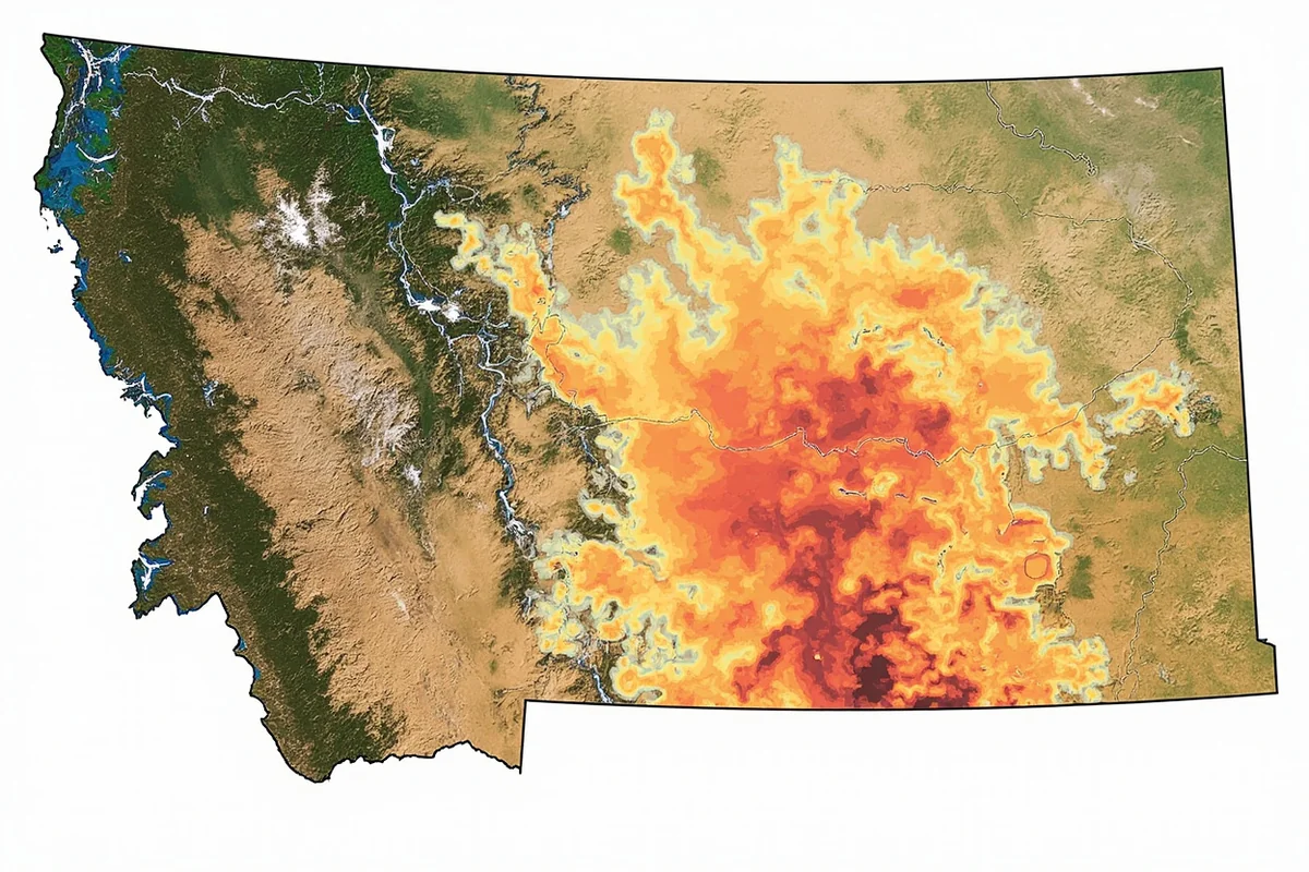
Highest Risk Areas (Western Montana)
The western third of Montana, roughly everything west of the Continental Divide, experiences the vast majority of the state’s seismic activity. If you’re visiting popular destinations like:
- Missoula and the surrounding valleys
- Glacier National Park and the Flathead area
- Helena and the Lewis and Clark Valley
- Butte and the upper Clark Fork region
- Bozeman and the Gallatin Valley
- West Yellowstone and the Hebgen Lake region
You’re in areas that regularly experience small earthquakes and occasionally feel moderate ones. This shouldn’t discourage you from visiting—millions of people live and travel in these areas safely every year.
Moderate Risk Areas (Southwestern Montana)
The area around Dillon, the Big Hole Valley, and the upper Madison River region also sees regular seismic activity, though somewhat less frequently than the areas immediately around major fault zones.
During my summer visits to southwestern Montana, I’ve always appreciated how the landscape itself tells the story of ongoing geological activity. Hot springs are common throughout this region, a sign of the heat and movement beneath the surface.
Lower Risk Areas (Eastern Montana)
If you’re planning to explore eastern Montana—the plains region that covers roughly two-thirds of the state’s land area—earthquakes are much less of a concern. This part of Montana sits on ancient, stable bedrock that rarely experiences significant seismic activity.
The eastern Montana plains have their own weather considerations, of course. Unlike coastal states, Montana doesn’t get hurricanes, but summer thunderstorms can be severe, and winter conditions can be challenging regardless of which part of the state you’re visiting.
What to Do If You Experience an Earthquake in Montana
During my coffee-rattling experience near Hebgen Lake, I’ll admit my first reaction was confusion rather than action. Having since educated myself on proper earthquake response, I want to share what every Montana visitor should know.
If You’re Indoors
The standard advice applies: Drop, Cover, and Hold On.
- Drop to your hands and knees before the earthquake knocks you down
- Cover your head and neck with your arms, and shelter under a sturdy piece of furniture if possible
- Hold On to your shelter and be prepared to move with it until the shaking stops
Don’t run outside during the shaking. In Montana’s many historic buildings and cabins, the greatest danger often comes from falling objects—light fixtures, items on shelves, and ceiling materials.
If You’re Outdoors
Move away from buildings, trees, streetlights, and utility wires. Drop to the ground and cover your head and neck with your arms.
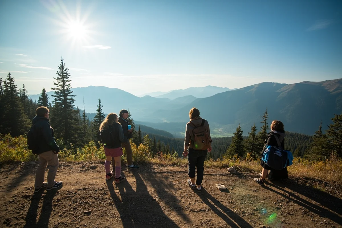
If you’re hiking in Montana’s backcountry—which I hope you are, because it’s spectacular—be aware of potential rockfall danger. Move away from cliffs, steep slopes, and areas with loose rock.
If You’re Driving
Pull over to a clear area away from buildings, overpasses, bridges, power lines, and trees. Stop and set your parking brake.
Stay inside your vehicle until the shaking stops. Your car’s suspension will absorb some of the shaking, and the vehicle provides protection from falling debris.
This is especially important advice for winter travelers who might be navigating challenging roads. Our Montana winter driving guide covers the many hazards of cold-weather travel, but earthquakes can happen in any season.
After the Shaking Stops
Expect aftershocks—smaller earthquakes that follow the main event. These can occur minutes, hours, or even days later.
Check yourself and those around you for injuries. In lodges and hotels, follow staff instructions for evacuation if necessary.
Be cautious about entering damaged buildings, and watch for hazards like broken glass, damaged utilities, and structural instability.
Should Earthquakes Change Your Montana Travel Plans?
I’ve been asked this question many times, and my answer is always the same: absolutely not.
The statistical likelihood of experiencing a damaging earthquake during a typical Montana vacation is extremely low. The vast majority of earthquakes that occur here are so small that you’d never notice them, and the ones you might feel are usually gentle enough to be more interesting than alarming.
I’ve spent cumulative months traveling in Montana over the years, and my single felt earthquake—that morning at Hebgen Lake—was actually a highlight of the trip. It connected me to the living geology of the landscape in a way that photographs and reading never could.
Perspective from a Frequent Montana Traveler
Consider that millions of people visit western Montana and Yellowstone every year. Significant earthquake injuries to tourists are virtually unheard of. The last earthquake-related deaths in Montana occurred in 1959—over six decades ago.
By comparison, you face far greater risk from common travel hazards like car accidents, wildlife encounters, or the hypothermia that can set in quickly if you’re unprepared for Montana’s winter weather.
If you’re concerned about cold-weather safety, I’d suggest focusing your preparation on practical items like appropriate winter boots and a proper winter clothing system. These will serve you far better than worrying about seismic activity.
Practical Preparation for Earthquake-Conscious Travelers
If you want to be prepared—and I believe in sensible preparation for any outdoor adventure—here are some practical steps that take almost no effort.
When Choosing Accommodations
- Newer buildings generally meet more stringent seismic codes than historic structures
- Ground-floor rooms have quicker exit access if evacuation becomes necessary
- Note the location of emergency exits when you check in
- Keep a flashlight and your phone near your bed at night
That said, I’ve stayed in everything from modern hotels to century-old ranch cabins throughout Montana, and I’ve never let earthquake considerations drive my accommodation choices. The character of an old lodge usually outweighs the marginal safety benefit of a modern building.
In Your Daypack
Whether you’re exploring earthquake country or not, a prepared daypack makes every Montana adventure safer and more comfortable:
- Flashlight or headlamp with fresh batteries
- Basic first aid supplies
- Emergency whistle
- Portable phone charger
- Snacks and water
- Layers for changing weather (because Montana can get surprisingly cold even in summer)
This is standard backcountry preparation that serves you well regardless of earthquakes.
Stay Informed
The USGS (United States Geological Survey) maintains real-time earthquake information at earthquake.usgs.gov. You can set up notifications for earthquakes in specific regions.
The Montana Bureau of Mines and Geology at Montana Tech monitors seismic activity statewide and provides excellent educational resources about Montana’s earthquake history and hazards.
Earthquake Tourism: Exploring Montana’s Seismic History
For visitors like me who find geological history fascinating, Montana offers several opportunities to explore earthquake-related sites and learn about seismic activity firsthand.
Earthquake Lake Visitor Center
I’ve already mentioned this fantastic facility, but it deserves emphasis. Located on Highway 287 between West Yellowstone and Ennis, this is the premier earthquake education site in the region.
The drive from either direction is spectacular, passing through some of the most beautiful mountain scenery in Montana. Combined with a visit to Virginia City, one of Montana’s warmest and most historic towns, you can make a full day of exploring this region.
Montana Bureau of Mines and Geology Museum
Located on the Montana Tech campus in Butte, this museum offers excellent exhibits on Montana’s geology, including seismic activity. The staff are knowledgeable and happy to answer questions.
Butte itself is worth exploring—it’s one of the most historically significant mining towns in the American West, and its geology is as interesting as its human history.
Yellowstone’s Geothermal Features
While technically in Wyoming, Yellowstone’s geothermal features are directly connected to the seismic activity that affects Montana. The geysers, hot springs, and mud pots are all surface expressions of the volcanic and seismic energy beneath the surface.
The Old Faithful Visitor Education Center has excellent exhibits explaining the connection between volcanism, seismic activity, and the park’s famous thermal features.
How Climate and Seasons Affect Montana Earthquake Activity
This is a question I’ve been asked several times, and it touches on some interesting science. While earthquakes themselves aren’t caused by weather, there are some seasonal patterns worth noting.
Research has shown that large snowmelt events and seasonal water loading can trigger small earthquakes in some fault zones. In Montana, this means late spring—when heavy mountain snowpack begins to melt—sometimes sees increased seismic activity.
The flooding that occasionally accompanies rapid snowmelt is usually a more significant concern for travelers than any earthquake connection, however.
There’s no “earthquake season” to avoid. Seismic events happen year-round, and the slight statistical variations aren’t meaningful for trip planning purposes.
Yellowstone Supervolcano: Separating Fact from Fiction
No article about Montana earthquakes would be complete without addressing the Yellowstone supervolcano, if only to calm some of the anxiety that sensationalized media coverage has created.
Yes, Yellowstone sits atop a massive volcanic system capable of producing catastrophic eruptions. Yes, this volcanic system generates thousands of earthquakes every year. And yes, scientists monitor it constantly.
But the probability of a major eruption during your lifetime—let alone your two-week Montana vacation—is vanishingly small. The last major eruption occurred 640,000 years ago, and there’s no indication that another is imminent.
When I asked a Yellowstone park geologist about this during a ranger program last summer, she smiled and said she gets the question constantly. Her response: “I wouldn’t have taken this job if I thought we were about to blow up.”
The thousands of small earthquakes in the Yellowstone region are actually signs that the system is releasing pressure gradually rather than building toward a catastrophic event.
Montana’s Seismic Monitoring Network
One reassuring aspect of Montana’s earthquake hazard is how thoroughly it’s monitored. The state has an extensive network of seismographs that detect and record every tremor.
The Montana Regional Seismic Network, operated in partnership with the University of Montana and Montana Tech, provides real-time monitoring data that feeds into national earthquake tracking systems.
In the Yellowstone region, the Yellowstone Volcano Observatory maintains one of the most sophisticated monitoring systems in the world, with dozens of seismometers, GPS stations, and other instruments constantly watching for any changes.
This monitoring means that scientists would likely have warning if earthquake or volcanic activity were building toward a significant event. It also means we have excellent data about the thousands of small earthquakes that occur routinely without incident.
Comparing Montana to Other Earthquake-Prone Destinations
Context helps put Montana’s earthquake risk in perspective. I’ve traveled extensively in California, including spending time in the San Francisco Bay Area and Los Angeles, both of which face far higher seismic hazards than Montana.
I’ve also explored Japan’s mountain regions, where earthquakes are a regular part of life and building codes reflect that reality.
Compared to these destinations, Montana’s earthquake risk is moderate. It’s higher than most of the American East Coast or Midwest, but significantly lower than the Pacific Ring of Fire regions that many travelers visit without concern.
The difference is awareness. Californians and Japanese travelers have earthquakes on their radar; Montana visitors often don’t. I hope this article helps bridge that knowledge gap without creating unnecessary worry.
Final Thoughts: Embracing Montana’s Dynamic Landscape
The same geological forces that create earthquake hazards in Montana also created the spectacular mountain landscapes, the hot springs, the mineral-rich ground that drew miners and settlers, and the dramatic scenery that draws millions of visitors today.
When I felt that small earthquake at Hebgen Lake, my initial surprise quickly gave way to a sense of connection. I was experiencing something real about this place—not just its beauty, but its ongoing creation.
The earth moves beneath Montana, and it has for millions of years. The mountains are rising, the valleys are widening, and the landscape continues to evolve. Being a witness to that process, even in the gentlest way, is part of what makes Montana travel so meaningful.
So should you worry about earthquakes during your Montana adventure? I don’t think so. Should you be aware of them, prepared in basic ways, and ready to respond appropriately if one occurs? Absolutely.
Pack your camera, lace up your hiking boots, and check our guides on how cold Montana gets, humidity levels across the state, how windy it can be, and whether Montana really is the coldest state. These practical weather considerations will serve your trip planning far better than earthquake anxiety.
Montana is waiting, and the ground beneath it is very unlikely to cause you any trouble at all.
Be prepared. Be aware. And most of all, be there—because this state is worth every mile of the journey.
Frequently Asked Questions
How common are earthquakes in Montana and should I worry while visiting?
Montana actually ranks as one of the most seismically active states in the US, experiencing about 7-10 earthquakes weekly, though most are too small to feel. As a traveler, I wouldn’t worry much since major damaging earthquakes are rare, and the last significant one was the 1959 Hebgen Lake earthquake near Yellowstone. Just be aware if you’re visiting the western part of the state where seismic activity is highest.
What areas of Montana have the highest earthquake risk for travelers?
Western Montana, particularly around Yellowstone National Park, the Helena area, and the Flathead Lake region near Glacier National Park, sees the most seismic activity. If you’re planning trips to popular destinations like Big Sky, Bozeman, or Missoula, you’re in more active zones. That said, I’ve traveled through these areas many times without feeling a single tremor.
Is it safe to visit Yellowstone’s Montana entrance with all the earthquake activity?
Yes, it’s completely safe to visit Yellowstone through Montana’s entrances despite the area averaging 1,500-2,500 earthquakes annually. Most of these are micro-earthquakes caused by the park’s geothermal activity and go unnoticed by visitors. The National Park Service monitors seismic activity 24/7, and I’ve never had a trip disrupted by earthquake concerns.
What should I pack for a Montana trip in case of an earthquake?
I recommend packing a basic emergency kit including a flashlight, portable phone charger, first-aid supplies, and a few days of any necessary medications. If you’re camping in western Montana, keep sturdy shoes near your sleeping bag and know where the nearest ranger station is located. These precautions cost under $30 and provide peace of mind without adding much weight to your luggage.
What’s the best time to visit Montana to avoid earthquake season?
Unlike severe weather, earthquakes in Montana don’t follow a seasonal pattern, so there’s no specific time to avoid them. The best time to visit Montana is generally June through September for outdoor activities, with July and August offering the warmest weather around 70-85°F. I’d focus more on avoiding winter road closures and spring mud season than worrying about earthquake timing.
Has Montana ever had a major earthquake that affected tourists?
The most significant earthquake affecting Montana tourism was the 7.3 magnitude Hebgen Lake earthquake in 1959, which tragically killed 28 people at a campground near Yellowstone. This event created Quake Lake, which is now actually a fascinating tourist attraction about 90 miles south of Bozeman where you can visit the Earthquake Lake Visitor Center. Since then, no earthquakes have caused tourist fatalities in Montana.
Do Montana hotels and lodges have earthquake safety protocols?
Most hotels and lodges in seismically active areas like Bozeman, Big Sky, and near Glacier National Park follow basic earthquake safety guidelines, though protocols vary by property. I always check that my room has clear exit paths and note the emergency information posted on doors. Budget around $100-250 per night for quality accommodations in tourist areas, and don’t hesitate to ask the front desk about their emergency procedures when checking in.
Sources
- https://www.umt.edu/this-is-montana/columns/stories/earthquake-slide.php
- https://www.nps.gov/yell/learn/nature/earthquakes.htm
- https://mbmg.mtech.edu/MontanaGeology/geohazards/earthquakes/safety.asp#gsc.tab=0
- https://des.mt.gov/Preparedness/Earthquakes
- https://www.montana.edu/emergency/emergency_actions/earthquake.html