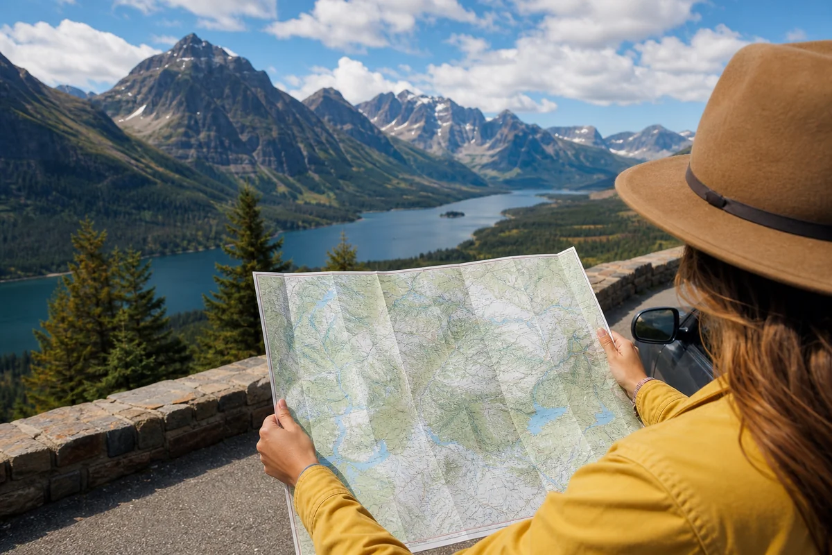
I was standing at a gas station in Lewistown — the geographic center of Montana — when a fellow traveler walked up, phone in hand, clearly frustrated, and asked: “How is everything so far apart here?” That moment perfectly captures what every first-time Montana visitor needs to understand: this state is massive, wildly diverse, and impossible to fully appreciate without a solid grasp of its geography and city layout.
Quick Answer — Montana Map With Cities
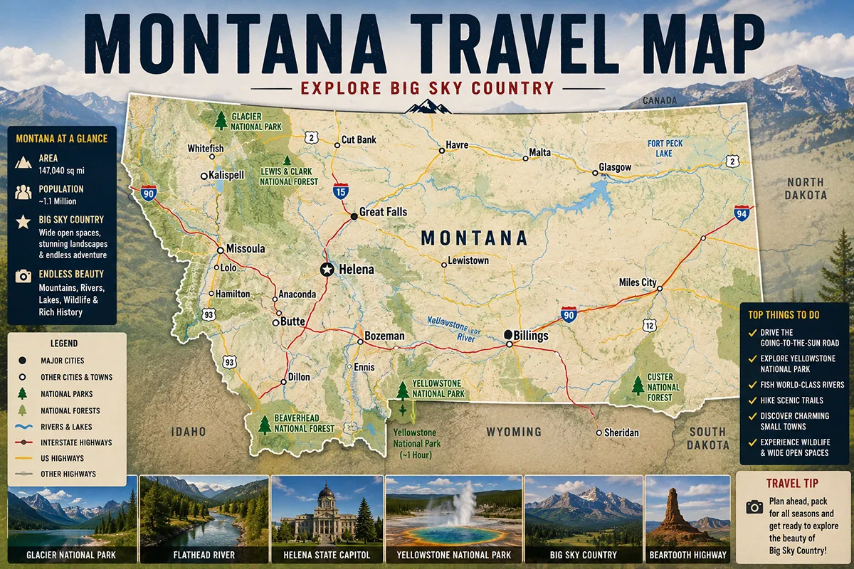
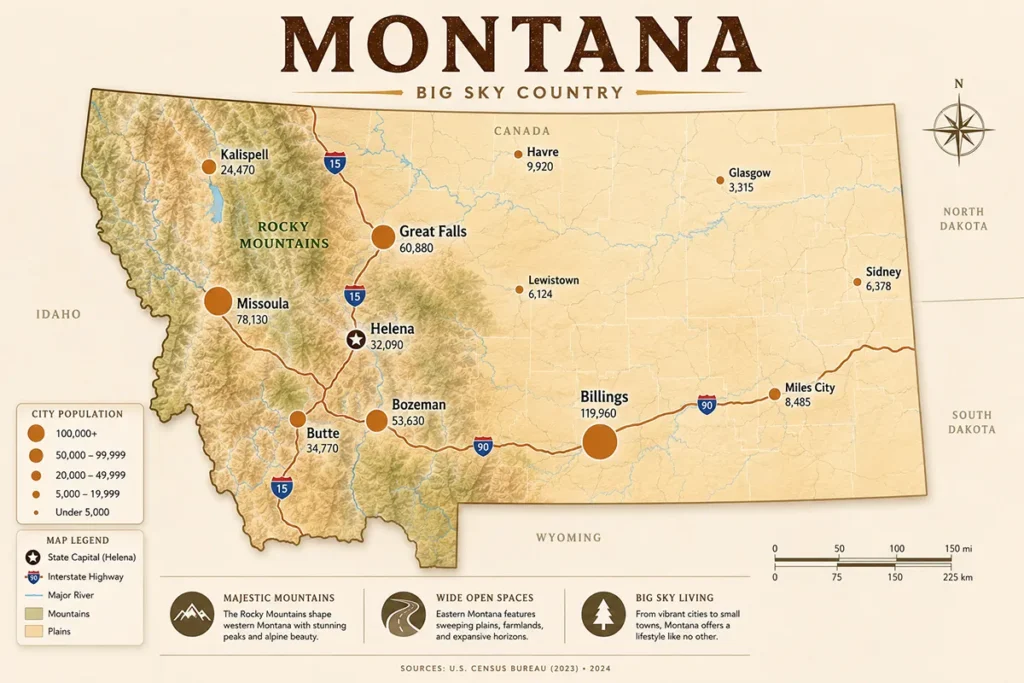
Montana has 129 incorporated cities spread across 147,040 square miles. The eight largest (all over 20,000 population) are Billings (largest, ~117,000), Missoula (~77,000), Great Falls (~60,000), Bozeman (~57,000), Butte (~35,000), Helena (~33,000, state capital), Kalispell (~26,000), and Havre (~10,000). Cities cluster along two interstate corridors: I-90 (east-west) and I-15 (north-south). The state spans 559 miles east to west — a full day’s drive without stops.
For the interactive 184-city Montana map, see our Montana cities and towns guide.
- Montana has 129 cities spanning 147,040 square miles — the fourth-largest state in the US
- Major cities align along I-90 (Billings → Butte → Missoula) and I-15 (Butte → Helena → Great Falls)
- Billings is the largest city and eastern gateway; Missoula anchors the west
- Free official Montana highway map: available at mdt.mt.gov or visitmt.com/montana-maps
- Download offline maps before every trip — cell service vanishes between cities
Montana Map With Cities: Where Every Major City Sits
For a fully interactive 184-city map of Montana with search, filter, and regional color-coding, visit our Montana cities and towns hub.
Montana Cities By Population: The Complete Reference Table
The table below covers all Montana cities with over 5,000 population — the data competitors like NationsOnline, OntheWorldMap, and GIS Geography all provide that your current page doesn’t. Population figures are approximate based on most recent Census data.
| City | Region | Population (approx.) | Nearest Major Feature |
|---|---|---|---|
| Billings | South-Central | ~117,000 | Yellowstone River, Rimrocks |
| Missoula | Western | ~77,000 | Clark Fork River, Rattlesnake Wilderness |
| Great Falls | Central | ~60,000 | Missouri River, Giant Springs |
| Bozeman | Southwest | ~57,000 | Gallatin Range, MSU |
| Butte | Southwest | ~35,000 | Continental Divide, Berkeley Pit |
| Helena (capital) | West-Central | ~33,000 | Last Chance Gulch, Capitol |
| Kalispell | Northwest | ~26,000 | Flathead Lake, Glacier NP |
| Havre | North-Central | ~10,000 | Hi-Line, Bear Paw Mountains |
| Anaconda | Southwest | ~9,000 | Pintler Mountains, Smelter Stack |
| Miles City | Southeast | ~8,500 | Yellowstone River, Tongue River |
| Belgrade | Southwest | ~12,000 | Gallatin Valley, near BZN airport |
| Livingston | South-Central | ~8,000 | Yellowstone River, Paradise Valley |
| Whitefish | Northwest | ~8,000 | Whitefish Mountain Resort, Glacier NP |
| Laurel | South-Central | ~7,000 | Yellowstone River, Billings suburb |
| Sidney | Far East | ~6,000 | Yellowstone River, North Dakota border |
| Lewistown | Central | ~6,000 | Geographic center of Montana |
| Glendive | Far East | ~5,000 | Yellowstone River, Makoshika State Park |
| Red Lodge | South-Central | ~2,300 | Beartooth Highway, Beartooth Mtns |
| West Yellowstone | Southwest | ~1,400 | Yellowstone NP west entrance |
| Gardiner | South-Central | ~900 | Yellowstone NP north entrance |
Montana officially has 129 incorporated cities and an additional 235 census-designated places — 364 populated communities total, spread across 56 counties.
For a complete clickable city list, see our Montana cities and towns guide covering all 184 named communities with regional guides.
Understanding Montana’s Geographic Layout
Before diving into specific cities, understand what took me several trips to fully appreciate: Montana is essentially two distinct states masquerading as one.
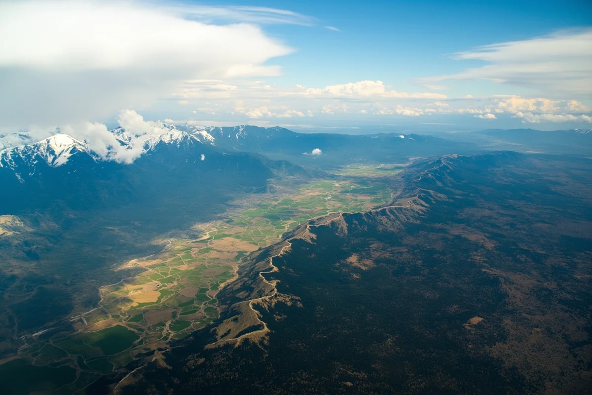
The Rocky Mountains create a dramatic spine through the western third, while the eastern two-thirds flatten into rolling prairies, badlands, and agricultural expanses stretching toward the Dakotas.
This split defines where cities developed, how roads connect them, and what experiences each region offers. For the full geographic breakdown, see my Montana regions guide and my where is Montana located post.
Montana spans 559 miles east to west and 315 miles north to south. The state contains 94 million acres of land — 29 million of which are federally managed public lands. It would take 10 hours or more to drive straight across without stops, and many first-time visitors dramatically underestimate this.
The Continental Divide on the Map
The Continental Divide runs diagonally through Montana from Glacier National Park in the northwest down toward Yellowstone in the south. It separates the state into Pacific-draining western rivers and Atlantic/Gulf-draining eastern rivers — and profoundly affects weather patterns.
Driving from Helena to Great Falls last September, I left overcast skies and 55°F temperatures, then emerged into bright sunshine and 72°F just 90 minutes later on the eastern side.
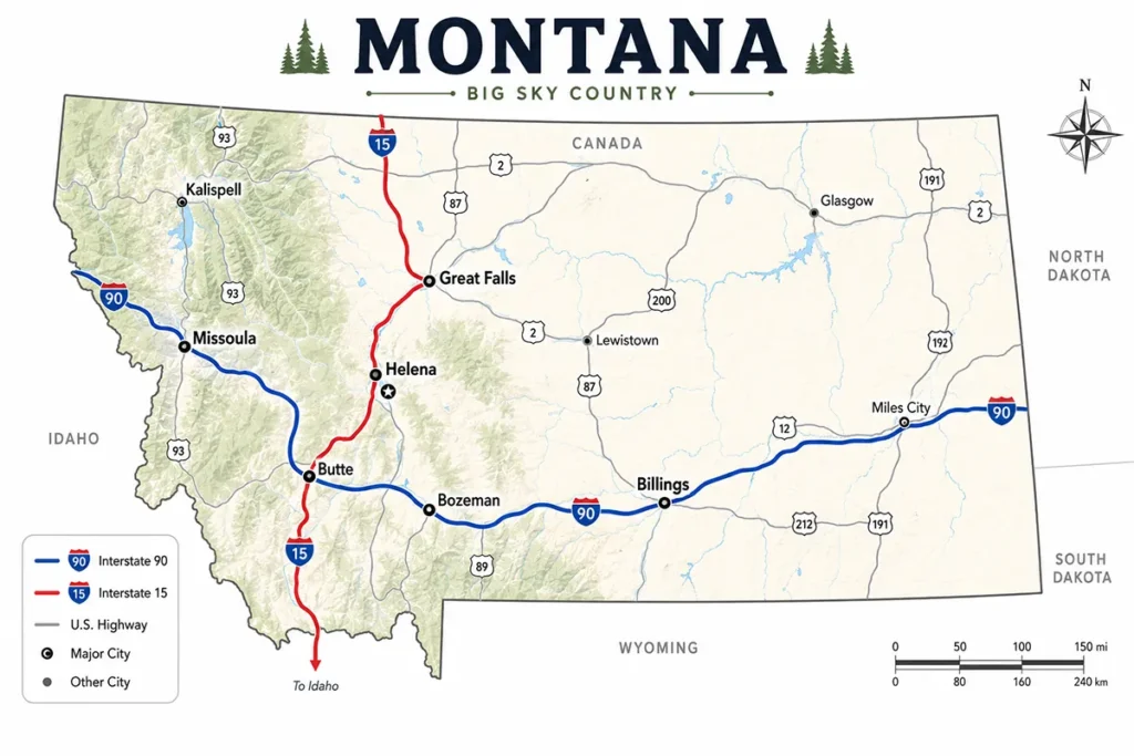
Montana’s Highway Map: The Interstate System
Understanding how Montana’s highway system works is essential for reading any Montana map with cities. Three interstates form the backbone.
Interstate 90 (I-90) — The East-West Spine
I-90 is Montana’s most important highway — and holds a distinction most travelers don’t know: Montana’s segment is the longest stretch of I-90 within a single state in the entire US. It runs approximately 550 miles across southern Montana from the Idaho border near Lookout Pass through Missoula, Butte, and Billings, exiting toward Wyoming and North Dakota.
Cities on I-90 (west to east): Missoula → Drummond → Deer Lodge → Anaconda junction → Butte → Three Forks → Bozeman → Livingston → Big Timber → Columbus → Billings
I-90 is the highway that most travelers use to cross Montana in either direction and is the most scenic of the three interstates in the western portion.
Interstate 15 (I-15) — The North-South Corridor
I-15 runs approximately 400 miles north-south through western Montana, connecting the Idaho border near Lima all the way to the Canadian border at Sweetgrass. It’s Montana’s only north-south interstate and passes through three of the state’s most important cities.
Cities on I-15 (south to north): Lima → Dillon → Butte (junction with I-90) → Helena (state capital) → Great Falls → Shelby → Sweetgrass/Canada border
The stretch between Helena and Great Falls along I-15 is unremarkable — flat, fast driving with little scenery. The section between Butte and Helena through the Big Belt Mountains is considerably more interesting.
Interstate 94 (I-94) — The Eastern Plains
I-94 splits from I-90 in Billings and runs 250 miles east through six counties to the North Dakota border at Wibaux. Speed limit raised to 80 mph in 2016 on most sections. This is the route for reaching eastern Montana and North Dakota’s Bakken region.
Cities on I-94 (west to east): Billings → Forsyth → Miles City → Glendive → Wibaux → North Dakota border
US Highway 2 — The Hi-Line
Not an interstate, but essential on any Montana map: US Route 2 runs across northern Montana from the Idaho border near Troy all the way to the North Dakota border at Culbertson — staying close to the Canadian border for most of its length. This route is nicknamed the “Hi-Line” because it follows the old Great Northern Railway line at the northern extreme of Montana’s plains.
Hi-Line communities (west to east): Havre, Malta, Glasgow, Wolf Point, Culbertson. The Hi-Line is the most authentic route for seeing eastern Montana without any tourist infrastructure — a freight-train-pacing, gas-station-watching, horizon-chasing experience.
Other Major US Highways
| Highway | Route | Key Connections |
|---|---|---|
| US-89 | N-S through central MT | Great Falls → Glacier NP east entrance → Browning |
| US-93 | N-S through western MT | Missoula → Kalispell → Canada (Roosville crossing) |
| US-191 | N-S through SW MT | Great Falls → Lewistown → Billings (alternate) |
| US-12 | E-W central MT | Missoula → Helena → Roundup |
| US-87 | N-S central MT | Great Falls → Lewistown → Billings |
| US-212 | Beartooth Highway | Red Lodge → Cooke City → Yellowstone NE entrance |
| US-2 | The Hi-Line | Troy → Havre → Culbertson (full northern corridor) |
Montana’s Major Cities: A Geographic Overview
Let me walk through each city you’ll encounter on a Montana map — in the order you’d travel them on the two main corridors.
Billings: The Eastern Gateway (I-90 / I-94 Junction)
Billings is Montana’s largest city at approximately 117,000 residents, sitting where I-90 and I-94 split. It’s the most practically connected city in the state — Montana’s “Magic City,” named for its explosive growth after the Northern Pacific Railroad arrived in 1882. The Rimrocks sandstone cliffs ring the north side of the city, rising 500 feet above downtown.
For visitors: Billings Logan International (BIL) has the best national flight connections in Montana. The city is a practical launch point for Beartooth Highway, Little Bighorn Battlefield, and eastern Montana road trips.
Missoula: The Cultural Heart of Western Montana (I-90 West)
Missoula (~77,000) sits in a broad valley where five valleys converge, giving it a bowl-like geography that can trap winter air inversions but makes for spectacular scenery.
Home to the University of Montana, this city has an energy that feels Pacific Northwest — independent bookstores, river culture, bike infrastructure, and a thriving arts scene. Norman Maclean wrote about its rivers; David Lynch grew up here.
For visitors: Missoula serves as the best base for the Bitterroot Valley to the south, Flathead Lake to the north, and the Clark Fork River corridor to the west.
Great Falls: The Underappreciated Gem (I-15 / US-89 Junction)
Great Falls (~60,000) sits on the Missouri River where Lewis and Clark struggled with five consecutive waterfalls during their 1805 expedition.
The Lewis and Clark National Historic Trail Interpretive Center here is one of the finest expedition museums in the country. The C.M. Russell Museum holds the largest collection of Charles Marion Russell’s Western art in the world.
Great Falls is strategically positioned on the map as the midpoint between Glacier National Park and Yellowstone on a north-south traverse.
Bozeman: The Outdoor Recreation Hub (I-90)
Bozeman (~57,000) has undergone the fastest growth of any Montana city since 2010 — driven by remote work migration, Montana State University, and Yellowstone tourism.
On the map it sits at the western edge of the Gallatin Valley with the Bridger Range immediately to the north and the Gallatin Range to the south.
Bozeman Yellowstone International (BZN) now rivals Billings for the most direct flight connections in Montana. The city is the primary gateway to Yellowstone’s north entrance, 90 miles south via Paradise Valley.
Helena: The Capital (I-15 / US-12 Junction)
Helena (~33,000) sits in a valley on the east side of the Continental Divide, built on the site of the 1864 Last Chance Gulch gold strike. As the state capital it anchors the I-15 / I-90 corridor geographically, positioned between Great Falls to the north and Butte to the south. The Cathedral of St. Helena and the Montana State Capitol are its signature landmarks.
Butte: The History Lesson (I-90 / I-15 Junction)
Butte (~35,000) sits at the exact junction of I-90 and I-15 — the single most important highway intersection on a Montana map.
Once the largest city in the state and the center of the copper mining industry, Butte’s “richest hill on earth” legacy is visible in the Berkeley Pit and the mine headframes still dotting the hillsides. The historic uptown district contains remarkable architecture from the early 1900s boom years.
Kalispell: The Flathead Lake Hub (US-93)
Kalispell (~26,000) sits between Flathead Lake (largest natural freshwater lake west of the Mississippi) and the south entrance to Glacier National Park.
Glacier Park International Airport (FCA) is here — the correct airport for Glacier visits, 30 miles south of the park entrance. Kalispell offers more affordable accommodations than Whitefish with easy access to the same park.
Whitefish: The Resort Town (US-93, northwest of Kalispell)
Whitefish (~8,000) is Montana’s most upscale resort community, known for Whitefish Mountain Resort and its position 30 miles west of Glacier. Peak summer hotel prices can exceed $350/night; the downtown has excellent restaurants and a walkable main street.
Livingston: The Artists’ Town (I-90, east of Bozeman)
Livingston (~8,000) sits on the Yellowstone River just 53 miles north of Yellowstone’s north entrance via the dramatic Paradise Valley. The downtown historic district is remarkably preserved; Dan Bailey’s Fly Shop is legendary among Montana anglers. The town has attracted artists and writers for decades.
Red Lodge: The Beartooth Gateway (US-212)
Red Lodge (~2,300) sits at the base of the Beartooth Mountains at the start of the Beartooth Highway (US-212). Charles Kuralt called the Beartooth “the most beautiful drive in America.” Red Lodge serves as both a mountain town in summer and a small ski destination in winter at Red Lodge Mountain Resort.
Gateway Cities to National Parks and Wilderness
For most visitors, Montana cities function primarily as launching points for wild spaces.

Glacier National Park access:
- West Entrance: Whitefish (30 mi), Kalispell (35 mi), Columbia Falls (10 mi)
- East Entrance: East Glacier Village, Browning (near Blackfeet Reservation border)
- The Going-to-the-Sun Road connects the two sides through Logan Pass
Yellowstone National Park access:
- North Entrance (Gardiner): Bozeman ~90 mi, Livingston ~53 mi
- West Entrance (West Yellowstone): Bozeman ~90 mi
- Northeast Entrance (Cooke City): Red Lodge via Beartooth Highway ~68 mi (summer only)
Bob Marshall Wilderness access:
- Great Falls / Choteau / Augusta from the east
- Missoula area from the west via Seeley Lake corridor
For a complete city-by-city guide with lodging and things to do, see our Montana cities and towns hub.
Map to Montana: How to Get Here From Every Direction
This is what the second keyword — “map to Montana” — actually means to most searchers: how do I plan a route into Montana from where I am? Here’s the honest breakdown of every major approach.
From the Pacific Northwest (Seattle / Portland)
Primary route: I-90 east from Seattle. Cross the Cascades, pass through Spokane, WA, and cross into Montana at Lookout Pass (milepost 0 of Montana’s I-90). Distance: Seattle to Missoula = ~480 miles (~7 hours). Portland to Missoula = ~480 miles (~7 hours) via US-2 or I-84 to I-82 to I-90.
The Lookout Pass entry into Montana is one of the most dramatically beautiful state line crossings in the US — the descent into the Clark Fork River valley makes an immediate statement about what Montana is.
From the Southwest (Salt Lake City / Las Vegas)
Primary route: I-15 north from Salt Lake City into southwestern Montana. Entry point: Lima or Dillon on I-15. Distance: Salt Lake City to Butte = ~470 miles (~6.5 hours). Las Vegas to Butte = ~800 miles (~11 hours) via I-15 straight north.
I-15 is the cleanest, fastest route into Montana from the south. You enter the state in the Beaverhead Mountains and I-15 takes you through Dillon, Butte, Helena, and Great Falls without leaving the interstate.
From the Midwest (Minneapolis / Chicago)
Primary route: I-94 west from Minneapolis or I-90 west from Chicago, converging at Billings. Distance: Minneapolis to Billings = ~900 miles (~13 hours) via I-94. Chicago to Billings = ~1,400 miles (~20 hours) — plan two days.
Entry into Montana from North Dakota on I-94 arrives at Wibaux and continues west to Glendive, Miles City, and Billings. I-90 from South Dakota enters at Alzada in the southeast corner.
From Denver / Colorado
Primary route: I-25 north to Billings via Wyoming, then I-90 west into Montana. Distance: Denver to Billings = ~640 miles (~9 hours). Alternatively, US-287 north through Wyoming connects to I-90 near Buffalo, WY.
The Beartooth Highway alternative (from Cody, WY up US-212) is dramatically more scenic but seasonal (late May–mid October) and adds significant time.
From Calgary, Alberta (Canada)
Primary route: Highway 2 south from Calgary crosses into Montana at Sweetgrass / Coutts on I-15. Distance: Calgary to Great Falls = ~230 miles (~3 hours). Calgary to Glacier National Park (Many Glacier, east entrance) via Chief Mountain border crossing = ~130 miles (~2.5 hours) — summer only.
Note: Valid passport required for all US-Canada border crossings. The Roosville crossing (US-93 north of Eureka) connects to Cranbrook, BC. The Piegan/Carway crossing south of Waterton Lakes NP connects to Glacier’s east side.
Montana Entry Points Map at a Glance
| From | Entry Highway | Montana Border Crossing | First Major City |
|---|---|---|---|
| Seattle / Spokane | I-90 east | Lookout Pass | Missoula (170 mi) |
| Portland | US-2 / I-84 / I-90 | Lookout Pass | Missoula (~480 mi) |
| Salt Lake City | I-15 north | Lima/Dillon area | Butte (~80 mi north) |
| Minneapolis | I-94 west | Wibaux | Billings (~250 mi) |
| Denver | I-25 north / US-87 | Alzada (I-90) | Billings (~200 mi) |
| Chicago | I-90 west | Alzada | Billings (~400 mi) |
| Calgary, Canada | HWY 2 south | Sweetgrass (I-15) | Great Falls (~90 mi) |
| Vancouver, Canada | US-93 south | Roosville | Kalispell (~70 mi) |
Where to Get a Montana Map: Free Resources
For the “map to Montana” searcher — here’s exactly where to get an actual Montana highway map.
Free printable Montana highway map (official): The Montana Department of Transportation (MDT) publishes an updated Montana highway map every two years. The 2025 Montana Highway Map is available as a free PDF download or free physical copy by mail at mdt.mt.gov/publications/maps.aspx. The reverse side includes tourism highlights and regional information. This is the definitive official Montana road map.
Visit Montana’s free map resources: visitmt.com/montana-maps offers digital and physical maps organized by region, plus an interactive trip planning tool. Also free.
Google Maps offline (essential for road trips): In Google Maps, tap your profile > Offline maps > Select a custom area covering your Montana route before departing. Montana’s rural cell coverage gaps are severe enough that offline maps aren’t optional — they’re required for safe navigation between cities. Cover the entire state in one offline download if you’re doing a multi-region trip.
Moon Travel Guides printable maps: Moon Montana publishes regional travel maps divided into 8 Montana zones including Missoula, Going-to-the-Sun Road, and Yellowstone corridors — useful for planning multi-region trips where a single state map lacks detail.
For more on navigating Montana’s transportation network, see my Montana transportation guide and Montana airports guide.
Practical Distance Guide Between Major Cities
This reflects actual driving times — not just what Google Maps calculates. Wildlife crossings, construction seasons, and mountain pass conditions add significant time to any Montana drive.
| Route | Distance | Realistic Drive Time | Notes |
|---|---|---|---|
| Billings → Missoula | 345 miles | 5–5.5 hours | I-90 the entire way; Butte is the ideal midpoint |
| Billings → Bozeman | 145 miles | 2 hours | I-90 west |
| Missoula → Glacier NP (West) | 150 miles | 2.5–3 hours | Beautiful drive via Flathead Lake on US-93 |
| Bozeman → Yellowstone (North) | 90 miles | 1.5–2 hours | Paradise Valley on US-89; gorgeous |
| Great Falls → Glacier NP (East) | 150 miles | 2.5 hours | Rocky Mountain Front on US-89 |
| Helena → Butte | 65 miles | 1 hour | Easy I-15 |
| Billings → Glacier NP (West) | 450 miles | 6.5–7 hours | Full day drive; plan an overnight stop |
| Red Lodge → Yellowstone NE | 68 miles | 2 hours (summer) | Beartooth Highway — seasonal only |
| Missoula → Helena | 115 miles | 1.5–2 hours | US-12 or I-90/I-15 via Butte |
| Canadian border → Wyoming | 315 miles | 4.5–5 hours | N-S across entire state on I-15 |
For more route-by-route planning, see my Montana transportation guide.
Eastern Montana Cities: The Overlooked Region
Most Montana visitors never venture east of Billings, and I understand why — the national parks dominate attention. But I’ve found genuine rewards in eastern Montana’s smaller cities.
Miles City (8,500) feels like stepping back into the frontier West that Hollywood depicts. The Range Riders Museum is unexpectedly excellent, and the annual Bucking Horse Sale each May draws crowds from across the country.
Glendive (~5,000) serves as the gateway to Makoshika State Park, Montana’s largest state park. The badlands formations here rival those in more famous parks, and during my visit I hiked for two hours without seeing another person.
Lewistown (~6,000) is Montana’s geographic center — a town of legitimate charm with excellent fly fishing access on the Judith River and the Judith Mountains and Big Snowy Mountains nearby, neither of which appear in most guidebooks. For travelers seeking authentic Montana without tourist infrastructure, Lewistown delivers completely.
For complete coverage of Montana’s 184 named communities, see our Montana cities and towns guide.
Smaller Western Montana Towns Worth Knowing
Kalispell (25,000) anchors the Flathead Valley between Whitefish and Flathead Lake, offering more affordable lodging than Whitefish while maintaining easy Glacier National Park access. I’ve found better restaurant value here than in Whitefish and a more local-feeling atmosphere. Full guide at Kalispell.
Hamilton anchors the Bitterroot Valley south of Missoula and provides access to the Selway-Bitterroot Wilderness. The town maintains a genuine Main Street character without tourist saturation.
Livingston has attracted artists and writers for decades; the downtown historic district is remarkably preserved. Dan Bailey’s Fly Shop here is legendary among anglers. Full guide at Livingston.
Red Lodge serves as the gateway to the Beartooth Highway — frequently called America’s most beautiful drive — and doubles as a legitimate small ski destination in winter. Full guide at Red Lodge.
Road Trip Itineraries: Using Montana’s Map Intelligently
Based on dozens of Montana trips, here are itinerary frameworks built around the actual highway map.
One Week: The Classic Mountain Loop
Fly into Bozeman (BZN). Spend one day in town, then drive south to Yellowstone for two days. Drive north through Paradise Valley to Livingston, continue to Helena or Great Falls, then angle northwest to Glacier for two days via US-89 along the Rocky Mountain Front. Exit via Missoula (MSO) or return to Bozeman.
Total driving: ~800 miles across 7 days. This covers Montana’s most famous destinations without driving more than 3 hours on any single day.
Two Weeks: The Full State Survey
Start in Billings (BIL). Explore the Rimrocks and Little Bighorn Battlefield, then drive south to Red Lodge and up the Beartooth Highway into Yellowstone.
Three days in the park, then north through Paradise Valley to Bozeman. Continue through Helena and Great Falls to Glacier for three days. Include time in Missoula before heading east via Great Falls back to Billings.
Total driving: ~1,400 miles across 14 days. This covers all five Montana regions with genuine time in each.
Three Days: Choose One Region
Pick one region and commit. For Glacier-focused trips, fly into Kalispell (FCA) and base yourself in Whitefish or Kalispell.
For Yellowstone-focused trips, fly into Bozeman and base yourself in Livingston or Bozeman. Trying to do both parks in three days means experiencing neither properly.
For seasonal timing of your trip, see my best time to visit Montana guide.
Practical Map Tips for Montana Travel
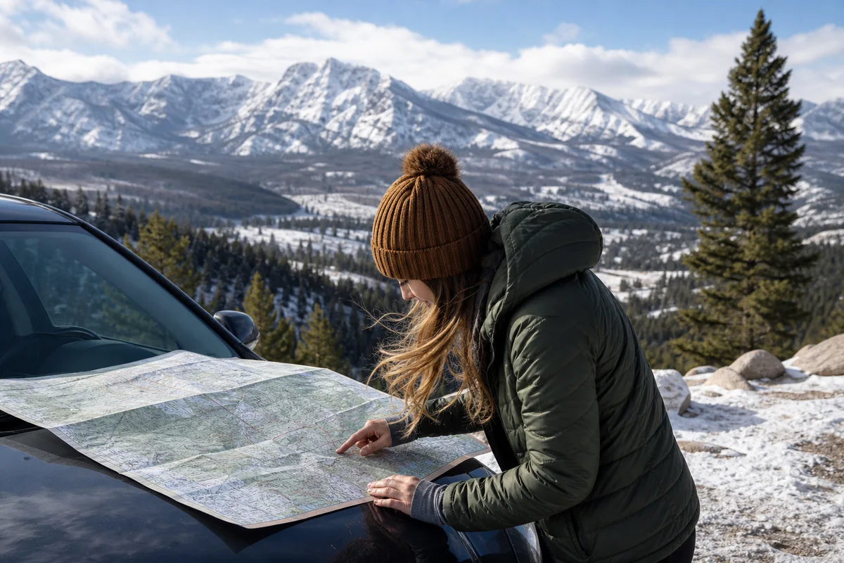
Download offline maps for the entire state before you leave home. Montana’s cell coverage map has enormous gaps. Between most cities — particularly in eastern Montana, along the Hi-Line, and throughout the national forests — your navigation apps go dark. I use Google Maps offline downloads and carry the MDT highway map as a paper backup.
Never pass a gas station below half a tank. Eastern Montana gas stations can be 80+ miles apart. The MDT highway map shows rest areas and services along major routes — invaluable for fuel planning.
Montana’s speed limits are among the highest in the US. I-90 and I-94 allow 80 mph on most rural sections. I-15 varies. State highways are typically 70 mph. Despite the high limits, actual travel time is often longer than expected because of wildlife crossings, road construction, and scenic slowdowns.
Wildlife creates genuine delays. Bison in the road inside Yellowstone. Elk crossing US-89 at dusk. A moose that materialized from roadside brush on US-93 south of Missoula with zero warning. Factor extra time for dawn and dusk driving near wilderness areas.
The Glacier vehicle reservation system requires planning. Glacier National Park requires timed entry permits during peak season (typically late May through mid-September). Book at recreation.gov months ahead. This affects your scheduling around Whitefish and Kalispell.
For full getting-around context, see my Montana transportation guide.
Getting to Montana’s Cities: Airports
Montana has eight commercial airports, but four handle the overwhelming majority of visitors. For full route information, see my Montana airports guide.
| Airport | Code | Best For | Direct From |
|---|---|---|---|
| Bozeman Yellowstone Intl | BZN | Yellowstone, Big Sky, SW Montana | Most major US hubs |
| Glacier Park Intl (Kalispell) | FCA | Glacier NP, NW Montana | Seattle, Denver, SLC, Minneapolis |
| Missoula International | MSO | Bitterroot Valley, Clark Fork corridor | Seattle, Denver, SLC, LA, Chicago |
| Billings Logan International | BIL | Eastern Montana, Beartooth, SE Montana | Seattle, Denver, SLC, Las Vegas, Dallas |
| Helena Regional | HLN | State capital, Central MT | Seattle, Denver, SLC, Minneapolis |
| Great Falls International | GTF | Rocky Mountain Front, Central MT | Seattle, Denver, SLC |
Amtrak Empire Builder: Crosses northern Montana through Havre, Shelby, Cut Bank, East Glacier, West Glacier, and Whitefish. A genuinely scenic way to arrive, though limited departure times reduce flexibility.
When to Visit Montana’s Cities
Each season changes the map experience dramatically. See my best time to visit Montana guide for the full seasonal breakdown.
Summer (June–August): Peak season, maximum prices, but full access to all roads and attractions. Going-to-the-Sun Road typically opens fully in late June or early July. Book 3–6 months ahead for popular areas.
Fall (September–October): My personal favorite. Crowds thin after Labor Day, larch trees turn gold through western Montana’s mountains, elk bugle in the valleys. The Beartooth Highway closes by mid-October.
Winter (November–April): Glacier’s Going-to-the-Sun Road closes (typically by mid-October). Many Yellowstone roads close. Ski cities (Whitefish, Bozeman) thrive. Wildlife watching — particularly wolves in Yellowstone — is at its best.
Spring (May–Early June): River levels run high, trails can be muddy or snow-covered at elevation, but wildflowers start in lower valleys by late May and crowds haven’t yet materialized.
Final Thoughts on Mapping Montana
After dozens of Montana trips, the most valuable map skill I’ve developed isn’t reading highways — it’s reading distances honestly. The state is 559 miles across. Cities that look close on a national-scale US map are often three to five hours apart. Glacier and Yellowstone are not a weekend trip.
Use cities as your anchors on the map — resupply, lodging, and genuine regional character in each. Understand which corridor (I-90 or I-15) connects your cities.
Download offline maps before you need them. And give yourself permission to stop in towns that don’t appear in the major guidebooks — that Lewistown moment at the geographic center of the state is what Montana road trips are actually about.
Ready to explore every city on the Montana map? Start with our Montana cities and towns hub — 184 communities with an interactive map, regional guides, and links to individual city pages.
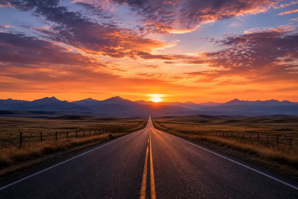
<!– wp:image –> <!– IMAGE PLACEHOLDER Position: Near conclusion, above FAQ Alt text: “Montana road stretching toward distant mountains at sunset, representing a Montana road trip” Caption: “Montana is 559 miles east to west — map it carefully and drive it slowly” AI Generation Prompt: “” –> <!– /wp:image –>
Frequently Asked Questions
What are the major cities on a Montana map?
Montana’s eight largest cities are Billings (~117,000, largest), Missoula (~77,000), Great Falls (~60,000), Bozeman (~57,000), Butte (~35,000), Helena (~33,000, state capital), Kalispell (~26,000), and Havre (~10,000). Most cluster along two corridors: I-90 running east-west through Billings, Bozeman, Butte, and Missoula; and I-15 running north-south through Butte, Helena, and Great Falls. Montana has 129 incorporated cities total. Our interactive Montana cities map shows all 184 communities with regional guides.
How far is it across Montana on the map?
Montana spans approximately 559 miles east to west and 315 miles north to south. Driving I-90 from the Idaho border to the North Dakota border takes 9–10 hours without stops. Driving from the Canadian border to Wyoming on I-15 is about 315 miles — roughly 4.5–5 hours. Never underestimate Montana’s distances on a smaller-scale US map — what looks like 2 inches on paper is often a 5-hour drive in real life.
Where can I get a free Montana highway map?
The Montana Department of Transportation (MDT) offers the official 2025 Montana Highway Map as a free PDF download and free physical copy by mail at mdt.mt.gov/publications/maps.aspx. The reverse side includes tourism details. Visit Montana (visitmt.com/montana-maps) also offers free digital and regional maps. Both are updated regularly and more reliable than phone navigation in rural areas.
What interstates run through Montana?
Montana has three interstates. I-90 runs east-west through Missoula, Butte, Bozeman, and Billings — Montana’s longest, and the longest single-state I-90 segment in the United States. I-15 runs north-south through Butte, Helena, and Great Falls to the Canadian border at Sweetgrass. I-94 runs 250 miles east from Billings to the North Dakota border through Miles City and Glendive.
What is the best route to drive to Montana?
From the Pacific Northwest (Seattle/Portland), I-90 east to Lookout Pass — most scenic western entry. From Salt Lake City, I-15 north — fastest route, enters near Dillon. From Minneapolis/Chicago, I-94 or I-90 west — enters near Billings or Alzada. From Denver, I-25 north through Wyoming then I-90 — enters near Billings. From Calgary, Highway 2 south on I-15 to Sweetgrass — enters near Great Falls. See the Montana transportation guide for full driving distances and directions.
How many cities does Montana have?
Montana has 129 incorporated cities and 235 census-designated places, totaling 364 communities. Only 8 cities have populations over 20,000. Cities with populations over 10,000 are: Billings, Bozeman, Butte, Great Falls, Havre, Helena, Kalispell, and Missoula. Montana’s low population density (7.4 people per square mile) means most of the state between cities is open land, national forest, or Indian reservation.
How do I navigate Montana without cell service?
Download offline maps to your phone before leaving any city — Google Maps allows you to download entire regions, and apps like Gaia GPS work well for backcountry routes. Carry the MDT highway map (free download) as a printed backup. Always note your starting point and destination before losing service. Cell service is reliable in major cities and along main interstates but disappears rapidly on US highways and all forest roads. Never rely solely on cell navigation in rural Montana.
What Montana city should I fly into?
It depends on your destination. Fly into Bozeman (BZN) for Yellowstone, Big Sky, and Southwest Montana. Fly into Kalispell (FCA) for Glacier National Park and Northwest Montana. Fly into Missoula (MSO) for the Bitterroot Valley and Clark Fork corridor. Fly into Billings (BIL) for Eastern Montana, the Beartooth Highway, and Little Bighorn. See the full Montana airports guide for routes and airlines.
Sources