I was standing at a pullout along Going-to-the-Sun Road last August, fumbling with three different paper maps while my phone showed no signal, when it finally hit me—Montana is simply too vast and too packed with attractions to navigate without a proper visual game plan.
That moment of cartographic chaos taught me something valuable: understanding where Montana’s attractions actually sit in relation to each other transforms a scattered, exhausting road trip into a logical, breathtaking adventure.
Whether you’re working from a comprehensive Montana travel map with cities or piecing together regional guides, knowing the lay of the land before you arrive is the difference between seeing everything you dreamed of and missing half of it because you didn’t realize Glacier and Yellowstone are nearly eight hours apart.
- Montana spans 147,000+ square miles with attractions clustered in distinct regions—plan by geography, not by “top 10” lists
- Glacier National Park dominates the northwest; Yellowstone anchors the southwest corner
- Central Montana holds underrated gems like the Missouri River Breaks and historic mining towns
- Eastern Montana rewards patient explorers with badlands, dinosaur trails, and genuine Western culture
- Allow 7-10 days minimum to cover two regions properly; 14+ days for a comprehensive state tour
- Cell service is unreliable outside major corridors—download offline maps before you go
Liked this article?
Add Roaming Montana as a preferred source so you see more of our articles and guides on Google.
Understanding Montana’s Geographic Reality
Before we dive into specific attractions, let me share the spatial reality check I wish someone had given me before my first Montana trip. The state measures roughly 550 miles east to west and 320 miles north to south.
That’s larger than the entire country of Germany. When I mentioned to a friend in Missoula that I planned to “pop over” to Makoshika State Park near Glendive, she laughed and reminded me that’s a six-hour drive—one way.
Montana’s attractions aren’t evenly distributed either. The western third of the state, defined by the Rocky Mountains, contains the majority of the headline destinations most visitors imagine.
The eastern two-thirds, dominated by high plains and badlands, holds fewer conventional tourist draws but offers something increasingly rare: solitude, authenticity, and landscapes that look exactly as they did when Lewis and Clark passed through.
The Continental Divide as Your Mental Anchor
The Continental Divide snakes through western Montana from Glacier National Park down through Helena and into Yellowstone. I’ve found this natural boundary helps organize my mental map of the state.
West of the Divide, expect dense forests, dramatic mountain peaks, and more temperate (though still cold) winters. Rivers flow toward the Pacific.
East of the Divide, the landscape opens into rolling grasslands, river breaks, and the kind of big-sky vistas that gave Montana its nickname. Rivers here eventually reach the Missouri and Mississippi, draining to the Gulf of Mexico.
When I’m planning Montana itineraries now, I always ask: am I staying on one side of the Divide, or am I crossing it? Crossing adds hours but reveals how dramatically the state changes character within a single day’s drive.
Northwest Montana: The Crown of the Continent
This region contains what most visitors picture when they imagine Montana. It’s where I’ve spent the majority of my Montana travels, and honestly, I understand why it dominates trip planning conversations.
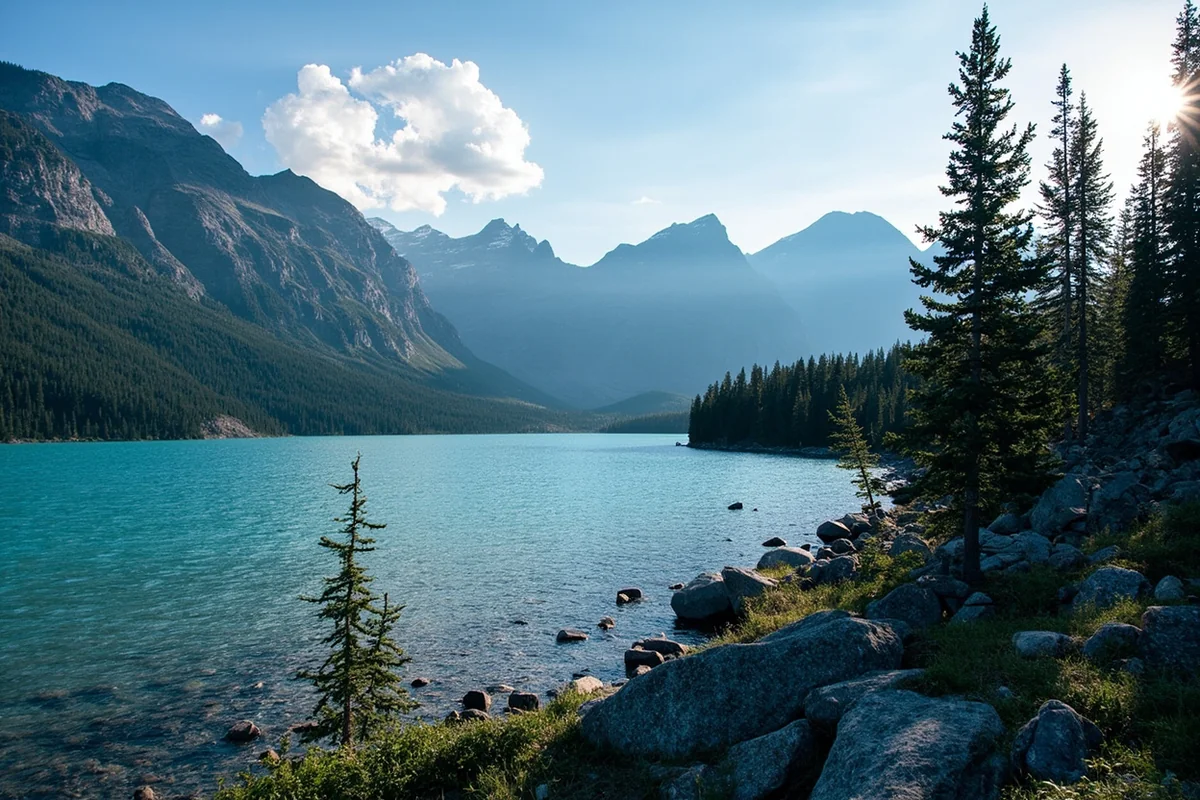
Glacier National Park
Glacier sits in the far northwest corner, pressed against the Canadian border. During my visits—spanning three different summers now—I’ve learned that the park functions almost as three separate destinations.
The west side, accessed from West Glacier, offers the most services and the famous Lake McDonald Lodge. This is where most visitors enter, and Going-to-the-Sun Road begins its eastward climb here.
The east side, accessed from St. Mary or Many Glacier, feels more remote and, in my opinion, offers better hiking. Many Glacier in particular has become my favorite Glacier basecamp. The Swiftcurrent Motor Inn isn’t fancy, but waking up to that valley view never gets old.
Going-to-the-Sun Road connects these two sides, but here’s what maps don’t always convey: this 50-mile road takes 2-3 hours to drive with stops, and vehicle size restrictions mean RVs over 21 feet can’t make the crossing at all.
I made the mistake my first year of booking lodging in West Glacier while planning to hike primarily on the east side. That’s a full day of driving for every hiking day—a waste of precious vacation time.
Flathead Lake and the Mission Valley
South of Glacier, Flathead Lake spreads across the valley floor like an inland sea. At 28 miles long, it’s the largest natural freshwater lake west of the Mississippi.
I spent a lazy July afternoon on a rented kayak near Bigfork, on the lake’s northeast shore. The water clarity stunned me—I could see the rocky bottom 15 feet down. Bigfork itself charmed me with its small-town arts scene and excellent restaurants. I still think about the huckleberry pie at a bakery there.
The Mission Mountains rise dramatically east of the lake, forming a stunning wall of peaks. Highway 93 runs along the lake’s west side, offering pullout after pullout where I’ve stopped to photograph those mountains reflected in calm water.
Whitefish and Kalispell
These neighboring towns serve as the primary gateway communities for Glacier. Whitefish has cultivated a ski-town vibe—upscale restaurants, breweries, boutiques—while Kalispell maintains a more working-class character with better hotel deals.
When I stay in this area now, I usually book in Kalispell and drive to Whitefish for dinners out. That 15-minute drive saves meaningful money, especially during peak summer season when Whitefish accommodations command premium prices.
The Whitefish Mountain Resort operates summer activities too—a scenic lift ride, mountain biking, and a zipline course I finally worked up the courage to try on my last visit.
Southwest Montana: Yellowstone Country and Beyond
The southwest quadrant draws visitors primarily for Yellowstone’s northern entrances, but I’ve discovered it holds some of Montana’s most compelling attractions beyond the park itself.
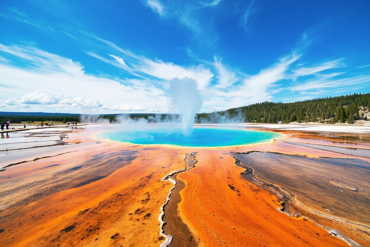
Yellowstone National Park (Montana Sections)
Three of Yellowstone’s five entrances lie in Montana: the North Entrance at Gardiner, the Northeast Entrance near Cooke City, and the West Entrance at West Yellowstone. Understanding which entrance serves your priorities saves hours of in-park driving.
The North Entrance provides the most reliable year-round access since the road from Gardiner to Mammoth Hot Springs stays open through winter. Mammoth’s travertine terraces and resident elk herd are highlights here.
The Northeast Entrance leads through the spectacular Lamar Valley—often called America’s Serengeti for its wolf packs, bison herds, and grizzlies. During a September visit, I watched a wolf pack take down an elk at dawn. That image stays with me.
West Yellowstone offers the quickest access to the park’s famous thermal features: Old Faithful, Grand Prismatic, and the Norris Geyser Basin. Most first-time visitors with limited time should consider this entrance.
The Paradise Valley and Livingston
The Yellowstone River flows north from the park through Paradise Valley, creating one of Montana’s most scenic drives along Highway 89. I’ve driven this corridor in every season now, and autumn might be the winner—cottonwoods turning gold against brown hillsides, elk bugling in the distance.
Livingston sits at the valley’s northern end, a former railroad town reinvented as an arts community. The historic downtown surprised me with its galleries, bookshops, and genuinely good restaurants. The Murray Hotel, where the likes of Calamity Jane once stayed, remains open for guests who appreciate creaky floors and historic character.
Bozeman
Bozeman has exploded in popularity, and on a recent trip, I understood why—and also why longtime residents seem ambivalent about the growth.
The Museum of the Rockies houses one of the world’s premier dinosaur collections, including specimens excavated from Montana’s famous bone beds. I spent four hours there, far longer than planned. The museum also serves as a Smithsonian affiliate, lending weight to its already impressive displays.
Downtown Bozeman’s Main Street buzzes with energy—outdoor gear shops, farm-to-table restaurants, coffee roasters. But parking has become a genuine headache, and prices have climbed to match the influx of remote workers and celebrities buying nearby ranches.
Montana State University adds youthful energy and a reliable calendar of cultural events. The city makes an excellent base for exploring both Yellowstone (90 minutes south) and the ski resorts of Big Sky.
Big Sky
Big Sky Resort is primarily known for winter skiing on one of North America’s largest ski terrains. But summer brings its own appeal: hiking, mountain biking, and a relatively cooler escape when lower elevations bake.
I’ve attended a summer concert at Big Sky Town Center, an outdoor venue with a mountain backdrop that elevates any performance. The resort’s year-round village now includes restaurants and shops worth exploring even if you’re not skiing or hiking.
Central Montana: The Overlooked Heart
If I could change one thing about how visitors map Montana attractions, it would be this: stop skipping the middle. Central Montana holds authentic Western experiences that the more touristed regions can’t match.
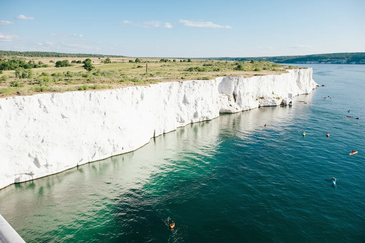
The Missouri River Breaks
This wild stretch of the Missouri River between Fort Benton and the Charles M. Russell National Wildlife Refuge remains largely unchanged since Lewis and Clark paddled through in 1805. The white cliffs they described still rise dramatically from the river, and modern paddlers can still make multi-day trips through designated wilderness.
I did a three-day canoe trip here with an outfitter based in Fort Benton, and it ranks among my top Montana experiences. No roads, no cell signal, just sandstone formations, eagle nests, and the same river current that carried the Corps of Discovery.
Fort Benton itself claims to be the “Birthplace of Montana” for its role as the head of Missouri River navigation during the fur trade and gold rush eras. The town’s Grand Union Hotel, beautifully restored, offers a taste of 19th-century river town elegance.
The Charlie Russell Trail
Artist Charles M. Russell made central Montana famous through his paintings of cowboy and Native American life. Great Falls, the region’s largest city, houses the C.M. Russell Museum—a collection that finally helped me understand why Russell’s work captures Montana’s spirit so completely.
Great Falls also features the Giant Springs State Park, where one of the largest freshwater springs in the country produces startlingly clear water at a constant 54°F. Lewis and Clark camped here, describing the springs in their journals.
The city’s downtown has improved dramatically in recent years. On my last visit, I found excellent craft beer, a riverside trail system, and a local energy that surprised me given Great Falls’ reputation as a pass-through destination.
Helena
Montana’s capital city gets overlooked, which strikes me as a mistake. The Last Chance Gulch walking mall downtown preserves buildings from Helena’s gold rush wealth, and the Montana State Capitol offers free tours through a stunning interior.
The Cathedral of St. Helena, modeled after a German cathedral, contains stained glass windows shipped from Bavaria. I wandered in on a quiet Tuesday afternoon and had the space nearly to myself—a different kind of Montana attraction, but moving nonetheless.
Mount Helena City Park, accessible directly from downtown, provides a quick hiking option when you want to stretch your legs without a major excursion.
Eastern Montana: Big Sky Solitude
East of the mountains, Montana opens into the high plains that most Americans associate with the Dakotas or Wyoming. Fewer visitors venture here, which means those who do find uncrowded roads, friendly locals eager to chat, and a pace that recalls earlier decades.
For navigating this region, having a detailed Montana road map proves essential—cell coverage fades quickly between towns, and GPS can struggle with unmarked ranch roads.
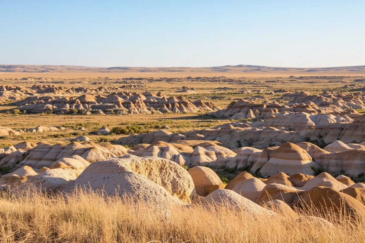
Makoshika State Park
Montana’s largest state park sits just outside Glendive, near the North Dakota border. The name comes from a Lakota word meaning “bad land” or “bad spirits,” and the eroded badlands landscape earns that description—in the best possible way.
I hiked the Cap Rock Trail during a late spring visit, when wildflowers softened the harsh terrain. Dinosaur fossils have emerged from these formations, including T. rex and triceratops specimens. The visitor center displays some of these finds and explains the geology.
The park rarely feels crowded. During my entire afternoon there, I crossed paths with maybe a dozen other hikers. That solitude, combined with the otherworldly terrain, made Makoshika one of my most memorable Montana stops.
Miles City and Western Heritage
Miles City maintains genuine cowboy culture in ways that feel increasingly rare. The Range Riders Museum documents eastern Montana’s ranching history through artifacts, photographs, and reconstructed buildings.
The annual Miles City Bucking Horse Sale, held each May, draws cowboys and horse buyers from across the country. I haven’t made it to the sale itself yet, but locals describe it as the real deal—working cowboys, serious competition, and legendary parties.
Little Bighorn Battlefield
Southeast of Billings, the site of Custer’s Last Stand occupies a windswept hillside that looks much as it did in June 1876. The National Park Service interpretive programs here have improved dramatically, now telling the battle’s story from both U.S. Army and Native American perspectives.
I visited on a hot July afternoon—temperatures matching the original battle conditions—and found the experience more somber and complex than I’d anticipated. The white marble headstones marking where soldiers fell dot the grassland, and newer red granite markers honor the Lakota, Cheyenne, and Arapaho warriors.
The on-site museum provides essential context. I’d recommend starting there before walking the battlefield itself.
Montana’s Scenic Byways: Connecting the Attractions
Several designated scenic routes connect Montana’s attractions while serving as destinations themselves. Mapping your trip along these corridors ensures the driving itself becomes part of the experience.
Beartooth Highway
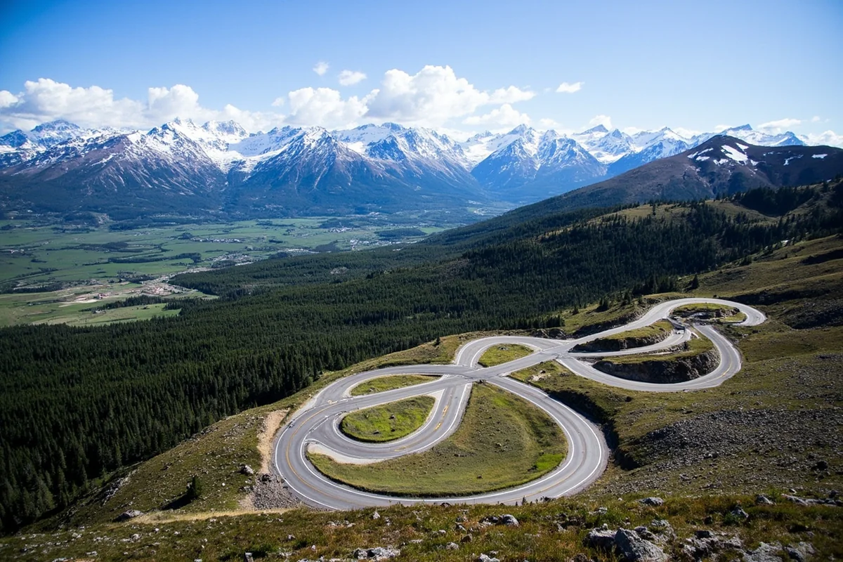
Charles Kuralt called this “the most beautiful drive in America,” and while I’ve heard that claim made about many roads, the Beartooth deserves the hyperbole. The road climbs from Red Lodge to nearly 11,000 feet before dropping into Yellowstone’s Northeast Entrance.
I drove it in mid-July during a recent summer, and snow still banked the highest sections. The alpine tundra at the top feels more like Arctic terrain than anything you’d expect in the lower 48. Plan at least three hours for the 68-mile drive, more if you’re stopping for photos (you will).
The highway typically opens late May and closes in mid-October, though early or late season snow can affect these dates. Check conditions before attempting the crossing.
Going-to-the-Sun Road
Glacier’s famous road spans 50 miles between West Glacier and St. Mary, climbing over 6,000-foot Logan Pass en route. The engineering marvel of carving this route into the mountainside in the 1930s still impresses.
Vehicle reservations are now required during peak hours in summer—a change implemented in 2022 that actually improves the experience by reducing congestion. Book through the Recreation.gov website starting in late spring.
I’ve driven the road from both directions now. Eastbound offers more dramatic reveals as the mountains build before you; westbound puts you closer to the cliff edge on some stretches, which either thrills or terrifies depending on your disposition.
Highway 200: The Forgotten Middle
This two-lane runs across central Montana’s agricultural heartland, connecting Great Falls to points east. Few tourists use it, which is precisely why I’ve come to appreciate the route.
Small towns like Lewistown and Jordan retain authentic character that more visited communities have polished away. I stopped for lunch at a café in Jordan where the conversation turned naturally to the weather, the cattle market, and whether the fishing had been any good lately. No one asked where I was from or suggested I try the “local specialties.”
Practical Planning: Mapping Your Montana Trip
| Region | Primary Attractions | Best Base Town | Minimum Days Needed |
|---|---|---|---|
| Northwest | Glacier NP, Flathead Lake, Mission Mountains | Whitefish or Kalispell | 4-5 days |
| Southwest | Yellowstone NP, Paradise Valley, Bozeman | Bozeman or Livingston | 4-5 days |
| Central | Missouri Breaks, Great Falls, Helena | Great Falls or Helena | 2-3 days |
| Eastern | Makoshika SP, Little Bighorn, Badlands | Billings or Miles City | 2-3 days |
Driving Distances Between Major Attractions
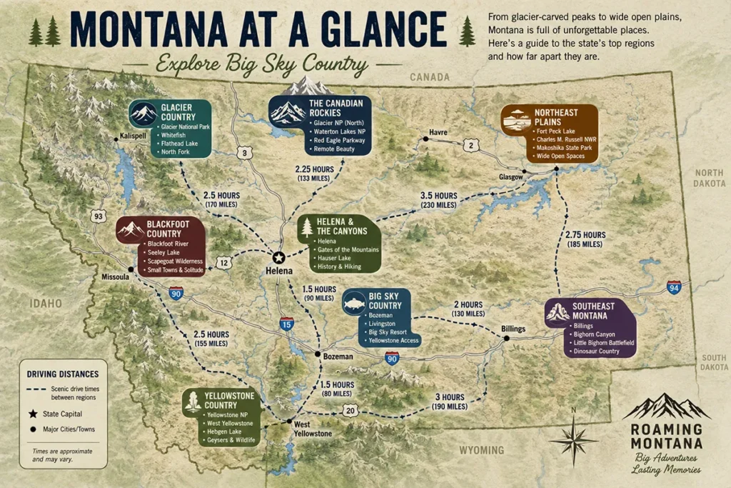
These drive times, based on my actual experiences, assume decent weather and minimal stops:
- Glacier NP to Yellowstone (West Entrance): 5.5-6 hours via I-90 and Highway 287
- Glacier NP to Yellowstone (North Entrance): 6-6.5 hours via I-90 and Highway 89
- Bozeman to Great Falls: 2.5-3 hours via I-90 and I-15
- Billings to Glacier NP (West Glacier): 5.5 hours via I-90 and Highway 93
- Missoula to Makoshika SP: 6+ hours across the state on Highway 200 or I-90
Seasonal Considerations
Montana’s attractions shift dramatically by season. I’ve learned this through both delightful discoveries and frustrating closures.
Summer (June-August) offers access to everything, but crowds at Glacier and Yellowstone can overwhelm infrastructure. Book accommodations 6+ months ahead for July visits.
September brings my favorite conditions: thinner crowds, fall colors beginning, cooler temps. Going-to-the-Sun Road typically stays open through mid-October.
Winter closes high-elevation roads but opens cross-country skiing, snowmobiling in West Yellowstone, and downhill skiing at a dozen resorts. Some attractions, like the northern Yellowstone loop, remain accessible year-round.
Spring (April-May) is transition season. Snow melts, roads gradually open, but conditions vary wildly by elevation. Call ahead before assuming attractions are accessible.
Essential Map Resources
My navigation toolkit for Montana trips now includes:
- Paper state map: The free one from Montana visitor centers works fine; the Benchmark Montana Road and Recreation Atlas offers more detail for backcountry exploration
- Downloaded offline maps: Google Maps and Gaia GPS both allow area downloads for when cell service disappears
- National Park Service apps: Both Glacier and Yellowstone have apps with offline trail maps and current conditions
I keep the paper map on my passenger seat for the big picture and use the phone apps for turn-by-turn when needed. This redundancy has saved me multiple times.
Hidden Attractions Worth Adding to Your Map
Beyond the headline destinations, Montana holds smaller attractions I’ve stumbled upon that rarely appear on mainstream itineraries.
Bannack State Park
This ghost town near Dillon preserves over 60 structures from Montana’s gold rush era. Unlike “living history” tourist sites, Bannack is simply left alone—buildings slowly weathering, streets empty, the only sounds coming from wind and magpies.
I visited on a weekday afternoon in late September and had the entire town to myself for nearly an hour. Walking through the abandoned Meade Hotel felt genuinely eerie, and the ore-processing buildings explained gold rush economics better than any museum exhibit could.
Pictograph Cave State Park
Just outside Billings, this modest park protects rock art created over 2,000 years ago. The paintings are faded now, requiring careful attention to spot, but the interpretive signs help visitors find the images.
I combined a visit here with a Billings afternoon and found it worth the short detour. The caves themselves are impressive sandstone formations even setting the art aside.
Natural Bridge Falls
South of Big Timber, this 100-foot waterfall cascades through a limestone canyon. The short hike from the parking area takes maybe 20 minutes, making it an easy add during drives through the Paradise Valley or along I-90.
When I stopped here last summer, the afternoon light caught the mist perfectly. A picnic area provides a lunch spot with views.
Building Your Personal Montana Attraction Map
After multiple Montana trips, I’ve developed a system for planning that might help you build your own customized attraction map.
First, I identify my anchor destinations—usually the one or two places I absolutely won’t skip. For most visitors, this means Glacier, Yellowstone, or both.
Then I look at the geography and ask: what interesting stops fall along the logical driving routes between those anchors? This approach led me to discoveries like the Missouri Breaks and the Beartooth Highway.
Finally, I build in flexibility. Montana rewards spontaneous detours—the random historic site, the local café recommendation, the wildlife sighting that demands an extra hour of observation. Cramming too many “must-sees” into a day means missing what makes Montana special.
The best Montana trips I’ve taken balanced ambition with openness. I saw the famous attractions and left time to discover my own.
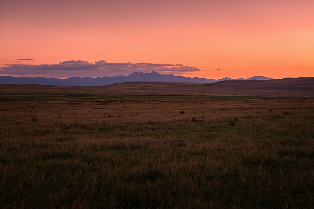
Montana’s map of attractions ultimately reveals a state of remarkable variety—mountain wilderness, prairie solitude, geothermal wonders, and historic sites that illuminate the American West’s complex story. Understanding how these attractions relate spatially, and planning your routes accordingly, transforms a list of destinations into a coherent journey through one of America’s most compelling landscapes.
That moment at the Going-to-the-Sun Road pullout, fumbling with maps, taught me to do the geographic homework before arrival. Now when I return to Montana—and I keep returning—I spend my time experiencing the attractions instead of figuring out where they are.
Frequently Asked Questions
What are the must-see attractions to include on a Montana road trip map?
I always recommend mapping out Glacier National Park, Yellowstone’s Montana entrance, the Beartooth Highway, and Flathead Lake as your anchor destinations. Don’t overlook smaller gems like Virginia City ghost town and the Missouri River headwaters—they’re often less than 50 miles off major routes and worth the detour.
How far apart are Montana’s major attractions from each other?
Montana is massive, so distances add up quickly—Glacier National Park to Yellowstone is roughly 340 miles and takes about 6 hours without stops. I suggest planning no more than 150-200 miles of driving per day to actually enjoy the attractions rather than just passing through them.
What is the best time of year to visit Montana attractions?
Late June through early September offers the best access to mountain attractions, as Going-to-the-Sun Road in Glacier typically doesn’t fully open until late June due to snow. I personally prefer September for fewer crowds and fall colors, though some high-elevation roads may close by mid-October.
How much does it cost to visit the top attractions in Montana?
Glacier and Yellowstone each cost $35 per vehicle for a 7-day pass, or you can grab an $80 America the Beautiful pass covering both plus other federal sites. State parks run $6-8 per vehicle, and I budget around $150-200 daily for mid-range lodging, gas, and meals during peak summer season.
What should I pack when visiting Montana attractions in summer?
I never travel Montana without layers—temperatures can swing 40 degrees between morning and afternoon, even in July. Pack bear spray ($40-50 at local outfitters) for any hiking, sturdy footwear, sunscreen, and a detailed paper map since cell service is unreliable throughout most of the state.
Can I use Google Maps offline for navigating Montana attractions?
Yes, and I strongly recommend downloading offline maps before you go since cellular coverage drops completely in areas like Glacier’s interior and rural eastern Montana. Download the entire regions you’ll be visiting while on WiFi, and carry a physical Montana road atlas as backup for remote areas.
How many days do I need to see Montana’s top attractions?
For a comprehensive Montana attractions trip covering Glacier, Yellowstone’s north entrance, and a few historic towns, I recommend at least 10-14 days. If you’re short on time, focus on one region—either Glacier and Flathead Valley (4-5 days) or the Yellowstone and Bozeman area (4-5 days) rather than rushing between both.
Sources