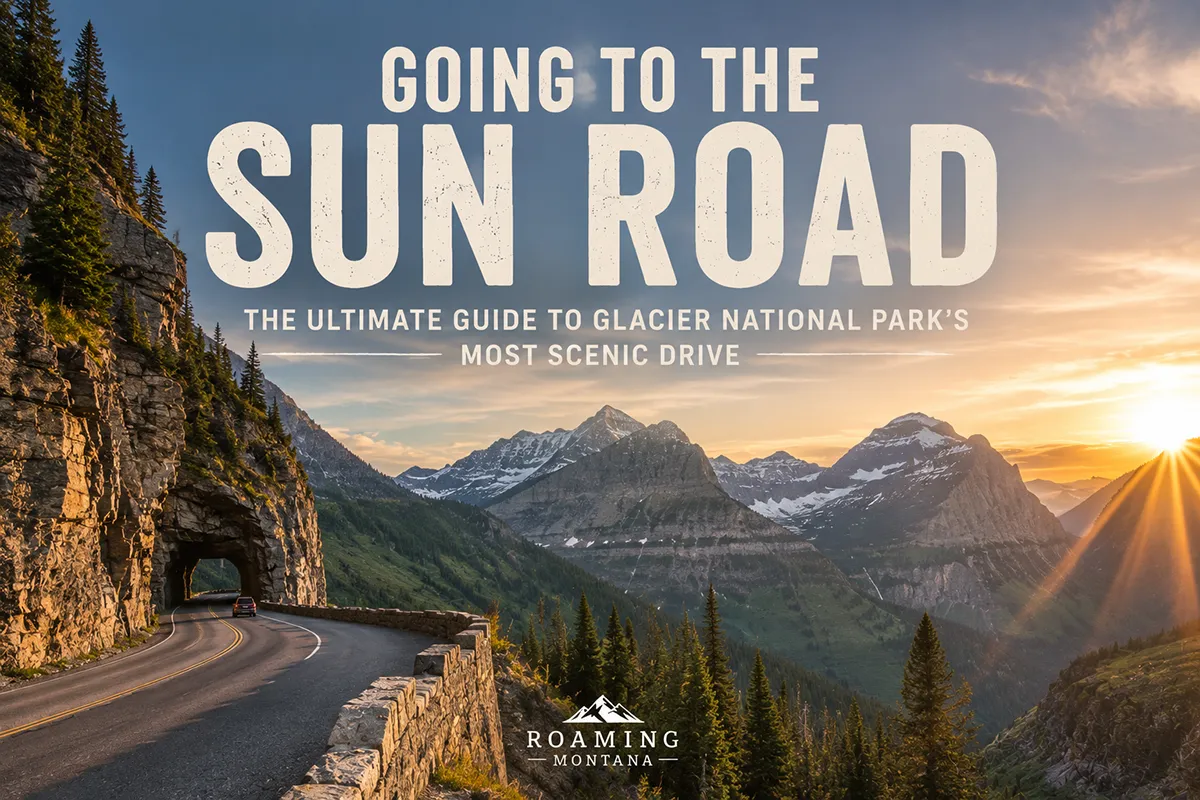
I once sat in a turnout halfway up the west side of Going-to-the-Sun Road on a late-June morning, watching a pair of mountain goats picking their way across a rock face above me, and thought to myself: most of the people I went to college with have never seen anything like this in their entire lives.
- Going-to-the-Sun Road is a 50-mile scenic drive that bisects Glacier National Park, crossing the Continental Divide at Logan Pass (6,646 feet).
- For 2026, vehicle reservations are NOT required, but Logan Pass parking is limited to 3 hours starting July 1, and the shuttle is now reservation-only express service.
- The road typically opens in full between mid-June and early July — though plowing 80 feet of snow off Logan Pass makes the exact date unpredictable every year.
- Best month for first-timers: early-to-mid July. Best month for solitude: September.
- Plan a full day for a one-way drive with stops. Two days lets you actually hike the trailheads.
- This guide covers the 12 essential viewpoints in driving order, every major trailhead, the 2026 shuttle and parking rules, and the historical opening date tracker.
Going-to-the-Sun Road at a Glance
| Length | ~50 miles (West Glacier to St. Mary) |
|---|---|
| Highest Point | Logan Pass, 6,646 ft (Continental Divide) |
| Typical Opening (Logan Pass) | Mid-June to early July |
| Typical Closing | Mid-October to early November |
| 2026 Vehicle Reservations | Not required |
| 2026 Logan Pass Parking | 3-hour limit beginning July 1 |
| 2026 Shuttle | Reservation-only express, begins July 1 |
| Vehicle Size Limit (mid-section) | 21 ft long, 8 ft wide |
| Park Entrance Fee | $35/vehicle, 7 days (verify current rate) |
| Drive Time (no stops) | ~2 hours one-way |
| Drive Time (with stops) | 4–8 hours one-way |
The Strangest Thing About America’s Most Beautiful Road
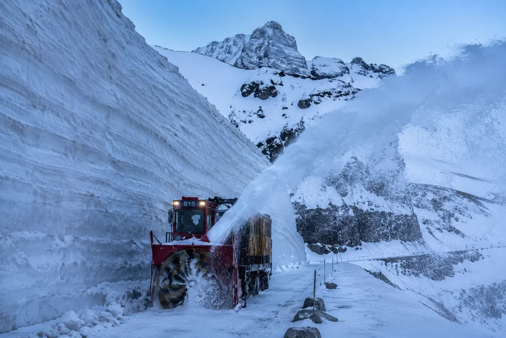
If you’ve never driven Going-to-the-Sun Road, here’s the thing nobody really tells you: this is not a year-round road. It’s not even a seasonal road in the normal sense. It’s a road that gets buried under tens of feet of snow every winter, and a small crew of people spends two and a half months every spring physically chipping it back into existence.
That’s why your dream Montana trip in June can absolutely fall apart if you didn’t do your homework. I’ve watched it happen — couples who flew in from Florida or Chicago, drove to West Glacier in early June expecting to cruise over the Continental Divide, and instead got turned around at the Avalanche Creek closure and spent the next three days wondering what to do.
I’ve been driving this road since I was a kid in the back of my parents’ station wagon, and I’ve done it dozens of times across every month it’s been open. This post is the resource I wish someone had handed me before I started planning Glacier trips for friends and family.
A Quick History: How This Road Even Exists
Going-to-the-Sun Road was built between 1921 and 1932, with formal dedication on July 15, 1933. The original idea was to make Glacier accessible to a new generation of automobile-borne tourists in a way that preserved the landscape rather than carving it up.
The chief landscape architect, Thomas Vint, fought for an alignment along what we now call the Garden Wall — fewer switchbacks, less visual scarring, more cost. He won that argument, and that’s why the upper section of the road is so distinctive.
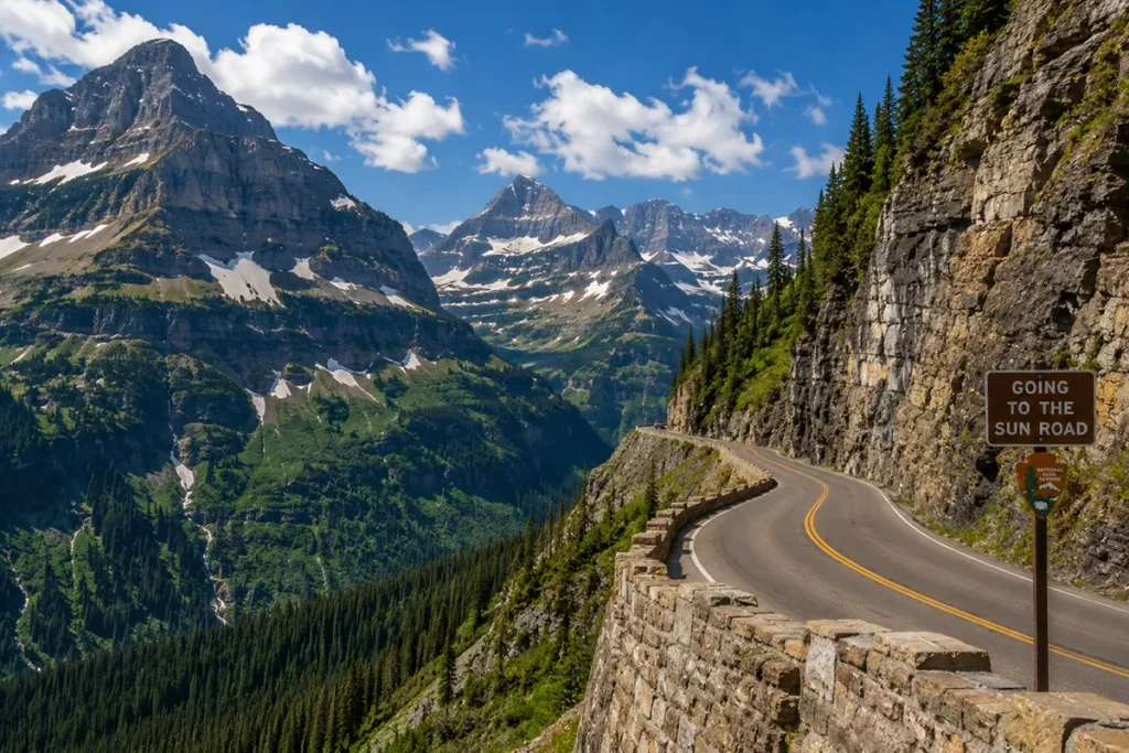
The road crosses the Continental Divide at Logan Pass, sitting at 6,646 feet, which is the highest point on the route. The whole thing is about 50 miles end to end, from West Glacier on the western boundary to St. Mary on the east. It’s a National Historic Landmark, a Historic Civil Engineering Landmark, and one of the most-photographed roads in North America.
What gets people every time is that the engineering is almost a century old, but it still feels like a road that shouldn’t quite exist. Driving the upper west side, with a sheer drop on one side and a wall of rock on the other, is one of those experiences that pulls passengers’ phones out of their hands.
What’s Different in 2026
Glacier has been a moving target on access rules for the past several summers. Here’s what’s actually changed for this year.
Vehicle Reservations Have Been Eliminated
For 2026, vehicle reservations are not required anywhere in Glacier National Park, including Going-to-the-Sun Road, Many Glacier, Two Medicine, and the North Fork. If you remember the 6 a.m. scramble for timed-entry tickets on Recreation.gov, that system is gone for 2026.
You’ll still pay the standard park entrance fee, but you don’t need to book a separate timed entry to drive the road. This is a big change — and I expect it’ll bring crowds back to pre-2021 levels.
The New Logan Pass 3-Hour Parking Rule
In place of vehicle reservations, the park is testing a different approach to managing crowds at Logan Pass. Beginning July 1, 2026, weather permitting, parking at Logan Pass is limited to three hours.
Three hours is plenty for most visitors — you can hike to Hidden Lake Overlook, browse the visitor center, and take in the views. But this rule penalizes anyone planning longer alpine hikes (Highline Trail, full Hidden Lake, Reynolds Mountain). For those, plan to take the shuttle or arrange a drop-off.
Shuttle System: Now Reservation-Only Express Service (Starting July 1)
This is the biggest operational change for 2026. The park shuttle is now a reservation-only express service rather than the old hop-on, hop-off model.
- West-side routes depart from Apgar Transit Center and Lake McDonald Lodge, with afternoon stops at The Loop
- East-side routes depart from St. Mary Visitor Center and Rising Sun
- Riders can transfer between routes at Logan Pass
- The shuttle starts July 1, 2026
- Avalanche Lake and Trail of the Cedars are NOT accessible by park shuttle in 2026 — plan accordingly
Reservations should be booked in advance through the park system before your visit. Walk-up availability is not guaranteed.
Vehicle Size Restrictions (Unchanged)
This rule has been the same forever, but I’ll mention it because RV travelers always ask. Vehicles over 21 feet long or 8 feet wide are not allowed on the middle section of the road, between Avalanche Creek and Sun Point (some sources cite Rising Sun as the eastern boundary — confirm current NPS guidance).
If you have a larger RV, you can still drive both ends of the road and use the shuttle in the middle. I’ve seen people in 24-foot rigs try to bluff their way through and end up turning around mid-switchback. Don’t be that person.
When the Road Opens: The Full Historical Tracker
This is the section I get the most emails about. People want to know: when will the road be open this year? The honest answer is that nobody knows for sure until late spring, but you can get a very good sense of the likely window by looking at the historical pattern.
The data below is sourced directly from the National Park Service’s official Logan Pass opening and closing records.
Recent Opening Dates (Last 16 Years)
| Year | Logan Pass Opened | Closed | Notes |
|---|---|---|---|
| 2010 | June 24 | Oct 18 | |
| 2011 | July 13 | Sept 17 | Exceptional snowpack year; continued winter weather through June U.S. National Park Service |
| 2012 | June 19 | Sept 16 | West-side rehabilitation work |
| 2013 | June 21 | Sept 23 | East side opened June 15; gov shutdown closed it Sept 23 |
| 2014 | July 2 | Sept 22 | |
| 2015 | June 19 | Oct 5 | West side opened June 10; full road June 19 |
| 2016 | June 16 | Oct 10 | |
| 2017 | June 28 | Sept 3 | Closure on west side due to Sprague Fire U.S. National Park Service |
| 2018 | June 22 | Sept 29 | |
| 2019 | June 22 | Sept 25 | |
| 2020 | July 13 | Oct 9 | Late opening due to COVID-19 U.S. National Park Service |
| 2021 | June 25 | Oct 13 | |
| 2022 | July 13 | Oct 16 | Exceptional avalanche year U.S. National Park Service |
| 2023 | July 2 | — | |
| 2024 | June 22 | — | |
| 2025 | June 13 | — | |
| 2026 | July 1 | — | nps.gov |
Earliest and Latest Openings on Record
- Earliest opening since records began: May 16, 1987
- Latest opening: July 13 (tied in 2011, 2020, and 2022)
- First-ever opening: July 15, 1933 (the road’s official dedication)
- Most common opening window: Mid-June to early July
Why Plowing Takes 10 Weeks
Up to 80 feet of snow can accumulate on top of Logan Pass, with even deeper drifts just east of the pass — the deepest of those is called the Big Drift. Imagine a snowdrift the height of a six-story building, sitting across a road that is a single lane wide in places.
It takes about ten weeks to plow the road each spring, even with industrial equipment that can move 4,000 tons of snow per hour. On bad days, crews clear as little as 500 feet of road in a single day. They’re not just removing snow — they’re working in active avalanche terrain, dealing with rockfall, repairing damage from the previous winter, and clearing nearly 40 avalanche paths in the process.
This is why the annual opening date varies so wildly year to year.
How to Predict When the Road Will Open
- Check April snowpack reports. The NRCS publishes basin snowpack data for the Flathead drainage. If snowpack is at or below 100% of average by April 1, expect a normal opening (mid-to-late June). Above 130%, plan for early July.
- Watch NPS plow progress reports starting in May. The park posts updates on which mile markers have been cleared. By early June, you can usually estimate opening within a 7–10 day window.
- Don’t book non-refundable lodging in early-to-mid June. Even in average years, full-road access before June 15 is a coin flip.
If you’re flying in with fixed dates, plan for the road to be closed when you arrive, and treat a full opening as a happy surprise.
How to Drive It: West-to-East vs East-to-West
Most visitors enter from West Glacier and drive east — it’s the natural choice if you’re flying into Kalispell or coming from Whitefish. But direction matters for two reasons.
Drive West-to-East If…
- You’re staying on the west side (Apgar, Lake McDonald, Whitefish)
- You want the dramatic build-up of climbing from forested valley to alpine pass
- You’re comfortable with the outside lane on the upper switchbacks (some sheer drops)
Drive East-to-West If…
- You’re staying on the east side (St. Mary, Many Glacier, East Glacier)
- You’re afraid of heights — the east-to-west direction keeps you on the inside lane against the rock wall for most of the upper section
- You want better afternoon light for photography on the way down
My recommendation for first-timers: drive west-to-east in the morning, hit Logan Pass, continue down to St. Mary for lunch, then return west-to-east in the afternoon. You’ll see the same road twice from two completely different perspectives.
The 12 Essential Viewpoints in Driving Order (West to East)
This is the section I always wanted but never found anywhere. Here are the pullouts and overlooks that genuinely matter, in the order you’ll hit them driving west-to-east. Mile markers are approximate from the West Glacier entrance.
1. Lake McDonald Lodge (Mile 10)
The road’s largest historic lodge sits on the south shore of Lake McDonald, Glacier’s biggest lake. Even if you don’t stay here, walk through the lobby — the architecture is classic 1913 Swiss-chalet style. Lake McDonald itself is worth a stop for the famously colorful pebbles visible through the clear water.
2. McDonald Creek and Sacred Dancing Cascade (Mile 11–12)
Pullouts along this stretch let you walk down to McDonald Creek where it tumbles through smoothed boulders. The Sacred Dancing Cascade is a short interpretive walk; quietest in early morning.
3. Trail of the Cedars / Avalanche Creek (Mile 16)
A flat, accessible boardwalk through old-growth western red cedars — the easternmost grove of this Pacific Northwest forest type in the country. Trail of the Cedars connects to the Avalanche Lake trail (4.5 miles round-trip), one of the most rewarding short hikes in the park. Note: not accessible by park shuttle in 2026 — drive yourself.
4. The Loop (Mile 22)
The road’s only true switchback, with parking and a small trailhead. This is the endpoint for hikers coming down from the Highline Trail at Granite Park Chalet. Looking up from The Loop, you can see the road climbing along the Garden Wall above you.
5. Bird Woman Falls Overlook (Mile 25)
A pullout with a direct view across the valley to Bird Woman Falls — a 492-foot ribbon waterfall pouring out of a hanging valley. Best in early summer when snowmelt is heaviest.
6. The Weeping Wall (Mile 26)
A genuine novelty: water seeps directly out of the rock wall onto the road, drenching cars that drive past in early summer. By August it’s reduced to a trickle. Roll up your windows.
7. Haystack Creek Pullout (Mile 27)
Look back the way you came for one of the iconic Going-to-the-Sun Road photographs — the road snaking along the cliff with peaks beyond.
8. Big Bend (Mile 29)
A long, sweeping pullout offering wide views of Mount Cannon and the McDonald Valley below. Less crowded than Logan Pass and a top sunrise photography location.
9. Logan Pass (Mile 32) — The Summit
The road’s high point at 6,646 feet. Visitor center, restrooms, the trailheads for Hidden Lake Overlook and the Highline Trail, and almost guaranteed mountain goat sightings. Parking limited to 3 hours in 2026 starting July 1.
10. East Side Tunnel (Mile 33)
A short tunnel carved through rock just east of Logan Pass. Two roadside arches built into the tunnel walls offer pull-off photography opportunities looking back toward the pass.
11. Jackson Glacier Overlook (Mile 36)
The single best roadside glacier view in the park. Jackson Glacier is visible across the valley — one of the few you can actually see from a car without hiking for it. Bring binoculars.
12. Sun Point and Sunrift Gorge (Mile 41)
Sun Point is a quick paved walk to a peninsula overlook on Saint Mary Lake. Sunrift Gorge is a narrow slot carved by Baring Creek — short walk, easily missed, worth the stop.
Bonus: Wild Goose Island Overlook (Mile 45)
One of the most-photographed views in any national park — a tiny tree-covered island in Saint Mary Lake with the Continental Divide as backdrop. Best at sunrise.
Trailheads Along the Road
Some of Glacier’s best hiking starts directly off Going-to-the-Sun Road. Here’s what’s where, in driving order west to east:
| Trailhead | Trail | Distance | Difficulty | Highlight |
|---|---|---|---|---|
| Apgar | Apgar Lookout | 7.2 mi RT | Moderate | Panoramic west-side views |
| Lake McDonald Lodge | Mt. Brown Lookout | 10.4 mi RT | Strenuous | Fire lookout, big views |
| Avalanche Creek | Avalanche Lake | 4.5 mi RT | Easy-moderate | Best easy alpine lake hike |
| The Loop | Granite Park Chalet (via Loop) | 7.8 mi RT | Strenuous | Backcountry chalet access |
| Logan Pass | Hidden Lake Overlook | 2.7 mi RT | Moderate | Wildflowers, mountain goats |
| Logan Pass | Hidden Lake (full) | 5.4 mi RT | Strenuous | Lake itself, fewer crowds |
| Logan Pass | Highline Trail to The Loop | 11.8 mi one-way | Strenuous | Glacier’s signature traverse |
| Siyeh Bend | Siyeh Pass | 10.3 mi point-to-point | Strenuous | High-alpine traverse |
| Jackson Glacier Overlook | Gunsight Pass Trail | varies | Strenuous | Backcountry access |
| Sun Point | Sun Point Nature Trail | 1.4 mi loop | Easy | Lakeside walk |
| St. Mary Falls | St. Mary & Virginia Falls | 3.6 mi RT | Easy-moderate | Two waterfalls in one hike |
The Highline Trail is the must-do if you have the legs and the weather. Start at Logan Pass, take the shuttle back from The Loop. Bring a windbreaker; the alpine traverse can be cold even in August.
For more on the broader park’s waterfalls, see my Montana waterfalls guide.
When You Should Actually Plan to Visit
Late June (June 15 – June 30): The Risky Bet
The road might be fully open by the time you arrive, or it might not. In the last 13 years, the road has opened in this window roughly half the time. Wildflowers are starting to pop, snowfields are still impressive, and the crowds aren’t fully there yet.
Best for: Photographers, repeat visitors, anyone who can pivot if the road’s still closed.
Avoid if: This is your only Glacier trip and you’ve flown in from far away.
Early-to-Mid July (July 1 – July 20): The Sweet Spot
If I had to pick one window for a first-time visitor, this is it. The road is almost always fully open. Snowfields at Logan Pass are still photogenic. Wildflowers in the alpine zone are at peak. Day length is maximum. Wildlife is active in the early mornings.
Best for: First-time visitors, families, anyone who wants the full Glacier experience.
Tradeoff: This is when crowds peak, and lodging gets booked 6–12 months in advance.
Late July to Mid-August: Peak Crowds, Reliable Weather
Best weather of the year, but you’ll share the road with everyone. Logan Pass parking will be full by 7 a.m. most days. The new 3-hour parking rule should help with turnover, but plan to start early regardless.
September: My Personal Favorite
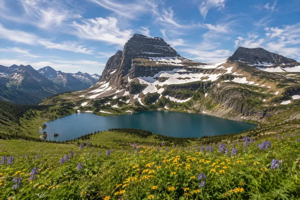
This is when I bring family and friends. Crowds drop dramatically after Labor Day, weather is excellent through mid-month, and the larches in the higher elevations turn yellow toward the end of the month. Wildlife activity picks back up — bears feed hard before winter, and elk start their rut.
Best for: Solo travelers, photographers, anyone who’s been before, couples.
Tradeoff: Some lodging closes after Labor Day. Most in-park lodging closes by mid-to-late September.
October: A Gamble Worth Taking
The road usually stays open into mid-October but can close for snow at any point. The light in October is unbelievable — low angles, golden grasses, snow on the high peaks. I’ve had some of my best Glacier days in early October.
Best for: Locals, photographers, the genuinely flexible.
Avoid if: You’re flying in for a fixed window and need a guaranteed full-road experience.
For more on broader Montana seasonal timing, see my guide to the best time to visit Montana.
Suggested Itineraries
Half-Day (4–5 hours): Logan Pass Highlight Reel
Best for: travelers with one day in Glacier who also want to do something else.
- 6:30 a.m. — Depart West Glacier or St. Mary
- 7:30 a.m. — Arrive Logan Pass before the parking fills
- 8:00 a.m. — Hike Hidden Lake Overlook (2.7 mi RT)
- 10:30 a.m. — Drive back, stopping at 2–3 viewpoints
- 12:00 p.m. — Lunch at Lake McDonald Lodge or St. Mary
Full Day (8–10 hours): The Whole Road
Best for: most visitors doing Glacier seriously.
- 6:00 a.m. — Depart west side
- 7:00 a.m. — Arrive Logan Pass
- 8:00 a.m.–12:00 p.m. — Hike Highline Trail toward Granite Park Chalet (turn around at your fitness limit)
- 12:30 p.m. — Lunch at Logan Pass or pack a picnic
- 1:00 p.m. — Continue east to St. Mary, stopping at Jackson Glacier Overlook, Sun Point, Wild Goose Island
- 4:00 p.m. — Late lunch in St. Mary
- 5:00 p.m. — Drive back west or continue to Many Glacier for the evening
Two Days: The Full Experience
Best for: anyone who wants to actually do the major hikes.
Day 1: West-to-east traverse with viewpoints + Avalanche Lake hike (4.5 mi RT). Stay overnight east side (St. Mary or Many Glacier).
Day 2: Early start to Logan Pass from the east. Take the shuttle to do Highline Trail one-way (Logan Pass to The Loop, 11.8 mi). Pick up your car at The Loop with the return shuttle.
For a complete Glacier itinerary in context with the rest of the state, see my 27 best things to do in Montana guide.
Red Bus Tours, Sun Tours, or DIY: Which Should You Pick?
| Option | Duration | Price (per person, approx.) | Best For |
|---|---|---|---|
| Drive Yourself | Flexible | Park entrance fee only | Most visitors, families, photographers |
| Red Bus Tours (Glacier NP Lodges) | 4–8 hours | [verify current rate, typically $50–110] | Travelers who don’t want to drive narrow alpine roads |
| Sun Tours (Blackfeet-owned) | 4–8 hours | [verify current rate] | Travelers wanting Indigenous cultural perspective |
| Park Shuttle (reservation-only express, 2026) | One-way segments | Free (reservation required) | Hikers doing one-way trails like Highline |
| Private guided tour | Customizable | $400–800+ per group | Small groups wanting a guide |
Red Bus Tours are the iconic 1930s convertible-top vintage buses you’ll see on the road. They run from late June through mid-September and have been operating in some form since 1936 — they’re as much part of Glacier history as the road itself.
Sun Tours are operated by the Blackfeet Nation and provide a Native perspective on the landscape, history, and ecology. This is the option I recommend for anyone wanting context beyond the standard “scenic drive” experience.
DIY is fine for most people. The road isn’t technically difficult to drive — it’s just narrow with steep drops in places. If you’re a confident driver who’s comfortable with mountain roads, driving yourself is the most flexible option. If you’re terrified of heights or unfamiliar with mountain driving, take a Red Bus or Sun Tour and enjoy looking out the window.
Photography Tips for Going-to-the-Sun Road
A few specific spots and times that have produced my best shots:
Sunrise at Wild Goose Island Overlook. Position yourself on the east side of St. Mary Lake before the sun crests the Continental Divide. The shot of Wild Goose Island with the dawn light hitting the peaks behind is probably Glacier’s most-photographed scene for a reason.
Sunrise at Big Bend. Less famous than Wild Goose but easier to access from the west side. The morning light catches the upper Garden Wall directly.
Mid-morning at Bird Woman Falls Overlook. Sun is high enough to light the entire waterfall and the valley below.
Late afternoon at Jackson Glacier Overlook. Western light hits the glacier face directly, making the ice glow.
Sunset at Lake McDonald. Walk to the lakeshore at the lodge or at Apgar Village. Reflections in the lake on calm evenings are stunning.
Lens recommendations: A wide-angle (16–35mm equivalent) captures the road itself and big landscapes. A medium zoom (24–105mm) handles most viewpoint shots. A telephoto (200mm+) for wildlife and isolated mountain detail.
Tripod note: It’s legal to set up a tripod at pullouts but courteous to do it quickly and move on. Don’t claim a pullout for an hour while other photographers wait.
What to Do If the Road Isn’t Open Yet
If you arrive in late May or early June and the road is only partially open, do not panic. There is still a tremendous amount to do.
Drive what’s open. The road from West Glacier opens to Avalanche Creek as soon as snow melts off the lower section, usually by early-to-mid May. From the east side, St. Mary to Rising Sun typically opens in mid-April.
Bike or hike the closed sections. This is the underrated gem of pre-season Glacier. Before the road opens to vehicles, hikers and cyclists are allowed on the cleared portions all the way up toward Logan Pass. I’ve biked from Avalanche to The Loop in early June with literally no one else on the road. It’s one of the best Montana experiences you can have.
Explore Many Glacier and Two Medicine. These are separate east-side park entrances with their own incredible scenery. Many Glacier is, in my opinion, the most underrated section of the entire park.
Lake McDonald in shoulder season is magic. No crowds, perfect reflections, the famous colored rocks visible in clear water.
For more shoulder-season ideas, see my Montana spring vacations guide.
What I Wish I’d Known
A decade-plus of driving this road, distilled.
Start before sunrise during peak season. I know this sounds extreme. Do it anyway. I’ve been on the road at 5 a.m. in late July with stretches to myself, watched goats coming down to the road for minerals, and made it to Logan Pass before the first parking-lot shuffle.
The east side is more dramatic than the west side. Most people enter from West Glacier and turn around. If you can do the full road both directions, the east side from Logan Pass down to St. Mary is, in my opinion, the most jaw-dropping single stretch of road in the country.
Always carry layers. Logan Pass can be 40°F and windy in July when it’s 80°F in West Glacier. I’ve watched people in flip-flops trying to do the Hidden Lake hike and turning around in five minutes.
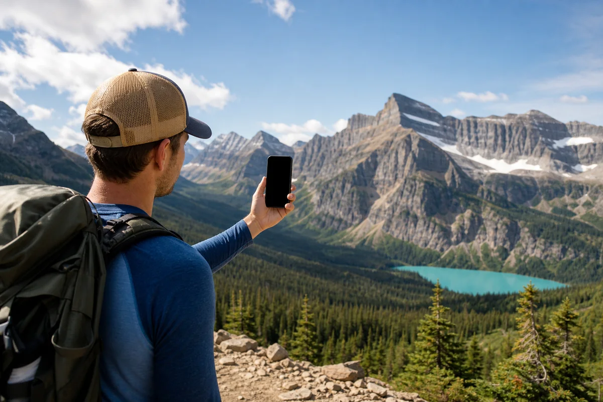
Don’t trust your phone for navigation. Cell service is spotty to nonexistent on most of the road. Download offline maps and bring a paper park map. My Montana travel map has the broader context if you’re combining this with other Montana stops.
Watch for rockfall. I’ve had small rocks come down across the road in front of me twice. Pay attention, especially after rain.
Refuel before entering the park. Once you’re past West Glacier or St. Mary, there are no gas stations on the road.
Bring more water than you think. It’s high alpine country and dehydration creeps up fast.
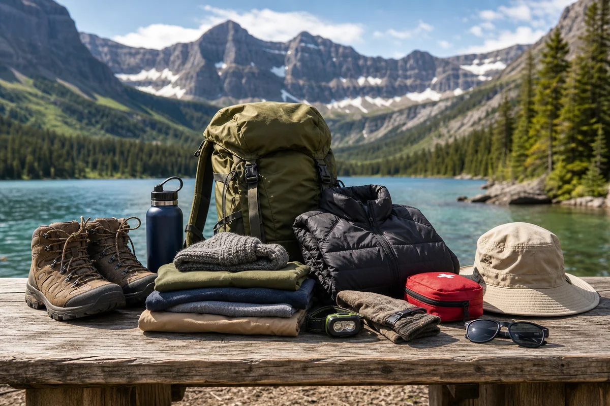
Pack the right gear for unpredictable weather. See my Montana trip packing list for the full breakdown.
Where to Stay for the Drive
Where you sleep determines whether you can pull off the predawn departures that make this road much more enjoyable.
| Base | Drive to Logan Pass | Vibe | Best For |
|---|---|---|---|
| Apgar / Lake McDonald (in-park west) | 45–60 min | Lakeside, classic | Most visitors |
| Whitefish, MT | 75–90 min | Mountain town, dining | Travelers wanting town amenities |
| West Glacier village | 60 min | Right outside park | Budget convenience |
| Many Glacier Hotel (in-park east) | 75 min | Historic alpine lodge | Splurge stays |
| St. Mary, MT (east) | 35 min | Quiet, scenic | East-side access |
| East Glacier village | 60 min | Historic, less crowded | Train travelers (Amtrak stop) |
For deeper lodging analysis, see my where to stay in Glacier National Park guide.
Conclusion
Going-to-the-Sun Road is one of those Montana experiences that deserves the hype and then some. But it’s also a road that punishes assumptions. The visitor who shows up in early June expecting a full crossing, or in mid-July without a Logan Pass parking strategy, is going to have a frustrating day.
The visitor who plans realistically — who watches the snowpack, who builds in a few buffer days, who’s willing to be on the road at 6 a.m. — comes home with photos and memories that nothing else in the lower 48 can match.
Bookmark this guide for your trip planning and check back each spring for updated opening predictions. I update the historical date table after each season’s official opening and closing.
Got a question about a specific date range you’re considering? Drop it in the comments — I read everything and I’ll give you my honest take based on whatever the snowpack and park updates are showing that year.
Frequently Asked Questions
When does Going-to-the-Sun Road open in 2026?
Going-to-the-Sun Road’s full opening date for 2026 is July 1, with the eastern and western sections opening progressively earlier as snow clears at lower elevations. The opening date varies every year based on snowpack and weather, with the road historically opening anywhere from mid-June to mid-July. Always confirm the current status on the National Park Service website before your trip.
Do I need a reservation to drive Going-to-the-Sun Road in 2026?
No — vehicle reservations are not required to drive Going-to-the-Sun Road in 2026. This is a change from previous years when timed-entry permits were required during peak season. You still need to pay the standard Glacier National Park entrance fee ($35 per vehicle for 7 days).
How long does it take to drive Going-to-the-Sun Road?
Driving Going-to-the-Sun Road takes about 2 hours one-way without stops, but you should plan 4–8 hours with viewpoint stops and a hike at Logan Pass. The road is 50 miles long but narrow and slow, with speed limits of 25–45 mph and frequent pull-offs for photos. Most visitors find the full one-way trip with meaningful stops takes a full half-day at minimum.
What is the highest point on Going-to-the-Sun Road?
The highest point on Going-to-the-Sun Road is Logan Pass at 6,646 feet (2,026 meters), which is also where the road crosses the Continental Divide. Logan Pass has a visitor center, restrooms, and trailheads for the popular Hidden Lake Overlook and Highline Trail hikes.
Can RVs drive Going-to-the-Sun Road?
Vehicles longer than 21 feet or wider than 8 feet (including mirrors) cannot drive the middle section of Going-to-the-Sun Road between Avalanche Creek and Sun Point/Rising Sun. Larger RVs can still drive the lower sections from both entrances and use the park shuttle for the alpine middle. Confirm current vehicle restrictions with the National Park Service before your trip.
What is the best time of day to drive Going-to-the-Sun Road?
Early morning, ideally arriving at Logan Pass before 7 a.m., is the best time of day to drive Going-to-the-Sun Road. Logan Pass parking typically fills between 9:30 a.m. and 4 p.m. during peak season, wildlife is more active in early morning hours, and lighting is best for photography. Late afternoon (after 5 p.m.) is a good secondary window when parking lots begin emptying.
Is Going-to-the-Sun Road scary to drive?
Going-to-the-Sun Road has narrow lanes and steep drop-offs in places, especially on the upper west side along the Garden Wall, which can be intimidating for drivers uncomfortable with heights. The road has stone walls and guardrails for safety, and driving east-to-west keeps you on the inside lane against the rock wall. Nervous drivers can take Red Bus Tours, Sun Tours, or the park shuttle instead.
How much does it cost to drive Going-to-the-Sun Road?
There’s no separate fee to drive Going-to-the-Sun Road — it’s included with the standard Glacier National Park entrance fee of $35 per vehicle for 7 days. The America the Beautiful annual pass ($80) also covers entrance. Guided Red Bus Tours and Sun Tours cost approximately $50–110 per person depending on duration. Verify current fees before your visit.
When does Going-to-the-Sun Road close for the season?
Going-to-the-Sun Road typically closes in mid-October to early November when snow accumulates at higher elevations. The road can close abruptly with early-season storms, sometimes as early as late September in heavy snow years. The lower sections from both entrances remain open longer than the alpine middle section that crosses Logan Pass.
Can I bike Going-to-the-Sun Road?
Yes — biking Going-to-the-Sun Road is excellent in spring (before vehicle opening) and in fall after the road closes to most vehicle traffic. Bicycles are restricted from certain sections during peak season (June 15 through Labor Day) and during specific daily hours due to traffic safety. Spring biking on the closed-to-vehicles road is one of the best experiences in Glacier and a chance to enjoy the road in near-solitude.