I once tried to drive from Glacier National Park to Yellowstone in a single day. By the time I rolled into Gardiner that night, I’d been behind the wheel for nearly nine hours, crossed three of Montana’s six tourism regions, watched the landscape transform from glaciated peaks to rolling wheat fields to volcanic plateau, and finally understood why Montanans get a little annoyed when out-of-staters say, “We’re planning a quick weekend trip to Montana.”
TL;DR
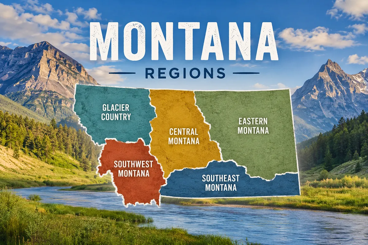
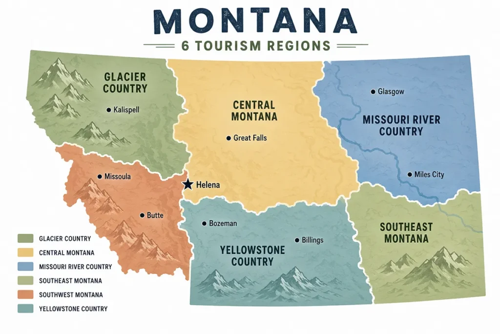
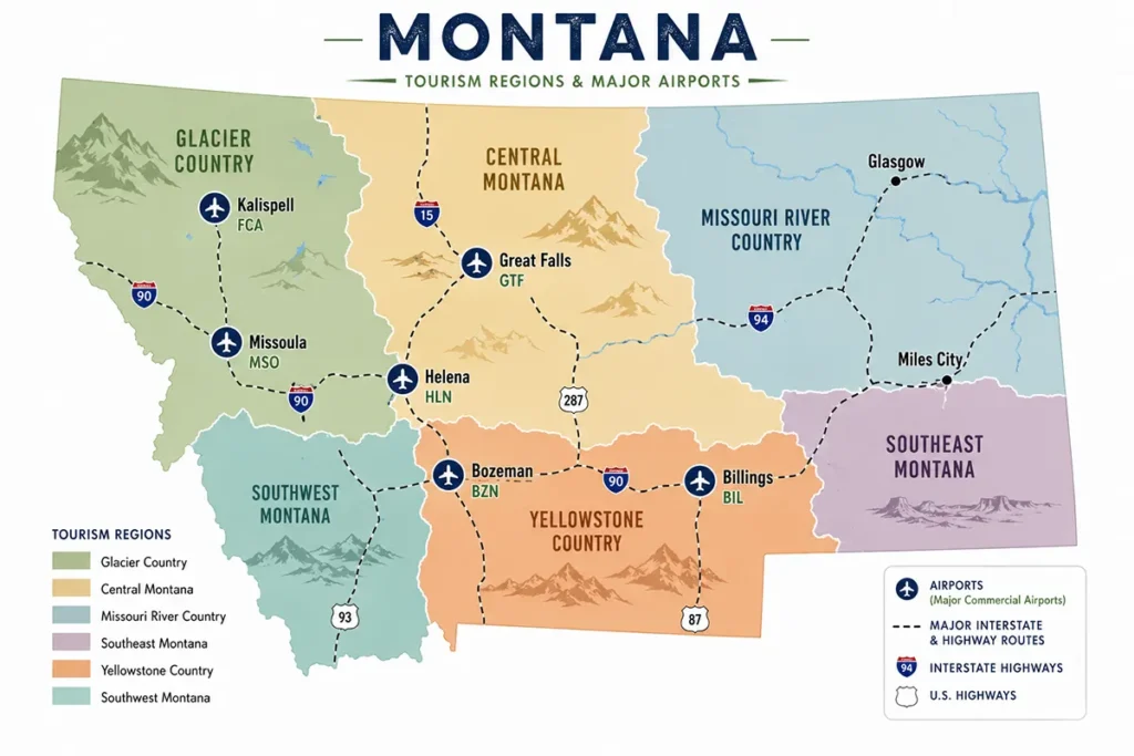
Montana is officially divided into 6 tourism regions — Glacier Country, Central Montana, Missouri River Country, Southeast Montana, Southwest Montana, and Yellowstone Country — each one large enough to be its own state and each with a wildly different personality. This guide breaks down what’s in each region, which one is right for your kind of trip, drive times between them, where to fly in, and which months you actually want to visit. If you only have a week, pick two adjoining regions. If you have 10 days, three is doable. And if anyone tells you that you can “see Montana” in a long weekend — they haven’t been here.
Why Montana Has 6 Regions (And Why the Names Are a Little Bit Weird)
Before we get into the regions themselves, a quick bit of context that nobody else seems to bother explaining.
In 1986–87, the Montana Legislature passed a state lodging tax to fund tourism promotion. To distribute that money sensibly, the state was carved into six tourism regions, each given its own Destination Marketing Organization (DMO).
Forty years later, that system is still in place — and it’s the reason places as different as Whitefish and Wibaux end up grouped together based on which corner of the state they sit in.
The names mostly make sense, but a few are slightly misleading once you look at a map.
- Central Montana reaches all the way to the Canadian border in the north.
- Southwest Montana doesn’t actually include Bozeman (which sits in Yellowstone Country) or the Bitterroot Valley (which is in Glacier Country).
- And Southeast Montana used to be called Custer Country — you’ll still hear locals use that name.
None of this matters for your trip, but it’ll save you confusion when reading other travel guides.
One more thing: Visit Montana now officially recognizes a seventh region — Montana’s Indian Country — which overlays the other six and highlights the state’s twelve tribal nations and seven reservations. Most travel sites still talk about “six regions” because Indian Country isn’t a contiguous geographic area, but if you’re interested in Montana’s Native heritage, that designation is worth knowing about.
Quick Decision Guide: Which Region Is Right for You?
Before I go into each region in detail, here’s the cheat sheet I give friends who text me asking, “We have a week. Where should we go?”
| If you want… | Go to… |
|---|---|
| Iconic mountain scenery + Glacier National Park | Glacier Country |
| Yellowstone access + alpine resort towns | Yellowstone Country |
| Historic mining towns, hot springs, ghost towns | Southwest Montana |
| Wide-open plains, dinosaur country, real ranch life | Southeast Montana |
| Big rivers, fewer crowds, rugged remoteness | Missouri River Country |
| The “in-between Montana” — wheat fields, prairies, the Front | Central Montana |
| First-time visitor, only one region | Glacier Country or Yellowstone Country |
| Second or third Montana trip | Southwest or Central for variety |
| Solitude, photography, no crowds | Missouri River Country or Southeast |
The two regions that get 80% of the visitors are Glacier Country and Yellowstone Country — for good reason. But if you’ve already seen the parks and want a different side of Montana, the other four are where the real surprises live.
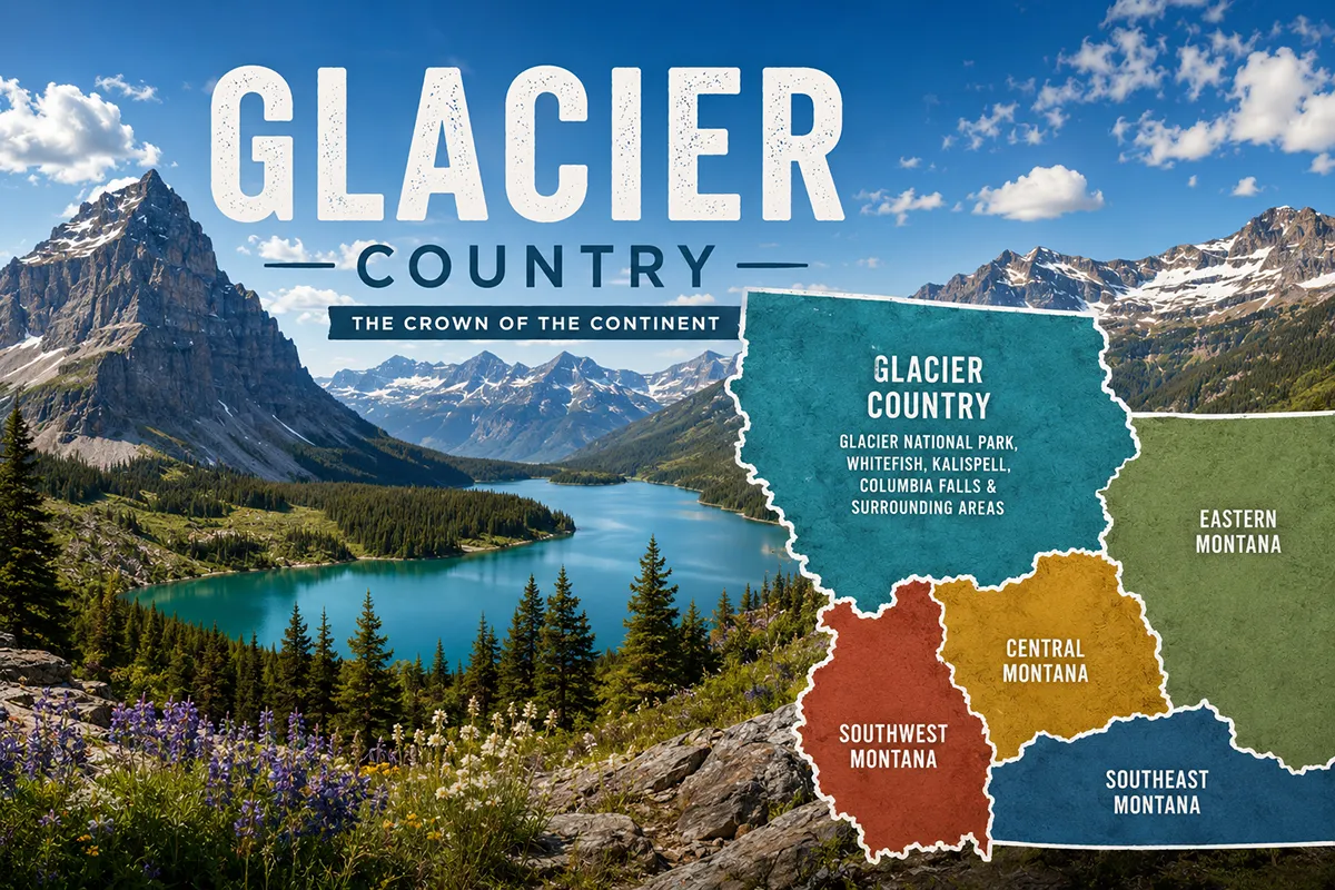
Region 1: Glacier Country (Northwest Montana)
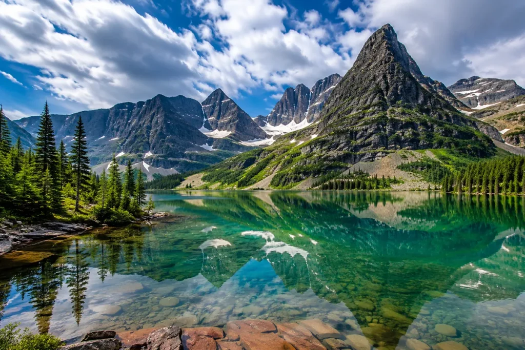
This is the postcard Montana. When someone says “I want to see mountains,” I send them to Glacier Country every time.
The region covers Montana’s northwest corner and is anchored by Glacier National Park — the “Crown of the Continent.” But there’s far more here than the park alone.
The iconic Going-to-the-Sun Road slices east-west through the park between roughly mid-June and mid-October, and even outside that window, you can hike, paddle, and ski elsewhere in the region year-round.
The towns are some of the most beloved in the state.
- Missoula is the cultural heart — a college town with great breweries and a genuinely artsy bent.
- Whitefish is the chic ski/lake hybrid that gets crowded in summer for a reason.
- Kalispell is the practical hub.
- Bigfork sits on Flathead Lake and gets my vote for the prettiest small town anywhere west of the Mississippi.
- And Polebridge, way up north past the park’s North Fork, is the kind of off-grid hamlet where the bakery sells huckleberry bear claws and nobody’s in a hurry.
Major towns: Missoula, Kalispell, Whitefish, Bigfork, Columbia Falls, Hamilton, Polebridge, Libby, Polson, Stevensville, Eureka, Seeley Lake, Thompson Falls, Troy, Browning, East Glacier Park Village
- Best for: First-timers, hikers, mountain photographers, lake lovers, ski trips
- Best time to visit: Mid-July through mid-September for the park; February for skiing at Whitefish Mountain Resort
- Fly into: Glacier Park International Airport (FCA) in Kalispell, or Missoula Montana Airport (MSO)
Don’t miss: Going-to-the-Sun Road, best hikes in Glacier National Park, Flathead Lake, the Highline Trail, Lake McDonald at sunset, and the best things to do in Whitefish
Heads-up: Going-to-the-Sun Road requires a timed-entry vehicle reservation in summer. Book it weeks in advance.
Region 2: Yellowstone Country (South-Central Montana)
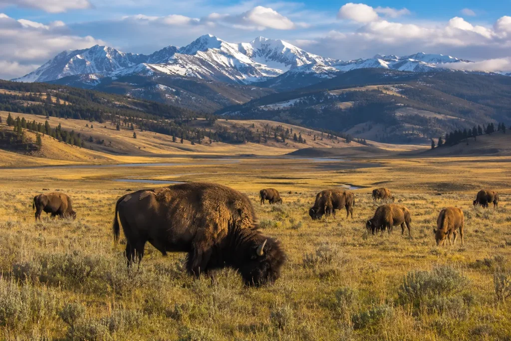
Most travelers fly into Bozeman, drive to Yellowstone, and assume they’ve “done Montana.” They haven’t — but they’ve definitely done Yellowstone Country, and they’ve done it well.
This region wraps the northern boundary of Yellowstone National Park and includes the resort gateway towns and ranchland between Big Sky and Red Lodge. The terrain is a dramatic mix of high alpine peaks (the Beartooths, the Crazies, the Absarokas) and big rolling valleys carved by the Yellowstone River.
- Bozeman is the boomtown — fast-growing, expensive, with the best food scene in the state.
- Big Sky is the megaresort.
- Livingston is the writers’-and-fly-fishermen’s town, gritty and gorgeous.
- Gardiner sits at Yellowstone’s North Entrance and gives you year-round park access.
- West Yellowstone is the summer-only gateway on the park’s west side.
- Cooke City sits at Yellowstone’s Northeast Entrance and feels like a Wild West outpost in winter.
- Red Lodge anchors the Beartooth Highway — one of the most beautiful drives in North America.
Major towns: Bozeman, Big Sky, Livingston, Gardiner, West Yellowstone, Cooke City, Red Lodge, Belgrade, Three Forks, Big Timber, Columbus, Absarokee, Wilsall
- Best for: Yellowstone wildlife watching, fly fishing, skiing, foodies, gateway-town basing
- Best time to visit: Late May to early June for wildlife and waterfalls; late September for fall color and elk rut; January–March for skiing and quiet
- Fly into: Bozeman Yellowstone International Airport (BZN) — by far the most-trafficked airport in Montana
Don’t miss: Yellowstone itself, Lamar Valley for wolves and bison, Chico Hot Springs, Beartooth Highway, downtown Bozeman, and the Grizzly & Wolf Discovery Center in West Yellowstone
Heads-up: Bozeman has gotten genuinely expensive. Stay in Livingston or Big Timber to save real money and only lose 30 minutes of drive time.
➡️ Full Yellowstone Country guide
Region 3: Southwest Montana
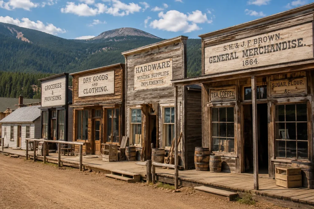
This is my favorite region for repeat visitors. It’s the most varied corner of Montana — high desert valleys, alpine lakes, ghost towns, hot springs, and the state capital all packed into one drivable area.
- Helena, the state capital, is criminally underrated.
- Butte is one of the most fascinating cities in the American West — a former mining boomtown with the most intact historic district in the country.
- Anaconda has the only Jack Nicklaus-designed Old Works golf course built on a reclaimed copper smelter site.
- Dillon is the Beaverhead County seat and your gateway to some of the best fly fishing on earth.
- Philipsburg is a candy-colored mining town turned tourist gem.
- Virginia City and Nevada City are preserved gold-rush towns where you can walk through history.
The region also has the densest concentration of natural hot springs anywhere in Montana, plus three ski areas, dozens of ghost towns, and the Pintler and Pioneer Mountain ranges.
Major towns: Helena, Butte, Anaconda, Dillon, Philipsburg, Sheridan, Twin Bridges, Whitehall, Boulder, Townsend, Deer Lodge, Drummond, Virginia City, Ennis
- Best for: History buffs, hot spring lovers, fly fishermen, ghost-town hunters, road trippers
- Best time to visit: Late June through September; the high country is snowed in until July
- Fly into: Bozeman (BZN) for east/Yellowstone side, Helena Regional (HLN) for central, or Missoula (MSO) for west — none ideal, all workable
Don’t miss: Lewis & Clark Caverns, Pintler Scenic Loop, best things to do in Helena, things to do in Butte, things to do in Dillon, and a soak at Norris, Boulder, or Potosi Hot Springs
Heads-up: Distances here look short on a map but mountain passes slow you down. Add 25% to whatever Google Maps tells you.
➡️ Full Southwest Montana guide
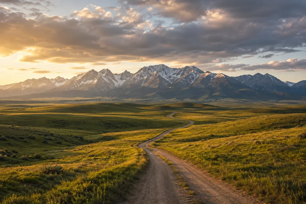
Region 4: Central Montana
Central Montana is the region most travelers blow through on the way somewhere else — and the one most likely to make a real impression if you slow down.
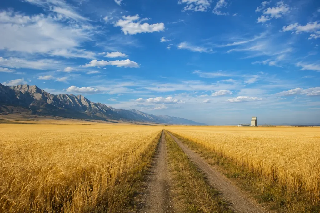
It runs from Great Falls north to the Canadian border and east through the Missouri Breaks. The west side hugs the spectacular Rocky Mountain Front, where the prairie slams into the Rockies like a wall. The east side is wheat-and-cattle country, with island mountain ranges (the Little Belts, the Highwoods, the Snowies) rising out of the plains.
- Great Falls is the second-largest city in Montana and the gateway to Lewis & Clark history along the Missouri River.
- Lewistown sits at the geographic center of the state.
- Havre is High-Line country, anchoring Montana’s northern railroad corridor.
- Fort Benton is the literal birthplace of Montana, with the most preserved 19th-century steamboat port in the West.
- Augusta and Choteau are gateway towns to the Front — quiet places where ranching is still the economy.
Major towns: Great Falls, Lewistown, Havre, Fort Benton, Choteau, White Sulphur Springs, Conrad, Shelby, Cut Bank, Chester, Big Sandy, Augusta, Fairfield, Dutton, Sunburst
- Best for: Lewis & Clark history, Native American heritage, dinosaur trail, off-grid quiet, wildlife watching on the Front
- Best time to visit: May through September; the wheat harvest in late August is genuinely beautiful
- Fly into: Great Falls International Airport (GTF), or other Montana airports connecting via shorter regional drives
Don’t miss: C.M. Russell Museum in Great Falls, Giant Springs State Park, the Rocky Mountain Front near Choteau, Bear Gulch Pictographs, Square Butte, Lewis & Clark Interpretive Center
Heads-up: Distances are deceiving. Lewistown to Havre looks close on a map; it’s a real two-hour haul through gorgeous nothing.
Region 5: Missouri River Country (Northeast Montana)
This is the Montana that almost nobody talks about — and I think it’s a quiet shame.
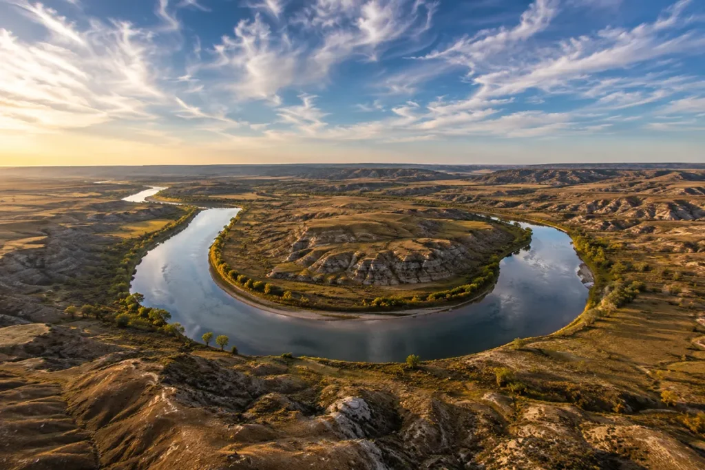
Tucked into the state’s far northeast corner, Missouri River Country is where Lewis and Clark spent more time than any other state on their entire expedition. It’s also where one of the most important dinosaur fossil beds in the world sits (the Hell Creek Formation around Jordan and Glendive).
The terrain is wide-open plains punctuated by badlands, the Missouri River, and Fort Peck Lake — a massive man-made reservoir that’s the fifth-largest in the U.S. by volume.
The towns are small and proud.
- Glasgow is the unofficial capital.
- Wolf Point is home to one of the oldest stampedes (rodeos) in the West.
- Sidney is the Bakken oil-patch hub.
- Plentywood and Scobey sit right up against the Saskatchewan border.
Major towns: Glasgow, Malta, Wolf Point, Sidney, Plentywood, Scobey, Poplar, Culbertson, Medicine Lake, Froid, Flaxville, Fairview, Richey, Westby
- Best for: Dinosaur enthusiasts, Lewis & Clark history, fishing on Fort Peck, true solitude, photographers wanting empty landscapes
- Best time to visit: Late May through September; July for the stampedes; winter is brutal and you should not visit unless you’re hardcore
- Fly into: No major commercial airport in the region. Easiest entry is Williston, ND (XWA) or driving in from Billings/Glasgow. See Montana airports for options.
Don’t miss: Fort Peck Dam and Interpretive Center, the Dinosaur Trail (Glendive’s Makoshika State Park, Jordan’s paleo museum), Medicine Lake National Wildlife Refuge, the Lewis & Clark sites along the Missouri
Heads-up: This is the region where cell service goes from “spotty” to “you should download offline maps.” Plan accordingly.
➡️ Full Missouri River Country guide
Region 6: Southeast Montana (Custer Country)
If you want the Montana your grandfather wrote about — wide-open ranchland, rodeos, working cowboys, history that still feels close to the surface — this is your region.
Southeast Montana (which a lot of locals still call Custer Country) is anchored by Miles City, home to the famous Bucking Horse Sale every May.
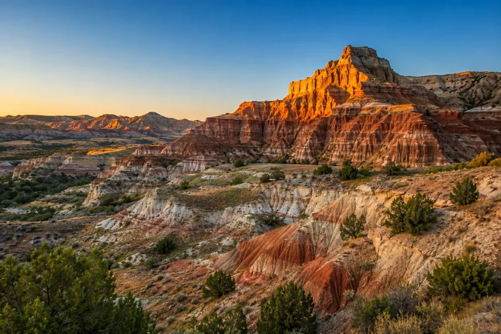
It includes the Little Bighorn Battlefield National Monument near Hardin — one of the most significant Native American history sites in the country — and the Tongue River Reservoir for fishing and camping. The terrain is rolling plains, pine-studded breaks, and serious badlands.
This is also where ranching is still the actual economy, not a tourist photo opportunity. The bars are real, the food is honest, and the pace is exactly what you came for.
Major towns: Miles City, Glendive, Hardin, Forsyth, Baker, Broadus, Ekalaka, Terry, Wibaux, Lame Deer, Circle, Jordan
- Best for: Native American history, dinosaur hunting, rodeos, hunting/fishing trips, photographers, slow travel
- Best time to visit: May (for the Bucking Horse Sale), June for green prairie, September for fall hunts
- Fly into: Billings Logan International Airport (BIL) is the practical gateway for the whole eastern half of the state
Don’t miss: Little Bighorn Battlefield, Pictograph Cave State Park, things to do in Miles City, Medicine Rocks State Park, Carter County Museum (one of the best small-town paleo museums anywhere)
Heads-up: Don’t expect chain hotels in most towns. The mom-and-pop motels are the experience.
➡️ Full Southeast Montana guide
Drive Times Between Regions: What to Expect
This is the chart I wish every other Montana travel site published. Distances and approximate drive times between major regional hubs:
| From → To | Distance (mi) | Drive Time |
|---|---|---|
| Kalispell (Glacier) → Bozeman (Yellowstone) | ~365 | 6.5–7 hours |
| Bozeman (Yellowstone) → Butte (Southwest) | ~85 | 1.5 hours |
| Butte (Southwest) → Missoula (Glacier) | ~120 | 2 hours |
| Bozeman (Yellowstone) → Billings (Southeast) | ~145 | 2.5 hours |
| Billings (Southeast) → Glasgow (Missouri River) | ~280 | 4.5 hours |
| Great Falls (Central) → Helena (Southwest) | ~90 | 1.5 hours |
| Great Falls (Central) → Glasgow (Missouri River) | ~290 | 4.5 hours |
| Missoula (Glacier) → Great Falls (Central) | ~165 | 2.75 hours |
| Bozeman → Miles City (Southeast) | ~290 | 4.5 hours |
| Kalispell → Glasgow (longest realistic crossing) | ~520 | 8–9 hours |
A useful rule of thumb: Montana is about 630 miles wide and 255 miles tall. That’s roughly the same as driving from London to Glasgow and back. Do not underestimate how vast Montana really is.
What I Wish I’d Known Before Trying to “See Montana”
A few things I tell every first-time visitor:
You can’t see the whole state in one trip. Pick two adjoining regions and do them properly. Trying to do four is how you end up spending your vacation behind the wheel.
The two parks are in different regions. Glacier National Park is in Glacier Country (NW corner); Yellowstone is mostly in Wyoming, but its northern gateways are in Yellowstone Country (south-central). They are 6–7 hours apart by the most direct route. Most first-timers don’t realize this until they’re looking at hotel reservations.
Fly into the right airport. Bozeman (BZN) for Yellowstone and Southwest; Kalispell (FCA) or Missoula (MSO) for Glacier Country; Great Falls (GTF) for Central; Billings (BIL) for the eastern half. See the full Montana airports breakdown before you book.
Cell service varies wildly by region. Glacier Country and Yellowstone Country have decent coverage in towns and patchy coverage in the parks. Missouri River Country and Southeast are essentially offline in many areas. Download offline maps before you go.
Each region has its own season. Glacier Country peaks July–early September. Yellowstone Country has a long shoulder season. Southwest is best in June and September. The eastern regions are most welcoming May–early June and September. Use our best time to visit Montana guide to fine-tune your trip.
Gas up when you can. This isn’t a joke. In Missouri River Country and Southeast, gas stations are 60–90 miles apart in some stretches.
Suggested Itineraries by Trip Length
3–4 days: Pick one region. Glacier Country or Yellowstone Country are easiest for first-timers.
5–7 days: Pick two adjoining regions. Best combos:
- Glacier Country + Southwest Montana (mountains + history + hot springs)
- Yellowstone Country + Southwest Montana (parks + mining towns)
- Glacier Country + Central Montana (Glacier + Lewis & Clark country)
8–10 days: Add a third region.
- Glacier Country → Southwest → Yellowstone Country is the classic “Montana grand tour” loop, roughly 1,200 miles total.
- Or skip Yellowstone and do Glacier → Central → Southeast for a less crowded, more authentic eastern Montana experience.
14+ days: You can realistically do four regions, but I’d argue against it. Better to do three deeply.
For full itinerary help, our Montana trip planning guide walks through it day-by-day.
Practical Info Box: Montana Regions at a Glance
| Region | Size Rank | Population Density | Best Airport | Best Months | Crowd Level |
|---|---|---|---|---|---|
| Glacier Country | Mid | Low–Mid | FCA / MSO | Jul–Sep | High |
| Yellowstone Country | Smaller | Mid | BZN | Late May–Sep | Very High |
| Southwest Montana | Mid | Low | HLN / BZN | Jun–Sep | Mid |
| Central Montana | Large | Very Low | GTF | May–Sep | Low |
| Missouri River Country | Large | Lowest | XWA (ND) | Jun–Aug | Very Low |
| Southeast Montana | Large | Very Low | BIL | May–Sep | Low |
[Verify population density figures and current airport codes before publishing.]
So Which Region Should You Actually Visit?
If you’re flying into Montana for the first time, fly into Bozeman or Kalispell, pick one of those two regions, and do it right. You’ll spend less time driving, see more, and leave with a real sense of place rather than a blur of windshield miles.
If you’ve been to Glacier or Yellowstone before and want the other Montana, Southwest is the easiest second trip — close enough to a major airport, packed with hot springs and ghost towns, and infinitely less crowded.
And if you’re the kind of traveler who wants to be somewhere most Americans have never even thought to visit, the eastern regions — Missouri River Country and Southeast — are still waiting. They’re not glamorous. They’re not curated. They are, in some ways, the most honestly Montanan corners of the state. And you’ll have them mostly to yourself.
Save this guide for your trip planning. Each region deserves its own deep dive — and I’m writing those next. Subscribe to the RoamingMontana newsletter to get the full Glacier Country, Yellowstone Country, Southwest, Central, Southeast, and Missouri River Country guides as they go live.
Got a region question? Drop it in the comments — I answer them all. And if you’ve already picked your region, the next step is choosing your cities and towns base camp.
Written by Sarah Bennett. I’ve spent the better part of a decade exploring Montana corner to corner, region by region, and I’m still finding new places I didn’t know existed.