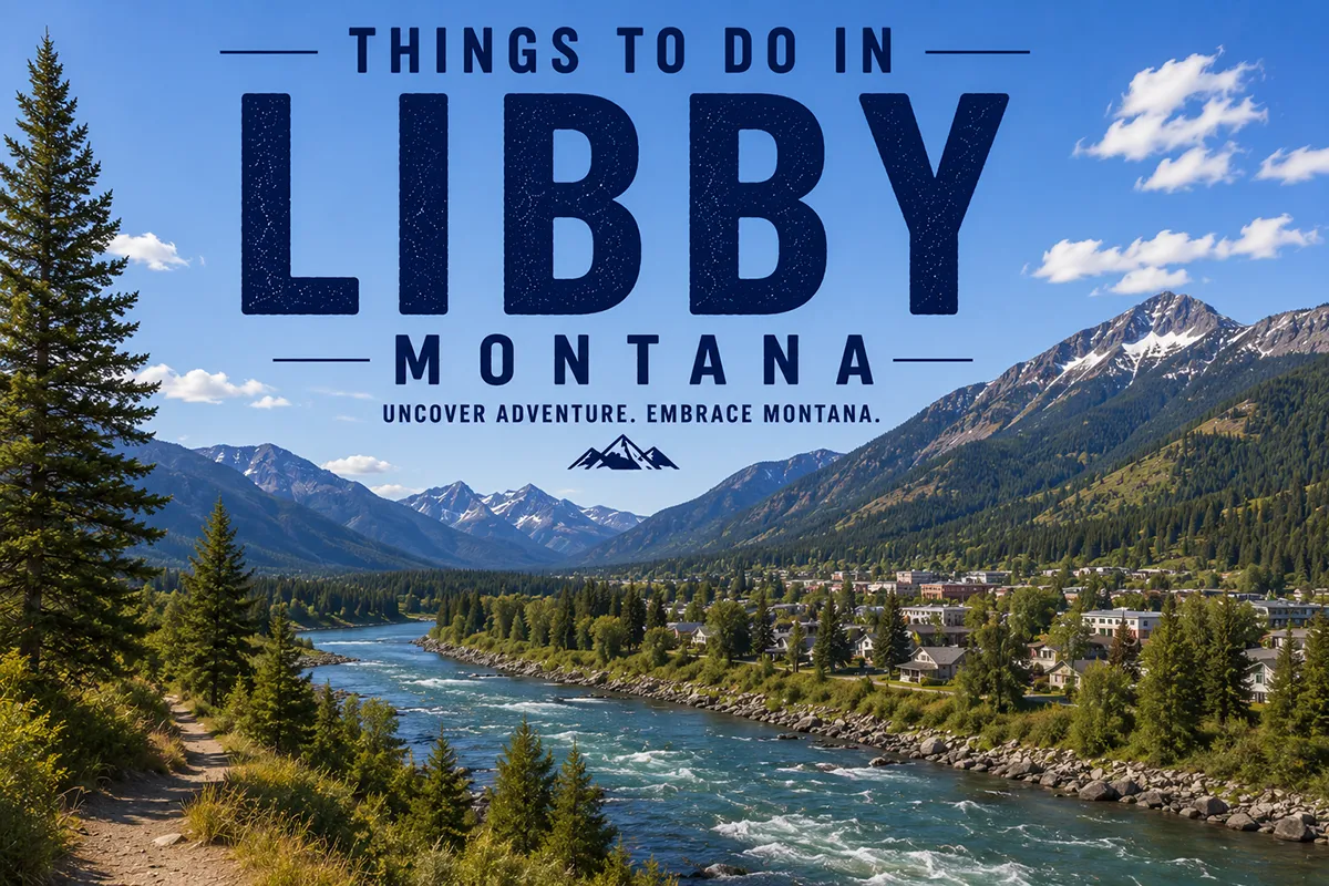
Most people driving US-2 through northwest Montana treat Libby as a fuel stop. The gas station is fine. The surrounding 2.2 million acres of Kootenai National Forest, the largest undammed waterfall in Montana 10 miles from downtown, a two-country reservoir with one of the most satisfying name etymologies in American geography, and a summer events calendar that punches well above a town of 2,700 — these are the reasons to stop for more than a tank of gas.
Libby is legitimately one of northwest Montana’s most underrated destinations, and the travel blog record on it is thin enough that this guide exists specifically to fix that.
Quick Answer — Things to Do in Libby Montana
Libby’s essential experiences: visit Kootenai Falls (largest undammed waterfall in Montana — full guide at our Libby waterfalls and hiking guide), explore the Heritage Museum (a 12-sided log structure on the National Register of Historic Places, with the massive frying pan exhibit), kayak or boat Lake Koocanusa (whose name combines Kootenai + Canada + USA), ski Turner Mountain in winter (uncrowded, local, and completely overlooked by competitors), attend the Riverfront Blues Festival (August 7–8, 2026), and visit the McGinnis Meadows ranch for Buck Brannaman horsemanship. Budget 2–4 days.
- Libby (~2,700) sits in the Kootenai River Valley, surrounded by Kootenai National Forest (2.2+ million acres), 90 miles from Glacier National Park
- For Kootenai Falls, the swinging bridge, Cabinet Mountains Wilderness, and Ross Creek Giant Cedars, see our dedicated Libby outdoor adventures guide
- Heritage Museum: a 12-sided log structure on the National Register of Historic Places — one of the most architecturally unusual museums in Montana — with a massive frying pan exhibit
- Lake Koocanusa: “Koocanusa” = Kootenai + Canada + USA — a reservoir spanning two countries with the most satisfying name etymology in northwest Montana
- McGinnis Meadows Ranch: teaches Buck Brannaman horsemanship — Brannaman is the real horse trainer who inspired Robert Redford’s film and the 2011 documentary “Buck”
- Riverfront Blues Festival (Aug 7–8, 2026) + Ignite the Nites car show (Aug 13–15, 2026, 400+ entries) make August the best events month in the Kootenai Valley
- Turner Mountain Ski Area: Libby’s local ski hill — and no travel blog covering Libby mentions it
- For the full Montana outdoor adventure context, see our things to do in Montana guide
Liked this article?
Add Roaming Montana as a preferred source so you see more of our articles and guides on Google.
Why Libby Rewards More Time Than Most Visitors Give It
Libby sits in the Kootenai River Valley in the extreme northwest corner of Montana — closer to the Canadian border than to Missoula, and hemmed in by mountain ranges that funnel the Kootenai River through a landscape of dense forest and rocky peaks.
The timber industry shaped Libby’s 20th century. The Kootenai National Forest — 2.2 million acres of public land surrounding the town — defined what happened here for generations.
What’s emerged in recent decades is a community that has diversified around the outdoor recreation that the same forests and rivers provide: fly fishing on the Kootenai, hiking in the Cabinet Mountains Wilderness, skiing at Turner Mountain, and events on the Riverfront Park along the river that run from May through September.
This post covers activities across all these categories. For the deep dive on Kootenai Falls (largest undammed waterfall in Montana), the famous swinging bridge, Cabinet Mountains hiking, and Ross Creek Giant Cedars — see our dedicated Libby Montana waterfalls and hiking guide. This post covers everything else.
All 22 Things to Do in Libby Montana
History & Culture:
- Heritage Museum — 12-sided log structure, massive frying pan ⭐
- Libby Dam Visitor Center + Birds of Prey programs ⭐
- Downtown Libby — Mineral Avenue, Cedar Street Bridge shops
Water & Lakes:
4. Lake Koocanusa — boating, fishing, camping ⭐
5. Koocanusa Resort and Marina
6. Kootenai River fishing — guided or wade
Outdoor Adventures:
7. Kootenai Falls + swinging bridge ⭐ (see /libby-montana-guide/)
8. Cabinet Mountains Wilderness hiking ⭐ (see /libby-montana-guide/)
9. Ross Creek Giant Cedars ⭐ (see /libby-montana-guide/)
10. Kootenai Aviation scenic flights ⭐
11. Mountain biking — Sheldon Mountain Trail
12. Cabinet View Golf Club (9-hole, Cabinet Mtn views)
Unique Experiences:
13. McGinnis Meadows Ranch — Buck Brannaman horsemanship ⭐
14. Kootenai Angler — guided fly fishing (35+ years)
Events:
15. Riverfront Blues Festival (Aug 7–8, 2026, full lineup) ⭐
16. Ignite the Nites car show (Aug 13–15, 2026, 400+ entries) ⭐
17. Kootenai River Stampede rodeo (19th Annual)
18. Farmers Market (Thursdays, Mineral Ave & Lincoln Blvd)
19. Happy’s Inn live music venue
Food & Drink:
20. The Black Board Bistro (modern Mediterranean)
21. Burger Express (huckleberry shake) 22. Rosita’s Mexican Restaurant
Winter:
- Turner Mountain Ski Area ⭐
Heritage Museum — The 12-Sided Log Structure ⭐
Here is the Libby cultural attraction that no major travel blog has developed properly.
The Heritage Museum is housed in a 12-sided log structure listed on the National Register of Historic Places — an architecturally distinctive building that is rare enough in northwest Montana to be significant on its own terms. The 12-sided design is a specific structural choice that visitors immediately notice and remember.
Inside, the museum documents the history of Libby and the surrounding Kootenai River Valley: Native American cultures, the fur trade era, pioneer colonization, the logging industry that defined the 20th century, and the mining operations that shaped — and eventually damaged — the community.
wanderlog.com’s review is specific: “One of the most unique items on display is a massive frying pan, reputed to be one of the largest in the world! It’s a fun and quirky piece of history that adds a bit of local flavor to the museum experience.”
The massive frying pan is the Heritage Museum’s most Libby-specific exhibit — large enough to be genuinely surprising, displayed with the specific humor that small-town Montana museums deploy when they know an object will make visitors stop and say something.
Google reviewers are consistently positive: “Great museum of history of Libby Montana and area’s if you like historical history this is the place to come and see so many things to see and the staff is fantastic.”
Cost: Modest admission. Address: Downtown Libby (verify current hours at local sources).
Lake Koocanusa — The Name Tells the Story ⭐
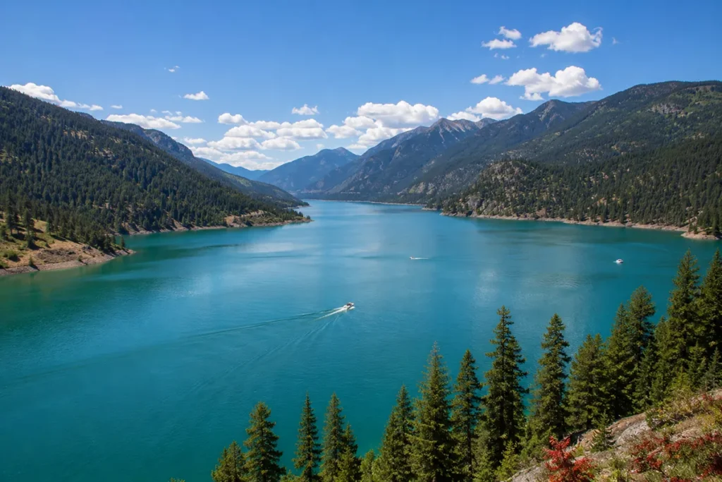
Lake Koocanusa is the reservoir created by Libby Dam on the Kootenai River. It is a large, stunning mountain lake — 90 miles long, narrow, with forested mountains on both sides and clear blue water.
But the best thing about Lake Koocanusa is the name.
“Koocanusa” is a portmanteau: Kootenai + Canada + USA. The lake was named when a local schoolgirl submitted the portmanteau as a naming suggestion for the new reservoir, and the name was adopted. The lake literally spans the US-Canada border — the southern section is in Montana; the northern section extends into British Columbia.
A lake that spans two countries and carries both their names in a single word is a specific geographic character that no travel blog covering Libby has developed as an attraction in its own right.
Activities on Lake Koocanusa:
- Boating (motorized access throughout the Montana section)
- Swimming (shore access, beaches at camping areas)
- Fishing: northern pike, rainbow trout, kokanee salmon, largemouth bass, perch, bull trout
- Camping: multiple Forest Service campgrounds along the shore
- Scenic drives: the highway along the lake’s western shore provides water views for miles
Koocanusa Resort and Marina provides boat rentals, a launch ramp, and the most developed visitor infrastructure on the Montana section of the lake. The Trout and Salmon Derby mentioned in libbymt.com events (May 16-17, 2026) is the most specific annual fishing competition — sign-up required before May 15.
Libby Dam Visitor Center and Birds of Prey Programs ⭐
The Libby Dam created Lake Koocanusa and provides flood control and hydroelectric power for the region. The dam’s Visitor Center sits at the dam complex and provides interpretive displays on the dam’s construction, Lake Koocanusa’s ecology, and the Kootenai River’s natural history.
The specific program no travel blog has covered: the libbymt.com events calendar specifically lists Birds of Prey programs at the Libby Dam Visitor Center at 1:00 PM and 3:30 PM during designated dates. Live raptor demonstrations at a dam visitor center are a specific and unusual educational experience worth timing a visit around.
Distance from Libby: ~17 miles south. [Verify current program schedule at the Libby Dam Visitor Center or libbymt.com.]
Kootenai Falls, Swinging Bridge, and Outdoor Adventures
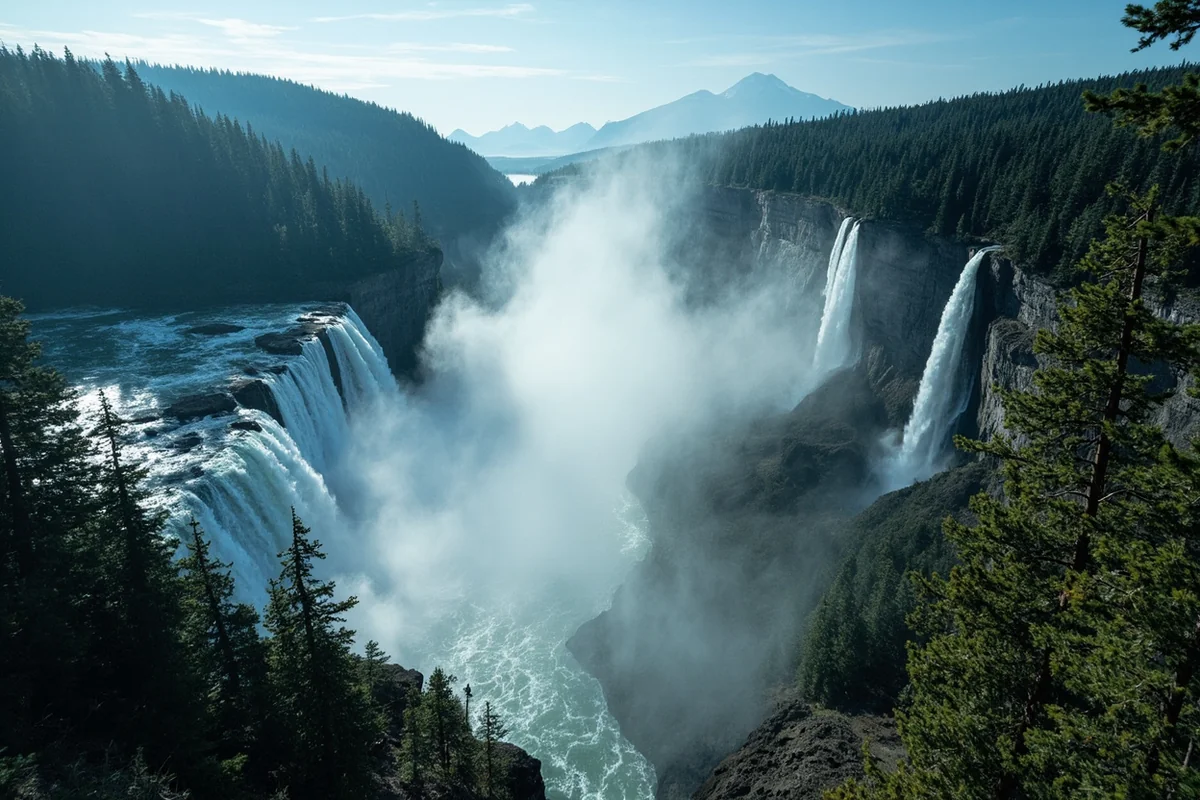
The largest undammed waterfall in Montana is 10 miles east of Libby on US-2. The swinging bridge crosses the gorge above the falls. The Cabinet Mountains Wilderness provides 94,000 acres of alpine hiking with genuine wildlife encounters. Ross Creek Giant Cedars, 29 miles south of Troy, hold 500-year-old trees on an easy loop trail.
These are covered in full depth — with trail specifics, seasonal conditions, personal experience, and logistics — in our dedicated Libby Montana waterfalls, hiking, and outdoor adventures guide.
That guide is the correct resource for planning the outdoor portion of your Libby visit. It covers the swinging bridge crossing, the best Cabinet Mountains trailheads for day hikes, and which season gives you the most dramatic Kootenai Falls experience.
For guided outdoor options across the region, see our Montana guided tours guide.
Kootenai Aviation — Scenic Flights Over the Wilderness ⭐
Here is the Libby-area activity that TripAdvisor lists and no travel blog has covered: Kootenai Aviation offers scenic flights over the Cabinet Mountains Wilderness area and nearby Glacier National Park.
TripAdvisor description: “Kootenai Aviation, Inc. provides local scenic flights over majestic mountains and beautiful lakes near Libby in the Cabinet Wilderness Area. We also provide longer Air Tours including Glacier Park.”
The combination of Cabinet Mountains Wilderness terrain — which is remote enough that many hikers never reach the alpine zones even on foot — and the broader Glacier Park corridor makes the Kootenai Aviation perspective genuinely different from ground-level experiences.
[Verify current flight availability and pricing with Kootenai Aviation directly.]
McGinnis Meadows Ranch — The Real Horse Whisperer ⭐
Here is the Libby-area experience that TripAdvisor lists and no travel blog has built out — and the story behind it is better than the listing suggests.
McGinnis Meadows Cattle & Guest Ranch is an authentic working cattle ranch in northwest Montana that specifically teaches Buck Brannaman horsemanship — the natural horsemanship method developed by the real-life trainer who inspired Robert Redford’s 1998 film The Horse Whisperer.
Buck Brannaman’s story is more interesting than the fictionalized film: he was a child rodeo performer who was abused as a child, was placed in foster care, and developed a profound relationship with horses that became a philosophy of communication rather than domination.
He has spent decades teaching this method — which emphasizes understanding a horse’s nature and communicating through feel rather than force — to riders at workshops across the US. The 2011 documentary Buck, directed by Cindy Meehl, was nominated for an Academy Award.
A ranch in the Kootenai River Valley outside Libby specifically teaching his method is a genuine connection to one of the most respected figures in American horsemanship.
A TripAdvisor reviewer who spent a week at McGinnis Meadows wrote: “Time will tell but I think I made more improvement in my riding and learning from the horse as well as from Shayne, Dez, and the wranglers than in the last 10 years combined.”
[Verify current season dates and availability at McGinnis Meadows directly.]
Fly Fishing the Kootenai River
Kootenai Angler has operated guided fly fishing trips on the Kootenai River for over 35 years — among the longest-running guide operations in northwest Montana. The Kootenai River below Libby Dam is a tailwater fishery that produces exceptional rainbow trout fishing through the year, with the cold, consistent dam releases creating ideal trout habitat.
TripAdvisor describes Kootenai Angler as offering “guided fly fishing trips and cabin rentals on the Kootenai River in North West Montana. From novice to advanced our team of experienced guides.”
The Kootenai below the dam is a specific fishery — not a natural river but a managed tailwater, with the water temperature and clarity controlled by dam releases. This produces large fish and consistent hatches that make it one of northwest Montana’s most reliable fly fishing destinations.
Kootenai River Fishing Charter (the BEATNiK charter, a G3 with jet outboard per TripAdvisor) provides an alternative format: “Fishing Charter, Sightseeing trip upriver or relaxing drift on the Kootenai River.” For non-anglers who want the river experience without wading, the charter drift provides the scenery without the casting.
Cabinet View Golf Club
Cabinet View Golf Club is a 9-hole course with views of the Cabinet Mountains — the specific combination of accessible golf (9-hole, not a destination course) and extraordinary setting (Cabinet Mtn backdrop) that makes it genuinely worth noting.
TripAdvisor: “No words can describe what you’ll see teeing off on #1 or #8. I can only tell you, we’ve been to Switzerland and the Austrian Alps… and it’s pretty darn close! Add to that the wildlife you are likely to spy, and it’s a tie. THE BEST part about this Libby course is that you can actually play it.”
Cabinet mountains as a golf backdrop, with wildlife sightings (including deer and occasional bear) making the course genuinely Montana, creates an experience where the scenery justifies the round regardless of your score.
Turner Mountain Ski Area — Libby’s Winter Identity ⭐
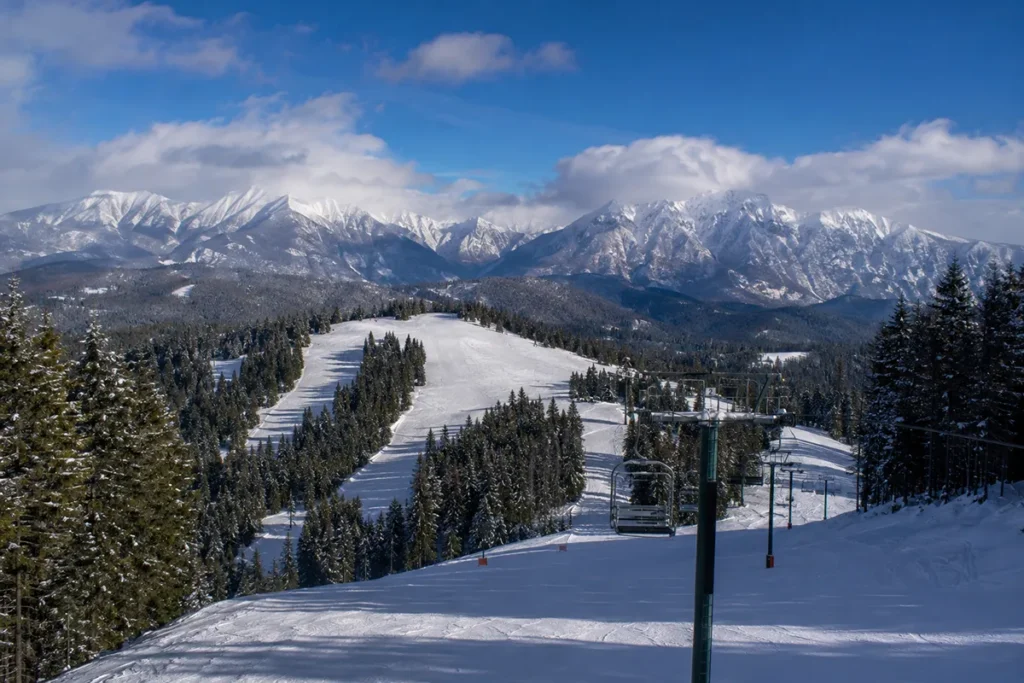
Here is the Libby activity that zero travel blogs mention: Turner Mountain Ski Area is Libby’s local ski hill — and it’s in our sitemap.
For the complete Turner Mountain guide — terrain, vertical drop, lift details, season dates, pricing, and how to get there from Libby — see our dedicated Turner Mountain Ski Area guide.
The brief version: Turner Mountain provides downhill skiing in the Cabinet Mountains with the specific uncrowded character of a community ski hill in a small northwest Montana town. No lift lines. No resort infrastructure. The skiing equivalent of the Kootenai Falls experience: genuinely excellent, genuinely unrecognized.
For the full Montana ski area comparison, see our Montana ski resorts guide.
Events: Libby’s 2026 Summer Calendar
Riverfront Blues Festival — August 7–8, 2026 ⭐
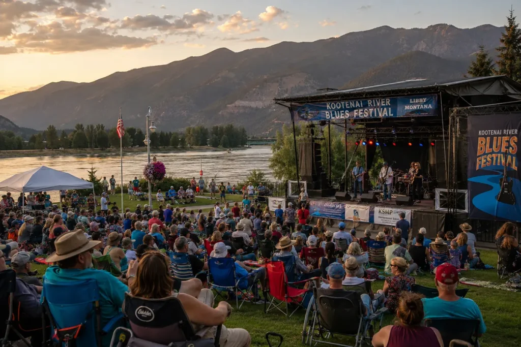
The 17th Annual Riverfront Blues Festival at Riverfront Park along the Kootenai River is the summit of Libby’s summer events calendar. visitmt.com provides the full 2026 lineup:
Friday, August 7, 2026:
- 4:30 PM: Money Penny
- 6:30 PM: Stoney Curtiss
- 8:30 PM: Tony Holiday
- 10:30 PM: Chris O’Leary
Saturday, August 8, 2026:
- Noon: Kelly’s Lot
- 2:00 PM: Atomic Jive
- 4:00 PM: Alison Joy Williams
- 6:00 PM: Jay Snow and the Tone Keepers
- 7:30 PM: Two Slim & the Taildraggers
- 9:00 PM: ALL-STAR JAM
Gates open at 4:00 PM Friday and 11:00 AM Saturday. The Riverfront Park venue along the historic Kootenai River provides the specific Montana outdoor festival atmosphere that makes this event worth planning a trip around.
No travel blog covering Libby has published the 2026 artist lineup. This guide does.
Ignite the Nites Car Show — August 13–15, 2026 ⭐
The Ignite the Nites car show and cruise draws over 400 entries from car clubs across the region to Mineral Avenue in downtown Libby.
visitmt.com’s 2026 schedule:
- Thursday, Aug 13: High Stakes Poker Run with 100% payout (4–8 PM, Mint Bar to Po’ Sam’s)
- Friday, Aug 14: Car Show and Cruise Registration (2–7:30 PM), Friday Night Cruise (6–9 PM on Mineral Ave), Neon Lights & Flame Throwers (9 PM), Live Music (9 PM on Mineral Ave)
- Saturday, Aug 15: Car Show Registration (8 AM–noon), Car Show (9 AM–3 PM on Mineral Ave), 1950s Pin-Up Girl costume contest
400+ classic and antique cars, trucks, and motorcycles on Mineral Avenue over three days, with a poker run, costume contest, and neon flame throwers — this is genuinely Libby’s most visually dramatic summer event, and no travel blog has covered it with these specifics.
Kootenai River Stampede — 19th Annual Rodeo
The Kootenai River Stampede (formerly Kootenai River Rodeo) is Libby’s summer rodeo tradition — now in its 19th consecutive year. PRCA-caliber rodeo competition in a community where the agricultural and ranching heritage is real, not performative.
[Verify current 2026 dates at visitmt.com or libbymt.com.]
Libby Farmers Market (Thursdays)
The Libby Farmers Market runs Thursdays, 3:00–6:30 PM, at the new location: Mineral Avenue and Lincoln Blvd. Fresh local produce, crafts, and community gathering from May through the season.
The Troy Farmers Market runs Fridays, 11 AM–3 PM, at the Troy Museum — worth the 17-mile drive to Troy for visitors spending multiple days in the Kootenai Valley.
Happy’s Inn — Live Music Venue
Happy’s Inn is Libby’s primary live music venue, hosting touring artists throughout summer. visitmt.com specifically covers 2026 bookings including Ian Munsick (June 27) and Bryan Martin (July 18), plus the Copper Mountain Band Summer Kick Off (May 23, free concert).
The Poker Ride and BBQ Horse Poker Ride on May 23 at Happy’s Inn is a specific annual fundraiser for local veterans and first responders — awards, raffles, and the Copper Mountain Band on Saturday.
Food, Drink, and Libby’s Downtown Scene
The Black Board Bistro
Libby’s most distinctive restaurant. wanderlog.com describes it: “Owned and operated by Seth and Riley Black, this bistro specializes in modern Mediterranean cuisine that is both handcrafted and chef-prepared. With a menu that changes seasonally, diners can expect fresh ingredients sourced from local farms whenever possible.”
Google reviewers: “Our waitress was wonderful, upbeat, happy and her suggestions were delicious. We had the Fried Prawns, a 12-inch Pizza to share, and key lime tart and raspberry white chocolate cheesecake.”
Modern Mediterranean cuisine with a seasonal menu sourced from local farms is a specific and unexpected offering in a northwest Montana timber town. The Black Board Bistro is Libby’s dining destination.
Address: Downtown Libby (opened winter 2016, verify current hours).
Burger Express and Huckleberry Shake
Yelp reviewers specifically call out the huckleberry shake at Burger Express: “based on my experience and other reviews, I will have to go back for a Huckleberry Shake!” In northwest Montana, where huckleberries are native and abundant in season, a local burger spot’s huckleberry shake is the specific regional treat that no visitor should skip.
Rosita’s Mexican Restaurant
Yelp: “Who would have known Libby MT is home to such a fantastic Mexican restaurant.” In a town of 2,700 in northwest Montana, a genuinely good Mexican restaurant is a specific find. The local surprise factor is built into every review.
Cedar Street Bridge
Yelp specifically mentions the Cedar Street Bridge as a shopping destination: “It is on the second floor of the Cedar Street Bridge, and there is an elevator for easy access with strollers, etc.” A covered bridge with shops on the second floor is a specific Libby retail character worth knowing before you arrive.
J. Neils Memorial Park
J. Neils Memorial Park is Libby’s primary outdoor social space — along the Kootenai River with picnic facilities, open grounds, and the disc golf course (a fundraising tournament runs here in May for the Friends of Scotchman Peaks Wilderness). The park is where the farmers market, outdoor events, and summer community life converge.
Things to Do in Libby by Traveler Type
For Outdoor Enthusiasts
Kootenai Falls and swinging bridge (largest undammed waterfall in Montana — see our detailed outdoor guide), Cabinet Mountains Wilderness hiking, Kootenai River fly fishing (Kootenai Angler, 35+ years), Ross Creek Giant Cedars, Kootenai Aviation scenic flights, Lake Koocanusa kayaking and boating.
For Anglers
Kootenai Angler guided trips (35+ years, tailwater fishery below Libby Dam), Kootenai River drift charter (BEATNiK, G3 with jet outboard), Lake Koocanusa fishing (northern pike, rainbow trout, kokanee salmon, bull trout), Trout and Salmon Derby (May, Koocanusa Resort and Marina).
For History Lovers
Heritage Museum (12-sided log structure, National Register, logging/mining history, massive frying pan exhibit), Libby Dam Visitor Center (dam construction history, Birds of Prey programs), downtown Libby’s timber town character.
For Events
Riverfront Blues Festival (August 7–8, 2026 — 2 days of live blues on the Kootenai River), Ignite the Nites (August 13–15, 400+ cars on Mineral Avenue), Kootenai River Stampede (19th Annual rodeo), Farmers Market (Thursdays).
For Horseback Enthusiasts
McGinnis Meadows Cattle & Guest Ranch — Buck Brannaman horsemanship. Multi-day programs for riders of all levels. The most specific and unusual equestrian experience in northwest Montana.
For Skiers (Winter)
Turner Mountain Ski Area — Libby’s local ski hill. See our complete Turner Mountain guide for terrain, season dates, and visitor tips. For the full Montana ski area comparison, see our Montana ski resorts guide.
For seasonal timing across Montana, see our best time to visit Montana guide.
Practical Planning
Getting to Libby: Libby sits on US-2 in northwest Montana, approximately 90 miles from Glacier National Park’s west entrance (Apgar). Glacier Park International Airport (FCA) in Kalispell is the nearest commercial airport — approximately 90 minutes southeast. The Amtrak Empire Builder (Chicago–Seattle) stops in Libby — the train follows US-2’s corridor through northwest Montana.
How long to stay: 2 days covers Heritage Museum, Lake Koocanusa, Kootenai Falls, and downtown. 3 days adds a Cabinet Mountains day hike and the Kootenai River fly fishing. 4+ days enables McGinnis Meadows ranch time, Turner Mountain (winter), and Troy/Ross Creek Cedar day trips.
For the complete Montana outdoor adventure picture, see our things to do in Montana guide.
What Competitors Miss About Libby
After reviewing every travel guide for this keyword, these are the consistently missed angles:
Lake Koocanusa’s name etymology — Kootenai + Canada + USA. A lake spanning two countries with a portmanteau name is a specific geographic story that no travel blog explains. The name alone is a reason to tell people about this lake.
Heritage Museum 12-sided log structure — wanderlog.com covers it; no major travel blog explains that this is an architecturally significant National Register building in an unusual 12-sided log form. The massive frying pan exhibit is a specific quirky draw that reviewers always mention.
Buck Brannaman at McGinnis Meadows — The real Horse Whisperer, subject of an Oscar-nominated documentary, teaches a method being practiced at a ranch outside Libby. TripAdvisor lists the ranch; no travel blog tells you WHY Brannaman’s connection matters.
The Riverfront Blues Festival’s full lineup — visitmt.com has it; no travel blog has published the 2026 artist schedule with times. This post does.
Ignite the Nites specifics — 400+ entries, three-day schedule, Poker Run, Pin-Up costume contest, Neon Lights & Flame Throwers. One of the most visually dramatic summer events in northwest Montana, covered by no travel blog.
Turner Mountain Ski Area — Libby’s ski hill. Zero travel blogs mention it. We have a dedicated guide at /turner-mountain-ski-area-libby-mt/.
Kootenai Aviation — Scenic flights over the Cabinet Wilderness and Glacier. TripAdvisor lists it; no travel blog covers it as a visitor activity.
Libby Dam Birds of Prey programs — Structured raptor demonstrations at the dam visitor center. Specific, unusual, no coverage.
Final Thoughts
Libby is northwest Montana’s best-kept secret, and it earns that designation legitimately.
The Kootenai Falls is the largest undammed waterfall in Montana, and it’s free, accessible, and 10 miles from town. The Heritage Museum is in a 12-sided log building that went on the National Register of Historic Places.
Lake Koocanusa has a name that literally spells out its geography: Kootenai + Canada + USA, a lake that spans two countries. Turner Mountain is Libby’s ski hill, uncrowded and excellent. McGinnis Meadows runs Buck Brannaman horsemanship in the Kootenai River Valley. The Blues Festival brings two days of serious blues to the riverfront every August.
Any one of these would justify including Libby in a Montana itinerary. The fact that all of them exist in the same small town in the same river valley is the specific argument for staying four nights instead of one.
Questions about Libby? Drop them in the comments. For more on Montana’s outdoor adventures and hidden gems, see our things to do in Montana guide.
Frequently Asked Questions
What are the best things to do in Libby Montana?
Libby’s essential experiences: visit Kootenai Falls (largest undammed waterfall in Montana — free, 10 miles from downtown; see our Libby outdoor adventures guide for the full trail and swinging bridge details), explore the Heritage Museum (12-sided log structure on the National Register of Historic Places, massive frying pan exhibit), kayak or boat Lake Koocanusa (a US-Canada reservoir whose name literally combines Kootenai + Canada + USA), attend the Riverfront Blues Festival (August 7–8, 2026), and visit McGinnis Meadows for Buck Brannaman horsemanship. In winter, ski Turner Mountain.
What is Lake Koocanusa near Libby Montana?
Lake Koocanusa is a reservoir created by Libby Dam on the Kootenai River. It is 90 miles long, spans the US-Canada border (the southern section is in Montana; the northern section extends into British Columbia), and was named with a portmanteau combining Kootenai + Canada + USA — a name submitted by a local schoolgirl when the reservoir was created. The lake supports boating, fishing (northern pike, rainbow trout, kokanee salmon, bull trout), camping, and swimming. The Koocanusa Resort and Marina provides the most developed visitor access on the Montana side.
Who is Buck Brannaman and what is his connection to Libby Montana?
Buck Brannaman is one of the most respected natural horsemanship trainers in the United States. He inspired the horse trainer character in Robert Redford’s 1998 film The Horse Whisperer and was the subject of the 2011 Oscar-nominated documentary Buck (directed by Cindy Meehl). His horsemanship method emphasizes understanding and communication with horses rather than domination. McGinnis Meadows Cattle & Guest Ranch near Libby specifically teaches Buck Brannaman horsemanship, making it a destination ranch for serious riders seeking instruction in his method.
What is the Riverfront Blues Festival in Libby?
The Riverfront Blues Festival is an annual two-day blues music festival at Riverfront Park along the Kootenai River in Libby. The 17th Annual event runs August 7–8, 2026. The 2026 lineup includes Tony Holiday, Chris O’Leary, Two Slim & the Taildraggers, and an All-Star Jam, among others. Gates open at 4:00 PM Friday and 11:00 AM Saturday. The festival features live music, vendors, food, brews, and the Kootenai River setting.
Is there skiing near Libby Montana?
Yes — Turner Mountain Ski Area is Libby’s local ski hill. For the complete guide including terrain, vertical drop, season dates, and visitor tips, see our Turner Mountain Ski Area guide. Turner Mountain provides uncrowded downhill skiing in the Cabinet Mountains — comparable in character to other beloved small Montana community ski areas.
What is the Heritage Museum in Libby Montana?
The Heritage Museum in Libby is housed in a 12-sided log structure listed on the National Register of Historic Places — an architecturally unusual building that is among the most distinctive museum structures in northwest Montana. The collection covers the history of Libby and the Kootenai River Valley: Native American cultures, the fur trade, pioneer colonization, logging, and mining. The museum is also known for its massive frying pan exhibit — one of the largest frying pans in the world — which has become a specific Libby landmark and a consistent visitor favorite in online reviews.