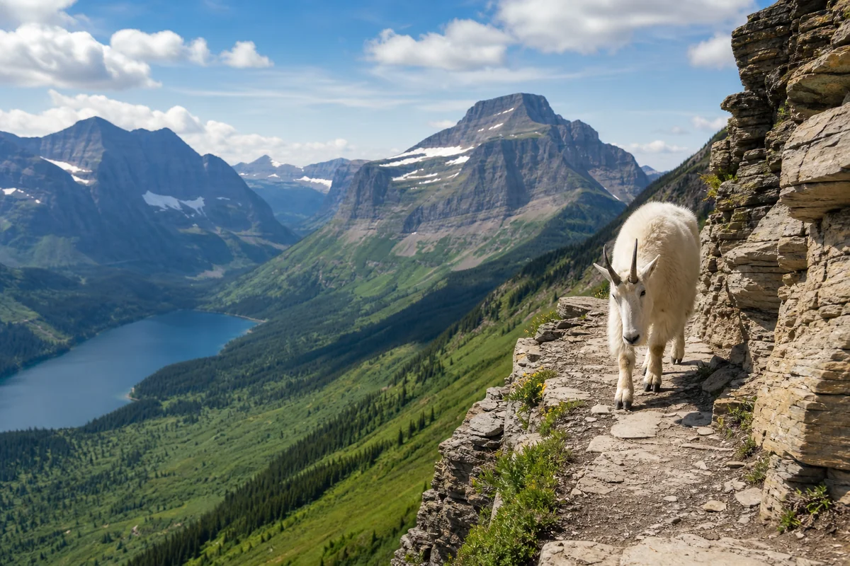
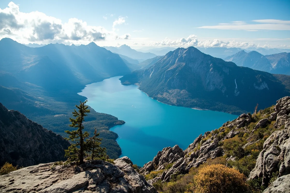
Standing at the Highline Trail’s edge last July, watching a mountain goat casually stroll past me on a ledge barely wider than my hiking boots, I realized Glacier National Park isn’t just another hiking destination — it’s a place where every trail feels like stepping into a living postcard.
After spending countless summers exploring these mountains, I’m still discovering new reasons to lace up my boots and head back. And if you ask me, hiking Glacier is the crown jewel of everything Montana has to offer outdoors — though if you want the full picture, I’ve ranked my 47 best outdoor adventures across the state that are well worth adding around your Glacier trip.
- Glacier National Park offers 700+ miles of trails ranging from easy boardwalks to strenuous summit climbs
- Best time to hike: mid-July through September when most trails are snow-free
- Vehicle reservations required for Going-to-the-Sun Road (May 24–September 8, 2025)
- Top picks for beginners: Trail of the Cedars, Avalanche Lake, Hidden Lake Overlook
- Must-do for experienced hikers: Highline Trail, Grinnell Glacier, Iceberg Lake
- Start early (before 7 AM) to avoid crowds and afternoon thunderstorms
What Makes Glacier’s Trails So Special
I’ve hiked in national parks across the country, but Glacier consistently delivers something the others can’t match—raw, untamed wilderness that feels genuinely wild. During my visit last summer, I counted seven grizzly bears in a single day on the Highline Trail. That’s not unusual here.
The park sits at the intersection of three major continental ecosystems, creating biodiversity you won’t find anywhere else in the Lower 48. Alpine wildflowers carpet the meadows from late June through August, and glacial lakes shimmer in impossible shades of turquoise.
But beyond the scenery, what keeps me coming back is the variety. Whether you’re traveling with kids who need a gentle path or you’re training for a thru-hike, Glacier has something that’ll push you just enough while rewarding you beyond measure.
Essential Planning Information
Before I dive into specific trails, let me share what I wish someone had told me before my first Glacier trip. This planning intel will save you headaches.
When to Visit for the Best Hiking
I strongly recommend visiting between mid-July and mid-September. During my early July trip two years ago, the Highline Trail still had significant snow patches that required microspikes. By late July the following year, those same sections were completely clear.
Going-to-the-Sun Road typically opens fully in late June or early July, depending on snowpack. Until it does, you can’t access many of the park’s best trailheads.
September brings fewer crowds and golden larch trees, but some services close after Labor Day. I personally love early September—the light is incredible for photography and the trails feel more peaceful.
Vehicle Reservations and Entry
Here’s something that catches many visitors off guard: you need a vehicle reservation to drive on Going-to-the-Sun Road during peak season. For 2025, reservations are required from May 24 through September 8.
Reservations open in batches on Recreation.gov. Set a reminder because they sell out within minutes of release. I’ve learned to have multiple browser tabs open and my payment information pre-saved.
Alternatively, you can enter before 6 AM or after 3 PM without a reservation—that’s actually my preferred strategy.
Trail Conditions and Safety
Always check current trail conditions at the park’s official website or visitor centers before heading out. Last summer, the Iceberg Lake Trail had a temporary closure due to bear activity, which changed my entire itinerary.
Carry bear spray and know how to use it. I keep mine in a hip holster, not buried in my pack. During my hikes, I’ve had three close-enough-for-comfort grizzly encounters—proper bear spray positioning isn’t optional here.
| Essential Gear | Why You Need It |
|---|---|
| Bear Spray | Required for all backcountry hiking; rent at park stores if needed |
| Layers | Temps can drop 30°F between trailhead and summit |
| Rain Gear | Afternoon storms roll in quickly, even on clear mornings |
| Microspikes | Essential for early-season hiking on high-elevation trails |
| Extra Water + Filter | Many trails lack water sources; streams require filtering |
Easy Hikes (Perfect for Families and Beginners)
Not every memorable hike requires a 2,000-foot elevation gain. Some of my most peaceful moments in Glacier have come on these gentler trails.
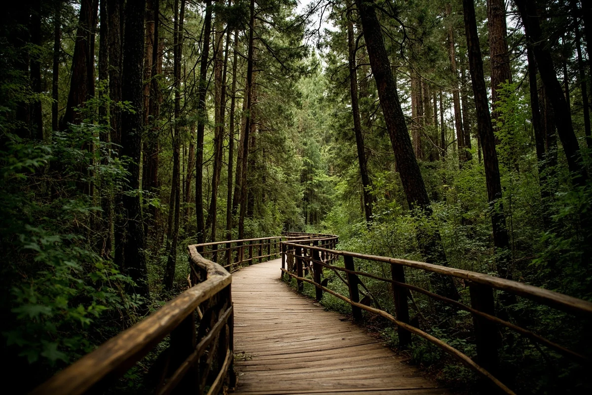
1. Trail of the Cedars
Distance: 0.7 miles (loop) | Elevation Gain: Flat | Difficulty: Easy
This fully accessible boardwalk loop through ancient cedar and hemlock forest is where I always bring first-time visitors. Last August, I watched my 78-year-old father navigate it easily in his wheelchair.
The forest floor stays cool even on hot days, and the interpretive signs explain the fascinating ecology of this old-growth rainforest. I love the moment when you reach the gorge overlook—the turquoise waters of Avalanche Creek cutting through red argillite rock never gets old.
Pro tip: Come early morning when mist rises from the creek. The photography opportunities are stunning, and you’ll likely have the trail to yourself.
2. Running Eagle Falls (Trick Falls)
Distance: 0.6 miles (out and back) | Elevation Gain: Minimal | Difficulty: Easy
Located in the Two Medicine area, this short walk leads to one of Glacier’s most unusual waterfalls. Here’s the “trick”—in early summer when water levels are high, the falls cascade over the top. By late summer, the upper falls disappear, and water only flows through a cave in the cliff face.
I visited twice during the same summer season (early July and late August), and it looked like two completely different waterfalls. If you’re staying in the East Glacier area, this is a must-do quick stop.
3. Johns Lake Loop
Distance: 2.2 miles (loop) | Elevation Gain: 200 feet | Difficulty: Easy
This often-overlooked trail near Lake McDonald Lodge provides a perfect introduction to Glacier’s forest ecosystems. During my September hike here, I had the entire trail to myself—something nearly impossible on the park’s famous routes.
The loop passes through a mix of burned and unburned forest, showing you how fire shapes these landscapes. Keep your eyes open for deer and the occasional moose near the lake’s marshy edges.
4. McDonald Creek Trail
Distance: Variable (up to 6 miles one way) | Elevation Gain: Minimal | Difficulty: Easy
This creekside path is perfect for those who want to stretch their legs without committing to a major hike. I often recommend starting at Lake McDonald Lodge and walking as far as feels right before turning back.
The trail follows the crystal-clear creek, with plenty of spots to rest on the rocky beach. During my last visit, I watched cutthroat trout swimming in pools so clear they looked like they were floating in air.
Moderate Hikes (The Sweet Spot)
These trails require decent fitness but reward you with Glacier’s most iconic scenery.
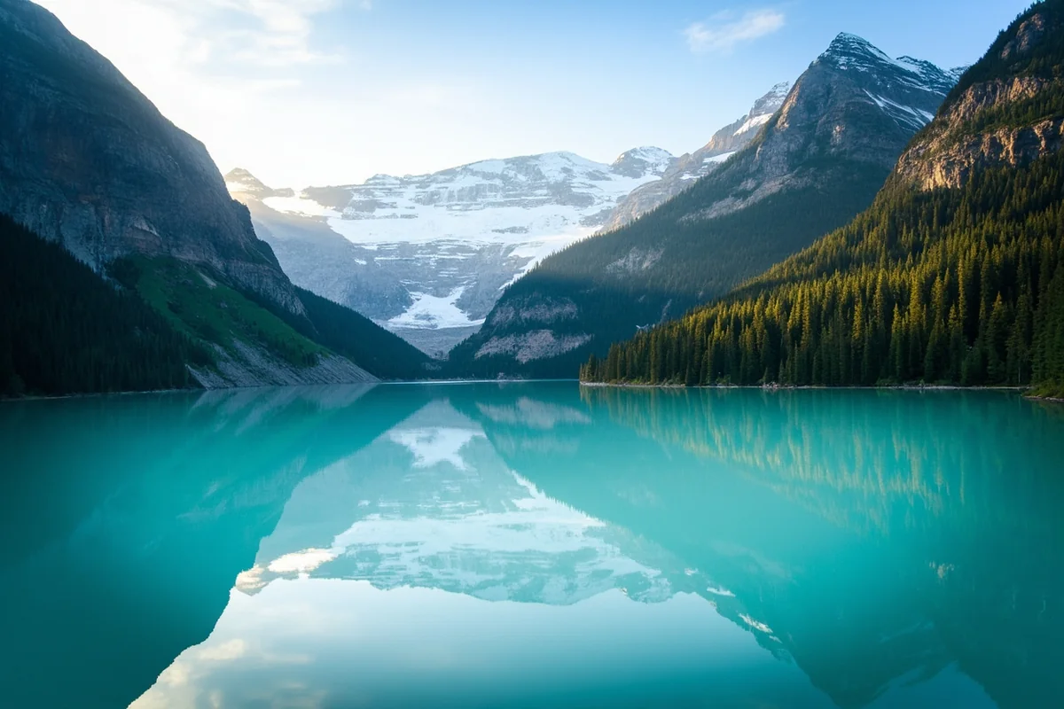
5. Avalanche Lake
Distance: 5.9 miles (out and back) | Elevation Gain: 757 feet | Difficulty: Moderate
If I could only recommend one hike to a Glacier first-timer, this would be it. The trail starts through the Trail of the Cedars, then climbs gradually through dense forest before emerging at a glacially-carved amphitheater.
The lake itself is ridiculously photogenic—waterfalls cascade down the surrounding cliffs, and the water color ranges from deep emerald to bright turquoise depending on the light. During my July visit, I counted five distinct waterfalls feeding the lake.
Fair warning: this is one of the park’s most popular trails. When I started at 6:30 AM, I had relative solitude; by noon on my return, I passed easily 300 people heading up.
6. Hidden Lake Overlook
Distance: 2.7 miles (out and back) | Elevation Gain: 540 feet | Difficulty: Moderate
Starting behind Logan Pass Visitor Center, this trail climbs through alpine meadows to a stunning overlook of Hidden Lake with Bearhat Mountain as the backdrop. I’ve done this hike probably a dozen times, and it never disappoints.
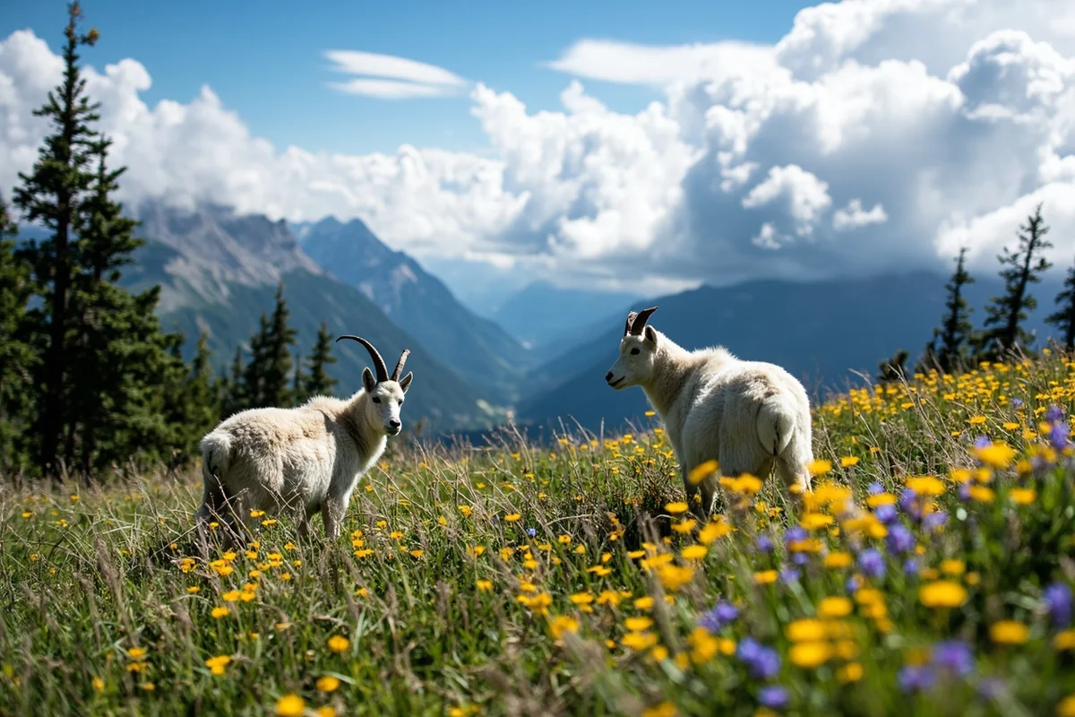
The meadows along this trail are prime mountain goat territory. On a recent trip, I watched a nanny and her kid grazing about 20 feet from the boardwalk, completely unbothered by the hikers. Remember: never approach wildlife, even if they seem docile.
Want to continue to the lake itself? Add another 1.5 miles each way and 765 feet of elevation loss (which means a tough climb back up). The swimming at the lake is brisk—okay, it’s absolutely freezing—but I’ve done it. Worth the bragging rights.
7. St. Mary and Virginia Falls
Distance: 3.6 miles (out and back) | Elevation Gain: 485 feet | Difficulty: Moderate
This two-for-one waterfall hike starts from the St. Mary Falls trailhead. The trail winds through forest with peek-a-boo views of the surrounding peaks before reaching St. Mary Falls at about 0.8 miles.
Most people turn around here, but continuing to Virginia Falls is absolutely worth the extra effort. Virginia Falls is taller and more dramatic, dropping 50 feet into a misty pool. On my last hike, the spray was so intense I had to wipe my camera lens every few seconds.
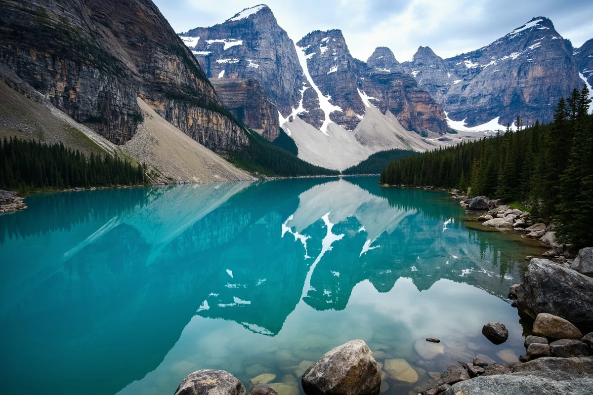
8. Grinnell Lake
Distance: 6.8 miles (out and back) | Elevation Gain: 480 feet | Difficulty: Moderate
Not to be confused with the more famous Grinnell Glacier Trail, this hike takes you to a stunning turquoise lake fed by that very glacier. The milky blue-green color comes from glacial flour—fine sediment suspended in the water.
I recommend taking the boat shuttle across Swiftcurrent Lake and Lake Josephine to shorten the hike by 3.8 miles round trip. The shuttle costs around $30 for adults and runs regularly during peak season.
The view up to Grinnell Glacier from the lakeshore provides a sobering reminder of climate change—the glacier has shrunk dramatically even in the years I’ve been visiting.
9. Iceberg Lake
Distance: 9.7 miles (out and back) | Elevation Gain: 1,275 feet | Difficulty: Moderate to Strenuous
The name says it all. This cirque lake often holds floating icebergs well into August, even as wildflowers bloom along the trail. I rank this among my top five hikes in North America.
The trail begins at Iceberg/Ptarmigan trailhead near Swiftcurrent Motor Inn and climbs steadily through subalpine forest before opening into spectacular alpine meadows. Keep your eyes peeled—I’ve seen more grizzly bears on this trail than anywhere else in the park.
The lake itself sits in a dramatic bowl surrounded by 3,000-foot cliffs. Sitting on the shore watching icebergs drift in the wind is a memory that stays with you. Fair warning though: swimming here requires a particular kind of crazy (I’ve seen it done; I’ve declined to participate).
Strenuous Hikes (For Experienced Adventurers)
These trails demand fitness and preparation but deliver Glacier’s most unforgettable experiences.
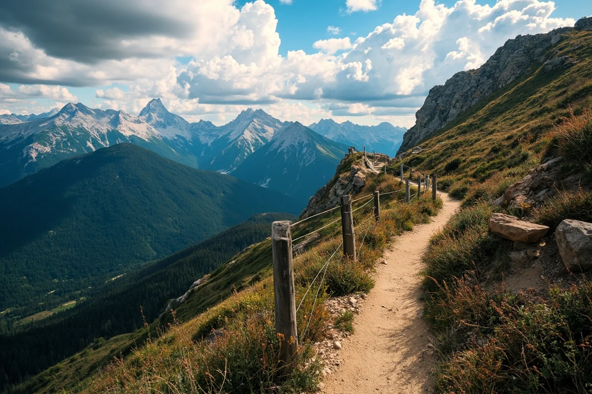
10. Highline Trail to Granite Park Chalet
Distance: 15.2 miles (point to point) | Elevation Gain: 800 feet up, 2,200 feet down | Difficulty: Strenuous
This is it—the crown jewel of Glacier hiking. The trail follows the Continental Divide with jaw-dropping views for nearly the entire route. On clear days, you can see all the way to Canada.
I’ve done this hike four times now, and I notice something new each time. The trail starts at Logan Pass and immediately traverses a cliff face (there’s a cable to hold, but if you’re scared of heights, this section might be challenging). After that exposure, the trail levels out into the famous Garden Wall traverse.
The wildflowers in late July are unreal—beargrass, paintbrush, glacier lilies carpeting the meadows. Mountain goats are practically guaranteed.
Plan for this to be an all-day adventure. I typically start at 6 AM and finish around 3 PM. You can either turn around at the Granite Park Chalet (7.6 miles each way) or arrange a shuttle and descend via The Loop trail.
11. Grinnell Glacier
Distance: 10.6 miles (out and back) | Elevation Gain: 1,840 feet | Difficulty: Strenuous
Hiking to an actual glacier—how many places can you do that? This trail climbs from the Many Glacier Valley to the base of Grinnell Glacier, one of the park’s most accessible (and rapidly shrinking) glaciers.
I recommend taking the boat shuttle to cut off 3.8 miles. From the boat dock at Lake Josephine, the trail climbs steadily through increasingly spectacular terrain. You’ll pass several waterfalls and overlooks before reaching the glacier’s terminal lake.
When I first hiked this trail in 2015, the glacier extended nearly to the water’s edge. On my most recent trip, it had retreated significantly—a stark visual reminder of what we’re losing. Scientists estimate the park’s glaciers will be gone by 2030.
12. Siyeh Pass
Distance: 10.3 miles (point to point) | Elevation Gain: 2,240 feet | Difficulty: Strenuous
If you want solitude with your spectacular views, Siyeh Pass delivers. This trail sees far fewer hikers than the Highline despite being equally stunning.
The route crosses Siyeh Pass at 8,080 feet, offering panoramic views of Sexton Glacier and the surrounding peaks. The descent through Preston Park’s wildflower meadows is particularly memorable in late July.
Last summer, I timed my hike to start from Siyeh Bend trailhead, which requires a short car shuttle but makes the overall hike more manageable. The final descent to Sunrift Gorge is steep but beautiful.
13. Dawson-Pitamakan Loop
Distance: 19 miles (loop) | Elevation Gain: 2,935 feet | Difficulty: Very Strenuous
This is my recommendation for experienced hikers looking to escape the crowds. The loop passes through Two Medicine area’s most dramatic terrain, crossing two high passes with virtually guaranteed solitude.
I backpacked this route over two days last August, camping at No Name Lake. The sunset light on the surrounding peaks was worth every ounce of my pack weight. If you’re fit enough, strong hikers complete it as a long day hike.
The trail’s remote nature means you’re more likely to encounter bears, so travel in groups and make noise. I saw grizzly tracks at multiple stream crossings during my hike.
14. Ptarmigan Tunnel
Distance: 10.2 miles (out and back) | Elevation Gain: 2,290 feet | Difficulty: Strenuous
This unique trail leads to a 183-foot tunnel blasted through the mountain by the Civilian Conservation Corps in 1931. Walking through that dark tunnel and emerging to views of the remote Belly River Valley is genuinely magical.
The hike shares the first section with Iceberg Lake before climbing steeply to the tunnel. On a clear day, you can see all the way to the Canadian Rockies from the tunnel exit.
Pro tip: The tunnel typically opens in late June or early July, depending on snow conditions. Check at the ranger station before committing to this hike.
Off-the-Beaten-Path Gems
After years of exploring Glacier, I’ve discovered some quieter trails that deserve more attention.
15. Apikuni Falls
Distance: 2 miles (out and back) | Elevation Gain: 640 feet | Difficulty: Moderate
This short but steep trail rewards you with one of the park’s tallest waterfalls. I stumbled upon this trail when the Iceberg Lake trailhead was overflowing, and I’ve been grateful for the discovery ever since.
The trail climbs quickly through wildflower meadows before reaching the falls’ viewing area. It’s best in early summer when snowmelt feeds the waterfall at full volume.
16. Scenic Point
Distance: 6.4 miles (out and back) | Elevation Gain: 2,350 feet | Difficulty: Strenuous
Located in the Two Medicine area, this challenging climb rewards you with panoramic views of the plains to the east and the Two Medicine Valley to the west. I’ve watched storms roll across the prairie from this vantage point—nature’s entertainment at its finest.
Start early because the exposed sections get hot by midday. The final push to the summit requires some light scrambling but nothing technical.
My Honest Recommendations Based on Your Situation
After years of guiding friends and family through Glacier, I’ve developed a quick assessment for recommending trails:
If you’re visiting for one day with limited hiking experience: Trail of the Cedars plus Avalanche Lake. You’ll see old-growth forest, a gorgeous lake, and multiple waterfalls—Glacier’s greatest hits in under six miles.
If you’re in good shape but not a regular hiker: Hidden Lake Overlook in the morning (for mountain goats), then St. Mary and Virginia Falls in the afternoon.
If you’re fit and want the iconic Glacier experience: Highline Trail to Granite Park Chalet, no question. Arrange a shuttle so you can complete the full point-to-point hike.
If you want solitude: Head to Two Medicine or Many Glacier early season. The Dawson-Pitamakan Loop sees a fraction of the visitors compared to Going-to-the-Sun Road trails.
If you’re traveling with kids under 10: Trail of the Cedars, Running Eagle Falls, and Hidden Lake Overlook (to the overlook only, not down to the lake). All offer big rewards for moderate effort.
Final Thoughts From the Trail
Glacier National Park has given me some of the most profound moments I’ve experienced in nature. Standing on the Highline Trail as morning mist rose from the valleys below. Watching a grizzly bear dig for roots in a distant meadow. Swimming (briefly!) in Hidden Lake’s glacial waters.
These trails offer something increasingly rare in our crowded world: genuine wildness. The glaciers that give this park its name won’t last forever, and neither will the chance to experience this landscape in its current form.
Whatever trail you choose, take your time. Put away your phone occasionally. Let the mountains work their particular magic on you.
I’ll see you on the trail.
Frequently Asked Questions
What is the best time of year to hike in Glacier National Park?
The best time to hike Glacier National Park is mid-July through mid-September when most trails are snow-free and the Going-to-the-Sun Road is fully open. I recommend visiting in early September for fewer crowds and stunning fall colors, though some high-elevation trails may close earlier due to early snowfall.
Do I need a permit to hike in Glacier National Park?
Day hikers don’t need a permit for most trails in Glacier National Park, but you will need a vehicle reservation ($2) to enter the park during peak season (late May through early September). If you’re planning overnight backpacking trips, you’ll need a wilderness camping permit, which costs $7 per person per night.
What are the easiest hikes in Glacier National Park for beginners?
The Trail of the Cedars is a flat, wheelchair-accessible 1-mile boardwalk loop perfect for beginners and families. Other easy Glacier hikes include Hidden Lake Overlook (5.4 miles round trip with gradual elevation gain) and Running Eagle Falls, a quick 0.6-mile out-and-back trail to a stunning waterfall.
How long does it take to hike the Highline Trail in Glacier?
The Highline Trail takes most hikers 4-6 hours to complete the 11.8-mile point-to-point route from Logan Pass to The Loop. If you add the detour to Grinnell Glacier Overlook, expect an additional 1.5 hours, and you’ll need to arrange a shuttle or second vehicle since it’s not a loop trail.
Are there grizzly bears on Glacier National Park hiking trails?
Yes, Glacier National Park has one of the highest concentrations of grizzly bears in the lower 48 states, and encounters on trails are possible. I always carry bear spray (available for rent at park entrances for around $10/day), hike in groups, make noise on the trail, and stay alert, especially near berry patches and streams.
What should I bring on a day hike in Glacier National Park?
Essential items for Glacier day hikes include bear spray, at least 2 liters of water per person, layered clothing (weather changes fast in the mountains), sturdy hiking boots with ankle support, and a packed lunch. I also recommend bringing a rain jacket, sunscreen, a trail map, and trekking poles for steep descents like Grinnell Glacier Trail.
Which Glacier National Park hikes have the best views of glaciers?
The Grinnell Glacier Trail (10.6 miles round trip) offers the most iconic glacier views in the park and lets you get up close to one of the remaining glaciers. Iceberg Lake Trail (9.6 miles) and the Highline Trail to Grinnell Glacier Overlook also provide spectacular views of glacial formations and turquoise alpine lakes.