The first time I drove the Beartooth Highway into Custer Gallatin National Forest, I pulled over at an overlook at roughly 10,000 feet and just stood there in the wind, speechless.
I had been to Yellowstone twice before. I had hiked Glacier. But this — the sheer unbroken expanse of it, the alpine tundra stretching farther than I could see in any direction — this was something different. Something wilder.
Montana’s national forests don’t get the postcards. They don’t show up on the license plates. But they cover nearly 17 million acres of this state, and if you know where to look, they hold experiences that rival anything the national parks can offer — with a fraction of the crowd and, in most cases, zero entry fee.
- Montana is home to 7 active national forests managed by the USFS, covering approximately 16.9 million acres — about 18% of the state’s total land area.
- Each forest has a distinct personality, from the Flathead’s Bob Marshall Wilderness to the Custer Gallatin’s Beartooth Plateau to the Kootenai’s ancient cedar groves.
- General access is free. The America the Beautiful Pass covers developed campground fees.
- Dispersed camping (free, no reservation) is allowed in most national forest land — one of Montana’s best-kept secrets.
- This guide covers every forest, key activities, seasonal access, permits, wildlife, and the insider tips I’ve gathered across years of exploring these lands.
Why Montana’s National Forests Deserve Your Attention
Most first-time visitors to Montana build their itinerary around the national parks — Glacier to the north, Yellowstone to the south. And look, I get it. Both are magnificent.
But here’s something the tourism brochures rarely say out loud: Glacier National Park covers 1.01 million acres. Flathead National Forest — which wraps around three sides of Glacier — covers 2.4 million acres.
The Bob Marshall Wilderness Complex alone, spread across Flathead and Helena-Lewis and Clark National Forest, encompasses over 1.5 million roadless acres.
The national parks are the jewels. The national forests are the crown.
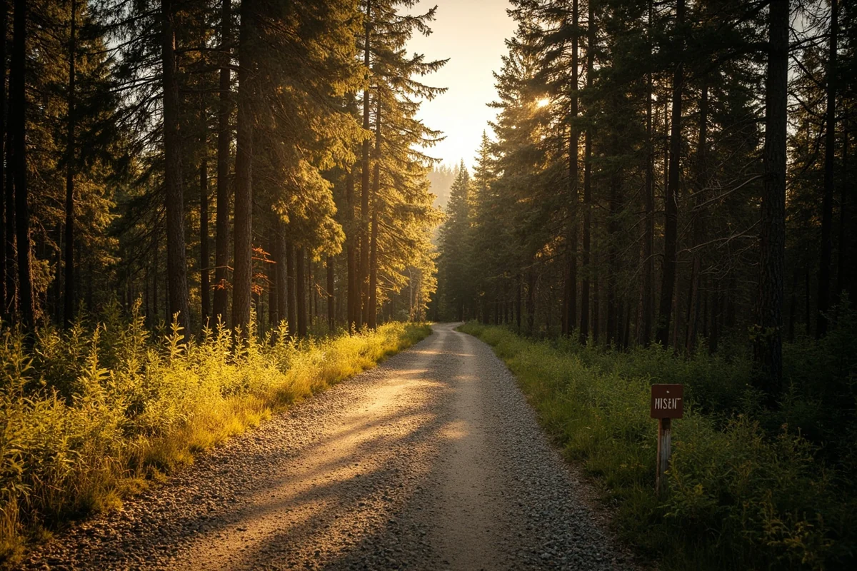
Beyond sheer scale, what sets Montana’s national forests apart is access. You can drive a forest service road to a trailhead, park for free, hike to a backcountry lake, and camp on its shore for as many nights as you want, at no cost beyond what you bring with you. Try that in Glacier during July.
I’ve spent a lot of time in both environments. My take: the national parks are where you go to see Montana’s greatest hits. The national forests are where you go to actually experience Montana.
The Real Count: How Many National Forests Does Montana Have?
You’ll see different numbers thrown around — some sources say 10, some say 12. The accurate answer as of 2026 is 7 active national forests administered by the USFS Northern Region (Region 1) in Montana. Here’s where the confusion comes from:
- Helena and Lewis and Clark National Forests merged in 2012 to form the Helena-Lewis and Clark National Forest. Many older sources still list them separately.
- The Kaniksu National Forest was absorbed into the Idaho Panhandle National Forests in 1973 and no longer exists as a standalone unit.
- The Gallatin Petrified Forest is a remarkable geological area within the Custer Gallatin National Forest, not a separate forest.
- The Yaak Valley is a drainage within the Kootenai National Forest, not its own administrative unit.
The 7 current national forests in Montana:
| Forest | Acreage | Primary Location |
|---|---|---|
| Beaverhead-Deerlodge | ~3.35 million acres | SW Montana (8 counties) |
| Bitterroot | ~1.6 million acres | SW Montana / W Idaho border |
| Custer Gallatin | ~3.0 million acres | SE Montana / NW South Dakota |
| Flathead | ~2.4 million acres | NW Montana |
| Helena-Lewis and Clark | ~2.9 million acres | Central Montana |
| Kootenai | ~2.2 million acres | Far NW Montana / NE Idaho |
| Lolo | ~2.0 million acres | W-central Montana |
Combined, these forests cover approximately 16.9 million acres — about the size of West Virginia and Connecticut put together.
Montana’s 7 National Forests, Up Close
Beaverhead-Deerlodge National Forest
Montana’s largest national forest stretches across eight counties in southwest Montana, and it’s also one of the least-visited despite its size.
That’s partly geography — it doesn’t have the dramatic topography of the Flathead or the fame of the Custer Gallatin — and partly because it’s spread across a patchwork of public and private land rather than one continuous block.
But that sprawl means solitude. I’ve camped in Beaverhead-Deerlodge campgrounds in mid-July without seeing another soul.
The Pioneer Mountains Scenic Byway is one of the most underrated drives in the state — 30 miles of paved and gravel road through high mountain rangelands, past the hot springs at Elkhorn and through tiny Wisdom, with the kind of big-open views that used to stop Lewis and Clark in their tracks.
The forest also contains the Anaconda-Pintler Wilderness and portions of the Lee Metcalf Wilderness, plus the Continental Divide Trail cuts through its heart.
Anglers chase native cutthroat and Arctic Grayling in the headwaters streams — species that are increasingly rare in the lower 48. The Big Hole River, which borders part of the forest, is one of Montana’s most celebrated blue-ribbon trout fisheries.
- Signature experience: Drive the Pioneer Mountains Scenic Byway, then camp at one of the forest’s 50+ campgrounds — many are free or under $15/night.
- Nearest gateway towns: Dillon, Butte, Anaconda, Ennis, Wisdom
- USFS office: Butte — (406) 683-3900
→ Complete Beaverhead-Deerlodge National Forest guide
Bitterroot National Forest
The Bitterroot has a personality that I can only describe as bold. The mountains on the Idaho side of this forest rise so steeply from the valley floor that the canyons look like they were cleaved open with an axe.
Trapper Peak, the highest point in the Bitterroot Range at 10,157 feet, dominates the southern skyline so completely that on clear days I’ve spotted it from 40 miles away driving south on Highway 93.
Half of the Bitterroot National Forest’s 1.6 million acres is dedicated to wilderness — a fact that surprises most visitors.
The Selway-Bitterroot Wilderness (which the Bitterroot shares with Idaho’s Nez Perce-Clearwater National Forest) is the fourth-largest wilderness area in the lower 48.
On the east side of the valley, the gentler Sapphire Mountains offer a completely different experience — rolling ridgelines, meadow hiking, and the occasional creek-bottom that holds wild brook trout.
I did a solo backpacking loop in the Selway-Bitterroot one September that I still think about regularly. Three days, two river crossings, and not another person after the first mile. If you want a true Montana backcountry experience within a few hours of Missoula, this is your forest.
- Signature experience: Hike into the Selway-Bitterroot Wilderness from one of the west-side canyon trailheads (Blodgett Canyon is spectacular and accessible).
- Nearest gateway towns: Hamilton, Darby, Stevensville
- USFS office: Hamilton — (406) 363-7100
→ Complete Bitterroot National Forest guide
Custer Gallatin National Forest
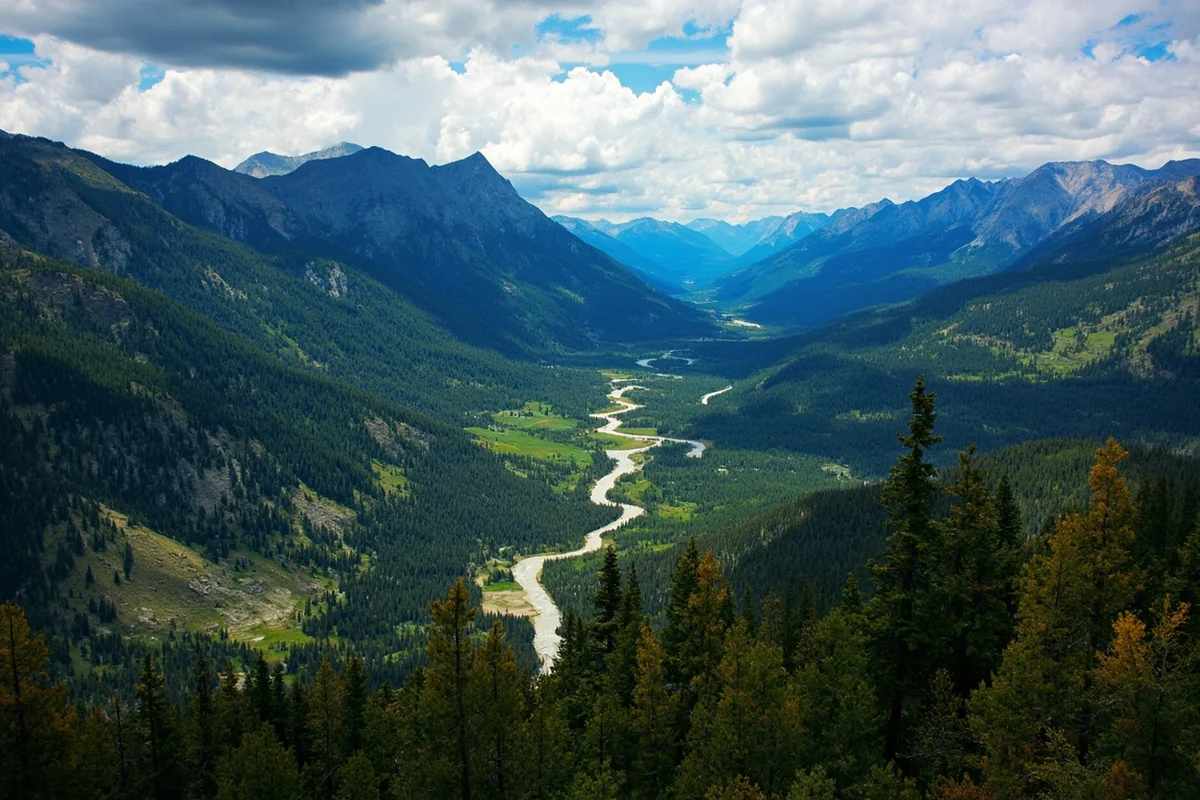
If I had to pick one Montana national forest for someone who’s never been to the state, it would be the Custer Gallatin. Not because it’s the “best” — that depends entirely on what you’re after — but because it contains more sheer variety than any other forest in the Northern Rockies.
At over 3 million acres, it stretches 500 miles from its western boundary near West Yellowstone to the buttes of northwestern South Dakota.
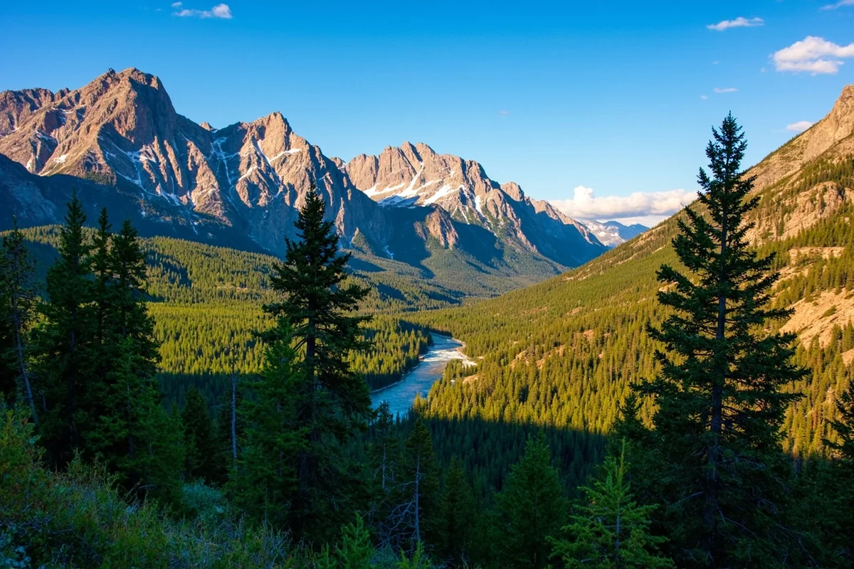
Within that span you’ll find: Granite Peak (12,799 feet, the highest point in Montana), the Absaroka-Beartooth Wilderness, three Yellowstone National Park gateway communities, the Beartooth Scenic Byway, world-class ski terrain at Bridger Bowl, the Hyalite Canyon recreation area just south of Bozeman, and critical habitat for every major large mammal in the Greater Yellowstone Ecosystem — grizzly bears, gray wolves, wolverines, lynx.
The Gallatin Range section (just south of Bozeman) gets heavy weekend traffic because of its proximity to the city, but push 20 miles east into the Absaroka Range and you enter country where I’ve spotted more grizzly tracks than boot prints on the trail.
- Signature experience: Drive the Beartooth Scenic Byway (US-212) between Red Lodge and Cooke City — widely considered one of the most stunning drives in North America.
- Nearest gateway towns: Bozeman, Red Lodge, Livingston, Cooke City, West Yellowstone
- USFS office: Bozeman — (406) 587-6701 / Billings — (406) 255-1400
→ Complete Custer Gallatin National Forest guide
Flathead National Forest
Flathead National Forest sits in the northwest corner of Montana, south of Glacier National Park, and it’s where I go when I want to feel genuinely small.
The 2.4-million-acre forest includes three Congressionally designated wilderness areas — the Bob Marshall, Great Bear, and Mission Mountains Wildernesses — which together make up roughly 46% of the forest’s land base.
The “Bob,” as Montanans call it, is one of the largest roadless areas in the contiguous United States at over one million acres.
Getting into the Bob requires commitment. The trailheads are often 20+ miles of forest road from pavement, and once you’re in, the nearest ranger station might be a two-day ride by horse.
I’ve been into the Bob twice — once via the Spotted Bear Ranger District on the south end, once via the South Fork of the Flathead on a three-day float. Both times I felt a profound sense of wildness that I haven’t found anywhere else in my travels.
Beyond the wilderness, the Flathead holds Jewel Basin Hiking Area (a 15,000-acre zone exclusive to foot travel, no horses or bikes — genuinely quiet), over 2,600 miles of trails, the wild and scenic South Fork of the Flathead River, and road-accessible gems like Hungry Horse Reservoir.
The forest also provides the backdrop to Whitefish Mountain Resort, with 157 miles of groomed snowmobile trails in winter.
- Signature experience: Access the Bob Marshall Wilderness via the Benchmark or Spotted Bear trailheads for a multi-day backcountry trip.
- Nearest gateway towns: Kalispell, Whitefish, Columbia Falls, Hungry Horse
- USFS office: Kalispell — (406) 758-5204
→ Complete Flathead National Forest guide
Helena-Lewis and Clark National Forest
This is the forest I know best because I’ve spent the most time driving through it without realizing it.
The Helena-Lewis and Clark wraps around Montana’s capital city and sprawls north into the Rocky Mountain Front — a dramatic transition zone where the Rockies abruptly meet the Great Plains in a wall of limestone reefs and overthrust ridges.
The two component forests merged in 2012 but still feel like distinct places. The Helena portion (about 976,000 acres) centers on the Big Belt, Elkhorn, and Scratchgravel Mountains.
The Lewis and Clark portion (about 1.8 million acres) covers the central Montana mountains and the Northern Rocky Mountain Front — one of the most important wildlife corridors in North America, providing critical movement habitat for grizzly bears expanding eastward from their mountain refugia.
The Sun River Wildlife Management Area, adjacent to the Lewis and Clark forest on the Rocky Mountain Front, is one of the best places in the state to see elk — herds of several hundred animals congregate there in late fall.
Augusta is the gateway town, and I’ve spent more than one Thanksgiving weekend there watching elk move through draws that haven’t changed since the Blackfeet Tribe hunted them.
- Signature experience: Drive the Rocky Mountain Front north from Augusta toward Choteau — pull over at any signed wildlife viewing area in late October/November for elk, golden eagles, and occasional grizzly sightings.
- Nearest gateway towns: Helena, Great Falls, Augusta, White Sulphur Springs
- USFS office: Helena — (406) 449-5490 / Great Falls (Lewis and Clark) — (406) 791-7700
→ Complete Helena-Lewis and Clark National Forest guide
Kootenai National Forest

The Kootenai sits in the far northwestern corner of Montana, tucked between the Idaho panhandle and the Canadian border, and it feels more like the Pacific Northwest than the Rocky Mountain West.
The modified maritime climate here — wetter than anywhere else in Montana — supports 15 species of conifers and a forest canopy so dense that I’ve hiked in it during rain without getting soaked.
The signature attraction is Ross Creek Cedar Grove, a stand of western red cedars some of which are over 500 years old and 8 feet in diameter.
I walked through it on a drizzly October morning with nobody else on the boardwalk trail. The scale of these trees is something you have to see in person — photographs don’t capture the way they make you feel compressed and protected simultaneously.
The forest also holds the Cabinet Mountains Wilderness, over 100 lakes, the Ten Lakes Scenic Area, and the mighty Kootenai River — a major Clark Fork tributary that carves through the forest on its way to Idaho.
Libby Dam on the Kootenai is one of the largest hydropower dams in the Northwest, and the reservoir it creates (Lake Koocanusa) stretches 90 miles north into Canada. Fishing, camping, and kayaking on Koocanusa can easily fill a week.
- Signature experience: Walk the Ross Creek Cedar Grove boardwalk trail, then drive up to the Ten Lakes Scenic Area for alpine lake hiking above 6,000 feet.
- Nearest gateway towns: Libby, Troy, Eureka
- USFS office: Libby — (406) 293-6211
→ Complete Kootenai National Forest guide — including the Yaak Valley
Lolo National Forest
The Lolo is the most accessible national forest in Montana if you’re based in Missoula, which means it’s the one I’ve visited most often in my years of living in western Montana.
The forest wraps around the Clark Fork River corridor from the Idaho border east through Missoula to the Blackfoot River drainage — a landscape that Norman Maclean made famous in A River Runs Through It.
But the Lolo is far more than Missoula’s backyard. It encompasses 2 million acres across a high-diversity landscape that ranges from Ponderosa pine savannas at low elevation to high alpine peaks along the Continental Divide.
The four wilderness areas within the Lolo — Rattlesnake, Welcome Creek, Scapegoat (partial), and Selway-Bitterroot (partial) — offer everything from afternoon hikes to week-long expeditions.
Seeley Lake, located within the Lolo’s Swan Valley ranger district, is a year-round destination that families often overlook.
The lake system there — Seeley, Alva, Inez, Rainy — is connected by the Swan River and surrounded by forest roads that lead to easily accessible dispersed campsites.
In summer it’s kayaking and paddleboarding; in winter it’s snowmobiling on groomed trail systems that are some of the best in western Montana.
I should also mention Lolo Hot Springs, which sits right on the edge of the forest along Highway 12. After a long day of hiking or cross-country skiing in the Lolo backcountry, it’s the kind of soak you plan your whole trip around.
- Signature experience: Paddleboard the Seeley Lake chain in July, then catch sunset from the dock while the mountains go pink on both sides.
- Nearest gateway towns: Missoula, Seeley Lake, Superior, Thompson Falls
- USFS office: Missoula — (406) 329-3750
→ Complete Lolo National Forest guide
What You Can Do in Montana’s National Forests
Hiking and Backpacking
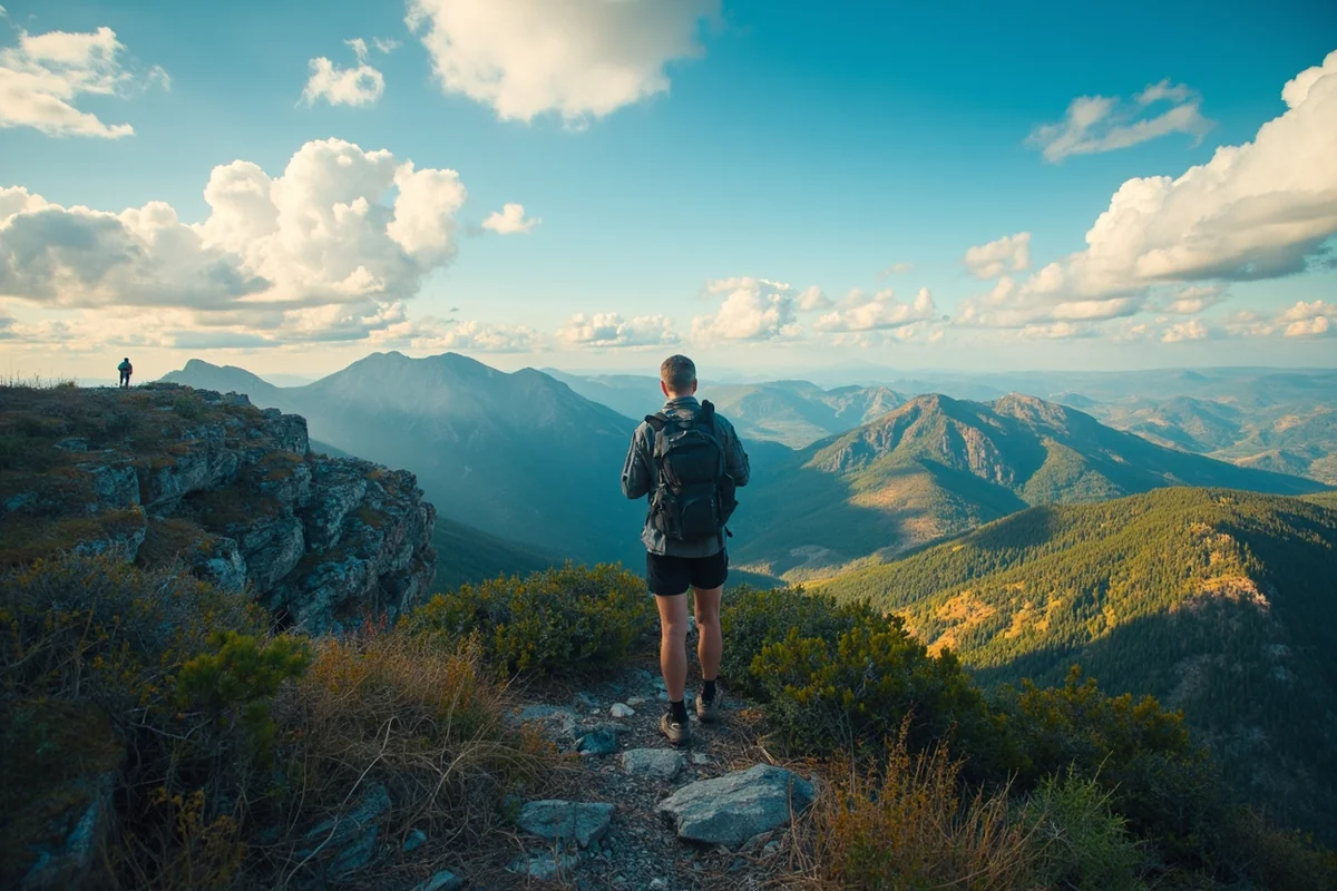
The seven national forests combined hold thousands of miles of trails — a number so large that even lifelong Montana residents haven’t scratched the surface. A few that I keep coming back to:
- Blodgett Canyon Trail (Bitterroot NF) — 9 miles one-way into a sheer-walled granite canyon. A thunderstorm halfway in was one of the most dramatic experiences I’ve had on a trail.
- Jewel Basin Loop (Flathead NF) — 15,000 acres of hiker-only terrain with 35 named lakes. I did a two-night loop in early September with near-perfect conditions.
- Hyalite Canyon trails (Custer Gallatin NF) — Multiple trailheads accessible from Bozeman, including the family-friendly Palisade Falls Trail (0.5 miles, paved) and the more demanding Hyalite Lake Trail (8 miles round-trip).
- Rattlesnake Wilderness (Lolo NF) — 20 minutes from downtown Missoula. I’ve been on trails here at 7 a.m. on a Wednesday and had them to myself.
- Rocky Mountain Front trails (Helena-Lewis and Clark NF) — The Sun River Canyon and Teton Canyon areas offer dramatic scenery without the crowds of more famous trailheads.
One note on the Bob Marshall Wilderness: trails here are long and remote. Plan for at minimum a 3-day commitment. Many people go in on horseback or with a licensed outfitter.
If you’re going on foot, study topo maps, bring a satellite communicator, and tell someone exactly where you’re going.
Fishing
Montana’s national forests are threaded with blue-ribbon trout streams, and the best of them are accessible to anyone willing to hike a mile or two from the trailhead. The general rule: the farther you walk from the road, the better the fishing and the fewer people you’ll encounter.
- Beaverhead-Deerlodge: The Big Hole River and its tributaries hold Arctic Grayling — one of the only populations left in the lower 48 outside Yellowstone.
- Bitterroot NF: The Bitterroot River and its west-side canyon streams hold brown trout, westslope cutthroat, and brook trout.
- Custer Gallatin NF: The Gallatin River south of Bozeman (made famous in the film A River Runs Through It) runs through national forest land. The Stillwater River on the east side is underrated.
- Flathead NF: The South Fork of the Flathead River inside the Bob Marshall Wilderness holds cutthroat trout that have never seen a hatchery.
- Lolo NF: The Blackfoot, Clark Fork, and Rock Creek all flow through Lolo territory. Rock Creek in particular is a legendary fishery with minimal road pressure once you’re past the first few miles.
A Montana fishing license is required for all fishing in national forests. A non-resident license [verify current fee with Montana FWP] is available at most sporting goods stores and online.
Wildlife Viewing
Montana’s national forests support the full suite of Rocky Mountain megafauna: grizzly bears, black bears, gray wolves, mountain lions, elk, moose, bighorn sheep, mountain goats, wolverines, lynx, and more. Here’s where I’ve had my best wildlife encounters:
- Grizzly bears: The Rocky Mountain Front (Helena-Lewis and Clark NF) and the Custer Gallatin’s Absaroka Range are the places I watch most carefully. I’ve had close encounters in both.
- Wolves: The Bitterroot NF and Lolo NF both have established wolf populations. Early morning along river bottoms in May gives the best odds.
- Elk: The Starr-Jenkins area of the Lewis and Clark NF near Augusta is where I go when I want to see large herds. Fall is the obvious choice, but I’ve seen 200-animal groups there in early winter.
- Moose: The Seeley-Swan Valley (Lolo and Flathead NFs) and the Kootenai’s wetter drainages are reliable moose habitat. Dawn in September around willowy creek bottoms is the formula.
- Mountain Goats: Visible from the Beartooth Scenic Byway in the Custer Gallatin NF and from many Flathead NF ridgeline trails.
Always carry bear spray and know how to use it. This is not optional in western Montana.
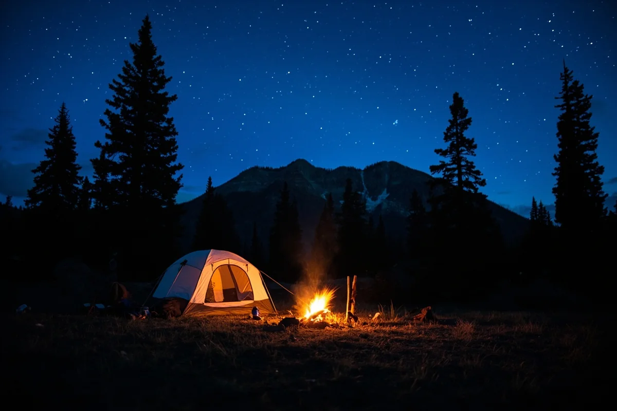
Camping: Developed Sites and Dispersed Camping
This is where Montana’s national forests truly shine compared to the national parks.
Developed campgrounds are scattered throughout all seven forests, ranging from primitive sites (pit toilet, no water, free) to fully developed sites with flush toilets, water, and reservation systems through Recreation.gov. Costs typically range from free to about $20-$25/night at developed sites. The Custer Gallatin NF alone operates 59 campgrounds across its ranger districts.
Dispersed camping — camping on undeveloped national forest land outside designated campgrounds — is allowed on most national forest land in Montana with some straightforward rules:
– Camp at least 200 feet from streams, lakes, and trails
– No stay longer than 14 consecutive days in one spot
– Pack out all trash and human waste
– No campfires during fire restrictions (check current restrictions before every trip)
– Some areas have specific closures — always check with the local ranger district before heading out
This is free camping with real privacy, available across millions of acres. It’s one of the best secrets in American travel and the reason I always build national forest nights into any Montana road trip.
Pro tip: Get a Motor Vehicle Use Map (MVUM) for any national forest before you drive forest roads to dispersed camping spots. These are available free at ranger district offices or as downloadable PDFs on the USFS website. They show which roads are open to vehicles and which are foot or horse traffic only.
Winter Recreation
Montana’s national forests are just as wild in winter, and far less visited. A few highlights:
- Snowmobiling: The Lolo, Flathead, and Kootenai NFs all have extensive groomed snowmobile trail systems. The Seeley Lake area in the Lolo is considered among the best in the Northwest.
- Cross-country and Nordic skiing: The Bitterroot NF’s Lake Como area, the Lolo’s Pattee Canyon area near Missoula, and the Custer Gallatin’s Hyalite Canyon all have accessible Nordic skiing and snowshoeing.
- Ski resorts within national forests: Bridger Bowl (Custer Gallatin NF, near Bozeman) and Whitefish Mountain Resort (Flathead NF) both sit on national forest land. Both are worth the trip.
- Cabin rentals: The USFS rents historic lookout towers and backcountry cabins within national forests through Recreation.gov. The Kootenai’s Yaak River Ranger District has particularly atmospheric options.
Permits, Passes, and Practical Planning
America the Beautiful Pass
A $90 annual America the Beautiful Pass covers entrance fees to all national parks and recreation fees at national forest campgrounds and day-use areas. If you’re spending more than a few days in Montana’s public lands, it pays for itself on the second or third camping night.
Seniors 62+ can buy a lifetime pass [verify current pricing] — one of the best deals in outdoor recreation anywhere.
The pass does not cover cabins, some specialized concession-run facilities, or Montana state park fees. General access to national forest land (driving on forest roads, dispersed camping) is always free regardless.
Recreation.gov Reservations
Developed campgrounds in Montana’s national forests — especially around Bozeman, Missoula, Whitefish, and the Beartooth Scenic Byway — book fast in summer.
I’ve made the mistake of showing up without a reservation on a Friday in July and spending two hours driving between full campgrounds. Book developed sites through Recreation.gov as early as the booking window opens (typically 6 months in advance for peak-season sites).
Wilderness permits are not currently required in most Montana wilderness areas, but group size limits apply (usually 12 people/stock in most wilderness areas; check the specific wilderness for current rules).
Maps and Navigation
Cell service is unreliable — often nonexistent — across most national forest land in Montana. Do not count on Google Maps or your phone for navigation.
Before any national forest trip, I carry:
- A printed or downloaded Motor Vehicle Use Map (MVUM) — free from USFS
- A USGS 7.5-minute topo map for any trail longer than a day hike
- A GPS device or offline maps downloaded to a device with a full battery
- A satellite communicator (Garmin inReach or similar) for any remote backcountry trip
Download the FSTopo app or Gaia GPS before you leave cell range.
Fire Season Awareness
Summer fire season in Montana is real and affects national forest access significantly. Fire restrictions — ranging from Stage 1 (no campfires in dispersed sites) to Stage 2 (no campfires period, even in developed campgrounds) to area closures — can change overnight.
Check current restrictions for your specific forest and ranger district at InciWeb (inciweb.nwcg.gov) or the USFS website before any summer trip. I’ve had planned camping routes shut down within 24 hours of arriving in the area.
Best Times to Visit Montana’s National Forests
| Season | Conditions | Best For |
|---|---|---|
| Late June – July | Most roads open by late June; wildflowers peak mid-July; some high passes may open after July 4 | Wildflower hiking, fishing, backpacking |
| August | Peak summer, all facilities open, warmest temps, highest fire risk | All activities; book ahead, check fire restrictions daily |
| September | Crowds thin dramatically; elk rut begins (mid-Sept); aspens turn gold; nights get cold | Wildlife watching, fall color, backpacking with fewer people |
| October | Some roads close; hunting season in full swing (wear orange); stunning fall color | Scenic drives, elk watching, photography |
| Winter | Most forest roads unplowed; snowmobiling and Nordic ski trails open; cabin rentals available | Winter recreation, solitude |
| Spring (April–May) | Mud season; many roads closed or rutted; rivers run high and fast; bears emerging | Fishing (rivers clear by May), bird migration |
My personal favorite window is the first two weeks of September. The crowds of August have cleared, the aspens and larches are beginning to turn (western larch goes vivid gold and is Montana’s secret weapon for fall color), the weather is usually stable and warm during the day, and the elk are active at dawn and dusk. The forests feel like they’ve exhaled.
What I Wish I Knew Before My First Montana National Forest Trip
The road conditions gap. Forest Service road condition reports lag behind reality. A road that was clear in a report three days ago may have had a tree blow down across it overnight. Always call the local ranger district the day before you plan to drive a remote forest road.
Dispersed camping means no amenities — pack everything. No trash service, no water, no toilet. Bring a water filter, a trowel and WAG bags, and pack out every piece of trash including food scraps. The “pack it in, pack it out” ethic is genuinely important here, not a suggestion.
Bears are not theoretical. I carry bear spray — the real stuff, 7+ ounces, EPA-registered — every single time I leave the trailhead in western Montana forests. I’ve deployed it once (a surprising encounter with a sow and two cubs in the Bitterroot). I hope never to do it again, but I’ll never hike without it.
The forest roads often aren’t signed the way you expect. Road numbers on the MVUM don’t always match what’s posted at intersections. Download the map, understand the route, and identify key waypoints before you leave. GPS coordinates for trailheads save significant stress.
Tell someone. For any backcountry trip in Montana’s national forests, leave a detailed trip plan with a reliable person: where you’re going, which trail, which campsite, what vehicle you’re driving, and when to call for help if you haven’t returned. Cell service won’t save you. Another human will.
Practical Info
| Category | Details |
|---|---|
| General access fee | Free (no charge for general national forest entry) |
| Developed campground fee | Free to ~$25/night depending on facility; book at Recreation.gov |
| America the Beautiful Pass | $90/year (covers developed campground day-use fees) |
| Senior Lifetime Pass | [Verify current pricing — was $80 for lifetime] |
| Dispersed camping | Free; 14-day stay limit; 200 ft. from water/trails |
| Fishing license | Required; purchase through Montana FWP (montanafwp.gov) |
| Bear spray | Required recommendation for all western Montana forests |
| Maps | Free Motor Vehicle Use Maps at ranger stations or usfs.usda.gov |
| Satellite communicator | Strongly recommended for any backcountry trip |
| Fire restrictions | Check daily in summer at inciweb.nwcg.gov |
| USFS Northern Region | fs.usda.gov/r1 |
Explore Montana’s National Forests: The Complete Guide Series
This is the pillar guide. Each forest gets its own deep-dive below:
- Beaverhead-Deerlodge National Forest →
- Bitterroot National Forest →
- Custer Gallatin National Forest →
- Flathead National Forest →
- Helena-Lewis and Clark National Forest →
- Kootenai National Forest →
- Lolo National Forest →
- The Yaak Valley: Kootenai’s Wild Heart →
Getting the Most Out of Montana’s National Forests
I’ve been exploring these forests for years and I still find places I’ve never been. That’s what nearly 17 million acres does — it stays ahead of you. The national parks are where Montana puts its best face forward. The national forests are where Montana shows you what it actually is.
Free. Wild. Enormous. Patient.
Plan your visit around one anchor forest and give yourself permission to go slow. Drive the forest roads without a destination in mind. Stop when something looks interesting. Camp somewhere that doesn’t have a name on a sign. Fish a creek you had to wade across to reach. That’s the Montana national forest experience — and there’s nothing else quite like it.
For help planning your trip around the seasons, take a look at our best time to visit Montana guide, and if you’re looking for a hot springs stop to round out your forest adventure, Lolo Hot Springs sits right at the edge of the Lolo National Forest on Highway 12.