Most people drive into Montana through one county and never think about the other 55. I used to be the same way — I’d roll into Gallatin County chasing the Yellowstone gateway, or cut through Flathead County on my way to Glacier, and call it a trip.
It wasn’t until I started deliberately exploring the state’s quieter corners — the ones that don’t show up on Instagram, the ones where gas stations close at 6 p.m. and the county population fits inside a high school gymnasium — that I understood what Montana’s county geography actually means for a traveler.
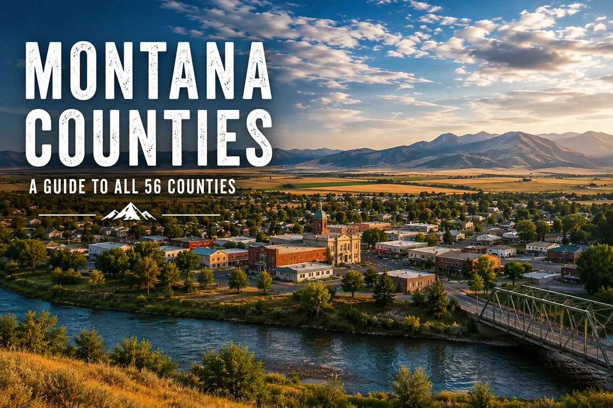
Montana has exactly 56 counties ranging from Yellowstone County (population ~174,000, home to Billings) to Petroleum County (population ~500, the seventh-least-populated county in the entire United States). This guide covers every county organized by tourism region, with travel highlights, county seats, population data, and links to individual county pages. Whether you’re planning a road trip, deciding where to base yourself, or just trying to understand how this massive state is organized, this is the reference you’ll come back to.
Why Montana’s County Geography Matters for Travelers
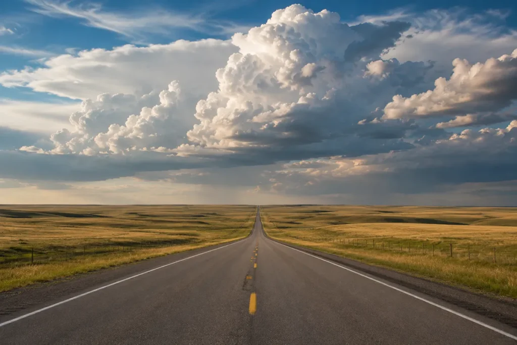
Montana is the fourth-largest state in the country, covering 147,040 square miles — roughly the size of Germany. It has just over 1.1 million people spread across those 56 counties, which means county lines here aren’t just administrative boundaries. They’re genuine geographic and cultural dividers.
Cross from Carbon County into Park County and you’re crossing from the Beartooth Plateau world into the Yellowstone gateway world.
Drive from Lewis and Clark County into Chouteau County and you’ve left the capital city’s orbit for genuine Hi-Line ranching country where the nearest traffic light might be 80 miles away.
Understanding Montana’s county structure helps you plan a better trip. It tells you which counties have services, which ones require a full fuel tank before entering, which ones border tribal reservations, and which ones anchor the outdoor adventures you’re actually after.
It also helps you understand why locals identify so strongly with their piece of the state — in a place this big, your county is often your community.
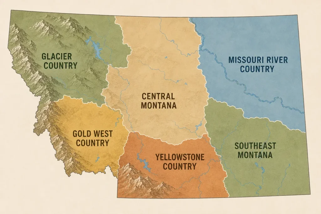
Montana’s 56 counties fall across six recognized tourism regions, each with a distinct landscape, economy, and character. I’ve spent time in all of them — some briefly, some repeatedly — and what follows is my honest assessment of what each county offers a traveler.
For a county-by-county breakdown of every city and town within each county, see my complete guide to Montana cities and towns. For historical context on how Montana was settled and organized, see key historical events in Montana.
Montana’s 56 Counties at a Glance
Before diving into the regional breakdowns, here are the key facts that every Montana traveler should know:
By the numbers:
- 56 total counties
- 7 federally recognized tribal nations with reservation lands spanning multiple counties
- 2 consolidated city-county governments: Butte–Silver Bow and Anaconda–Deer Lodge County
- State capital (Helena) is located in Lewis and Clark County
- Montana’s oldest counties were established in 1864, the same year the territory was created
- Newest county: Petroleum County, established in 1925
Largest and smallest:
- Largest by area: Beaverhead County (5,542 sq mi — larger than Connecticut)
- Smallest by area: Silver Bow County (718 sq mi)
- Most populous: Yellowstone County (~174,000)
- Least populous: Petroleum County (~500)
Geographic spread:
- Western counties are dominated by Rocky Mountain terrain, national forests, and Glacier National Park
- Eastern counties transition to the Great Plains — wide open, sparsely settled, and enormously underrated by most travelers
- The Missouri River cuts roughly east-to-west across the northern tier, shaping county boundaries and historical settlement patterns
Glacier Country: Northwest Montana Counties
Glacier Country occupies the northwest corner of the state and is where most first-time visitors to Montana end up.
It’s the region of Glacier National Park, Flathead Lake, the Swan Range, and some of the most dramatic mountain scenery on the continent. The eight counties here range from densely forested to genuinely alpine.
Flathead County (seat: Kalispell, pop. ~116,000) is the gateway county for Glacier National Park and the largest county by population in northwest Montana. Kalispell anchors the valley, but most travelers gravitate toward Whitefish for its mountain-town energy and proximity to Whitefish Mountain Resort, or toward Columbia Falls and Bigfork for quieter bases near the park’s west entrance. Flathead Lake — the largest natural freshwater lake west of the Mississippi — sits in the southern half of the county. I’ve watched both the best sunsets of my Montana life and the most brutal August thunderstorms from the shore of that lake. Don’t skip it. See my Whitefish guide and where to stay in Glacier National Park.
Glacier County (seat: Cut Bank, pop. ~13,700) is home to the Blackfeet Nation and the east entrance to Glacier National Park. Cut Bank is the county seat and a working ranching town; Browning is the headquarters of the Blackfeet Tribe and home to the Museum of the Plains Indian. East Glacier Park Village is where many travelers enter the park from the east. This county gets far fewer tourists than Flathead County despite sharing Glacier National Park — which means fewer crowds and a more authentic encounter with both the park and Indigenous Montana.
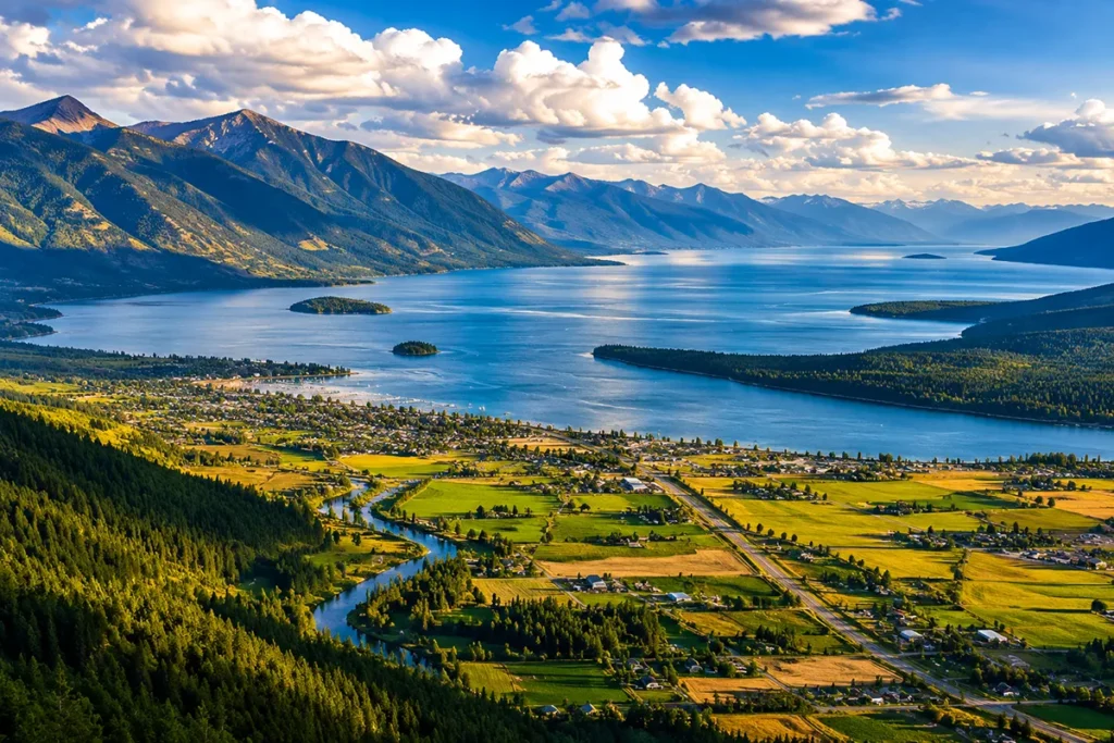
Lake County (seat: Polson, pop. ~32,000) wraps around the southern half of Flathead Lake and covers most of the Flathead Indian Reservation, home to the Confederated Salish and Kootenai Tribes. Polson sits right at the southern tip of the lake — the views from town are staggering. The National Bison Range at Moiese is one of the best wildlife-viewing sites in the state. St. Ignatius has a 19th-century mission church with murals painted by a lay brother that genuinely stop you in your tracks.
Lincoln County (seat: Libby, pop. ~21,000) occupies Montana’s northwest corner, bordered by Idaho to the west and Canada to the north. Libby sits in the Kootenai River valley and is the base for Turner Mountain Ski Area, one of Montana’s most affordable and least-crowded ski hills. Troy is the westernmost town in Montana and one of the lowest-elevation communities in the state. Eureka near the Canadian border has a surprising arts and antiques scene for its size. This county’s combination of deep forests, the Kootenai River corridor, and relative isolation makes it a legitimate hidden gem.
Mineral County (seat: Superior, pop. ~5,000) is a long, narrow county running along the Clark Fork River valley and I-90 corridor between Missoula and the Idaho border. Most travelers pass through it without stopping, which is their loss — the Clark Fork canyon scenery is beautiful, Superior has good fly-fishing access, and Lozeau Trout Creek Road leads into quiet forest country that sees almost no visitors. A good county for a deliberate slow-down on an otherwise fast drive.
Missoula County (seat: Missoula, pop. ~124,000) is anchored by the University of Montana and a city that punches well above its size for food, arts, and outdoor access. Missoula sits at the confluence of three rivers — the Clark Fork, Bitterroot, and Blackfoot — and has trail systems, breweries, and a live music culture that can genuinely eat a week of your itinerary if you let it. See breweries in Missoula and hotels in Missoula.
Ravalli County (seat: Hamilton, pop. ~47,000) covers the Bitterroot Valley, one of the most scenically consistent corridors in the state. The Bitterroot Range lines the entire western flank; the Sapphire Mountains run down the east. Hamilton is a pleasant base; Stevensville is Montana’s oldest non-Indigenous settlement, established by Catholic missionaries in 1841 at St. Mary’s Mission. Victor, Corvallis, and Florence are small valley towns with their own quiet appeal. Ravalli County is ideal for travelers who want mountain scenery without the Glacier crowds.
Sanders County (seat: Thompson Falls, pop. ~11,000) is one of the least-visited counties in western Montana, which is genuinely puzzling once you’ve driven through it. The Clark Fork River widens into a series of reservoir lakes here, the Cabinet Mountains loom to the north, and Thompson Falls has a waterfall right in town. The Kootenai Falls near Libby (just west of Lincoln County) and Quinn’s Hot Springs Resort in Paradise make Sanders County a worthwhile destination in its own right.
Gold West Country: Southwest Montana Counties
Southwest Montana is where the state’s mining and gold rush history runs deepest. The nine counties here cover the upper Missouri River headwaters, the Continental Divide, the historic Beaverhead country, and Montana’s state capital.
Beaverhead County (seat: Dillon, pop. ~9,700) is the largest county in Montana by area at 5,542 square miles, and one of the most rewarding for travelers who like solitude. The Beaverhead and Big Hole rivers are blue-ribbon trout streams. The Pioneer, Anaconda, Beaverhead, and Gravelly mountain ranges all converge here. Dillon is a classic western ranching and college town (home to the University of Montana Western). The Big Hole National Battlefield — site of the 1877 Nez Perce War — is one of the most moving historic sites in the state. See things to do in Dillon.
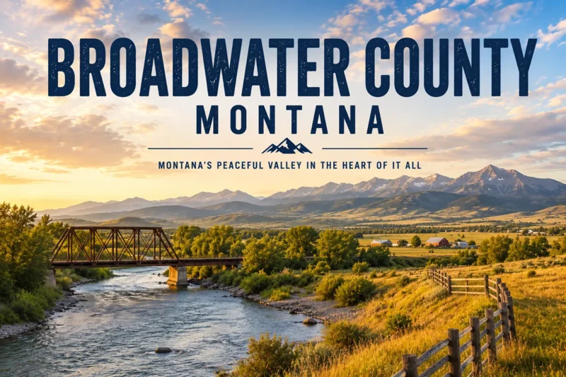
Broadwater County (seat: Townsend, pop. ~7,800) sits between Helena and Bozeman along the Missouri River corridor. Canyon Ferry Lake — a massive reservoir created by the Missouri River dam — dominates the county’s eastern edge and draws anglers and boaters from across the region. Townsend is a quiet town with good river access and a growing reputation for agritourism.
Deer Lodge County (seat: Anaconda, pop. ~9,500) is one of two consolidated city-county governments in Montana. Anaconda was built by copper king Marcus Daly as a company town for the Anaconda Copper Mining Company smelter — the 585-foot smelter stack still stands (now protected as Anaconda Smoke Stack State Park). The county’s mining and environmental legacy is impossible to miss, and honestly, that history is part of what makes it compelling. Discovery Ski Area sits just outside Anaconda. See Discovery Ski Area.
Granite County (seat: Philipsburg, pop. ~3,500) is one of my favorite quiet corners of the state. Philipsburg is a beautifully preserved Victorian mining town turned tourist destination — The Sweet Palace candy shop alone is worth a detour, and the surrounding sapphire mines at Gem Mountain let you dig your own gems. Georgetown Lake nearby is excellent for trout fishing and winter ice fishing. See Montana sapphires and gemstone mining in Montana.
Jefferson County (seat: Boulder, pop. ~12,800) sits between Helena and Butte and is often overlooked by travelers focused on those two cities. Boulder has a quirky small-town energy and a hot springs pool right in the county seat. Whitehall is a gateway to the Jefferson River Valley. Jefferson County’s stretch of I-15 passes through some surprisingly beautiful canyon country.
Lewis and Clark County (seat: Helena, pop. ~74,000) is home to the state capital and some of Montana’s most layered history. Helena was founded during the 1864 gold rush as “Last Chance Gulch” — the original mining gulch still runs beneath the main street. The Montana State Capitol is genuinely worth a visit. Mt. Helena City Park gives you a hike from the edge of downtown to a summit with city views. See best things to do in Helena and Helena breweries.
Madison County (seat: Virginia City, pop. ~9,265) is anchored by one of the best-preserved gold rush towns in the American West. Virginia City and its sister ghost town Nevada City are living museums maintained by the Montana Heritage Commission — the kind of place where you walk unpaved streets past original 1860s storefronts and actually feel the era rather than just reading about it. The Madison River runs through the county and is one of the most celebrated fly-fishing rivers in the world. Ennis is the base for most river guides.
Powell County (seat: Deer Lodge, pop. ~7,000) is home to the Montana State Prison — the old territorial prison in Deer Lodge is now the Old Montana Prison Museum complex and well worth a stop. The Flint Creek and Warm Springs creek valleys offer quiet fishing and scenic driving. Powell County sees few tourists despite being on the main I-90 corridor.
Silver Bow County (seat: Butte, pop. ~36,000) is the smallest county in Montana by area and one of the most historically significant. Butte is unlike anywhere else in the state — a hard-luck mining city built on top of one of the richest copper deposits ever discovered, home to a fierce Irish-Croatian-Finnish-Cornish working-class culture that never entirely went away. The Berkeley Pit (an open-pit copper mine filled with toxic water) is perversely fascinating. The Montana State Prison history intersects with Silver Bow County’s own labor history. See things to do in Butte.
Central Montana: Hi-Line, Russell Country, and the High Plains
Central Montana covers the largest stretch of the state’s interior — thirteen counties spanning from the Missouri River breaks to the wheat fields of the Hi-Line, from the Highwood Mountains to the Judith Basin. This is ranching country, rodeo country, and genuine big-sky-prairie country.
Cascade County (seat: Great Falls, pop. ~85,000) is the hub of central Montana and home to the state’s third-largest city. Great Falls sits on the Missouri River at the historic portage the Lewis and Clark Expedition spent nearly a month navigating. The Lewis & Clark National Historic Trail Interpretive Center here is one of the best free museums in Montana. The Giant Springs — one of the largest freshwater springs in the country — is right in town. See coffee shops in Great Falls and RV parks in Great Falls.
Chouteau County (seat: Fort Benton, pop. ~5,900) is one of Montana’s most historically rich counties. Fort Benton was the head of navigation on the Missouri River — for decades, it was the farthest point that steamboats could reach, making it the commercial gateway to the entire territory. The walking waterfront along the Missouri is beautiful. The Upper Missouri River Breaks National Monument — 149 miles of designated Wild and Scenic River — runs through the county.
Fergus County (seat: Lewistown, pop. ~11,600) anchors the geographic center of Montana. Lewistown is one of my favorite underrated Montana towns — genuinely pretty, with a historic downtown, excellent trout fishing on Big Spring Creek, and the Judith Mountains rising to the north. The county’s broad valleys and abundant water make it some of the best ranch land in the state. The Charlie Russell country starts here.
Golden Valley County (seat: Ryegate, pop. ~835) is one of Montana’s smallest and quietest counties. Ryegate has a grain elevator, a bar, and not much else — which is exactly the point for travelers who want to experience the true scale and emptiness of the Montana plains without driving 100 miles from the nearest town.
Hill County (seat: Havre, pop. ~16,000) sits on the Hi-Line (US Highway 2) near the Canadian border. Havre is the largest city on the Hi-Line and a key service center for a vast stretch of northern Montana. The Havre Beneath the Streets tour — exploring the underground city used by bootleggers, opium dealers, and brothels in the early 1900s — is one of the more unexpectedly entertaining historical tours in the state. Rocky Boy’s Reservation (Chippewa Cree Tribe) is located partially in Hill County.
Judith Basin County (seat: Stanford, pop. ~2,100) is almost entirely agricultural — wheat fields, cattle ranches, and Judith Basin’s sweeping landscape. The small town of Hobson was the birthplace of early Montana artist and author insights. The Judith River and its canyon offer accessible public land for hiking and wildlife viewing.
Liberty County (seat: Chester, pop. ~2,000) is one of the smallest Hi-Line counties by population, positioned between Havre and Shelby. Chester is a quiet grain-farming community with services for travelers crossing the northern tier. The county sits in the transition zone between the Rocky Mountain Front and the open plains.
Meagher County (seat: White Sulphur Springs, pop. ~2,000) is one of my favorite understated counties in the state. White Sulphur Springs has a natural hot springs fed pool, a beautifully quirky castle-museum (the Castle), and the Smith River access point for one of the most sought-after float permits in Montana. The Smith River canyon, accessible only by multi-day float trip, is drop-dead gorgeous. Smith River State Park permits are by lottery — worth entering every year.
Musselshell County (seat: Roundup, pop. ~5,200) sits along the Musselshell River valley. Roundup is a small ranching town with a strong local rodeo tradition. The Bull Mountains to the north offer hunting and limited recreational access. The county is largely off the tourist map, which means quiet roads and genuine encounters with working Montana.
Pondera County (seat: Conrad, pop. ~6,100) straddles the Rocky Mountain Front — the dramatic transition zone where the Rockies meet the Great Plains. Conrad is a farming and ranching town on I-15 between Great Falls and the Canadian border. The Front provides exceptional wildlife habitat and is prime country for viewing raptors, pronghorn, and migrating waterfowl.
Teton County (seat: Choteau, pop. ~6,400) is centered on the small town of Choteau, which sits right at the foot of the Rocky Mountain Front and serves as the gateway to the Bob Marshall Wilderness. The Egg Mountain paleontological site near Choteau is one of the most significant dinosaur nesting sites ever discovered — the museum in town is surprisingly excellent.
Toole County (seat: Shelby, pop. ~5,100) is another Hi-Line county anchored by the small city of Shelby, near the Canadian border on I-15. Shelby is famous as the site of the 1923 Jack Dempsey–Tommy Gibbons world heavyweight championship fight — an event that nearly bankrupted the town. The oil patch in northern Toole County has ebbed and flowed with commodity prices for a century.
Wheatland County (seat: Harlowton, pop. ~2,000) sits at the edge of central Montana’s ranching and grain country. Harlowton is an interesting stop for railroad history — it was the eastern end of the Milwaukee Road’s electrified rail line, and the Upper Musselshell Historical Society Museum has a surprisingly complete collection of Milwaukee Road artifacts.
Yellowstone Country: Southcentral Montana Counties
The five counties of Yellowstone Country surround Montana’s southern gateway corridor — from the Beartooth Plateau to the Gallatin Range, from the Paradise Valley to the Stillwater Basin.
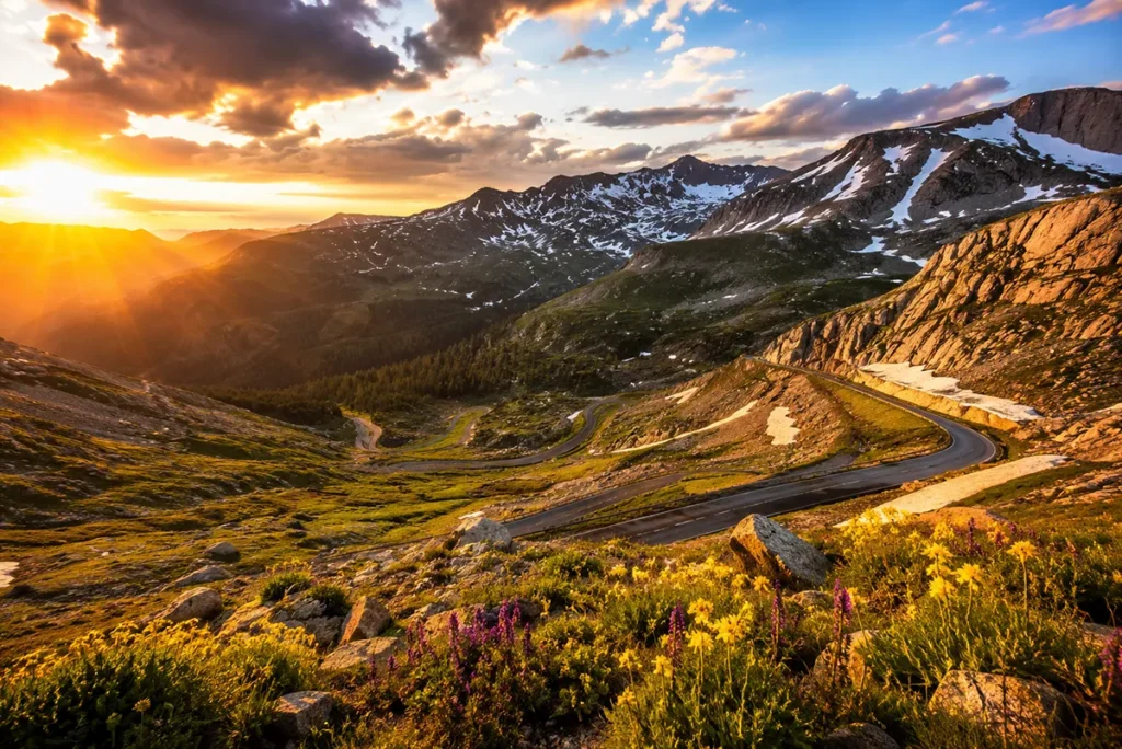
Carbon County (seat: Red Lodge, pop. ~11,000) is best known for Red Lodge and the Beartooth Highway — US 212 from Red Lodge to Yellowstone’s northeast entrance, which Charles Kuralt called “the most beautiful drive in America.” I’ve driven it twice. He wasn’t wrong. The county also includes the Pryor Mountains, which shelter a herd of wild horses in the Pryor Mountain Wild Horse Range. Bearcreek is a ghost town worth a quick detour. Bear Paw Ski Bowl isn’t in this county but the Carbon County ski culture is strong — Red Lodge Mountain is the local hill.
Gallatin County (seat: Bozeman, pop. ~130,000) is Montana’s fastest-growing county and the economic engine of the Yellowstone gateway corridor. Bozeman has transformed dramatically over the past decade into a university city (Montana State University) with a nationally recognized food and craft beer scene. Big Sky Resort is one of the largest ski resorts in the country and a full-season outdoor destination. West Yellowstone sits on the county’s southern border and is the western gateway to Yellowstone National Park. See things to do in Bozeman, Bozeman breweries, and best pizza in Bozeman.
Park County (seat: Livingston, pop. ~17,800) is anchored by the Paradise Valley — one of the most scenic river corridors in Montana, where the Yellowstone River runs north between the Absaroka and Gallatin ranges. Livingston is a genuine artistic community with more working writers and painters per capita than almost any small town in America. Gardiner is the north gateway to Yellowstone National Park. The Chico Hot Springs Resort sits in the Paradise Valley and is one of the best soaking destinations in the state. See Chico Hot Springs, RV parks in Gardiner, and where to stay in Yellowstone.
Stillwater County (seat: Columbus, pop. ~9,200) runs along the Stillwater River valley between Billings and Red Lodge. Columbus is the base for mining operations in the Stillwater Complex, which contains one of the world’s largest deposits of platinum group metals. Absarokee sits at the confluence of the Stillwater and Rosebud rivers and is a popular starting point for float trips. The county has a strong ranching identity and easy access to the Beartooth foothills.
Sweet Grass County (seat: Big Timber, pop. ~3,700) is one of those quietly beautiful Montana counties that most road-trippers blow through on I-90 without stopping. Big Timber is worth at least a coffee-and-stretch stop — the Grand Hotel (an 1890s property) has a surprisingly good bar, and the drive up the Boulder River valley south of town to Natural Bridge Falls is a genuine hidden gem. The Crazy Mountains — a strikingly isolated range that rises seemingly out of nowhere from the plains — are partially accessible from Sweet Grass County.
Southeast Montana Counties
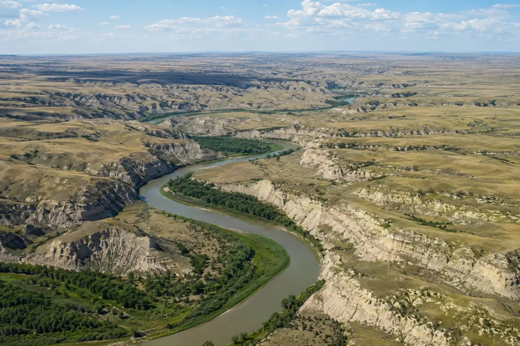
Southeast Montana is the state’s most underexplored region for visitors. These nine counties cover the Crow and Northern Cheyenne tribal homelands, the Little Bighorn Battlefield, Montana’s badlands, Makoshika State Park, and the wide-open country where Lewis and Clark traveled down the Yellowstone River on their return journey.
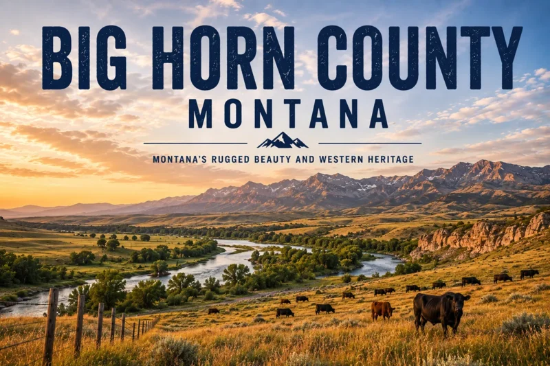
Big Horn County (seat: Hardin, pop. ~12,850) is the homeland of the Crow Nation — the Crow Reservation covers most of the county and is the largest reservation in Montana. Hardin is the county seat and the base for visiting the Little Bighorn Battlefield National Monument, where the 1876 Battle of the Little Bighorn took place. The Chief Plenty Coups State Park near Pryor offers one of the most nuanced introductions to Crow culture in Montana. For Crow cultural context, see Montana history.
Carter County (seat: Ekalaka, pop. ~1,400) is about as remote as it gets in Montana. Ekalaka sits in the extreme southeast corner of the state — the nearest city of any size is an hour or more in any direction. The Carter County Museum has one of the best collections of dinosaur fossils in eastern Montana. Medicine Rocks State Park, with its eroded sandstone formations, is genuinely strange and beautiful. Carter County rewards travelers who deliberately seek the end of the road.
Custer County (seat: Miles City, pop. ~12,000) is anchored by Miles City, the self-proclaimed Cow Capital of the West. The Bucking Horse Sale every May is among the most authentic rodeo and horse-trading events still operating in the American West — cowboys come from five states and Canada to buy horses and watch bucking stock auctions in a setting unchanged in 50 years. See top things to do in Miles City.
Fallon County (seat: Baker, pop. ~3,000) straddles the Yellowstone plateau and the edge of the Bakken oil field. Baker has a small-town character shaped equally by ranching and energy extraction. Medicine Lake Wildlife Refuge — shared with neighboring counties — provides excellent waterfowl viewing during migration seasons.
Powder River County (seat: Broadus, pop. ~1,725) is remote, sparsely populated, and genuinely gorgeous in a way that doesn’t announce itself. Broadus sits where the Powder River meets the Little Powder River, and the county’s rolling red-shale badlands and ponderosa pine draws are ideal for hunters and off-the-beaten-path road trippers.
Prairie County (seat: Terry, pop. ~1,100) is one of Montana’s smallest counties by population. Terry sits along the Yellowstone River and I-94 and has one of the best small-town museums in eastern Montana — the Prairie County Museum has exceptional Montana photography collections. Pirogue Island State Park near Terry offers primitive camping on a Yellowstone River island.
Rosebud County (seat: Forsyth, pop. ~8,100) covers the Northern Cheyenne Reservation (partially) and the Tongue River valley. Forsyth is on the Yellowstone River at I-94 and has good river access and a charming historic courthouse. Colstrip — home to one of the state’s large coal-fired power plants — is in this county and represents Montana’s resource extraction economy in its most visible form.
Treasure County (seat: Hysham, pop. ~758) is Montana’s smallest county by population — a quiet stretch of the Yellowstone River valley with little more than a courthouse, a grain elevator, and some of the most sweeping river-bottom scenery in the state. Hysham is worth a deliberate stop if you appreciate genuine small-town Montana.
Yellowstone County (seat: Billings, pop. ~174,000) is Montana’s most populous county and home to Billings — the state’s largest city and the regional hub for most of eastern Montana. Billings doesn’t get the tourist love of Bozeman or Missoula, but it punches well above its head for restaurants, arts, and strategic location. Rimrocks — the dramatic sandstone cliffs that rim the north edge of the city — are walkable from downtown. Pompeys Pillar National Monument east of Billings has William Clark’s 1806 signature carved into the rock — the only physical evidence of the Lewis and Clark Expedition remaining on the landscape.
Missouri River Country: Northeast Montana Counties
Northeast Montana is the state’s most remote and least-visited tourism region. These twelve counties follow the Missouri River eastward across the Hi-Line plains, covering the Fort Peck Reservation, the American Prairie Reserve, and some of the least-populated terrain in the continental United States.
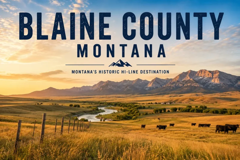
Blaine County (seat: Chinook, pop. ~7,000) covers part of the Fort Belknap Reservation (home to the Aaniiih and Nakoda peoples) and some of the most productive waterfowl habitat in Montana. Chinook has a good small-town museum and a poignant connection to the 1877 Bear Paw Battlefield, where Chief Joseph of the Nez Perce surrendered to the U.S. Army just 40 miles from the Canadian border.
Daniels County (seat: Scobey, pop. ~1,630) is classic Hi-Line wheat country — flat, open, and self-contained. Scobey has an exceptional collection of historic pioneer buildings at the Daniels County Pioneer Town museum. One of the most authentic small-town Montana experiences left.
Dawson County (seat: Glendive, pop. ~8,800) anchors the southeastern edge of Missouri River Country and is the gateway to Makoshika State Park — Montana’s largest state park and one of the best badlands landscapes in the northern plains. Glendive is a practical base with good motel options and the Frontier Gateway Museum. See Glendive guide.
Garfield County (seat: Jordan, pop. ~1,200) is one of the most isolated counties in the lower 48. Jordan is roughly 100 miles from the nearest city of any size in any direction. The county has no traffic lights, no fast food, and very few services — but the Missouri River Breaks to the north are accessible from here, and the Charles M. Russell National Wildlife Refuge (one of the largest wildlife refuges in the lower 48) runs across the county’s northern edge.
McCone County (seat: Circle, pop. ~1,700) sits in the Missouri River country plains. Circle is a tidy ranching town with a frontier character. The Redwater River valley here has good fishing and wildlife habitat.
Petroleum County (seat: Winnett, pop. ~500) is consistently one of the least-populated counties in the entire United States — seventh least, according to the most recent census data. Winnett has a bar, a post office, and a museum. That’s more or less it. The surrounding Musselshell River basin is beautiful in a stark, uncompromising way.
Phillips County (seat: Malta, pop. ~4,200) is home to some of the most significant wildlife habitat in the lower 48. The American Prairie Reserve — a private conservation project aiming to create the largest wildlife reserve in the continental U.S. — is being assembled primarily in Phillips County. Malta is the base for exploring the Missouri Breaks and the CMR Wildlife Refuge. See Montana wildlife refuges.
Richland County (seat: Sidney, pop. ~11,200) sits at the Montana-North Dakota border and is the epicenter of Montana’s Bakken oil patch. Sidney has gone through several boom-bust cycles tied to oil prices and has more infrastructure and services than most northeast Montana towns.
Roosevelt County (seat: Wolf Point, pop. ~10,600) covers much of the Fort Peck Reservation (Assiniboine and Sioux Tribes). Wolf Point hosts the famous Wild Horse Stampede in July — one of the oldest PRCA rodeos in Montana and a significant cultural event. The Fort Peck Lake complex to the south (in Valley and Phillips counties) begins near the county boundary.
Sheridan County (seat: Plentywood, pop. ~3,600) occupies Montana’s extreme northeast corner. Plentywood is the county seat and a charming Hi-Line town with a fascinating history — it was a hotbed of radical socialist politics in the 1920s and 1930s when much of the county’s wheat farmers supported a Farmer-Labor government. The county borders Saskatchewan and North Dakota.
Valley County (seat: Glasgow, pop. ~7,500) is anchored by Glasgow, one of the more livable Hi-Line towns. Fort Peck Lake and Fort Peck Dam sit in the southern end of the county — the dam, built in the 1930s as a New Deal project, created one of the largest earth-filled dams and reservoirs in the world. Fishing, boating, and wildlife viewing around Fort Peck are excellent.
Wibaux County (seat: Wibaux, pop. ~920) is Montana’s second-least-populous county and sits at the North Dakota border. Wibaux is named after Pierre Wibaux, a French cattle baron who built one of the largest ranching empires in Montana history after the 1886-87 die-up wiped out most competitors. The Pierre Wibaux Museum tells this story well.
Tribal Nations and Montana’s County Geography
Understanding Montana’s county boundaries requires understanding the tribal reservation geography that crosses those boundaries. Seven federally recognized tribal nations have reservation lands in Montana, and their territories overlap with dozens of counties:
Blackfeet Nation — primarily in Glacier County, along the east side of Glacier National Park and the Rocky Mountain Front.
Confederated Salish and Kootenai Tribes (Flathead Nation) — the Flathead Reservation covers portions of Lake, Sanders, Flathead, and Mineral counties and is the largest reservation in western Montana.
Crow Nation — the Crow Reservation covers most of Big Horn County and portions of adjacent counties. The Crow Tribe has the largest land base of any Montana tribe.
Northern Cheyenne Nation — the Northern Cheyenne Reservation is in Rosebud and Big Horn counties.
Fort Belknap Indian Community (Aaniiih and Nakoda) — the Fort Belknap Reservation is in Blaine and Phillips counties.
Fort Peck Assiniboine and Sioux Tribes — Fort Peck Reservation spans Roosevelt, Sheridan, Valley, and Daniels counties in northeast Montana.
Chippewa Cree Nation (Rocky Boy’s) — Rocky Boy’s Reservation is in Hill and Blaine counties near Havre.
Travelers visiting reservations should approach with respect and awareness. Many tribal nations have their own tourism resources and welcome respectful visitors. See Montana history and about Montana for more cultural context.
Montana County Superlatives
Largest by area: Beaverhead County — 5,542 sq mi. Larger than Connecticut.
Smallest by area: Silver Bow County — 718 sq mi. Montana’s smallest county contains Butte, one of its most historically significant cities.
Most populous: Yellowstone County — ~174,000 (2024 est.). Home to Billings, Montana’s only city with over 100,000 residents.
Least populous: Petroleum County — ~500. The seventh-least-populous county in the United States.
Fastest growing: Gallatin County — Bozeman-area growth has been among the fastest in the Mountain West for over a decade. Population roughly doubled between 2000 and 2020.
Most remote county seat: Jordan (Garfield County) — approximately 100 miles from the nearest city in any direction.
Oldest county: A tie between seven counties all formed in 1864 — the year Montana Territory was created: Beaverhead, Deer Lodge, Gallatin, Jefferson, Lewis and Clark, Madison, and Missoula.
Newest county: Petroleum County — formed in 1925, carved out of Fergus County.
Most nationally recognized natural feature: Glacier County shares Glacier National Park with Flathead County. Park County gives access to Yellowstone’s north and northeast entrances.
Best county for fly fishing: Madison County — the Madison River is among the most famous trout streams in the world. Park County and Gallatin County are close contenders.
Best Montana Counties for Different Types of Travelers
National park visitors: Flathead County (Glacier’s west entrances) and Glacier County (east entrance) for Glacier National Park. Gallatin County (West Yellowstone) and Park County (Gardiner north entrance) for Yellowstone. See best hikes in Glacier National Park and Going-to-the-Sun Road.
Skiers and snowboarders: Gallatin County for Big Sky Resort (one of the largest ski areas in North America), Flathead County for Whitefish Mountain Resort, Carbon County for Red Lodge Mountain. See Montana ski resorts.
Hot springs seekers: Park County (Chico Hot Springs), Sanders County (Quinn’s Hot Springs), Missoula County (Lolo Hot Springs), Silver Bow County and Jefferson County vicinity (Boulder Hot Springs). See Montana hot springs.
History and culture: Lewis and Clark County (Helena’s gold rush history), Silver Bow County (Butte mining heritage), Madison County (Virginia City), Big Horn County (Little Bighorn Battlefield, Crow culture), Sanders County and Lake County (Flathead Reservation cultural sites). See Montana gold rush.
Wildlife watching: Park County for Yellowstone wolf and bison watching via the Lamar Valley, Lake County for the National Bison Range, Phillips County for the American Prairie Reserve, Glacier County for Glacier National Park’s alpine wildlife. See Lamar Valley and Yellowstone wolf watching.
Remote adventure and solitude: Garfield County, Petroleum County, Carter County, McCone County, Prairie County — any of these will give you a Montana that most travelers never see.
Fly fishing: Madison County, Gallatin County, Park County, Beaverhead County — these four counties cover the most celebrated trout rivers in the state.
Road trips and scenic drives: Carbon County for the Beartooth Highway, Flathead County for Going-to-the-Sun Road approach, Lewis and Clark County to Glacier County along US 89 on the Rocky Mountain Front.
What I Wish I Knew Before Exploring Montana’s Counties
The eastern counties are genuinely worth it, but fuel planning is non-negotiable. I nearly ran out of gas in Petroleum County once. I’ve had friends strand themselves in Garfield County. Gas stations close early, close for days, or close permanently in eastern Montana’s small towns. Always fill up in the last town of any size before heading into the remote counties.
County lines don’t always match cultural divides. The best example is the Gallatin/Park county line — you can be in Gallatin County at Big Sky and Park County in Paradise Valley and feel like you’re in entirely different states. But drive along US 2 across Hill, Liberty, Toole, and Pondera counties and they blend seamlessly into one long Hi-Line experience.
Tribal reservation etiquette matters. Several of Montana’s most historically and culturally significant sites are on or adjacent to reservation lands. Photography rules, access restrictions, and cultural protocols vary by nation. Research before you go, and when in doubt, ask.
The county seat isn’t always the most interesting town. Granite County’s county seat is Philipsburg — fine. But the drive through Georgetown Lake and the Pioneer Mountains in the same county might be more memorable. Virginia City (Madison County seat) is extraordinary. But Ennis, 14 miles away, is the actual fly-fishing hub.
Consolidation matters. Silver Bow County and Butte have operated as a single consolidated city-county government since 1977. So has Deer Lodge County and Anaconda since 1976. This means there’s no separate city government — the county government runs everything.
Check county road conditions before leaving pavement. In the remote central and eastern counties, county roads can be beautiful, graded gravel one week and impassable mud the next. The Montana Department of Transportation road conditions line ([verify current phone/URL]) is worth bookmarking. See Montana winter driving guide for seasonal conditions.
For comprehensive trip planning across regions, see Montana trip planning guide and best time to visit Montana.
Practical Info
| Total counties | 56 |
| State capital county | Lewis and Clark County (Helena) |
| Most populous county | Yellowstone County (~174,000) |
| Least populous county | Petroleum County (~500) |
| Largest by area | Beaverhead County (5,542 sq mi) |
| Smallest by area | Silver Bow County (718 sq mi) |
| Consolidated city-counties | Silver Bow (Butte) and Deer Lodge (Anaconda) |
| Tribal reservations | 7 federally recognized nations across 13+ counties |
| Tourism regions | 6 official regions |
| Best general planning resource | Montana Association of Counties (MACo), mt.gov |
| Population data source | U.S. Census Bureau, Montana CEIC |
| Best road trip companion | Montana transportation guide |
Complete Montana Counties A–Z Directory
All 56 counties listed alphabetically with county seat, area, formation year, and estimated population. Click any county name for the full county guide.
| County | County Seat | Area (sq mi) | Pop. (est.) | Formed | Region |
|---|---|---|---|---|---|
| Beaverhead County | Dillon | 5,542 | 9,719 | 1864 | Gold West |
| Big Horn County | Hardin | 4,995 | 12,851 | 1913 | Southeast |
| Blaine County | Chinook | 4,226 | 6,936 | 1912 | Missouri River |
| Broadwater County | Townsend | 1,192 | 7,793 | 1897 | Gold West |
| Carbon County | Red Lodge | 2,048 | 11,179 | 1895 | Yellowstone |
| Carter County | Ekalaka | 3,340 | 1,382 | 1917 | Southeast |
| Cascade County | Great Falls | 2,698 | 85,390 | 1887 | Central |
| Chouteau County | Fort Benton | 3,973 | 5,898 | 1865 | Central |
| Custer County | Miles City | 3,783 | 12,032 | 1865 | Southeast |
| Daniels County | Scobey | 1,426 | 1,628 | 1920 | Missouri River |
| Dawson County | Glendive | 2,373 | 8,830 | 1865 | Missouri River |
| Deer Lodge County | Anaconda | 737 | 9,510 | 1864 | Gold West |
| Fallon County | Baker | 1,620 | 3,011 | 1913 | Southeast |
| Fergus County | Lewistown | 4,339 | 11,663 | 1885 | Central |
| Flathead County | Kalispell | 5,099 | 116,491 | 1893 | Glacier Country |
| Gallatin County | Bozeman | 2,507 | 129,982 | 1864 | Yellowstone |
| Garfield County | Jordan | 4,668 | ~1,218 | 1919 | Missouri River |
| Glacier County | Cut Bank | 2,995 | 13,681 | 1919 | Glacier Country |
| Golden Valley County | Ryegate | 1,175 | 835 | 1920 | Central |
| Granite County | Philipsburg | 1,728 | 3,502 | 1893 | Gold West |
| Hill County | Havre | 2,896 | 16,068 | 1912 | Central |
| Jefferson County | Boulder | 1,657 | 12,826 | 1864 | Gold West |
| Judith Basin County | Stanford | 1,870 | 2,105 | 1920 | Central |
| Lake County | Polson | 1,494 | 32,853 | 1923 | Glacier Country |
| Lewis and Clark County | Helena | 3,461 | 73,832 | 1864 | Gold West |
| Liberty County | Chester | 1,430 | 1,972 | 1920 | Central |
| Lincoln County | Libby | 3,613 | 21,525 | 1909 | Glacier Country |
| Madison County | Virginia City | 3,587 | 9,265 | 1864 | Gold West |
| McCone County | Circle | 2,643 | 1,709 | 1919 | Missouri River |
| Meagher County | White Sulphur Springs | 2,392 | 2,013 | 1867 | Central |
| Mineral County | Superior | 1,220 | 5,058 | 1914 | Glacier Country |
| Missoula County | Missoula | 2,598 | 124,555 | 1864 | Glacier Country |
| Musselshell County | Roundup | 1,867 | 5,197 | 1911 | Central |
| Park County | Livingston | 2,656 | 17,790 | 1887 | Yellowstone |
| Petroleum County | Winnett | 1,654 | 524 | 1925 | Missouri River |
| Phillips County | Malta | 5,140 | 4,240 | 1915 | Missouri River |
| Pondera County | Conrad | 1,625 | 6,078 | 1919 | Central |
| Powder River County | Broadus | 3,297 | 1,725 | 1919 | Southeast |
| Powell County | Deer Lodge | 2,326 | 7,051 | 1901 | Gold West |
| Prairie County | Terry | 1,737 | 1,107 | 1915 | Southeast |
| Ravalli County | Hamilton | 2,394 | 47,298 | 1893 | Glacier Country |
| Richland County | Sidney | 2,084 | 11,237 | 1914 | Missouri River |
| Roosevelt County | Wolf Point | 2,356 | 10,572 | 1919 | Missouri River |
| Rosebud County | Forsyth | 5,012 | 8,088 | 1901 | Southeast |
| Sanders County | Thompson Falls | 2,762 | 9,719 | 1905 | Glacier Country |
| Sheridan County | Plentywood | 1,677 | 3,564 | 1913 | Missouri River |
| Silver Bow County | Butte | 718 | 36,068 | 1881 | Gold West |
| Stillwater County | Columbus | 1,795 | 9,177 | 1913 | Yellowstone |
| Sweet Grass County | Big Timber | 1,855 | 3,715 | 1895 | Yellowstone |
| Teton County | Choteau | 2,293 | 6,368 | 1893 | Central |
| Toole County | Shelby | 1,946 | 5,082 | 1914 | Central |
| Treasure County | Hysham | 984 | 758 | 1919 | Southeast |
| Valley County | Glasgow | 5,062 | 7,513 | 1893 | Missouri River |
| Wheatland County | Harlowton | 1,428 | 2,032 | 1917 | Central |
| Wibaux County | Wibaux | 890 | 919 | 1914 | Missouri River |
| Yellowstone County | Billings | 2,633 | 173,836 | 1883 | Southeast |
Population data: 2022 Census estimates for most counties; 2024–2026 estimates used for Yellowstone, Gallatin, Missoula, Flathead, and Cascade counties (worldpopulationreview.com). All figures subject to update.
Wrapping Up
Montana’s 56 counties are, in a sense, 56 different versions of the same state — same sky, same distances, same culture of self-reliance, but radically different landscapes, economies, and identities.
Gallatin County with its university growth and ski resorts doesn’t look much like Petroleum County with its 500 residents and empty horizons. Silver Bow County’s industrial heritage has nothing in common with Madison County’s gold rush ghost towns. And yet all of it is Montana, all of it is worth knowing.
I keep a running list of counties I want to spend more time in — Carter, McCone, and Powder River are near the top right now.
If your own Montana travel has been concentrated in the western counties (and it probably has, statistically speaking), I’d encourage you to push east on your next trip.
There’s a Montana out there that most people never find, spread across a dozen counties that barely register on a travel blog. It’s some of the best of the state.
For full trip planning help, start with Montana trip planning guide, best time to visit Montana, and Montana transportation guide.
For the complete list of Montana cities and towns organized by county, see Montana cities and towns. And for recommendations on where to eat, stay, and explore throughout the state, browse the full things to do in Montana guide.
Have a Montana county that’s your personal favorite? Drop it in the comments — especially if it’s one of the quieter ones.