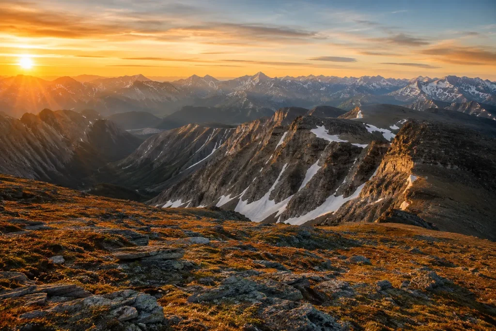
The word “Montana” comes from the Spanish montaña — mountainous. And after eleven years of hiking, hunting, and writing about this state from a saddle and the seat of a pickup, I can tell you the name doesn’t oversell it.
Montana has more than 100 named mountain ranges. I’ve set foot in roughly half of them, and I’m still finding new ridgelines to walk.
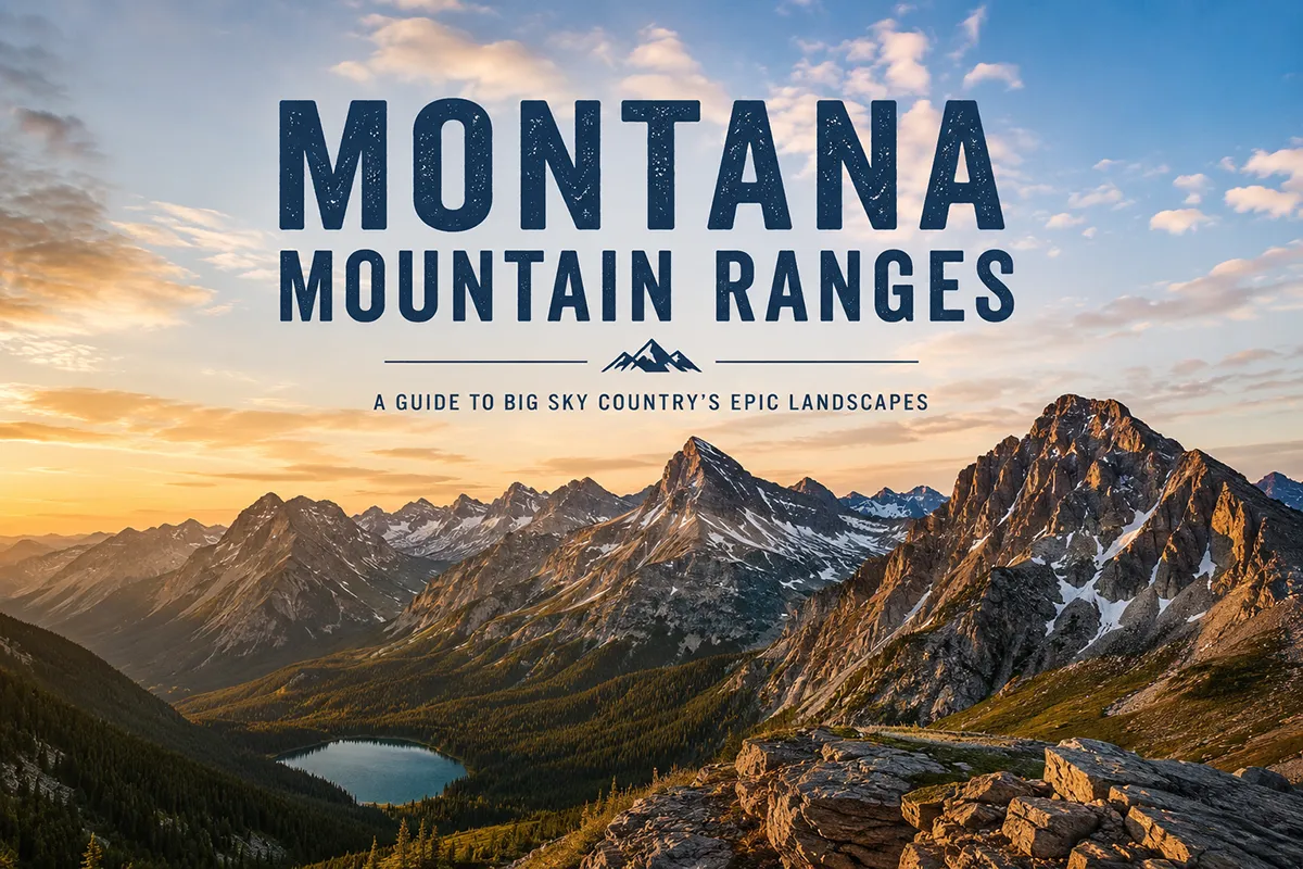
Montana contains over 100 named mountain ranges, ranging from the 12,807-foot Granite Peak in the Beartooths down to obscure prairie “island ranges” like the Sweet Grass Hills. The state breaks cleanly into two mountain regions: the cordilleran Rockies that run through the western third, and the isolated island ranges scattered across the central and eastern plains. Below I cover the 17 ranges every Montana traveler should know — with maps, elevations, basecamp recommendations, and the seasonal windows that actually work. Then I list every officially named range in the state, county by county.
Why Montana Has So Many Mountain Ranges
Most states with mountains have a mountain region. Montana has two completely different mountain geographies, and once you understand the difference, the whole map starts to make sense.
The western third of the state — roughly from Helena west — is the Northern Rocky Mountain cordillera.
This is the classic chain-of-ranges geography you’d recognize from Colorado or Wyoming: ridge after ridge running roughly north–south, drainages cutting between them, alpine forests giving way to subalpine meadows and tundra above treeline.
The Bitterroot, Mission, Cabinet, Swan, Sapphire, Pioneer, Anaconda, Flint Creek, and the entire Glacier National Park complex (Lewis Range and Livingston Range) all belong to this cordilleran system.
East of the Continental Divide, the geography flips. The plains take over. But scattered across those plains like islands in an ocean are the island ranges — isolated mountain massifs that rise abruptly from rolling prairie with nothing connecting them to the main Rockies.
The Crazy Mountains are the most famous example; you’ll be driving I-90 east of Big Timber and they just appear, jagged and white, with flat prairie running right up to their base.
The Bears Paw, Sweet Grass Hills, Highwood, Little Rocky, Big Snowy, Judith, Bull, and Pryor Mountains are all island ranges.
They formed mostly from volcanic activity or laccolithic intrusions roughly 50 million years ago, and they’re some of the wildest, least-visited country in the Lower 48.
This split matters when you’re planning a trip. Cordilleran-range travel means trailheads, ranger stations, and a National Forest infrastructure. Island-range travel means BLM land, gravel roads, and a much higher chance you’ll see no one else all day.
For more on how Montana’s terrain shapes its ecosystems, see our Montana biomes overview and the Montana elevation guide.
How I Organized This Guide
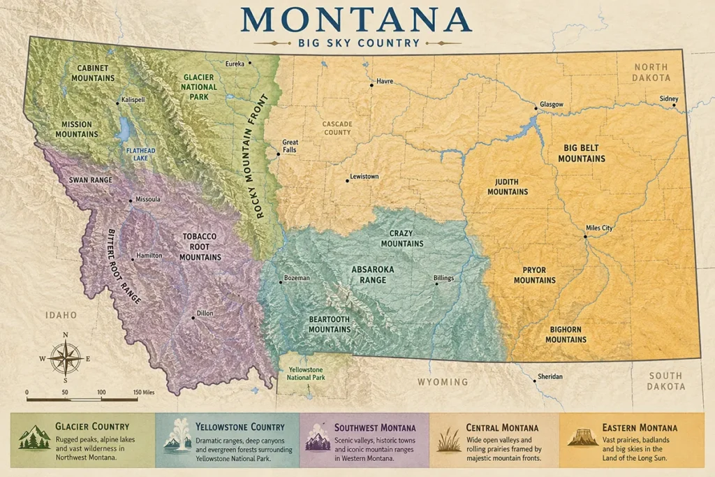
I grouped Montana’s ranges by Montana’s six official tourism regions, since that’s how most travelers plan a trip.
Within each region, I lead with the ranges I’d send a first-time visitor to and end with the ones that reward deeper exploration.
Each range below links to a full standalone guide with trailheads, photos, wildlife, and what I personally learned getting up there.
Glacier Country Mountain Ranges
The northwest corner of Montana is the densest mountain country in the state. Five major ranges plus Glacier National Park’s twin spines are packed into roughly 15,000 square miles.
1. The Lewis Range
The Lewis Range is the eastern spine of Glacier National Park and the more famous of the park’s two ranges. Mount Cleveland sits at 10,479 feet — the highest point in Glacier.
The range stretches from the Marias Pass area north into Alberta, where it becomes Waterton Lakes National Park.
If you’ve ever seen a photograph of Glacier — the iconic shot with the turquoise lake and the wedge-shaped peak behind it — you’re almost certainly looking at the Lewis Range.
I’ve spent more time here than in any other Montana range. The west side of the Lewis Range gets dumped on by Pacific storms; the east side sits in the rain shadow and feels almost like the High Plains stuck to a mountain wall.
That’s why Many Glacier on the east side is dry-grass-and-sky and Lake McDonald on the west is dense cedar forest, both in the same park.
The classic Highline Trail and Going-to-the-Sun Road corridor sits in the Lewis Range.
2. The Livingston Range
The Livingston Range is Glacier National Park’s western spine, often confused with the town of Livingston, Montana (which is three hours southeast in completely different country).
Kintla Peak at 10,101 ft (3,079 m) is the high point, and the range contains some of the most remote backcountry in the park.
Polebridge, the unincorporated community at the north end of Glacier, sits at the foot of the Livingston Range.
This is the range to visit if you want Glacier without the Going-to-the-Sun crowds. The North Fork area gets a fraction of the park’s visitors. Cell service is nonexistent.
The road in is unpaved and rough. That filter is the entire point. For where to stay nearby, see our guide to Polebridge, Montana.
3. The Mission Mountains
The Mission Mountains are sometimes called the American Alps for good reason. McDonald Peak at 9,820 feet anchors the range, and the western face is a wall of vertical granite and hanging glaciers visible from Highway 93 for an hour as you drive between Polson and Missoula.
The Missions are split into two management zones: the Mission Mountains Wilderness on the Flathead National Forest side, and the Tribal Wilderness managed by the Confederated Salish and Kootenai Tribes, which has its own permit system and seasonal closures (the grizzly bear closure in the McDonald Peak area runs roughly July 15 through October 1).
I think the Missions are the most under-appreciated range in Montana. The trailheads see a fraction of Glacier’s traffic, and the high country is just as dramatic.
4. The Cabinet Mountains
The Cabinets are Montana’s far-northwest range, a rugged wilderness west of Libby that’s been called one of the last truly wild mountain ranges in the Lower 48. Snowshoe Peak tops the range at 8,738 feet, and the Cabinet Mountains Wilderness covers 94,000 acres of glacially carved cirques and alpine lakes.
This is one of the few places in the contiguous U.S. where grizzly bears and woodland caribou historically overlapped — the caribou are essentially gone now, but the grizzlies are still here. For trip planning, see our Libby, Montana guide.
5. The Swan Range
The Swan Range runs north–south between the Mission Mountains and the Bob Marshall Wilderness, framing the eastern side of the Swan Valley.
Swan Peak at 9,289 ft is the high point. The Swan is the buffer between the Missions and the largest roadless area in the Lower 48 (the Bob Marshall–Great Bear–Scapegoat complex).
It’s also the access corridor for huckleberry pickers in late July — locals have favorite slopes they will absolutely not tell you about.
6. The Salish Mountains
The Salish Mountains sit west of Flathead Lake and form the low, rolling forested country around Kalispell. These are not dramatic alpine peaks; they’re sub-7,000-foot timbered ridges with logging history.
But they’re where you go for quiet hiking, side roads, and the kind of huckleberry-and-larch country that defines northwest Montana off-season.
7. The Whitefish Range
The Whitefish Range runs from the Canadian border south to the Flathead River, forming the western boundary of Glacier National Park.
Whitefish Mountain Resort sits on its southern flank, and the range’s western drainages feed into the Tobacco Valley. For winter access, see our guide to Whitefish, Montana in winter.
8. The Purcell Mountains
The Purcells extend up from Idaho into Lincoln County and continue north into British Columbia.
They’re geologically part of the Columbia Mountains, not the Rockies, and the Yaak River drainage cuts through them. This is the wettest, mossiest country in Montana — closer to the Pacific Northwest than the Rockies in feel.
Yellowstone Country Mountain Ranges
The south-central swath of Montana from Bozeman to Red Lodge contains the highest peaks in the state and the most concentrated alpine recreation.

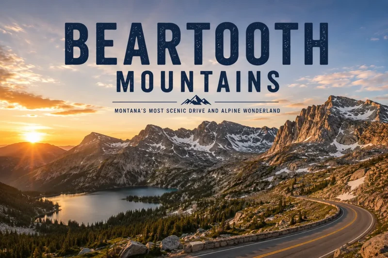
9. The Beartooth Mountains

The Beartooths are the highest range in Montana, and Granite Peak at 12,807 feet is the state’s high point. The range straddles the Montana–Wyoming border and forms half of the 944,000-acre Absaroka–Beartooth Wilderness.
The Beartooth Plateau itself is unusual: a vast expanse of alpine tundra at 10,000 to 11,000 feet, dotted with hundreds of lakes, the closest thing in the Lower 48 to the Tibetan Plateau.
The Beartooth Highway (US-212) over Beartooth Pass — 10,947 feet — is one of the most spectacular paved roads in America.
It’s open roughly Memorial Day through mid-October, with snow potential any month. Base out of Red Lodge for the north side or Cooke City for the south.
10. The Absaroka Range
The Absarokas run from south of Livingston, Montana down into northwest Wyoming and form the eastern boundary of Yellowstone National Park.
The range is volcanic in origin — most of the peaks are eroded remnants of an enormous Eocene volcanic field — and it’s a different feel from the granitic Beartooths next door. Elevations top out at 11,329 feet (Tumble Mountain).
The Paradise Valley between Livingston and Gardiner runs along the Absaroka’s western foot, with the town of Gardiner serving as the north entrance to Yellowstone.
11. The Gallatin Range
The Gallatin Range runs roughly 75 miles from Bozeman south to Yellowstone National Park, with Electric Peak (10,997 feet) anchoring the southern end at the Yellowstone border.
The Gallatin Crest Trail — also called the Devil’s Backbone — is one of the great ridge walks in the West, traversing the entire range above timberline. The range is also home to one of the world’s largest petrified forests from the Eocene epoch.
For the best access, base out of Bozeman or Big Sky.
12. The Madison Range
The Madison Range runs roughly parallel to the Gallatin Range, separated from it by the Gallatin River.
Hilgard Peak at 11,321 feet is the range’s high point, and Lone Mountain at 11,167 feet is the iconic peak above the Big Sky resort.
This is one of the best wildlife ranges in the state — grizzlies, wolves, mountain goats, and one of Montana’s largest elk herds all overlap here.
The Lee Metcalf Wilderness covers the most rugged section. For wolf watching nearby, see our Lamar Valley and Yellowstone wolf watching guides.
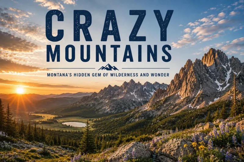
13. The Crazy Mountains

The Crazies are Montana’s signature island range. They rise 7,000 feet above the surrounding prairie in roughly 10 horizontal miles, with Crazy Peak at 11,214 feet as the high point. The range is sacred to the Crow people, who know it as Awaxaawippíia, “the ominous mountains.”
The Crazies are notorious for two things: their weather (storms build up over the prairie and slam the range with disproportionate violence) and the ongoing public-access disputes with private landowners on the eastern flank. Bring patience, a map, and a current land-status check before you go.
14. The Bridger Range
The Bridger Range is Bozeman’s eastern wall — the ridgeline you see from anywhere in the Gallatin Valley, with Sacajawea Peak (9,665 feet) and Hardscrabble Peak as the high points.
Bridger Bowl ski area sits on the east slope. The Sypes Canyon and “M” trails on the west side are the most-hiked trails in southwest Montana for good reason: they start ten minutes from downtown Bozeman.
Southwest Montana Mountain Ranges
Southwest Montana is the most mountain-dense region in the state, with ten major ranges packed into the area between Butte, Bozeman, and Dillon.
15. The Tobacco Root Mountains
The Tobacco Roots straddle the Jefferson and Madison rivers between Bozeman and Butte. Hollowtop Mountain at 10,604 feet is the high point of the range’s 43 named peaks.
The range has a deep gold and silver mining history — Pony, Mammoth, and Virginia City all sit on its flanks — and many of the trails follow old mining roads.
For nearby base towns, see Virginia City, Sheridan, and Twin Bridges.
16. The Flint Creek Range
The Flint Creek Range sits between Drummond and Philipsburg, with Mount Powell at 10,168 feet as the high point. About 60,000 acres of the range are roadless.
The Discovery Ski Area sits on the eastern slope, and the gem-rich Sapphire Mountains lie just to the south.
Base out of Philipsburg — one of Montana’s prettiest small towns. Related read: Discovery Ski Area Montana.
17. The Bitterroot Mountains
The Bitterroot Range forms the entire Montana–Idaho border on the west side of the Bitterroot Valley.
Trapper Peak at 10,157 feet is Montana’s high point in the range, though the overall range high point (Scott Peak at 11,394 feet) sits on the Idaho side.
The east face is a wall of glacially carved canyons — Blodgett, Bear Creek, Sweathouse, Mill Creek, Lost Horse — each one a different hike. Stevensville, Hamilton, Corvallis, and Darby all sit at the foot of the range.
The Sapphire Mountains
The Sapphire Mountains run between the Bitterroot Valley and the Rock Creek drainage, with Kent Peak 8,999 feet (2,743 meters) as the high point.
They’re best known to rockhounds — yes, real sapphires come out of these mountains, primarily from the Gem Mountain mine area near Philipsburg.
The Pioneer Mountains
The Pioneers sit south of Butte and west of Dillon. Tweedy Mountain at 11,159 feet is the high point. The range is split into the East Pioneers (high alpine, glacier-cut) and the West Pioneers (lower, forested, full of lakes), with the Pioneer Mountain Scenic Byway connecting them.
Crystal Park, where you can dig your own quartz crystals, sits in the middle of the byway. Base out of Dillon.
The Anaconda Range
The Anaconda Range — also called the Anaconda–Pintler — runs roughly east–west between Butte and Wisdom, an unusual orientation for a Montana range.
West Goat Peak at 10,793 ft is the high point. The Anaconda–Pintler Wilderness covers the highest portion. The town of Anaconda sits on the north slope.
The Big Hole / Beaverhead Mountains
The Beaverhead Mountains run along the southwestern Montana–Idaho border, forming the Continental Divide.
They’re rolling, high-elevation, sage-and-aspen country with elk and pronghorn — different in character from the granitic ranges to the north.
The Tendoy, Snowcrest, Gravelly, Ruby, and Greenhorn Ranges
These smaller southwest Montana ranges all sit in the high, open country between Dillon and Yellowstone. The Gravellys in particular are some of the best elk and bighorn sheep country in the state.
The Highland Mountains and Boulder Mountains
Both of these compact ranges sit south of Butte and Boulder respectively, with old mining districts scattered across their flanks.
The Elkhorn Mountains
The Elkhorns sit between Helena and Townsend. Crow Peak at 9,414 feet (2,869 meters) is the high point. The historic ghost town of Elkhorn — one of Montana’s best-preserved — sits on the eastern slope.
Central Montana Mountain Ranges
Central Montana is island-range country: isolated ranges rising from wheat and cattle prairie, each with its own ecosystem and access challenges.
18. The Big Belt Mountains
The Big Belts sit east of Helena and Canyon Ferry Reservoir, stretching about 75 miles. Mount Edith at 9,491 feet is the most prominent peak.
The Gates of the Mountains Wilderness — named by Lewis and Clark when they passed through in 1805 — covers the range’s southern end.
19. The Little Belt Mountains
The Little Belts are one of the largest island-range complexes in Montana, covering nearly a million acres of the Lewis and Clark National Forest between Great Falls and White Sulphur Springs.
Big Baldy Mountain at 9,190 feet is the high point. Sapphires were mined here historically, and the range is now better known for Memorial Falls and great cross-country skiing. Base out of White Sulphur Springs.
20. The Highwood Mountains
The Highwoods are a compact volcanic island range east of Great Falls. Highwood Baldy at 7,670 feet is the high point. The range is small enough to drive around in a morning but the back-canyon roads can take you to genuine solitude inside 30 minutes from town.
The Castle Mountains
The Castles sit east of White Sulphur Springs, with the ghost town of Castle on the eastern flank. Elatherium Mountain 8,589 ft is the high point. The range is heavily timbered and lightly traveled.
The Big Snowy Mountains and Little Snowy Mountains
The Big Snowies sit south of Lewistown — a long, east–west-oriented island range with Greathouse Peak at 8,681 feet as the high point. The Crystal Lake area is the easiest access. For nearby travel, see Lewistown.
The Judith Mountains, Moccasin Mountains, and North/South Moccasin Mountains
A cluster of small island ranges north and west of Lewistown. They were mining country in the 1880s — Gilt Edge, Maiden, and Kendall ghost towns all sit on their flanks.
Southeast Montana Mountain Ranges
Southeast Montana is the driest, most overlooked corner of the state, but it has its own quiet ranges.
21. The Bighorn Mountains (a note)
Most “Montana mountain ranges” lists include the Bighorn Mountains. I’m including this entry mostly to set the record straight: the Bighorn Mountains are overwhelmingly in Wyoming.
A tiny northern toe of the range crosses into Big Horn County, Montana near Decker, but the famous Cloud Peak (13,167 feet), the Bighorn National Forest, and most of what you’d recognize as “the Bighorns” are all south of the state line.
If you’re driving up from Wyoming and want to claim a Montana visit to the Bighorns, you can technically do it, but if you came to Montana to hike the Bighorns, you’re in the wrong state.
The Pryor Mountains
The Pryors sit south of Billings near the Wyoming border and are some of the most geologically and culturally distinctive country in Montana. Big Pryor Mountain at 8,776 ft is the high point.
The range is best known for the Pryor Mountain Wild Horse Range, the BLM-managed home of a herd of feral Spanish mustangs descended from Colonial-era stock.
The Long Pines, Chalk Buttes, and Ekalaka Hills
The far southeast corner of the state has small, isolated forested uplands rising from sage country — the Long Pines and Ekalaka Hills near the town of Ekalaka and the Chalk Buttes south of Ekalaka. Real outliers, real solitude.
The Wolf Mountains and Rosebud Mountains
These low ranges run through the heart of the Northern Cheyenne and Crow reservations and contain some of the most historically significant ground in the West, including the Little Bighorn Battlefield foothills.
Missouri River Country Mountain Ranges
Northeast and north-central Montana is mostly plains, but a handful of island ranges break the horizon.
The Bears Paw Mountains
The Bears Paw — singular, despite what mapmakers sometimes write — sit south of Havre. Old Baldy Mountain at 6,916 ft (2,108 m) is the high point.
Chief Joseph and the Nez Perce surrendered on the north slope of the Bears Paws in 1877, just 40 miles short of the Canadian border.
There’s a Bear Paw Ski Bowl on the range that may be the most remote lift-served skiing in America.
The Sweet Grass Hills
The Sweet Grass Hills sit on the Canadian border in Liberty County: three distinct buttes — West Butte, Gold Butte, and East Butte — visible for 50 miles in every direction.
Sacred to the Blackfeet and Gros Ventre peoples, geologically a laccolithic island range, and one of the most striking sights in the state.
The Little Rocky Mountains
The Little Rockies sit on the southern edge of the Fort Belknap Indian Reservation. Antoine Butte and Old Scraggy Peak top out around 5,600 feet.
The range is best known for the Zortman gold mining history and for its quiet ponderosa-and-prairie character.
Full A–Z List of Montana Mountain Ranges (by County)
Here’s the complete inventory. I’ve drawn on the U.S. Board on Geographic Names data and the Montana State Library’s GNIS records.
Some of these “ranges” are technically named hills or buttes; I’ve included them because they appear in the official record. Ranges marked with an asterisk have a dedicated guide on this site.
A
- Absaroka Range* — Park County
- Anaconda Range — Deer Lodge County
B
- Badger Hills — Big Horn County
- Bears Paw Mountains — Blaine and Hill Counties
- Beartooth Mountains* — Park and Carbon Counties
- Big Belt Mountains* — Broadwater County
- Bighorn Mountains* — Big Horn County (mostly Wyoming)
- Big Sheep Mountains — Dawson County
- Big Snowy Mountains — Fergus County
- Bitterroot Mountains* — Ravalli and Mineral Counties
- Black Reef — Lewis and Clark County
- Boulder Hills — Jefferson County
- Boulder Mountains — Deer Lodge and Jefferson Counties
- Bridger Range — Gallatin County
- Bull Mountains — Musselshell County
- Butcher Hills — Carter County
C
- Cabinet Mountains* — Sanders and Lincoln Counties
- Calderwood Hills — Valley County
- Castle Mountains — Meagher County
- Cayuse Hills — Sweet Grass County
- Chalk Buttes — Carter County
- Coeur d’Alene Mountains — Sanders County
- Crazy Mountains* — Park, Sweet Grass, and Wheatland Counties
D
- Dahl Hills — Valley County
- Dickie Hills — Silver Bow County
- Dry Range — Meagher County
E
- Ekalaka Hills — Carter County
- Elkhorn Mountains — Jefferson and Broadwater Counties
F
- Flathead Alps — Powell County
- Flathead Range — Flathead County
- Flattops — Carter County
- Flint Creek Range* — Granite and Powell Counties
- Franklin Hills — Sweet Grass County
G
- Gallatin Range* — Gallatin County
- Garnet Range — Powell and Granite Counties
- Granite Range — Stillwater County
- Gravelly Range — Madison County
- Greenhorn Range — Madison County
H
- Henrys Lake Mountains — Madison County
- Highland Mountains — Silver Bow County
- Highwood Mountains* — Chouteau County
- Honeycomb Hills — Powder River County
- Horn Mountains — Madison County
- Horseshoe Hills — Gallatin County
- Humboldt Hills — Carter County
J
- John Long Mountains — Granite County
- Judith Mountains — Fergus County
L
- Larb Hills — Phillips County
- Lewis Range* — Glacier and Flathead Counties
- Lewis and Clark Range — Powell and Lewis and Clark Counties
- Limestone Hills — Broadwater County
- Little Belt Mountains* — Meagher, Judith Basin, and Cascade Counties
- Little Rocky Mountains — Blaine and Phillips Counties
- Little Snowy Mountains — Fergus County
- Little Wolf Mountains — Big Horn County
- Livingston Range* — Glacier and Flathead Counties
- Long Pines — Carter County
M
- Madison Range* — Madison and Gallatin Counties
- Milk River Hills — McCone County
- Mission Range* — Lake and Missoula Counties
N
- North Hills — Missoula County
- North Moccasin Mountains — Fergus County
O
- Opheim Hills — Valley County
P
- Papoose Hills — Valley County
- Park Hills — Meagher County
- Pike Creek Hills — Petroleum County
- Piney Buttes — Garfield County
- Pioneer Mountains — Beaverhead County
- Pryor Mountains — Big Horn and Carbon Counties
- Purcell Mountains — Lincoln County
R
- Rattlesnake Mountains — Lake and Missoula Counties
- Rocky Hills — Beaverhead County
- Ruby Range — Madison County
S
- Salish Mountains — Flathead and Lincoln Counties
- Sapphire Mountains — Ravalli and Granite Counties
- Sawtooth Range — Teton County
- Smoky Range — Flathead County
- Snowcrest Range — Madison and Beaverhead Counties
- South Hills — Missoula County
- South Moccasin Mountains — Fergus County
- Spear Hills — Powder River County
- Spokane Hills — Lewis and Clark County
- Swan Range — Flathead and Missoula Counties
- Sweet Grass Hills — Liberty and Toole Counties
T
- Taylor Hills — Carter County
- Tendoy Mountains — Beaverhead County
- The Pine Hills — Custer County
- The Pinnacles — Cascade County
- Thoeny Hills — Phillips County
- Three Buttes — Blaine County
- Tobacco Root Mountains* — Madison and Jefferson Counties
W
- Whitefish Range — Flathead County
- Wilson Range — Glacier County
- Wolf Mountains — Big Horn and Rosebud Counties
If you count seriously, you’ll get somewhere between 80 and 120 depending on whether you include named hills and unofficial sub-ranges. Montana’s geographic literature has never fully agreed on what counts as a range versus a foothills cluster versus a butte group.
Personal Tips: What I Wish I Knew Before I Started Climbing Around Montana
Weather windows are short. In the high country — anything above 9,000 feet — your usable window is roughly mid-July through mid-September. The Beartooth Plateau has had snow in every month. Don’t plan an alpine traverse for early June and expect dry trail.
Cell service is a fiction in most ranges. I have a Garmin inReach for backcountry trips and consider it cheap insurance. Most of the wilderness areas in this guide have no signal whatsoever once you’re off the highway.
Grizzly country is most ranges. From the Cabinets in the northwest down through the Missions, Swan, Bob Marshall complex, Glacier, the Madisons, the Absaroka–Beartooth, and the Crazy Mountains — all of these are confirmed grizzly bear country. Carry bear spray on the hip, not in the pack. See our Montana bear guide for full safety protocols.
Island ranges have private land issues. Some of Montana’s most spectacular island ranges — particularly the Crazies — have ongoing public-access disputes. Always check current land status with the Forest Service ranger district or the Montana Public Land/Water Access Association before you go.
The Forest Service ranger districts are your friend. Every range I’ve listed falls under one or more National Forest ranger districts. Call them. Ask about current conditions, road status, fire closures, and bear activity. They will tell you things no website does.
Fire season changes everything. August through September can bring closures, smoke, and complete trail-system shutdowns. See our Montana fire history overview and wildfire guide.
Practical Info Box
| Item | Detail |
|---|---|
| Number of named ranges | 80–100+ depending on classification |
| Highest peak | Granite Peak, 12,807 ft (Beartooth Mountains) |
| Best months for high-country travel | Mid-July through mid-September |
| Required permits | Most National Forest areas: none. Glacier National Park backcountry: yes. Mission Tribal Wilderness: yes. |
| Bear spray | Recommended in every range from the Madison north and west |
| Cell service | Unreliable to nonexistent in most ranges |
| Best basecamp towns | Bozeman, Red Lodge, Missoula, Hamilton, Whitefish, Philipsburg, Helena |
| Driving access | Open seasonally — many high passes closed Oct–May |
Frequently Asked Questions
How many mountain ranges are in Montana?
Montana has more than 100 named mountain ranges depending on how you classify named hills and sub-ranges. The U.S. Board on Geographic Names recognizes roughly 80 distinct ranges.
What is the highest mountain in Montana?
Granite Peak in the Beartooth Mountains, at 12,807 feet, is the highest point in Montana.
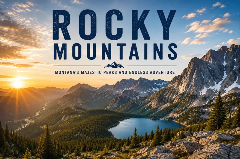
Are the Rocky Mountains in Montana?
Yes. The Northern Rocky Mountains run through the entire western third of Montana and contain most of the state’s major ranges, including the Bitterroot, Mission, Swan, Cabinet, and Glacier National Park’s Lewis and Livingston ranges.
What’s the difference between an island range and a cordilleran range?
Cordilleran ranges are part of a connected chain — in Montana’s case, the Northern Rockies. Island ranges rise in isolation from surrounding plains, with no connection to the main mountain system. Montana’s Crazy Mountains, Bears Paw, Sweet Grass Hills, Highwood, and Big Snowy Mountains are all island ranges.
Which Montana mountain range is best for first-time visitors?
For dramatic scenery with road access, the Lewis Range in Glacier National Park via Going-to-the-Sun Road. For a hiking-focused trip, the Beartooth Mountains out of Red Lodge. For solitude, the Cabinet Mountains.
When can you drive the Beartooth Highway?
The Beartooth Highway typically opens around Memorial Day weekend and closes mid-October, though exact dates depend on snowpack and storms.
Are there grizzly bears in Montana’s mountains?
Yes — confirmed grizzly populations exist in the Cabinet, Mission, Swan, Bob Marshall, Glacier, Madison, Absaroka–Beartooth, and Crazy Mountains, with expanding range elsewhere. Carry bear spray.
Final Thoughts
I’ve been writing about Montana for over a decade, and the mountain ranges are still the part of this state I find most humbling. Every range has its own character, its own weather patterns, its own wildlife pressures, its own access politics. You could spend a lifetime here and still find a ridgeline you’ve never walked. That’s the gift of Montana.
If you’re planning your first trip, pick one range and do it properly — three or four days, a local trailhead-by-trailhead exploration, a night in a nearby town. Don’t try to bag five ranges in a week from the car. The mountains here reward patience more than ambition.
Bookmark this guide and use it to plan range by range. Each linked child post goes deeper than I could here. And if you have a favorite Montana range I’ve shortchanged, leave it in the comments — I genuinely want to know.