In the 1910s and 1920s, homesteaders flooding into northeastern Montana tried various crops before settling on hard red spring wheat as the region’s mainstay.
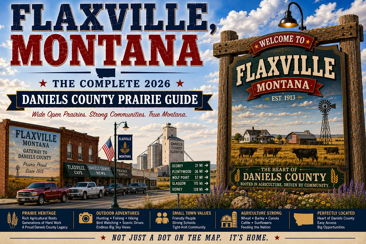
Flax was one of those experimental crops — a fiber plant that produced linseed oil from its seeds and flax fiber from its stalks, important for linen and industrial uses in the pre-synthetic era. Daniels County’s early farmers grew enough flax that when a railroad townsite was platted here in 1913, the crop’s name stuck.
Today the flax is largely gone, replaced by wheat, canola, and barley, but the name Flaxville persists in a community of about 100 people who maintain the same agricultural service functions the town was built to provide.
Flaxville is genuinely small. But it represents something important: the purest form of Hi-Line agricultural community — a grain elevator, a bar, a church, a post office, a school, and the farm families whose operations cover thousands of acres around it.
That combination of elements, repeated at 30-mile intervals across the Hi-Line, built Montana’s agricultural economy and defines much of the state’s rural character today.
TL;DR
- Flaxville (~100) is a Daniels County farming community on MT-5, between Scobey (30 miles west) and Plentywood (45 miles east).
- Named for the flax crop grown by homesteaders in the 1910s–1920s.
- A pure Hi-Line agricultural service community — grain elevator, bar, church, school, and farm families.
- Best for: Hi-Line corridor completers, agricultural Montana photography, and authentic small-town experience between Scobey’s Pioneer Town and Plentywood’s Communist era history.
Liked this article?
Add Roaming Montana as a preferred source so you see more of our articles and guides on Google.
Flaxville at a Glance
| Population (2020) | ~100 | | County | Daniels County | | Distance to Scobey | ~30 miles west (~35 min) | | Distance to Plentywood | ~45 miles east (~50 min) | | Distance to Canadian border | ~20 miles north |
What Makes Flaxville Different
Flaxville’s distinction is its purity. No tourist infrastructure, no famous history, no dramatic landscape — just the agricultural community that survives because the farms around it need it to survive.
The elevator processes wheat, the bar serves the community, the school educates the children of farm families. This is what the majority of Hi-Line towns look like, and most travelers drive past without acknowledging them.
The agricultural landscape around Flaxville is genuinely beautiful in its scale and honesty. In May, the fields are a patchwork of dark brown freshly seeded earth and emerging green.
In July, the canola fields are brilliant yellow for 2–3 weeks. In August, the wheat harvest transforms the community into an around-the-clock operation. In October, the landscape returns to bare earth and sky.
The Daniels County wheat operation is serious agriculture. Average farm size exceeds 3,000 acres. Modern air seeders cover 60+ feet per pass; GPS guidance systems ensure precision planting.
The combines that harvest in August cut 30-foot swaths through fields that extend to the horizon. Understanding that scale makes a drive through Flaxville more than a curiosity — it’s a window into industrial-scale agriculture at the northern margin of the American wheat belt.
For broader trip context, see my Montana cities and towns hub.
The Top 10 Things to Do
1. Agricultural Observation at Different Seasons
The most rewarding “activity” in Flaxville is seasonal observation — spring planting (May), canola bloom (July), wheat harvest (August), and post-harvest (September) all present dramatically different landscapes. Pull off on county roads and absorb the scale.
2. Day Trip to Scobey’s Pioneer Town (30 minutes west)
Thirty miles west, Scobey’s Pioneer Town Museum Complex has 35+ original frontier buildings with costumed interpreters in summer — one of the best small-town living history sites in northeastern Montana. See Scobey guide.
3. Day Trip to Plentywood (45 minutes east)
The Sheridan County Museum covering the Communist Party era (1918–1934), Brush Lake State Park, and Medicine Lake NWR. See Plentywood guide.
4. Flaxville Bar
The community gathering place — genuine small-town Montana bar culture where agricultural workers and community members mix. The conversations here about farming conditions, commodity prices, and weather patterns are more relevant to understanding Montana’s economy than anything in a museum.
5. Hi-Line Prairie Photography
The light quality on the northeastern Montana plains is exceptional at golden hour — grain elevators catching low afternoon sun, wheat fields in gold and green, enormous skies with dramatic cloud formations. County roads provide access to compositions unavailable from the highway.
6. Daniels County Scenic Drive (MT-5 East/West)
MT-5 through Flaxville passes through classic Daniels County landscape — wheat, canola, barley, and the occasional Hutterite colony operation. The highway itself is well-maintained and low-traffic; pull off anywhere for unobstructed prairie views.
7. Canadian Border Proximity
The Canadian border is about 20 miles north of Flaxville via county roads. The border country between Flaxville and the Canadian line is some of the most remote and open terrain in Montana.
8. Stargazing
Flaxville’s remoteness and the absence of nearby urban centers means exceptional dark sky viewing. The Milky Way is clearly visible to the naked eye on clear nights.
9. Hutchinson County Roads (North of Flaxville)
The county roads north of Flaxville toward the Canadian border pass through agricultural terrain that few travelers ever see — vast fields, occasional ranch buildings, and the gradual transition toward the Canadian prairie.
10. Understand Hi-Line Community Economics
The grain elevator economics of a town like Flaxville — how the cooperative elevator works, how commodity prices affect the community, how the seasonal cash flow of agricultural communities creates specific rhythms — is a legitimate educational lens for understanding rural Montana.
Where to Stay
No lodging in Flaxville. Scobey (30 min west) or Plentywood (45 min east) are the practical bases.
Where to Eat
- Flaxville Bar — the community gathering place; basic food
- Scobey (30 min west) — Cattle King Restaurant
- Plentywood (45 min east) — more variety
Getting There
MT-5. Between Scobey (30 miles west) and Plentywood (45 miles east).
When to Visit
July — Canola bloom; the brief window when the Hi-Line wheat belt is brilliant yellow. August — Wheat harvest; the community’s most active and visually dramatic season. Year-round — The bar and elevator are operational in all seasons.
Quick Facts
Founded 1913 (Great Northern Railroad). Named for flax crop (1910s homestead era). Average summer high: 81°F. Average winter low: -5°F.
Conclusion
Flaxville is the Hi-Line at its most essential — a 100-person community that exists because 3,000-acre wheat farms need services every 30 miles. The grain elevator, the bar, and the church are the institutions; the farm families are the community. Understanding Flaxville is understanding a lot of rural Montana.
Have a Flaxville question? Drop it in the comments — I read every one.
Frequently Asked Questions
Is Flaxville Montana worth visiting?
Worth a stop as the most essential Hi-Line agricultural community experience between Scobey’s Pioneer Town (30 min west) and Plentywood’s Communist era history (45 min east). Not a destination in itself, but an honest window into northeastern Montana’s agricultural character. Why is Flaxville named Flaxville? Flaxville was named for the flax crop grown by early homesteaders in the 1910s and 1920s, before wheat varieties bred for the region’s short growing season took over as the dominant crop.