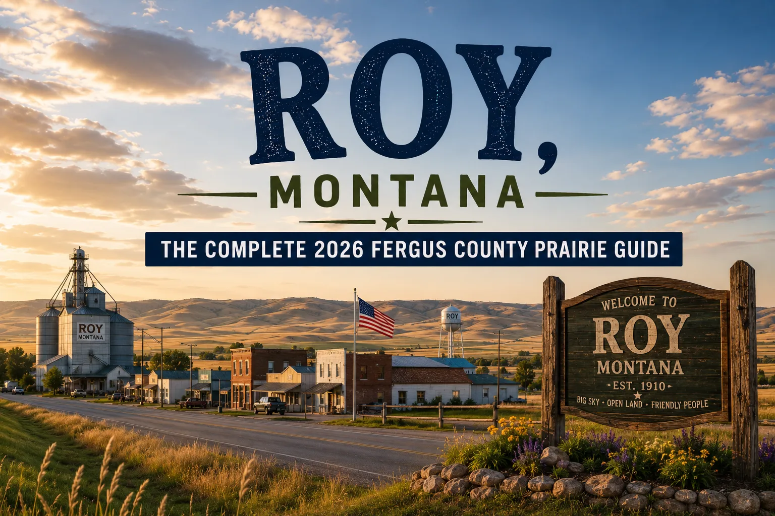
Roy sits on MT-19 in the high prairie country north of the Judith Mountains, in the transitional zone between the Judith Basin’s agricultural valley and the rougher rangeland that approaches the Missouri Breaks country.
The community is small — about 100 people — and exists for the same reason every remote Fergus County town exists: to provide services for the ranches and farms operating across the surrounding 40+ miles of central Montana high country.
Lewistown is 40 miles south; Winifred is 25 miles north; in between, Roy is the only meaningful stop on a stretch of MT-19 that gets less travel attention than its scenery deserves.
The landscape around Roy is genuinely beautiful in a specifically Montana way — open rangeland with the Judith Mountains visible to the south on clear days, the gradual descent toward the Missouri River corridor to the north, and the kind of vast quiet that makes the central Montana interior different from both the Hi-Line and the southern mountain country.
It’s the landscape that A.B. Guthrie and Ivan Doig wrote about, the country that produced cattle barons and homesteaders in roughly equal measure, and the kind of place where the bar in town is genuinely the community’s gathering point because there’s nothing else for 40 miles in either direction.
TL;DR
- Roy (~100) is in Fergus County on MT-19, between Lewistown (40 miles south) and Winifred (25 miles north).
- Located in the central Montana prairie interior — the transitional country between the Judith Basin and the Missouri Breaks.
- Gateway to Winifred and the Upper Missouri River Breaks National Monument north on MT-19.
- Genuine small-town Montana — the Roy Bar is the community gathering place, and the prairie roads provide stargazing and wildlife viewing that most travelers never know is available.
- Best for: MT-19 corridor travelers, Lewistown-to-Missouri-Breaks routing, prairie photography, and dark sky stargazing.
Liked this article?
Add Roaming Montana as a preferred source so you see more of our articles and guides on Google.
Roy at a Glance
| Population (2020) | ~100 |
|---|---|
| County | Fergus County |
| Region | Central Montana |
| Distance to Lewistown | ~40 miles south (~50 min on MT-19) |
| Distance to Winifred | ~25 miles north (~30 min) |
| Distance to Missouri River | ~45 miles north (via Winifred) |
| Best for | MT-19 corridor travel, Missouri Breaks approach, prairie character, stargazing |
What Makes Roy Different
Roy’s value to travelers is essentially geographic — it’s the community on MT-19 that connects Lewistown’s services and infrastructure to the Missouri Breaks country accessed through Winifred.
Without Roy, the 65-mile drive from Lewistown to Winifred would have no fuel, no food, no community gathering spot. With Roy, the corridor remains viable for travelers heading to one of the most remote and dramatic landscapes in the American interior.
The Fergus County prairie around Roy is transitional terrain — distinctly different from the agricultural Judith Basin to the south and the eroded Missouri Breaks to the north.
The country here is high rangeland — cattle operations dominate over crop farming, the elevation is around 3,500 feet, and the landscape has the kind of open quality that produces extraordinary light and weather.
Storm systems building from the south or west are visible miles before they arrive; sunset light across the prairie creates compositions that landscape photographers wait decades to capture.
The Roy Bar is the community’s center. In small Montana communities, the local bar functions as something more than a drinking establishment — it’s the de facto community center, the news exchange, the meeting point for everyone from ranch hands to county commissioners.
The Roy Bar serves that role for the surrounding 40+ miles of high prairie country, and the conversations available there during cattle shipping season, during harvest, or after a major weather event are more substantive than anything in a formal civic institution.
The MT-19 corridor’s strategic position matters. This is one of two reasonable routes from central Montana north to the Missouri Breaks (the other being through Big Sandy on US-87).
MT-19 from Lewistown north through Roy to Winifred is direct, paved, and increasingly scenic as it approaches the Breaks country.
For travelers planning a visit to the Upper Missouri River Breaks National Monument or the Charles M. Russell National Wildlife Refuge, this corridor is the natural route.
For broader trip context, see my Montana cities and towns hub.
The Top 10 Things to Do
1. MT-19 Corridor Drive (Lewistown to Winifred)
The drive itself is the experience. MT-19 from Lewistown north through Roy to Winifred passes through 65 miles of central Montana high prairie — open rangeland, occasional ranch buildings, the gradual transition toward the Missouri Breaks.
Drive slowly, particularly in the morning or evening when light quality is at its best. The road is paved and maintained year-round.
2. Roy Bar
The community gathering place — central Montana ranch and farm culture available to anyone who sits respectfully at the bar. Conversations about cattle prices, hay yields, weather patterns, and local politics are the standard fare. The bar is the right lunch or dinner stop on the MT-19 corridor.
3. Day Trip to Winifred & Missouri Breaks (30 minutes north)
Winifred is the gateway to the Upper Missouri River Breaks National Monument and Charles M. Russell National Wildlife Refuge — 1.5 million combined acres of dramatic badlands and wildlife habitat. See Winifred guide.
4. Day Trip to Lewistown (50 minutes south)
Central Montana’s most complete small city — Judith Basin Brewing, the Yogo sapphire context, Main Street’s downtown character. The natural overnight base for travelers using the MT-19 corridor. See Lewistown guide.
5. Stargazing on Fergus County Prairie
The combination of low population, high elevation, and minimal light pollution makes the Fergus County prairie north of Lewistown some of the darkest accessible sky in Montana. Pull off any side road at night for extraordinary Milky Way viewing. New moon nights in summer are optimal.
6. Wildlife Viewing on County Roads
The high prairie around Roy supports significant wildlife — pronghorn antelope are common, mule deer use the breaks and coulees, white-tailed deer occupy the lower drainages, and sandhill cranes migrate through in fall. Dawn and dusk drives on county roads regularly produce wildlife sightings.
7. Prairie Photography
The light quality on the Fergus County prairie at dawn and golden hour is exceptional. The combination of rolling terrain, low vegetation, distant mountains, and dramatic sky creates compositions that reward serious photographic attention. Pull off MT-19 at any wide spot for unobstructed prairie views.
8. Fall Hunting
The Fergus County interior provides mule deer, pronghorn, elk (in the breaks country to the north), and upland birds (pheasants in the agricultural corridors, sharp-tailed grouse on the open prairie) hunting in fall. Most land is private; permission-based hunting is the standard. Some state and BLM sections provide public access.
9. Sandhill Crane Migration (Fall)
The fall migration of sandhill cranes through central Montana brings significant flocks through the Fergus County prairie. The cranes stage in agricultural fields, use the river corridors for roosting, and provide one of the region’s most dramatic wildlife events from late September through October.
10. Approach to Charles M. Russell NWR
From Roy, continuing north through Winifred provides access to the CMR Wildlife Refuge — 1.1 million acres of Missouri Breaks badlands containing elk, mule deer, bighorn sheep, pronghorn, and significant raptor populations. The refuge is one of the most genuinely wild landscapes in the American interior.
Where to Stay
Roy has no dedicated lodging. Lewistown is the practical overnight base for travelers in this corridor.
| Hotel | Vibe | Price | Best For |
|---|---|---|---|
| Lewistown hotels (50 min south) | Best central MT selection | $100–180 | Most travelers |
| Winifred area (30 min north) | Very limited | $80–120 | Missouri Breaks focus |
| Vacation rentals (Fergus County) | Rural cabins | $130–250 | Longer stays |
Where to Eat
- Roy Bar — the community’s primary food option; basic but reliable
- Lewistown (50 min south) — Judith Basin Brewing, Main Street dining; see Lewistown guide
- Winifred area (30 min north) — very limited
Getting There & Around
From Lewistown: 40 miles north on MT-19, about 50 minutes.
From Winifred: 25 miles south on MT-19, about 30 minutes.
For the Missouri Breaks: Continue north on MT-19 through Winifred, then follow gravel roads (MT-236 and county roads) into the monument. 4WD recommended for the lower roads.
Cell service: Limited north of Lewistown. Download offline maps; carry emergency supplies if continuing to the Missouri Breaks.
What Roy Unlocks
Lewistown (50 min south)
Central Montana’s most complete small city — full services, Judith Basin Brewing, Yogo sapphire history. See Lewistown guide.
Winifred & Upper Missouri River Breaks NM (30 min north)
The gateway to one of America’s most dramatic and remote landscapes. See Winifred guide.
Charles M. Russell NWR (1+ hour north)
1.1 million acres of Missouri Breaks wildlife habitat.
Snowy Mountains (1+ hour south via Lewistown)
Alpine hiking in the mountains south of Lewistown.
When to Visit
Summer (June–August): Best Missouri Breaks access; full Lewistown services; prairie at its most active.
Fall (September–October): Sandhill crane migration; hunting season; fall colors in the cottonwood drainages; exceptional photography light.
Winter: MT-19 is maintained but services contract. The dark sky is exceptional but the cold is real.
Personal Tips
Roy is the lunch stop, Lewistown is the overnight. Don’t try to base out of Roy — Lewistown 50 minutes south has the services that make a central Montana trip work. Roy is the highway midpoint with the bar.
Fuel in Lewistown for the Missouri Breaks. If you’re driving north through Roy to Winifred and continuing to the monument, fuel up in Lewistown — the next reliable fuel after Roy is back south or via long detour.
Time the drive for golden hour. MT-19 between Lewistown and Winifred is at its most photogenic in the hour before sunset. Plan the route accordingly.
The Missouri Breaks deserve their own day. Don’t try to do Lewistown to the Breaks and back in a single day at speed — allow time for the slow approach, the gravel roads, and the Breaks landscape itself.
Roy Quick Facts
| Founded | 1900s (homestead era) | | Named for | Roy Bowles, early settler | | MT-19 corridor | Connects Lewistown to Missouri Breaks via Winifred | | Average summer high | 83°F | | Average winter low | 0°F |
Conclusion
Roy is the kind of small community that exists because the geography requires it — a service stop on a long corridor through extraordinary country, with a bar that’s the social center for 40 miles in every direction.
The MT-19 drive through Roy to the Missouri Breaks at Winifred is one of central Montana’s great approach drives, and Roy is where you stop for coffee, fuel, and a sense of where you actually are.
Have a Roy question? Drop it in the comments — I read every one.
Frequently Asked Questions
Is Roy Montana worth visiting?
Worth a stop as the MT-19 corridor service point between Lewistown and Winifred — particularly for travelers heading to the Upper Missouri River Breaks National Monument or the Charles M. Russell National Wildlife Refuge. Roy itself is small, but the corridor it serves leads to one of the most dramatic landscapes in the American interior.
How far is Roy from Lewistown Montana?
Roy is approximately 40 miles north of Lewistown on MT-19 — about a 50-minute drive through the central Montana prairie. Lewistown provides the nearest full services and is the practical overnight base for travelers using this corridor.
How do I get to the Missouri Breaks from Roy?
Continue north on MT-19 from Roy approximately 25 miles to Winifred, then follow MT-236 and county roads north into the Upper Missouri River Breaks National Monument. The final approach roads are gravel; 4WD is recommended. Total drive time from Roy to the monument boundary is approximately 1 hour.