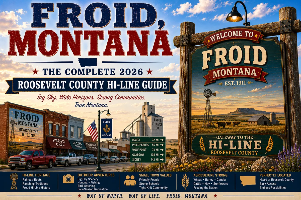
The town name is simply the French word for “cold” — and the winters here justify it completely. Average January lows in Roosevelt County reach -15°F to -20°F; arctic outbreaks drive wind chills below -50°F.
The homesteaders who settled here in the 1910s and named the community were being honest rather than optimistic, which is a refreshing change from the frontier-era habit of naming places “Pleasant Valley” or “Fairview” to attract settlers who might be put off by the truth. Froid was always going to be cold. The settlers knew it and said so.
Today Froid is a small Roosevelt County community of about 180 people on US-2, positioned between Wolf Point to the west and Culbertson to the east, adjacent to the eastern extent of the Fort Peck Indian Reservation.
The economy is wheat and sunflowers — the same agricultural combination that defines most of northeastern Montana’s Hi-Line communities. But Froid has something most of them don’t: a lake.
Froid Lake sits southeast of town, a natural prairie lake that provides quiet, unpublicized fishing and waterfowl habitat in a region where most recreation is organized around the Missouri River 15 miles south or the Fort Peck Reservoir far to the west.
Walleye, perch, and northern pike. Ducks and geese in fall. The peaceful sound of wind across open water in the middle of the wheat belt — an experience that most travelers driving US-2 never know is available.
TL;DR
- Froid (~180) is a Roosevelt County community on US-2, between Wolf Point (25 miles west) and Culbertson (15 miles east).
- Named for the French word froid (cold) — an honest acknowledgment of Hi-Line winter reality.
- Froid Lake provides walleye, perch, and northern pike fishing plus waterfowl habitat in a quiet, undeveloped setting.
- The sunflower fields around Froid in August create one of the Hi-Line’s most striking seasonal visual displays.
- Adjacent to the eastern boundary of the Fort Peck Indian Reservation.
- Best for: Hi-Line US-2 corridor travelers, Froid Lake anglers, and authentic eastern Montana agricultural character.
Liked this article?
Add Roaming Montana as a preferred source so you see more of our articles and guides on Google.
Froid at a Glance
| Population (2020) | ~180 |
|---|---|
| County | Roosevelt County |
| Region | Eastern Montana (Hi-Line) |
| Named for | French word froid (cold) |
| Distance to Culbertson | ~15 miles east (~18 min) |
| Distance to Wolf Point | ~25 miles west (~30 min) |
| Distance to Williston, ND | ~55 miles east (~1 hour) |
| Distance to Poplar | ~35 miles west (~40 min) |
| Best for | Froid Lake fishing, sunflower fields in August, US-2 corridor travel |
What Makes Froid Different
Froid’s position on US-2 places it at an interesting geographic seam. Fifteen miles east is Culbertson — the gateway to Fort Union Trading Post NHS and the Missouri-Yellowstone Confluence, one of the most historically significant landscapes in the American West.
Twenty-five miles west is Wolf Point — the Fort Peck Reservation’s commercial center and the site of the Wild Horse Stampede Rodeo. Froid sits between these two distinct worlds without belonging fully to either, which gives it a particular Hi-Line independence.
The agricultural economy here runs on wheat and sunflowers. The wheat dominates — hard red spring wheat grown on farms that average 3,000+ acres in Roosevelt County — but the sunflower component creates something genuinely striking.
In late July and August, sunflower fields surrounding Froid turn brilliant yellow, with the flower heads tracking the sun from east to west through the day.
The visual effect on the Hi-Line — bright yellow fields under enormous blue sky, grain elevators rising at regular intervals — is one of those agricultural landscape moments that surprises travelers who expect the Hi-Line to be monotonous.
Froid Lake is the community’s quiet recreational asset. It’s not promoted, not developed for tourism, not even consistently mentioned in regional travel content.
But it’s there, southeast of town, holding fish that local anglers have been catching for decades. Walleye in the main lake. Northern pike in the shallower sections near the emergent vegetation. Perch year-round. Waterfowl using the lake during spring and fall migrations.
The Fort Peck Reservation boundary runs just west of Froid, and the reservation’s agricultural presence — tribal members and non-Native farmers working land with complex ownership histories shaped by the allotment policies of the early 20th century — is woven into the economic landscape of the entire corridor.
For broader trip context, see my Montana cities and towns hub.
The Top 10 Things to Do In & Around Froid
1. Fish Froid Lake
The lake southeast of Froid holds walleye, perch, and northern pike accessible from shore or via small boat. There is no developed launch facility — trailers can be backed to the water at the natural access area.
The lake fishes best in spring (April–May) when walleye are most active in shallow water, and again in fall (September–October) when pike are feeding aggressively before ice-up. Perch provide year-round action including ice fishing in winter.
Practical: Montana fishing license required. Check current FWP regulations for any special provisions on this body of water.
2. Waterfowl Hunting at Froid Lake (Fall)
The lake and surrounding wetland fringe provide duck and goose hunting from September through November. Mallards, teal, gadwall, and diving ducks use the lake during fall migration.
Layout blind or shore blind setups with decoys work well in the shallower sections. Contact Montana FWP for current season dates, bag limits, and any specific regulations for Froid Lake.
3. Sunflower Field Photography (August)
The sunflower fields around Froid in late July and August create one of the Hi-Line’s most distinctive seasonal visual experiences. Sunflowers are heliotropic — they track the sun through the day — meaning the faces point east in the morning and west by late afternoon. Morning photography (east-facing flowers illuminated by morning light) is the most dramatic.
Pull off on county roads east of Froid for the best unobstructed field compositions with the grain elevator or sky as background.
The bloom period is relatively brief — typically 2–3 weeks in late July through mid-August depending on planting dates and weather. If sunflower photography is a specific goal, call ahead to local farmers or the Roosevelt County Extension Office for current bloom status.
4. Hi-Line US-2 Drive Through Roosevelt County
The US-2 corridor through Froid is classic Hi-Line — flat wheat and sunflower country, grain elevators at regular intervals, the Missouri Valley visible to the south in certain stretches, and the enormous northeastern Montana sky.
This is the main highway that connected the Hi-Line’s agricultural communities before the interstate era, and it retains a character that I-90 and I-94 don’t — small communities at 20–30-mile intervals, each with its grain elevator and bar and school, the agricultural economy visible in every direction.
5. Day Trip to Culbertson and Fort Union (18 minutes east)
Fort Union Trading Post National Historic Site — one of the most important fur trade sites in American history, with a fully reconstructed 1828 American Fur Company post and costumed living history interpreters — is 25 miles east via Culbertson.
The Missouri-Yellowstone Confluence Interpretive Center is adjacent. Combined, these represent one of the most historically significant landscapes in the American West. See Culbertson guide.
6. Day Trip to Wolf Point (30 minutes west)
The Fort Peck Reservation’s commercial center has the Wild Horse Stampede Rodeo (one of Montana’s most celebrated regional rodeos, held annually in July), Fort Peck Tribal offices, and Missouri River fishing access. See Wolf Point guide.
7. Missouri River Fishing (via Wolf Point or Culbertson, 20–30 min)
The Missouri River corridor runs south of Froid through the broader Roosevelt County landscape. Access from Wolf Point (west) or from the Fort Union area (east) provides walleye, catfish, sauger, and northern pike fishing in a major Plains river. Tribal recreation permits required for fishing on reservation sections of the Missouri.
8. Fort Peck Reservation Cultural Context (Wolf Point, 30 min west)
Froid’s proximity to the Fort Peck Reservation’s eastern extent makes it a useful staging point for understanding the reservation’s geographic and cultural presence.
The Fort Peck Assiniboine and Sioux Tribes operate cultural events, tribal colleges, and community programs accessible from Wolf Point and Poplar. See Poplar guide.
9. Prairie Wildlife Watching
County roads north and south of US-2 near Froid pass through open rangeland with good wildlife. White-tailed deer are common in the creek bottoms; pronghorn antelope use the open rangeland; raptors — red-tailed hawks, Swainson’s hawks, ferruginous hawks, and golden eagles in fall — are regularly visible from the highway. Sandhill cranes migrate through in fall, sometimes in large numbers over the Froid area.
10. Stargazing
Roosevelt County’s vast extent and sparse population mean exceptional dark sky viewing. From Froid or county roads outside town, the Milky Way is clearly visible to the naked eye on clear nights. There is essentially no light pollution to the north, east, or south for many miles. New moon nights in August and September — when the atmospheric clarity is highest — are the best conditions.
Where to Stay
Froid has no dedicated lodging. Wolf Point and Culbertson are the practical overnight bases for travelers in this corridor.
| Hotel | Vibe | Price | Best For |
|---|---|---|---|
| Wolf Point motels (25 min west) | Local range | $90–150 | Most travelers |
| Culbertson motels (18 min east) | Basic local | $85–130 | Fort Union focus |
| Sidney hotels (55 min west) | Full selection | $120–220 | More variety |
| Williston, ND hotels (55 min east) | Full city | $130–250 | Eastern approach |
Where to Eat
- Froid Bar — the community gathering place; basic bar food in an authentic Hi-Line setting
- Froid area cafés — limited; call ahead to confirm hours
- Wolf Point (25 min west) — local restaurants and more variety; see Wolf Point guide
- Culbertson (18 min east) — the Homesteader Restaurant for a reliable meal
Getting There & Around
From Culbertson: 15 miles west on US-2, about 18 minutes.
From Wolf Point: 25 miles east on US-2, about 30 minutes.
From Sidney: 55 miles east on US-2, about 1 hour.
From Williston, ND: 55 miles west on US-2, about 1 hour.
For Froid Lake: Ask locally for the access road southeast of town — no formal signage.
Cell service: Variable in this area. Download offline maps before exploring county roads.
What Froid Unlocks
Culbertson & Fort Union Trading Post (18 min east)
One of America’s most important fur trade sites, fully reconstructed. See Culbertson guide.
Wolf Point & Fort Peck Reservation (30 min west)
Wild Horse Stampede Rodeo, Missouri River access, reservation cultural context. See Wolf Point guide.
Missouri River Corridor (south of Froid via county roads)
Walleye, catfish, and northern pike in a major Plains river.
Poplar & Fort Peck Tribal Center (35 min west)
Fort Peck Assiniboine and Sioux Tribes government and cultural programs.
North Dakota Badlands (1+ hour east)
Theodore Roosevelt National Park via Williston.
When to Visit
August: Sunflower fields in peak bloom — the Hi-Line’s most visually striking seasonal display. Combine with wheat harvest observation for the full agricultural calendar moment.
Spring (April–May): Froid Lake walleye active in shallow water; spring migration waterfowl on the lake; wildflowers on the prairie.
Fall (September–November): Peak duck and goose hunting at Froid Lake; sandhill crane migration; northern pike aggressive before freeze-up; Fort Union NHS still operating.
Winter (December–March): Ice fishing on Froid Lake; the cold the town was named for in full effect; not recommended for casual visitors without specific winter recreation plans.
Year-round: US-2 is maintained and the corridor is accessible in all seasons.
Personal Tips
Ask at the Froid Bar about lake access. Local knowledge of current Froid Lake conditions — water levels, fish activity, best access points — is available at the bar. This is true of most small Montana communities: the local bar is the informal information exchange.
Sunflower timing requires research. Call the Roosevelt County Extension Office or a local farm supply store in late July to confirm current bloom status before making sunflower photography the primary reason for visiting.
The Froid Bar conversation is part of the experience. In small Hi-Line communities, the bar is the social center — agricultural workers, farmers, ranchers, and occasional travelers sharing the same stools. Genuine conversation about farming conditions, commodity prices, and Montana weather is available to anyone who sits down respectfully.
Combine Froid with Fort Union as an east-west day. Starting at Wolf Point in the morning, driving east through Froid, and spending the afternoon at Fort Union Trading Post NHS gives a full arc of the eastern Roosevelt County corridor — reservation present to fur trade past.
The cold is real in winter. If you’re driving US-2 in January or February, carry emergency supplies, download offline maps, and know that the communities along this stretch are 15–25 miles apart. The Froid Bar will be open; call ahead if you need fuel.
Froid Quick Facts
| Named for | French froid (cold) |
|---|---|
| Average January low | -15°F to -20°F |
| Average summer high | 84°F |
| Froid Lake | Walleye, perch, northern pike; waterfowl habitat |
| Sunflower season | Late July–mid-August |
| Fort Union NHS | 15 miles east via Culbertson |
Conclusion
Froid named itself honestly — the winters here are genuinely cold, and the town persists because the surrounding farms need it. But honest doesn’t mean empty. Froid Lake provides quiet fishing that most travelers drive past without knowing about.
The August sunflower fields are one of the Hi-Line’s most striking visual moments. The position between Fort Union’s fur trade history and the Fort Peck Reservation’s living culture gives it contextual depth that exceeds its size.
For Hi-Line travelers willing to turn off US-2 and find the lake, Froid rewards the effort.
Have a Froid question? Drop it in the comments — I read every one.
Frequently Asked Questions
Is Froid Montana worth visiting?
Worth a stop for Froid Lake fishing (walleye, perch, and northern pike in a quiet, undeveloped setting), the August sunflower fields, and as a US-2 corridor point between Fort Union Trading Post (18 min east via Culbertson) and the Fort Peck Reservation’s Wolf Point (25 min west). The Froid Bar is the authentic Hi-Line community gathering place.
Why is Froid Montana named Froid?
Froid is named for the French word froid, meaning “cold” — an honest acknowledgment of the harsh Hi-Line winters in Roosevelt County, where January lows average -15°F to -20°F and arctic outbreaks drive wind chills below -50°F. The homesteaders who named the community in the 1910s chose honesty over promotional optimism.
What fish are in Froid Lake?
Froid Lake holds walleye, perch, and northern pike. Walleye are most active in spring (April–May) in the shallows; northern pike are aggressive in fall before ice-up; perch provide year-round fishing including ice fishing in winter. No developed boat launch; small boats can access the lake via a natural shore entry.
How far is Froid from Wolf Point Montana?
Froid is approximately 25 miles east of Wolf Point on US-2 — about a 30-minute drive. Wolf Point is the Fort Peck Reservation’s commercial center and the site of the annual Wild Horse Stampede Rodeo.
How far is Froid from Fort Union Trading Post?
Froid is approximately 15 miles west of Culbertson, which is 25 miles west of Fort Union Trading Post NHS — making Froid about 40 miles total, or approximately 45 minutes from Fort Union. The quickest route is US-2 east to Culbertson, then northeast on County Road 367.