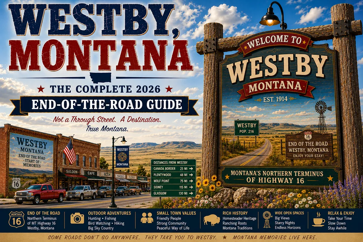
Westby sits at 48°55′ North latitude — within 2 miles of the Canadian border, a few miles from North Dakota, at the converging corner of three jurisdictions. It’s the northernmost incorporated community in eastern Montana.
The town was platted in 1913 when the Great Northern Railroad extended a spur line to this remote corner of Sheridan County, and its economy has been supported by wheat farming ever since.
Westby has about 170 residents, a grain elevator that defines its skyline, a bar, a church, and the particular self-sufficiency of a community that exists at the geographic margins of three states and a country.
What draws travelers to Westby isn’t what the town has — it’s where the town is. Standing on Westby’s main street, Saskatchewan is visible as a horizon to the north, North Dakota is a short drive east, and the vast northeastern Montana wheat belt stretches south and west. The three-jurisdiction proximity gives Westby a geographic specificity that most American small towns don’t have.
TL;DR
- Westby (~170) is Montana’s northernmost incorporated eastern community, 2 miles south of the Canadian border and a few miles west of North Dakota.
- Founded 1913 as a Great Northern Railroad townsite; economy entirely agricultural (wheat, canola, barley).
- The Westby-Outlook border crossing connects to Saskatchewan’s Highway 18.
- Best for: extreme northeastern Montana circuit travelers, border proximity novelty, and the genuine end-of-the-road Hi-Line experience.
Liked this article?
Add Roaming Montana as a preferred source so you see more of our articles and guides on Google.
Westby at a Glance
| Population (2020) | ~170 | | County | Sheridan County | | Distance to Canadian border | ~2 miles north | | Distance to Plentywood | ~25 miles southwest (~30 min) | | Distance to Scobey | ~50 miles west (~55 min) | | Distance to Williston, ND | ~55 miles southeast (~1 hour) |
What Makes Westby Different
The geographic novelty is real and significant. Most American communities can be categorized broadly by region — Midwest, Mountain West, Northwest.
Westby defies easy categorization because it sits precisely at the convergence of multiple boundaries. Montana, Saskatchewan, and North Dakota meet within a short drive in any direction. The cultural and economic influences of all three territories are present in Westby’s character.
The agricultural economy is strictly Hi-Line standard — hard red spring wheat is the primary crop, with canola, winter wheat, and barley in rotation.
The average farm in Sheridan County covers 3,000+ acres; the communities exist to provide services for those farms. Westby’s grain elevator — owned cooperatively by the surrounding farm families — is the town’s economic engine.
The Great Northern Railroad (now BNSF) established Westby in 1913 as part of a spur line development through northeastern Montana.
The original intention was to open up new agricultural territory; the settlers who arrived in the 1910s and 1920s, fleeing drought and difficult conditions elsewhere, built the community that persists today.
The border crossing at Westby-Outlook is a smaller port — not 24-hour, not commercially significant, but genuinely functional for crossings into Saskatchewan.
The highway on the Canadian side connects to the small Saskatchewan community of Outlook and the broader Saskatchewan provincial highway network.
For broader trip context, see my Montana cities and towns hub.
The Top 10 Things to Do
1. Drive to the Canadian Border (2 miles north)
The most distinctive activity in Westby. The Canadian border is a 2-minute drive north of town — actual border monuments, the port of entry, and the physical demarcation of two countries. For travelers who’ve driven across Montana without touching Canada, this is the closest approach.
2. Westby-Outlook Border Crossing
The crossing connects to Saskatchewan’s Highway 18. Check current hours before crossing — this is a smaller port with limited operating hours. Passport or enhanced driver’s license required. The Saskatchewan side has its own small communities and the rolling prairie that looks remarkably similar to what you just left in Montana.
3. Sheridan County Wheat Belt Photography
The landscape around Westby is prime agricultural photography country — grain elevators, wheat fields in various stages of growth or harvest, enormous skies, and the horizon-to-horizon scale of modern dryland farming. Golden hour light on the wheat is particularly dramatic.
4. Day Trip to Plentywood (25 minutes southwest)
The Sheridan County seat with the Communist era history museum, Brush Lake State Park (31 miles south), and Medicine Lake NWR. See Plentywood guide.
5. Day Trip to Scobey (50 minutes west)
Pioneer Town Museum Complex and the Dirty Shame Showdown. See Scobey guide.
6. Westby Bar
The community gathering place — where farm families, the occasional traveler, and Westby residents share the same barstools. Genuine small-town Montana bar culture.
7. Stargazing
Sheridan County has some of the darkest skies in the continental United States. The 2 miles to Canada and the sparse population north mean no light pollution in the northern hemisphere of Westby’s sky. New moon nights are extraordinary.
8. Observe Harvest Season (August)
The Sheridan County wheat harvest in August is one of the Hi-Line’s most impressive annual events — massive combines working fields that stretch to the horizon, grain trucks running continuously to the elevator, and the community organizing around this concentrated agricultural effort.
9. Spring Planting (May)
The spring planting season — when the massive air seeders and fertilizer rigs move across the fields — is equally impressive in its scale. The agriculture around Westby operates at a level of mechanization and efficiency that represents modern farming at its most optimized.
10. The Three-State/Province Novelty
From Westby, you can reach Montana, Saskatchewan (Canada), and North Dakota within 15 minutes of driving in different directions. Very few communities in the contiguous United States have this geographic specificity. It’s worth appreciating deliberately.
Where to Stay
Westby has no lodging. Plentywood (25 min southwest) is the practical overnight base.
| Hotel | Vibe | Price | Best For |
|---|---|---|---|
| Plentywood (25 min southwest) | Motels, basic | $85–140 | Most travelers |
| Scobey (50 min west) | Limited options | $85–130 | Pioneer Town focus |
Where to Eat
- Westby Bar — the community gathering place; basic food and cold beer
- Plentywood (25 min southwest) — more variety; see Plentywood guide
Getting There
From Plentywood: 25 miles northeast on US-5, about 30 minutes.
From Scobey: 50 miles east on MT-5, about 55 minutes.
From Williston, ND: 55 miles northwest via ND-5 and MT-5, about 1 hour.
When to Visit
August: Wheat harvest — the Hi-Line’s most dramatic agricultural event.
Winter: Cold and isolated. Not recommended for casual visitors, but the dark sky stargazing is exceptional.
Year-round: The border is accessible year-round during port hours.
Personal Tips
Check border crossing hours before going. The Westby-Outlook port is a smaller crossing with limited hours — not 24/7 like the major I-15 or US-2 crossings. Verify current hours at the US CBP website.
The stargazing here is exceptional. Two miles from Canada, 25 miles from the nearest significant town — Westby has the darkest accessible skies in the northeastern Montana corner.
Combine with Plentywood. The Communist era history and Brush Lake State Park at Plentywood (25 min southwest) fill out the Westby visit with substance.
Westby Quick Facts
| Founded | 1913 (Great Northern Railroad) | | Geographic position | Northernmost incorporated eastern Montana town | | Distance to Canada | ~2 miles | | Westby-Outlook crossing | Limited hours; Saskatchewan Highway 18 | | Average summer high | 80°F | | Average winter low | -8°F |
Conclusion
Westby is the end of the line — literally and geographically. Montana’s northernmost eastern community, 2 miles from Canada, a few miles from North Dakota, sustained by wheat farming and community resilience. For travelers completing the extreme northeastern Montana circuit, it’s the corner piece of the puzzle.
Have a Westby question? Drop it in the comments — I read every one.
Frequently Asked Questions
Is Westby Montana worth visiting?
Worth a deliberate stop for travelers completing the extreme northeastern Montana circuit. Westby’s status as Montana’s northernmost eastern incorporated community, 2 miles from Canada and near the North Dakota border, gives it genuine geographic interest. Combine with Plentywood (25 min southwest) for the region’s standout historical attractions.
What is the border crossing near Westby Montana?
The Westby-Outlook port of entry connects Westby, Montana to the community of Outlook, Saskatchewan, Canada, via Montana’s US-5 and Saskatchewan’s Highway 18. It is a smaller port with limited operating hours — not a 24/7 commercial crossing. Verify current hours before planning a crossing.
How far is Westby from the Canadian border?
Westby is approximately 2 miles south of the Canadian border at the Westby-Outlook port of entry.