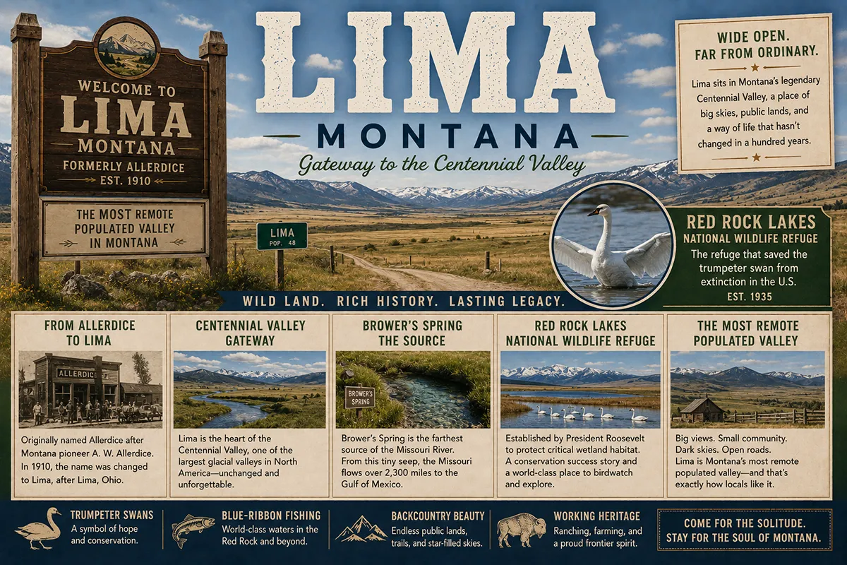
In the early 20th century, when there were only 69 known trumpeter swans left in the contiguous United States, every single one of them was breeding at the same place — the wetlands of the Centennial Valley, on the southern flank of the Centennial Mountains in extreme southwest Montana.
The largest waterfowl species in North America had been pushed nearly to extinction by hunting and habitat loss. The Centennial Valley population was the entire surviving breeding group; everything else south of Alaska was gone.
In 1935, the federal government established Red Rock Lakes National Wildlife Refuge specifically to protect those last 69 birds. Today the trumpeter swan is no longer endangered in the lower 48.
The refuge that saved the species is still here. And the small town of Lima — 60 miles south of Dillon on I-15, the practical jumping-off point for visiting the Centennial Valley and Red Rock Lakes — is the closest thing to a service town in one of the most genuinely remote populated landscapes in the American West.
Lima itself is small: about 229 residents living on I-15 in southwestern Beaverhead County. The town was originally called Allerdice when it was first settled in the 19th century, with the name eventually changing to Lima — for which there are multiple competing explanations (named for Lima, Wisconsin by an early settler; named in reference to lima beans grown in the area; named by Union Pacific Railroad officials looking for a short station name; none of these have been definitively confirmed).
What is confirmed is that the railroad arrived, the town grew up around it, and by the early 20th century Lima had become the service center for the ranches and homesteads scattered across the Centennial Valley to the east.
The geography defines everything here. Lima sits at the western edge of one of Montana’s most striking and overlooked landscapes — the Centennial Valley, a 45-mile-long, 15-mile-wide bowl framed on the south by the Centennial Mountains (which form the Montana-Idaho border for sixty miles of the Continental Divide National Scenic Trail) and on the north by the Snowcrest and Gravelly ranges.
The valley sits at approximately 6,700 feet elevation. Winters are brutal; summers are brief and stunning. The combination of high-altitude wetlands, isolation, and remarkable wildlife habitat has made the Centennial Valley one of the most ecologically significant landscapes in the Greater Yellowstone Ecosystem.
TL;DR
- Lima (~229) is in Beaverhead County on I-15, 60 miles south of Dillon and 25 miles north of the Idaho border.
- Originally named Allerdice before becoming Lima in its railroad-town era.
- The gateway to the Centennial Valley — a 45-mile-long, 15-mile-wide high-elevation valley considered one of Montana’s most remote inhabited landscapes.
- Red Rock Lakes National Wildlife Refuge (65,810 acres, established 1935, National Natural Landmark 1966) was the last refuge of the trumpeter swan in the contiguous United States — saved the species.
- Brower’s Spring in the Centennial Mountains at ~8,800 feet is the farthest traceable source of the Missouri River.
- Lima Reservoir (13 miles long, dam completed 1964) and the upper Red Rock River offer outstanding cutthroat trout and grayling fishing.
- The Centennial Mountains carry approximately 60 miles of the Continental Divide National Scenic Trail; Mt. Jefferson (10,203 ft) is the highest peak.
- Best for: serious wildlife refuge travelers, trumpeter swan enthusiasts, remote backcountry seekers, fly fishers, and Continental Divide Trail through-hikers.
Liked this article?
Add Roaming Montana as a preferred source so you see more of our articles and guides on Google.
Lima at a Glance
| Population (2020) | ~229 |
|---|---|
| County | Beaverhead County |
| Region | Southwest Montana |
| Elevation | 6,257 ft |
| Distance to Dillon (county seat) | ~60 miles north (~55 min on I-15) |
| Distance to Idaho border | ~25 miles south |
| Distance to Idaho Falls | ~120 miles south (~2 hours) |
| Distance to West Yellowstone | ~110 miles east via Centennial Valley (~3 hours on dirt road) |
| Distance to Lakeview / Red Rock Lakes NWR HQ | ~30 miles east (~50 min, gravel) |
| Distance to Bozeman | ~150 miles north (~2.75 hours) |
| Best for | Centennial Valley access, Red Rock Lakes NWR, trumpeter swans, fly fishing, Continental Divide Trail |
What Makes Lima Different
The Centennial Valley deserves more explanation than it usually gets in travel content. This is one of the most genuinely remote populated valleys in the contiguous United States.
The standard tourist gateway to Yellowstone via West Yellowstone is about 110 miles east of Lima — but the route between the two communities crosses the Centennial Valley along the Red Rock Pass Road, a gravel route through approximately 90 miles of essentially uninhabited country. There are no stores along that route. There is no fuel. There is no reliable cell phone service for most of the distance. The only “town” between Lima and West Yellowstone is Lakeview (formerly called Shambow), which was a stagecoach lunch stop in the early 1900s and now consists primarily of the Red Rock Lakes NWR headquarters, a few ranches, and not much else. Driving the Centennial Valley is a genuine wilderness-adjacent experience that requires preparation, supplies, and reasonable expectations.
Red Rock Lakes National Wildlife Refuge sits at the heart of this landscape. Established in 1935 specifically to protect the last 69 trumpeter swans in the contiguous United States, the refuge covers 65,810 acres at an average elevation of 6,700 feet — one of the highest-elevation national wildlife refuges in the system. It was designated a National Natural Landmark in 1966.
The wetland complex within the refuge is the largest in the Greater Yellowstone Ecosystem. Beyond trumpeter swans, the refuge supports moose, elk, grizzly bears, gray wolves, river otters, beavers, sandhill cranes, ospreys, peregrine falcons, and hundreds of other species. Bird-watching here is genuinely world-class.
The trumpeter swan recovery story is one of the most successful endangered-species comebacks in American conservation history, and Lima sits at its center. By 1935, every breeding trumpeter swan known in the lower 48 states was in the Centennial Valley.
The Red Rock Lakes NWR designation, combined with supplementary feeding programs through harsh winters, allowed the population to slowly recover and then expand.
Today trumpeter swans can be seen breeding across portions of the Greater Yellowstone Ecosystem, the Pacific Northwest, and increasingly across the upper Midwest.
The species is no longer formally endangered. The Lakeview NWR headquarters maintains a permanent Trumpeter Swan exhibit covering the recovery story.
The Continental Divide story is the other piece of Lima’s geographic significance. The Centennial Mountains south of Lima carry approximately 60 miles of the Continental Divide National Scenic Trail. Mt. Jefferson (10,203 ft) is the highest peak; nine others exceed 9,000 feet.
And on the Continental Divide ridgeline at approximately 8,800 feet sits Brower’s Spring — named for surveyor and explorer Jacob Brower — which produces the trickle of water that geographers and the U.S. Geological Survey recognize as the farthest traceable source of the Missouri River.
Hell Roaring Creek emerges from Brower’s Spring, flows down to Red Rock Creek, through Upper and Lower Red Rock Lakes, into the Red Rock River, eventually into the Beaverhead River, into the Jefferson River, and finally to Three Forks where the Missouri River officially begins. The drop of water that begins at Brower’s Spring and eventually reaches the Mississippi Delta covers approximately 4,000 miles.
For broader trip context, see my Montana cities and towns hub.
The Top 10 Things to Do In & Around Lima
1. Red Rock Lakes National Wildlife Refuge (Lakeview, ~30 miles east)
The primary attraction. The 65,810-acre refuge sits in the heart of the Centennial Valley with headquarters at Lakeview. Trumpeter swans are the signature species; the Lakeview headquarters maintains a permanent Trumpeter Swan exhibit covering the recovery story.
Bird-watching is exceptional — sandhill cranes, white pelicans, ospreys, peregrine falcons, sandpipers, and dozens of waterfowl species.
Wildlife beyond birds: moose, elk, pronghorn antelope, occasional grizzly bears, gray wolves, and beavers. The Sparrow Pond and Lower Red Rock Lake area provide accessible viewing. Refuge open year-round 8 a.m. onward; free.
2. Brower’s Spring & Farthest Source of the Missouri
For travelers interested in the actual most-distant source of the Missouri River, the trailhead access to Brower’s Spring is accessible via the Centennial Valley road and forest service routes.
The hike to the actual spring at approximately 8,800 feet elevation requires backcountry navigation and physical preparation; many travelers content themselves with photographing Hell Roaring Creek where it emerges from the Centennial Mountains visible from the valley road. The Hell Roaring Creek drainage is genuinely beautiful and historically significant.
3. Lima Reservoir Fishing
The 13-mile-long Lima Reservoir on the Red Rock River is one of Beaverhead County’s underrated fisheries — brown trout, rainbow trout, and some lake trout.
Multiple access points along the reservoir; relatively low pressure compared to better-known Beaverhead County waters. The reservoir was created by a dam completed in 1964. Camping available at multiple sites. Montana fishing license required.
4. Red Rock River Fly Fishing
The Red Rock River from below Lima Reservoir to Clark Canyon Reservoir is genuinely excellent fly fishing water — brown and rainbow trout, west slope cutthroat, and brook trout.
Even more remarkable is the upper Red Rock River above the wildlife refuge: native west slope cutthroat trout and Arctic grayling in nearly pristine high-elevation habitat. Access requires primitive backcountry roads. Montana fishing license required.
5. Continental Divide National Scenic Trail (Centennial Mountains)
The CDT crosses approximately 60 miles of the Centennial Mountains south of Lima. Trailhead access available at multiple points; backcountry permits not required for day hiking.
The Mt. Jefferson area is the most popular section. Through-hikers passing through during summer season often stop in Lima for resupply. Trail conditions can be challenging; verify with Forest Service before extended trips.
6. Centennial Valley Scenic Drive (Lima to West Yellowstone via Lakeview)
The 110-mile route from Lima east through the Centennial Valley to West Yellowstone is one of America’s most remote drivable corridors. Gravel road most of the distance.
Plan a full day; bring fuel, water, food, and a spare tire. No cell service most of the route. The scenery is genuinely spectacular — broad valley with the Centennial Mountains on one side and the Snowcrest/Gravelly ranges on the other. Wildlife encounters are routine.
7. Beaverhead-Deerlodge National Forest Backcountry
Lima sits on the western edge of an enormous Forest Service area — Beaverhead-Deerlodge NF covers more than 3 million acres of southwest Montana.
Day hiking, backpacking, hunting, fishing, and remote camping are all available within 30 minutes of town. Ranger district materials available at the Dillon office.
8. Trumpeter Swan Viewing (Late Fall & Winter)
While trumpeter swans nest on Red Rock Lakes during summer (when the lakes are partially closed to fishing and boating to protect breeding), the most dramatic viewing is often in late fall and early winter when the swans concentrate at the few remaining open-water areas before migration or settling for the winter. November and early December often provide the most impressive concentrations.
9. Day Trip to Dillon (1 hour north)
Beaverhead County seat with the Beaverhead County Museum, full restaurant variety, Beaverhead Brewing, and the Patagonia Outlet store. See Dillon guide.
10. Day Trip to West Yellowstone (~3 hours via Centennial Valley, longer via paved roads)
Yellowstone National Park’s west entrance. The Centennial Valley dirt-road route is more direct but requires preparation; the paved route via Dillon/I-15/Idaho/MT-87 is significantly longer but more reliable. See West Yellowstone guide.
Where to Stay
| Hotel | Vibe | Price | Best For |
|---|---|---|---|
| Lima Motel | Basic local motel | $80–130 | Budget, anglers |
| Mountain View Motel | Older property | $85–135 | Travelers passing through |
| Centennial Valley camping | USFS dispersed and developed sites | Free–$25 | Self-sufficient travelers |
| Lakeview camping (Red Rock Lakes NWR) | Refuge-managed primitive | Free | Birders, hardcore wildlife travelers |
| Dillon hotels (1 hour north) | Best regional selection | $120–220 | Most travelers |
| Vacation rentals (Lima area) | Limited options | $130–250 | Longer stays |
Where to Eat
- Jan’s Café & Steakhouse (Lima) — the local institution; steaks, breakfast, community gathering point
- Mountain View Café (Lima) — breakfast and lunch
- Peat Hotel & Bar (Lima) — bar food
- Dillon dining (1 hour north) — Beaverhead Brewing, Sparky’s Garage, Patagonia food trucks; see Dillon guide
Lima has very limited dining and almost nothing in the Centennial Valley itself. Bring supplies for any extended exploration east of town.
Getting There & Around
From Dillon: 60 miles south on I-15, about 55 minutes.
From Bozeman: ~150 miles via I-90 west to Bozeman, US-287 south, MT-41/MT-43 west, then I-15 south. About 2.75 hours.
From Idaho Falls: ~120 miles north on I-15, about 2 hours.
From West Yellowstone (Centennial Valley route): ~110 miles via the Red Rock Pass Road (gravel). 3+ hours; preparation required.
Cell service: Generally available in Lima itself; essentially unavailable in the broader Centennial Valley east of town. Download offline maps before exploration.
What Lima Unlocks
Red Rock Lakes National Wildlife Refuge (30 min east)
The trumpeter swan recovery story; one of America’s most significant wildlife refuges.
Centennial Valley (15 mi N-S, 45 mi E-W)
One of the most remote inhabited landscapes in the contiguous United States.
Brower’s Spring & Farthest Missouri Source
The geographically true most distant source of the Missouri River, ~8,800 ft in the Centennial Mountains.
Continental Divide National Scenic Trail (Centennial Mountains)
~60 miles of Continental Divide; Mt. Jefferson 10,203 ft.
Lima Reservoir & Red Rock River
13-mile reservoir; world-class fly fishing including native cutthroat and grayling.
Dillon (1 hour north)
Beaverhead County seat with full services. See Dillon guide.
Beaverhead-Deerlodge National Forest
3+ million acres of public land for hunting, fishing, hiking, and backcountry exploration.
When to Visit
Late June–early September: Best Centennial Valley accessibility; Red Rock Lakes NWR roads passable; CDT through-hiker season; trumpeter swan nesting.
Late September–early November: Fall colors in the cottonwood drainages; cooler hiking temperatures; hunting season for elk and deer with proper permits.
Late November–early December: Often peak trumpeter swan viewing when birds concentrate at open water.
Winter (December–March): Centennial Valley roads largely closed by snow; Lima itself accessible via I-15 but limited services. Backcountry cross-country skiing for prepared travelers.
Spring (April–May): Snowmelt and unpredictable weather; many backroads remain closed.
Personal Tips
Prepare seriously for the Centennial Valley. This is not a casual scenic drive. Bring extra fuel, water, food, a first aid kit, a spare tire, and offline maps. Tell someone where you’re going and when you’ll be back. The remoteness is the appeal but it’s also a genuine safety consideration.
Lakeview NWR headquarters first. Stop at the Red Rock Lakes NWR headquarters at Lakeview for current road conditions, wildlife viewing recommendations, and the Trumpeter Swan exhibit. Refuge staff have current information that’s not available elsewhere.
Lima is the supply town. Buy fuel, food, and any supplies you need in Lima before heading east into the Centennial Valley. There is essentially nothing between Lima and Lakeview except landscape.
Bird-watching demands a spotting scope. Good binoculars work for most species; a spotting scope is the right tool for the Red Rock Lakes wetland complex. Many of the trumpeter swans and waterfowl are visible only at significant distance from accessible vantage points.
Brower’s Spring is for serious hikers. Don’t plan a casual day trip to the actual source of the Missouri. The hike requires backcountry route-finding, significant elevation gain, and physical preparation. Most travelers settle for photographing Hell Roaring Creek where it emerges from the mountains.
Jan’s Café is the only dinner option in Lima most nights. Plan accordingly; arrive before kitchen closing or eat in Dillon.
Lima Quick Facts
| Original name | Allerdice | | Red Rock Lakes NWR established | 1935 (to protect 69 trumpeter swans) | | Red Rock Lakes NWR size | 65,810 acres | | National Natural Landmark designation | 1966 | | Centennial Valley dimensions | 15 mi N-S × 45 mi E-W | | Centennial Mountains highest peak | Mt. Jefferson 10,203 ft | | Continental Divide Trail (Centennial section) | ~60 miles | | Brower’s Spring elevation | ~8,800 ft (farthest Missouri source) | | Lima Reservoir length | 13 miles | | Lima Reservoir dam completed | 1964 | | Lakeview NWR headquarters distance | ~30 miles east of Lima | | Average summer high | 78°F | | Average winter low | 0°F |
Conclusion
Lima is the gateway to one of the most genuinely consequential conservation landscapes in the American West — the Centennial Valley and Red Rock Lakes National Wildlife Refuge that saved the trumpeter swan from extinction in the contiguous United States nearly a century ago. Add the farthest source of the Missouri River at Brower’s Spring, 60 miles of Continental Divide National Scenic Trail through the Centennial Mountains, world-class fly fishing on the Red Rock River and Lima Reservoir, and the remarkable remoteness that defines this corner of Montana, and you have one of the most substantive 2-4 day destinations in the entire state. The drive south from Dillon is short. The rewards of slowing down here are real.
Have a Lima question? Drop it in the comments — I read every one.
Frequently Asked Questions
Is Lima Montana worth visiting?
Yes — Lima is worth visiting as the gateway to Red Rock Lakes National Wildlife Refuge, the 65,810-acre wildlife refuge established in 1935 to save the trumpeter swan from extinction in the contiguous United States. The broader Centennial Valley is one of America’s most remote and ecologically significant landscapes — exceptional bird-watching, world-class fly fishing on the Red Rock River and Lima Reservoir, the Continental Divide National Scenic Trail in the Centennial Mountains, and the farthest traceable source of the Missouri River at Brower’s Spring.
What is Red Rock Lakes National Wildlife Refuge?
Red Rock Lakes National Wildlife Refuge is a 65,810-acre wildlife refuge in the Centennial Valley of Beaverhead County, Montana — approximately 30 miles east of Lima. The refuge was established in 1935 specifically to protect the last 69 known trumpeter swans in the contiguous United States. It was designated a National Natural Landmark in 1966. The refuge contains the largest wetland complex within the Greater Yellowstone Ecosystem and supports trumpeter swans, sandhill cranes, white pelicans, ospreys, moose, elk, grizzly bears, gray wolves, and hundreds of other species.
What was Lima Montana’s original name?
Lima was originally named Allerdice before being renamed Lima in its railroad-town era. The exact origin of the name “Lima” is uncertain — explanations include reference to Lima, Wisconsin (where some early settlers came from), the lima bean (grown in limited quantities locally), or a short station name chosen by Union Pacific Railroad officials.
Where is the source of the Missouri River?
The geographically farthest traceable source of the Missouri River is Brower’s Spring, located on the Continental Divide ridgeline of the Centennial Mountains south of Lima at approximately 8,800 feet elevation. Named for surveyor and explorer Jacob Brower, the spring produces the small trickle that becomes Hell Roaring Creek, which flows into Red Rock Creek, through Upper and Lower Red Rock Lakes, into the Red Rock River, eventually into the Beaverhead River, into the Jefferson River, and to Three Forks where the Missouri River officially begins. The drop of water beginning at Brower’s Spring covers approximately 4,000 miles to reach the Mississippi Delta.
What is the Centennial Valley?
The Centennial Valley is a high-elevation basin in southwestern Beaverhead County, Montana — approximately 45 miles long (east-west) and 15 miles wide (north-south), at an average elevation of 6,700 feet. The valley is bordered on the south by the Centennial Mountains (Montana-Idaho border, Continental Divide) and on the north by the Snowcrest and Gravelly mountain ranges. It is considered one of the most remote inhabited valleys in the contiguous United States, with no commercial services, no fuel stations, and no reliable cell phone service across most of its length.
How far is Lima from Dillon Montana?
Lima is approximately 60 miles south of Dillon on Interstate 15 — about a 55-minute drive. Dillon, the Beaverhead County seat, serves as the practical urban anchor for travelers visiting Lima and the Centennial Valley.