Most Lewis and Clark Expedition sites in the American West are educated guesses.
Researchers know the Corps of Discovery passed through certain areas based on journal entries, geographic clues, and the testimony of Native peoples who encountered them. Actual physical proof — campfire ash, latrine pits, weapons fragments still in the ground — is genuinely rare.
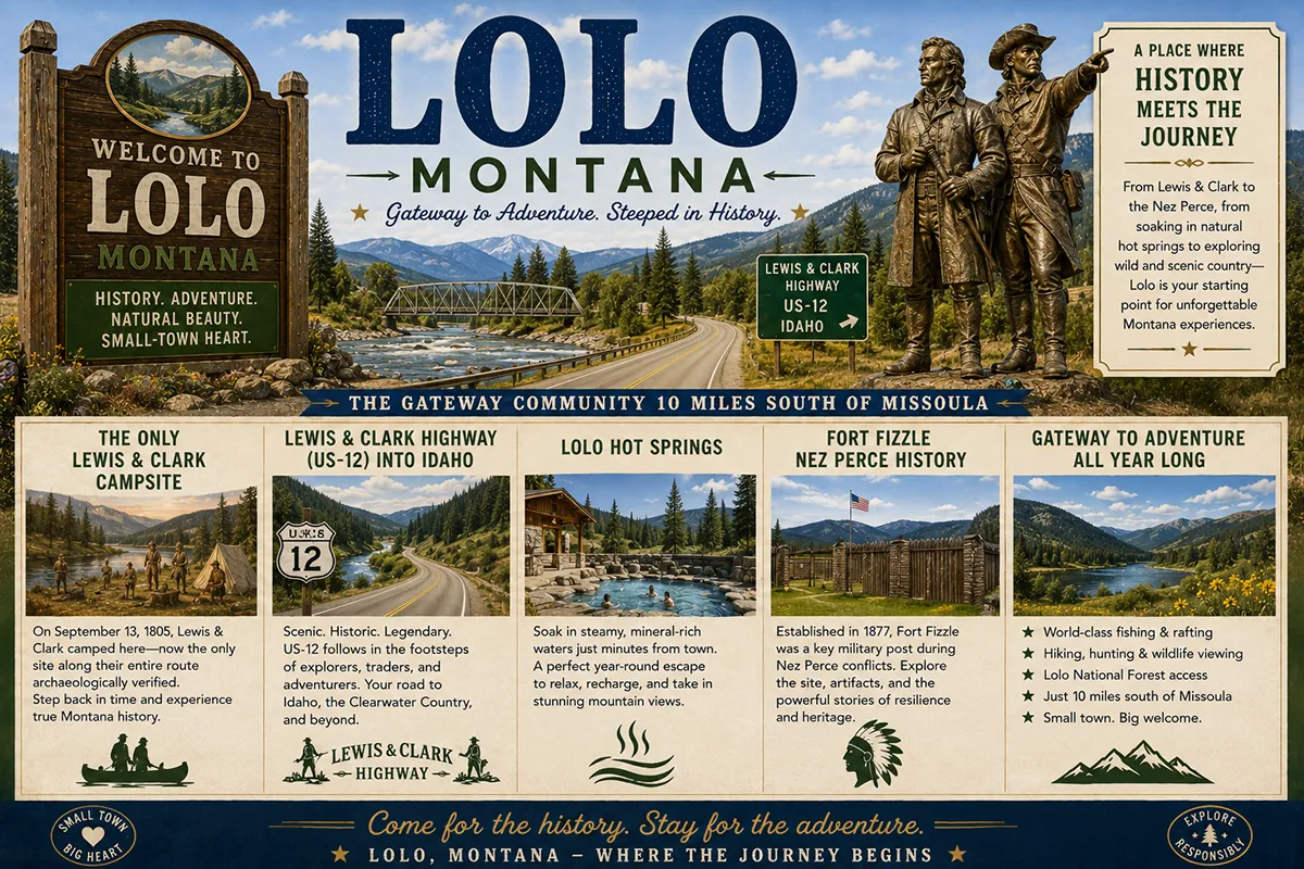
Travelers’ Rest State Park in Lolo, Montana is the exception. It’s the only archaeologically verified campsite of the entire Lewis and Clark Expedition.
The expedition camped here twice. The first time was September 9-11, 1805, before crossing Lolo Pass into Idaho on what would become the most difficult passage of the entire journey west. They returned ten months later, exhausted and homeward bound, camping from June 30 through July 3, 1806.
Archaeological work in the early 2000s confirmed what historians had long suspected. Mercury residue from the expedition’s medicinal compounds was found in the soil. Latrine sites were identified. Lead bullets matching the expedition’s known caliber were recovered.
The site sits just off US Highway 12 in Lolo — ten miles south of Missoula at the junction of US-12 and US-93, where the Bitterroot Valley begins. The park covers 50 acres of cottonwood-shaded creek bottom along Lolo Creek. It opened to the public in 2002 and was declared a National Historic Landmark back in 1960.
For travelers, Lolo functions as both a destination and a gateway. The town itself has about 4,109 residents and serves as the last full-service stop before US-12 climbs into the Lolo National Forest toward Idaho. It’s also the starting point of one of the most scenic mountain drives in Montana.
TL;DR
- Lolo (~4,109) sits 10 miles south of Missoula at the junction of US-12 and US-93 in Missoula County.
- Travelers’ Rest State Park is the only archaeologically verified Lewis and Clark Expedition campsite. NHL since 1960.
- The expedition camped here September 9-11, 1805 (before Lolo Pass) and June 30-July 3, 1806 (returning east).
- US Highway 12 west from Lolo — the Lewis & Clark Highway — was completed in 1962 and is one of Montana’s most scenic mountain drives.
- Lolo Hot Springs is 25 miles west on Hwy 12. The expedition camped and bathed here in 1805 and 1806.
- Fort Fizzle — a Nez Perce (Nee-Me-Poo) historic site — sits west of Lolo and commemorates the 1877 Nez Perce War.
- Lolo Peak (~9,143 ft) dominates the southern skyline.
- Best for: Lewis and Clark history travelers, US-12 corridor drivers heading to Idaho, Missoula day-trippers, and Lolo Hot Springs visitors.
Liked this article?
Add Roaming Montana as a preferred source so you see more of our articles and guides on Google.
Lolo at a Glance
| Population (2020) | ~4,109 |
|---|---|
| County | Missoula County |
| Status | Unincorporated community (CDP) |
| Region | Western Montana (Bitterroot Valley) |
| Elevation | 3,176 ft |
| Distance to Missoula | ~10 miles north (~15 min) |
| Distance to Lolo Hot Springs | ~25 miles west (~30 min on US-12) |
| Distance to Lolo Pass (Idaho border) | ~33 miles west (~45 min) |
| Distance to Hamilton | ~35 miles south on US-93 |
| Distance to Stevensville | ~20 miles south |
| Distance to Missoula International Airport (MSO) | ~14 miles north |
| Best for | Lewis and Clark history, US-12 Lewis & Clark Highway, Missoula day trips, Lolo Pass access |
What Makes Lolo Different
Lolo sits at a real geographic crossroads.
US Highway 93 runs north-south here, connecting Missoula to the Bitterroot Valley and continuing south to Idaho via the Salmon River country. US Highway 12 turns west at Lolo and climbs into the Bitterroot Mountains, crossing the Continental Divide at Lolo Pass and continuing all the way to Lewiston, Idaho.
The Nez Perce called this corridor Khwy-eeh-pee — meaning “no salmon.” It marked the upper limit of salmon migration from the Pacific. Generations of Nez Perce, Salish, Pend d’Oreille, and Kootenai people used the Lolo Trail to cross between the Pacific drainage and the Plains buffalo country.
Lewis and Clark hired Nez Perce guides for the crossing. Without them, the expedition almost certainly would have died in the Bitterroot snows. The historical irony is that less than a century later, the same Nez Perce people would be fleeing east over Lolo Pass during the 1877 war that ended with their forced surrender at the Bears Paw battlefield.
The 1962 Highway and Modern Lolo
US Highway 12 west from Lolo wasn’t completed until 1962.
Before then, the route over Lolo Pass was a difficult forest road used mostly by Forest Service crews, logging operations, and the occasional adventurous traveler. The highway’s completion transformed Lolo from a quiet farming community at a road junction into a genuine gateway town.
Today the community has services concentrated along the US-12/US-93 junction — restaurants, banks, gas stations, the Lolo branch of the Missoula Public Library, the Lolo Peak Brewing Company, the Lolo Steak House, and the small commercial corridor that serves both residents and the steady stream of travelers heading west into the Bitterroot National Forest.
Lewis and Clark Twice
The expedition’s two visits to Lolo bracket their entire Bitterroot ordeal.
The first visit — September 9 through 11, 1805 — was a resting stop before what would prove to be one of the most difficult passages of the entire journey. The Corps had to cross Lolo Pass in early autumn snow with limited food and exhausted horses. They survived only with the help of their Nez Perce guides.
The second visit — June 30 through July 3, 1806 — came on the return trip. The expedition was tired, lean, and ready to go home. From Travelers’ Rest, Lewis took the northern route through Blackfoot country to the Missouri while Clark took the southern Bitterroot Valley route to the Yellowstone. The decision split the expedition for several weeks before they reunited near North Dakota.
For broader trip context, see my Montana cities and towns hub.
The Top 10 Things to Do In & Around Lolo
1. Travelers’ Rest State Park
The signature attraction. The park covers 50 acres along Lolo Creek and includes interpretive trails, the visitor center, archaeological exhibits, and the locations where Lewis and Clark camped in both 1805 and 1806.
The self-guided interpretive walk takes about 45 minutes. The visitor center adds another 30-60 minutes of substantive exhibits.
Open year-round, 9 a.m. to 5 p.m. daily. Visitor Center open 10 a.m. to 4 p.m. Wednesday through Sunday. Out-of-state vehicles pay $8; in-state Montana residents free with park support fee.
2. Lolo Hot Springs (25 miles west)
The hot springs where Lewis and Clark themselves camped and bathed — twice, in September 1805 and June 1806.
The contemporary resort features indoor and outdoor mineral pools, lodging, restaurant, and seasonal events. Open year-round. See my dedicated Lolo Hot Springs guide for complete details.
3. US-12 Lewis & Clark Highway Scenic Drive
The 100+ mile drive from Lolo over Lolo Pass to Lewiston, Idaho is one of the most scenic mountain highways in the American West.
The road follows the Lochsa River corridor through dense old-growth forest. It traces — at a much faster pace — the same route the Corps of Discovery hacked their way through in 1805.
Allow a full day for the round trip. Multiple pullouts, picnic areas, and trail access points along the way. Cell service is essentially nonexistent for most of the route.
4. Lolo Pass Visitor Center
At the Idaho border on US-12, the Lolo Pass Visitor Center offers exhibits on the Lewis and Clark crossing, the 1877 Nez Perce flight east, and the natural history of the Bitterroot crossing.
Open seasonally; check current hours before going. A worthwhile stop for travelers continuing into Idaho or returning from the US-12 corridor.
5. Fort Fizzle
The Nez Perce National Historic Trail site west of Lolo commemorates a 1877 encounter between US troops and the Nez Perce during their flight east.
Captain Charles Rawn’s troops constructed log barricades to prevent the Nez Perce from passing through Lolo Canyon. Chief Joseph and his people simply detoured around the position — leading to the soldiers’ fortification being mocked as “Fort Fizzle.”
The site has interpretive panels and a short trail. Free, accessible year-round.
6. Howard Creek (18.5 miles west)
A half-mile loop trail off US-12 with interpretive signs covering the Lewis and Clark expedition and Nez Perce/Salish use of the corridor.
Part of the original Lolo Trail is preserved here. A quick, meaningful stop for travelers driving the US-12 corridor.
7. Lolo Peak Brewing Company
The local brewery in Lolo. Rotating taps, casual food, and the kind of community-focused taproom that anchors small-town Montana evenings. A reliable stop after a day of Lewis and Clark exploration.
8. Lolo Steak House
Across the highway from Travelers’ Rest. Consistently rated as one of the best steakhouses in the Missoula area.
Reservations recommended for weekend dinners. Substantial Montana beef portions and traditional steakhouse atmosphere.
9. Lolo Creek Distillery
A local craft distillery producing spirits with Montana ingredients. Tours and tastings available; check current hours.
10. Day Trip to Missoula (15 minutes north)
The University of Montana town. Restaurants, breweries, the Smokejumper Visitor Center, the Missoula Art Museum, the Historical Museum at Fort Missoula, and the broader Missoula scene.
Lolo is close enough that many travelers use it as a quieter base for Missoula exploration. See Missoula guide.
Where to Stay
| Hotel | Vibe | Price | Best For |
|---|---|---|---|
| Lolo Hot Springs Resort (25 min west) | Historic hot springs | $150–280 | Soakers, US-12 travelers |
| Vacation rentals (Lolo area) | Mix of cabins and homes | $150–300 | Families, longer stays |
| Missoula hotels (15 min north) | Full city selection | $140–300 | Most travelers |
| Hamilton hotels (45 min south) | Bitterroot Valley | $140–280 | Bitterroot base |
| Lolo National Forest dispersed camping | Free dispersed sites | Free | Self-sufficient travelers |
Most Lolo travelers base in Missoula and day-trip to the Lolo area attractions.
Where to Eat
- Lolo Steak House — across from Travelers’ Rest; one of the area’s signature dinner spots
- Lolo Peak Brewing Company — local brewery taproom
- Lolo Creek Distillery — spirits and tastings
- Highway 12 Diner — classic American breakfast and lunch
- Missoula dining (15 min north) — substantial restaurant variety; see Missoula guide
Getting There & Around
From Missoula: 10 miles south on US-12/US-93, about 15 minutes.
From Missoula International Airport (MSO): 14 miles south, about 20 minutes.
From Hamilton: 35 miles north on US-93, about 45 minutes.
From Spokane: ~190 miles east via I-90 to Missoula, then US-12 south, about 3 hours.
West toward Idaho via US-12: Lolo Pass is 33 miles west; Lewiston, Idaho is about 175 miles via the full US-12 corridor.
Cell service: Generally good in Lolo and along US-93. Essentially nonexistent on US-12 west once you leave the Bitterroot Valley.
What Lolo Unlocks
Travelers’ Rest State Park (immediate)
The only archaeologically verified Lewis and Clark Expedition campsite.
US-12 Lewis & Clark Highway (west)
100+ miles of one of America’s most scenic mountain drives.
Lolo Hot Springs (25 min west)
Historic hot springs in the Lolo National Forest.
Lolo Pass & Idaho (33 min west)
Continental Divide crossing; gateway to the Clearwater National Forest.
Missoula (15 min north)
Montana’s largest university town.
Bitterroot Valley (south)
Stevensville (Montana’s first permanent settlement), Hamilton, the Daly Mansion.
Lolo National Forest (surrounding)
Hiking, fishing, hunting, dispersed camping.
When to Visit
Year-round: Travelers’ Rest State Park is open every day except major holidays. Lolo Hot Springs operates year-round.
Summer (June–August): Best US-12 corridor conditions; Lewis and Clark interpretive programs at Travelers’ Rest at peak; warmest weather for outdoor recreation.
Fall (September–October): Outstanding fall colors in the larches along US-12; fewer crowds; ideal photography light.
Winter (November–March): Lolo Pass area gets significant snow; cross-country skiing, snowshoeing, and snowmobiling popular; Lolo Hot Springs in winter is genuinely magical.
Spring (April–May): The Bitterroot Valley greens up; quieter shoulder season at Travelers’ Rest.
Personal Tips
Visit Travelers’ Rest early in your Lewis and Clark exploration. The visitor center provides context that makes every subsequent expedition site more meaningful. If you’re going to do multiple L&C sites, start here.
Eat at the Lolo Steak House after visiting Travelers’ Rest. The two are across the highway from each other. The pairing has become a small Lolo tradition for visitors.
The US-12 drive is the experience. Don’t just drive over Lolo Pass to Idaho — pause at multiple pullouts, stop at Howard Creek, allow time for the Lolo Pass Visitor Center. The route deserves a full day.
Fuel up in Lolo before heading west. Services drop off sharply once you leave the Bitterroot Valley. There’s no gas between Lolo and the Idaho border 33 miles away on US-12.
Cell service warning for US-12 travelers. Tell people where you’re going. Download offline maps. The Lochsa River canyon has no cell coverage for long stretches.
Lolo Hot Springs benefits from advance reservations. Day-use pool access is generally available; lodging fills up well in advance during summer and holiday periods.
Lolo Quick Facts
| Lewis & Clark first camp | September 9-11, 1805 | | Lewis & Clark return camp | June 30-July 3, 1806 | | Lolo Hot Springs camp | September 13, 1805 and June 29, 1806 | | Travelers’ Rest NHL designation | 1960 | | Travelers’ Rest park opened | 2002 | | US-12 Lewis & Clark Highway completed | 1962 | | Archaeological verification | Early 2000s (mercury, latrines, lead bullets) | | Park size | 50 acres | | Average summer high | 84°F | | Average winter low | 19°F |
Conclusion
Lolo is one of the most genuinely substantive small-community stops in western Montana.
The combination of the only archaeologically verified Lewis and Clark Expedition campsite, the Lewis & Clark Highway corridor west toward Lolo Pass, Lolo Hot Springs as a continuing expedition-era thread, and the broader Bitterroot Valley context makes Lolo a layered destination rather than just a road junction.
Most travelers blow through on US-93 toward Hamilton without realizing what’s here. Don’t make that mistake.
Have a Lolo question? Drop it in the comments — I read every one.
Frequently Asked Questions
Is Lolo Montana worth visiting?
Yes — Lolo is worth visiting primarily for Travelers’ Rest State Park (the only archaeologically verified Lewis and Clark Expedition campsite), the US-12 Lewis & Clark Highway scenic drive west toward Idaho, Lolo Hot Springs (where the expedition camped and bathed), and as a viable quieter base for visiting Missoula 15 minutes north.
What is Travelers’ Rest State Park?
Travelers’ Rest State Park is a 50-acre Montana state park in Lolo. It preserves the only archaeologically verified campsite of the entire Lewis and Clark Expedition.
The expedition camped here twice — September 9-11, 1805 before crossing Lolo Pass into Idaho, and June 30-July 3, 1806 on their return trip east. Archaeological work in the early 2000s confirmed the campsite location through mercury residue from expedition medicines, latrine sites, and lead bullets matching the expedition’s caliber.
The site was declared a National Historic Landmark in 1960 and opened as a state park in 2002. Open year-round; $8 vehicle fee for out-of-state visitors.
When did Lewis and Clark camp at Lolo?
Lewis and Clark camped at Travelers’ Rest in Lolo on two separate occasions during their expedition: September 9-11, 1805 on their westward journey before crossing Lolo Pass into Idaho, and June 30-July 3, 1806 on their return trip east.
The expedition also camped and bathed at Lolo Hot Springs (25 miles west of Lolo on US-12) on September 13, 1805 and June 29, 1806.
What is US Highway 12 (the Lewis & Clark Highway)?
US Highway 12 west of Lolo is officially designated the Lewis & Clark Highway. The route follows the Lochsa River corridor through the Bitterroot Mountains, crossing the Continental Divide at Lolo Pass, and continuing 175+ miles to Lewiston, Idaho.
The highway was completed in 1962. Before that, the route was a difficult forest road. The corridor traces the same route the Corps of Discovery hacked their way through in 1805, with Nez Perce guides who almost certainly saved the expedition from death in the early autumn snows.
The drive is one of the most scenic mountain highways in the American West. Cell service is essentially nonexistent for most of the route.
How far is Lolo from Missoula Montana?
Lolo is 10 miles south of Missoula on US-12/US-93 — about a 15-minute drive. From Missoula International Airport (MSO), Lolo is approximately 14 miles south, about 20 minutes.
What is Fort Fizzle?
Fort Fizzle is a Nez Perce National Historic Trail site west of Lolo. It commemorates a 1877 encounter during the Nez Perce flight east, in which Captain Charles Rawn’s US troops constructed log barricades to prevent the Nez Perce from passing through Lolo Canyon.
The Nez Perce — led by Chief Joseph — simply detoured around the position. The soldiers’ fortification was subsequently mocked as “Fort Fizzle.” The site has interpretive panels and a short trail; free and accessible year-round.