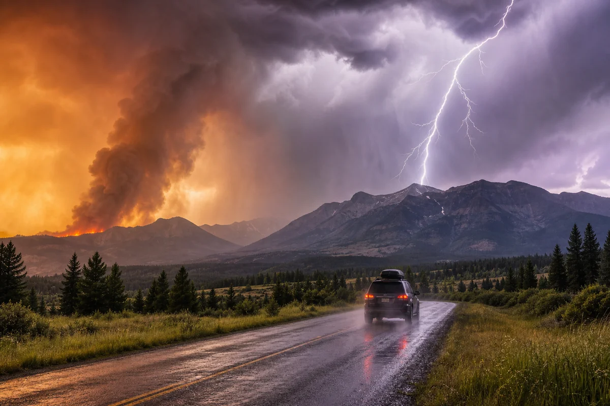
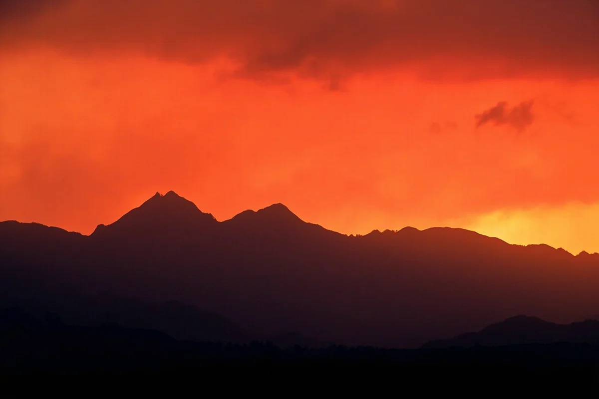
I’ll never forget standing on the shore of Flathead Lake last August, watching an orange haze swallow the Mission Mountains as a wildfire 30 miles away turned the afternoon sun blood-red.
That moment crystallized something every Montana traveler needs to understand: this wild, beautiful state plays by nature’s rules, not yours.
If you’re exploring Montana Living or planning an adventure in Big Sky Country, knowing what natural hazards you might encounter isn’t fear-mongering—it’s smart travel.
- Wildfires are Montana’s most common natural disaster, peaking July–September with significant air quality impacts
- Flash floods strike mountain valleys with little warning, especially during spring runoff and summer thunderstorms
- Severe winter storms can strand travelers for days—always carry emergency supplies
- Earthquakes happen more often than visitors expect, with Yellowstone’s geologic activity affecting western Montana
- Tornadoes occur primarily on eastern Montana’s plains during late spring and summer
- Avalanches pose serious risks to backcountry skiers and snowmobilers from November through April
- Drought conditions can close recreation areas and increase fire danger throughout the state
Understanding Montana’s Relationship With Natural Forces
Montana spans a staggering 147,040 square miles—the fourth-largest state in America. When I drove from the Badlands near Glendive to the cedar forests outside Troy, I crossed through seven distinct climate zones in a single day.
This geographic diversity means that natural disasters here don’t follow a single pattern.
The state’s low population density works both for and against travelers. On one hand, you’re less likely to encounter crowded evacuation routes. On the other, help can be hours away if you’re stranded in the backcountry.
During my decade of traveling through Montana, I’ve learned that locals have a saying: “If you don’t like the weather, wait fifteen minutes.”
What they don’t always mention is that sometimes those weather changes involve 60-mph wind gusts, horizontal hail, or a wildfire popping up over the ridge you were planning to hike.
1. Wildfires: Montana’s Most Pressing Natural Threat
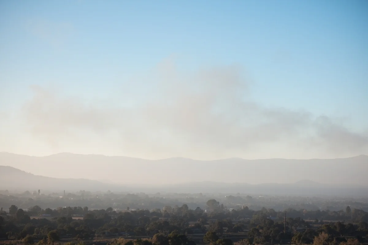
Let me be direct with you: wildfires have fundamentally changed summer travel in Montana over the past decade. When I first started visiting in the early 2010s, smoky days were occasional inconveniences. Now, they’re the expectation from late July through mid-September.
What I’ve Witnessed Firsthand
During a camping trip near Seeley Lake in 2021, I watched the air quality index jump from “good” to “hazardous” within 18 hours. A fire that started 40 miles away had conditions change, pushing smoke directly into the valley.
We cut our trip three days short—not because flames threatened us, but because breathing became genuinely difficult.
The 2017 fire season was even worse. I was working on a story near Glacier National Park when the Sprague Fire forced closures of the park’s most iconic areas. The Going-to-the-Sun Road—the bucket-list destination for most visitors—had sections closed for weeks.
How Wildfires Impact Your Trip
| Impact Type | What to Expect | Planning Advice |
|---|---|---|
| Road Closures | Major highways and scenic routes shut down with little notice | Check MT511.gov daily during fire season |
| Trail Closures | Popular hiking areas may close entirely | Have 3-4 backup hiking destinations ready |
| Air Quality | AQI can exceed 300 (hazardous) for days | Pack N95 masks and monitor AirNow.gov |
| Visibility | Mountain views completely obscured by smoke | Book June or late September for best views |
| Campfire Bans | Often implemented statewide during dry periods | Bring a camp stove as backup |
For more detailed information about fire conditions, I recommend reading our complete guide to Montana wildfires.
Practical Fire Season Tips From Experience
When I’m planning trips during fire season, I always book refundable accommodations. Last summer, I had to cancel a week-long Glacier trip two days before departure when smoke made conditions unacceptable.
I also travel with a quality air purifier for hotel rooms. It sounds excessive until you’re trying to sleep while your throat burns from smoke that’s seeped into every building in town. The investment was worth every penny.
2. Flash Floods: The Hidden Killer
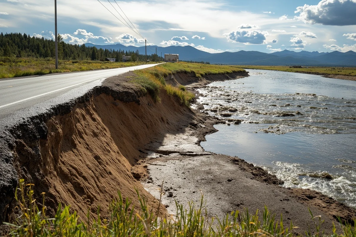
Most visitors don’t associate Montana with flooding, but flash floods kill more people in the American West than any other natural disaster. I’ve seen the aftermath firsthand, and it changed how I approach backcountry travel here.
The June 2022 Yellowstone Floods
Though technically in Wyoming and Montana’s border regions, the catastrophic flooding in June 2022 reshaped communities I’d visited dozens of times. When I returned to Gardiner six months after the floods, I couldn’t believe my eyes. The Yellowstone River had carved entirely new channels, swallowing homes, businesses, and the only road into the park’s north entrance.
What struck me most was talking with longtime residents who said they’d never seen anything like it. These weren’t naive newcomers—they were people who’d lived alongside that river for generations.
When and Where Floods Happen
Montana experiences two distinct flood seasons. Spring runoff floods occur when snowpack melts rapidly, usually in May and June. These are somewhat predictable if you’re watching mountain snowpack levels.
Summer flash floods are more dangerous because they strike with little warning. During a July trip through the Beartooth Mountains, I watched a clear sky turn into a violent thunderstorm in under 30 minutes. Within an hour, creeks that had been ankle-deep became impassable torrents.
The areas most prone to flash flooding include:
- Canyons and narrow valleys in mountain ranges
- Dry creek beds (called “coulees” locally)
- River bottoms near Helena, Missoula, and Great Falls
- Burned areas where vegetation no longer absorbs rainfall
Protecting Yourself From Flash Floods
Never camp in dry washes or at the bottom of steep valleys. During my last trip to the Missouri Breaks, I met a family who’d set up camp in what looked like a perfect sheltered spot—a dry creek bed with shade trees. When I mentioned the flood risk, they genuinely had no idea. They moved their camp that afternoon, and we got a heavy thunderstorm overnight.
If you’re driving during a storm, remember this mantra: Turn around, don’t drown. Even six inches of moving water can sweep a vehicle off the road. I’ve watched confident 4×4 drivers learn this lesson the hard way on flooded forest roads.
3. Severe Winter Storms: Montana’s Brutal Cold
I’ll admit it: Montana’s winters terrified me before my first winter visit. And honestly? They should be respected. The state holds the record for the coldest temperature ever recorded in the lower 48: minus 70°F at Rogers Pass in 1954.
My White-Knuckle Drive Through a Ground Blizzard
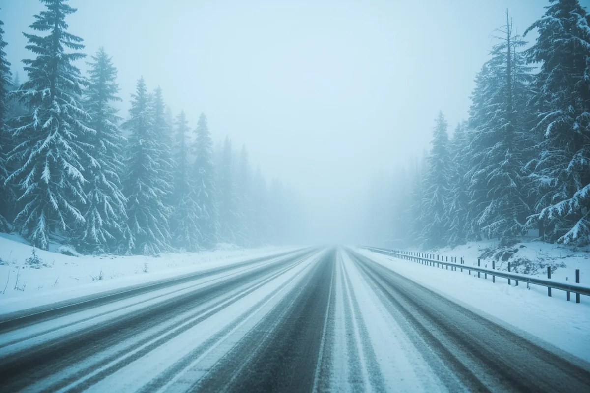
On a January trip from Bozeman to Billings, I experienced my first Montana ground blizzard. The sky was perfectly clear—I could see blue overhead—but wind was whipping snow across the interstate so intensely that visibility dropped to zero. I spent three hours crawling at 20 mph, watching cars that had slid off the road every few miles.
What made it worse was the wind chill. When I stopped to help push a sedan back onto the road, the minus 30°F wind chill cut through my gear within minutes. I couldn’t feel my fingers for an hour afterward.
Winter Storm Types You’ll Encounter
Montana gets several distinct winter storm patterns:
Alberta Clippers sweep down from Canada, bringing fast-moving but relatively light snow with extremely cold temperatures. These can drop temperatures 40 degrees in a few hours.
Pacific Systems bring heavier, wetter snow to western Montana. Areas like the snowiest places in Montana—including the mountains around Whitefish and the ranges south of Missoula—can receive several feet from a single storm.
Upslope Events occur along the Rocky Mountain Front, where easterly winds push moisture against the mountains. Great Falls and the Hi-Line region can get buried while areas 50 miles away remain clear.
Winter Travel Essentials
Based on my winter travel experiences, I never drive Montana roads between November and April without:
- A full tank of gas (stations can be 100+ miles apart in eastern Montana)
- Sleeping bag rated to minus 20°F
- Emergency food and water for 48 hours
- Tow strap, shovel, and traction devices
- Fully charged phone with battery bank
- Physical road maps (cell service is unreliable)
Understanding winter conditions is crucial when considering the pros and cons of living in Montana or just visiting during the cold months.
4. Earthquakes: Montana’s Hidden Seismic Activity
Most visitors don’t realize that Montana experiences thousands of earthquakes each year. The vast majority are too small to feel, but the state has a history of significant seismic events that should be on every traveler’s radar.
The 1959 Hebgen Lake Earthquake
Before visiting Quake Lake near West Yellowstone, I’d never heard of the 1959 Hebgen Lake earthquake. Standing at the visitor center overlooking the lake—which didn’t exist before the quake created it—sent chills down my spine.
The magnitude 7.3 earthquake struck just before midnight on August 17, 1959. A massive landslide buried a campground, killing 28 people in seconds. The Madison River was dammed by debris, creating Quake Lake. You can still see trees standing dead in the water, preserved for over 60 years.
Ongoing Seismic Activity
The Yellowstone Caldera—one of the world’s largest active volcanic systems—sits partly in Montana and generates constant earthquake activity. During a four-day stay in the Paradise Valley last fall, the USGS recorded over 40 small earthquakes in the region. I felt one distinctly while eating breakfast in Livingston: a quick jolt followed by a low rumble, gone within seconds.
Montana’s western region sits at the intersection of several fault systems. The Intermountain Seismic Belt runs from Yellowstone through Helena and up to the Flathead Valley. Another significant earthquake struck Helena in 1935, killing four people and causing major damage.
What Travelers Should Know
The probability of experiencing a major earthquake during a Montana visit is low, but the risk isn’t zero. I keep my earthquake awareness simple:
If you’re indoors, get under sturdy furniture and stay there until shaking stops. If you’re outdoors, move away from buildings, power lines, and trees. If you’re driving, pull over safely and stay in your vehicle.
The more important consideration is understanding that the Yellowstone system, while monitored closely, remains one of the planet’s great geological unknowns. Scientists don’t expect a catastrophic eruption in our lifetimes, but the system’s hydrothermal features can change suddenly, occasionally with fatal consequences for visitors who ignore safety rules.
5. Tornadoes: Eastern Montana’s Violent Spring Storms
When most people picture tornado country, they think of Kansas or Oklahoma. But Montana’s eastern plains are firmly within tornado territory, something that surprised me during my first extended stay in the region.
Experiencing a Tornado Watch Near Miles City
During a June road trip through the eastern Montana region, I was camping near Miles City when the sky turned an unnatural shade of green. Locals at a gas station were watching the clouds with studied calm. When I asked about the weather, one rancher just said, “Might get interesting tonight.”
It got interesting. I spent three hours in a truck stop basement as rotation-producing storms moved through the area. A tornado touched down about 15 miles away, damaging a ranch outbuilding. The locals treated it like routine.

Montana Tornado Statistics
Montana averages about 10-15 tornadoes per year, primarily between May and August. Most are relatively weak (EF0 or EF1), but stronger tornadoes do occur. The state’s deadliest tornado struck Lavina in 1959, killing one person and causing significant damage.
The eastern two-thirds of Montana—everything east of the Continental Divide—sits in what meteorologists consider marginal tornado territory. The landscape is similar to the northern Great Plains: flat, with temperature and moisture contrasts that can spawn supercell thunderstorms.
Staying Safe During Severe Storms
If you’re traveling through eastern Montana during severe weather season:
- Check NOAA weather forecasts every morning
- Know where sturdy buildings are along your route
- Understand that tornado watches (conditions favorable) vs. warnings (tornado spotted or on radar) require different responses
- Never try to outrun a tornado in your vehicle unless you have clear escape routes
- Ditch vehicles and seek low ground if a tornado is approaching and no shelter is available
The same weather systems that produce tornadoes also bring severe hail. I’ve seen golf ball-sized hailstones shatter vehicle windows in Great Falls. If hail is forecast, get your vehicle under cover.
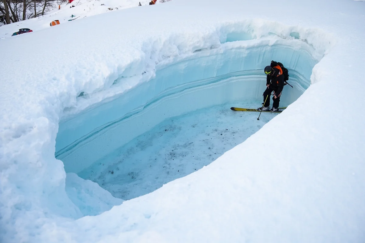
6. Avalanches: Backcountry Danger in Big Sky Country
For backcountry skiers, snowboarders, and snowmobilers, avalanches represent Montana’s most lethal natural hazard. The state averages about two to three avalanche fatalities per year, and many close calls go unreported.
What I Learned From an Avalanche Safety Course
Before my first backcountry ski trip near Big Sky, I took a two-day avalanche safety course with a local outfitter. That course fundamentally changed how I see Montana’s winter landscape.
Our instructor took us into terrain that looked perfect for skiing—a 35-degree slope with fresh powder. Then he had us dig a pit and showed us the layer of sugar-like snow crystals buried beneath the surface. “This,” he said, “is what kills people.” That weak layer could collapse under our weight, sending the entire slope crashing down.
Avalanche-Prone Areas
Montana’s most dangerous avalanche terrain includes:
- The mountains around Big Sky and the Madison Range
- Glacier National Park’s backcountry (closed to winter travel in many areas)
- The Bitterroot Mountains along the Idaho border
- The Bridger Range north of Bozeman
- The Cooke City area near Yellowstone’s northeast entrance
The Gallatin National Forest Avalanche Center provides daily forecasts for popular backcountry areas. During a recent trip, I checked their reports every morning before deciding where to go. Their hazard ratings—Low, Moderate, Considerable, High, and Extreme—provide crucial guidance.
Essential Avalanche Safety
If you’re entering avalanche terrain, you need three things: a beacon, probe, and shovel. More importantly, you need the training to use them. The statistics are stark: burial victims who aren’t rescued by their partners within 15 minutes rarely survive.
I’ve met too many visitors who venture into backcountry terrain without proper equipment or training. Don’t be one of them. If you’re not prepared for avalanche terrain, stick to resorts and marked trails.
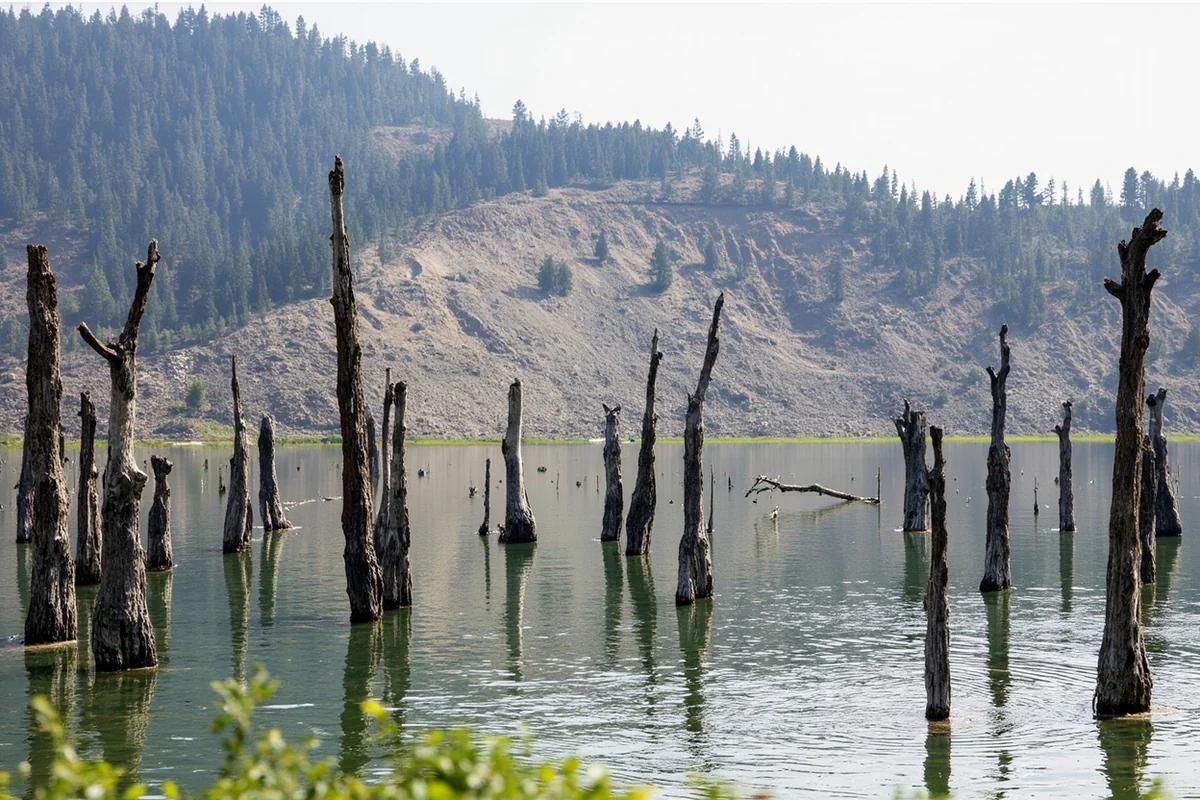
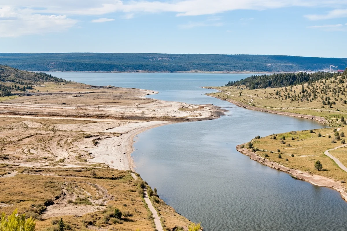
7. Drought: The Slow-Motion Disaster
Unlike other natural disasters on this list, drought doesn’t strike suddenly. Instead, it builds over months and years, fundamentally reshaping the Montana landscape and affecting everything from recreation to the local economy.
Witnessing Drought’s Impact
During a 2021 visit to the Missouri River region, I saw reservoir levels lower than longtime locals could remember. Boat ramps that typically reached the water stood 50 feet from the shoreline. Fishing restrictions were in effect because low, warm water stressed trout populations.
The same year, I drove through normally green cattle country that had turned brown by early July. Ranchers were selling off herds because they had no grass for grazing. The desperation was palpable.
How Drought Affects Travelers
Drought conditions create cascading effects for Montana visitors:
Fire Danger: Dry conditions dramatically increase wildfire risk, leading to more frequent and intense closures.
Water Recreation: Rivers may be too low for floating, reservoirs may have limited access, and fishing can be restricted to protect stressed fish populations.
Wildlife Viewing: Animals concentrate around remaining water sources—sometimes creating good viewing opportunities but also increasing human-wildlife conflicts.
Scenic Changes: Drought transforms Montana’s famous green landscapes into brown, with wildflowers absent and waterfalls reduced to trickles.
Understanding drought patterns connects to broader questions about the cost of living in Montana, as agricultural communities feel drought’s economic impacts severely.
Preparing for Your Montana Trip: A Realistic Approach
After experiencing or witnessing all seven of these natural hazards, I’ve developed what I call a “respectfully prepared” mindset for Montana travel. I’m not afraid of the state—quite the opposite. But I approach it with the same respect I’d give any powerful natural environment.
Essential Apps and Resources
I keep these resources readily available:
- MT511: Road conditions and closures, updated in real-time
- AirNow: Air quality monitoring, essential during fire season
- InciWeb: Current wildfire information and maps
- NOAA Weather: Detailed forecasts including severe weather alerts
- USGS Earthquake: Recent seismic activity in the region
- Gallatin National Forest Avalanche Center: Winter backcountry conditions
Building Flexibility Into Your Plans
The most important lesson I’ve learned is that rigid itineraries and Montana don’t mix well. When I plan trips now, I build in alternatives at every stage. If Glacier is smoky, I have East Glacier and the prairie as backups. If eastern Montana is under severe weather, I can pivot west. If my planned campsite is flooded, I know where the nearest town with hotels sits.
This flexibility connects to the question of whether Montana is boring—ironically, the same unpredictability that creates natural hazards also creates adventure.
Seasonal Risk Summary
Winter (November-March): Primary risks are severe winter storms and avalanches. Road closures are common. Pack emergency supplies and check road conditions obsessively.
Spring (April-June): Flooding peaks during snowmelt. Severe thunderstorms begin in May, bringing tornado risk to eastern Montana. Roads may be closed due to mud or washouts.
Summer (July-September): Wildfire season dominates. Flash flood risk continues with afternoon thunderstorms. This is the best weather but requires most monitoring.
Fall (October-November): Transitional period with decreasing fire risk but increasing winter storm potential. Often the best time for visits if you’re risk-averse.
Why I Keep Coming Back Despite the Risks
Every time I mention Montana’s natural hazards to potential visitors, I worry I’m scaring them away. That’s not my intention. These risks are real, but they’re manageable with awareness and preparation.
The truth is, Montana’s wild nature is exactly what makes it special. The same forces that create wildfire danger also maintain the pine forests that smell like heaven. The geologic activity that causes earthquakes created Yellowstone’s wonders. The fierce winters that strand travelers also produce the legendary powder that skiers travel across continents to experience.
When you’re considering the best places to live in Montana or planning a visit, understanding these risks isn’t about fear—it’s about respect. Montana doesn’t care about your vacation schedule or your comfort. It operates on its own terms.
Those of us who love this state accept that bargain. We carry emergency supplies, check weather forecasts religiously, and maintain flexibility in our plans. In return, we get to experience one of the last truly wild places in the lower 48.
Final Thoughts for Travelers
If you’re planning a Montana trip, don’t let this article scare you away. Let it prepare you instead. The vast majority of visitors experience nothing more severe than a brief afternoon thunderstorm or a smoky sunset. But those who prepare for worse are the ones who handle surprises gracefully.
Montana’s natural disasters are part of a larger story about a landscape that refuses to be tamed. That wildness attracts celebrities to Montana ranches, drives booming real estate prices, and inspires people to consider homesteading in Montana.
Understanding the risks makes you a better traveler. It also deepens your appreciation for the communities that call this challenging, beautiful place home. The ranchers who’ve rebuilt after floods, the ski patrollers who assess avalanche conditions every morning, the firefighters who face walls of flame each summer—they’re part of what makes Montana’s human story as compelling as its natural one.
So check those weather forecasts. Pack those emergency supplies. Build flexibility into your plans. And then go experience Montana in all its wild, unpredictable glory. The state will test you, but it will also reward you in ways few other places can match.
That orange haze over Flathead Lake? I drove around it and found myself on the eastern side of the Rockies under crystal-clear skies, watching antelope sprint across golden prairie under a sunset that seemed to stretch forever. That’s Montana: always challenging, always worth it.
Frequently Asked Questions
What natural disasters are most common in Montana that could affect my trip?
Montana experiences wildfires, severe winter storms, flooding, earthquakes, tornadoes, avalanches, and drought conditions. Wildfires are most prevalent from July through September, while blizzards and avalanches pose risks from November through March. I always recommend checking current conditions with the Montana Department of Natural Resources before finalizing travel plans.
Is it safe to visit Montana during wildfire season?
Visiting Montana during wildfire season (July-September) is generally safe, but air quality can deteriorate rapidly and some trails or parks may close without notice. I suggest downloading the AirNow app to monitor smoke levels and having flexible backup plans for outdoor activities. Popular destinations like Glacier National Park have experienced temporary closures during severe fire years.
What should I pack for Montana in case of unexpected severe weather?
Pack layers including a waterproof jacket, emergency blankets, a flashlight, and a portable phone charger regardless of season. If visiting in winter, bring tire chains, extra food and water, and cold-weather survival gear for your vehicle since blizzards can strand travelers for hours on remote highways. I never drive Montana’s mountain passes without a full tank of gas and basic emergency supplies.
How do Montana earthquakes affect tourists and should I be worried?
Montana sits near the Yellowstone seismic zone and experiences small earthquakes regularly, though most are barely noticeable. The last significant quake was the 1959 Hebgen Lake earthquake near West Yellowstone, which measured 7.3 magnitude. As a traveler, there’s no need for major concern, but knowing basic earthquake safety like drop-cover-hold is smart practice.
What is the safest time of year to visit Montana to avoid natural disasters?
Late May through June and mid-September through early October offer the best balance of good weather with minimal disaster risk. You’ll avoid peak wildfire smoke, extreme winter storms, and spring flooding during these windows. I’ve found September especially ideal since crowds thin out and the fall colors begin appearing in mountain valleys.
Does travel insurance cover natural disaster disruptions in Montana?
Most comprehensive travel insurance policies cover trip interruptions from wildfires, severe storms, and other natural disasters, but coverage varies significantly between providers. Expect to pay $50-$150 for a week-long trip policy that includes weather-related cancellations. I recommend purchasing cancel-for-any-reason coverage if traveling during high-risk seasons like peak summer or winter.
Are Montana roads dangerous during natural disasters and winter storms?
Montana highways, especially mountain passes like Lookout Pass and Marias Pass, can become extremely hazardous during blizzards with whiteout conditions and black ice. The state closes roads regularly during severe weather, and I-90 and Highway 2 see frequent winter closures. Check the Montana 511 road conditions website before any winter drive, and know that some routes add 2-3 hours to travel times during storms.
Sources
- https://nca2014.globalchange.gov/report/regions/midwest
- http://dnrc.mt.gov/divisions/forestry/fire-and-prevention
- https://readyandsafe.mt.gov/Prepare/Floods
- https://www.weather.gov/
- https://mbmg.mtech.edu/
- https://www.drought.gov/drought/states/montana
- https://droughtmonitor.unl.edu/
- www.weather.gov
- www.noaa.gov
- https://des.mt.gov/Recovery/Recovery-Program