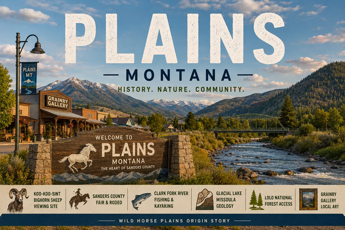
The name “Plains” is honest understatement. The town sits in a perfectly circular valley at 2,450 feet of elevation, ringed by the Cabinet Mountains to the north and the Bitterroot Mountains’ western reach to the south, drained by the Clark Fork River as it makes its long westward journey toward Idaho and the Columbia.
Long before any of the place names that show up on contemporary maps, this valley had a different identity: Wild Horse Plains.
Indigenous tribes — primarily the Salish and Pend d’Oreille — recognized that the lush bunchgrass that grew in the valley’s mild microclimate made it ideal for wintering ponies.
They came here every fall with horse herds; the animals fattened on the grasses through the cold months; the people held councils, harvested salmon from the Clark Fork, and traded with neighboring bands.
The Northern Pacific Railway arrived in 1881-1883 and the community that grew up around the new station took the valley’s name with it.
Through the 1880s and ’90s, “Wild Horse Plains” appeared on railroad timetables and topographic maps. The post office shortened it to “Horse Plains” around 1900, and to simply “Plains” by 1905.
The horses gradually disappeared from the surrounding hills as fencing and homesteading transformed the valley into farming and ranching country — but the geological setting that made the valley a horse pasture for centuries still defines its character today.
What I find most striking about Plains is how genuinely beautiful the setting is in a state where genuinely beautiful settings aren’t exactly rare. The Clark Fork River curves through town in slow, photogenic arcs.
The mountain views are exceptional in every direction. The MT-200 corridor that connects Plains to Thompson Falls (30 miles west) and to Paradise and St. Regis (20-40 miles east) is one of Montana’s underrated scenic drives.
And the town itself — population about 1,106 — has retained the kind of authentic small-town character that’s getting harder to find as larger Western Montana communities are reshaped by population growth.
TL;DR
- Plains (~1,106) is in Sanders County on MT-200, midway between Thompson Falls (30 miles west) and Paradise (12 miles east).
- Originally Wild Horse Plains — named for the Indigenous practice of wintering horse herds in the valley’s lush bunchgrass.
- The Clark Fork River flows through the town with excellent fishing, kayaking, and rafting access.
- The Koo-Koo-Sint Bighorn Sheep Viewing Site (between Plains and Thompson Falls) offers premier bighorn viewing November-December and into spring.
- The Sanders County Fair & Rodeo (Labor Day weekend) is one of Western Montana’s authentic county fairs.
- Lolo National Forest — Plains is the ranger district headquarters; 2,500+ miles of trails accessible from the area.
- The valley is the geological remnant of Glacial Lake Missoula — 70,000-130,000 years ago, ice age glaciers dammed the Clark Fork and the valley became the floor of a massive prehistoric lake.
- Best for: Clark Fork River recreation, Sanders County Fair travelers, bighorn sheep viewing, MT-200 scenic corridor travel, and Lolo National Forest access.
Liked this article?
Add Roaming Montana as a preferred source so you see more of our articles and guides on Google.
Plains at a Glance
| Population (2020) | ~1,106 |
|---|---|
| County | Sanders County |
| Region | Western Montana (Clark Fork Valley) |
| Elevation | 2,450 ft |
| Distance to Thompson Falls (county seat) | ~30 miles west (~35 min on MT-200) |
| Distance to Paradise | ~12 miles east (~15 min) |
| Distance to Hot Springs (town) | ~10 miles east (~15 min via MT-28) |
| Distance to St. Regis | ~40 miles east (~50 min on MT-200) |
| Distance to Missoula | ~85 miles southeast (~1.5 hours) |
| Distance to Quinn’s Hot Springs Resort | ~12 miles east (~15 min) |
| Best for | Sanders County Fair, Clark Fork River, Koo-Koo-Sint bighorn viewing, MT-200 corridor, Lolo NF access |
What Makes Plains Different
The geology around Plains is the part of the story that doesn’t show up on most travel content but should.
Between 70,000 and 130,000 years ago, ice age glaciers from the Bull Lake glaciation dammed the Clark Fork River downstream of Plains, creating Glacial Lake Missoula — a body of water that backed up across thousands of square miles of western Montana including the Bitterroot, Mission, and Flathead valleys.
When the ice dam eventually failed, the resulting outburst flood was one of the largest known in geological history; for a brief period, the Clark Fork carried more water than the combined flow of all the streams on Earth today.
The flood waters scoured the channeled scablands of eastern Washington, reshaped the Columbia River corridor, and ultimately drained into the Pacific.
What’s left in Plains is the lake bed. The circular valley, the lush soils, the unusual flatness of the basin floor in the middle of mountainous country — all of it derives from the Glacial Lake Missoula sediments that accumulated here over millennia.
The same geology that made the valley perfect for wintering horses also made it productive farming country once settlers arrived.
The Salish and Pend d’Oreille connection runs deep. The valley wasn’t just casually used; it was a recognized seasonal gathering place for centuries.
When David Thompson — the British geographer and explorer whose Salish name was Koo-Koo-Sint (“The Man Who Looks at Stars”) — traveled through this corridor in the early 1800s, he documented Indigenous use of the valley and the surrounding country.
His name lives on at the Koo-Koo-Sint Bighorn Sheep Viewing Site, where MT-200 passes a steep limestone face that the local bighorn population uses for winter habitat.
The contemporary Plains is a working agricultural and forestry community. The Lolo National Forest ranger district has its headquarters here — managing a chunk of the more than 2,500 miles of trails that thread through Sanders County’s mountain country.
Cattle ranching, timber, log home construction, sawmills, and increasingly tourism contribute to the local economy. The Sanders County Fair & Rodeo, held at the fairgrounds south of the Clark Fork River bridge, is the community’s signature annual event.
The town’s adaptive reuse projects deserve attention. The Grainry Gallery — a former grain elevator converted into a community art space — is one of those small-town transformations that captures the spirit of Plains’ contemporary identity.
The Wild Horse Plains Women’s Club maintains the old town school as a community gathering space. These aren’t museum-piece preservation efforts; they’re functional community buildings being kept in use.
For broader trip context, see my Montana cities and towns hub.
The Top 10 Things to Do In & Around Plains
1. Koo-Koo-Sint Bighorn Sheep Viewing Site (between Plains and Thompson Falls)
The bighorn viewing area on MT-200 between Plains and Thompson Falls is one of Montana’s most accessible bighorn sheep observation sites.
The herd uses the steep limestone cliffs above the highway as winter habitat, and viewing is excellent from November through early spring (with peak activity typically December-February when the snow drives them down to lower elevations).
The site is named for David Thompson’s Salish name, Koo-Koo-Sint. Interpretive signage covers both the geographer’s expedition history and bighorn biology. Free; pull-off parking on MT-200.
2. Clark Fork River Fishing, Kayaking & Rafting
The Clark Fork River through Plains provides excellent fishing for cutthroat, rainbow, and brown trout, with bull trout in some sections (catch and release for bull trout).
Multiple public access sites in the Plains area allow wade fishing, drift boat launching, and kayak put-ins.
The lower river toward Thompson Falls is also popular for whitewater rafting in spring runoff. Montana fishing license required.
3. Sanders County Fair & Rodeo (Labor Day Weekend)
The county fair held annually over Labor Day weekend at the Plains fairgrounds south of the Clark Fork bridge — agricultural exhibits, livestock shows, food vendors, carnival, and the rodeo (with traditional bucking horses, bulls, barrel racing, and team roping).
Genuine community character. The fair is the right reason to time a Sanders County visit for late August.
4. The Grainry Gallery
The former grain elevator on Railroad Avenue has been converted into a community art gallery — local artists, rotating exhibitions, regional crafts, and the kind of small-town gallery that anchors community cultural life. Check current hours; typically open Thursday-Saturday during summer months.
5. Wild Horse Plains Golf Course
The local 9-hole golf course offers mountain views and modest greens fees. A casual round in genuinely beautiful surroundings. Open seasonally May through October.
6. Quinn’s Hot Springs Resort (12 minutes east via MT-200)
The destination hot springs resort at Paradise — five outdoor mineral pools at varying temperatures, a historic lodge dating to the early 1900s, restaurant, and cabin/lodge accommodations.
One of the most beloved hot springs experiences in Western Montana. Reservations strongly recommended; the resort fills well in advance during summer and holiday weekends.
7. Lolo National Forest Day Hiking
Plains is the ranger district headquarters for this section of the Lolo NF, providing access to thousands of miles of trail in the surrounding Cabinet Mountains and Bitterroot Range.
Day hikes from the Plains area access alpine lakes, mountain streams, and the kind of low-traffic wilderness that distinguishes Lolo from more crowded Montana wilderness areas.
Stop at the ranger district office on Main Street for current trail conditions and recommendations.
8. Sanders County Yard Sale-ing Weekend (Early June)
The annual community-wide yard sale event spans the MT-200 corridor across Sanders County (Plains, Thompson Falls, Heron, Noxon, Trout Creek) over a weekend in early June.
Hundreds of households participate; treasures range from working antiques to genuine vintage furniture. A particular Sanders County tradition worth timing a visit around if you’re a yard-saler.
9. Annual Huckleberry Festival
Sanders County’s huckleberry harvest is a Western Montana institution; the county hosts huckleberry-themed events including the annual Huckleberry Festival (typically August). Local pies, jams, syrups, and ice cream feature prominently. Check current festival schedule.
10. Day Trip to Thompson Falls (35 minutes west)
The Sanders County seat — Old Jail Museum, Clark Fork dam, Thompson Falls State Park. The combination of Plains and Thompson Falls gives travelers the full Sanders County MT-200 experience. See Thompson Falls guide.
Where to Stay
| Hotel | Vibe | Price | Best For |
|---|---|---|---|
| Quinn’s Hot Springs Resort (12 min east) | Historic hot springs resort | $200–450 | Romantic stays, soaking |
| Plains area motels & B&Bs | Basic local options | $90–160 | Budget travelers |
| Vacation rentals (Plains area) | Mix of properties | $150–280 | Families, longer stays |
| Hot Springs town hotels (15 min east) | Symes Hotel and motels | $120–250 | Hot springs combo |
| Thompson Falls (35 min west) | Basic motels | $90–150 | Highway-corridor travelers |
Where to Eat
- The Lantern (Plains) — local bar and grill; community gathering spot
- Quinn’s Hot Springs Resort restaurant (12 min east) — upscale dining in historic setting; reservations recommended
- Hot Springs town dining (15 min east) — Symes Hotel dining room and local cafés; see Hot Springs guide
- Thompson Falls dining (35 min west)
Getting There & Around
From Missoula: 85 miles northwest via I-90 west to St. Regis, then MT-135 north and MT-200 east, about 1.5 hours.
From Spokane: ~120 miles east via I-90 and MT-200, about 2 hours.
From Kalispell: ~120 miles southwest via US-93 and MT-200, about 2.25 hours.
From Thompson Falls: 30 miles east on MT-200, about 35 minutes.
Cell service: Generally good in Plains itself; thins out on Lolo National Forest backroads.
What Plains Unlocks
Clark Fork River Corridor
World-class fly fishing, kayaking, and rafting through Western Montana’s most underrated river valley.
Quinn’s Hot Springs Resort (12 min east)
One of Montana’s most beloved historic hot springs destinations.
Hot Springs Town (15 min east)
The Symes Hotel and Camas Hot Springs — a different hot springs experience. See Hot Springs guide.
Lolo National Forest
2,500+ miles of trail; alpine lakes, mountain rivers, low-traffic wilderness.
Thompson Falls & Sanders County Seat (35 min west)
Old Jail Museum, Clark Fork dam, Thompson Falls State Park. See Thompson Falls guide.
Glacial Lake Missoula Geology
The geological pedigree of the entire Wild Horse Plains valley.
When to Visit
Labor Day Weekend: Sanders County Fair & Rodeo — the year’s defining community event.
November–February: Peak Koo-Koo-Sint Bighorn Sheep viewing season; cold but spectacular.
Summer (June–August): Clark Fork River fully accessible for fishing and kayaking; Sanders County Yard Sale-ing in early June; Lolo NF trails open at higher elevations.
Fall (September–October): Fall colors in the cottonwoods along the Clark Fork; cooler temperatures for hiking; harvest activity.
Spring (April–May): Whitewater season on the Clark Fork; valley greens up dramatically; quieter shoulder season.
Personal Tips
Bighorn viewing is a December activity. The Koo-Koo-Sint site is at its best when winter snow drives the sheep down from higher elevations. Bring binoculars; the sheep are often 200+ yards up the cliff face. Mid-morning light is usually optimal.
Quinn’s books up far ahead. If hot springs soaking is part of the trip, reserve months in advance — Quinn’s fills its summer and holiday-weekend dates well before the season. The Tuesday-Thursday windows are easier to book.
Time visits around the Sanders County Fair if possible. Labor Day weekend brings the fair, the rodeo, and the community at its most vibrant. Lodging fills up in Plains, Hot Springs, and the surrounding area — book early.
The Grainry Gallery has variable hours. Call ahead or check the current schedule before counting on a visit; it’s a community-run space that follows community rhythms rather than rigid tourism hours.
MT-200 is the experience. Don’t drive Plains as a quick stop on the way somewhere else. The MT-200 corridor between St. Regis (or Missoula via MT-135) and Thompson Falls is one of Montana’s most rewarding scenic drives. Allow time to pull off at viewpoints, the bighorn site, and Quinn’s.
Plains Quick Facts
| Founded | 1880s (Northern Pacific Railway, 1881-1883) | | Original name | Wild Horse Plains; shortened to Plains by 1905 | | Elevation | 2,450 ft | | Geological setting | Glacial Lake Missoula lakebed | | Koo-Koo-Sint | David Thompson’s Salish name (“Man Who Looks at Stars”) | | Sanders County Fair | Labor Day Weekend annually | | Average summer high | 85°F | | Average winter low | 21°F |
Conclusion
Plains is one of those Western Montana towns that rewards travelers willing to slow down. The circular Wild Horse Plains valley, framed by the Cabinet Mountains and the Bitterroot’s western reach, holds a geological story that goes back 130,000 years, an Indigenous history of horse-wintering that ran for centuries, a railroad-era community that’s quietly maintained its character for over 140 years, and a contemporary mix of agriculture, forestry, river recreation, and adaptive reuse that adds up to genuine small-town Montana.
Pair it with Quinn’s Hot Springs or the Sanders County Fair, and you have one of the most rewarding three-day itineraries in western Montana.
Have a Plains question? Drop it in the comments — I read every one.
Frequently Asked Questions
Is Plains Montana worth visiting?
Yes — Plains is worth visiting for Clark Fork River fishing and kayaking, the Koo-Koo-Sint Bighorn Sheep Viewing Site (one of Montana’s best accessible bighorn observation sites), the Sanders County Fair & Rodeo (Labor Day weekend), Quinn’s Hot Springs Resort (12 minutes east at Paradise), and as the gateway to Lolo National Forest’s 2,500+ miles of trails. The Wild Horse Plains valley setting is genuinely beautiful.
Why is Plains Montana called Plains?
The town was originally called Wild Horse Plains — named for the Indigenous practice of wintering horse herds in the valley’s lush bunchgrass. Salish and Pend d’Oreille tribes recognized that the valley’s mild microclimate and rich grasses made it ideal for sustaining ponies through Montana winters. The name was shortened to Horse Plains, then to simply Plains around 1905 when the US Post Office formalized the abbreviated form.
What is Koo-Koo-Sint?
Koo-Koo-Sint is the Salish name for David Thompson, the British geographer and explorer who mapped vast portions of western North America in the early 1800s. The name translates as “The Man Who Looks at Stars” — a reference to Thompson’s use of celestial navigation in his surveying work. The Koo-Koo-Sint Bighorn Sheep Viewing Site on MT-200 between Plains and Thompson Falls honors his expedition through the area and provides one of Montana’s most accessible bighorn sheep observation locations, with peak viewing from November through early spring.
What is the Sanders County Fair?
The Sanders County Fair & Rodeo is held annually over Labor Day weekend at the fairgrounds in Plains. Activities include traditional agricultural exhibits, livestock shows, food vendors, carnival rides, and a rodeo featuring bucking horses, bulls, barrel racing, and team roping. It’s one of Western Montana’s authentic county fairs and the signature annual community event for Sanders County.
How far is Plains from Missoula?
Plains is approximately 85 miles northwest of Missoula — about a 1.5-hour drive via I-90 west to St. Regis, then MT-135 north and MT-200 east through the Clark Fork River valley. The drive is one of Montana’s most scenic non-interstate routes.
What is Glacial Lake Missoula?
Glacial Lake Missoula was a massive ice age lake that formed between 70,000 and 130,000 years ago when ice age glaciers dammed the Clark Fork River downstream of Plains. The lake backed up across thousands of square miles of western Montana including the Bitterroot, Mission, and Flathead valleys. When the ice dam failed, the resulting outburst flood was one of the largest known in geological history — the Clark Fork briefly carried more water than the combined flow of all the streams currently on Earth. The Wild Horse Plains valley sits on the sediments left from the lake’s bed.