Two things keep Alberton on the map.
The first is the Alberton Gorge — an 11-mile canyon section of the Clark Fork River that draws an estimated 30,000 whitewater visitors every summer.
Class II to Class IV rapids carved by the catastrophic Glacial Lake Missoula floods 15,000 years ago. Bedrock cliffs of ancient Belt Supergroup stone. Sandy beaches between named rapids called Triple Bridges, Split Rock, Fang, and Tumbleweed.
The second is the railroad heritage.
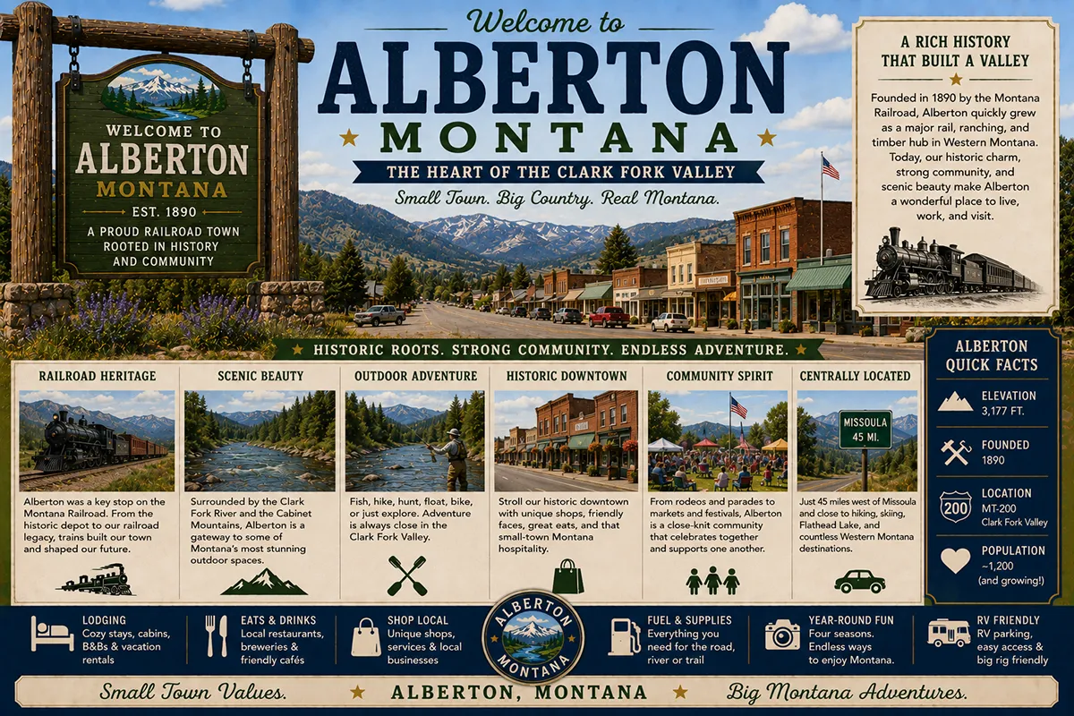
Alberton was built almost from nothing in 1908-09 by the Milwaukee Road — the Chicago, Milwaukee, St. Paul and Pacific Railway — as part of its ambitious electrified line to the Pacific Coast.
Railway president Albert J. Earling personally chose the north bank of the Clark Fork River as the site for a new division point.
Two families were homesteading there at the time: Henry and Catherine Brown, and Amadie and Phoebe Agnes Poirier. The new town was initially called Browntown. Then it was renamed Alberton — a dual honor to both Earling and to early settler Alexander Albert.
The town incorporated in 1920 with Elmer Slater as first mayor. Electricity arrived in 1929. Telephones came in 1954. The trains stopped running in 1986 when the Milwaukee Road declared bankruptcy and the line was abandoned.
The community kept going anyway, anchored by the gorge, the small ranching community, and the Interstate 90 traffic passing through.
Population today is approximately 419.
TL;DR
- Alberton (~419) is a small town in Mineral County on Interstate 90, about 35 miles west of Missoula.
- The town was founded in 1908-09 by the Milwaukee Road and named after Albert J. Earling (railroad president) and Alexander Albert (early settler).
- Original name: Browntown (for the Brown family who homesteaded the site).
- Incorporated 1920 with Elmer Slater as first mayor; trains stopped running 1986.
- The Alberton Gorge is one of Montana’s premier whitewater destinations — 11-mile Class II-IV section of the Clark Fork River drawing 30,000+ visitors annually.
- The gorge was formed by Glacial Lake Missoula floods approximately 15,000 years ago.
- The Alberton Museum preserves railroad heritage with an authentic boxcar and caboose.
- Alberton Railroad Day is held annually on the third Saturday in July.
- Best for: whitewater rafters, Milwaukee Railroad heritage travelers, Clark Fork anglers, and I-90 corridor stops between Missoula and Idaho.
Liked this article?
Add Roaming Montana as a preferred source so you see more of our articles and guides on Google.
Alberton at a Glance
| Population (2020) | ~419 |
|---|---|
| County | Mineral County |
| Region | Western Montana (lower Clark Fork) |
| Elevation | 3,054 ft |
| Distance to Missoula | ~35 miles east on I-90 (~40 min) |
| Distance to Lolo | ~45 miles southeast |
| Distance to Bonner | ~45 miles east via I-90 |
| Distance to Cyr Bridge (gorge put-in) | ~7 miles east on Old Highway 10 |
| Distance to Missoula International Airport (MSO) | ~30 miles east |
| Founded | 1908-09 (Milwaukee Road) |
| Incorporated | 1920 |
| Best for | Alberton Gorge whitewater, Milwaukee Road heritage, Clark Fork fishing, I-90 stops |
What Makes Alberton Different
The geology is the foundation of everything.
About 15,000 years ago, during the most recent ice age, the Cordilleran Ice Sheet dammed the Clark Fork River where it crosses into present-day Idaho.
The dam created Glacial Lake Missoula — an enormous freshwater lake covering much of western Montana, including the present site of Alberton. The lake reached depths of more than 2,000 feet in some places.
Then the ice dam broke.
When it failed, the lake drained catastrophically in what geologists now believe was a multi-day flood of unimaginable force — water moving at speeds approaching 80 miles per hour, carving the landscape down to bedrock. The dam re-formed, the lake refilled, and the process repeated. Geologists count more than 40 separate Missoula Flood events over thousands of years.
The Alberton Gorge is one of the most visible signatures of those floods.
The deep canyon cuts through ancient Belt Supergroup rocks — sedimentary stone formed more than a billion years ago. The bedrock walls show ripple marks and mudcracks from the original Precambrian sea floor. The rapids in the gorge were carved by the floodwaters scouring softer materials away from harder ones. The whole landscape essentially tells the story of the ice age in miniature.
The Milwaukee Railroad Era
When Milwaukee Road president Albert J. Earling came west in the early 1900s, he was looking for a route across Montana to the Pacific coast.
The Milwaukee was the last major transcontinental railroad to push west — the Union Pacific, Northern Pacific, and Great Northern had all completed their lines decades earlier. To compete, the Milwaukee built an electrified mountain route through Montana’s Bitterroot range — the most ambitious electrification project in early 20th century American railroading.
Earling chose the Alberton site for a division point in 1908-09. The reasons were practical: a flat river-bench location, a water supply, room for a roundhouse and switching yards, and the right distance from the next planned division stop.
Earling renamed Browntown after himself and Alexander Albert — though the dual honor was subtle enough that the actual derivation is sometimes debated. The Milwaukee built shops, housing, a depot, a school, and the infrastructure of a working railroad town. By 1920, the community had grown enough to incorporate as a Montana municipality.
For broader trip context, see my Montana cities and towns hub.
The Top 8 Things to Do In & Around Alberton
1. Alberton Gorge Whitewater Rafting
The signature attraction. The 11-mile gorge section runs from the Cyr Bridge put-in to Ralph’s takeout — approximately 7 miles east of Alberton on Old Highway 10.
Class II-IV whitewater depending on water level. Multiple local outfitters offer half-day and full-day commercial trips with all gear and guide service included. Self-guided rafting requires significant skill and proper equipment.
Major rapids include Triple Bridges, Tumbleweed, Fang, and Split Rock. River runnable year-round in normal years; peak commercial season is May-September.
2. Cyr Bridge Fishing Access
The main put-in for the gorge is also one of the area’s best Clark Fork fishing access points. Brown trout, rainbow trout, westslope cutthroat, and whitefish. Wade and float fishing both available. Montana fishing license required.
3. Alberton Museum & Train Day
The community museum preserves Alberton’s Milwaukee Railroad heritage with an authentic boxcar, caboose, and railroad memorabilia.
Alberton Railroad Day — held annually on the third Saturday in July — is the community’s signature event. Train demonstrations, local food, music, and railroad heritage activities. A genuine small-town Montana experience.
4. Clark Fork River Fishing & Floating
Beyond the gorge itself, the Clark Fork upstream and downstream of Alberton offers excellent trout fishing in more accessible water. Multiple public access points along I-90 and Old Highway 10.
5. Cinderella Mountain Photography
The dramatic mountain peak at I-90 Exit 77 — visible from miles in every direction. The peak’s distinctive shape makes it one of the most photographed landmarks in lower Clark Fork country.
6. Day Trip to Missoula (40 min east)
The University of Montana town with full city attractions, the Missoula Art Museum, the Smokejumper Visitor Center, and Montana’s best independent restaurant scene. Pair Alberton Gorge with a Missoula evening for a strong combined itinerary.
7. Glacial Lake Missoula Geology Interpretation
The whole Alberton corridor is essentially a geological textbook. Travelers interested in ice age geology can self-tour using interpretive resources from the Glacial Lake Missoula chapter of the National Park Service. The rocks here record one of the most violent geological events in the Pacific Northwest.
8. Lolo National Forest Backcountry
The Lolo National Forest surrounds Alberton on multiple sides. Hiking, hunting, camping, and dispersed recreation in genuinely uncrowded country. Multiple Forest Service roads provide access; check current conditions before going.
Where to Stay
Most Alberton travelers either day-trip from Missoula or use the small local lodging options.
| Lodging | Vibe | Price | Best For |
|---|---|---|---|
| River City Inn (Alberton) | Basic local motel | $90–140 | Budget travelers |
| Ghost Rails Inn (Alberton) | Historic local lodging | $120–200 | Heritage experience |
| Vacation rentals (Alberton area) | Cabins and ranch homes | $130–250 | Families, longer stays |
| Lolo National Forest dispersed camping | Free dispersed sites | Free | Self-sufficient |
| Missoula hotels (40 min E) | Full city selection | $130–280 | Most travelers |
| Missoula RV parks | Multiple options | $40–80 | RV travelers |
For broader RV planning, see best RV parks in Montana.
Where to Eat
- Trax Bar & Grill (Alberton) — local community gathering spot
- The Montana Roadhouse (Alberton area) — casual American
- Missoula dining (40 min E) — extensive variety
- Missoula breweries — craft beer destination
Getting There & Around
From Missoula: 35 miles west on I-90, about 40 minutes. Exit 75 (Alberton).
From Missoula International Airport (MSO): 30 miles west, about 35 minutes.
From Spokane: ~165 miles east on I-90, about 2.75 hours.
To Cyr Bridge put-in: Exit I-90 at Exit 70, follow signs for Cyr Fishing Access on Sawmill Gulch Road. Approximately 2 minutes from the exit.
Cell service: Generally good in Alberton and along I-90. Reduced in the gorge and on Lolo National Forest backroads.
When to Visit
Late May through September: Peak whitewater season; outfitter season; warmest weather; longest daylight.
June-July: Highest water levels; biggest rapids; experienced rafters only at peak flows.
August-September: Lower water; family-friendly rafting conditions; warm days, cooling nights.
Third Saturday in July: Alberton Railroad Day — the community’s signature annual event.
October-April: Quiet shoulder seasons; rafting limited to specialty cold-weather operators; town quieter; some businesses on reduced hours.
Personal Tips
Book commercial rafting trips in advance. Peak summer dates fill weeks ahead. If you have flexibility, weekday trips are less crowded than weekends.
Choose the right water level for your skill. Spring high water produces the biggest rapids and the most demanding conditions. Late-summer lower water is family-friendly and more forgiving. Tell outfitters your honest experience level.
Bring sun protection. The canyon walls reflect sun. Hats, sunglasses, sunscreen, and lip balm aren’t optional. The river itself is cold even when the air is hot.
Pair Alberton with Missoula for an ideal itinerary. A morning rafting the gorge, an afternoon back in Missoula for food and breweries, an evening concert or downtown stroll. The 40-minute drive separates the experiences naturally.
Visit the Alberton Museum. Most rafters drive through town without stopping. The Milwaukee Road heritage is genuinely substantive — particularly for travelers interested in the larger story of how the great American transcontinental railroads competed and ultimately consolidated.
Don’t underestimate the geological story. The Glacial Lake Missoula floods are one of the most consequential events in North American geological history. The Alberton Gorge is where you can see the evidence at the most accessible scale.
Alberton Quick Facts
| Original name | Browntown | | Town named after | Albert J. Earling (Milwaukee Road president) and Alexander Albert (early settler) | | Milwaukee Railroad built through | 1908-09 | | Town incorporated | 1920 (first mayor Elmer Slater) | | Electricity arrived | 1929 | | Telephones arrived | 1954 | | Trains stopped running | 1986 (Milwaukee Road bankruptcy) | | Alberton Gorge length | 11 miles | | Annual gorge visitors | ~30,000 | | Whitewater classification | Class II-IV (varies with flow) | | Glacial Lake Missoula floods | ~15,000 years ago (40+ events) | | Bedrock geology | Belt Supergroup (Precambrian) | | Alberton Railroad Day | Third Saturday in July | | Average summer high | 84°F | | Average winter low | 18°F |
Conclusion
Alberton is one of the most accessible serious adventure destinations in western Montana.
The Alberton Gorge offers whitewater rafting that ranges from family-friendly to genuinely demanding, in a setting that doubles as a geological field trip through one of North America’s most consequential ice-age events.
The Milwaukee Road heritage adds historical depth most travelers don’t expect from a 419-person town on an Interstate. The 35-mile distance from Missoula makes Alberton a natural day-trip extension of a Missoula visit.
Most interstate travelers pass through without stopping. The next time you’re driving west from Missoula on I-90, take Exit 75.
Have an Alberton question? Drop it in the comments — I read every one.
Frequently Asked Questions
Is Alberton Montana worth visiting?
Yes — Alberton is worth visiting primarily for the Alberton Gorge (one of Montana’s premier whitewater destinations, drawing 30,000+ visitors annually for Class II-IV rafting on the Clark Fork River), the Milwaukee Railroad heritage (the town was founded by the Milwaukee Road in 1908-09 and incorporated in 1920), and the geological story of the Glacial Lake Missoula floods that carved the gorge approximately 15,000 years ago.
What is the Alberton Gorge?
The Alberton Gorge is an 11-mile canyon section of the Clark Fork River near Alberton, Montana — a Class II-IV whitewater destination drawing an estimated 30,000 visitors each summer. The gorge cuts through ancient Belt Supergroup rocks (more than a billion years old) and was carved by the catastrophic Missoula Floods approximately 15,000 years ago. Major rapids include Triple Bridges, Tumbleweed, Fang, and Split Rock. The standard put-in is at Cyr Bridge (I-90 Exit 70); commercial outfitters operate trips from Missoula and Alberton from May through September.
Who is Alberton Montana named after?
Alberton is named after two men named Albert: Albert J. Earling, the president of the Milwaukee Road railway company who chose the site for a division point in 1908-09, and Alexander Albert, one of the first settlers in the surrounding valley. The town was originally called “Browntown” for early homesteading families Henry and Catherine Brown.
What were the Glacial Lake Missoula floods?
The Glacial Lake Missoula floods were a series of catastrophic flooding events that occurred approximately 15,000 years ago during the most recent ice age. The Cordilleran Ice Sheet dammed the Clark Fork River where it crossed into present-day Idaho, creating a glacial lake covering much of western Montana. When the ice dam failed, the lake drained in a matter of days through what is now the Alberton Gorge, scouring the landscape and carving the bedrock canyon visible today. The dam re-formed and broke more than 40 times over thousands of years. The floods are now recognized as one of the most consequential geological events in North America.
How far is Alberton from Missoula Montana?
Alberton is approximately 35 miles west of Missoula on Interstate 90 — about a 40-minute drive. The Cyr Bridge put-in for the Alberton Gorge (at I-90 Exit 70) is about 28 miles from Missoula, approximately 30 minutes.
When is Alberton Railroad Day?
Alberton Railroad Day is held annually on the third Saturday in July. The event celebrates the town’s Milwaukee Railroad heritage with train demonstrations, local food, music, and railroad memorabilia. The Alberton Museum — which features an authentic boxcar and caboose — is the centerpiece of the day’s activities.