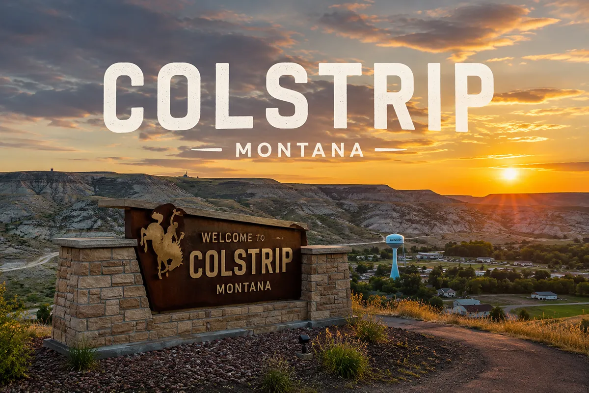
Drive south on MT-39 out of Forsyth and you’ll see them before you see the town — four reinforced concrete smokestacks rising more than 500 feet above the rolling Rosebud County rangeland, visible from twenty miles out, with thin white plumes drifting east on the prevailing wind.
The Colstrip Steam Electric Station is one of the largest coal-fired power plants west of the Mississippi River, and it’s also the largest single corporate investment in Montana history.
The town that grew up around it carries the official nickname “Energy Capital of Montana,” and the nickname is earned. Colstrip exists for the coal seam beneath it.
The Crow people knew this country long before the railroads found the coal. They had two names for the area: Where the Enemy Camps, marking a contested boundary, and Where the Colts Died, marking a place where horses had been lost in winter.
Both names sit in the landscape’s older memory beneath the more recent industrial story.
The Northern Cheyenne Reservation begins less than 20 miles south of Colstrip, and the proximity matters — Colstrip is not just a power plant town; it’s a power plant town inside one of the most culturally layered corners of the American West.
TL;DR
- Colstrip (~2,096) is the Energy Capital of Montana — home to a 2,094 MW coal-fired power station and the adjacent Rosebud Mine.
- Born 1924 when the Northern Pacific Railroad began mining coal here for its steam locomotives. Officially incorporated as a city in 1998.
- The Schoolhouse History & Art Center — the original 1924 schoolhouse — offers free coal mine tours May through October.
- Castle Rock Lake on the edge of town provides walleye and bass fishing with surrounding bike paths and picnic areas.
- Northern Cheyenne Reservation begins ~20 miles south; Crow Reservation is to the east — both add cultural depth.
- Best for: energy infrastructure tourism, industrial photography, Castle Rock Lake fishing, Powder River Country travel, and the Northern Cheyenne/Crow corridor.
Liked this article?
Add Roaming Montana as a preferred source so you see more of our articles and guides on Google.
Colstrip at a Glance
| Population (2020) | ~2,096 |
|---|---|
| County | Rosebud County |
| Region | Southeast Montana |
| Distance to Forsyth (county seat) | ~30 miles north (~35 min on MT-39) |
| Distance to Billings | ~120 miles northwest (~2 hours) |
| Distance to Miles City | ~75 miles east (~1.5 hours) |
| Distance to Lame Deer (Northern Cheyenne) | ~30 miles south (~40 min) |
| Distance to Hardin | ~95 miles west (~1.75 hours) |
| Best for | Power plant tours, Castle Rock Lake fishing, industrial photography, Northern Cheyenne/Crow corridor |
What Makes Colstrip Different
Colstrip is one of the most genuinely unique towns in Montana, and the uniqueness comes from the scale of what’s built into it. The Colstrip Steam Electric Station — four coal-fired generating units operated by Talen Montana — produces 2,094 megawatts of electricity.
That power flows west through a 240-mile twin 500-kilovolt transmission line to Townsend, then west again into the Bonneville Power Administration system serving Washington, Oregon, and Idaho. Lights come on in Seattle, Portland, and parts of the Idaho panhandle because of what burns at Colstrip.
The ownership reflects this Pacific Northwest connection. Puget Sound Energy holds the largest share (677 MW), followed by Talen Energy (529 MW), Portland General Electric (296 MW), Avista (222 MW), NorthWestern Energy (222 MW), and PacifiCorp (148 MW).
Five of those six are Pacific Northwest utilities — Montana keeps less than 11% of Colstrip’s power for in-state use.
The Rosebud Mine adjacent to the plant is a 25,000-acre surface coal operation owned by Western Energy Company, a subsidiary of Westmoreland Coal.
Coal moves from the mine pit to the power plant via a 4.2-mile conveyor belt, making Colstrip what energy industry people call a “mine-mouth” plant — the fuel never leaves the property.
The mine produces roughly 10 million tons of coal annually, and the seam runs about 23 feet thick. In 2019 the U.S. Department of the Interior approved an expansion that extends the mine’s operational life through 2038.
The town itself was largely constructed during two waves. The first was the 1920s Northern Pacific era — when Colstrip was a small company town of about 63 homes, a schoolhouse, two churches, a mess hall, and a boarding house, all built to support the workers mining coal for steam locomotives.
After diesel replaced steam in the 1950s, Northern Pacific sold the coal leases, mining machinery, and the townsite itself to Montana Power Company in 1959.
The second wave came in the 1970s and 1980s, when Units 1 and 2 were built during the national energy crisis (early ’70s) and Units 3 and 4 followed in the ’80s.
Peak construction-era population reached approximately 7,500; current population sits around 2,096.
The result is a company town with company-town amenities. Median household income approaches $75,000 — high for southeastern Montana.
The town contains roughly 100 parks. Historically, residents have enjoyed free or heavily subsidized community amenities including the swimming pool, water slide, gymnasium, golf course, and basic municipal services (water, sewer, garbage).
In 2005 Sports Illustrated named Colstrip the best sports town in Montana — a recognition that reflects the disproportionate investment a small town with major industry can make in school facilities and youth athletics.
The cultural geography matters as much as the industrial geography. The Northern Cheyenne Reservation begins about 20 miles south of Colstrip; the Crow Reservation lies to the east.
The energy economics of Colstrip and the political and cultural realities of both reservations exist in complex relationship — coal jobs versus tribal sovereignty, reservation employment versus environmental impact, economic interdependence layered onto centuries of contested land.
Visitors who pay attention will sense this complexity even without engaging it directly.
For broader trip context, see my Montana cities and towns hub.
The Top 10 Things to Do In & Around Colstrip
1. Schoolhouse History & Art Center
The 1924 schoolhouse — the original Northern Pacific company-town schoolhouse from Colstrip’s earliest years — now serves as the town’s visitor center, art gallery, and history museum.
The building itself is a piece of the story it tells. Exhibits cover the railroad era, the Montana Power Company transition, the construction boom of the 1970s-80s, and the contemporary energy economics of the region. This is the right first stop in Colstrip.
2. Rosebud Coal Mine Tours (May–October)
Free guided tours of the Rosebud Mine are available May through October, departing from the Schoolhouse History & Art Center.
The tour shows the active surface mining operation — the massive draglines, the coal seam, the reclamation work on previously mined sections — and provides direct exposure to the scale of industrial coal production.
For travelers who’ve only seen coal as a fuel reference in news stories, walking the edge of an active strip mine is genuinely informative. Tours run on a published schedule; check with the visitor center for current departure times.
3. Castle Rock Lake
The reservoir on the edge of town was created as part of the power plant cooling system and is open for public recreation. Walleye and largemouth bass are the primary fishery; some northern pike and perch are also present.
Surrounding the lake: bike paths, picnic areas, swimming beach, and walking trails. Montana fishing license required. Castle Rock is the town’s primary outdoor amenity and is heavily used by Colstrip residents — a good place to meet locals.
4. Power Plant Smokestack Viewing
The four 500-foot smokestacks of the Colstrip Steam Electric Station are visible from miles out, but the closer perspectives — from the highway approach into town, from the Rosebud Mine overlook, or from the gravel back roads west of town — show the scale most dramatically.
Industrial photographers will find Colstrip rewarding. Dawn and golden-hour light catching the steam plumes is particularly striking.
5. Day Trip to Northern Cheyenne Reservation (~30 minutes south)
Lame Deer — the seat of tribal government for the Northern Cheyenne — is roughly 30 miles south of Colstrip via MT-39 and US-212.
Chief Dull Knife College, the Northern Cheyenne Powwow grounds (powwows in summer are open to respectful visitors), and the Two Moons Monument provide cultural and historical context that significantly deepens any Colstrip-area visit.
Approach with appropriate respect; reservation rules and tribal customs apply.
6. Day Trip to Forsyth (~30 minutes north)
Forsyth is the Rosebud County seat and a historic Yellowstone River town. The Rosebud County Museum, the Howdy Hotel, the 1912 Rosebud County Courthouse, and Yellowstone River access make it a worthwhile half-day. The Lewis & Clark Expedition camped near here on July 28, 1806.
7. Day Trip to Little Bighorn Battlefield (~1.5 hours west)
The Little Bighorn Battlefield National Monument near Crow Agency is one of the most significant historical sites in the American West — the site of the June 1876 battle where the 7th Cavalry under George Armstrong Custer was destroyed by a coalition of Lakota, Cheyenne, and Arapaho forces.
Plan a full half-day for the visitor center, the battlefield monuments, and the Indian Memorial.
8. Powder River Country Backroad Driving
The county roads south and east of Colstrip pass through some of Montana’s most authentic rangeland — sagebrush country with the kind of vast quiet that the Powder River basin is known for.
Wildlife sightings (mule deer, pronghorn antelope, occasional elk) are routine. 4WD recommended after wet weather; many county roads turn to gumbo when wet.
9. Cooney Reservoir (~2 hours via Billings)
For travelers continuing west toward Red Lodge or Yellowstone, Cooney Reservoir is one of south-central Montana’s best fishing destinations — a brief detour off I-90 west of Billings.
10. Hunting (Fall)
Eastern Rosebud County and adjacent Powder River and Custer counties provide excellent mule deer and pronghorn antelope hunting in fall, along with sharp-tailed grouse and Hungarian partridge.
Public land is limited; most hunting is permission-based on private ranches. Block management areas administered by Montana Fish, Wildlife & Parks provide some free public access — check the current BMA atlas before scouting.
Where to Stay
| Hotel | Vibe | Price | Best For |
|---|---|---|---|
| Fort Union Inn (Colstrip) | Basic, clean, business-travel oriented | $95–145 | Most travelers |
| Super 8 Forsyth (30 min north) | Reliable interstate-corridor motel | $90–130 | Budget |
| Howdy Hotel (Forsyth) | Historic local property | $95–140 | Character preferred |
| Vacation rentals (Colstrip area) | Company-town homes for rent | $130–220 | Longer stays, families |
| Billings hotels (2 hours northwest) | Full city selection | $130–250 | More amenities |
Where to Eat
- The Pit Stop Bar & Grill — Colstrip’s primary dinner spot; steaks, burgers, local atmosphere
- Hometown Diner — breakfast and lunch institution
- Forsyth restaurants (30 min north) — more variety including the Howdy Hotel dining room
- Bring supplies for road trips — services thin out quickly south and east of Colstrip
Getting There & Around
From Billings: ~120 miles east via I-94 to Forsyth, then south on MT-39 — about 2 hours total.
From Miles City: ~75 miles west via I-94 to Forsyth, then south on MT-39 — about 1.5 hours.
From Hardin: ~95 miles east via US-212 — about 1.75 hours through Crow and Northern Cheyenne Reservation country.
Cell service: Generally good in Colstrip itself; thins out on county roads. Download offline maps for backcountry exploration.
What Colstrip Unlocks
Northern Cheyenne Reservation (30 min south)
Lame Deer, Chief Dull Knife College, summer powwows — significant cultural depth.
Forsyth & Yellowstone River (30 min north)
Rosebud County seat, Lewis & Clark history, river access.
Crow Reservation & Little Bighorn (1.5 hours west)
The most significant historical battlefield in the American West.
Powder River Country (south and east)
Authentic rangeland, hunting, vast quiet.
Miles City (1.5 hours east)
The Cowboy Capital; Bucking Horse Sale in May.
When to Visit
May through October: Coal mine tours operate; Castle Rock Lake fully accessible; Northern Cheyenne summer powwow season (typically late June–early September).
September–October: Hunting season; fall colors in the Rosebud Creek cottonwoods; cooler temperatures for industrial photography.
Summer (June–August): Hot but full operations. Heat advisories common in eastern Montana — temperatures regularly exceed 95°F in July and August.
Winter (November–March): Cold and remote. Coal mine tours not available. The power plants continue operating but the town quiets significantly.
Personal Tips
Take the coal mine tour. Most travelers driving through Colstrip never realize the free mine tour is available — it’s one of the most genuinely educational industrial tourism experiences in Montana. Reserve through the Schoolhouse History & Art Center.
Combine Colstrip with Lame Deer. Treating Colstrip and the Northern Cheyenne Reservation as a single day’s exploration adds enormous depth. The juxtaposition of industrial-scale coal energy and tribal sovereignty in adjacent landscapes is the actual story of this part of Montana — neither side makes sense without the other.
Photograph at golden hour. The smokestacks and the surrounding rangeland are most photogenic in the hour before sunset. The light catches both the steam plumes and the dust off the mine.
Approach the reservations with care. Both Northern Cheyenne and Crow tribal lands have their own laws and customs. Don’t photograph without permission. Respect powwow protocols. Stop at the tribal offices if you have questions before visiting cultural sites.
Fuel up in Forsyth or Hardin. Services contract significantly south and east of Colstrip. Fill the tank before heading into Powder River Country backroads.
Colstrip Quick Facts
| Founded | 1924 (Northern Pacific Railroad coal mining) | | Incorporated as a city | 1998 | | Crow name for the area | “Where the Enemy Camps” / “Where the Colts Died” | | Power plant capacity | 2,094 MW (4 coal-fired units) | | Rosebud Mine size | 25,000 acres; ~10 million tons coal/year | | Coal seam thickness | ~23 feet | | Sports Illustrated recognition | 2005 — best sports town in Montana | | Average summer high | 88°F | | Average winter low | 6°F |
Conclusion
Colstrip is one of Montana’s genuinely unique places — a 1920s railroad coal camp turned mid-century Montana Power Company town turned 21st-century Pacific Northwest energy supplier, all set in a corner of the state where Crow and Northern Cheyenne history, Powder River rangeland, and Yellowstone River corridor history overlap in dense and complicated ways.
For travelers willing to engage with the actual contemporary American West — which is industrial, contested, beautiful, and culturally layered all at once — Colstrip is one of the most rewarding small-town stops in eastern Montana. The free mine tour alone justifies the drive.
Have a Colstrip question? Drop it in the comments — I read every one.
Frequently Asked Questions
Is Colstrip Montana worth visiting?
Yes — Colstrip is worth visiting for the free Rosebud coal mine tours (May–October, via the Schoolhouse History & Art Center), Castle Rock Lake fishing, and the unique industrial-tourism opportunity to see one of the largest coal-fired power plants west of the Mississippi. Combined with the adjacent Northern Cheyenne Reservation (~30 min south) and Little Bighorn Battlefield (~1.5 hours west), Colstrip anchors one of southeast Montana’s most culturally and historically substantive itineraries.
What is the Colstrip power plant?
The Colstrip Steam Electric Station is a 2,094 megawatt coal-fired power plant — one of the largest west of the Mississippi River. It consists of four generating units, owned by a consortium of Pacific Northwest utilities including Puget Sound Energy, Talen Energy, Portland General Electric, Avista, NorthWestern Energy, and PacifiCorp, and operated by Talen Montana. The plant has been the largest single corporate investment in Montana history.
What was Colstrip called by the Crow?
The Crow people had two names for the area that became Colstrip: Where the Enemy Camps (marking a contested tribal boundary) and Where the Colts Died (commemorating a winter in which young horses were lost). Both names sit in the landscape’s older memory beneath the industrial story that followed in the 1920s.
Can you tour the Rosebud coal mine?
Yes — free guided tours of the Rosebud surface coal mine operate May through October, departing from the Schoolhouse History & Art Center in Colstrip. The tour shows active surface mining operations including the draglines, coal seam, and reclamation work, providing one of Montana’s most genuinely educational industrial tourism experiences.
How far is Colstrip from Billings?
Colstrip is approximately 120 miles east of Billings — about a 2-hour drive via I-94 east to Forsyth, then south on MT-39. From Miles City, it’s approximately 75 miles west (about 1.5 hours).