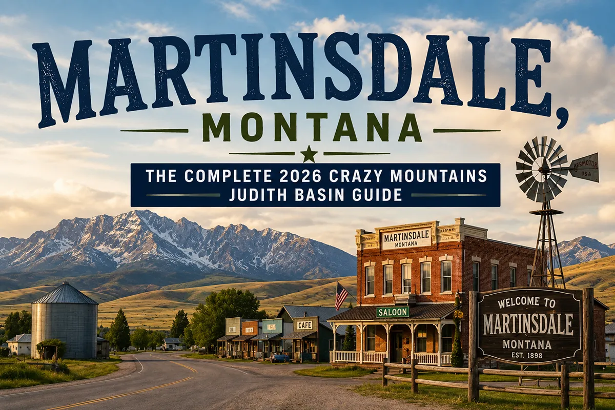
The Crazy Mountains end at Martinsdale. Not literally — the range doesn’t have a clean terminus — but the community sits at the point where the Crazy Mountains’ southern reach meets the agricultural plains of the Judith Basin, where the volcanic geology of the range gives way to the sedimentary formations of central Montana’s wheat country.
Highway 294 passes through Martinsdale connecting White Sulphur Springs (25 miles west) to the Judith Basin beyond, and it’s this position — at the seam between mountain country and basin agriculture — that gives the town its character.
The Judith Basin begins east of Martinsdale in earnest. The broad valley ringed by isolated mountain ranges — the Judith Mountains to the southeast, the Snowy Mountains to the south, the Little Belt Mountains to the west, and the Crazy Mountains to the northwest — is one of central Montana’s most beautiful agricultural landscapes.
C.M. Russell loved this country; Ivan Doig wrote about it; A.B. Guthrie set parts of his Montana literature here. The basin’s wheat fields and cattle ranches have sustained communities like Martinsdale for over a century.
Two Dot — 8 miles west of Martinsdale on Highway 294 — is one of Montana’s most distinctively named communities. George “Two Dot” Wilson was a cattleman whose brand was simply two dots.
When the community needed a post office, they used the brand for the name. Two Dot has fewer than 100 residents today, but the story of its naming is pure Montana: practical, direct, tied to the cattle economy that defined the landscape.
TL;DR
- Martinsdale (~80) is in Meagher County on Highway 294, 25 miles east of White Sulphur Springs and 50 miles west of Lewistown.
- Southern gateway to the Crazy Mountains — the isolated volcanic range whose southern access roads begin near Martinsdale.
- The Judith Basin begins east of Martinsdale — one of central Montana’s most beautiful and literature-associated agricultural valleys.
- Two Dot (8 miles west) is named for cattle rancher George “Two Dot” Wilson’s brand — a perfect Montana naming story.
- Martinsdale Reservoir provides local fishing and recreation.
- Best for: Crazy Mountains southern access, Judith Basin scenic drives, central Montana corridor travel.
Liked this article?
Add Roaming Montana as a preferred source so you see more of our articles and guides on Google.
Martinsdale at a Glance
| Population (2020) | ~80 |
|---|---|
| County | Meagher County |
| Region | Central Montana |
| Distance to White Sulphur Springs | ~25 miles west (~30 min) |
| Distance to Lewistown | ~50 miles northeast (~1 hour) |
| Distance to Two Dot | ~8 miles west (~10 min) |
| Distance to Harlowton | ~40 miles east (~45 min) |
| Best for | Crazy Mountains access, Judith Basin scenic driving, central Montana corridor |
What Makes Martinsdale Different
The Crazy Mountains’ southern access is less developed than the northern and western approaches — fewer formal trailheads, more county road navigation, but ultimately less crowded than the more popular Halfmoon Campground approach from the west.
County roads northeast of Martinsdale reach the range’s southern faces, where the volcanic geology is dramatic and the access to the range’s interior is genuine.
The Judith Basin’s literary and artistic associations give the landscape additional resonance. C.M. Russell — the Great Falls-based cowboy artist — painted the Judith Basin repeatedly; the basin’s cattle culture and the ranching operations visible from Highway 294 east of Martinsdale are direct descendants of the open-range cattle era that Russell documented.
Ivan Doig’s fiction is set in the Judith Basin and Meagher County country; A.B. Guthrie’s The Big Sky and its sequels reference this territory. Understanding that creative association makes the drive through Martinsdale and east into the basin more than just transportation.
Martinsdale Reservoir, just west of town, provides the kind of quiet local recreation — fishing, camping, wildlife watching — that functions as a community amenity rather than a regional destination. Walleye and perch in the main reservoir; good waterfowl in fall.
For broader trip context, see my Montana cities and towns hub.
The Top 10 Things to Do
1. Crazy Mountains Southern Approach
County roads northeast of Martinsdale reach the Crazy Mountains’ southern faces. The approach is less traveled than the Halfmoon Campground route (accessible from the north via Clyde Park and Wilsall).
Drive the county roads to the range’s base for views of the southern volcanic faces — less visited, equally dramatic. 4WD recommended for the final approaches.
2. Two Dot Community (8 miles west)
Two Dot — named for George “Two Dot” Wilson’s cattle brand — is the most distinctively named community in central Montana.
The Two Dot Bar is the gathering place for both communities; the surrounding landscape is classic Meagher County cattle country. The story of the name is worth knowing before you arrive.
3. Martinsdale Reservoir
Fishing (walleye, perch, some trout), camping, and wildlife watching at the reservoir west of Martinsdale. A quiet, functional recreation site — the kind of place local families use for weekend outings. Fall waterfowl hunting is the reservoir’s most popular seasonal activity.
4. Judith Basin Scenic Drive (East on Highway 294/89)
Driving east from Martinsdale into the Judith Basin — the valley opening up, the mountain ring becoming visible in multiple directions — is one of central Montana’s finest scenic drives. Continue toward Harlowton or north toward Lewistown for the full basin experience.
5. C.M. Russell Country Context
The Judith Basin landscapes visible from Highway 294 are the same ranching country Russell painted throughout his career. His depictions of cattle roundups, wolf hunts, and Montana wildlife were based on firsthand experience in exactly this terrain. Understanding the connection transforms the agricultural landscape.
6. Day Trip to White Sulphur Springs (30 minutes west)
Spa Hot Springs soaking, Castle Mountains, Meagher County Museum. See White Sulphur Springs guide.
7. Day Trip to Harlowton (40 minutes east)
The Milwaukee Road’s last electric locomotive preserved outdoors, the Upper Musselshell Museum with “Ava” the Avaceratops dinosaur. See Harlowton guide.
8. Day Trip to Lewistown (1 hour northeast)
Central Montana’s most complete small city — Judith Basin Brewing, Yogo sapphire context, downtown character. See Lewistown guide.
9. Hunting the Judith Basin (Fall)
The Judith Basin and surrounding Meagher County terrain provides elk, mule deer, whitetail, and pronghorn hunting. The basin’s combination of agricultural land (permission-based hunting) and public land sections creates a productive hunting landscape.
10. Crazy Peak Views
On clear days from highway pull-offs east and north of Martinsdale, Crazy Peak (approximately 11,200 feet) is visible — the highest point in the isolated volcanic range that dominates the western horizon.
Where to Stay
| Hotel | Vibe | Price | Best For |
|---|---|---|---|
| White Sulphur Springs (30 min west) | Hot springs, local | $100–180 | Most travelers |
| Lewistown hotels (1 hour northeast) | Best selection | $100–180 | Judith Basin focus |
| Harlowton area (40 min east) | Basic motels | $85–130 | Budget |
Where to Eat
- Martinsdale Bar — basic community bar food
- Two Dot Bar (8 min west) — community gathering, local character
- White Sulphur Springs (30 min west) — more variety; see White Sulphur Springs guide
Getting There
From White Sulphur Springs: 25 miles east on Highway 294, about 30 minutes.
From Lewistown: 50 miles southwest, about 1 hour.
From Harlowton: 40 miles west, about 45 minutes.
When to Visit
Summer (June–August): Crazy Mountains access optimal; Judith Basin in full agricultural activity; Martinsdale Reservoir recreation season.
Fall (September–October): Hunting season; fall colors; Judith Basin harvest observable.
Winter: White Sulphur Springs hot spring soaking (30 min west) is the best winter draw from Martinsdale.
Personal Tips
Stop in Two Dot. The bar is open, the name is genuine, and the cattle-brand naming story is one of the best in central Montana. Eight minutes west on Highway 294.
Drive the Judith Basin east at golden hour. The mountain ring around the Judith Basin visible from Highway 294 east of Martinsdale is most dramatic in late afternoon light — drive slowly and let the landscape reveal itself.
White Sulphur Springs for the overnight. The Spa Hot Springs make it the right base for this part of Montana — soaking after a day of Crazy Mountains driving is the appropriate conclusion.
Quick Facts
| Named for | Archie Martin, rancher | | Two Dot | Named for George “Two Dot” Wilson’s cattle brand | | Crazy Peak | Highest point in Crazy Mountains, ~11,200 ft | | Average summer high | 80°F | | Average winter low | -5°F |
Conclusion
Martinsdale sits at one of Montana’s most meaningful geographic seams — where an isolated volcanic mountain range meets the beginning of a famous agricultural basin, where cattle ranching history meets literary landscape, where the drive east into the Judith Basin opens up views that painters and writers have been responding to for over a century.
The Two Dot naming story is the right beginning for a day in this part of central Montana.
Have a Martinsdale question? Drop it in the comments — I read every one.
Frequently Asked Questions
Is Martinsdale Montana worth visiting?
Worth a stop for Crazy Mountains southern access, Judith Basin scenic driving, and Martinsdale Reservoir. Two Dot (8 min west) adds the best naming story in central Montana. White Sulphur Springs (30 min west) provides hot spring soaking; Lewistown (1 hour northeast) provides central Montana’s fullest small-city experience.
Why is Two Dot Montana called Two Dot?
Two Dot is named for George “Two Dot” Wilson, a cattle rancher whose brand was simply two dots. When the community needed to establish a post office in the late 19th century, Wilson’s cattle brand became the town’s name — a perfectly practical Montana solution.
What is the Judith Basin near Martinsdale?
The Judith Basin is a broad central Montana agricultural valley ringed by isolated mountain ranges — the Crazy Mountains to the northwest, Judith Mountains to the southeast, Snowy Mountains to the south, and Little Belt Mountains to the west. It’s named for the Judith River, which Captain William Clark named in 1805 for his future wife. C.M. Russell, Ivan Doig, and A.B. Guthrie all drew on the Judith Basin landscape in their work.