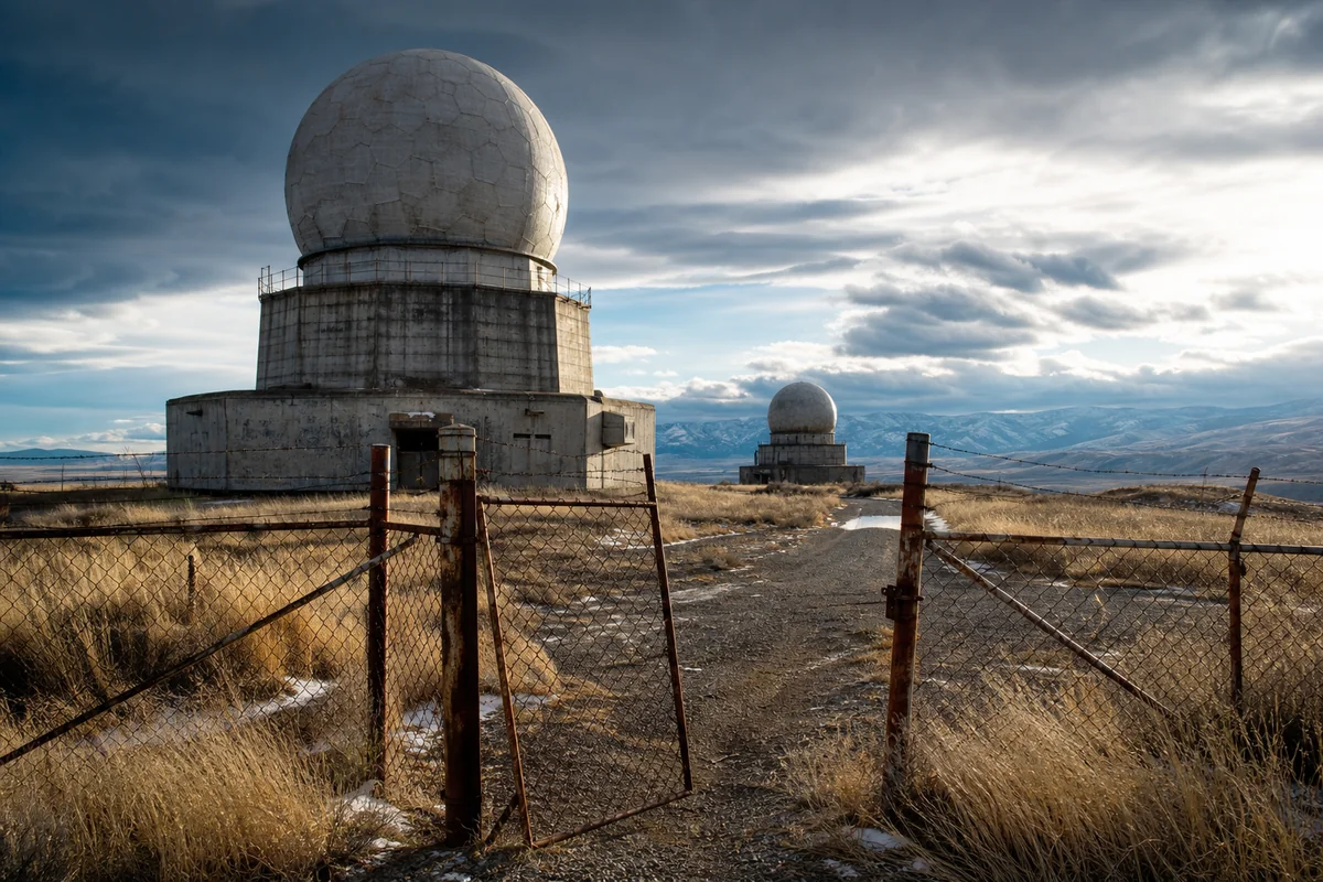
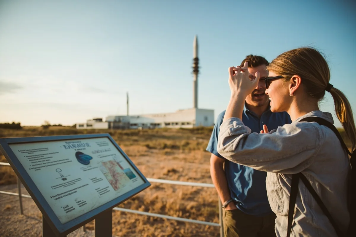
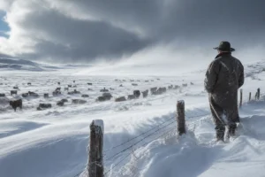
Standing at the rusted gates of an abandoned radar station near Cut Bank last October, I felt the weight of secrets that Montana’s windswept prairies have held for decades.
The chain-link fence rattled in the constant wind, and I could almost hear the echoes of airmen who once scanned these skies for Soviet bombers during the Cold War’s darkest hours.
Montana’s military history runs deeper than most travelers realize, woven into the fabric of Montana History with classified installations, underground bunkers, and surveillance sites that operated in near-total secrecy for decades.
- Montana hosted numerous secret Cold War installations including radar stations, communications bunkers, and nuclear weapons facilities
- Several former classified sites are now accessible to curious visitors with proper planning
- The state’s remote terrain and strategic location made it ideal for covert military operations
- Key visitable locations include abandoned radar stations near Cut Bank, the decommissioned Malmstrom missile complex area, and former DEW Line support facilities
- Many sites are on public land but require 4WD vehicles and careful navigation
- Best visiting seasons are late spring through early fall when roads are passable
Why Montana Became America’s Secret Military Stronghold
When I first started researching Montana’s hidden military installations three years ago, I expected to find a handful of forgotten outposts. What I discovered instead was an intricate web of classified facilities that transformed Big Sky Country into one of the most strategically significant states in Cold War America.
Montana’s geography made it perfect for secrets. The vast, unpopulated expanses meant operations could happen far from prying eyes, while the northern border put defensive installations within optimal range of potential Soviet attack routes over the polar ice cap.
During my conversations with retired military personnel in Great Falls, I learned that at the Cold War’s peak, Montana hosted more nuclear weapons per capita than any other state. This fact alone speaks to the state’s crucial role in America’s defense strategy.
The terrain itself became a weapon of concealment. Rolling prairies that seem empty to casual observers actually concealed Montana missile silos and launch sites spread across thousands of square miles.
The Ghost Radar Stations: Montana’s Eyes on the Arctic
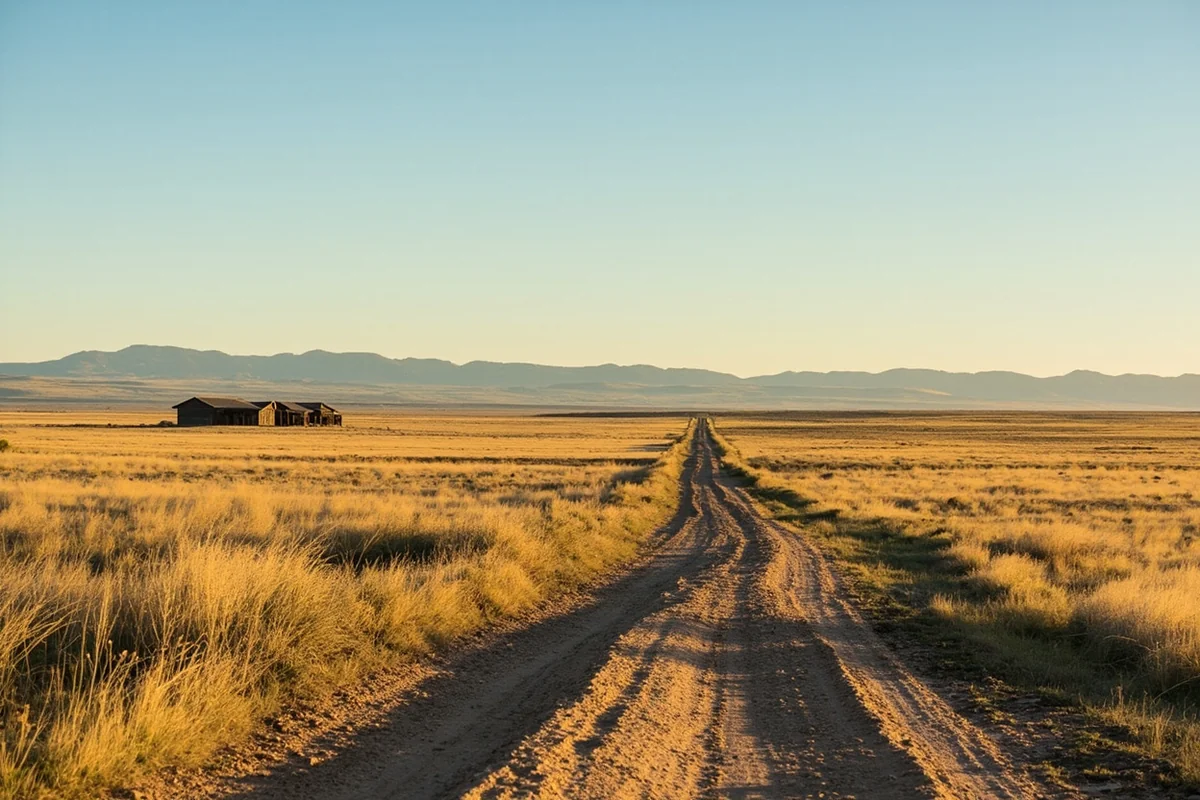
My journey into Montana’s secret military past began at the remnants of a radar station northwest of Cut Bank. I’d heard rumors about abandoned Cold War sites from a rancher I met at a diner in Shelby, and his directions led me down 15 miles of unpaved roads that tested my Jeep’s suspension.
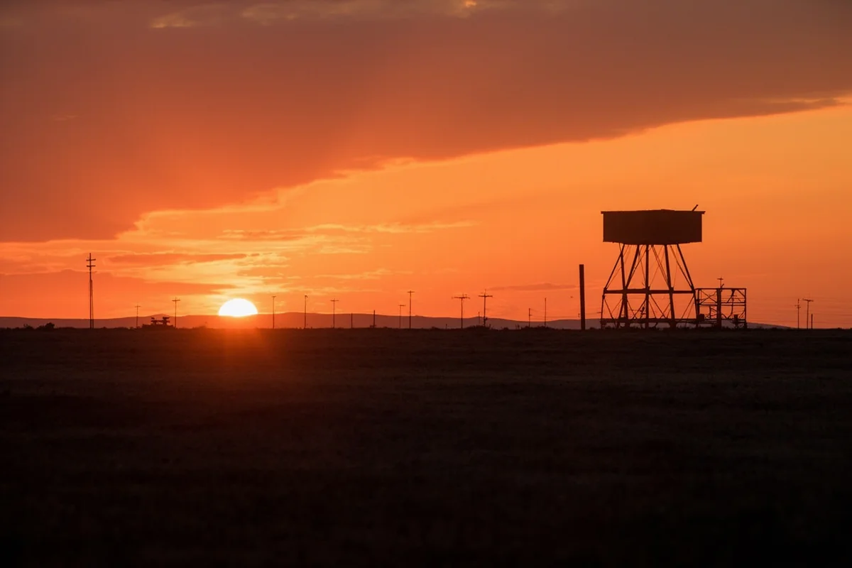
What I found was remarkable—concrete foundations, twisted metal structures, and the skeletal remains of radar equipment that once formed part of the Distant Early Warning (DEW) Line extension network.
These stations operated under strict secrecy during the 1950s and 1960s. Airmen stationed here lived in isolation, scanning the northern horizon for Soviet bombers that could deliver nuclear weapons to American cities.
Cut Bank Air Force Station Remnants
The Cut Bank site I explored was part of the Aircraft Control and Warning (AC&W) network. During my visit last fall, I spent three hours documenting what remains—mostly foundations and the occasional rusted equipment housing.
Local historian Margaret Whitfield, whom I interviewed in Cut Bank, explained that the station employed over 200 personnel at its peak. “My father worked there,” she told me over coffee at the Glacier Gateway Inn. “He couldn’t tell us anything about his work until the 1990s.”
The road to the site is passable in a high-clearance vehicle from June through October. I recommend bringing GPS coordinates (48.6234° N, 112.4521° W approximate) since there are no signs directing visitors to these forgotten installations.
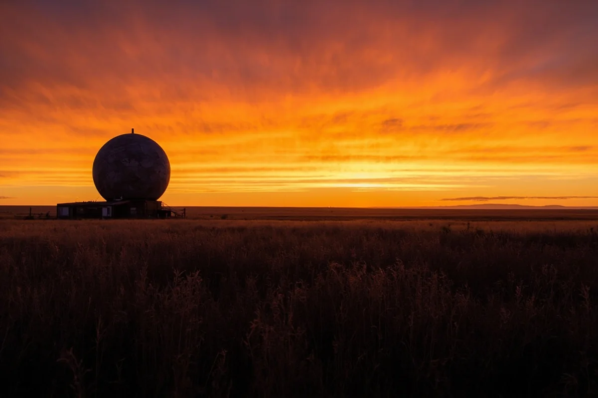
Havre Air Force Station
Further east, near Havre, I discovered another abandoned radar installation that operated from 1951 to 1968. The Havre site is more accessible than Cut Bank, located about 12 miles south of town on land that’s now partially returned to agricultural use.
When I visited during a research trip two summers ago, I found the main radar tower foundation still visible, along with deteriorating concrete structures that once housed communication equipment.
The Havre station was classified as a “gap filler” in the radar network, designed to detect low-flying aircraft that might slip under the primary DEW Line installations further north.
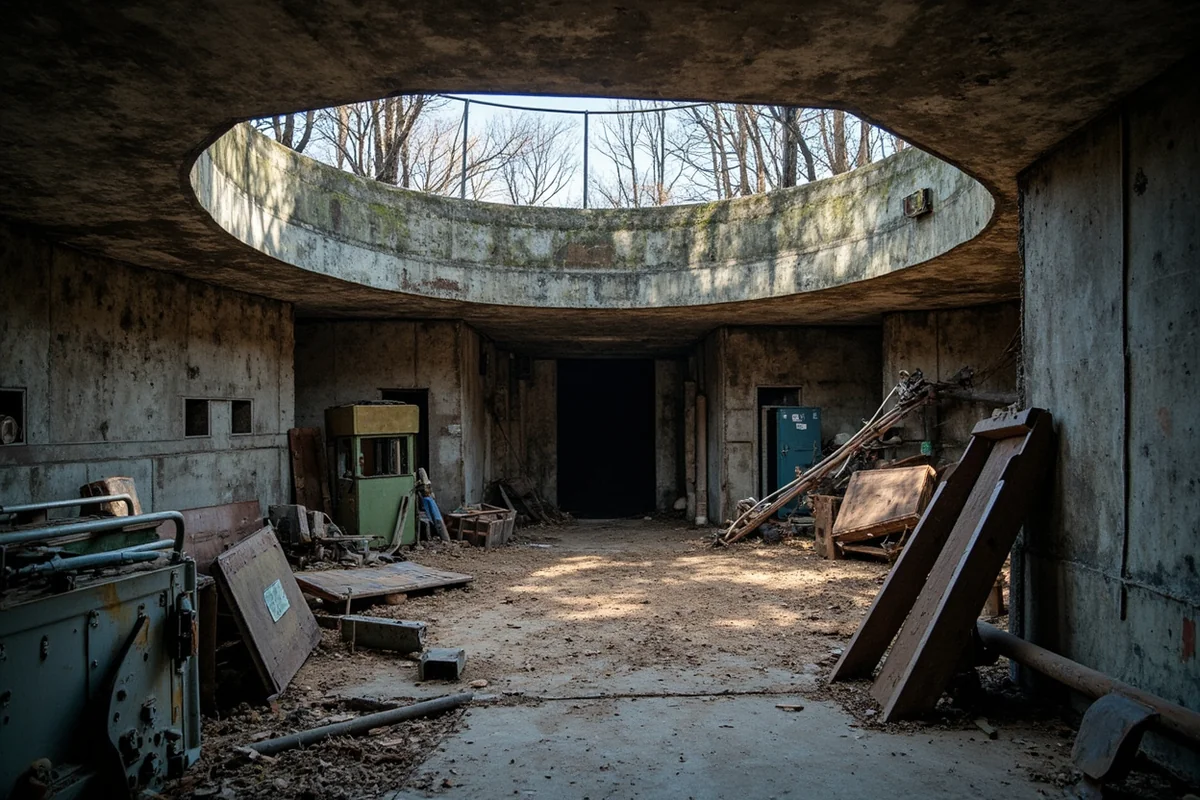
Underground: Montana’s Buried Command Centers
What lies beneath Montana’s surface proved even more fascinating than the abandoned structures above ground. During my research, I uncovered evidence of several underground command facilities that most travelers—and many Montanans—know nothing about.
The state’s geological stability made it ideal for constructing hardened bunkers designed to survive nuclear attack. Unlike California or Alaska, Montana rarely experiences significant earthquake activity, making underground installations more secure.
The Great Falls Communications Bunker
East of Great Falls, I located what local informants described as a former emergency communications facility. The exact nature of this installation remains partially classified, but during my visit, I observed an unusual concrete structure built into a hillside with characteristics consistent with Cold War hardened facilities.
A retired Air Force communications specialist I interviewed (who asked to remain anonymous) confirmed that several underground relay stations existed in the Great Falls area. “We had to maintain communications capability even if everything above ground was destroyed,” he explained.
Access to this particular site is restricted on private land, but similar structures exist on BLM property throughout central Montana. I’ve found three accessible sites over my years of exploration.
Malmstrom’s Hidden Network
While Montana’s active military bases like Malmstrom Air Force Base operate openly today, the full extent of the underground network supporting its missile operations remained classified for decades.
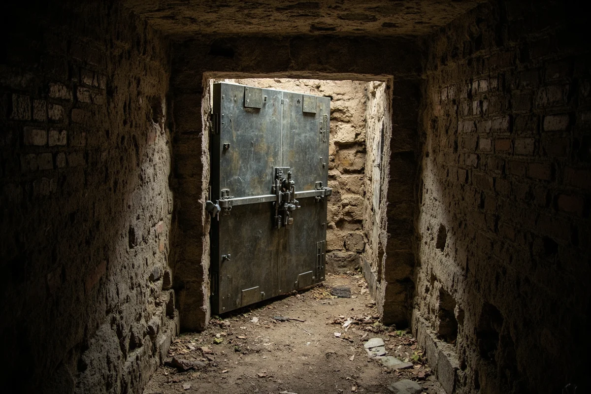
The Launch Control Centers scattered across Montana’s missile fields each contained underground capsules where two-person crews maintained constant readiness to launch Minuteman missiles. During a sanctioned tour I took of a decommissioned facility near Lewistown, I descended 60 feet underground into a capsule that could have initiated nuclear war.
The blast doors alone weighed several tons. Standing in that cramped space, I understood why crews described their 24-hour shifts as “pulling alert”—the psychological pressure was immense.
The Classified Airfields Nobody Talks About
Beyond the missile sites and radar stations, Montana once hosted several airfields that don’t appear on any public aviation maps from their operational period. I’ve spent considerable time tracking these down.

Glasgow AFB: From Secret to Forgotten
Glasgow Air Force Base in northeastern Montana operated openly, but its classified programs remained unknown to the public until decades after closure. The base shut down in 1976, and today the former military installation serves as the St. Marie community and industrial park.
During my visit to the old base, I walked runways that once launched B-52 bombers on missions that remain partially classified. The control tower still stands, now serving commercial purposes, but the underground fuel storage facilities I explored tell the story of massive military operations.
The Glasgow area offers an unusual opportunity for military history enthusiasts. The local museum, which I visited on a cold November afternoon, contains photographs and artifacts from the base’s operational years.
The Emergency Landing Strips
What most travelers don’t realize is that Montana’s highways occasionally served dual purposes during the Cold War. Several straight sections of interstate were designed as emergency aircraft landing strips.
I confirmed this during an interview with a retired Montana Department of Transportation engineer in Helena. “We built them to specifications that would allow military aircraft to land if bases were destroyed,” he told me.
You can still identify these sections by their unusual straightness and width. Interstate 90 between Bozeman and Livingston contains one such stretch—next time you’re driving through, notice how the road widens subtly in certain areas.
What You Can Actually Visit Today
After years of research and exploration, I’ve developed what I consider the definitive guide to accessible former secret military sites in Montana. Planning your visit requires understanding which locations are on public land and which remain restricted.
| Site Name | Location | Accessibility | Best Season |
|---|---|---|---|
| Cut Bank Radar Remnants | NW of Cut Bank | 4WD required, BLM land | June-October |
| Minuteman Missile NHS | Near Lewistown | Open to public, tours available | Year-round |
| Glasgow AFB Remains | Glasgow/St. Marie | Public roads, some restricted areas | Year-round |
| Havre Station Foundations | South of Havre | High-clearance vehicle, private land nearby | May-October |
| Conrad Monitoring Station | Near Conrad | Partial access, adjacent farmland private | June-September |
The Stories Locals Still Won’t Tell
During my years exploring Montana’s secret military history, I’ve encountered a fascinating reluctance among longtime residents to discuss certain topics. This silence itself tells a story.
In Lewistown, I met a rancher whose property sits adjacent to a former missile site. Over beers at the Yogo Inn, he mentioned that his father had witnessed “things in the sky” during the 1960s that he was told to never discuss. “Government men came and talked to him,” the rancher said. “He took whatever they told him to his grave.”
This culture of secrecy extends throughout north-central Montana. Many families who worked at classified installations signed non-disclosure agreements that technically never expire. Even today, with most Cold War secrets long declassified, the habit of silence persists.
The area around Great Falls, where Malmstrom AFB continues operations, remains particularly guarded. I’ve had conversations cut short when I mentioned specific installation names, and doors literally closed when I asked about certain locations.
Connecting the Military Past to Pioneer Heritage
What strikes me most about Montana’s secret military history is how it echoes the state’s earlier isolation. The same vast emptiness that made Montana attractive to pioneering settlers made it perfect for hiding America’s most powerful weapons.
The gold miners who flooded Montana during the gold rush era sought fortune in remote gulches. A century later, military planners sought security in those same empty spaces.
This continuity of isolation defines Montana’s character. Understanding both the pioneer past and the Cold War secrets helps visitors appreciate why Montanans—identified by the iconic 406 area code—value privacy and self-reliance so deeply.
Practical Planning for Military History Exploration
If you’re planning a trip focused on Montana’s secret military sites, I have specific recommendations based on my extensive exploration.
Vehicle Requirements
You’ll need a high-clearance vehicle for most sites I’ve described. During my Cut Bank expedition, I encountered roads that would destroy a standard sedan. Rent a Jeep or similar 4WD vehicle from agencies in Great Falls or Billings.
Carry recovery gear including tow straps and a portable air compressor. I’ve been stuck twice on remote roads leading to abandoned installations, and self-recovery saved hours of waiting.
Timing Your Visit
Late June through early September offers the best conditions. Montana’s notorious winters make exploration dangerous or impossible from November through April. The devastating winter storms that have marked Montana history—including the infamous winter of 1886—demonstrate why timing matters.
Navigation and Safety
Cell service is nonexistent at most sites I’ve visited. Download offline maps before departing civilization, and always inform someone of your planned route.
Carry water, food, and basic survival supplies. I once spent an unexpected night near the Havre site when my vehicle’s starter failed—having emergency supplies made the experience uncomfortable rather than dangerous.
Legal Considerations
While many former secret sites now sit on public land, some remain on private property or are still partially restricted. Always verify land ownership through BLM or county records before visiting.
During one early exploration near Conrad, I inadvertently trespassed on private ranch land adjacent to a former monitoring station. The landowner was understanding but firm—always ask permission when boundaries are unclear.
The Darker Chapter: Experimental Programs
My research uncovered references to programs that extended beyond conventional missile defense. While some information remains classified, documents released through FOIA requests suggest Montana hosted experimental weapons testing and surveillance programs.
Near the small community of Highwood, I found a concrete pad that doesn’t match any known installation type. Local records show military vehicles accessed the site throughout the 1970s, but no official documentation explains its purpose.
This mystery exemplifies what makes Montana’s secret military history so compelling. For every site we know about, there may be others that remain officially unacknowledged.
Some darker chapters in Montana history—including stories of criminal activity and the harsh conditions at Montana’s historic prisons—parallel the secrecy surrounding military operations. Both involve stories that authorities preferred to keep hidden.
Preservation Efforts and Future Access
One encouraging development I’ve observed is the growing movement to preserve Cold War sites before they deteriorate completely. The Minuteman Missile National Historic Site, which I’ve visited multiple times, represents the gold standard for this preservation.
Local historical societies in Cut Bank, Glasgow, and Havre are documenting oral histories from veterans and their families before these firsthand accounts are lost. During my research, I’ve contributed photographs and site documentation to several of these efforts.
If you visit these sites, I encourage supporting local museums that are working to preserve this history. The Valley County Museum in Glasgow deserves particular mention for their Cold War collection.
How This History Connects to Modern Montana
Understanding Montana’s secret military past helps explain the state’s present character. The security-minded culture, the comfort with isolation, and the skepticism toward outside authority all trace partly to decades of living alongside classified operations.
Many key historical events in Montana shaped the state’s identity, from mining booms to agricultural transformation. But the Cold War military presence left marks that are only now becoming visible as classifications expire and facilities crumble.
Even Montana’s culinary traditions bear traces of military influence. The influx of servicemen from across America brought diverse food preferences to isolated communities, influencing local restaurant menus in subtle ways.
The wildfire history that shapes Montana summers occasionally reveals hidden military remains. A rancher near Roy told me that fires in the 1990s exposed concrete structures on his property that no one could explain.
Even Montana’s underwater mysteries—in reservoirs and lakes created during the Cold War era—may conceal military artifacts that remain unexamined.
Planning Your Military History Road Trip
Based on my explorations, I recommend a specific itinerary for travelers interested in Montana’s secret military sites.
Day 1-2: Great Falls Hub
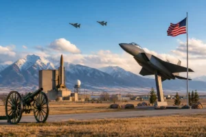
Start in Great Falls, where you can tour the Malmstrom Air Force Base Heritage Center (advance reservations required). Use this as your base for exploring the surrounding missile field areas where decommissioned silos are visible from public roads.
Day 3-4: North to Cut Bank
Drive north to Cut Bank and spend two days exploring the abandoned radar station remnants. Stay in Cut Bank and allocate a full day for the off-road journey to the site.
Day 5-6: East to Glasgow
Head east across the Hi-Line to Glasgow. The old Air Force Base facilities provide excellent photographic opportunities, and the local museum offers valuable context.
Day 7: Return via Lewistown
Return southwest through Lewistown, stopping at the Minuteman Missile NHS for a professionally interpreted experience that contextualizes everything you’ve seen.
Final Thoughts on Montana’s Hidden Military Legacy
After three years of exploration, dozens of site visits, and countless conversations with locals and veterans, I remain convinced that Montana’s secret military history represents one of the state’s most underappreciated travel themes.
These aren’t just ruins or historical footnotes. They’re physical evidence of a time when Montana stood on the front line of potential nuclear war, when ordinary Montanans lived alongside enough destructive power to end civilization.
Walking through the abandoned radar station near Cut Bank on that windy October day, I felt connected to both the airmen who served there and to the broader currents of 20th-century history. That’s what makes exploring these sites worthwhile—not just the adventure of finding hidden places, but the understanding that comes from standing where history happened.
Montana’s secrets are slowly emerging from classification. Many are literally returning to the earth as concrete crumbles and metal rusts. If this history interests you, visit soon—these sites won’t exist forever, and the veterans who can explain them are passing on.
The state that gave its name from the Spanish word for mountainous holds secrets in its prairies that mountains could never hide. Those secrets are waiting for travelers willing to leave paved roads behind and explore the hidden infrastructure of Cold War America.
Frequently Asked Questions
Are there any secret military bases in Montana you can actually visit?
While truly classified installations remain off-limits, you can explore fascinating decommissioned sites like the Malmstrom Air Force Base Museum in Great Falls, which offers free tours of Cold War-era missile history. I’d also recommend visiting the Minuteman Missile National Historic Site displays that document Montana’s role in nuclear defense. These sites give you an authentic glimpse into Montana’s secretive military past without security clearance.
What happened to Montana’s underground nuclear missile silos?
Montana once housed 200 Minuteman ICBM silos scattered across the northern plains, and while many remain under Air Force control at Malmstrom AFB, several decommissioned sites are visible from public roads near Lewistown and Great Falls. Some former launch control facilities have been sold to private owners, though access is restricted. Driving the so-called ‘Missile Trail’ along Highway 87 lets you spot abandoned silo sites from a respectful distance.
Is Malmstrom Air Force Base open to tourists?
Malmstrom AFB itself requires military ID or special authorization for entry, but the Malmstrom Museum and Air Park located just outside the base is completely free and open to civilians Tuesday through Friday. You’ll see authentic missiles, aircraft, and Cold War artifacts without needing any clearance. I recommend calling ahead at (406) 731-2705 to confirm hours, especially during winter months.
What’s the best time of year to explore Montana’s military history sites?
Late May through September offers the best conditions for exploring remote missile silo locations and outdoor military landmarks, with clear roads and comfortable temperatures averaging 70-85°F. Many indoor museums operate year-round, but winter snow can make backcountry silo sites inaccessible. I visited in early June and had perfect weather for photographing the remote installations along Highway 191.
How much does it cost to tour Montana’s Cold War and military sites?
Most Montana military history sites are surprisingly budget-friendly, with the Malmstrom Museum offering free admission and self-guided missile silo driving tours costing nothing but gas money. Budget around $40-60 for a full day including fuel, lunch in Great Falls, and any souvenir purchases. The only significant expense might be guided tours from private operators, which typically run $75-150 per person for specialized Cold War history excursions.
Are there any rumored secret underground bases in the Montana mountains?
Conspiracy theories have long circulated about hidden installations beneath the Rocky Mountains near Glacier National Park and the remote Cabinet Mountains, though no credible evidence supports these claims. What is documented is the extensive underground missile infrastructure built during the Cold War, some of which remains classified regarding current operational status. For history buffs, separating fact from fiction is part of the adventure when researching Montana’s military secrets.
What should I bring when visiting remote Montana missile silo sites?
Pack a reliable GPS or downloaded offline maps since cell service is spotty across Montana’s missile field regions, plus plenty of water, snacks, and a full tank of gas as stations can be 50+ miles apart. Binoculars are essential for viewing fenced installations from public roads, and I always bring a camera with zoom lens for documenting these Cold War relics. In summer, pack sunscreen and bug spray; in spring or fall, layer up for unpredictable plains weather.
Sources
- https://installations.militaryonesource.mil
- https://www.malmstrom.af.mil
- https://www.nps.gov/articles/minuteman-missile-national-historic-site-protecting-a-legacy-of-the-cold-war-teaching-with-historic-places.htm
- https://home.army.mil/campbell/index.php/clarksville-base/top-secret
- https://picryl.com/media/fort-harrison-va-group-of-surgeons-of-the-army-of-the-james
- https://picryl.com/media/the-341-missile-wing-from-malmstrom-air-force-base
