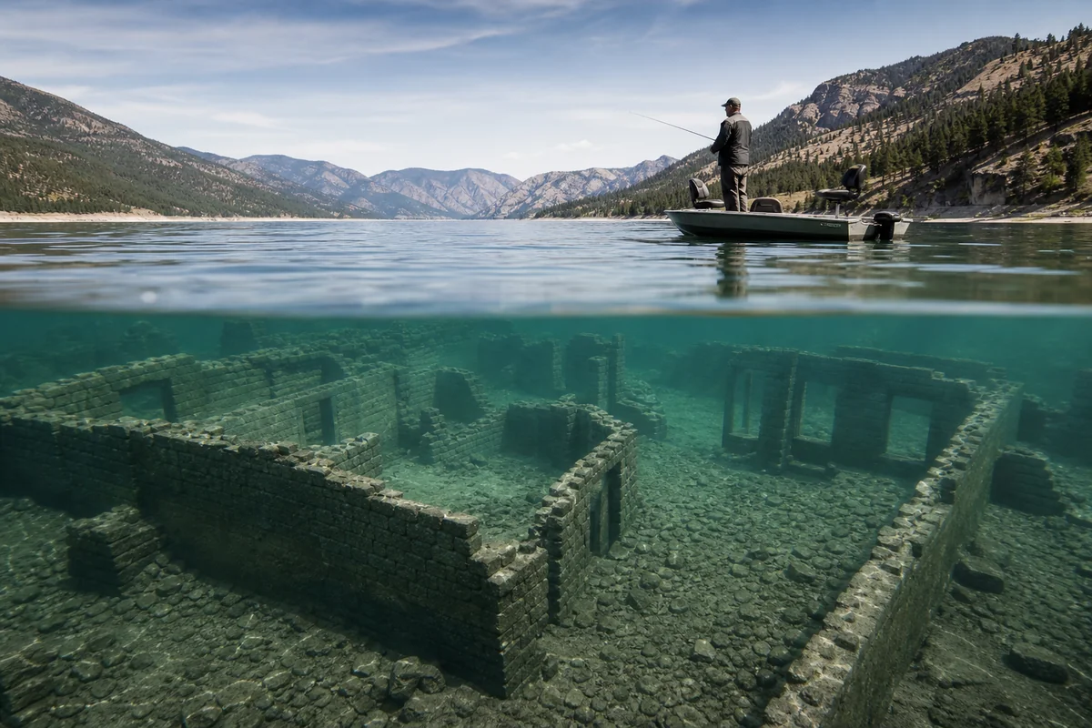
Standing on the shores of Fort Peck Lake last August, I watched a local fisherman point toward the water and say, “There’s a whole town down there—streets, foundations, everything.”
I thought he was joking until I started researching what lies beneath Montana’s countless reservoirs and discovered a submerged world that few visitors ever think to explore.
Montana’s Montana History isn’t just preserved in museums and ghost towns—some of the most fascinating stories are hidden underwater, drowned by progress, engineering marvels, and the relentless march of dam construction throughout the 20th century.
- Over a dozen Montana communities now lie beneath reservoir waters, including the original Fort Peck townsite and several Missouri River settlements
- Glacial Lake Missoula’s ancient history created some of Montana’s most dramatic landscapes
- Canyon Ferry, Hungry Horse, and Fort Peck reservoirs each flooded significant historical sites
- Low water years occasionally reveal remnants of submerged settlements, creating unique exploration opportunities
- Several Montana lakes contain sunken artifacts, from steamboats to mining equipment
- Best viewing times are late summer and drought years when water levels drop significantly
The Drowned Towns of Montana’s Reservoir System
When I first started exploring Montana’s underwater history during a trip in 2019, I expected to find maybe one or two interesting stories. What I uncovered was an entire category of Montana heritage that most travel guides completely ignore.
The dam-building era of the 1930s through 1970s transformed Montana’s landscape in ways that erased entire communities from the map. These weren’t just a few scattered homesteads—we’re talking about established towns with post offices, schools, churches, and generations of families.
Fort Peck: America’s Largest Earth-Filled Dam and What It Buried
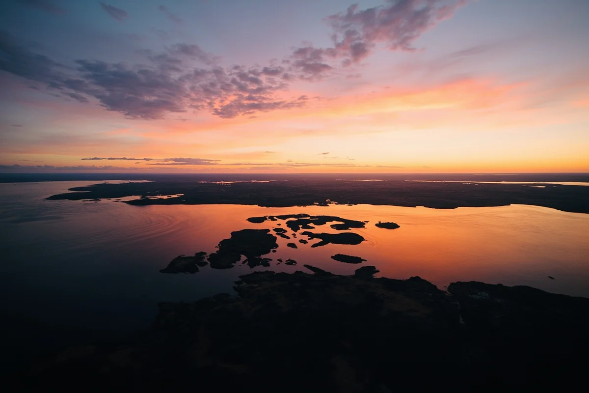
I spent three days at Fort Peck Lake during my visit last summer, and the scale of what lies beneath still amazes me. The dam, completed in 1940, created a reservoir with 1,520 miles of shoreline—more than the entire California coast.
But here’s what the tourism brochures don’t mention: the reservoir flooded multiple communities along the Missouri River, including the original Fort Peck townsite and several smaller settlements.
The original Fort Peck was a trading post established in 1867, named after Colonel Campbell K. Peck. When the dam project began during the Great Depression, the Army Corps of Engineers created a new “government town” to house the 10,000+ workers, but the historical site went underwater.
During drought years, portions of old foundations, road beds, and even cemetery remains have surfaced. A local historian I met at the Fort Peck Interpretive Center told me that in 2021, water levels dropped enough to reveal wooden pilings and brick fragments from a Missouri River steamboat landing.
Canyon Ferry Lake: When the Missouri Swallowed History
Canyon Ferry Lake, about 20 miles east of Helena, is one of Montana’s most popular recreation areas. I’ve kayaked here multiple times, and knowing what’s underwater changes the experience completely.
The current reservoir flooded the original Canyon Ferry townsite in 1954. This wasn’t some frontier outpost—it was a well-established community with the remnants of a ferry crossing that dated back to the Roaming Montanald Rush era.
The ferry crossing was established in 1865 to move prospectors and supplies across the Missouri River. For nearly 90 years, this location served as a critical transportation hub. Today, it sits beneath approximately 60 feet of water.
What fascinated me most during my research was learning that the original ferry operator’s cabin foundations are supposedly still intact on the lake bottom. Divers who’ve explored the area report finding glass bottles, metal hardware, and stone foundations.
Hungry Horse Reservoir: The Lost Homesteads of the South Fork
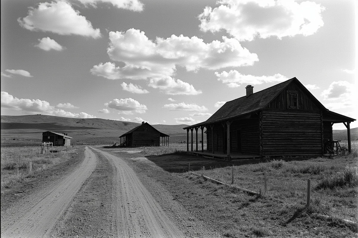
Hungry Horse Dam, completed in 1953, flooded the South Fork of the Flathead River valley and took several homesteading settlements with it. When I visited the Hungry Horse Dam area during a road trip through northwestern Montana, the visitor center had photographs of the evacuation.
Families who had worked the land for three generations had to pack up and leave. The reservoir flooded prime agricultural bottomland, ranch houses, and at least two small unincorporated communities.
What strikes me about Hungry Horse is that some of the flooded structures were surprisingly substantial. We’re not talking about rough frontier cabins—there were two-story farmhouses and barns that represented decades of labor.
I spoke with a ranger at the Hungry Horse Ranger District who mentioned that during severe drought years, portions of old wagon roads become visible along the reservoir margins. She’d personally seen remnants of a corral fence emerge from the water in 2007.
Glacial Lake Missoula: Montana’s Prehistoric Underwater Story
Long before any dam builder arrived in Montana, nature created and destroyed an inland sea that makes our modern reservoirs look tiny. This connects to the broader story of key historical events in Montana that shaped the landscape.
Glacial Lake Missoula existed approximately 15,000-13,000 years ago, and its story is one of the most dramatic geological events in North American history.
The Lake That Filled Western Montana
During my visit to Missoula last fall, I drove out to see the ancient shorelines etched into Mount Jumbo and Mount Sentinel. These horizontal lines, visible from downtown Missoula, mark the water levels of a prehistoric lake that would have covered the entire valley under 950 feet of water.
At its maximum extent, Glacial Lake Missoula contained approximately 500 cubic miles of water—roughly equivalent to Lake Erie and Lake Ontario combined. The lake formed when a lobe of the Cordilleran Ice Sheet blocked the Clark Fork River near present-day Lake Pend Oreille in Idaho.
What’s remarkable is that this lake didn’t just form once. The ice dam would fail catastrophically, releasing floods of biblical proportions, then re-form and fill again. Scientists estimate this cycle repeated at least 40 times over 2,000 years.
The Missoula Floods: When the Lake Escaped
Each time the ice dam failed, the resulting flood was the largest known flood in Earth’s geological record. The floodwaters raced across Idaho, Washington, and Oregon at speeds up to 65 miles per hour, carving the Channeled Scablands.
I’ve driven through the Scablands in eastern Washington, and the landscape is genuinely alien. Massive coulees, dry waterfalls 400 feet high, and giant ripple marks that are only visible from the air—all created by Montana’s ancient lake draining in a matter of days.
For Montana visitors, the evidence of Glacial Lake Missoula is everywhere once you know what to look for. The ancient shorelines, the gravel deposits in mountain valleys, and the silt layers throughout western Montana all tell this story.
Steamboats and Shipwrecks: What Sank in Montana’s Waters
Montana isn’t exactly known for maritime history, but the state’s rivers and lakes have claimed their share of vessels. This aspect of Montana’s past connects to the broader legacy of pioneers who relied on river transportation.
The Missouri River Steamboat Era
Between 1860 and 1890, steamboats were the primary method of transporting goods and people to Montana’s interior. Fort Benton served as the head of navigation on the Missouri River, and hundreds of steamboats made the treacherous journey from St. Louis.
Not all of them made it.
During my research at the Montana Historical Society in Helena, I found records of at least 27 steamboat wrecks on the Missouri River within Montana’s current borders. Most were lost to snags (submerged trees), sandbars, and boiler explosions.
The most significant wreck I learned about was the *Yellowstone*, which sank near the mouth of the Yellowstone River in 1832. It was one of the first steamboats to navigate this far upriver, and its loss represented a significant financial blow to the early fur trade.
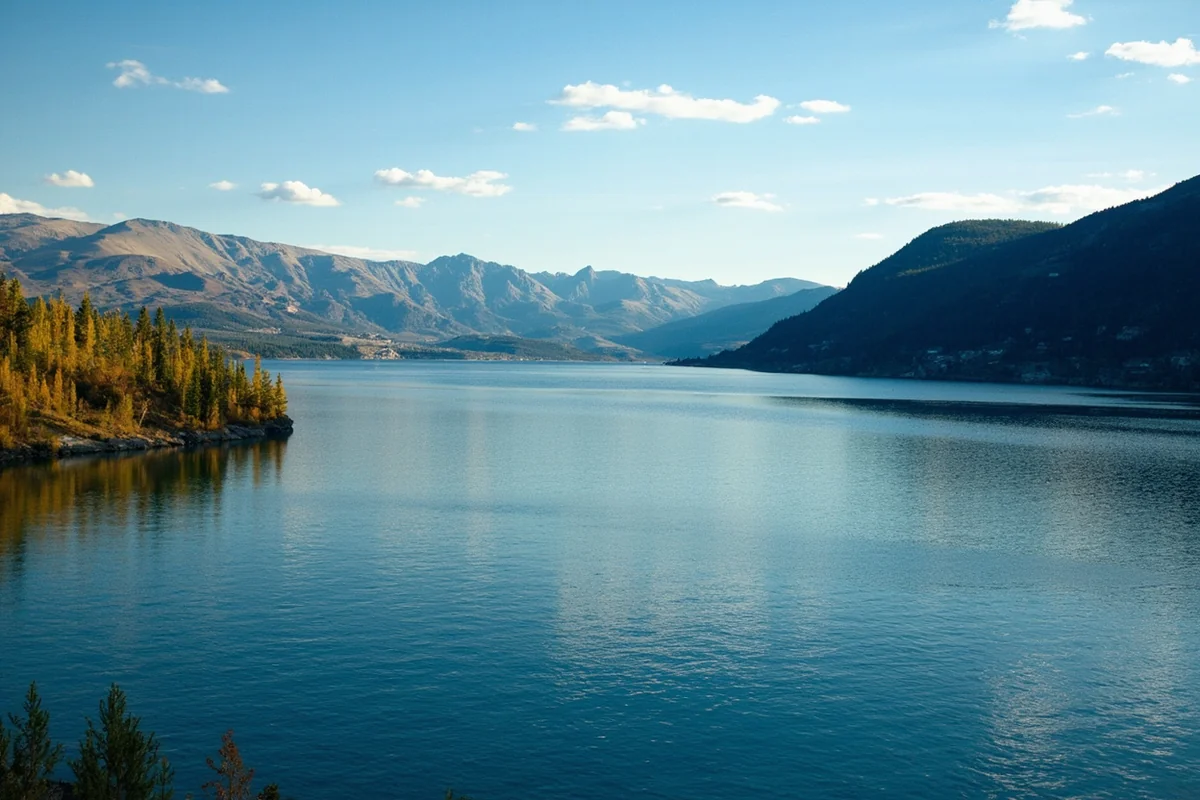
Flathead Lake’s Submerged Secrets
Flathead Lake, the largest natural freshwater lake west of the Mississippi (within the United States), has accumulated its share of underwater artifacts over the past 150 years.
I took a boat tour on Flathead Lake during a visit three years ago, and the captain mentioned that old logging equipment, early motorboats, and even a few aircraft lie on the lake bottom.
The clearest water typically occurs in late fall and early winter before ice formation. Divers have reported visibility exceeding 30 feet in some areas, making Flathead Lake one of the better locations for underwater exploration in Montana.
One particularly interesting site is the remains of an early 20th-century ferry that sank near Polson. Local dive shops occasionally offer guided trips to this location, though conditions vary significantly by season.
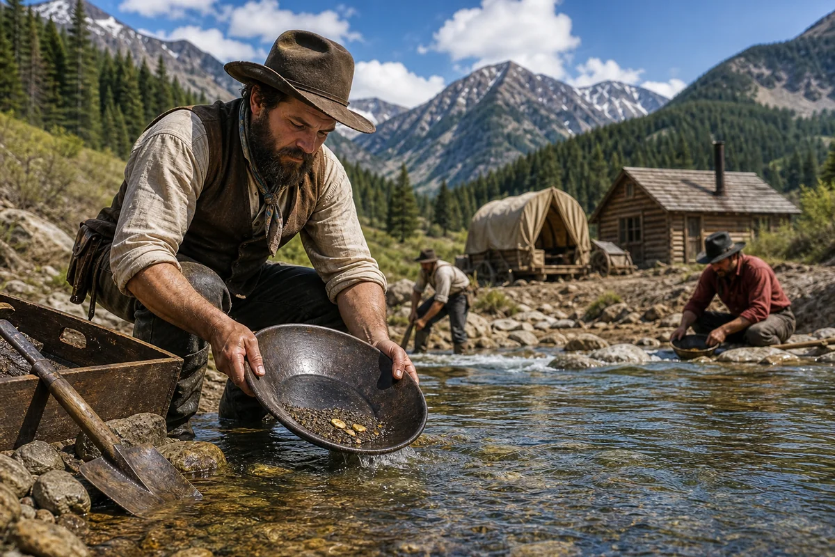
The Mining Equipment Graveyards
Montana’s mining heritage, which includes some of the most dramatic booms and busts in American history, left behind considerable underwater infrastructure. This connects to both the gold rush era and the later industrial mining operations that shaped Montana’s identity.
Berkeley Pit: The Toxic Lake That Was Once a Mine
The Berkeley Pit in Butte isn’t exactly a natural lake, but it represents one of the most significant bodies of water in Montana’s industrial history. I visited the viewing platform above the pit last year, and the scale is genuinely unsettling.
When Anaconda Copper Mining Company ceased operations in 1982, they stopped the pumps that kept groundwater out of the open pit mine. The pit has been filling ever since, and it now contains approximately 50 billion gallons of heavily contaminated water.
What lies beneath this toxic lake includes mining equipment, vehicles, and the infrastructure of one of America’s most productive copper mines. The water is so acidic (pH around 2.5) that a flock of snow geese that landed on the pit in 1995 died from exposure.
For visitors, the Berkeley Pit is viewable from a designated platform. It’s an important site for understanding Montana’s industrial past and the environmental consequences of large-scale mining.
Georgetown Lake’s Mining Relics
Georgetown Lake, located near Anaconda in southwestern Montana, sits atop what was once a productive mining district. The current lake level, maintained by a small dam, has covered portions of early mining operations.
I’ve ice-fished Georgetown Lake twice, and local fishermen told me stories about finding old bottles, tools, and mining hardware that wash up on shore after spring thaw. One angler showed me a collection of handmade nails and a copper fitting he’d found over the years.
The lake’s relatively shallow depth (maximum around 15 feet) means that underwater artifacts are occasionally visible in clear conditions. Early morning, before boat traffic stirs up sediment, offers the best viewing opportunities.
What Severe Droughts Reveal
Climate variations occasionally expose Montana’s underwater history in dramatic fashion. These events are somewhat related to the worst winters and extreme weather that characterize Montana’s climate patterns.
The 2021 Drought Exposures
The severe drought conditions of 2021 dropped water levels across Montana’s reservoirs to historically low levels. During my travels that year, I witnessed several sites that normally remain hidden.
At Tiber Reservoir in north-central Montana, the drought exposed foundations of homesteads that were flooded when the Tiber Dam was completed in 1956. Local residents told me they’d seen concrete foundations, old wells, and even portions of a road network that had been underwater for 65 years.
Fort Peck Lake dropped enough that year to reveal additional artifacts from the pre-dam era. A local news report documented the discovery of a Model A Ford that had apparently been abandoned on the riverbank before the reservoir filled.
Best Times to See Underwater History
If you’re specifically interested in seeing exposed underwater sites, timing your visit is crucial. Generally, late summer and early fall offer the lowest water levels in most Montana reservoirs.
However, the most significant exposures occur during drought years. Monitoring reservoir levels through the Bureau of Reclamation website can help you identify years when unusual discoveries might be possible.
I recommend checking water levels at these specific reservoirs if you’re interested in underwater history:
| Reservoir | What’s Submerged | Best Exposure Conditions |
|---|---|---|
| Fort Peck Lake | Original townsite, steamboat remains | Drought years, late summer |
| Canyon Ferry Lake | Ferry crossing site, pioneer structures | September-October, low water years |
| Hungry Horse | Homesteads, wagon roads | Severe drought conditions only |
| Tiber Reservoir | Homestead foundations, wells | Late summer, drought years |
| Georgetown Lake | Mining equipment, artifacts | Early morning, calm conditions |
Practical Information for Underwater History Exploration
Based on my multiple trips researching Montana’s submerged sites, here’s what you need to know for planning your own exploration.
Diving and Snorkeling Opportunities
Montana isn’t a diving destination in the traditional sense, but several locations offer possibilities for underwater exploration.
Flathead Lake has the clearest water and warmest summer temperatures (relatively speaking—we’re still talking about a mountain lake). Water temperatures rarely exceed 70°F even in August, so a wetsuit is advisable for any extended immersion.
I’ve personally snorkeled in Flathead Lake near Somers, and the visibility was surprisingly good—probably 15-20 feet on the day I visited. The lake bottom near shore contains scattered artifacts including old bottles, fishing tackle, and occasional larger items.
For serious diving, you’ll want to connect with local dive shops in Missoula or Kalispell. There’s no formal dive industry focused on Montana’s lakes, so expect to do some research and potentially hire a guide with local knowledge.
Shore-Based Exploration
Most visitors will explore Montana’s underwater history from shore, and there are several excellent options.
The Fort Peck Interpretive Center has displays about the communities flooded by the reservoir, including photographs and artifacts recovered before the dam filled. I spent about two hours here and found it genuinely informative.
In Missoula, the University of Montana’s geology department has produced excellent materials about Glacial Lake Missoula. The drive up to the “M” trail on Mount Sentinel passes through ancient shoreline terraces.
The Montana Historical Society in Helena maintains archives of photographs and documents from the dam construction era. These archives include images of communities before they were flooded—a poignant way to understand what was lost.
Safety Considerations
Montana’s lakes and reservoirs are cold. Even in summer, hypothermia is a real risk for anyone who ends up in the water unexpectedly. I always carry a personal flotation device when I’m doing any shore exploration that involves steep banks or slippery surfaces.
The Bureau of Reclamation prohibits diving near dam structures for obvious safety reasons. Keep appropriate distances from intake structures, spillways, and dam faces.
Some submerged sites may be on private land or tribal land. Fort Peck Reservation encompasses much of the reservoir’s shoreline, and you should check regulations before exploring these areas.
The Human Stories Behind the Water
What continues to strike me about Montana’s underwater history is the human dimension. These weren’t just buildings and roads that went underwater—they were communities with histories and families with memories. This kind of displacement has parallels to other dramatic changes in Montana’s past, including the harsh winter of 1886 that devastated ranching communities.
The Displacement of Communities
When I spoke with descendants of families displaced by Montana’s dam construction, the stories were surprisingly vivid even generations later. One woman in Havre told me her grandmother never fully recovered from leaving the family ranch that went underwater beneath Fort Peck Lake.
“She had the dam,” the woman told me. “Every time someone mentioned Fort Peck, she’d get this look. That land had been in the family since 1882, and then it was just gone.”
The New Deal programs that built many of Montana’s dams brought jobs and electricity, but they also erased communities that had existed for generations. This is a complicated legacy that deserves acknowledgment.
Cemetery Relocations
One of the more somber aspects of dam construction was the relocation of cemeteries before reservoirs filled. When I researched this topic, I found that several Montana cemeteries were moved to higher ground during the 1930s-1950s.
However, not all graves were successfully relocated. Historical records from the Canyon Ferry project indicate that some early unmarked graves may have been missed during the relocation process. The same is likely true for other reservoirs.
This adds a certain gravity to recreation on Montana’s reservoirs. The lakes we boat and fish on cover not just former communities but, in some cases, the final resting places of pioneers.
Connecting Underwater History to Other Montana Experiences
Montana’s underwater history intersects with many other aspects of the state’s heritage. Understanding these connections enriches any visit to Big Sky Country.
The dam construction era coincided with the development of Montana’s military presence, as hydroelectric power supported World War II industrial production. Fort Peck Dam’s electricity powered aluminum smelters that contributed to aircraft production.
The mining operations that left equipment scattered across lake bottoms were often staffed by immigrant workers who also contributed to Montana’s culinary heritage. Cornish pasties, Finnish saunas, and Irish pubs all trace back to mining communities.
Even Montana’s area code connects to this history—what 406 means is tied to the mid-20th century development that included major dam construction.
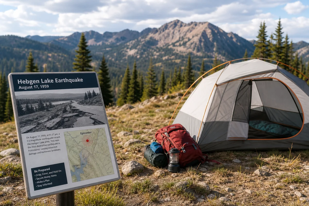
Natural Disasters and Underwater History
Montana’s history of natural disasters has occasionally affected underwater sites. The major earthquakes that have struck Montana, including the 1959 Hebgen Lake earthquake, dramatically altered lake levels and exposed previously submerged areas.
Similarly, Montana’s fire history has impacted watershed health in ways that affect reservoir levels and water clarity. Post-fire erosion can deposit significant sediment in reservoirs, potentially burying underwater artifacts.
Planning Your Montana Underwater History Trip
If I were planning a trip specifically focused on Montana’s underwater history, here’s the itinerary I’d recommend based on my multiple visits.
Day 1-2: Missoula and Glacial Lake Missoula
Start in Missoula to understand the prehistoric context. Drive the ancient shorelines visible on Mount Jumbo and Mount Sentinel. Visit the UM geology department exhibits if available.
Take the half-day drive to the Scablands in eastern Washington to see the flood evidence. This makes the scale of Glacial Lake Missoula tangible in a way that’s hard to achieve otherwise.
Day 3: Hungry Horse and Flathead Lake
Drive north to Hungry Horse Dam. The visitor center provides context about construction and what was flooded. Continue to Flathead Lake for the afternoon.
If water clarity is good and you’re adventurous, consider snorkeling near Somers or hiring a boat to explore areas where submerged artifacts have been reported.
Day 4-5: Fort Peck
The drive to Fort Peck crosses the Hi-Line and gives you a sense of Montana’s agricultural landscape. Spend time at the Fort Peck Interpretive Center and explore the dam itself, which is a National Historic Landmark.
If conditions allow, drive the reservoir’s shoreline looking for low-water exposures. The western shore near the dam tends to have the most significant historical sites.
Day 6: Canyon Ferry and Helena
On your way back toward western Montana, stop at Canyon Ferry Lake. The Helena area offers excellent facilities, and the Montana Historical Society is worth a visit for anyone interested in what went underwater.
Day 7: Butte and Georgetown Lake
End your trip in Butte, viewing the Berkeley Pit and exploring the mining heritage. A side trip to Georgetown Lake adds another underwater history dimension if time allows.
Why This History Matters
Some readers might wonder why they should care about towns that went underwater decades ago. From my perspective, this history matters for several reasons.
First, understanding what we’ve lost helps us appreciate what remains. Montana’s above-water ghost towns are famous, but they represent only part of the story. The underwater sites complete the picture.
Second, this history illuminates the tradeoffs involved in development. The dams that created Montana’s reservoirs provide irrigation, electricity, and recreation—but at a cost. Understanding that cost helps us make better decisions about future development.
Third, climate change is making this history newly relevant. As water levels fluctuate more dramatically, we may see more exposures of underwater sites. Knowing what’s down there helps us protect and interpret what emerges.
Finally, the families displaced by dam construction are still with us, and their stories deserve to be heard. When you recreate on Montana’s reservoirs, you’re enjoying landscapes with deep human connections.
Montana’s underwater history isn’t as accessible as a museum or as photogenic as a sunset over the mountains. But for visitors willing to look beneath the surface—literally and figuratively—it offers a unique perspective on how this remarkable state came to be.
Frequently Asked Questions
What underwater fossils can I see in Montana and where are they located?
Montana was covered by the Western Interior Seaway 75-100 million years ago, leaving behind incredible marine fossils including ammonites, mosasaurs, and ancient fish. The best spots to explore Montana’s underwater history include the Museum of the Rockies in Bozeman and fossil beds near Fort Peck Reservoir, where I’ve seen visitors discover prehistoric sea creatures in landlocked Montana.
Can you swim or dive in Flathead Lake to see submerged historical sites?
Yes, Flathead Lake offers fascinating underwater exploration with submerged logging equipment, old boats, and historic artifacts from Montana’s timber industry era. The crystal-clear water provides visibility up to 30 feet, and local dive shops in Polson and Bigfork rent equipment for around $75-100 per day. Summer months from June through August offer the warmest water temperatures for diving.
Where can I find prehistoric sea creature fossils in Montana for free?
The Makoshika State Park near Glendive and the Hell Creek Formation offer free fossil hunting on public lands where ancient marine and dinosaur remains surface regularly. I recommend bringing sturdy hiking boots, a small brush, and checking with the park office about collection rules since some fossils require permits. The drive from Billings to Glendive is about 220 miles east on I-94.
What is the best time of year to visit Montana’s paleontology museums and fossil sites?
Late spring through early fall (May-September) is ideal since many outdoor fossil beds and dig sites are inaccessible during Montana’s harsh winters. Museums like the Museum of the Rockies and the Carter County Museum operate year-round, but summer offers special paleontology programs and guided digs that cost between $50-150 per person. I suggest visiting weekdays to avoid crowds at popular exhibits.
Are there guided tours of Montana’s ancient seabed fossil locations?
Several outfitters offer guided fossil hunting tours in Montana’s ancient seabed regions, with prices ranging from $75 for half-day tours to $300+ for multi-day expeditions. Makoshika Dinosaur Museum and private operators near Jordan and Glasgow lead expeditions where you can legally keep certain fossils you discover. Book at least 2-3 weeks in advance during summer since experienced paleontology guides fill up quickly.
What should I bring when exploring Montana’s underwater history sites and fossil beds?
Pack sturdy hiking boots, sun protection, plenty of water, and a small geology hammer if you’re visiting designated collecting areas. I always bring a field guide to Montana fossils, GPS device, and ziplock bags for protecting any finds you’re permitted to keep. Temperatures in eastern Montana fossil country can exceed 100°F in summer, so start early and carry at least one gallon of water per person.
How much does it cost to visit Montana’s top underwater history and marine fossil attractions?
Museum admission ranges from $5-15 per adult, with the Museum of the Rockies charging $14.50 and smaller county museums often accepting donations. State park entry fees run $8 per vehicle for Montana residents and $10 for out-of-state visitors at places like Makoshika. Budget around $50-75 per day for a family of four covering admission, gas, and lunch when exploring Montana’s prehistoric marine heritage sites.
Sources