French trappers passing through what is now Missoula in the early 1800s gave the constricting canyon east of the valley a vivid name.
They called it “Porte de l’Enfer” — the Gate of Hell.
The reason wasn’t the canyon’s geography (though the steep walls of Mount Jumbo on the north and Mount Sentinel on the south do create a dramatic gorge).
The reason was what the trappers found there: substantial human remains scattered throughout the canyon — the gruesome evidence of generations of ambushes carried out by the Niitsítapi (Blackfeet) against the Séliš u Ql̓ispé / k̓upawiȼq̓nuk (Flathead/Salish) as the western tribes traveled through the narrow canyon en route to buffalo hunting grounds on the eastern prairies.
The English translation — Hell Gate — stuck.
For a few years in the 1860s, “Hell Gate” was even the original name for what is now Missoula itself. Captain Christopher P. Higgins and Frank Worden established the Hell Gate Trading Post at the confluence of the Bitterroot and Clark Fork rivers in 1860, downstream from present-day Missoula.
By 1865, the trading post had been moved four miles east to the present site of Missoula and renamed Missoula Mills.
The original Hell Gate town was abandoned by 1866. But the canyon itself retained the name. So did Hellgate High School in Missoula, Hellgate Elementary, and the Postal Service’s Hell Gate Station downtown.
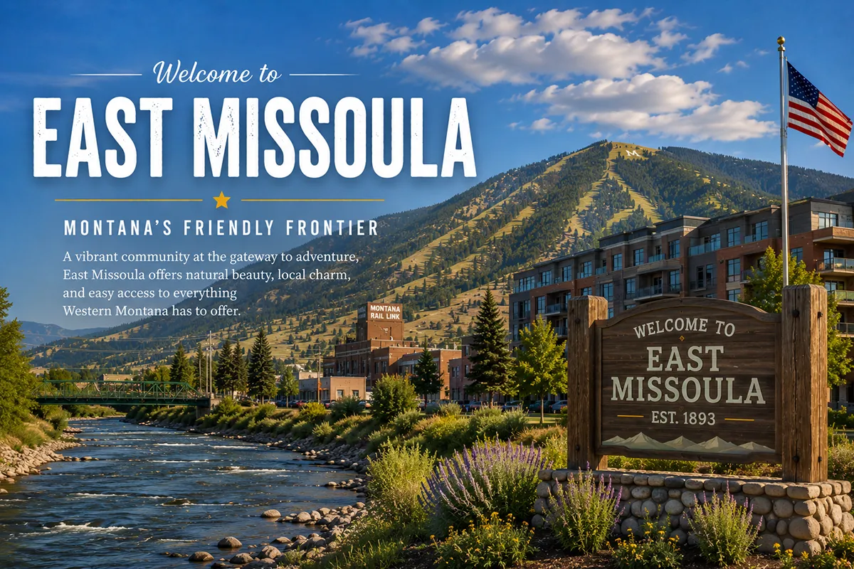
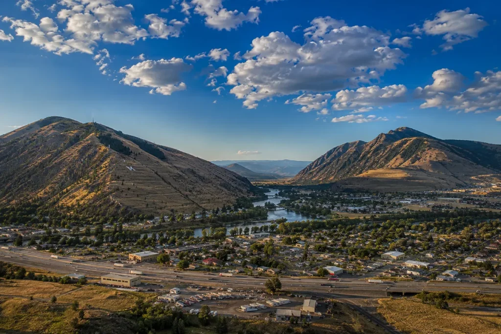
And at the western entrance to Hellgate Canyon — wedged between Mount Jumbo to the north and Mount Sentinel to the south, with the Clark Fork River running through the middle — sits the small unincorporated community of East Missoula.
The community had 2,465 residents at the 2020 census — up from 2,157 in 2010. East Missoula functions as a substantively important transitional community between metropolitan Missoula (immediately west, across the Clark Fork’s bend) and the broader Blackfoot River corridor and Hellgate Canyon to the east.
Former US Route 10 and Montana Highway 200 pass through the center. Interstate 90 runs along the southern edge, with access from Exit 107.
TL;DR
- East Missoula (2,465) is an unincorporated CDP in Missoula County, immediately east of Missoula at the western entrance to Hellgate Canyon.
- The community sits between Mount Jumbo (north) and Mount Sentinel (south), with the Clark Fork River bordering it to the east.
- It is part of the broader Missoula metropolitan area and serves as a substantively important transitional community between the city and the eastern Blackfoot River corridor.
- Hellgate Canyon — the 50-mile gorge to the east — was named “Porte de l’Enfer” (Gate of Hell) by French trappers for the substantial human remains they found from generations of Blackfeet-Salish ambush warfare.
- The original 1860 Hell Gate town (founded by Higgins and Worden) was a different location west of present-day Missoula, abandoned by 1866 — separate from contemporary East Missoula.
- Lewis and Clark camped near the Clark Fork in this area on July 4, 1806.
- The famous Hellgate Winds — cold winter Arctic air funneled through the canyon — make East Missoula one of the windiest spots in western Montana during cold-air outflow events.
- Former US-10 and MT-200 pass through East Missoula; I-90 Exit 107 is on the southern edge.
- The 2008 removal of the Milltown Dam (just east of East Missoula) was a major chapter in the EPA’s most expensive Superfund cleanup.
- Best for: Missoula commuters, Hellgate Canyon access, Clark Fork River recreation, eastern gateway to the Blackfoot River.
Liked this article?
Add Roaming Montana as a preferred source so you see more of our articles and guides on Google.
East Missoula at a Glance
| Population (2010) | 2,157 |
| County | Missoula County |
| Status | Unincorporated CDP |
| Region | Western Montana (Missoula metro area) |
| Elevation | 3,225 ft |
| CDP area | 1.25 sq miles (1.20 land + 0.04 water) |
| ZIP code | 59802 (shared with Missoula) |
| Distance to downtown Missoula | ~3 miles west |
| Distance to Bonner | ~3 miles east |
| Distance to Lolo | ~10 miles southwest |
| Distance to Clinton | ~15 miles east on I-90 |
| Distance to Seeley Lake | ~60 miles northeast |
| Distance to Frenchtown | ~20 miles west |
| Highway access | I-90 (Exit 107), former US-10, MT-200 |
| Surrounding mountains | Mount Sentinel (south), Mount Jumbo (north) |
| Best for | Missoula commuters, Hellgate Canyon access, Clark Fork recreation |
What Makes East Missoula Different
The community’s identity is defined by its position at the entrance to Hellgate Canyon.
Pre-Contact Heritage
The area where East Missoula now sits has been continuously inhabited for substantially longer than European-American history.
Archaeological evidence indicates the first known human settlements along the Clark Fork River date to approximately 3,500 BCE. By the 16th century, six different Native American tribes used the broader Missoula Valley.
The narrow canyon east of the valley — what would become Hellgate Canyon — was a critical migration and trade corridor. The Séliš u Ql̓ispé / k̓upawiȼq̓nuk people (commonly known in English as the Salish or Flathead) used the canyon to travel east in pursuit of buffalo on the prairies beyond the Continental Divide. The Niitsítapi (Blackfeet) — territorially based on the eastern prairies — repeatedly ambushed Salish hunting parties as they passed through the canyon’s narrow confines.
The ambushes left substantial physical evidence: human bones and remains throughout the canyon.
“Porte de l’Enfer”
French-Canadian trappers and explorers passing through the area in the 1820s and 1830s found the canyon’s accumulated evidence of warfare deeply unsettling.
They named the canyon “Porte de l’Enfer” — the Gate of Hell.
In English usage, the name became Hell Gate.
David Thompson and Lewis & Clark
The first documented European-American visitors to the broader Missoula Valley were members of the Lewis and Clark Expedition — who camped near the confluence of Rattlesnake Creek and the Clark Fork on July 4, 1806 during their return journey from the Pacific Coast.
In 1811, English-Canadian explorer David Thompson visited the area, mapping much of the valley and the surrounding peaks. Mount Jumbo — the north wall of Hellgate Canyon, visible from East Missoula — was among the peaks Thompson documented.
The 1860 Hell Gate Town
In 1860, two entrepreneurs — Army Captain Christopher Powers Higgins and businessman Francis Lyman “Frank” Worden — established the Hell Gate Trading Post along the Mullan Road.
The trading post was located approximately five miles downstream from present-day Missoula — near what is now Frenchtown, at the western end of the Missoula Valley. The location was substantively distinct from contemporary East Missoula at the eastern end of the valley.
The original Hell Gate town never grew large. The water supply was unsuitable for the lumber and flouring mills that Higgins and Worden wanted to build. In 1865, the settlement was moved four miles east to the present site of Missoula and renamed Missoula Mills. The original Hell Gate town was abandoned by 1866.
The canyon itself, however, retained the name.
The Clark Fork Name History
The river running through East Missoula has had multiple names over the past 200 years.
Lewis and Clark referred to it as the Flathead River. In the 1830s, trapper Jim Bridger talked about traveling on the “deer lodge River.” In 1833, Warren Ferris of the American Fur Company wrote of crossing the mountain to the “Deer House Plains and following the Arrowstone River.”
From territorial days until 1920, the river was officially known as the Deer Lodge River from its headwaters to Garrison (Anaconda area), and as the Hellgate River below Garrison to Missoula.
In 1866, after the Flathead Native Americans signed a treaty and relinquished much of their land, the lower segment was renamed for the Salish word meaning “river of ambush” — recognition of the very same Hellgate Canyon warfare that had given the canyon its French name.
The full river was eventually renamed the Clark Fork (in honor of William Clark of the Lewis and Clark Expedition) — though the name change wasn’t fully formalized until 1920.
The Hellgate Winds
The most distinctive contemporary phenomenon associated with East Missoula and Hellgate Canyon is the Hellgate Wind.
When deep cold Arctic high-pressure systems flood the eastern prairies of Montana in winter, cold air seeps westward through the canyon walls of Hellgate. The constricting canyon walls force the cold air to accelerate dramatically before exploding into the otherwise gentle Missoula Valley.
The result is some of the most extreme wind-chill conditions experienced in western Montana — many University of Montana students walking to classes through East Missoula attest to it. The Hellgate Winds can be substantively dangerous during deep winter cold snaps.
The 2008 Milltown Dam Removal
The most significant contemporary event affecting East Missoula was the 2008 removal of the Milltown Dam — located at the confluence of the Clark Fork and Blackfoot rivers just east of East Missoula in Bonner.
The dam — built in 1908 — had trapped approximately 6.6 million cubic yards of contaminated sediment from upstream copper smelting operations at Anaconda and Butte. The contaminated sediment included substantial concentrations of arsenic, copper, zinc, lead, and other heavy metals.
The Clark Fork upstream of Missoula became the EPA’s most expensive Superfund site ever designated. After a long, heated political debate, the dam was removed in 2008.
The contaminated sediment behind the dam was excavated, loaded onto train cars, and buried in waste facilities near Anaconda, Montana. The health of the nutrient-rich Clark Fork River has substantially improved since.
For broader trip context, see my Montana cities and towns hub and Montana history overview.
The Top 6 Things to Do In & Around East Missoula
1. Hellgate Canyon Drive
The signature regional experience.
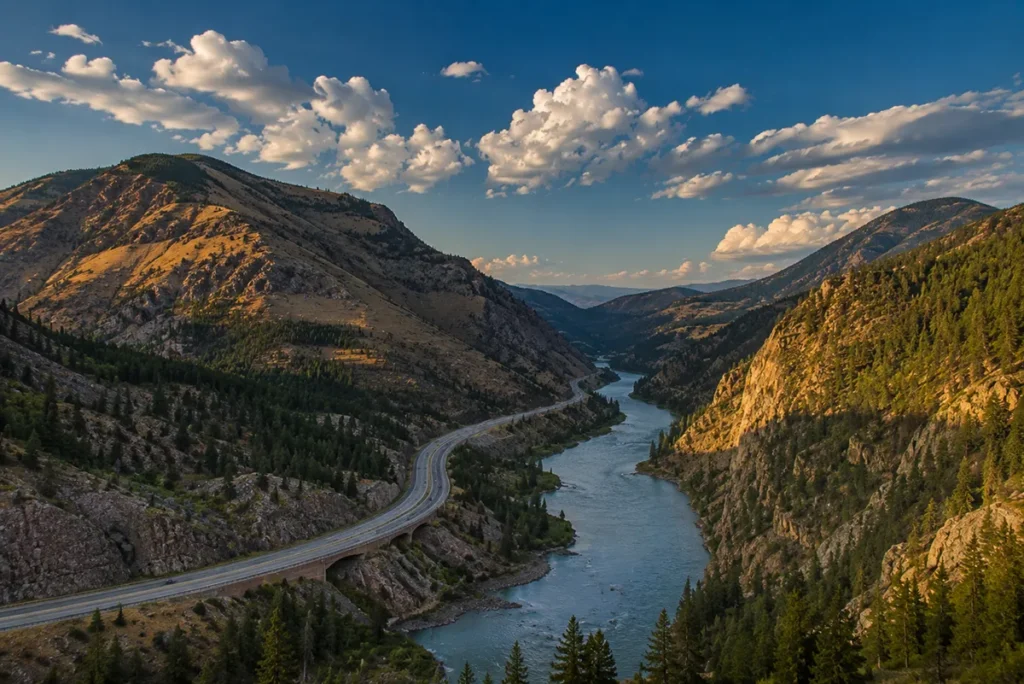
The drive east through Hellgate Canyon on Interstate 90 or former US-10 / MT-200 between East Missoula and Bonner crosses some of western Montana’s most substantively dramatic landscape. The 50-mile canyon extends east from East Missoula along the Clark Fork River.
2. Kim Williams Trail
The 3-mile Kim Williams Trail along the south bank of the Clark Fork River — running from downtown Missoula east through Hellgate Canyon — replaces an old railroad grade and provides substantively important pedestrian/bicycle access to the canyon.
The trail starts in downtown Missoula and extends to a point east of East Missoula. Connections to broader Missoula trail systems are available throughout.
3. Mount Jumbo
The 4,768-foot Mount Jumbo rises immediately north of East Missoula.
Multiple hiking trails ascend the mountain from trailheads on the East Missoula side. The summit provides substantively dramatic views of the entire Missoula Valley, Hellgate Canyon, and the surrounding mountain ranges. The mountain is protected as Missoula city open space.
4. Mount Sentinel & The “M”
The 5,158-foot Mount Sentinel rises immediately south of East Missoula on the Missoula side of the Clark Fork.
The mountain is famous for the large concrete “M” — a University of Montana symbol installed in 1909 — visible from across the valley. A challenging switchback trail leads to the M; an even more challenging continuation leads to the summit. Excellent views over East Missoula and Hellgate Canyon.
5. Day Trip to Missoula (3 miles west)
The largest city in western Montana is essentially adjacent.
Attractions include the University of Montana (with its substantial museum collections), the Smokejumper Visitor Center, the Missoula Art Museum, the Carousel for Missoula, and substantial restaurant, brewery, and shopping options. See things to do in Missoula for a comprehensive guide; for dining and drink: Missoula breweries, best restaurants in Montana; for lodging: hotels in Missoula; for RV options: RV parks in Missoula.
6. Eastern Day Trip to Bonner and Seeley Lake
East from East Missoula, the Blackfoot River corridor provides substantial recreational opportunities.
Bonner (3 miles east) anchors the Clark Fork-Blackfoot confluence and the former Milltown Dam site. Seeley Lake (60 miles northeast) provides a major mountain lake recreation destination on the Seeley-Swan Valley corridor.
Where to Stay
East Missoula has limited dedicated lodging.
Most travelers base in Missoula (3 miles west).
| Lodging | Vibe | Price | Best For |
|---|---|---|---|
| Missoula hotels (10 min W) | Full city selection — see hotels in Missoula | $130–280 | Most travelers |
| RV parks — see RV parks in Missoula | RV options | $40–80 | RV travelers |
| Seeley Lake lodging (1 hr NE) | Mountain lake options | $130–250 | Recreation-focused |
| Vacation rentals (East Missoula area) | Clark Fork river access | $130–280 | Anglers, longer visits |
Where to Eat
East Missoula has limited dining within the community itself.
- Missoula restaurants (10 min W) — extensive city variety; see Missoula breweries and best restaurants in Montana
- Bonner options (5 min E) — small selection
- Clinton restaurants (15 min E) — additional small-town options
Getting There & Around
From Missoula: 3 miles east on I-90 to Exit 107, about 5 minutes. Alternative routes via Broadway / former US-10 or via MT-200 access the community center directly.
From Bonner: 3 miles west on MT-200, about 5 minutes.
From Lolo: 10 miles northeast via US-93 and I-90, about 15 minutes.
From Clinton: 15 miles west on I-90, about 18 minutes.
Cell service: Excellent throughout East Missoula and Hellgate Canyon.
When to Visit
Summer (June-August): Best Hellgate Canyon weather; full Clark Fork River recreation; warmest temperatures.
Fall (September-October): Outstanding canyon color along the Clark Fork; cooler temperatures.
Winter (December-March): Be aware of Hellgate Winds — cold Arctic air funneled through the canyon can produce extreme wind-chill conditions. Travel only with proper winter preparation during cold-air outflow events.
Spring (April-May): Clark Fork River runoff; the canyon greens up.
Personal Tips
Understand the wind risk. The famous Hellgate Winds are not a casual phenomenon. During deep winter cold-air outflow events, wind chill in East Missoula can become genuinely dangerous. Verify forecast conditions before any extended outdoor activity in winter.
Don’t confuse East Missoula with the original Hell Gate town. The original 1860 Hell Gate Trading Post (Higgins and Worden) was a substantively different community at the western end of the Missoula Valley near present-day Frenchtown. East Missoula is at the eastern end of the valley, at the entrance to Hellgate Canyon.
Read about the 2008 Milltown Dam removal. Understanding the Clark Fork Superfund context — including the dam removal and the substantial sediment cleanup — adds significant depth to any Clark Fork-area visit.
Use East Missoula as a strategic base. The community’s position between metropolitan Missoula (3 miles west) and the rural Blackfoot River corridor makes it substantively practical for travelers wanting both city access and quicker access to mountain recreation east of Hellgate Canyon.
Walk the Kim Williams Trail. The trail along the Clark Fork between downtown Missoula and Hellgate Canyon provides substantively meaningful pedestrian access to the river corridor that has been continuously important to the region for over 5,500 years.
Photograph Mount Sentinel. The famous concrete “M” on Mount Sentinel — the University of Montana symbol installed in 1909 — is visible from substantial portions of East Missoula and across the Clark Fork.
East Missoula Quick Facts
| Population (2020) | 2,465 | | Population (2010) | 2,157 | | Population growth (2010-2020) | +14% | | County | Missoula County | | CDP area | 1.25 sq mi | | Elevation | 3,225 ft | | ZIP code | 59802 (shared with Missoula) | | Highway access | I-90 (Exit 107), former US-10, MT-200 | | Mount Sentinel | 5,158 ft (south) | | Mount Jumbo | 4,768 ft (north) | | Hellgate Canyon length | ~50 miles | | Original French name for canyon | Porte de l’Enfer (Gate of Hell) | | Original 1860 Hell Gate Trading Post location | West of Missoula (near Frenchtown) | | 1860 founders | Capt. Christopher P. Higgins, Frank Worden | | Original town abandoned | 1866 | | Lewis & Clark Missoula Valley camp | July 4, 1806 | | David Thompson mapping | 1811 | | Clark Fork name change | 1920 (from Hellgate River / Deer Lodge River) | | Milltown Dam built | 1908 | | Milltown Dam removed | 2008 | | Clark Fork Superfund | EPA’s most expensive ever designated | | Average summer high | 84°F | | Average winter low | 18°F (without Hellgate Winds) |
Conclusion
East Missoula is a 2,465-person unincorporated community at the substantively significant geographic transition between the Missoula Valley and Hellgate Canyon.
The position between Mount Jumbo and Mount Sentinel. The history of the canyon’s “Porte de l’Enfer” naming by French trappers documenting generations of Niitsítapi-Séliš warfare. The Lewis and Clark camp of July 4, 1806.
The 1860 Hell Gate Trading Post and 1866 abandonment. The 2008 Milltown Dam removal and the EPA’s most expensive Superfund cleanup.
The famous Hellgate Winds that periodically explode into the valley. And the contemporary character as a substantively important transitional community in the Missoula metropolitan area.
For travelers exploring the broader Missoula area and the Hellgate Canyon corridor east toward Bonner, the Blackfoot River, and Seeley Lake, East Missoula sits in the most geographically substantive position in the entire western Montana mountain crossroads.
Have an East Missoula question? Drop it in the comments — I read every one.
Frequently Asked Questions
Is East Missoula Montana worth visiting?
East Missoula is worth a stop primarily for Hellgate Canyon access (the western entrance to the 50-mile canyon along the Clark Fork River), the trailheads to Mount Jumbo (north) and Mount Sentinel (south, with the famous University of Montana “M”), the Kim Williams Trail along the south bank of the Clark Fork, and as a substantively practical base for exploring the broader Missoula area without staying in the city itself.
What is Hellgate Canyon?
Hellgate Canyon is a 50-mile-long canyon east of Missoula, Montana, formed by the Clark Fork River. The canyon’s name traces to French-Canadian trappers who passed through the area in the 1820s and 1830s and found substantial evidence of generations of warfare between the Niitsítapi (Blackfeet) and the Séliš u Ql̓ispé (Flathead/Salish) peoples. The Salish used the canyon to travel east in pursuit of buffalo on the prairies beyond the Continental Divide; the Blackfeet repeatedly ambushed Salish hunting parties as they passed through the canyon’s narrow confines. The accumulated human remains led the French trappers to name the canyon “Porte de l’Enfer” — the Gate of Hell — translated in English as Hell Gate. The canyon’s western entrance is at East Missoula.
What are the Hellgate Winds?
The Hellgate Winds are a meteorological phenomenon affecting Missoula and East Missoula during winter cold-air outflow events. When deep cold Arctic high-pressure systems flood the eastern prairies of Montana, cold air seeps westward through Hellgate Canyon. The constricting canyon walls force the cold air to accelerate dramatically before exploding into the otherwise gentle Missoula Valley. The result is some of the most extreme wind-chill conditions experienced in western Montana — substantively dangerous during deep winter cold snaps. The Hellgate Winds typically affect East Missoula most intensely (being directly at the canyon entrance) before spreading across the broader Missoula Valley.
How big is East Missoula Montana?
East Missoula had a population of 2,465 at the 2020 U.S. Census — up from 2,157 at the 2010 census (a 14% growth rate). The community covers approximately 1.25 square miles in central Missoula County. The CDP is bordered to the west by the city of Missoula, to the east by the Clark Fork River (across which is an exclave of Missoula), with Interstate 90 running along the southern edge (Exit 107) and former US-10 / MT-200 passing through the center.
Is East Missoula the same as the original Hell Gate town?
No — East Missoula and the original 1860 Hell Gate town are substantively different communities. The original Hell Gate town was founded in 1860 by Captain Christopher Powers Higgins and Frank Worden at the western end of the Missoula Valley near present-day Frenchtown — approximately five miles downstream from the present site of Missoula. The original town never grew large; the water supply was unsuitable for the mills Higgins and Worden wanted to build. In 1865, the settlement was moved four miles east to the present site of Missoula and renamed Missoula Mills. The original Hell Gate town was abandoned by 1866. East Missoula, by contrast, is at the eastern end of the Missoula Valley, at the entrance to Hellgate Canyon — a substantively different geographic location entirely.
How far is East Missoula from Missoula Montana?
East Missoula is approximately 3 miles east of downtown Missoula via Interstate 90 to Exit 107 — about a 5-minute drive. The community is part of the broader Missoula metropolitan area and shares the 59802 ZIP code with Missoula. Functionally, East Missoula operates as a residential suburb of Missoula while retaining its distinct identity as a separate unincorporated CDP.
What was the Milltown Dam?
The Milltown Dam was a hydroelectric dam built in 1908 at the confluence of the Clark Fork and Blackfoot rivers in Bonner, Montana — just east of East Missoula. Over a century of operation, the dam trapped approximately 6.6 million cubic yards of sediment contaminated with arsenic, copper, zinc, lead, and other heavy metals from upstream copper smelting operations at Anaconda and Butte. The Clark Fork upstream of Missoula became the EPA’s most expensive Superfund site ever designated. After a long, heated political debate, the dam was removed in 2008. The contaminated sediment was excavated, loaded onto train cars, and buried in waste facilities near Anaconda. The health of the nutrient-rich Clark Fork River has substantially improved since the dam removal.