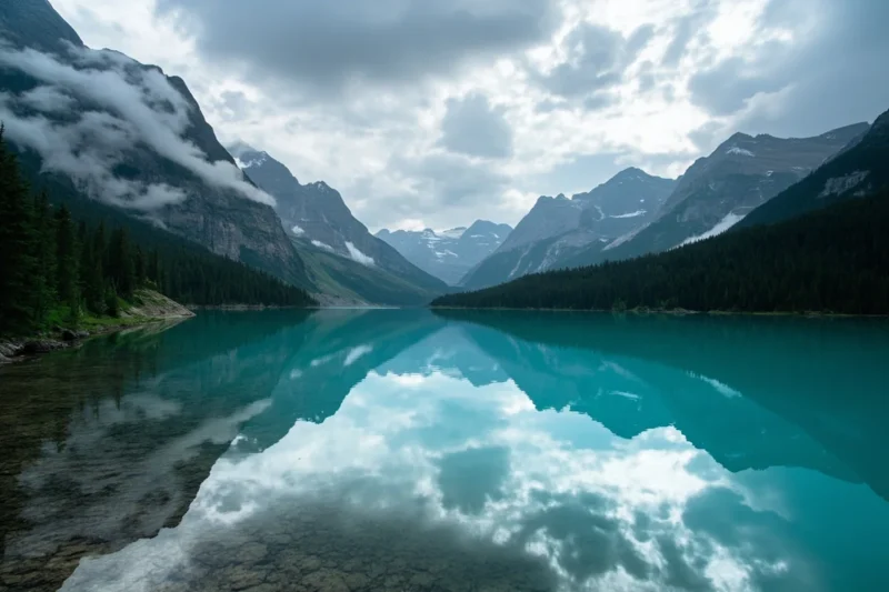
I once tried to count how many shades of blue Flathead Lake goes through in a single day and gave up somewhere around eight. Steel gray at 6 a.m., near-turquoise by noon, and a color I still don’t have a name for right before sunset when the Mission Mountains go pink behind it.
Flathead Lake is the largest natural freshwater lake west of the Mississippi River, stretching 27 miles north to south and reaching depths of nearly 370 feet. This guide focuses on the lake itself — the geology behind it, where to actually get in the water, what lives beneath the surface, the state parks that ring its shoreline, and the real safety considerations most guides skip. For a full activity-by-activity, town-by-town itinerary, see my complete Flathead Lake things-to-do guide; this post is the deep dive on the lake itself.
How Flathead Lake Was Formed
Flathead Lake sits at the bottom of what used to be Glacial Lake Missoula’s smaller neighbor, carved out by the same Ice Age glaciation that shaped Glacier National Park an hour north.
As the glaciers retreated roughly 12,000 years ago, they left behind a natural basin that filled with meltwater and has been fed ever since by the Flathead River system.
That glacial origin explains a lot about the lake’s character. The water is cold nearly year-round because much of its inflow comes from snowmelt off the Swan and Mission ranges and, further upstream, from Glacier National Park itself.
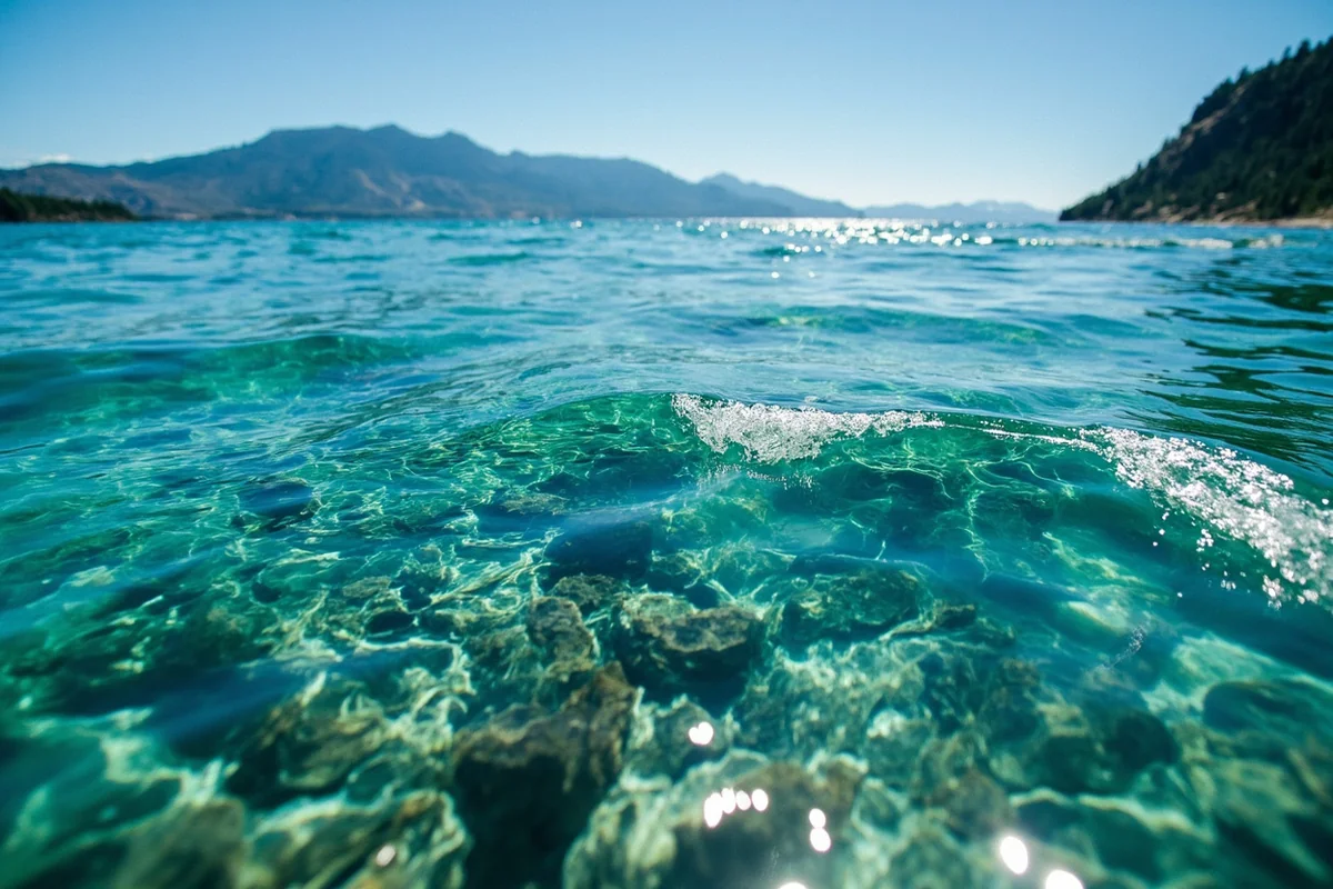
It also explains the clarity — I’ve dropped a white dinner plate off the side of a boat near Yellow Bay in July and watched it stay visible past 15 feet down, which locals will tell you is normal for this lake and unusual for almost anywhere else.
Flathead Lake by the Numbers
- Surface area: approximately 191.5 square miles
- Length: about 27 miles north to south
- Width: up to 15 miles at its widest point
- Maximum depth: approximately 370 feet
- Shoreline: roughly 185 miles
- Elevation: about 2,893 feet above sea level
Kerr Dam, at the lake’s southern outlet near Polson, regulates the lake’s level seasonally, which is why the shoreline you see in May can look noticeably different from the shoreline in September.
The dam is operated by Energy Keepers, Inc., owned by the Confederated Salish and Kootenai Tribes, whose reservation encompasses the southern half of the lake.
Where to Actually Get in the Water
I get asked constantly which beach on Flathead Lake is “the good one,” and the honest answer depends on what you want.
For swimming with services nearby: Volunteer Park in Polson and the beach at Somers both have easy parking and are close enough to town that you can grab lunch afterward. The water off Polson tends to be a touch warmer since it’s shallower near the outlet.
For a quieter, more scenic swim: Yellow Bay State Park, on the east shore along Highway 35, has a rocky beach and some of the clearest water on the lake. I’ve had entire stretches of shoreline here to myself on weekday mornings even in July.
For families: Wayfarers State Park near Bigfork has a gentler entry and enough shallow water near shore that I’ve watched toddlers wade in safely while parents kept an eye on them from a picnic table twenty feet away.
Wherever you go in, know before you jump: even in August, Flathead Lake’s surface temperature in open water typically sits in the mid-to-upper 60s Fahrenheit, and it drops fast once you’re more than a few feet down. It is not a warm lake by national standards. I always pack a rash guard even on the hottest days.
Fishing Flathead Lake
Flathead Lake supports a genuinely interesting and somewhat contentious fishery. Lake trout (mackinaw) dominate the deep water and can run large — fish over 20 pounds aren’t unheard of, though they’ve also reshaped the lake’s ecosystem in ways fisheries biologists have spent decades studying, since lake trout predation contributed to the historic decline of native bull trout and kokanee salmon populations here.
Yellow perch, northern pike, and largemouth bass round out the warmer bays, particularly around Somers and the lake’s southern arms.
If you’re after lake trout specifically, downrigging near Rollins or Big Arm in the deep central basin is the standard approach, and most of the guide services based in Bigfork and Somers specialize in exactly that trip.
A Montana fishing license is required lake-wide, and if you’re fishing the southern portion of the lake within the Flathead Indian Reservation, you’ll also need a [tribal recreation permit] from the Confederated Salish and Kootenai Tribes — a detail I’ve seen trip up more than a few out-of-state anglers who assumed one license covered the whole lake.
State Parks Around the Lake
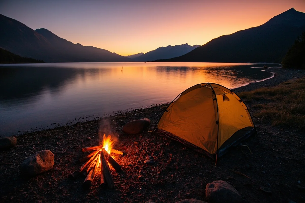
Flathead Lake is unusual for having so many small, dedicated state park units directly on its shoreline rather than one large park. I’ve camped at most of them over the years:
- West Shore State Park — quiet, wooded sites on the lake’s less-developed west side.
- Big Arm State Park — good boat launch access and views across to Wild Horse Island.
- Yellow Bay State Park — smaller, day-use focused, with limited camping.
- Wayfarers State Park — the busiest of the group, closest to Bigfork, with the most developed facilities.
- Finley Point State Park — a boater’s park at the lake’s south end, with slips for boats up to 25 feet.
Each charges a day-use or camping fee [verify current fees], and the more popular ones (Wayfarers especially) fill up on summer weekends — I’d recommend booking ahead rather than showing up hoping for a walk-in site in July or August.
Wild Horse Island
Wild Horse Island sits in the lake’s western half and is the largest island on Flathead Lake, managed as a state park you can only reach by your own boat or a chartered tour.
I took a kayak out to it one September and spent a slow afternoon watching bighorn sheep move across the grassland slopes — there are also a handful of wild horses on the island, which gave it its name, though sightings aren’t guaranteed.
There’s no camping allowed and no facilities beyond a few trails, so bring water and plan your return trip before the afternoon wind picks up, which it reliably does on this lake.
The Flathead Lake Monster
No honest guide to this lake skips the monster. Sightings of a large, unidentified creature in Flathead Lake date back to at least 1889, and reports have continued sporadically ever since, enough that the Flathead Lake Biological Station has fielded serious inquiries about it over the decades.
I don’t put much stock in it personally, but I’ll admit that watching a submerged log roll unexpectedly near the boat one evening off Big Arm gave me a full-body startle. Most researchers point to sturgeon, large lake trout, or simple wave action and driftwood as the likely explanations.
Water Quality and Why It Matters
Flathead Lake is considered one of the cleanest large lakes in the country, largely because the surrounding watershed has relatively low nutrient runoff, which keeps algae growth down and the water clear.
That clarity is genuinely fragile — invasive mussels have been detected in other Montana reservoirs (notably the Tiber and Canyon Ferry systems), and a mussel infestation here would change the lake’s ecology and clarity permanently.
This is why boat inspection stations around the lake are mandatory, not optional, for any trailered watercraft — see my full boating in Montana guide for details on permits and inspection requirements statewide.
I’ve waited in line at these stations on a busy Saturday and it’s added maybe 20 minutes to my day — worth it.
Rockhounds should also know that the gravel beaches near Yellow Bay and elsewhere along the shoreline occasionally turn up small agates washed down from the surrounding drainages, though nothing like the volume you’d find along the Yellowstone River.
If gemstone hunting is a bigger part of your trip, see my Montana gemstones guide for better-dedicated sites.
Flathead Lake in Winter
Most visitors think of Flathead Lake as strictly a summer destination, and I understand why — the marinas empty out, the cherry stands close, and the highway traffic along both shores drops to a trickle by November.
But I’ve come back in January more than once, and the lake in winter has its own quiet appeal. It rarely freezes solid across its full surface because of its size and depth, which means you won’t see the kind of lake-wide ice fishing you’d find on smaller reservoirs like Canyon Ferry — instead, ice tends to form in the shallower bays and inlets first, particularly around Somers and the lake’s southern arms near Polson.
I’ve driven the full loop on a clear, cold December day and had entire pullouts to myself that would be packed with cars in July.
The Mission Mountains carry snow well into the spring, and the contrast between the dark, open water and the white peaks behind it is a completely different postcard than the summer version of this lake.
If you’re chasing a quieter, moodier Flathead Lake experience and don’t mind the cold, the shoulder months of November and March are worth considering, especially for photography.
A Few More Things Worth Knowing
The lake’s water level changes noticeably by season. Kerr Dam manages the lake for both flood control and hydroelectric generation, which means the shoreline you see in May, when the lake is being filled toward its summer pool level, can look meaningfully different from the shoreline in September or October, when levels are typically drawn down. If you’re picking a specific beach or dock based on a photo you saw online, keep in mind it may look different depending on when you visit.
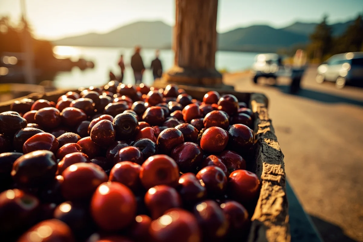
Cherry stands are a whole side trip. Beyond the well-known picking season in mid-to-late summer, several roadside stands along Highway 35 sell fresh Flathead cherries, cherry cider, and preserves well into early fall. I make a point of stopping at least twice on any full loop of the lake — once heading north, once heading south.
Personal Tips / What I Wish I Knew
Bring a wetsuit top even in August. I underestimated the cold the first two summers I swam here and cut my time in the water short both times.
The afternoon wind is real and predictable. Flathead Lake tends to calm down in the early morning and pick up wind chop by early-to-mid afternoon, especially on the open water in the lake’s center. If you’re kayaking or paddleboarding, go early.
Cherry season overlaps with peak crowds. Flathead cherries ripen from mid-July through August, which is also when every campground and beach on the lake is busiest. If you want both the cherries and some elbow room, aim for the first week of that window rather than the peak of it.
The east and west shores feel like different lakes. Highway 35 on the east side runs closer to the water with more orchards and small-town charm through Bigfork and Yellow Bay; Highway 93 on the west side is faster and more commercial. I switch which one I drive depending on whether I’m in a hurry or not.
Practical Info: Flathead Lake
| Best season to visit | Mid-June through September for water access; May and October for quieter shoulder-season visits |
| Water temperature (August) | Mid-to-upper 60s°F at the surface, colder below a few feet |
| Nearest airport | Glacier Park International Airport (FCA), about 20–30 minutes from the north end |
| Fishing license | Montana state license required; add a tribal permit for the reservation portion (south half of lake) |
| Boat inspection | Mandatory at designated stations for trailered watercraft [verify current station locations] |
| Main access towns | Bigfork, Polson, Somers, Lakeside, Woods Bay, Big Arm |
Frequently Asked Questions
How deep is Flathead Lake?
Flathead Lake reaches a maximum depth of approximately 370 feet, making it one of the deepest natural lakes in the western United States.
Is Flathead Lake safe to swim in?
Yes, swimming is popular and generally safe at designated beaches and state parks, though there are no lifeguards at most access points and the water stays cold even in summer.
Do I need a permit to fish Flathead Lake?
You need a Montana fishing license for the entire lake, plus a tribal recreation permit from the Confederated Salish and Kootenai Tribes if you’re fishing the southern portion within the Flathead Indian Reservation.
Can you drink the water from Flathead Lake?
I wouldn’t recommend drinking untreated lake water anywhere, including here, despite its reputation for clarity. Treat or filter it as you would any backcountry water source.
Is Flathead Lake bigger than Whitefish Lake?
Considerably. Flathead Lake covers about 191.5 square miles, while Whitefish Lake covers roughly 5 square miles — Flathead is the anchor lake of the region, and Whitefish is its smaller, quieter neighbor 30 minutes north.
Does Flathead Lake freeze in winter?
Portions of it do, particularly the shallower bays near Somers and Polson, but the lake’s size and depth mean it rarely freezes solid across its entire surface the way smaller Montana reservoirs do.
What towns are on Flathead Lake?
The main towns and communities around the lake are Bigfork, Polson, Somers, Lakeside, Woods Bay, Big Arm, Elmo, Rollins, and Dayton, each offering a slightly different mix of services and access points.
Final Thoughts
Flathead Lake rewards the kind of trip where you slow down and actually get in the water rather than just photographing it from a pull-off. I’ve come back to this lake more than any other in Montana, and I still find a new bay, a new beach, or a new state park unit I hadn’t tried before.
For the full rundown of things to do around the lake — towns, restaurants, seasonal events, and a complete loop-drive itinerary — head to my Flathead Lake things-to-do guide.
And if you’re building a bigger Montana lake trip, check out the full guide to Montana’s best lakes for what else is worth adding to your route.