I hiked two miles, crested a ridge at 10,500 feet, and crossed an entire state line without a single sign telling me it happened.
- This Glacier Lake sits in the Beartooth Mountains off US-212, a short but steep day hike climbing about 1,000 feet over roughly 2.2 miles
- It’s a completely different lake from any “Glacier Lake” near Condon or inside Glacier National Park — this one straddles the Montana-Wyoming border south of Red Lodge
- This guide covers the trailhead access, the rough forest road getting there, what to expect at the lake, and the extension trail to Moon Lake for those wanting more
- Best as a half-day outing rather than a full commitment, though afternoon weather here turns fast
Liked this article?
Add Roaming Montana as a preferred source so you see more of our articles and guides on Google.
A Name You’ll Find in Three Different Places
Before anything else, I want to clear up a genuine point of confusion. Montana has more than one lake called Glacier Lake, and this guide covers a specific one: the Glacier Lake in the Beartooth Mountains, reached via US-212 south of Red Lodge.
This is not the same as any lake inside Glacier National Park itself, and it’s also a completely different Glacier Lake from the one near Condon in the Bob Marshall Wilderness area, which is an easy 3.3-mile round trip through forest — nothing like the alpine terrain described here.
If you searched for “Glacier Lake hike” and ended up planning a trip based on the wrong one, you wouldn’t be the first.
Getting to the Trailhead
From Red Lodge, follow US-212 south — the Beartooth Highway — as it climbs toward Beartooth Pass. Watch for the turnoff onto the forest road leading to the Glacier Lake trailhead, which branches off before the highway crests the pass itself.
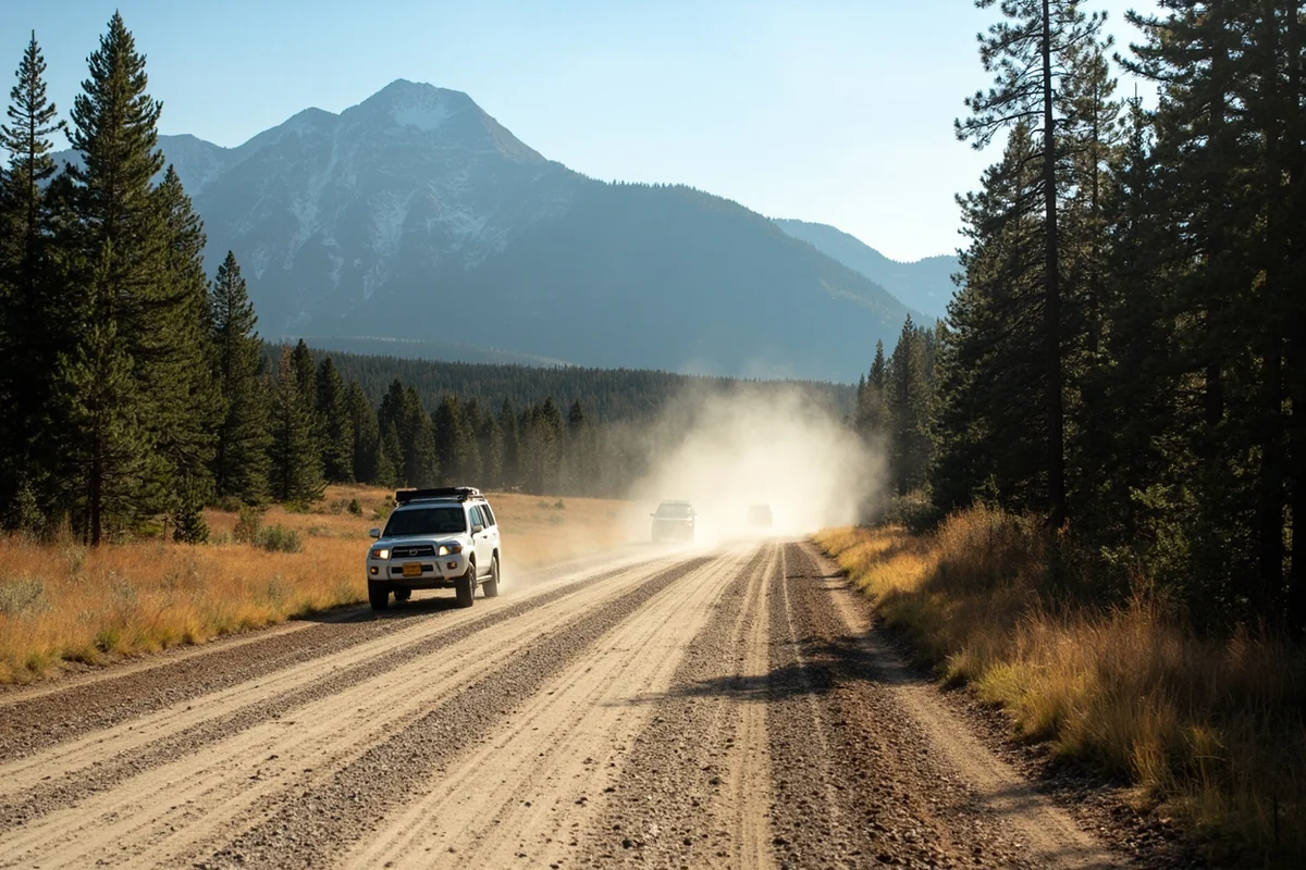
I’d budget real time and patience for this access road. It’s rough, washboarded, and dusty, and while a standard passenger car can usually make it in dry conditions, I’ve seen plenty of visitors wishing they’d brought a higher-clearance vehicle instead. Your car will take more abuse getting to the trailhead than your legs will take on the actual trail.
The Hike Itself
At just over 2 miles one way, this is one of the shortest true alpine hikes in the entire Beartooth range, which is exactly why I recommend it so often to visitors who want genuine high-country scenery without committing to a full backpacking trip. The trailhead sits around 8,680 feet, and the lake itself sits at roughly 9,700 feet.
Here’s the part that surprises people: the trail actually climbs higher than that elevation difference suggests. A ridge partway through rises about 800 feet above the lake’s own elevation, meaning you’ll top out somewhere around 10,500 feet before descending to the water.
About half a mile in, a sturdy bridge crosses Moon Creek — a genuinely good photo stop and a reliable landmark for tracking your progress.
I’d rate the total climb around 1,000 feet over 2.2 miles, which adds up to a short but genuinely aerobic push, especially at this elevation if you’re not already acclimated.
Crossing State Lines Without Trying
Once you reach Glacier Lake, you’ve very likely crossed from Montana into Wyoming without any marker to tell you so. I’ve heard locals refer to this stretch of ambiguous border territory as “Wymont,” a nickname I’ve grown fond of over several visits.
I think this detail is worth knowing before you go, if only because it’s a genuinely fun piece of trivia to share with whoever you’re hiking with once you realize where you’re actually standing.
What You’ll Find at the Lake
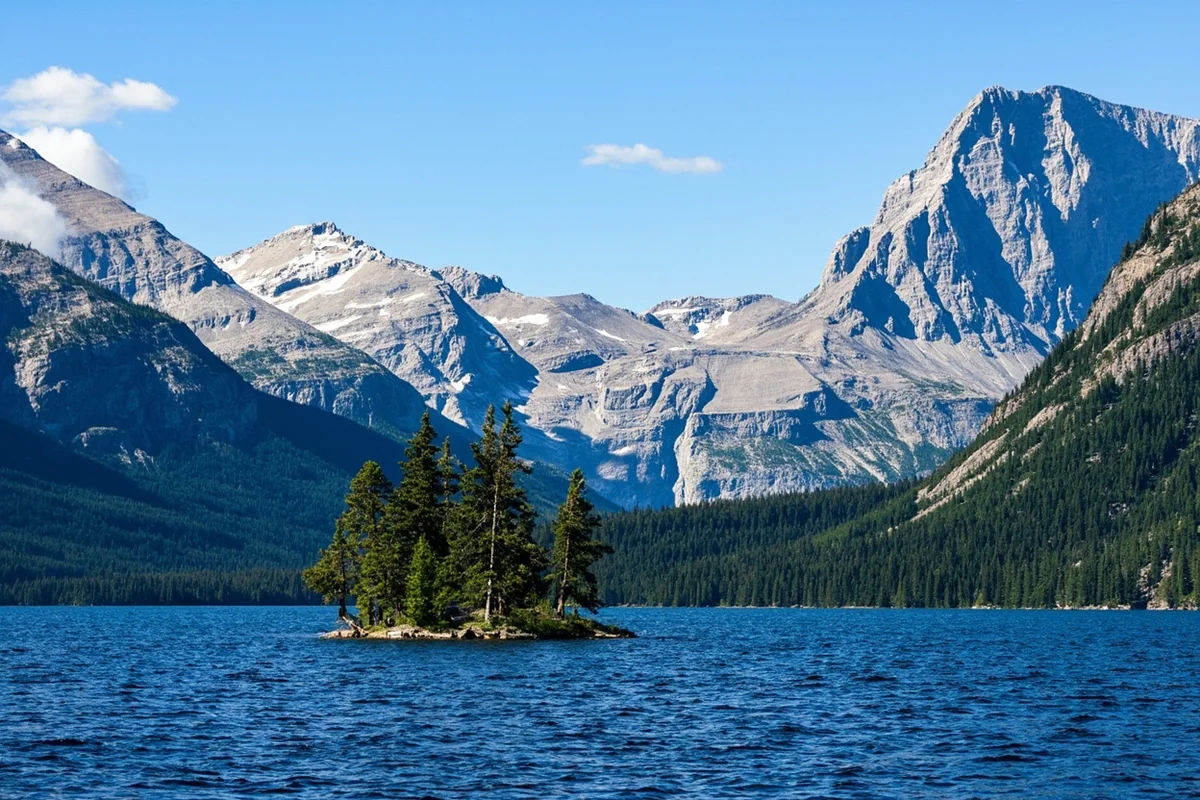
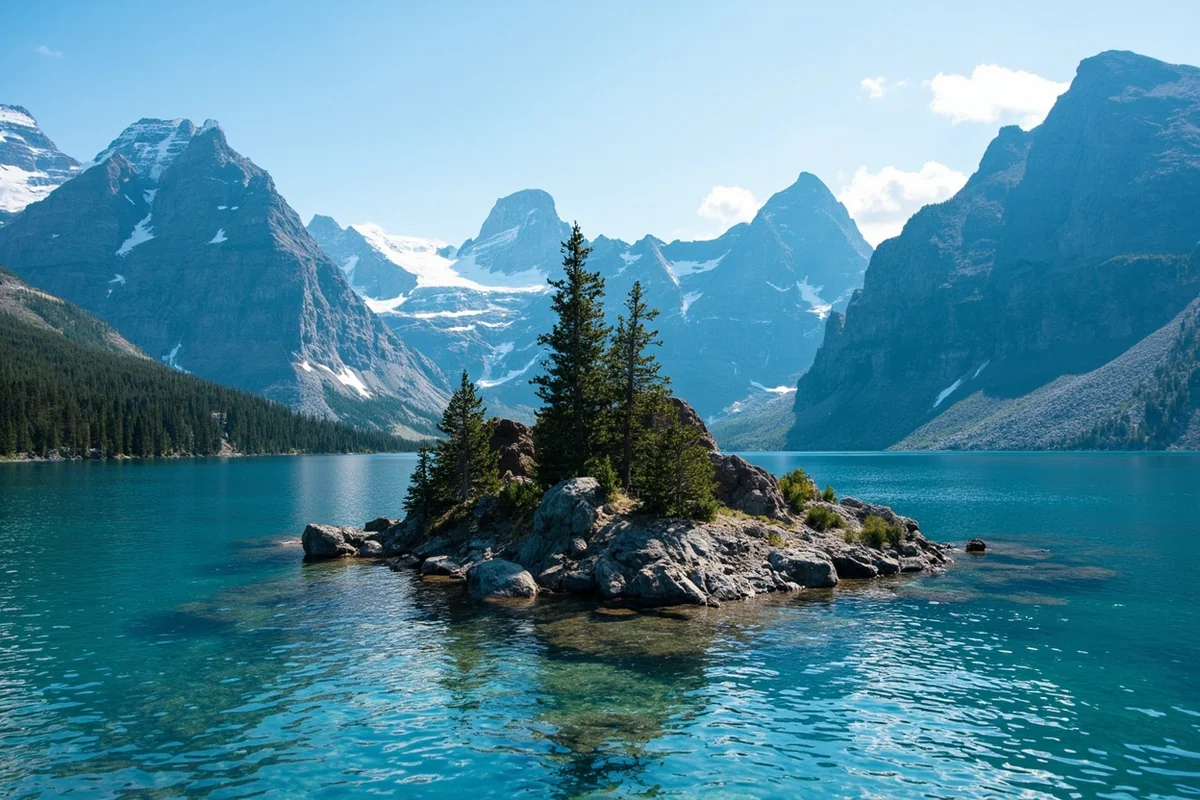
Glacier Lake sits against a striking granite headwall, with a small island visible near the center of the water on most visits.
I’ve watched hikers eye that island and consider swimming out to it, and I’d gently discourage that — this lake stays cold enough that even a brief dive feels like a genuine shock to the system, and I’ve seen more than one person come out gasping after barely a few seconds in the water.
Wildflowers line sections of the trail in season, and the overall scenery — dramatic peaks, clear alpine water, genuine above-treeline terrain — punches well above what the short mileage would suggest.
Afternoon Weather: Plan Around It
Given the lake’s exposed, high-elevation setting, afternoon weather here shifts fast and often. I’ve hiked in under clear morning skies and been caught in a genuine snow and hail mix by early afternoon on the same visit, despite it being the height of summer.
I’d bring a real wind shell regardless of the forecast, and I’d plan to be off any exposed ridge sections before early afternoon if storms look likely. This is standard high-elevation mountain advice, but I’d apply it here more strictly than at lower, more sheltered hikes elsewhere in this guide.
Fishing Glacier Lake
Anglers do fish this lake and the broader basin it sits within, and I’d call this a legitimate bonus activity if you’re bringing gear along anyway.
A Montana or Wyoming fishing license is required depending on exactly where you’re casting from, given the ambiguous border territory — I’d carry whichever license matches your home state or check current cross-border requirements before you go [verify current fishing license requirements for this specific border-straddling location].
Extending the Hike: On to Moon Lake
If Glacier Lake alone doesn’t feel like enough for the drive out, a genuinely faint, non-maintained trail continues past it toward Moon Lake, roughly another mile and a half further and about 800 feet higher in elevation. I’d only recommend this extension to hikers comfortable with off-trail navigation and rock cairns rather than a clearly marked path.
I’ve done this extension once, and it turned what would have been an easy half-day into a genuinely rewarding full day, with considerably fewer people willing to make the extra push.
What to Pack for This Hike
Given the short distance but genuine elevation and exposure, I’d pack more deliberately here than the mileage alone suggests.
Sunscreen matters enormously above treeline, where there’s no canopy to filter direct sun even on a cool day. My Montana bear guide covers the basics worth knowing before any Beartooth hike, even one this short and popular.
Trekking poles help considerably on the steeper sections and especially on the descent, where loose rock and the trail’s overall grade can make footing tricky. I’d also bring more water than feels necessary at the trailhead — there’s less shade and more direct exertion here than the short distance implies.
A Good Introduction to the Beartooths as a Whole
If this is your first visit to the Beartooth Mountains, I think Glacier Lake makes a genuinely excellent introduction to what the range has to offer.
It previews the granite, the exposed alpine terrain, and the fast-shifting weather that define bigger trips like the Beaten Path or a Mystic Lake approach, without requiring anywhere near the same commitment.
I’ve used this exact hike to gauge whether visitors were ready for a bigger Beartooth trip later in their visit, and it’s worked well as that kind of litmus test more than once.
For seasonal planning across this whole region, my best time to visit Montana guide covers timing considerations that apply well beyond just this one trailhead.
Personal Tips / What I Wish I Knew
Bring a higher-clearance vehicle if you have one. The access road is rough enough that I’d genuinely think twice about attempting it in a low sedan after wet weather.
Pack a real wind shell, not just a light jacket. Afternoon weather at this elevation has caught me off guard more than once, even on trips that started under perfectly clear skies.
Don’t confuse this with the Condon-area Glacier Lake. If your GPS or search results are pointing you toward an easy 3.3-mile forest hike, you’re looking at the wrong lake entirely.
Treat the water as genuinely cold, not just “alpine lake cold.” I’ve seen people underestimate this specific lake’s temperature and regret a spontaneous swim within seconds.
Practical Info: Glacier Lake (Beartooths)
| Trail distance | About 2.2 miles one way (4.4 miles round trip) |
| Elevation gain | Approximately 1,000 feet to the lake; total climb higher due to a mid-trail ridge |
| Trailhead elevation | About 8,680 feet |
| Lake elevation | About 9,700 feet |
| Access | Rough forest road off US-212 (Beartooth Highway), south of Red Lodge |
| Best season | Mid-summer through early fall; afternoon weather is a real factor |
Frequently Asked Questions
Is this the same Glacier Lake that’s in Glacier National Park?
No, this Glacier Lake sits in the Beartooth Mountains off US-212, south of Red Lodge — a completely different lake from anything inside Glacier National Park.
Is this the same as the Glacier Lake near Condon?
No, that’s a separate, easy 3.3-mile forest hike in the Bob Marshall Wilderness area, unrelated to this alpine lake in the Beartooths.
How hard is the hike to Glacier Lake?
Short but genuinely steep — about 2.2 miles one way with roughly 1,000 feet of elevation gain, made tougher by the high starting elevation.
Does Glacier Lake sit in Montana or Wyoming?
Both, effectively — the trail crosses the ambiguous Montana-Wyoming border near the lake itself, an area some locals nickname “Wymont.”
Can you extend the hike beyond Glacier Lake?
Yes, a faint, non-maintained trail continues to Moon Lake, about 1.5 miles further and roughly 800 feet higher in elevation.
Why This Hike Gets Recommended So Often
I send more first-time Beartooth visitors to this specific trail than any other in the range, and the reasoning is simple. Most of the range’s best scenery requires multi-day backpacking trips or genuinely demanding day hikes with real mileage and elevation gain.
Glacier Lake breaks that pattern. It delivers legitimate above-treeline alpine terrain, a dramatic granite headwall, and clear cold water in a package short enough for visitors with limited time or moderate fitness.
I’ve brought people here who’d never attempted anything above 9,000 feet before, and they’ve all come away genuinely impressed rather than just surviving the effort.
Photography at Glacier Lake
Morning light tends to work best here, both for the quality of light on the granite headwall and because afternoon wind and weather can complicate a longer photography session.
I’ve gotten my favorite shots of this lake within an hour or two of sunrise, when the water sits calm enough to produce a genuine mirror reflection of the peaks behind it.
A polarizing filter helps considerably if you shoot with one, cutting glare on the water’s surface and making that granite backdrop pop with more contrast than a straight shot typically captures.
Combining Glacier Lake With the Beartooth Highway Drive
Given its location right off US-212, I’d genuinely treat this hike as a natural stop on a broader Beartooth Highway drive rather than a standalone destination requiring its own dedicated trip.
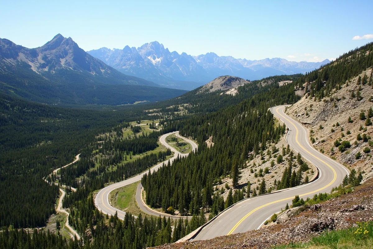
The highway itself ranks among the most scenic drives in the country, and adding a short, rewarding hike partway along the route makes for a genuinely well-rounded day.
I’ve combined a Glacier Lake hike with a full drive from Red Lodge to Cooke City more than once, treating the trail as a mid-day leg-stretcher between long stretches of driving and photo stops at the highway’s various overlooks.
Final Thoughts
Glacier Lake delivers genuine alpine drama for a remarkably short hike, which is exactly why I send first-time Beartooth visitors here before anywhere else in the range. Rough road, short trail, real payoff — and a fun piece of trivia about an accidental state line crossing to take home with you.
For the faint-trail continuation past this lake, see my guide to Moon Lake, or check out the complete guide to Montana’s best lakes for the rest of the region.
For the nearest town, my Red Lodge guide covers services and lodging before or after your hike, and for another Beartooth lake worth comparing, see my guide to Mystic Lake, reached from a completely different trailhead.
For broader context on this mountain range, my Montana mountain ranges guide rounds out the picture.