There’s a moment driving north from Augusta on the road toward the Sun River Canyon when the mountains on your left aren’t getting closer the way mountains usually do — they’re just suddenly there, a 3,000-foot limestone wall rising straight from the prairie without preamble, without foothills, without warning. I’ve made this drive probably a dozen times and that moment still surprises me.
This is the Rocky Mountain Front, and it’s the defining feature of the Lewis and Clark National Forest. The Helena portion — surrounding Montana’s capital city with nearly a million acres of Big Belts, Elkhornns, and Scratchgravel Hills — is the forest that more Montanans use for their regular outdoor recreation than perhaps any other in the state.
Together, as the Helena-Lewis and Clark National Forest (merged in 2012), these lands form the most historically significant and ecologically important forest in central Montana.
- The Helena-Lewis and Clark National Forest covers approximately 2.9 million acres across central and north-central Montana.
- Formed in 2012 by merging the Helena NF (~976,000 acres) and Lewis and Clark NF (~1.8 million acres).
- Home to the Rocky Mountain Front — one of the most important wildlife corridors in North America.
- Key draws: Rocky Mountain Front elk watching, Gates of the Mountains, Continental Divide Trail, Bear Trap Canyon, Elkhorn ghost town area, Sun River Wildlife Management Area.
- Best gateway towns: Helena (Helena portion); Great Falls, Augusta, Choteau (Lewis and Clark portion).
Two Forests, One Identity
Understanding the Helena-Lewis and Clark requires knowing that it was two separate administrative units until 2012, and still functionally operates with two headquarters:
- Helena portion (~976,000 acres): Mountains surrounding Montana’s capital — Big Belt, Elkhorn, Scratchgravel, and northern Tobacco Root ranges.
- Lewis and Clark portion (~1.8 million acres): Central and north-central Montana, including the Rocky Mountain Front, the Castle Mountains, Little Belts, Highwoods, and the Judith Mountains.
The merger was administrative; the character of these two areas remains quite distinct.
Quick Stats:
| Category | Details |
|---|---|
| Total Acreage | ~2.9 million acres |
| Location | Central and north-central Montana |
| Wilderness | Scapegoat (part, shared with Lolo NF), Gates of the Mountains, Bear Trap Canyon |
| Continental Divide Trail | Runs through the forest |
| USFS Helena Office | (406) 449-5490 |
| USFS Great Falls Office | (Lewis and Clark) (406) 791-7700 |
| Best Season | Year-round (accessible); July–Sept (high country); Oct–Nov (elk) |
The Rocky Mountain Front
The Rocky Mountain Front is the single ecological feature that makes the Lewis and Clark National Forest unique among Montana’s national forests.
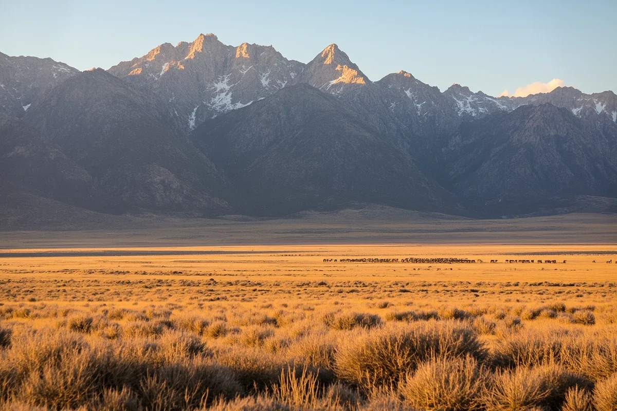
Here, the Rockies rise directly from the Great Plains — no intermountain valley, no piedmont, just flatland grass that becomes 3,000-foot limestone cliffs in the space of a mile.
This abruptness creates a wind-scoured, dramatic landscape that is biologically unlike anything else in the Northern Rockies.
The Front also functions as the most important grizzly bear movement corridor in the lower 48. Grizzly populations from the Northern Continental Divide Ecosystem (centered on Glacier National Park) have been expanding eastward onto the plains for decades — the Lewis and Clark National Forest and adjacent BLM lands are where that expansion is happening.
I’ve heard reliable first-hand accounts of grizzlies 30 miles east of the mountain front itself.
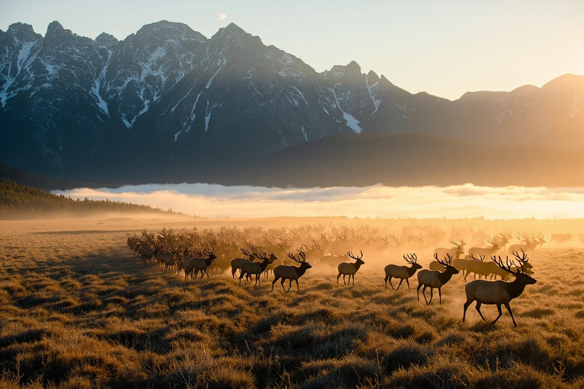
For wildlife watching on the Rocky Mountain Front, Augusta and Choteau are the gateway towns. The Sun River Wildlife Management Area, administered by Montana FWP adjacent to the national forest, is one of the premier elk viewing areas in the state. Fall elk hunting season draws attention to the area’s elk herds, but they’re spectacular to simply observe — I’ve watched herds of 500+ animals move through the Sun River Canyon drainages in late October.
Key Front access points:
- Gibson Reservoir Road (west of Augusta) — through the Lewis and Clark into the Scapegoat Wilderness
- Teton Canyon Road (west of Choteau) — access to the Rocky Mountain Front’s dramatic northern reefs
- Deep Creek Road (Neihart area) — access via the Little Belt Mountains from the east
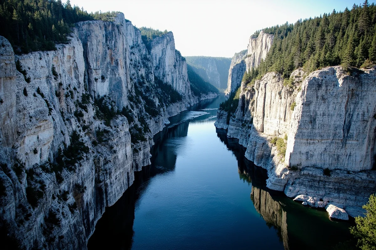
Gates of the Mountains
In 1805, Meriwether Lewis wrote in his journal of passing through a limestone canyon on the Missouri River where the walls rose so high and so steeply that the sky above the river “appeared to be closed in.” He named it the Gates of the Rocky Mountains.
Today, the Gates of the Mountains Wilderness preserves this exact stretch of the upper Missouri as a 28,562-acre wilderness area within the Helena National Forest portion.
The most popular access is by boat tour from the Gates of the Mountains launch site north of Helena, where commercial boat tours run in summer through the canyon.
The contrast between the white limestone cliffs (some rising 1,200 feet), the deep blue river, and the dense conifer on the canyon walls is genuinely unlike anything else in central Montana.
For the more adventurous: the Meriwether Lewis Campground (accessible only by boat or trail) sits within the wilderness and offers a genuine wilderness camping experience within an hour of Helena.
[Verify current boat tour operators and schedule at the Gates of the Mountains Boat Tours website]
Top Trails in the Helena-Lewis and Clark
Continental Divide National Scenic Trail (CDT)
The CDT passes through the Helena-Lewis and Clark National Forest for substantial mileage along Montana’s main mountain spine.
Day-accessible sections include the approach from the Stemple Pass area and the MacDonald Pass corridor west of Helena.
The CDT here is a more remote, less-traveled section than the glamour portions in Glacier or the Bitterroot.
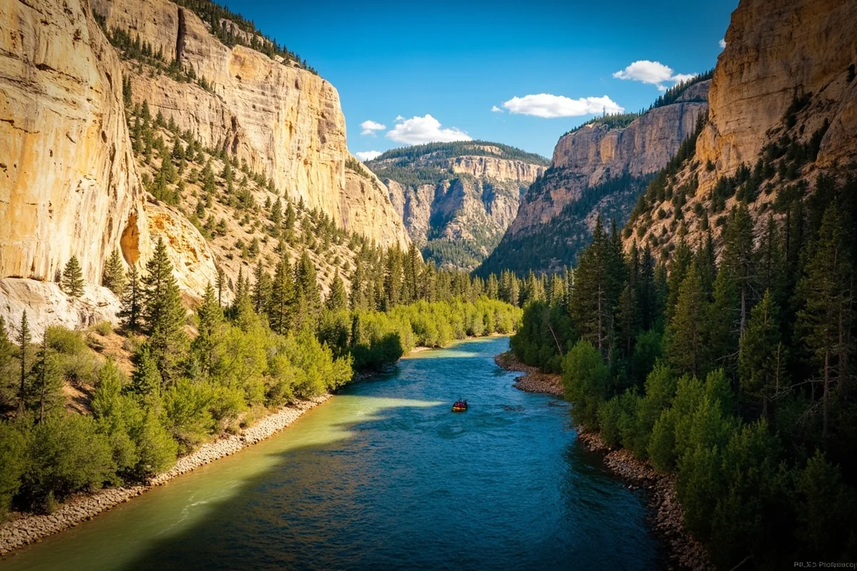
Bear Trap Canyon (Madison River)
Just south of the Helena NF boundary in the Lee Metcalf Wilderness (managed cooperatively with the Beaverhead-Deerlodge National Forest), Bear Trap Canyon offers one of Montana’s premier whitewater experiences and an exceptional wilderness hike.
The trail follows the Madison River through a dramatic 9-mile canyon with the river thundering below.
- Distance: 9 miles one-way (out-and-back or shuttle)
- Difficulty: Moderate (the trail; the kayaking is Class IV)
- Access: From Norris, west of Bozeman
Little Belt Mountains Trails
The Little Belt Mountains in the Lewis and Clark NF are a vast, undervisited island range in central Montana that most visitors drive past on Highway 89. The Neihart-Monarch corridor gives access to the Kings Hill National Scenic Byway and multiple trailhead options:
- Crown Butte Trail — 4 miles round-trip, limestone formations and panoramic views
- Memorial Falls Trail — Short, easy waterfall hike accessible from Highway 89
- Highwood Mountains — Remote range northeast of Great Falls; outstanding solitude
Elkhorn Mountains and Ghost Town Area
Southeast of Helena, the Elkhorn Mountains contain the Elkhorn Ghost Town — the remnant of an 1880s silver mining boomtown.
The area is a unique combination of Montana history and outdoor recreation: you can hike to crumbling mine structures, then continue up to alpine ridge country above 8,000 feet.
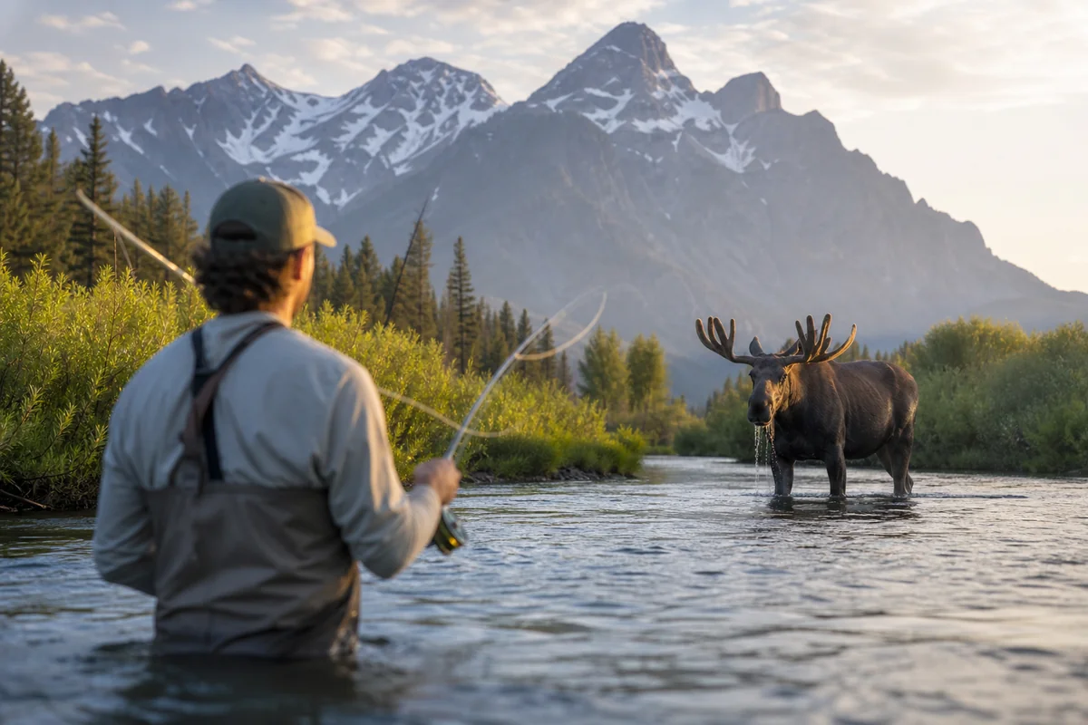
The Elkhorn Mountains are moose country — one of the better moose habitats in western Montana’s mountains.
Fishing: Missouri River System Headwaters
The Helena-Lewis and Clark NF encompasses portions of the upper Missouri River watershed, including the Smith River — one of Montana’s most famous and most regulated float fishing rivers.
The Smith River flows through a spectacular limestone canyon entirely within national forest and BLM land. Access is strictly controlled: a limited number of float permits are issued by lottery each year, with the float season running May–June.
If you don’t get a permit, there is no legal float access — which is exactly what keeps it extraordinary. The canyon walls reach 1,000 feet in places, golden eagles nest on the cliffs, and the brown trout fishing is as good as it gets.
[Verify current Smith River permit lottery dates at montanafwp.gov — the lottery typically opens in the fall for the following spring season]
Belt Creek and Judith River tributaries in the Lewis and Clark portion offer more accessible fishing with solid trout populations and almost no pressure compared to better-known Southwest Montana rivers.
Montana fishing license required. [Verify current fees at montanafwp.gov]
Wildlife
The Helena-Lewis and Clark’s wildlife story is dominated by two themes: elk and the grizzly frontier.
Elk: The Sun River area in the Lewis and Clark NF holds one of the largest migratory elk herds in Montana. In a normal October, the herds moving from summer mountain range down to the prairie are a natural spectacle. The Bob Marshall-Sun River corridor — the wilderness complex that begins in the Flathead National Forest and extends south through the Lewis and Clark NF — is the most important elk migration route in the Rocky Mountain Front ecosystem.
Grizzly bears expanding east: The Rocky Mountain Front is the leading edge of the Northern Continental Divide Ecosystem grizzly bear population’s eastward expansion. Grizzlies are increasingly documented on the prairie east of the forest boundary. This is a remarkable conservation story unfolding in real time — and it means bear spray is warranted anywhere in the forest, not just the wilderness areas.
Lynx: The Lewis and Clark NF’s central Montana forests contain documented lynx populations, particularly in the Little Belt Mountains. Lynx are present where snowshoe hare populations are high — dense young-growth conifer forests, usually.
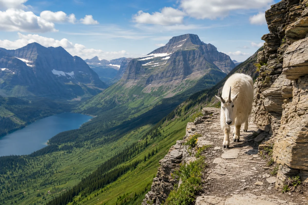
Bighorn sheep and mountain goats: Both occur in the Rocky Mountain Front’s limestone reef terrain. The dramatic cliff faces in the Teton Canyon area are the most reliable bighorn sheep habitat I’ve found in the Lewis and Clark.
Camping in the Helena-Lewis and Clark National Forest
| Campground | Fee | Location | Notes |
|---|---|---|---|
| Departure Point | ~$12/night | Helena area | Missouri River access; near Gates of the Mountains |
| Logging Creek | Free | Smith River drainage | Primitive; excellent fishing access |
| Kings Hill | ~$12/night | Little Belts | Adjacent to Kings Hill Scenic Byway |
| Many Pines | ~$10/night | Little Belts | Near Yogo Creek; fishing |
| Aspen Grove | ~$10/night | Judith Mountains | Remote; outstanding solitude |
| Cave Mountain | Free | Judith Mountains | Primitive; high elevation views |
[Verify current fees at USFS Helena-Lewis and Clark or Recreation.gov]
Dispersed camping is available throughout most of both the Helena and Lewis and Clark portions of the forest. The Little Belt Mountains and the Rocky Mountain Front drainages are particularly good for dispersed camping with solitude.
Scenic Drives
Kings Hill National Scenic Byway (Montana Highway 89) winds through the heart of the Little Belt Mountains between White Sulphur Springs and Neihart — 71 miles of mountain scenery that most highway traffic drives past without stopping.
The byway crests at Kings Hill Pass (7,393 ft) and passes through old mining districts, along Belt Creek Canyon, and through some of the most underrated scenery in central Montana. Ski Showdown operates a small downhill ski area at the pass. [verify current seasons and hours at skishowdown.com]
Gibson Reservoir Road west of Augusta follows the North Fork of the Sun River into the Rocky Mountain Front and eventually to Gibson Reservoir, with the dramatic limestone reefs rising on both sides.
This road provides some of the best grizzly bear viewing habitat in the Rocky Mountain Front — I’ve seen grizzlies from this road in both spring and fall.
What I Wish I Knew Before My First Helena-Lewis and Clark Trip
The Lewis and Clark portion is enormous and mostly overlooked. The forest surrounding Helena gets relatively heavy local recreation use, but the Little Belt Mountains, Judith Mountains, and Castle Mountains — all in the Lewis and Clark portion — are some of the most solitary public land in Montana. I’ve had entire hiking areas to myself on July weekends in the Little Belts.
The Smith River permit lottery is fiercely competitive. Apply in the fall lottery the previous year. It fills every year. If you want to float it, plan 12–18 months ahead.
Rocky Mountain Front grizzlies are real. This isn’t theoretical anymore — grizzlies have been documented miles out onto the prairie east of the national forest boundary in recent years. Anyone camping or hiking in the Rocky Mountain Front drainages should treat this as grizzly country.
Practical Info
| Category | Details |
|---|---|
| General access | Free |
| Campground fees | Free–~$15/night [verify] |
| Nearest airports | Helena Regional (HLN); Great Falls International (GTF) |
| Main gateways | Helena (Helena portion); Great Falls, Augusta, Choteau (L&C portion) |
| USFS Helena | (406) 449-5490 |
| USFS Great Falls | (406) 791-7700 |
| Cell service | Good near Helena; poor to absent in most L&C forest drainages |
FAQs: Helena-Lewis and Clark National Forest
When did the Helena and Lewis and Clark National Forests merge?
The two forests were officially merged in 2012 to form the Helena-Lewis and Clark National Forest, under a single Forest Supervisor. The two ranger district headquarters in Helena and Great Falls continue to operate.
Is the Gates of the Mountains accessible by hiking only?
The most popular access is by commercial boat tour from the launch site north of Helena. Hikers can access some Gates of the Mountains Wilderness trails from the Meriwether picnic area (accessible by boat), but there is no significant road access directly into the wilderness portion of the canyon.
Are there wolves in the Helena-Lewis and Clark National Forest?
Wolves are present, particularly in the Lewis and Clark portion. The Rocky Mountain Front has hosted established wolf packs, and wolves range widely through the forest’s wilderness areas.
What is the best time to see elk in the Sun River area?
Late October through November, when large herds are actively moving from summer mountain range to lower winter grounds. Early morning is best. Access via the Augusta area on Highway 21 west.
Central Montana’s Most Underappreciated Public Land
The Helena-Lewis and Clark National Forest doesn’t have an obvious headline attraction — no single feature with the brand recognition of the Beartooth Highway or the Bob Marshall Wilderness.
What it has instead is breadth: nearly three million acres of mountain terrain that wraps around Montana’s capital city and reaches north to the Rocky Mountain Front in some of the most ecologically significant landscape in the Northern Rockies.
I’ve spent parts of many seasons in this forest — driving the Gibson Reservoir Road in the October light when elk herds are moving, fishing the Smith River on a permit I waited two years to draw, hiking the Little Belts on a June Saturday when the wildflowers were weeks ahead of schedule after a warm spring.
Each time, I find that the Helena-Lewis and Clark offers more than I expected and fewer people than I feared.
The Rocky Mountain Front alone is worth the trip — one of the last places in the lower 48 where you can watch grizzly bears moving at the edge of the plains in a landscape that hasn’t fundamentally changed since the Blackfeet hunted it.
Our Montana national forests guide provides the full context on where this forest fits in Montana’s public lands system.
Planning a central Montana outdoor trip? Drop your questions in the comments or pin this post for your research.
Explore the Full Montana National Forests Series
← Back to the Montana national forests guide
Also in this series: