The Beartooth Highway hit me at mile two. I was already in low gear for the switchbacks, but then the road crested a false summit and the full Beartooth Plateau opened up ahead — alpine tundra, glacial lakes, snowfields in late July, and nothing resembling a tree for 50 miles in every direction. I pulled over. The only sound was wind and a couple of Clark’s nutcrackers.
This is the Custer Gallatin National Forest. Three million acres. Six mountain ranges. The highest point in Montana. Three Yellowstone gateways. One of the most important wildlife corridors on the continent. And Bozeman’s literal backyard.
- Custer Gallatin National Forest spans ~3 million acres from West Yellowstone to northwest South Dakota — one of the longest national forests in the country.
- Contains Granite Peak (12,799 ft, Montana’s highest), the Absaroka-Beartooth Wilderness, Hyalite Canyon, the Beartooth Scenic Byway, and 59 campgrounds.
- It’s an anchor of the Greater Yellowstone Ecosystem — grizzly bears, wolves, and wolverines all roam here.
- Three gateway towns to Yellowstone (Gardiner, Cooke City, West Yellowstone) sit on or near the forest boundary.
- Bridger Bowl ski area and world-class fly-fishing on the Gallatin River are year-round draws.
Overview: A Forest of Superlatives
The Custer Gallatin was created in 2012 by merging the former Gallatin National Forest (established 1899) and Custer National Forest into a single administrative unit.
The result is a forest that stretches over 500 miles from its western boundary near West Yellowstone to its eastern edge in the Black Hills of South Dakota.
Within Montana alone, the forest encompasses six distinct mountain ranges: the Gallatin Range (south of Bozeman), Madison Range (Lee Metcalf Wilderness, shared with the Beaverhead-Deerlodge National Forest), Absaroka Range (east of Livingston), Beartooth Mountains (Red Lodge to Cooke City), Crazy Mountains (northeast of Livingston), and Pryor Mountains (near Billings).
Each range has its own personality, ecology, and recreational character.
Quick Stats:
| Category | Details |
|---|---|
| Total Acreage | ~3 million acres |
| Location | SE Montana, NW South Dakota |
| Highest Point | Granite Peak — 12,799 ft (highest in Montana) |
| Wilderness | Absaroka-Beartooth (~950,000 acres), Lee Metcalf (part, shared with Helena-Lewis and Clark) |
| Campgrounds | 59 |
| Yellowstone Gateways | 3 (Gardiner, Cooke City, West Yellowstone) |
| USFS Offices | Bozeman (406) 587-6701 / Billings (406) 255-1400 |
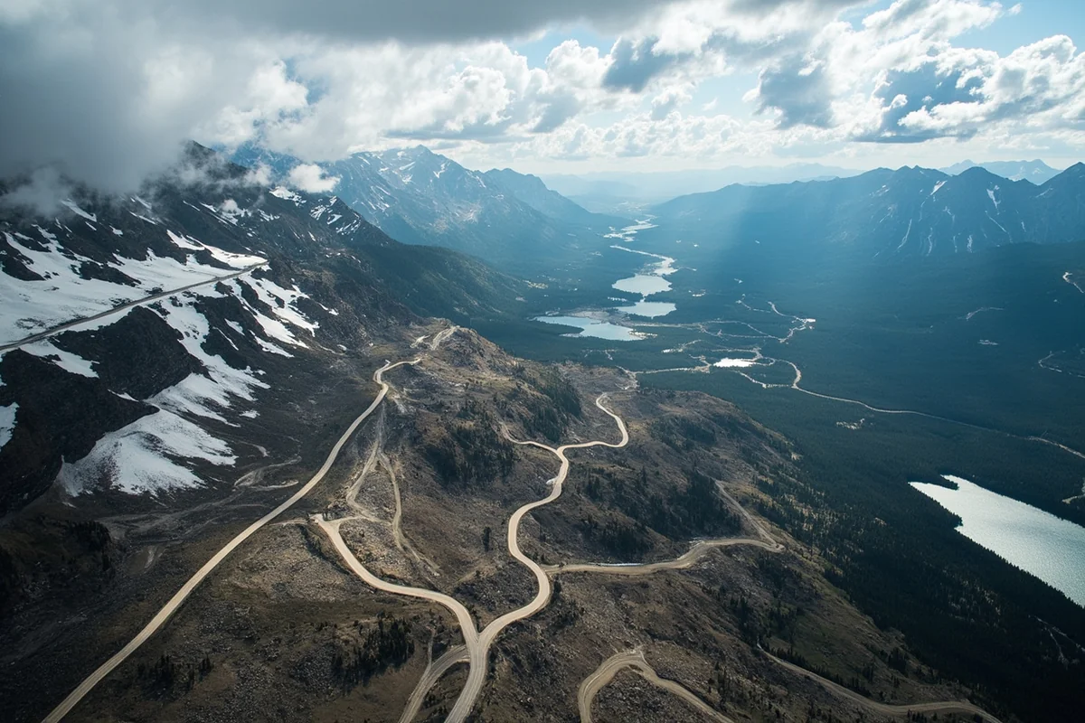
The Beartooth Scenic Byway
No description does it justice. US Highway 212 between Red Lodge, Montana and Cooke City has been called — by no less an authority than Charles Kuralt — “the most beautiful drive in America.” I’ve driven it six times and I think that might actually be true.
The byway climbs from Red Lodge (5,555 ft) over Beartooth Pass (10,947 ft) — the highest paved road in the Northern Rockies — and then descends into the Cooke City area via a series of switchbacks that pass through three distinct climate zones.
The alpine plateau at the top is surreal: tundra, glacial lakes, ptarmigan, mountain goats, and occasional grizzly bears at road’s edge. Snowdrifts remain along the highway into July most years.
When to go: The byway typically opens by Memorial Day weekend [verify current opening date] and closes in early November when snow makes passage dangerous. Peak wildflower season on the plateau is mid-July. If you’re driving it in August, go early morning to get clear views before afternoon clouds build.
The 68-mile byway also passes the Rock Creek Vista Point overlook (the canyon below is staggering), the Twin Lakes picnic area, and multiple pullouts with walking access to high-alpine terrain.
Top Trails and Recreation Areas
Hyalite Canyon (South of Bozeman)
Hyalite Canyon is the most-used recreation corridor in the Custer Gallatin — and for good reason. The canyon sits 20 minutes from downtown Bozeman, the road is paved to Hyalite Reservoir, and the trail system accommodates everything from a 30-minute walk with children to a full-day summit attempt on Hyalite Peak.
I’ve been to Hyalite Canyon more times than I can count. In summer: hiking, mountain biking, kayaking on the reservoir.
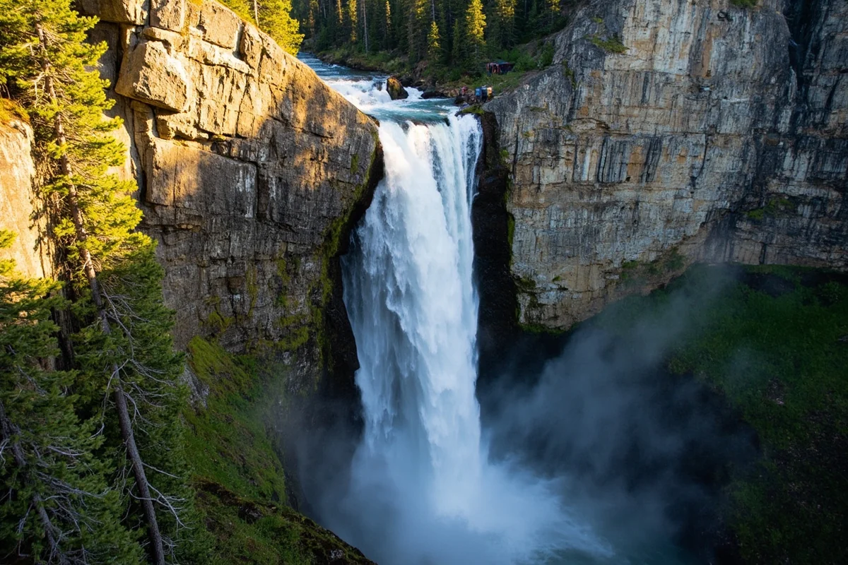
In winter: ice climbing on dozens of frozen waterfalls that form in the canyon walls, and Nordic skiing on groomed trails. The Palisade Falls Trail (0.5 miles, fully paved) is genuinely one of the most accessible waterfalls in the state for families with strollers or mobility considerations.
Key trails:
- Palisade Falls: 0.5 miles paved, ADA accessible, waterfall at the end
- Hyalite Lake: 8 miles round-trip, 1,800 ft gain, excellent alpine lake fishing
- Hyalite Peak: 12 miles round-trip, 3,400 ft gain, strenuous
Gallatin River Canyon (US-191)
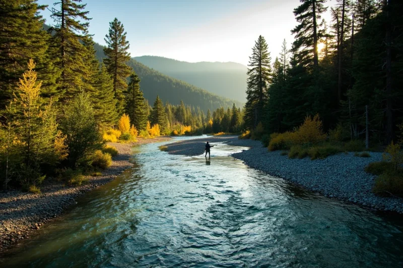
The Gallatin River runs through a deep canyon south of Bozeman that Norman Maclean immortalized in A River Runs Through It, and the national forest flanks both sides of the road for most of the canyon’s length. Numerous trailheads line the highway, and the river itself is one of the most fished in the state.
Top trails from the Gallatin Canyon:
- Storm Castle Peak: 5.5 miles round-trip, 1,500 ft gain — great views of the Gallatin Valley
- Portal Creek to Garnet Mountain: 10 miles round-trip, rewarding ridge walk
- Lava Lake: 5.5 miles round-trip, moderate, popular with families
Absaroka-Beartooth Wilderness
At approximately 950,000 acres, the Absaroka-Beartooth Wilderness is the crown of the Custer Gallatin.
Straddling the Absaroka and Beartooth ranges, it offers some of the most dramatic high-country terrain in the Rocky Mountain West — high alpine plateaus, cirque basins, over 700 named lakes, and the wild upper reaches of the Stillwater and Yellowstone River drainages.
Granite Peak sits in the center of the Absaroka-Beartooth. At 12,799 feet, it’s the highest point in Montana and among the most technically demanding state high points in the lower 48.
Three approach routes exist, all 21–25 miles round-trip with significant technical scrambling on the upper mountain. Multiple guide companies in Billings and Red Lodge offer guided Granite Peak expeditions.
I hiked to the wilderness boundary in the Stillwater drainage on a September trip and counted grizzly tracks at three separate creek crossings. This is not beginner backcountry.
Crazy Mountains (Northeast of Livingston)
The Crazy Mountains are one of Montana’s most dramatic and least-visited ranges — an isolated island of alpine terrain rising 5,000 feet above the surrounding plains with no connection to any other mountain range.
The Custer Gallatin NF manages a portion of the Crazies, with trailheads accessible from the Big Timber and Harlowton areas.
The Porcupine Creek Trail and Trespass Lake Trail are the most commonly used approaches. Fair warning: access disputes involving private land intermittently affect Crazy Mountains access — check with the USFS Bozeman Ranger District for current conditions before making this a destination trip.
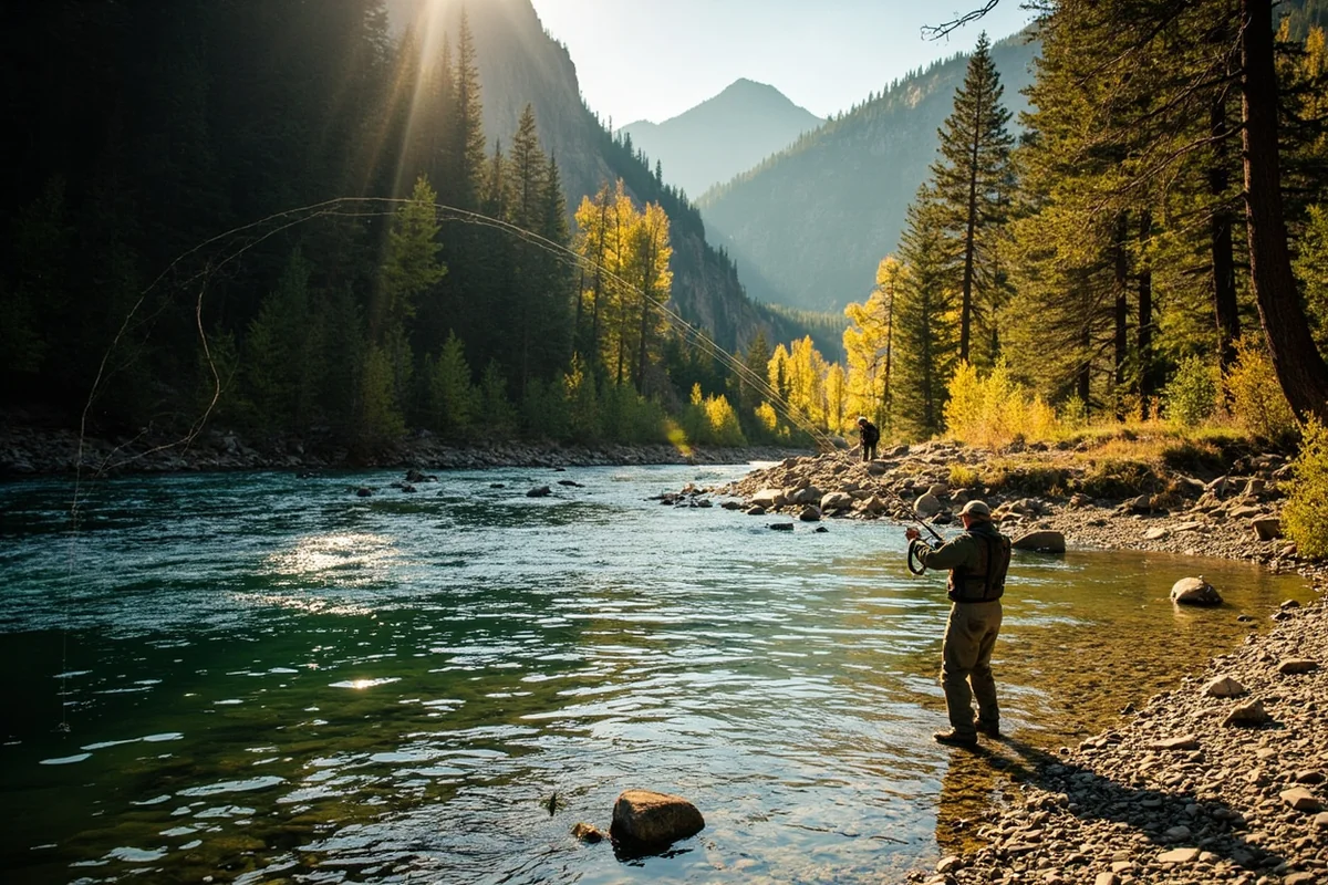
Fishing the Custer Gallatin
The Gallatin River is the most-visited fishing water in the forest — accessible directly from Highway 191 for its entire canyon length, holding brown trout, rainbow trout, and whitefish. The river is a tail-water fishery below Hebgen Lake and fishes well even in summer when other streams run warm.
The Stillwater River on the forest’s south side is a less-pressured option with excellent cutthroat and rainbow trout fishing. The Boulder River south of Big Timber passes through national forest land and is one of those Montana rivers that most out-of-staters never find.
For stillwater fishing, the 700+ lakes in the Absaroka-Beartooth Wilderness hold cutthroat, rainbow, and brook trout — many of them in backcountry basins that require 8–12 miles of hiking to reach. The solitude and fishing quality correlate directly with the effort required.
Montana fishing license required. [Verify current fees at montanafwp.gov]
Wildlife in the Custer Gallatin
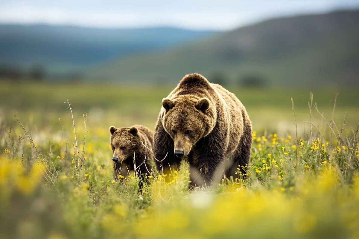
The Custer Gallatin is an integral part of the Greater Yellowstone Ecosystem — the largest intact temperate ecosystem in the contiguous United States. This means the full suite of Greater Yellowstone megafauna is present:
Grizzly bears: Active throughout the forest, particularly in the Absaroka Range and the area south of Bozeman toward Yellowstone. Bear-human conflict is a regular occurrence here — carry bear spray always, hang or canister your food, know your protocols.
Gray wolves: Established packs occupy multiple drainages. The Lamar Valley (just across the Yellowstone border) is the easiest place to see wolves in the Greater Yellowstone area.
Wolverines: Among the rarest sightings, but the Beartooth Plateau is one of the better wolverine habitats in the lower 48 due to its year-round snowfields.
Elk: Enormous herds winter in the Paradise Valley north of Yellowstone and use the national forest as summer range. Fall rutting activity in the Absaroka foothills is spectacular.
Pronghorn and bison: The Pryor Mountains section of the forest borders the Pryor Mountain Wild Horse Range — the only place where you can see true wild horses roaming public land in Montana.
Winter Recreation
Bridger Bowl Ski Area sits on the west face of the Bridger Mountains within the Custer Gallatin NF, 16 miles north of Bozeman.
With 2,000+ skiable acres, 2,700 feet of vertical drop, 300+ inches of annual snowfall, and terrain that ranges from gentle groomed beginner runs to the legendary “Ridge” expert terrain, it’s legitimately world-class — and still locally owned, which keeps the culture and the lift ticket prices in check. [Verify current lift ticket prices at bridgerbowl.com]
The Hyalite Canyon ice climbing scene is arguably the best in the Rocky Mountain West: dozens of ice routes form along the canyon walls in December through February, and the Bozeman Ice Festival held annually brings elite climbers from around the world.
Snowmobiling and Nordic skiing are also available throughout the forest’s trail networks.
Camping in the Custer Gallatin
With 59 campgrounds, the Custer Gallatin has more developed camping than any other Montana national forest. A selection by area:
| Campground | Fee | Notes |
|---|---|---|
| Hyalite Reservoir | ~$15-$20/night | South of Bozeman; popular, book ahead in summer |
| Moose Flat (Gallatin Canyon) | ~$15/night | River access; good fishing |
| Woodbine (Stillwater) | ~$12/night | Near Stillwater River; horse camping available |
| Sheridan (Big Timber area) | ~$10/night | Boulder River access |
| Red Lodge-area campgrounds | Various | Multiple options; book through Recreation.gov |
[Verify current fees at Recreation.gov or USFS Custer Gallatin]
Dispersed camping is available throughout much of the forest outside designated campgrounds. The Absaroka Range east of Livingston and the Beartooth area offer excellent dispersed options for self-sufficient campers.
Practical Info
| Category | Details |
|---|---|
| General access | Free |
| Campground fees | Free–~$25/night [verify] |
| Nearest airports | Bozeman (BZN), Billings (BIL), Cody WY (COD) |
| Main gateways | Bozeman, Red Lodge, Livingston, Cooke City, West Yellowstone |
| USFS Bozeman | (406) 587-6701 |
| USFS Billings | (406) 255-1400 |
| Bear spray | Required for all backcountry in Greater Yellowstone area |
| Best season | Year-round (Beartooth Byway: late May–early November) |
What I Wish I Knew Before My First Custer Gallatin Trip
Don’t drive the Beartooth Byway in both directions the same day. Go one way in the morning from Red Lodge, spend the afternoon exploring the plateau and the Cooke City area, and return the same way at dusk. Doing it as a loop through Yellowstone takes most of a day and you miss the time to actually stop and explore.
Hyalite Canyon fills up on Friday evenings in summer. Go Saturday morning instead, and arrive by 8 a.m. for trailhead parking.
The Absaroka Range is different from the Beartooth. The Absaroka is steep, heavily forested, and genuinely remote — conditions change fast and trail signs can be absent. The Beartooth Plateau is exposed alpine terrain where afternoon thunderstorms are the primary hazard. Know which zone you’re entering and prepare accordingly.
FAQs: Custer Gallatin National Forest
How do I get to the Custer Gallatin National Forest?
Multiple access points: from Bozeman (Highway 191 south for Gallatin Canyon, Hyalite Canyon Road south of town); from Red Lodge (US-212 west toward Beartooth Pass); from Livingston (US-89 south for Absaroka Range); from West Yellowstone (Highway 191 north).
Is the Beartooth Scenic Byway open year-round?
No. It typically opens around Memorial Day and closes in early November. Check the Montana Department of Transportation (MDT) website for current road status before driving.
Are there wolves in Custer Gallatin National Forest?
Yes. Multiple wolf packs range through the forest, particularly in the Absaroka Range and areas adjacent to Yellowstone National Park.
Can I hike to Granite Peak without a guide?
Yes, but it’s a technical mountaineering objective (Class 4-5 scrambling) with significant route-finding challenges. Most first ascents are completed with guide service or by experienced mountaineers with prior high-mountain experience.
Six Ranges, One Forest, Endless Reasons to Go
I’ve spent more time in the Custer Gallatin than in any other national forest in Montana, and I still haven’t touched half of it. The Pryor Mountains in the south.
The full length of the Stillwater drainage. The high basins in the Absaroka east of Livingston that see a fraction of the traffic of the more accessible Gallatin Range trailheads. Every time I think I’ve gotten a handle on this forest’s scale, I discover another section that resets my expectations.
If you’re based in Bozeman or coming through on I-90, the Custer Gallatin is your most accessible entry point into serious Montana wilderness.
Hyalite Canyon in the morning, the Gallatin River in the afternoon, and if the timing is right, the drive over to Red Lodge for the Beartooth Byway in the evening — that’s a Montana day that’s hard to improve on.
For the full picture on Montana’s public lands, start with our Montana national forests guide. And if you’re planning time in the Yellowstone gateways that border this forest, our guides to West Yellowstone and Gardiner will help fill out the trip.
Planning a Custer Gallatin trip? Drop your questions in the comments, or pin this post to save it for your Montana research.
Explore the Full Montana National Forests Series
← Back to the Montana national forests guide
Also in this series: