In March 1951, the Korean War was eight months old.
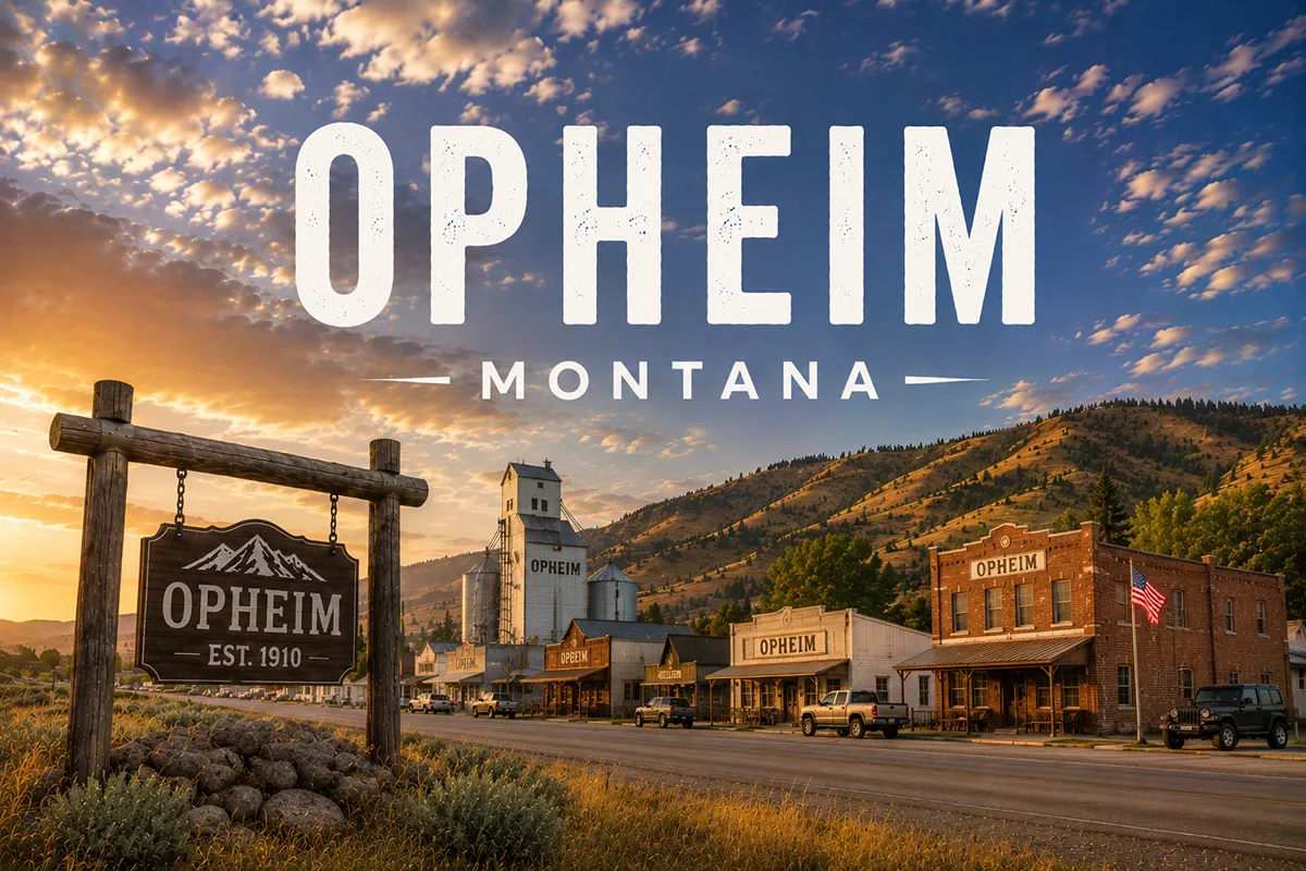
The U.S. Air Force needed to expand its early-warning radar network across the northern United States. Air Defense Command selected Opheim, Montana — a small Norwegian-American farming community in far northern Valley County, ten miles south of the Canadian border — as one of 28 radar stations built as part of the second segment of the permanent radar surveillance network.
On March 1, 1951, the 779th Aircraft Control and Warning Squadron was activated at the new Opheim Air Force Station, located 3.3 miles west of town.
Initial equipment included AN/FPS-3 search radar and AN/FPS-4 height-finder radar. The mission was Ground-Control Intercept (GCI) and early warning — scanning the skies for potential Soviet bomber incursions over the polar route.
By 1961, the station had joined the Semi Automatic Ground Environment (SAGE) system — the massive computer-coordinated air defense network feeding radar data to centralized direction centers (in Opheim’s case, DC-20 at Malmstrom Air Force Base near Great Falls). The squadron was redesignated as the 779th Radar Squadron (SAGE) on July 15, 1961.
The radar base brought 135 U.S. Air Force personnel and 23 civilian workers to a town that had previously been a quiet wheat-farming community. Opheim’s population soared. Three bars served the town (Tim’s Club Bar, The Mint Bar, Turk’s Tavern).
Three lodging options operated (EZ Rest, Valley Hotel, Dahl’s Apartments). A small bowling alley, mercantile, machine shop, gun shop, K-12 school, and a local airstrip rounded out the boom-era business district.
The station closed in 1979.
The 28-year Cold War boom ended. Personnel left. Businesses contracted. The radar base buildings were demolished or repurposed.
Today, the former station site is a near-ghost-town landscape of overgrown streets, empty foundations, and remnants of what was once one of the most strategically significant Air Force installations in the upper Great Plains.
Opheim itself dropped to 75 residents at the 2020 census.
TL;DR
- Opheim (75) is in Valley County on Montana Highway 24, 50 miles north of Glasgow and 10 miles south of the Canadian border.
- Home of the Opheim-West Poplar River Border Crossing — among the 10 least-used US-Canada border crossings.
- Site of the historic Opheim Air Force Station (1951-1979) — a Cold War-era General Surveillance Radar Station 3.3 miles west of town.
- The 779th Aircraft Control and Warning Squadron, later renamed the 779th Radar Squadron (SAGE), operated AN/FPS-3, AN/FPS-4, AN/FPS-7, AN/FPS-26, AN/FPS-90, and other radar systems.
- The radar station brought ~158 military personnel and civilians to a small farming town; closure in 1979 led to long population decline.
- Strong Norwegian-American heritage: the high school mascot is the Vikings.
- Granrud’s Lefse — 1 mile south of town — offers traditional home-made Norwegian potato lefse and brings visitors from far away.
- Was the historic northern terminus of the Great Northern Railway’s Scobey Subdivision from Bainville (now BNSF-operated, though the line no longer extends to Opheim).
- Best for: Cold War heritage travelers, remote border crossing photographers, Norwegian-American cultural visitors, far-northern Montana prairie explorers.
Liked this article?
Add Roaming Montana as a preferred source so you see more of our articles and guides on Google.
Opheim at a Glance
| Population (2020) | 75 |
|---|---|
| County | Valley County (far north) |
| Region | Northeast Montana (10 mi from Canadian border) |
| Elevation | 2,775 ft |
| Distance to Canadian border | ~10 miles north |
| Distance to Glasgow (county seat) | ~50 miles south on MT-24 |
| Distance to Scobey | ~40 miles east |
| Distance to Plentywood | ~80 miles east |
| Distance to Malta | ~70 miles southwest |
| Distance to Wolf Point | ~80 miles southeast |
| Distance to Bainville | ~115 miles east-southeast |
| Distance to Opheim AFS site | ~3.3 miles west |
| Air Force Station active | 1951-1979 |
| Border crossing opened | 1917 |
| Best for | Cold War heritage, remote border crossing, Norwegian heritage |
What Makes Opheim Different
Three distinct stories define Opheim’s character: the Norwegian heritage, the Cold War radar station, and the extreme remoteness.
The Norwegian Settlement
Opheim was settled in the early 20th century by Norwegian-American homesteaders as part of the broader Scandinavian migration that shaped much of northeastern Montana.
The Norwegian heritage is still actively expressed in contemporary Opheim. The high school athletic teams are the Vikings. Granrud’s Lefse — located one mile south of town — operates as a traditional Norwegian potato lefse production facility that draws visitors from across the region.
Lefse is a soft, thin Norwegian flatbread made from potatoes, flour, and butter. The Granrud operation produces it in the traditional home-made style, and customers can watch the production process and sample lefse hot off the grill.
It’s an unusual cultural specialty for a 75-person Montana town.
The Opheim Air Force Station Era
The 1951 selection of Opheim for a permanent radar station fundamentally transformed the community.
The Air Force needed radar coverage across the entire northern tier of the United States to detect potential Soviet bomber attacks crossing the polar route.
28 stations were built as part of the second segment of the permanent radar surveillance network. Opheim — with its remote far-northern position and proximity to the Canadian border — was one of them.
The 779th Aircraft Control and Warning Squadron was activated on March 1, 1951 at the new Opheim Air Force Station located 3.3 miles west of town. The squadron operated radar systems through multiple technology generations:
- AN/FPS-3 search radar (initial equipment)
- AN/FPS-4 height-finder radar (initial equipment)
- AN/FPS-7C search radar (1963)
- AN/FPS-26A and AN/FPS-90 height-finder radars (1963)
- AN/FPS-107 and other systems through the 1970s
The station joined the Semi Automatic Ground Environment (SAGE) computer network in 1961, feeding data to DC-20 at Malmstrom Air Force Base near Great Falls. The squadron was renamed the 779th Radar Squadron (SAGE) on July 15, 1961. Radar identification codes assigned to the site included ADC ID P-26 and NORAD ID Z-26.
The Boom Town Years
The radar station’s manning brought enormous economic stimulus to Opheim.
135 Air Force personnel and 23 civilian workers were assigned to the base. Many lived on base, but many also lived in town. Three lodging operations served the area: the EZ Rest, the Valley Hotel, and Dahl’s Apartments (the long green building still visible in some Opheim photographs).
Three bars operated: Tim’s Club Bar, The Mint Bar, and Turk’s Tavern. A small bowling alley, a mercantile, a machine shop (run by retired Sgt. Stroh), a gun shop, the post office, a local airstrip, a consolidated K-12 school, and several churches all served the boom-era community.
The only paved roads in town were the highway leading in from the south and the road leading from town to the base.
The 1979 Closure
In 1979, the Air Force closed Opheim Air Force Station as part of the broader contraction of the permanent radar surveillance network.
The radar towers were dismantled. The personnel buildings were largely demolished or abandoned. Today, the former base site is a near-ghost-town landscape of overgrown streets and empty foundations — accessible via gravel roads from MT-24.
Opheim itself lost its population stimulus. Businesses contracted. The town has trended downward in population every census since.
The Border Crossing
The Opheim-West Poplar River Border Crossing — 10 miles north of town — is among the 10 least-used border crossings on the US-Canada border.
The crossing connects MT-24 in Montana to Saskatchewan Highway 2 at Rockglen, Saskatchewan. It opened in 1917 and has operated continuously since. The location is so remote that border officials live in housing next to each country’s stations.
The U.S. replaced its small border station with a large facility in 2004. Canada replaced its West Poplar River station in 2015. Both stations remain operational today.
For broader trip context, see my Montana cities and towns hub.
The Top 5 Things to Do In & Around Opheim
1. Former Opheim Air Force Station Site
The signature historical attraction.
The former radar station site sits 3.3 miles west of town on a gravel road. Today the site features overgrown streets, empty foundations, and the remains of buildings that once housed 135 Air Force personnel and 23 civilian workers. Approach respectfully; some of the site is private property.
The former personnel area is described by visitors as resembling a tiny version of the much larger former Glasgow Air Force Base — empty foundations, abandoned streets, and the distinctive layout of a Cold War-era military installation gradually returning to prairie.
2. Granrud’s Lefse
The traditional Norwegian-American potato lefse production facility one mile south of town.
Tours of the production process and sampling of lefse hot off the grill are typically available. A genuinely substantive cultural attraction for a 75-person town. Verify operating hours and any seasonal closures before traveling.
3. Opheim-West Poplar River Border Crossing
The crossing 10 miles north of town offers a substantively interesting border experience.
The remote position, the housing-next-to-station configuration for border officials, the small US station (replaced 2004) versus the slightly larger Canadian station (replaced 2015), and the contrast with major border crossings elsewhere make this one of the more substantive small border crossings on the entire US-Canada line. Bring proper documentation if you plan to actually cross.
4. MT-24 Northern Prairie Drive
The 51-mile stretch of Montana Highway 24 between Glasgow and Opheim crosses some of the wildest prairie lands in the northern Missouri River Country.
Antelope, mule deer, sage grouse, and a remarkable array of waterfowl on the seasonal prairie potholes. The drive is genuinely empty in a way that’s increasingly rare in the contiguous United States.
5. Day Trip to Glasgow (50 miles south)
The Valley County seat — the natural urban anchor for any Opheim visit.
Attractions include the Valley County Pioneer Museum, the Hi-Line Travel Center, and significantly broader services than Opheim can provide. Glasgow is also the practical base for accessing Fort Peck Lake and Fort Peck Dam to the east.
Where to Stay
Opheim has very limited lodging.
Most travelers base in Glasgow (50 miles south).
| Lodging | Vibe | Price | Best For |
|---|---|---|---|
| Glasgow hotels (50 mi S) | Full Valley County selection | $100–200 | Most travelers |
| Scobey lodging (40 mi E) | Daniels County options | $90–150 | Eastern base |
| Vacation rentals (Opheim area) | Limited; ranch and farm stays | $120–250 | Hunters, longer visits |
Where to Eat
- Granrud’s Lefse (1 mile S) — Norwegian specialty foods
- Local Opheim cafes and bar — verify current operations
- Glasgow dining (50 mi S) — broader selection
- Scobey restaurants (40 mi E) — additional options
Getting There & Around
From Glasgow: 50 miles north on MT-24, about 1 hour.
From Scobey: ~40 miles west on MT-5/MT-13, about 1 hour.
From Plentywood: ~80 miles west on MT-5/MT-13, about 1.5 hours.
From Malta: ~70 miles north and east via US-2 and county roads, about 1.5 hours.
From the Canadian border (Opheim-West Poplar River): ~10 miles south, about 12 minutes.
Cell service: Limited in Opheim and along MT-24. Bring offline maps.
When to Visit
Summer (June-August): Best for prairie driving conditions, longest daylight, full Granrud’s Lefse operations, border crossing access.
Fall (September-October): Outstanding northern prairie light; hunting season; harvest activity; quieter than summer.
Winter (December-March): Severe northern weather; temperatures below -30°F not uncommon. Travel only with proper winter preparation. The border crossing operates year-round.
Spring (April-May): Snow melt; prairie greens up; waterfowl migration through the prairie potholes.
Personal Tips
Stop at Granrud’s Lefse. Even if you don’t think lefse will interest you, the production tour and the chance to sample traditional Norwegian potato flatbread hot off the grill is a genuinely substantive small-town cultural experience.
Read about the SAGE system. The Cold War-era integrated continental air defense network is one of the more significant computing and military history stories of the mid-20th century. Understanding what the Opheim Air Force Station was actually doing makes the visit to the former site substantively more meaningful.
Approach the AFS site respectfully. Some of the former radar station property is private land; some is publicly accessible. Photograph from established roads. Don’t enter abandoned structures.
Time your border crossing visit. Hours at the West Poplar River border crossing are limited. Verify current operating times if you plan to actually cross into Saskatchewan. Have proper documentation ready.
Plan around services. Opheim has minimal services. Fuel up in Glasgow or Scobey before driving in.
Combine with Scobey Sub heritage. Travelers interested in the Great Northern Railway Scobey Subdivision can trace the former rail line south through Scobey, Plentywood, and ultimately to Bainville on the US-2 mainline.
Opheim Quick Facts
| Population (2020) | 75 | | County | Valley County | | Distance to Canadian border | ~10 miles | | Position | MT-24, far northern Montana | | Norwegian heritage mascot | Vikings (high school) | | Granrud’s Lefse location | 1 mile south of town | | Border crossing name | Opheim-West Poplar River | | Border crossing opened | 1917 | | US station replaced | 2004 | | Canadian station replaced | 2015 | | US-Canada border crossing usage rank | Among 10 least-used | | Air Force Station established | March 1, 1951 | | Air Force Station closed | 1979 | | AFS location | 3.3 miles west of town | | Squadron | 779th Aircraft Control & Warning, then 779th Radar Squadron (SAGE) | | AFS ADC ID | P-26 | | AFS NORAD ID | Z-26 | | Cold War network position | One of 28 stations in second segment of permanent radar surveillance network | | Peak military personnel at AFS | 135 + 23 civilian workers | | Average summer high | 81°F | | Average winter low | -7°F |
Conclusion
Opheim is a 75-person Valley County town with genuinely substantive Cold War history and active Norwegian-American cultural heritage.
The Opheim Air Force Station (1951-1979) was one of 28 strategically significant radar installations defending the northern United States during the Korean War and Cold War eras. The 779th Aircraft Control & Warning Squadron and its later SAGE-era successor operated cutting-edge mid-20th-century radar technology from this remote far-northern position. The former site — 3.3 miles west of town — remains visible today as overgrown streets and empty foundations.
Granrud’s Lefse one mile south of town preserves and celebrates the Norwegian heritage that defines Opheim’s settlement story. The high school Vikings mascot reinforces it.
The Opheim-West Poplar River Border Crossing ten miles north — among the 10 least-used border crossings on the entire US-Canada line — is one of the more substantive remote border experiences available in Montana.
Most travelers never make it to Opheim. For those willing to drive the 51 miles of empty MT-24 north from Glasgow, the rewards are genuine.
Have an Opheim question? Drop it in the comments — I read every one.
Frequently Asked Questions
Is Opheim Montana worth visiting?
Opheim is worth visiting primarily for Cold War heritage travelers (the former Opheim Air Force Station 1951-1979 was one of 28 strategically significant northern-tier radar stations), Norwegian-American cultural visitors (Granrud’s Lefse traditional production facility one mile south of town), remote border crossing photographers (the Opheim-West Poplar River crossing is among the 10 least-used on the US-Canada border), and far-northern Montana prairie explorers willing to drive the 51 empty miles north from Glasgow on MT-24.
What was the Opheim Air Force Station?
Opheim Air Force Station was a U.S. Air Force General Surveillance Radar station located 3.3 miles west of Opheim, Montana, operating from March 1951 to 1979. The 779th Aircraft Control and Warning Squadron (later renamed the 779th Radar Squadron (SAGE)) operated the facility as part of the second segment of the U.S. permanent radar surveillance network — one of 28 stations built across the northern United States to detect potential Soviet bomber incursions over the polar route. The station joined the Semi Automatic Ground Environment (SAGE) computer network in 1961, feeding data to DC-20 at Malmstrom Air Force Base. Operating radars included AN/FPS-3, AN/FPS-4, AN/FPS-7C, AN/FPS-26A, AN/FPS-90, and AN/FPS-107. The station was identified as ADC ID P-26 and NORAD ID Z-26. It closed in 1979 as part of broader contraction of the permanent radar surveillance network.
What is Granrud’s Lefse?
Granrud’s Lefse is a traditional Norwegian-American potato lefse production facility located one mile south of Opheim, Montana. Lefse is a soft, thin Norwegian flatbread made from potatoes, flour, and butter. The Granrud operation produces traditional home-made-style lefse and welcomes visitors to tour the production process and sample lefse hot off the grill. The facility represents an unusually substantive cultural attraction for a 75-person Montana town and reflects the strong Norwegian-American heritage that has defined Opheim since its early-20th-century homestead settlement.
How big is Opheim Montana?
Opheim had a population of 75 at the 2020 U.S. Census, making it one of the smaller incorporated towns in Montana. The town’s population peaked during the Opheim Air Force Station era (1951-1979) when 135 Air Force personnel and 23 civilian workers were assigned to the radar base, dramatically stimulating the local economy. Population has declined steadily since the 1979 station closure.
What is the Opheim-West Poplar River Border Crossing?
The Opheim-West Poplar River Border Crossing connects Opheim, Montana (via Montana Highway 24) to Rockglen, Saskatchewan (via Saskatchewan Highway 2) at the Canada-United States border, approximately 10 miles north of Opheim. The crossing opened in 1917 and is among the 10 least-used border crossings on the entire US-Canada border. The location is so remote that border officials live in housing next to each country’s stations. The U.S. replaced its small border station with a larger facility in 2004; Canada replaced its West Poplar River station in 2015. Both stations remain operational today.
How far is Opheim from Glasgow Montana?
Opheim is approximately 50 miles north of Glasgow (the Valley County seat) on Montana Highway 24 — about a 1-hour drive. The 51-mile stretch of MT-24 between Glasgow and Opheim crosses some of the wildest prairie lands in the northern Missouri River Country. Glasgow serves as the practical urban anchor for any Opheim visit, with full hotels, restaurants, and the Valley County Pioneer Museum.
What was the SAGE system?
The Semi Automatic Ground Environment (SAGE) was a Cold War-era integrated continental air defense network that became operational in the early 1960s. SAGE used networked computers to process radar data from dozens of stations (including Opheim Air Force Station from 1961) and provide centralized direction of intercept aircraft and surface-to-air missile responses to potential Soviet bomber incursions. The system represented one of the most ambitious computing projects of its era and pioneered many techniques later applied to commercial computing and air traffic control. Opheim AFS fed radar data to DC-20 at Malmstrom Air Force Base near Great Falls as part of the broader SAGE network.