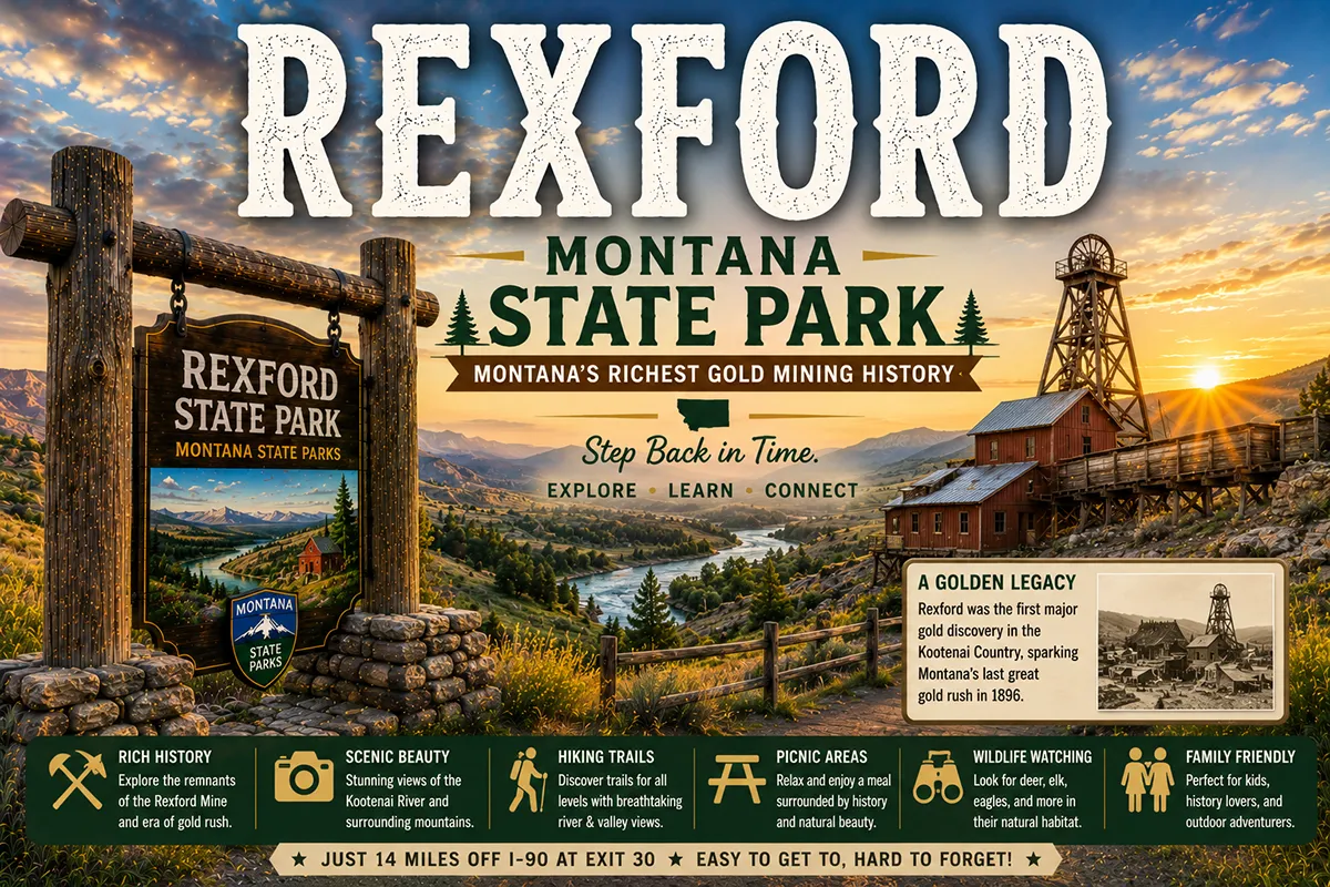
There used to be a string of small towns in the Kootenai River valley of far northwestern Montana.
Warland. Tweed. Ural. Volcour. Yarnell. And Rexford — the largest of them — established in 1901 along the Great Northern Railway’s branch line from Jennings, Montana to Fernie, British Columbia.
Then came the dam.
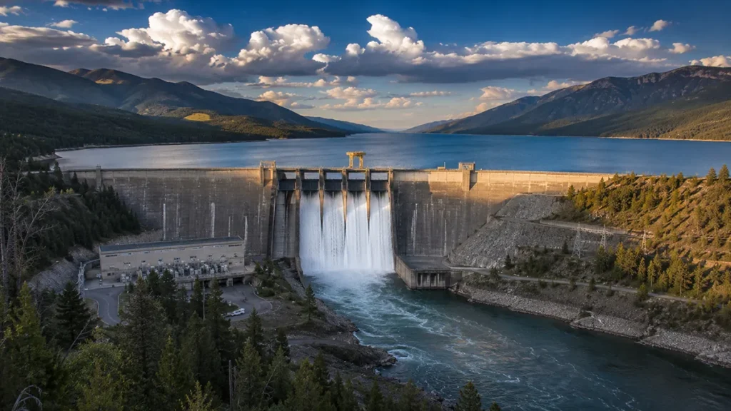
In 1966, the U.S. Army Corps of Engineers began construction of the Libby Dam — a 422-foot-tall, 3,055-foot-long concrete gravity structure on the Kootenai River.
The dam was built as a joint U.S.-Canada project under the Columbia River Treaty, designed to control annual spring flooding throughout the Kootenai and Columbia River watersheds.
When complete, the dam would create Lake Koocanusa — a 90-mile-long reservoir holding 13% of all the water in the Columbia River system.
The Kootenai River valley north of the dam would be flooded.
Warland, Tweed, Ural, Volcour, and Yarnell all simply disappeared from the map.
Rexford survived — but only because the community incorporated as a municipality in 1966 specifically to give it legal standing to negotiate with the Army Corps of Engineers. The federal government agreed to relocate the entire town to a new site on a bench above the original townsite.
Every house in the old valley townsite was purchased by the Corps. Bulldozers tore down the structures. The remains were set on fire. Some buildings — including the church, the general store, and the railroad depot — were moved up the hill to the new Rexford or to nearby Eureka. The rest were destroyed.
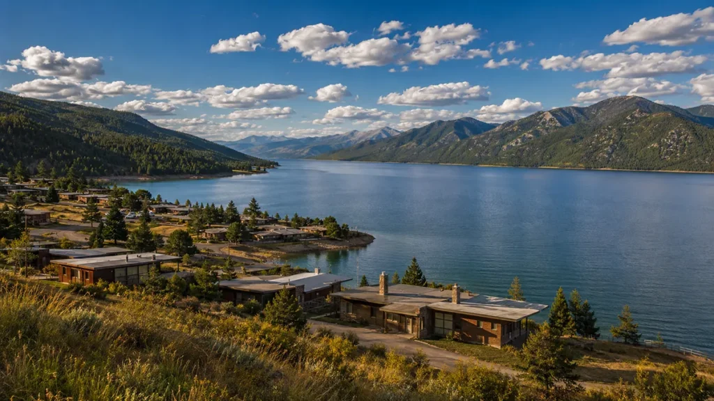
The new Rexford that emerged in the early 1970s was built almost entirely in the mid-20th century modern aesthetic — both in the design of individual buildings and in the town plan itself. The town that was created represents one of Montana’s most substantive landscape examples of mid-century modernism.
Today, Lake Koocanusa stretches 90 miles north from the dam — 48 miles in Montana, 42 miles into British Columbia. The old Rexford lies under the deep, slate-blue water. The new Rexford perches above it on the hillside.
TL;DR
- Rexford (~100) is in Lincoln County in far northwestern Montana, about 7 miles south of the Canadian border and 12 miles northwest of Eureka.
- Founded in 1901 with construction of the Great Northern Railway’s branch line from Jennings to Fernie, British Columbia.
- Named for “Kings Crossing” in the native Ireland of founders George M. Stannard and William Ambrose.
- The town was relocated 1-2 miles to a higher bench in the late 1960s to make way for Lake Koocanusa behind the new Libby Dam.
- The original townsite, along with neighboring towns Warland, Tweed, Ural, Volcour, and Yarnell, was destroyed and flooded by 1972.
- Many historic Rexford buildings were preserved and moved to the Tobacco Valley Historical Village in Eureka.
- The new town embodies the mid-20th century modern aesthetic in both individual building design and overall town plan.
- The name “Koocanusa” is a portmanteau of KOOtenai + CANada + USA — coined by Alice Beers of Rexford in a naming contest.
- The Lake Koocanusa Bridge is the state’s longest multi-truss bridge — 2,437 feet long, 270 feet above water at full pool.
- Best for: Libby Dam history travelers, Lake Koocanusa recreation, mid-century modern architecture enthusiasts, Tobacco Valley heritage visitors.
Liked this article?
Add Roaming Montana as a preferred source so you see more of our articles and guides on Google.
Rexford at a Glance
| Population (estimated) | ~100 |
|---|---|
| County | Lincoln County |
| Region | Far Northwest Montana (Lake Koocanusa) |
| Elevation | 2,461 ft |
| Distance to Canadian border | ~7 miles north |
| Distance to Eureka | ~12 miles southeast |
| Distance to Libby | ~50 miles south |
| Distance to Whitefish | ~80 miles east |
| Distance to Kalispell | ~95 miles east |
| Distance to Troy | ~80 miles southwest |
| Founded | 1901 (Great Northern Railway branch) |
| Incorporated | 1966 (to negotiate with Army Corps) |
| Relocated | Late 1960s-early 1970s |
| Lake Koocanusa filled | 1972-1973 |
| Best for | Lake Koocanusa, Libby Dam history, mid-century modern architecture |
What Makes Rexford Different
Most Montana towns have one founding story. Rexford has two.
The Original 1901 Founding
In 1901, the Great Northern Railway built a branch line from Jennings, Montana (now a ghost town) to Fernie, British Columbia — a corridor connecting the Great Northern’s main transcontinental line to Canadian Pacific coal-mining operations across the border.
The branch line passed through the Kootenai River valley. A new station and townsite was platted along the route. Two of the early founders — George M. Stannard and William Ambrose — chose the name Rexford to commemorate a place called Kings Crossing in their native Ireland.
In 1903, the railroad built a new depot one mile north of the original site to accommodate the rapidly developing main line and the Fernie branch.
The town developed slowly through the early 20th century. Logging was the primary economic activity. The Kootenai valley provided abundant timber for the Great Northern’s tie operations and for broader Northwest lumber markets. A general store, school, post office, churches, and the railroad depot constituted the basic town infrastructure.
For 60 years, Rexford operated as a quiet far-northwestern Montana logging and railroad community.
The 1960s Threat
In the 1940s, news reached the Kootenai valley that the U.S. Army Corps of Engineers was studying potential dam sites on the river.
The studies continued through the 1950s. By the early 1960s, it was clear that a major dam project was coming.
The Columbia River Treaty — signed in 1961 between the United States and Canada — formalized the project. The Libby Dam would be built as one of three U.S. dams on the upper Columbia River system. The other Treaty dams were in British Columbia. Together, they would provide flood control, hydroelectric generation, and coordinated water management across the entire international watershed.
For the small towns in the Kootenai valley, the news meant displacement.
The 1966 Incorporation
In 1966, the U.S. Army Corps of Engineers began Libby Dam construction. The same year, Rexford voted to incorporate as a municipality — a strategic decision that gave the community legal standing to negotiate with the Corps.
The negotiation produced an agreement to relocate the entire town to a new site on a bench above the original townsite. The federal government would purchase every property, demolish every structure, and provide land and infrastructure for the new community.
The other towns in the valley — Warland, Tweed, Ural, Volcour, and Yarnell — had no such legal standing. They simply disappeared.
The Move
The relocation took several years.
Each property was appraised and purchased by the Corps. Bulldozers tore down the structures. The remains were set on fire to clear the valley before flooding. Some buildings — including the church, the general store, and the railroad depot — were moved up the hill to the new Rexford site.
Other historically significant structures were moved 12 miles southeast to Eureka, where they became the core of the Tobacco Valley Historical Village.
The new Rexford was built almost entirely between 1966 and 1972 — during the peak of American mid-century modern architectural production. The houses, the commercial buildings, and the town plan itself all reflect that era’s design aesthetic. Geometric flat roofs. Carport-integrated single-story homes. Modular construction patterns. The grid street system laid out for automobile dominance.
Local historians have argued that the new Rexford deserves National Register of Historic Places consideration as a mid-century modern landmark — a substantively unusual designation for a Montana community.
Lake Koocanusa
The lake itself filled between 1972 and 1973.
The name — Koocanusa — was selected through a public naming contest won by Alice Beers of Rexford. The portmanteau combines KOOtenai (the river) + CANada + USA, reflecting the bi-national character of the reservoir.
The completed lake stretches 90 miles north from the Libby Dam — 48 miles in Montana and 42 miles into British Columbia. The reservoir surface covers 46,700 acres. The lake holds approximately 13% of all the water in the entire Columbia River system — making it one of the 10 largest reservoirs in the United States.
The Lake Koocanusa Bridge — the state’s longest multi-truss bridge — crosses the reservoir. The bridge is 2,437 feet long and stands approximately 270 feet above the water at full pool. The bridge provides access to a Mennonite community on the lake’s west shore and the back road to the Yaak.
For broader trip context, see my Montana cities and towns hub and Montana history overview.
The Top 6 Things to Do In & Around Rexford
1. Lake Koocanusa Recreation
The signature attraction.
The 90-mile-long reservoir supports boating, kayaking, fishing (kokanee salmon, rainbow trout, lake trout, burbot), swimming, and shoreline camping. Public boat launches and access points are available throughout the corridor.
Spring conditions can include the occasional dust storm when the reservoir is low — visible across the lake on windy days.
2. Libby Dam Tour
The 422-foot dam itself is accessible via the Libby Dam Visitors Center — operated by the U.S. Army Corps of Engineers approximately 50 miles south near Libby.
The visitor center includes exhibits on dam construction, the Columbia River Treaty, the displaced communities, and the engineering challenges of one of the largest American dam projects of the 1960s. The dam itself was formally dedicated by President Gerald Ford on August 24, 1975.
3. Tobacco Valley Historical Village (Eureka)
The 12-mile drive southeast to Eureka accesses the Tobacco Valley Historical Village — where many of the historic Rexford buildings (including the church, general store, library, schoolhouse, railroad depot, fire tower, hand-hewn house, and two log cabins) were preserved when the original townsite was flooded.
A substantively important collection of preserved historic structures with direct connection to old Rexford.
4. Mid-Century Modern Architecture Walk
The relocated Rexford embodies the mid-20th century modern design aesthetic.
A walking tour of contemporary Rexford reveals one of the more substantive small-community mid-century modern landscapes in Montana. The buildings, the street layout, and even the surviving public infrastructure all reflect the 1966-1972 construction era.
5. Lake Koocanusa Bridge
The state’s longest multi-truss bridge crosses the lake at 2,437 feet long and 270 feet above the water at full pool.
The bridge provides scenic photography opportunities and access to a Mennonite community on the west shore and the back road to the Yaak River valley to the south.
6. Ten Lakes Scenic Area & Kootenai National Forest
The surrounding Kootenai National Forest — covering 2.2 million acres — offers extensive recreation including the Ten Lakes Scenic Area with 89+ miles of trails, the Cabinet Mountains Wilderness to the south, and the Lake Koocanusa Scenic Byway along the entire eastern shore of the reservoir.
Where to Stay
Rexford has limited dedicated lodging.
Most travelers base in Eureka (12 miles southeast) or Libby (50 miles south).
| Lodging | Vibe | Price | Best For |
|---|---|---|---|
| Eureka lodging (12 min SE) | Tobacco Valley options | $100–200 | Most travelers |
| Libby hotels (1 hr S) | Lincoln County seat | $100–200 | Dam-focused visits |
| Lake Koocanusa shoreline campgrounds | USFS sites | $20–35 | Self-sufficient |
| Vacation rentals (Rexford area) | Lake cabins available | $150–300 | Lake-focused travelers |
Where to Eat
- Local Rexford options — small cafes; verify current operations
- Eureka dining (12 min SE) — broader Tobacco Valley selection
- Libby restaurants (1 hr S) — full Lincoln County selection
Getting There & Around
From Eureka: 12 miles northwest on US-93 and MT-37, about 15 minutes.
From Libby: 50 miles north via the Lake Koocanusa Scenic Byway (MT-37), about 1 hour.
From Whitefish: 80 miles east via US-93, about 1.5 hours.
From Kalispell: 95 miles east via US-93, about 1.75 hours.
From the Canadian border (Roosville crossing): 25 miles south, about 30 minutes.
Cell service: Limited in Rexford and along the Lake Koocanusa corridor.
When to Visit
Summer (June-August): Peak lake recreation; warmest weather; longest daylight; full Lake Koocanusa access.
Fall (September-October): Outstanding northwestern Montana light; cooler temperatures; quieter lake.
Winter (December-March): Severe northwestern Montana weather; lake substantially reduced; some access limited.
Spring (April-May): Lake refilling; occasional dust storms when reservoir is low; quieter shoulder season.
Personal Tips
Visit the Tobacco Valley Historical Village. The 12-mile drive to Eureka puts you in direct contact with the church, general store, depot, and other buildings that were saved from the original Rexford before the flooding. The collection is one of Montana’s more substantive small-community heritage preservation efforts.
Take the Lake Koocanusa Scenic Byway. The 67-mile route between Libby and the Canadian border is one of Montana’s underrated scenic drives. Multiple overlooks, interpretive markers, and lake access points along the way.
Read the displaced-towns story. Understanding what happened to Warland, Tweed, Ural, Volcour, and Yarnell — the towns that simply disappeared because they didn’t have the legal standing Rexford gained through 1966 incorporation — adds substantive depth to a Rexford visit.
Photograph the mid-century architecture. The relocated Rexford is a genuine landscape-scale example of mid-20th century modernism. Some local historians believe the entire town deserves National Register of Historic Places consideration as a heritage district in its own right.
Combine with Libby Dam tour. The Libby Dam Visitors Center 50 miles south anchors the broader story. A combined Rexford + dam + Tobacco Valley itinerary makes a substantive 1-2 day Lincoln County experience.
Respect the displacement history. Rexford’s existence in its current form is the result of one of Montana’s most significant 20th-century cultural displacement events. Many original residents — and their descendants — still mourn the loss of the original valley. Bring that respect to your visit.
Rexford Quick Facts
| Population (estimated) | ~100 | | County | Lincoln County | | Region | Far Northwest Montana | | Original founding | 1901 (Great Northern Railway branch) | | Founders | George M. Stannard and William Ambrose | | Name origin | “Kings Crossing” in native Ireland | | 1903 development | New depot built 1 mile north | | Incorporated | 1966 (for Army Corps negotiations) | | Libby Dam construction began | 1966 | | Lake Koocanusa filled | 1972-1973 | | Libby Dam formally dedicated | August 24, 1975 (by President Gerald Ford) | | Libby Dam height | 422 ft | | Libby Dam length | 3,055 ft (more than 1/2 mile) | | Lake Koocanusa total length | 90 miles (48 in US, 42 in BC) | | Lake surface area | 46,700 acres | | Lake holds | ~13% of Columbia River system water | | Reservoir ranking | Top 10 largest in United States | | Towns destroyed by lake | Warland, Tweed, Ural, Volcour, Yarnell | | Town named by contest winner | Alice Beers of Rexford | | Name origin | Portmanteau of KOOtenai-CANada-USA | | Lake Koocanusa Bridge | 2,437 ft long (state’s longest multi-truss) | | Bridge height above water (full pool) | ~270 ft | | Power generation capacity | 600 MW (5 turbines) | | Annual generation | 1,574.4 GWh | | Architectural consultant | Paul Thiry of Seattle | | Sculptor of granite bas-relief | Albert Wein (competition) | | Average summer high | 80°F | | Average winter low | 14°F |
Conclusion
Rexford is one of the most substantively unusual small communities in Montana.
The town’s 1901 founding by Irish immigrants honoring their native Kings Crossing. The 1966 strategic incorporation that gave Rexford legal standing to negotiate its survival when the Libby Dam project threatened to flood the entire Kootenai River valley.
The systematic relocation of the entire community to a new bench above the old townsite. The mid-century modern architecture that defines the rebuilt community.
The Lake Koocanusa naming contest won by local resident Alice Beers. The systematic preservation of historic buildings at the Tobacco Valley Historical Village in Eureka. The five neighboring towns that simply disappeared because they lacked the legal standing Rexford gained.
The dam was formally dedicated by President Gerald Ford on August 24, 1975. Fifty years later, the lake remains. The relocated Rexford remains. The story of the towns that didn’t survive — Warland, Tweed, Ural, Volcour, Yarnell — remains too, for travelers willing to seek it.
Have a Rexford question? Drop it in the comments — I read every one.
Frequently Asked Questions
Is Rexford Montana worth visiting?
Yes — Rexford is worth visiting for the substantial historical story of its 1960s relocation when Libby Dam construction flooded the original Kootenai River valley townsite, the resulting mid-century modern architecture and town plan, easy access to Lake Koocanusa recreation, and as a starting point for the Lake Koocanusa Scenic Byway along the eastern shore of one of the 10 largest reservoirs in the United States. Best paired with a visit to the Tobacco Valley Historical Village in Eureka and the Libby Dam Visitors Center 50 miles south near Libby.
Why was Rexford Montana moved?
Rexford was relocated from its original Kootenai River valley townsite to a new site on a higher bench in the late 1960s and early 1970s to make way for Lake Koocanusa, the reservoir created by the construction of Libby Dam by the U.S. Army Corps of Engineers between 1966 and 1972. Libby Dam was built as part of the Columbia River Treaty between the United States and Canada, designed to provide flood control and hydroelectric generation throughout the upper Columbia River system. Rexford had incorporated as a municipality in 1966 specifically to give the community legal standing to negotiate with the Corps. The negotiated settlement included relocation. Five neighboring communities (Warland, Tweed, Ural, Volcour, and Yarnell) lacked similar legal standing and were simply destroyed and flooded.
What is Lake Koocanusa?
Lake Koocanusa is the reservoir created by the construction of Libby Dam on the Kootenai River in Lincoln County, Montana. The lake stretches 90 miles north from the dam — 48 miles in Montana and 42 miles into British Columbia, Canada — making it a bi-national reservoir. Lake Koocanusa covers 46,700 acres and holds approximately 13% of all the water in the entire Columbia River system, ranking it among the 10 largest reservoirs in the United States. The lake was named through a public naming contest won by Alice Beers of Rexford. The name is a portmanteau of KOOtenai (the river) + CANada + USA.
Where did the historic Rexford buildings go?
Many of the historic buildings from the original Rexford townsite were preserved by moving them to the Tobacco Valley Historical Village in Eureka, approximately 12 miles southeast of Rexford. The village now includes the original Rexford church, general store, library, schoolhouse, railroad depot, fire tower, hand-hewn house, and two log cabins. Some buildings — including the church, general store, and depot — were moved up the hill to the new Rexford townsite instead. Most other structures were destroyed: bulldozers tore down the buildings, and the remains were set on fire to clear the valley before the reservoir filling.
How big is Rexford Montana?
Rexford is a very small community with approximately 100 residents. The town was relocated 1-2 miles north of its original site between 1966 and 1972 in connection with Libby Dam construction. The relocated town occupies a small footprint on a bench above the former townsite, now under Lake Koocanusa.
What was the Columbia River Treaty?
The Columbia River Treaty is a 1961 international agreement between the United States and Canada that governs the development and management of the upper Columbia River system. Under the treaty, the U.S. agreed to build Libby Dam in Montana, while Canada agreed to build three storage dams in British Columbia (Mica, Duncan, and Keenleyside). Together, the treaty dams provide coordinated flood control, hydroelectric generation, and water management across the entire international watershed. The treaty was ratified in 1964 and Libby Dam construction began in 1966. The treaty has been a source of ongoing political negotiation between the US and Canada — most recently regarding the Canadian Entitlement and Lincoln County’s continued petition for compensation for the lake’s footprint.
How far is Rexford from Eureka Montana?
Rexford is approximately 12 miles northwest of Eureka via US Highway 93 and Montana Highway 37 — about a 15-minute drive. Eureka is the practical urban anchor for the broader Tobacco Valley region and houses the Tobacco Valley Historical Village, where many historic Rexford buildings were preserved from the pre-relocation original townsite.