I pulled over on the walkway of the Koocanusa Bridge one evening in September. Below me, 270 feet down, the lake stretched out in both directions until it disappeared into Canada.
Lake Koocanusa is a 90-mile-long reservoir that straddles the U.S.-Canada border in far northwest Montana, formed by Libby Dam in 1972. This guide covers the scenic byway drive, the bridge everyone stops for, fishing and camping along the shoreline, and an honest look at a water-quality issue upstream that’s worth knowing about before you go.
A Name Invented for a Contest
Most Montana lakes carry names with deep history behind them. Koocanusa doesn’t.
When Libby Dam went in during the late 1960s and early 1970s, the Army Corps of Engineers held a contest to name the new reservoir. A woman named Alice Beers, from the small town of Rexford, won.
Her formula was simple: take the first three letters of Kootenai, add the first three letters of Canada, and finish with USA. Koo-Can-USA.
It sounds like it should be an old Indigenous word. It’s actually a mid-20th-century invention, and I think that’s a genuinely fun piece of trivia to share with anyone in the car as you cross the bridge.
What Got Left Behind
The lake’s creation wasn’t without cost. The town of Rexford had to be physically relocated before the water rose, along with a stretch of the Great Northern Railway line.
Across the border in British Columbia, the small town of Waldo simply disappeared under the reservoir entirely.
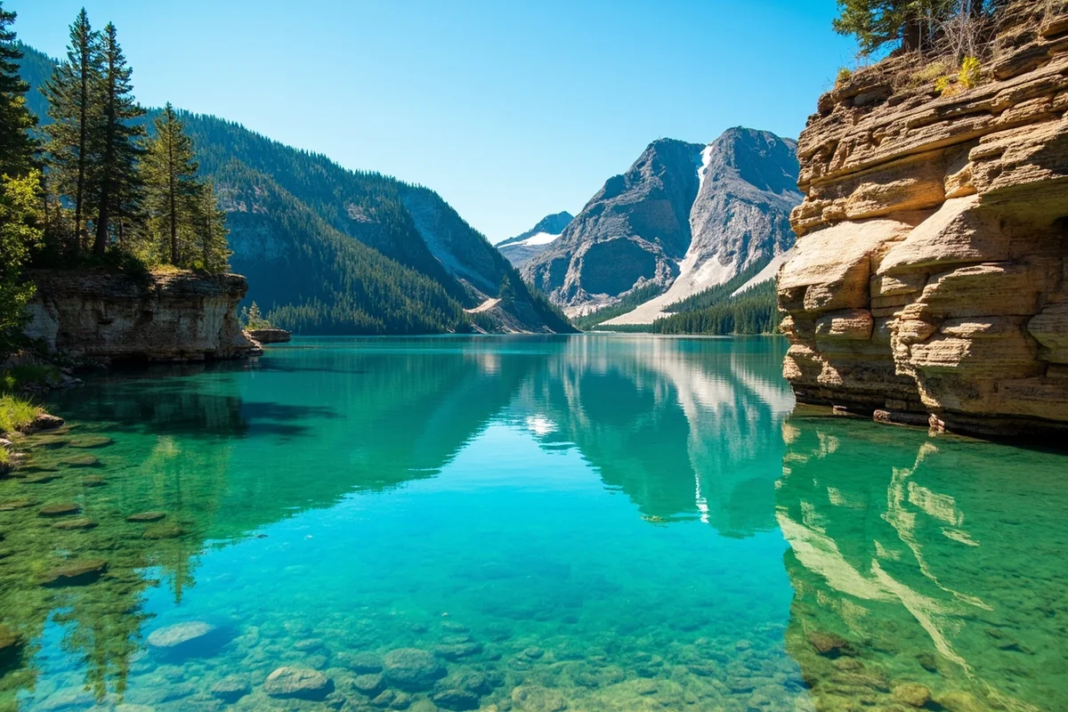
I think about this every time I drive the byway. The lake looks so permanent and natural now, sandstone cliffs and all, but there’s a whole displaced town somewhere beneath the surface.
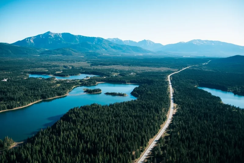
The Lake Koocanusa Scenic Byway
This is the drive I’d recommend to anyone passing through northwest Montana with an afternoon to spare. The byway runs 67 paved miles between the towns of Eureka and Libby, following Highway 37 along the lake’s eastern shore.
The first stretch out of Eureka rolls through the open Tobacco Valley. Once you pass Rexford, the road tucks in close to the water for nearly 50 miles, with the Purcell and Salish mountains rising on both sides.
I’ve done this drive in a single afternoon and in two unhurried days with stops at every pullout. Both are worth doing, depending on how much time you have.
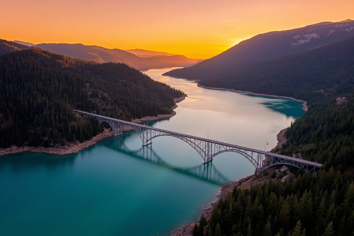
The Koocanusa Bridge
You’ll cross this whether you mean to stop or not, and I’d recommend stopping. At 2,437 feet long and standing roughly 270 feet above the water, it’s the longest and highest bridge in Montana.
A small parking area near the bridge lets you walk out onto a pedestrian sidewalk for the view. I’ve done this on a windy day and felt the whole structure hum slightly underfoot — not dangerous, just a little unnerving the first time.
The photos from up here are some of the best I’ve gotten of any Montana lake, especially in early evening when the water goes glassy.
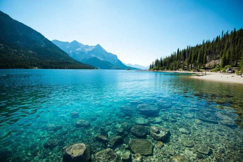
Fishing Lake Koocanusa
This lake has a reputation as one of the better landlocked salmon fisheries in the Pacific Northwest, and I’ve talked to serious anglers who make the trip here specifically for that reason.
Beyond kokanee, you’ll find rainbow and cutthroat trout, whitefish, and burbot, also known locally as ling. Streams feeding into the lake add brook trout to the mix.
A standard Montana fishing license covers the U.S. side. If you’re fishing across the border into the Canadian portion, different rules apply, so check current regulations before you cross that line, even by boat.
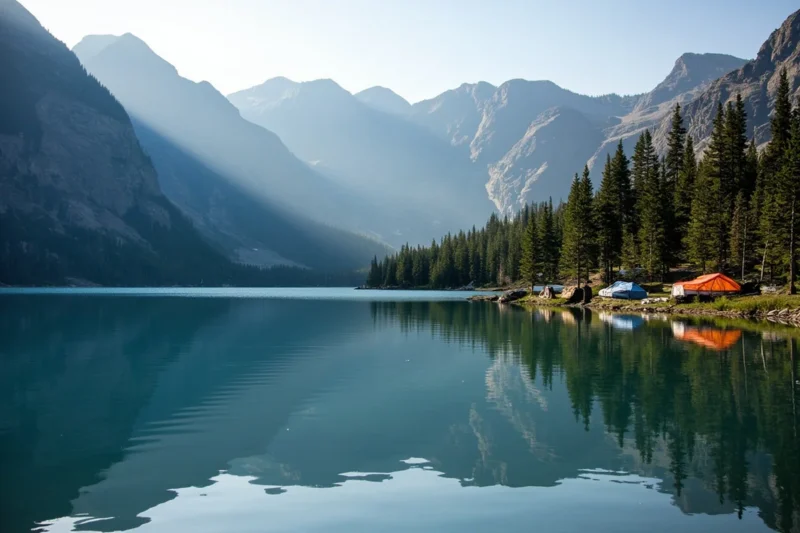
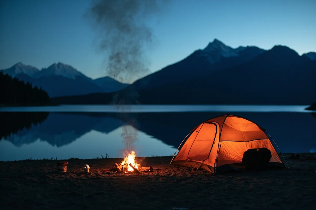
Camping and Access Points
Several developed recreation sites line the Montana shore. Rocky Gorge is the largest, with about 120 sites suitable for both tents and RVs, plus a boat ramp.
Peck Gulch offers restrooms, a boat ramp, and both picnic and camping space. Barron Creek keeps things simpler with dispersed camping and its own ramp.
McGillivray Recreation Site rounds things out with a swimming beach, ball fields, and group picnic shelters — a good pick if you’re traveling with kids who need more than a shoreline to explore.
I’ve camped at Rocky Gorge and Peck Gulch both, and I’d pick Peck Gulch if solitude matters more to you than amenities.
Libby Dam and Its Visitor Center
The dam itself is worth a stop even if fishing and camping aren’t your priority. At more than 400 feet tall, Libby Dam ranks among the larger dams in the country, and it was formally dedicated by President Gerald Ford in 1975.
Seasonal tours run through the visitor center, walking you through the powerhouse and its five massive turbines. I did this tour on a whim during a rainy afternoon and came away more impressed than I expected to be [verify current tour schedule and availability].
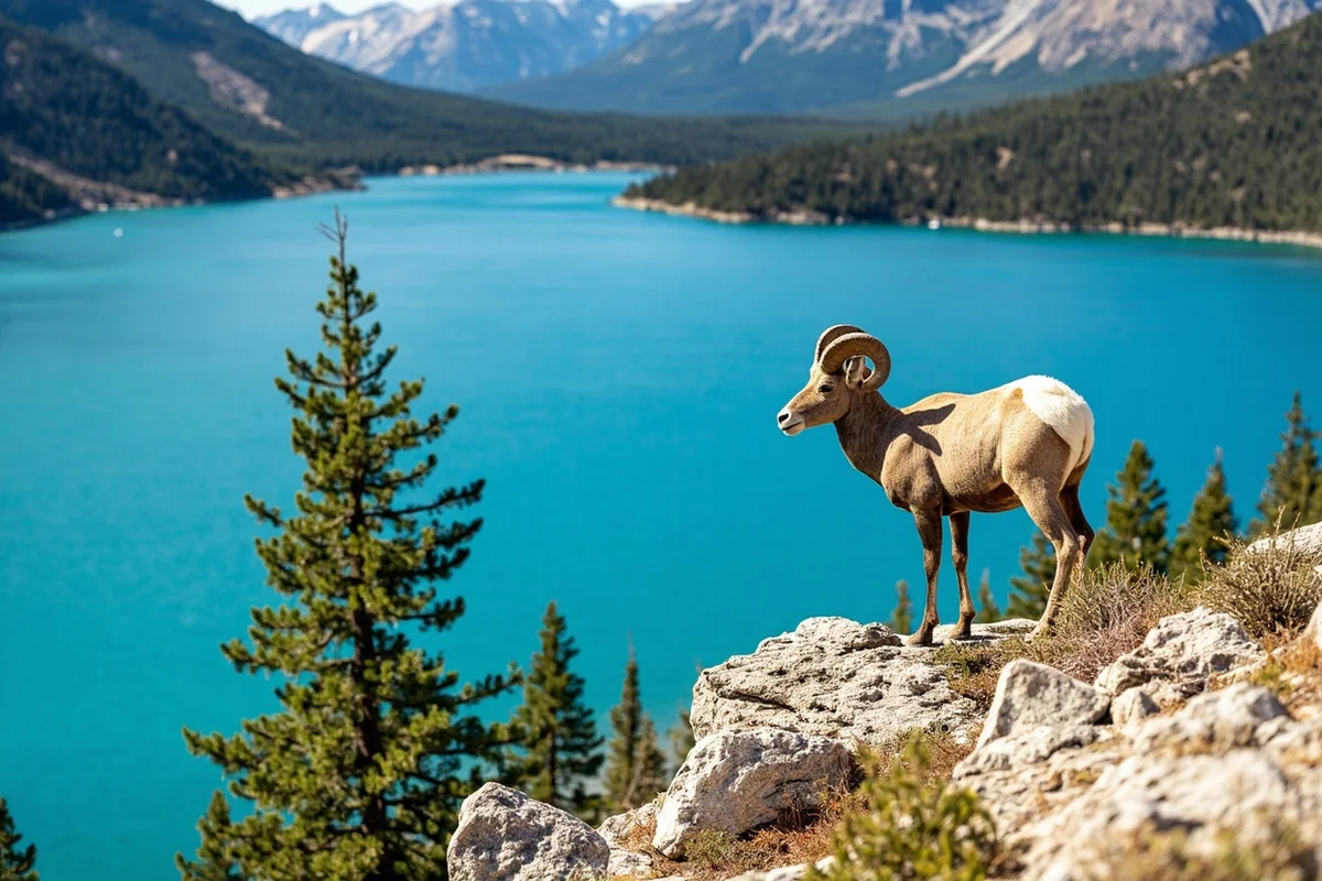
Wildlife Around the Lake
The area around Libby Dam has been officially designated a Watchable Wildlife Area by Montana Fish, Wildlife and Parks. That’s not marketing language — it genuinely delivers.
I’ve spotted bald eagles, ospreys, and trumpeter swans on a single slow drive along the byway. Bighorn sheep show up regularly on the rock outcrops near the water, and deer, moose, and black bears move through the surrounding forest.
A Downside Worth Knowing About
I try to give honest assessments in these guides, and this lake has a real issue worth mentioning. Selenium pollution from coal mining operations upstream in British Columbia’s Elk Valley has been detected in the lake system.
Montana environmental regulators have traced the large majority of that selenium back to the Elk River on the Canadian side.
It’s an ongoing, actively monitored issue rather than a settled one, and I’d encourage checking current water quality advisories before planning extensive time in the water here, particularly if you’re fishing to eat your catch [verify current advisories with Montana DEQ].
I mention this not to scare anyone off the lake, which remains a genuinely beautiful place to visit. But a fair guide doesn’t leave out the parts that complicate the postcard image.
Personal Tips / What I Wish I Knew
Fill your tank before Eureka or Libby. Services thin out fast once you’re on the byway itself, and it’s a long way back if you misjudge your fuel.
Go in early fall for the best light and fewest people. September traffic on the byway is noticeably lighter than July, and the water still looks incredible.
Don’t rush the bridge stop. I’ve driven past it in a hurry before and regretted not taking the ten minutes to walk out and actually look.
Pack binoculars. Between the eagles, the bighorn sheep, and the sheer scale of the lake, I’ve never regretted having them along. A spotting scope is even better if you have room to pack one.
Practical Info: Lake Koocanusa
| Length | Approximately 90 miles, with about 48 miles in Montana |
| Scenic byway | 67 paved miles between Eureka and Libby |
| Bridge | 2,437 feet long, roughly 270 feet above the water — Montana’s longest and highest |
| Best season | June through September for full access and warm-weather recreation |
| Fishing license | Standard Montana state license for the U.S. side |
| Camping | Rocky Gorge, Peck Gulch, Barron Creek, McGillivray Recreation Site |
Frequently Asked Questions
Where does the name Lake Koocanusa come from?
It was invented for a 1970s naming contest, combining letters from Kootenai, Canada, and USA. A resident of Rexford, Montana, won the contest.
How long is the Koocanusa Bridge?
It’s 2,437 feet long and stands roughly 270 feet above the water, making it the longest and highest bridge in Montana.
Is Lake Koocanusa in both the U.S. and Canada?
Yes, the lake extends across the border, with roughly half its length in Montana and the rest in British Columbia.
Is it safe to swim in Lake Koocanusa?
Swimming is popular at developed recreation sites, though selenium pollution from upstream coal mining is an active water quality concern worth checking current advisories on before extended water contact.
What fish are in Lake Koocanusa?
The lake holds rainbow and cutthroat trout, kokanee salmon, whitefish, and burbot, with brook trout in the feeder streams.
The International Character of the Lake
Half of Lake Koocanusa’s water sits in Canada. That international split shows up in small, interesting ways.
Fishing regulations differ once you cross the border, even by boat. Currency and cell coverage can shift too, depending on how close you get to the line.
I’ve talked to Montana anglers who fish the U.S. side exclusively just to avoid the paperwork of crossing regulations. Others make a point of doing both sides in the same trip, treating it as a genuine binational fishing experience.
The reservoir also holds roughly 13 percent of the entire Columbia River system’s water. That’s a staggering share for a single lake, and it underscores just how significant Libby Dam’s role is in regional hydroelectric planning.
The Pacific Northwest National Scenic Trail
Long-distance hikers know Lake Koocanusa for a different reason. The Pacific Northwest National Scenic Trail follows Highway 37 along the lake’s east side for a stretch, then crosses the Koocanusa Bridge itself before climbing Webb Mountain.
I’ve met through-hikers on this section during a summer drive along the byway. It’s a strange, pleasant surprise to realize a cross-country trail runs right past a spot most visitors only see from a car window.
If you’re not attempting the full trail, short sections near the bridge make for an easy, scenic add-on walk.
Ten Lakes Scenic Area
North of the main reservoir, within Kootenai National Forest, the Ten Lakes Scenic Area protects roughly 15,000 acres of alpine terrain dotted with smaller backcountry lakes. This is a different kind of experience than the main reservoir.
Access here is largely foot, horse, or bike traffic. I’d treat this as a separate trip rather than an add-on, since reaching the good lakes requires real trail time.
For cyclists, the annual Tour de Koocanusa event draws riders from across the region every year, and Libby itself has become something of a road cycling hub thanks to the terrain.
A Note on Cell Service and Planning Ahead
Cell coverage along much of the byway is spotty at best. I’d download offline maps before heading out, especially if you’re planning to explore any of the recreation sites off the main highway.
This ties into the broader theme of this corner of Montana: it rewards preparation. For the historical backdrop of dam-building projects like this one across the state, see my Montana history guide, which covers the era that reshaped rivers like the Kootenai into the recreation lakes we visit today.
What Sets Koocanusa Apart From Other Montana Reservoirs
I’ve visited most of the major reservoirs in this state at this point. What makes Koocanusa distinct isn’t any single feature — it’s the combination.
The scale is genuinely different from Canyon Ferry or Hungry Horse. Ninety miles of water crossing an international border isn’t something Montana has anywhere else.
The sandstone cliffs give it a different visual character too, more canyon-like than the broad open basins of most reservoirs further south.
Combined with the bridge and the wildlife-watching designation, it adds up to a lake that rewards a full day rather than a quick drive-by. I’ve never regretted giving this place more time than I originally planned.
Final Thoughts
Lake Koocanusa is one of those Montana lakes that surprises people who’ve never heard of it. The scale alone — 90 miles of water threading between two countries — is hard to picture until you’re standing on that bridge looking down.
I keep coming back to this stretch of Montana precisely because it never feels crowded, even in July. Every time I drive the byway, I find some new pullout or angle on the lake I hadn’t noticed before, and that alone makes it worth a return trip, year after year.
For more of northwest Montana’s lakes, see my guide to Bowman Lake, or check out the complete guide to Montana’s best lakes for the rest of the region. If you’re basing your trip out of Troy or Kalispell’s airport hub, the byway makes an easy full-day loop.
For help timing your visit around the region’s short summer window, see my best time to visit Montana guide, and for the birding angle, my Montana bird species guide covers what to watch for along the shoreline.