A journalist took a train ride one day in 1908.
He was sitting next to Albert J. Earling, president of the Chicago, Milwaukee, St. Paul and Pacific Railroad. The Milwaukee Road was deep into building its Pacific Coast Extension — the ambitious project to connect Chicago to the Pacific Coast — and Earling was traveling along the new line through central Montana.
The two men got to talking.
The journalist worked for the Chicago Tribune. His name was Melvin Stone.
Earling — for reasons known only to himself — was naming new Milwaukee Road towns as they went. He asked Stone his name. He liked it. He decided to combine the journalist’s first and last names and call the next new community Melstone.
That’s how the town was christened.
The same Albert J. Earling had already named Alberton, Montana after himself further west on the Milwaukee mainline. He would soon name Ismay, Montana after his daughters Isabella and May.
Three of Montana’s small Milwaukee Road towns therefore trace their names directly to Earling’s personal involvement in the railroad’s western settlement.
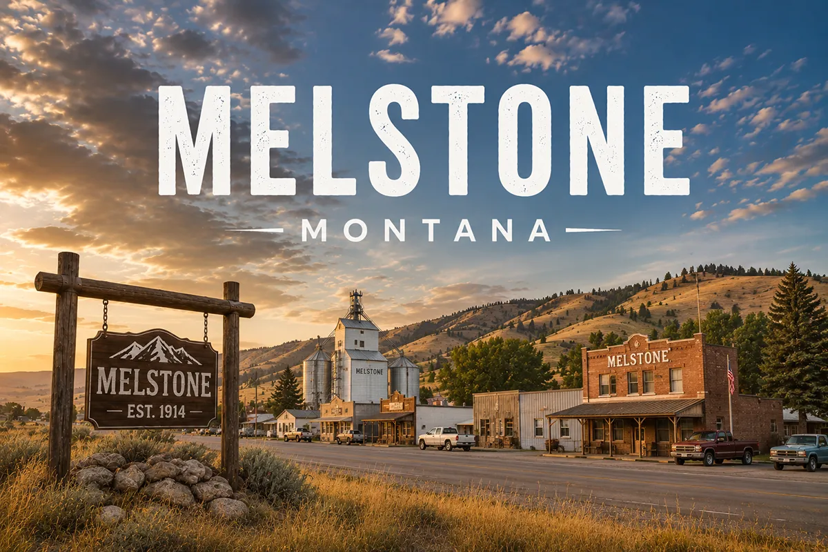
Melstone was established in 1908 as a base for operating crews on the Chicago, Milwaukee, St. Paul and Pacific Railroad. It would eventually develop into a freight division point on the line. Homesteaders followed under the Enlarged Homestead Act of 1909.
By the late 1910s, Melstone had grown into a small but established Musselshell Valley community.
The Milwaukee Road declared bankruptcy in 1977 and abandoned much of its western mileage in 1980.
Melstone survived anyway.
Today the town has approximately 126 residents — slightly larger than the 96 counted in the 2010 census. The school remains the town’s central institution.
The Melstone Bar and Cafe still operates as a classic roadside US-12 stop. Jake’s Garage handles vehicle work. A small hardware/general store serves the surrounding ranches and farms.
TL;DR
- Melstone (126) is in eastern Musselshell County on US Highway 12, 35 miles east of Roundup (county seat) and 67 miles northwest of Forsyth.
- Founded 1908 as a base for Chicago, Milwaukee, St. Paul and Pacific Railroad operating crews.
- Named for Melvin Stone, a Chicago Tribune journalist who was sitting next to Milwaukee Road president Albert J. Earling on a train.
- The same A.J. Earling also named Alberton (after himself) and Ismay (after daughters Isabella and May).
- Milwaukee Road abandoned its western mainline in 1980; Melstone survived as a ranching community.
- The Melstone Oil Field west of town developed in the 1950s; production was renewed in the 1990s.
- The Delphia-Melstone Canals — built 1950 and 1953 by the State of Montana — provide irrigation to the lower Musselshell Valley.
- The town has lost its signature 1912 Antlers Hotel but retains its school, general store, café, and garage.
- Best for: Milwaukee Road heritage travelers, US-12 corridor stops, lower Musselshell Valley exploration.
Liked this article?
Add Roaming Montana as a preferred source so you see more of our articles and guides on Google.
Melstone at a Glance
| Population (2020) | 126 |
|---|---|
| County | Musselshell County |
| Region | Eastern Montana (lower Musselshell Valley) |
| Elevation | 2,762 ft |
| Distance to Roundup (county seat) | ~35 miles west on US-12 |
| Distance to Forsyth | ~67 miles southeast on US-12 |
| Distance to Miles City | ~130 miles southeast |
| Distance to Billings | ~90 miles southwest |
| Distance to Lavina | ~65 miles northwest |
| Distance to Rosebud County line | ~2 miles east |
| Founded | 1908 (Milwaukee Road) |
| Best for | Milwaukee Road heritage, US-12 stops, lower Musselshell Valley |
What Makes Melstone Different
The founding story is unusual even by Montana railroad-town standards.
The Earling Naming Pattern
Albert J. Earling was president of the Chicago, Milwaukee, St. Paul and Pacific Railroad during the construction of the Pacific Coast Extension between 1906 and 1909.
The Milwaukee Road was the last of the major American transcontinental railroads to push west. Building the line required substantial railroad-town development across central Montana. New stations, water stops, sidings, and depots were established every 10-15 miles along the mainline.
Many were never properly named when they appeared on the survey maps.
Earling — apparently with the personal authority of the railroad presidency — took to naming them on the fly. The pattern is genuinely documented across at least three communities that became part of the Milwaukee’s central Montana network:
- Alberton (western Montana) was named for Earling himself combined with early settler Alexander Albert.
- Ismay (southeastern Montana) was named for Earling’s daughters Isabella and May.
- Melstone (central Montana) was named for Melvin Stone, the Chicago Tribune journalist who happened to be sitting next to Earling on a train.
The Operating Base
Beyond the unusual name, Melstone was a practical railroad town.
The Milwaukee needed a base for crews working construction in the lower Musselshell Valley. A flat river-bench location, water access from the Musselshell, and the right spacing relative to other planned stations made Melstone the choice.
The town developed in the standard pattern: grain elevators along the tracks, a small commercial Main Street parallel to the railroad alignment, and a school positioned away from the immediate industrial corridor.
The Homestead Boom Years
Between 1909 and 1916, the Enlarged Homestead Act doubled the standard homestead allotment from 160 acres to 320 acres for dryland Western lands.
Melstone benefited briefly from the resulting settlement boom. The 1912 Antlers Hotel — built on the most prominent corner where Main Street met US-12 — was the boom-era signature building. Saloons, banks, churches, and additional commercial buildings followed.
Then the bust came.
The drought of 1917-1924 drove most of the area’s homesteaders out. The Great Depression compounded the contraction. World War II rural depopulation finished what drought had started. The Antlers Hotel was eventually torn down; its prominent corner is now a grassy lot.
The Delphia-Melstone Canals
In the 1950s, the State of Montana made one of its most substantive 20th-century infrastructure investments in the lower Musselshell Valley.
The Delphia-Melstone Canal Project — constructed in 1950 and 1953 — built diversion dams and canals to irrigate Musselshell Valley bottomland. The diversion dam at Musselshell (the upstream community to the west) was the largest at 182 feet.
The canals transformed agricultural production in the valley. Hay, alfalfa, and supplemental forage for cattle operations became reliable products. The system still operates today.
The Melstone Oil Field
The Melstone Oil Field — located approximately west of town — was discovered and developed during the 1950s.
Production was substantial but never matched the much larger Kevin-Sunburst field in northern Montana. The field went into decline by the 1960s.
In the 1990s, production was renewed. Improved horizontal drilling technology and rising oil prices made previously uneconomic wells viable. The field continues to produce at modest levels today.
For broader trip context, see my Montana cities and towns hub.
The Top 6 Things to Do In & Around Melstone
1. Melstone Bar and Cafe
The town’s social anchor.
A classic Montana roadside cafe/bar combination that has served the community for decades. Working ranchers, US-12 travelers, and local school families all stop in. Limited menu but substantive small-town atmosphere. Hours vary; verify before visiting.
2. Milwaukee Road Heritage Walking
The abandoned Milwaukee Road grade runs through town parallel to US-12.
The rails are gone (the line was abandoned in 1980), but the grade, depot foundations, water tower remnants, and several historic commercial buildings along the original tracks remain. A brief walk provides genuine connection to early-20th-century railroad infrastructure.
See my Montana railroads guide for broader rail context.
3. US-12 Lower Musselshell Drive
US Highway 12 between Roundup and Forsyth follows the Musselshell River through some of the most genuinely scenic ranching country in central-eastern Montana.
The route passes through Melstone, Ingomar (a much smaller surviving community further east), and Forsyth — multiple substantive small-town stops along an underrated cross-state corridor.
4. Delphia-Melstone Canal System
The 1950s irrigation infrastructure is still operating throughout the lower Musselshell Valley.
Drive any of the secondary roads near Melstone to see the canal system in operation — diversion gates, working canals, irrigated hayfields. A genuine working agricultural infrastructure tour.
5. Musselshell River Access
The Musselshell River runs along the southern edge of town.
The river isn’t well-known for fishing compared to the Yellowstone or Missouri, but it offers brown trout and smallmouth bass in some stretches. Multiple public access points along US-12 and the canal road.
6. Day Trip to Roundup or Forsyth
Both are substantively interesting smaller cities accessible via US-12:
Roundup (35 miles west) — Musselshell County seat with the Musselshell Valley Historical Museum, additional restaurants, and lodging.
Forsyth (67 miles southeast) — Rosebud County seat with the Rosebud County Pioneer Museum and the historic Rosebud County Courthouse.
Where to Stay
Melstone has no dedicated lodging.
Most travelers base in Roundup (35 minutes west) or Forsyth (1 hour southeast).
| Lodging | Vibe | Price | Best For |
|---|---|---|---|
| Roundup lodging (35 min W) | Musselshell County seat | $100–180 | Most travelers |
| Forsyth hotels (1 hr SE) | Yellowstone Valley options | $100–180 | Eastern travelers |
| Billings hotels (1.5 hrs SW) | Full city selection | $130–280 | City comforts |
| Vacation rentals (Musselshell Valley) | Ranch and farm stays | $130–250 | Hunters, longer visits |
Where to Eat
- Melstone Bar and Cafe — local community gathering spot
- Jake’s Garage (Melstone) — supplies and service
- Roundup dining (35 min W) — broader Musselshell County selection
- Forsyth restaurants (1 hr SE) — Rosebud County options
Getting There & Around
From Roundup: 35 miles east on US-12, about 45 minutes.
From Forsyth: 67 miles northwest on US-12, about 1.25 hours.
From Billings: ~90 miles, about 1.5 hours via US-87 or MT-3 to Roundup, then US-12.
From Miles City: ~130 miles northwest via I-94 to Forsyth, then US-12, about 2.5 hours.
Cell service: Generally available in Melstone and along US-12. Reduced on surrounding county roads.
When to Visit
Summer (June-August): Best driving conditions; warmest weather; lower Musselshell Valley at peak agricultural character.
Fall (September-October): Outstanding eastern Montana light; harvest activity; hunting season.
Winter (December-March): Severe Montana weather possible.
Spring (April-May): Spring runoff; canal system active; quieter shoulder season.
Personal Tips
Stop at the Melstone Bar and Cafe. The cafe is the town’s social anchor. Spending 30 minutes here over a meal provides more genuine small-town Montana context than any historic marker tour.
Take the Earling naming connection seriously. Three Montana Milwaukee Road towns (Alberton, Ismay, Melstone) trace their names directly to Albert J. Earling’s personal involvement. The pattern is a genuine piece of Montana railroad heritage.
Plan a US-12 multi-town day. A morning in Roundup, an afternoon in Melstone and Ingomar, an evening in Forsyth makes a substantive lower Musselshell Valley road experience.
Don’t expect tourism amenities. Melstone is a working ranching community of 126 people. The interesting things are the railroad heritage, the irrigation infrastructure, and the broader US-12 corridor — not visitor services.
Bring full supplies. Lower Musselshell Valley services are spaced widely apart. Fuel up in Roundup or Forsyth before extended exploration. Carry water and snacks.
Read about the Antlers Hotel. The town’s lost 1912 signature building was once one of the more substantial commercial structures along the Milwaukee Road in central Montana. The grassy lot where it stood is now a brief educational stop.
Melstone Quick Facts
| Population (2020) | 126 | | Population (2010) | 96 | | Founded | 1908 | | Railroad | Chicago, Milwaukee, St. Paul and Pacific Railroad | | Named for | Melvin Stone (Chicago Tribune journalist) | | Named by | Albert J. Earling (Milwaukee Road president, 1908) | | Milwaukee Road abandoned | 1980 | | Antlers Hotel built | 1912 | | Antlers Hotel | Lost (grassy lot today) | | Delphia-Melstone Canal Project | Built 1950 and 1953 | | Largest project diversion dam (Musselshell) | 182 ft | | Melstone Oil Field discovered | 1950s | | Melstone Oil Field renewed | 1990s | | Town area | 0.62 square miles | | Distance to Rosebud County line | ~2 miles east | | Average summer high | 86°F | | Average winter low | 4°F |
Conclusion
Melstone is a 126-person eastern Musselshell County town with genuinely interesting railroad heritage.
The 1908 founding by Milwaukee Road president Albert J. Earling — the same Earling responsible for naming Alberton and Ismay — gives Melstone a distinctive place in Montana railroad history. The story of the Chicago Tribune journalist who happened to be sitting next to Earling on a train and ended up with a Montana town named for him is one of the better small-community origin stories anywhere in the American West.
The contemporary town is small and working. Most travelers blow through on US-12 without stopping. Take 30 minutes.
Have a Melstone question? Drop it in the comments — I read every one.
Frequently Asked Questions
Is Melstone Montana worth visiting?
Melstone is worth a brief stop primarily for the unique Milwaukee Road founding story, the working Melstone Bar and Cafe (classic Montana roadside experience), and as a stop on the broader US-12 lower Musselshell Valley corridor between Roundup and Forsyth. It is not a traditional tourism destination but rewards travelers willing to slow down for the substance.
Who is Melstone Montana named after?
Melstone is named after Melvin Stone, a journalist for the Chicago Tribune. According to the most commonly cited origin story, Stone was sitting next to Albert J. Earling — president of the Chicago, Milwaukee, St. Paul and Pacific Railroad — on a train in 1908 during construction of the railroad’s Pacific Coast Extension through central Montana. Earling asked Stone his name, liked it, and impulsively decided to name the next new Milwaukee Road community along the line after the journalist by combining his first and last names: Mel + Stone = Melstone.
When was Melstone Montana founded?
Melstone was founded in 1908 as a base for operating crews on the Chicago, Milwaukee, St. Paul and Pacific Railroad (the “Milwaukee Road”), which was then under construction across Montana as part of its Pacific Coast Extension. The town developed into a freight division point along the line and became a service center for surrounding ranches and homesteaders. The Milwaukee Road was abandoned in 1980, but Melstone has survived as a community center for the lower Musselshell River valley.
How big is Melstone Montana?
Melstone had a population of 126 at the 2020 U.S. Census — an increase from 96 residents in 2010. The town covers approximately 0.62 square miles in eastern Musselshell County, about 2 miles west of the Rosebud County line. The community is anchored by its school, the Melstone Bar and Cafe, Jake’s Garage, and a small hardware/general store.
What is the Melstone Oil Field?
The Melstone Oil Field is an oil field located west of Melstone, Montana, in Musselshell County. The field was discovered and developed during the 1950s, producing oil at modest levels for a decade or so before declining by the 1960s. In the 1990s, production was renewed in the field as improved horizontal drilling technology and rising oil prices made previously uneconomic wells viable. The field continues to produce at modest levels today.
What are the Delphia-Melstone Canals?
The Delphia-Melstone Canal Project is a State of Montana irrigation infrastructure system constructed in 1950 and 1953 in the lower Musselshell River valley. The project includes diversion dams (the largest at Musselshell measures 182 feet) and a canal system that delivers irrigation water to bottomland farms and ranches in the Melstone area. The canals transformed the agricultural economics of the lower Musselshell Valley by enabling reliable hay, alfalfa, and supplemental forage production for cattle operations. The system still operates today.
How far is Melstone from Roundup Montana?
Who was Albert J. Earling?
Albert J. Earling was the president of the Chicago, Milwaukee, St. Paul and Pacific Railroad (the “Milwaukee Road”) during the construction of the railroad’s ambitious Pacific Coast Extension between 1906 and 1909. Earling personally involved himself in naming new Milwaukee Road communities along the line in Montana, with at least three small Montana towns directly tracing their names to his involvement: Alberton (named partly for Earling himself), Ismay (named for his daughters Isabella and May), and Melstone (named for Chicago Tribune journalist Melvin Stone, who happened to be sitting next to Earling on a train in 1908).