In 1908, Moore produced more wheat than any other community in the Judith Basin.
The town had a modern creamery. An ice cream plant. The Citizen’s Bank had opened in 1905. So had the first hardware store. The Montana Railroad Company — locally known as the “Jawbone Railroad” — had built through Moore just five years earlier, in 1903.
The Judith Basin around Moore was being broken to the plow at a furious rate. Homesteaders were arriving by the trainload. By the late 1910s, approximately 1,200 people called Moore home.
The story is now familiar across central Montana.
The drought-driven homestead collapse of 1917-1924. The Great Depression. The slow contraction of branch-line railroad operations. The mechanization of agriculture that reduced labor requirements. The consolidation of farms into larger operations with fewer workers.
Today Moore has approximately 190 residents.
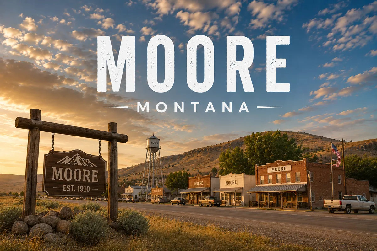
The town sits on US Highway 87 about 15 miles west of Lewistown in central Fergus County. The Big Snowy Mountains rise dramatically to the south. The Judith Basin — one of the most agriculturally productive areas in Montana — surrounds the town in every direction.
The 1915 Moore Woman’s Club and Community Center, the surviving commercial buildings on Main Street, and the abandoned Milwaukee Road grade still tell the story of what Moore was at its peak.
The Jawbone Railroad got its name from the way Richard Harlow — the railroad’s principal builder — talked his way into financing.
The line ran from Lombard (south of Townsend) through Harlowton (named for Harlow himself) and into Lewistown in 1903. Moore was one of dozens of small communities established along the new line.
The town has hung on for over 120 years.
TL;DR
- Moore (~190) is in Fergus County on US Highway 87, 15 miles west of Lewistown.
- Founded 1903 when the Montana Railroad Company (the “Jawbone Railroad“) built its line west from Lewistown.
- Named after Henry D. Moore, who helped finance the railroad construction.
- The Jawbone Railroad was built by Richard Harlow — same person Harlowton was named for.
- By 1908, Moore produced more wheat than any other community in the Judith Basin.
- Peak population approximately 1,200 during the early-20th-century homestead boom.
- The 1915 Moore Woman’s Club and Community Center survives as a homestead-era institution.
- The Milwaukee Road eventually acquired the line; abandoned much of it in 1980.
- Best for: Judith Basin agricultural country, Jawbone Railroad heritage, US-87 corridor stops, central Montana road trips.
Liked this article?
Add Roaming Montana as a preferred source so you see more of our articles and guides on Google.
Moore at a Glance
| Population (estimated) | ~190 |
|---|---|
| County | Fergus County |
| Region | Central Montana (Judith Basin) |
| Elevation | 4,160 ft |
| Distance to Lewistown (county seat) | ~15 miles east on US-87 (~20 min) |
| Distance to Stanford | ~30 miles southwest |
| Distance to Judith Gap | ~40 miles southwest |
| Distance to Grass Range | ~45 miles east |
| Distance to Geraldine | ~60 miles northwest |
| Distance to Hobson | ~5 miles west |
| Founded | 1903 (Jawbone Railroad) |
| Best for | Judith Basin country, Jawbone Railroad heritage, US-87 corridor |
What Makes Moore Different
The story begins with one man’s determination to build a railroad.
Richard Harlow and the Jawbone
Richard Harlow was a Helena lawyer and businessman who wanted to build a railroad through central Montana.
In the 1890s, the Northern Pacific Railroad mainline ran through southern Montana via Billings. The Great Northern crossed the northern part of the state through the Hi-Line. But the Judith Basin — one of the most agriculturally productive regions in the territory — had no direct rail connection.
Harlow set out to build one.
The challenge was financing. Harlow had limited capital and limited investor backing. Through what historical sources describe as relentless personal persuasion (“jawboning”), he gradually assembled the financing needed to build short sections of track.
The colloquial name for the resulting railroad — the Jawbone — stuck. Officially the line was the Montana Railroad Company.
Construction began in 1899. The first section ran from Lombard (south of Townsend on the Missouri River) east through the Musselshell Valley to a planned terminus called Harlowton (named for Harlow himself). Harlowton was reached in 1900.
The push north into the Judith Basin came next. The line reached Lewistown in 1903.
The Founding of Moore
The town of Moore was established along the new Jawbone Railroad line approximately 15 miles west of Lewistown in 1903.
The community was named for Henry D. Moore (also sometimes recorded as D.K. Moore) — one of the financial backers who had supported Richard Harlow’s railroad construction. Naming a station after a major investor was standard practice on early Montana railroads.
Moore developed rapidly.
The first hardware store opened in 1905. The Citizen’s Bank opened the same year. By the late 1910s, the town had grown to approximately 1,200 residents.
Multiple commercial blocks anchored Main Street. Saloons, churches, schools, and the substantive support infrastructure of a working Judith Basin agricultural community filled in around the railroad alignment.
The 1908 Wheat Production Peak
In 1908, Moore reached a remarkable distinction.
The town produced more wheat than any other community in the Judith Basin. The Judith Basin itself was one of Montana’s most productive wheat regions — making Moore briefly one of the most significant grain-shipping points in the state.
The town also had a modern creamery and an ice cream plant — substantive industrial infrastructure for a 1908 farming community.
The Homestead Boom and Bust
The Enlarged Homestead Act of 1909 doubled the standard homestead allotment from 160 to 320 acres for dryland Western lands.
Homesteaders flooded the Judith Basin and surrounding country. Moore’s commercial base expanded to serve them. The Moore Woman’s Club and Community Center — built in 1915 — represents this era of community institutional investment that swept through central Montana railroad towns.
Then came the bust.
The drought of 1917-1924 drove most of the homesteaders off the land. The Great Depression compounded the contraction.
World War II rural depopulation finished the job. Moore’s population fell from 1,200 to a few hundred in roughly two decades. Many of the boom-era buildings were eventually torn down or repurposed.
The Milwaukee Road Era
The Jawbone Railroad — originally the Montana Railroad Company — was acquired by the Chicago, Milwaukee, St. Paul and Pacific Railroad in 1908.
The Milwaukee Road operated the line for the next 72 years. The corridor through Moore connected the Pacific Coast Extension to Lewistown and the broader Fergus County agricultural country.
In 1980, the Milwaukee declared bankruptcy and abandoned much of its western trackage.
But a small portion of the former Jawbone line survives. Central Montana Rail (CMR) — the non-profit short line that preserves rail service for central Montana grain shippers — built five miles of new track near Moore in the late 1980s to augment BNSF and CMR operations. CMR operates a small portion of the legacy alignment to this day.
For broader trip context, see my Montana cities and towns hub and Montana railroads overview.
The Top 6 Things to Do In & Around Moore
1. Moore Woman’s Club and Community Center
The 1915 community building is the town’s most architecturally significant surviving structure.
Built during the homestead boom era as a community institutional anchor, the building still hosts community events and gatherings. Brief stop for photography; verify any interior tour availability.
2. Jawbone Railroad Heritage
The abandoned Milwaukee Road grade runs through Moore parallel to US-87.
A short walking tour reveals the original railroad alignment, surviving railroad-era commercial buildings on Main Street, and the small portion of the line still operated by Central Montana Rail.
See Montana railroads for broader rail context including the Charlie Russell Chew Choo dinner train operating from Kingston Junction near Lewistown on former Jawbone trackage.
3. Judith Basin Wheat Country Drive
The country around Moore is one of Montana’s most productive agricultural regions.
Drive any of the secondary roads near town to see working wheat farms, modern grain handling infrastructure, and the rolling Judith Basin landscape that supported the 1908 production peak.
4. Big Snowy Mountains Day Trip
The Big Snowy Mountains rise dramatically south of Moore.
The range includes Crystal Lake — a popular Forest Service recreation destination with hiking trails and a USFS campground. The Big Snowy Wilderness Study Area protects substantial roadless terrain. Mountain access roads from US-87 lead toward the range.
5. Day Trip to Lewistown (20 minutes east)
The Fergus County seat — the natural urban anchor for any Moore visit.
Attractions include the Central Montana Museum, the Symmes-Wicks House, Big Spring Creek (Blue Ribbon trout water), the Frontier Town historic site, and significantly broader services than Moore can provide.
6. Charlie Russell Chew Choo (from Kingston Junction)
Travelers willing to drive to Kingston Junction (~10 miles northwest of Lewistown) can ride the historic dinner train on former Jawbone Railroad trackage.
The 56-mile round-trip excursion to Denton operates on Central Montana Rail trackage with vintage 1950s Budd Rail Diesel Cars. A substantive railroad heritage experience pairing well with a Moore Jawbone Railroad walking tour.
Where to Stay
Moore has no dedicated lodging.
Most travelers base in Lewistown (20 minutes east).
| Lodging | Vibe | Price | Best For |
|---|---|---|---|
| Lewistown hotels (20 min E) | Full small-city selection | $120–220 | Most travelers |
| Vacation rentals (Judith Basin) | Limited; ranch and farm stays | $130–250 | Hunters, photographers |
| Crystal Lake USFS campground (S) | Big Snowy Mountains | $20–30 | Self-sufficient |
Where to Eat
- Local Moore cafes and bar — verify current operations
- Lewistown dining (20 min E) — full restaurant variety
Getting There & Around
From Lewistown: 15 miles west on US-87, about 20 minutes.
From Stanford: 30 miles east via MT-200 then north on US-87, about 45 minutes.
From Judith Gap: 40 miles northeast via US-191 to US-87, about 50 minutes.
From Grass Range: 45 miles west on US-87, about 55 minutes.
From Great Falls: ~95 miles east via US-87, about 1.75 hours.
Cell service: Generally available in Moore and along US-87. Reduced on the surrounding rural roads.
When to Visit
Summer (June-August): Best driving conditions; warmest weather; Judith Basin wheat country at peak visual character.
Fall (September-October): Harvest season; outstanding light over the wheat fields; cooler temperatures.
Winter (November-March): Severe central Montana weather possible; town quieter.
Spring (April-May): Quieter shoulder season; the prairie greens up; calving activity on the ranches.
Personal Tips
Stop at the Moore Woman’s Club building. The 1915 community center is one of the more architecturally substantive small-town homestead-era buildings in central Montana.
Read about the Jawbone Railroad. Richard Harlow’s relentless financing campaign that built the Montana Railroad Company is one of the more colorful early Montana business stories. Understanding the Jawbone gives substantive context to every small-town visit between Lombard and Lewistown.
Combine Moore with the Chew Choo. A morning Moore visit followed by an afternoon Kingston Junction dinner train ride makes a strong Jawbone Railroad heritage day.
Day trip from Lewistown. Use Lewistown 20 minutes east as your operational base. Moore has minimal services; Lewistown has full hotels, restaurants, and infrastructure.
Photograph the Big Snowy Mountains. The range rises dramatically south of Moore. Early morning and late afternoon produce particularly substantive light. Crystal Lake area is the most accessible mountain destination.
Don’t expect tourism amenities. Moore is a 190-person working agricultural community. The historic Woman’s Club, the surviving Main Street buildings, and the broader Judith Basin context are the substantive attractions.
Moore Quick Facts
| Population (estimated) | ~190 | | Peak population | ~1,200 (early 1900s) | | Town founded | 1903 (Jawbone Railroad) | | Named for | Henry D. Moore (railroad financier) | | Railroad | Montana Railroad Company (“the Jawbone”) | | Jawbone Railroad built by | Richard Harlow (1899-1903) | | Citizen’s Bank opened | 1905 | | First hardware store opened | 1905 | | Top wheat producer in Judith Basin | 1908 | | Modern creamery and ice cream plant | 1908 | | Moore Woman’s Club and Community Center built | 1915 | | Jawbone Railroad acquired by Milwaukee Road | 1908 | | Milwaukee Road abandonment | 1980 | | CMR new track near Moore built | Late 1980s (5 miles) | | Elevation | 4,160 ft | | Town area | 0.29 square miles | | Average summer high | 80°F | | Average winter low | 5°F |
Conclusion
Moore is a 190-person Fergus County town that briefly anchored one of Montana’s most productive wheat regions.
The 1903 founding by Richard Harlow’s Jawbone Railroad. The 1908 peak when Moore produced more wheat than any other Judith Basin community.
The early-1900s population peak around 1,200. The 1915 Moore Woman’s Club and Community Center. The contemporary 190-resident contraction. All of it adds up to a substantively interesting Montana small-town story.
The Big Snowy Mountains rise to the south. The Judith Basin agricultural country surrounds the town. The next time you’re driving US-87 between Lewistown and Great Falls, take 15 minutes.
Have a Moore question? Drop it in the comments — I read every one.
Frequently Asked Questions
Is Moore Montana worth visiting?
Moore is worth a brief stop primarily for the 1915 Moore Woman’s Club and Community Center (one of the more architecturally substantive homestead-era community buildings in central Montana), the surviving Main Street commercial buildings from the early-20th-century peak, and the broader Jawbone Railroad heritage that defines Moore’s founding story. The town also offers Judith Basin agricultural country exploration and Big Snowy Mountains access via short drives.
Who is Moore Montana named after?
Moore is named after Henry D. Moore (also sometimes recorded as D.K. Moore), one of the financial backers who supported Richard Harlow’s construction of the Montana Railroad Company — colloquially known as the “Jawbone Railroad.” The town was established in 1903 when the Jawbone reached the area on its push from Harlowton north to Lewistown. Naming a station after a major investor was standard practice on early Montana railroads.
When was Moore Montana founded?
Moore was founded in 1903 when the Montana Railroad Company (the “Jawbone Railroad”) built through the area on its line from Harlowton to Lewistown. The town was platted, named after railroad financier Henry D. Moore, and began rapid development to serve homesteaders moving into the surrounding Judith Basin agricultural country. The first hardware store and Citizen’s Bank both opened in 1905. By 1908, Moore was producing more wheat than any other community in the Judith Basin.
What was the Jawbone Railroad?
The Jawbone Railroad was the colloquial name for the Montana Railroad Company, built by Helena lawyer and businessman Richard Harlow between 1899 and 1903. The “Jawbone” nickname derived from Harlow’s reputation for relentless personal persuasion (“jawboning”) to assemble financing for the line. The railroad ran from Lombard (south of Townsend) through the Musselshell Valley to Harlowton (which was named after Harlow himself) and then north into the Judith Basin to Lewistown. Moore, Montana was established along the line in 1903. The Chicago, Milwaukee, St. Paul and Pacific Railroad acquired the Jawbone in 1908 and operated it as part of its Pacific Coast Extension until the railroad’s 1980 western abandonment. A small portion of the former Jawbone trackage near Moore is still operated by Central Montana Rail.
How big is Moore Montana?
Moore has approximately 190 year-round residents. The town covers approximately 0.29 square miles in central Fergus County. At its early-20th-century peak during the homestead boom, Moore had approximately 1,200 residents.
How far is Moore from Lewistown Montana?
Moore is approximately 15 miles west of Lewistown (the Fergus County seat) on US Highway 87 — about a 20-minute drive. Lewistown serves as the practical urban anchor for any Moore visit, with hotels, restaurants, and the Central Montana Museum.
What is the Moore Woman’s Club and Community Center?
The Moore Woman’s Club and Community Center is a 1915 community building in Moore, Montana. The structure represents the early-20th-century institutional investment that swept through central Montana railroad towns during the homesteading boom. The building still hosts community events and is one of the most architecturally substantive surviving small-town homestead-era community centers in central Montana. Many similar rural club buildings across Montana date to the same 1910s decade.