The Bear Paw Mountains don’t announce themselves from a distance the way the Rockies do. Driving east from Havre on US-2, they emerge gradually — a low blue silhouette that solidifies over miles into something substantial.
By the time you reach Big Sandy, the Bears Paw are clearly visible to the south, rising about 6,000 feet from the Hi-Line wheat country.
C.M. Russell — the cowboy artist whose paintings defined the romantic image of Montana for the world — hunted elk in the Bear Paw Mountains regularly in the 1890s and 1900s.
He called this stretch of the Hi-Line some of the finest hunting country in the West. Standing on Big Sandy’s main street looking south at those mountains, it’s easy to understand what he meant.
TL;DR
- Big Sandy (~575) is a Hi-Line community in Chouteau County on US-87, between Havre (40 miles west) and Fort Benton (50 miles south).
- The Bear Paw Mountains — visible south of town — were C.M. Russell’s favorite hunting country and rise above 6,000 feet from the surrounding wheat plains.
- The Big Sandy Museum covers the Hi-Line homestead era with genuine regional depth.
- The town sits in the Lonesome Prairie — one of the most genuinely remote agricultural landscapes in Montana.
- Best for: Hi-Line road trippers, Bear Paw Mountains gateway, authentic north-central Montana agricultural character.
Liked this article?
Add Roaming Montana as a preferred source so you see more of our articles and guides on Google.
Big Sandy at a Glance
| Population (2020) | ~575 |
|---|---|
| County | Chouteau County |
| Region | North-Central Montana (Hi-Line) |
| Elevation | 2,715 ft |
| Distance to Havre | ~40 miles west (~45 min) |
| Distance to Fort Benton | ~50 miles south (~1 hour) |
| Distance to Chinook | ~65 miles east (~1.25 hours) |
| Distance to Great Falls | ~100 miles south (~1.75 hours) |
| Best for | Hi-Line character, Bear Paw Mountains access, C.M. Russell country, authentic prairie Montana |
What Makes Big Sandy Different
Big Sandy occupies a specific geographic position that gives it a character different from most Hi-Line towns. It’s not on the main US-2 corridor — it’s on US-87, the highway that angles southeast from Havre toward Great Falls, cutting through the interior of north-central Montana. This positioning means fewer passing travelers and a more genuinely local character.
The Bear Paw Mountains — formally the Bears Paw Mountains — are the visual anchor. At their highest point (around 6,910 feet at Baldy Mountain), they rise dramatically from surrounding plains that sit at 2,500–3,000 feet elevation.
The mountain-to-plains visual contrast from Big Sandy is striking, and the mountains themselves contain National Forest land with excellent hiking and hunting access.
C.M. Russell’s connection to this country is real and significant. Russell based himself in Great Falls, but his hunting trips took him north and east into exactly this terrain.
His paintings of elk hunts, wolf runs, and Bear Paw Mountain country drew from firsthand experience in these landscapes. The C.M. Russell Museum in Great Falls is the definitive destination for Russell’s work, but understanding that he hunted these mountains gives the Big Sandy landscape an artistic layer.
The Lonesome Prairie landscape south of Big Sandy — along US-87 toward Fort Benton — is one of the finest stretches of unbroken prairie in Montana. The Missouri River Breaks begin southeast of Fort Benton, and the approaching transition from wheat country to river breaks is visible driving south from Big Sandy.
For broader trip context, see my Montana cities and towns hub.
The Top 10 Things to Do In & Around Big Sandy
1. Bear Paw Mountains Hiking & Wildlife (South of Havre via US-87)
The Bear Paw Mountains — Rocky Mountain-style terrain rising from the Hi-Line plains — contain Havre-Ranger District of the Lewis and Clark National Forest.
Access roads lead south from US-2 near Havre and from county roads east of Big Sandy. Elk, mule deer, black bears, and significant raptors including golden eagles inhabit the mountains. The Rocky Boy’s Reservation occupies the eastern Bear Paw Mountains — access requires respect for tribal boundaries.
2. Big Sandy Museum
The town’s regional history museum, covering Chouteau County’s homestead era, the Great Northern Railroad’s role in Hi-Line settlement, and the agricultural evolution from early dryland farming to modern wheat production. The museum preserves photographs and artifacts from the 1910s–1920s homestead era that shaped the region.
3. Hi-Line Character Walk (Downtown Big Sandy)
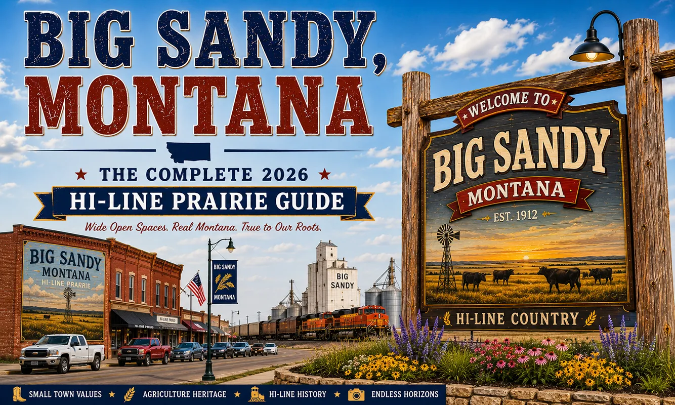
Big Sandy’s compact downtown preserves the architectural character of 1910s–1920s Hi-Line commercial development — false-front buildings, brick storefronts, and the grain elevator complex that dominates the town’s eastern edge. The grain elevators are as significant to Hi-Line town identity as any other structure; they represent the economic force that made these communities viable.
4. Drive US-87 South to Fort Benton (50 minutes)
One of Montana’s most scenic and least-known highway drives — US-87 from Big Sandy toward Fort Benton passes through deep prairie country transitioning toward the Missouri River. Grain fields give way to breaks country south of Fort Benton.
The Chouteau County landscape is classic northern Montana — enormous sky, rolling wheat, and occasional coulees cutting down toward the river.
5. Fort Benton Day Trip (50 miles south)
The “Birthplace of Montana” and the upper limit of Missouri River steamboat navigation — the Lewis and Clark Expedition’s river route, the fur trade’s primary artery, and a beautifully preserved frontier city. The Museum of the Northern Great Plains and the Museum of the Upper Missouri are both excellent. See Fort Benton guide.
6. Havre Day Trip (40 miles west)
Havre Beneath the Streets, Fort Assinniboine, Bear Paw Battlefield access from Havre, and the Hi-Line’s largest city. See Havre guide.
7. Chinook & Bear Paw Battlefield (65 miles east)
The Blaine County Museum and Bear Paw Battlefield National Monument — where Chief Joseph surrendered. See Chinook guide.
8. Lonesome Prairie Photography
The Hi-Line between Big Sandy and Fort Benton is one of Montana’s finest landscapes for prairie photography. Enormous skies, geometric grain fields, abandoned homestead structures, and grain elevators at regular intervals — the light in early morning and late afternoon is extraordinary.
9. Pheasant Hunting (Fall Season)
The creek bottoms and CRP (Conservation Reserve Program) fields around Big Sandy are productive pheasant habitat in fall. Permission-based hunting on private land; some public land hunting access via Chouteau County.
10. Annual Big Sandy Rodeo
Big Sandy’s summer rodeo — a community event drawing participants and spectators from across Chouteau County. Authentic northern Montana ranch culture rather than a tourist-oriented event.
Where to Stay
Big Sandy has limited lodging — the town serves primarily local agricultural commerce rather than tourism. Most travelers use Havre or Fort Benton as overnight bases.
| Hotel | Vibe | Price | Best For |
|---|---|---|---|
| Big Sandy Motel | Local, basic | $80–120 | Most travelers |
| Havre motels (40 min west) | Full range | $100–180 | More variety |
| Fort Benton lodging (50 min south) | Historic character | $110–180 | History focus |
Where to Eat
The dining scene in Big Sandy is minimal by design — this is an agricultural service town, not a food destination.
- Sagebrush Café — Big Sandy’s main restaurant; reliable home-cooked meals
- The Stockman Bar — community gathering place for lunch and dinner; bar food
- Simple Fare Bakery — morning pastries and coffee (verify current hours)
- Fort Benton dining (50 min) for a better dinner selection
Getting There & Around
From Havre: 40 miles east on US-2, then south on US-87, about 45 minutes.
From Fort Benton: 50 miles north on US-87, about 1 hour through Chouteau County farmland.
From Great Falls: ~100 miles north via US-87, about 1.75 hours.
From Chinook: ~65 miles west on US-2 and south on US-87, about 1.25 hours.
By car: Big Sandy is car-only. No public transportation. Plan fuel and supplies before extended backcountry exploration.
Cell service: Variable. Download offline maps.
What Big Sandy Unlocks
Fort Benton (50 min south)
The Lewis and Clark Expedition’s river landmark, fur trade history, and one of Montana’s most beautifully preserved frontier cities. See Fort Benton guide.
Bear Paw Mountains (via Havre access, 45 min west then south)
National Forest hiking, elk and deer hunting, spectacular isolated mountain terrain.
Havre (40 min west)
Hi-Line’s largest city, Havre Beneath the Streets, Fort Assinniboine. See Havre guide.
Bear Paw Battlefield (65 min east via Chinook)
Chief Joseph’s surrender site. See Chinook guide.
C.M. Russell Museum (Great Falls, 1.75 hours south)
The definitive collection of C.M. Russell’s paintings and sculptures. See Great Falls guide.
When to Visit
Summer (June–August): Best weather for driving US-87 and exploring the Bear Paw Mountains. Big Sandy Museum operating at full hours. Rodeo in summer.
Fall (September–October): Wheat harvest visible across Chouteau County — combines working the fields are one of the Hi-Line’s most impressive sights. Pheasant hunting season begins. Elk hunting in the Bear Paw Mountains.
Spring (April–May): Prairie wildflowers, early green wheat, enormous migrating flocks of waterfowl moving through the Hi-Line corridor.
Winter: Cold, quiet. US-87 is plowed and reliable but ranch communities operate at reduced services.
Personal Tips
Drive US-87 to Fort Benton rather than US-2. Most Hi-Line travelers stay on US-2 all the way. The US-87 route from Big Sandy to Fort Benton cuts through a more interior section of north-central Montana that’s quieter and more scenic than the main highway.
The grain elevators tell Big Sandy’s story. The complex of elevator towers visible from the highway is the town’s real monument — they represent the agricultural economy that has sustained the community for a century. Understanding what they do (receiving, cleaning, storing, and shipping wheat by rail) contextualizes everything else.
Bear Paw Mountains need more time than a day. Plan an overnight in Havre or a base camp in the national forest if you want to seriously hike or hunt. A day drive through the mountains is fine, but the backcountry deserves more.
Call ahead for restaurant hours. Small Hi-Line restaurants often have irregular hours and may close without notice for agricultural events, holidays, or lack of staff. A quick phone call prevents a hungry arrival.
Light quality on the Hi-Line. The northern Montana plains have extraordinary photographic light in the hour before sunset — flat terrain, no obstructions, and the last light hitting the grain elevators and wheat fields with rich color. Worth timing a US-87 drive for late afternoon.
Big Sandy Quick Facts
| Founded | 1880s (ranching) |
|---|---|
| Named for | Big Sandy Creek |
| County | Chouteau County |
| Bear Paw Mountains | Peak elevation ~6,910 ft (Baldy Mountain) |
| C.M. Russell | Hunted elk in the Bear Paws regularly 1890s–1900s |
| Average summer high | 84°F |
| Average winter low | 0°F |
Conclusion
Big Sandy is the Hi-Line at its most unmediated — an agricultural service town in the middle of north-central Montana’s wheat country, with the Bear Paw Mountains to the south and enormous open sky in every direction.
C.M. Russell hunted these mountains and painted this landscape. Fort Benton’s extraordinary frontier history is 50 miles down US-87. For travelers who want the authentic Hi-Line experience without the larger-city context of Havre, Big Sandy is where you actually see it.
Have a Big Sandy question? Drop it in the comments — I read every one.
Frequently Asked Questions
Is Big Sandy Montana worth visiting?
Worth a stop for US-87 travelers between Havre and Fort Benton, and for anyone interested in Bear Paw Mountains access or the authentic Hi-Line agricultural landscape. The Big Sandy Museum provides good regional context; the drive through the Chouteau County wheat country toward Fort Benton is excellent.
What are the Bear Paw Mountains near Big Sandy?
The Bear Paw Mountains (formally Bears Paw Mountains) are an isolated mountain range rising to approximately 6,910 feet south and east of Big Sandy. They contain National Forest land with hiking and hunting access, and were a favorite hunting destination of artist C.M. Russell in the 1890s and 1900s. The eastern portion of the Bear Paw Mountains is within the Rocky Boy’s Reservation.
How far is Big Sandy from Havre Montana?
Big Sandy is approximately 40 miles east of Havre — about a 45-minute drive on US-2 and US-87. Havre is the Hi-Line’s largest city and provides full hotel and dining options.
How far is Big Sandy from Fort Benton?
Big Sandy is approximately 50 miles north of Fort Benton on US-87 — about a 1-hour drive through Chouteau County farmland. Fort Benton is one of Montana’s most historically significant small cities — the upper limit of Missouri River steamboat navigation and a major Lewis and Clark trail site.
Was C.M. Russell connected to Big Sandy Montana?
Yes — while C.M. Russell was based in Great Falls, he hunted elk and other game in the Bear Paw Mountains south of Big Sandy throughout the 1890s and 1900s. He referenced this country in his paintings of Montana wildlife and hunting scenes. The C.M. Russell Museum in Great Falls holds the definitive collection of his work.