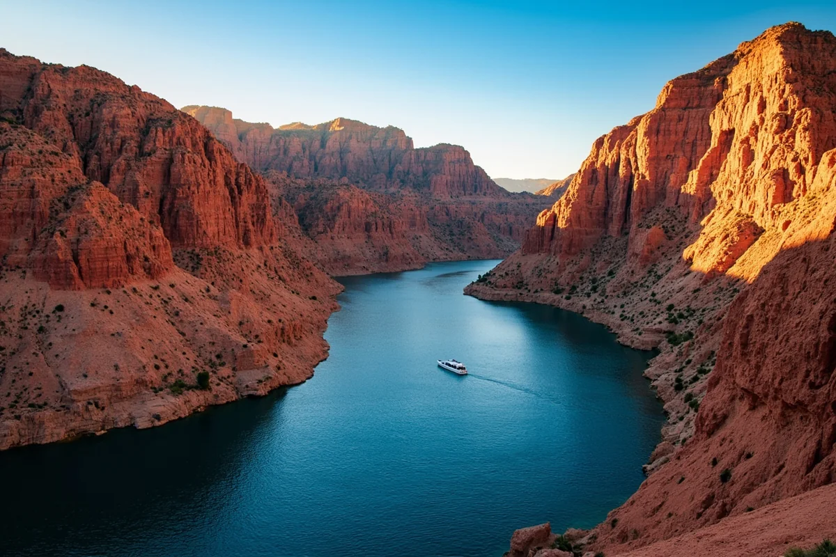
I’ve had visitors tell me there’s nothing worth seeing in Montana once you’re out of the mountains, and then I bring them to a canyon 1,000 feet deep that most of them never knew existed.
- Bighorn Lake sits inside Bighorn Canyon National Recreation Area, straddling the Montana-Wyoming border south of Hardin
- The lake winds through a limestone canyon running up to 1,000 feet deep in places, with genuinely underrated fishing — trout in the tailwater sections, walleye and warm-water species further into the reservoir
- This guide covers both districts, boat access, fishing by section, and why this belongs on any Little Bighorn Battlefield loop itinerary
- Formed by Yellowtail Dam in the 1960s, named for Crow tribal chairman Robert Yellowtail
Liked this article?
Add Roaming Montana as a preferred source so you see more of our articles and guides on Google.
The Lake Most Southeastern Montana Loops Skip
I recommend Bighorn Lake more often than almost anywhere else in this guide to visitors doing a southeastern Montana loop who assume the mountains are behind them and there’s nothing left worth a detour. That assumption is exactly backwards.
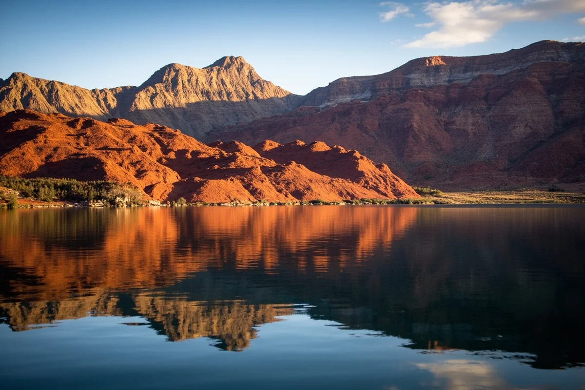
Bighorn Canyon National Recreation Area is the third largest canyon in America, and it delivers a genuinely different kind of Montana scenery than anywhere else in this collection — dramatic limestone walls rising straight from blue water, in a landscape that feels considerably more like the desert Southwest than anything most visitors associate with this state.
How Yellowtail Dam Created This Lake
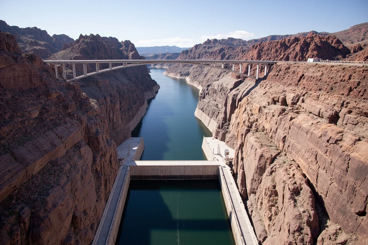
Bighorn Lake exists because of Yellowtail Dam, a 525-foot concrete arch structure completed in 1965-67 on the Bighorn River near Fort Smith.
The dam is named after Robert Yellowtail, a Crow tribal chairman who spent his life fighting for the rights of the Crow people and helped shape the Crow Act of 1920, which protects Crow tribal lands from being taken away.
I think this history matters for understanding the lake’s context. The project emerged from genuine negotiation, and at times deep division, within the Crow Tribe over whether and how to lease or sell reservation land to the federal government.
Much of the reservoir that resulted, extending upstream into Wyoming, sits within the Crow Indian Reservation itself.
Two Districts, No Road Between Them
This is a detail that trips up first-time visitors more than anything else about this park: Bighorn Canyon National Recreation Area splits into two separate districts, and there’s no through road connecting them. The North District is accessed via Fort Smith, Montana; the South District via Lovell, Wyoming.
I’d plan your visit around one district or the other rather than assuming you can easily see both on the same day. If you’re coming from the Montana side specifically, Fort Smith and the North District are your realistic option unless you’re prepared for a considerably longer drive around to reach Wyoming’s side.
Bighorn Lake by the Numbers
The lake stretches approximately 70 to 72 miles at full pool, with about 55 miles of that length lying within the recreation area itself — the rest extends further upstream into Wyoming. Surface area runs around 17,300 acres at normal storage, and the reservoir holds a capacity of over 1.38 million acre-feet of water.
I’d note that water levels here have been a genuine point of tension between Montana and Wyoming over the years, with disagreements about how much water to hold back for boating and recreation versus how much to release to maintain the trout fishery downstream.
Fishing Bighorn Lake and Below the Dam
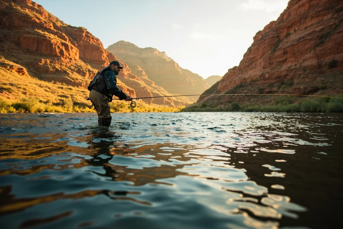
This is where I think Bighorn genuinely earns the “underrated” label I give it. Below Yellowtail Dam and the Afterbay Dam that regulates its output, the Bighorn River transforms into one of Montana’s premier tailwater trout fisheries.
The National Park Service has documented between 8,000 and 11,000 trout per mile on the most heavily fished stretch below Afterbay Dam, a genuinely remarkable density for any river in the state.
Within the lake itself, south of the dam, the character shifts to warm-water species. Montana Fish, Wildlife and Parks manages the reservoir as a walleye fishery, and you’ll also find smallmouth and largemouth bass, channel catfish, sauger, crappie, yellow perch, and shovelnose sturgeon.
Afterbay Lake, the smaller body of water between the two dams, offers good rainbow trout fishing and reliable wildlife viewing for ducks and geese.
I’d fish the river below the dams if trout are your priority, and the reservoir itself if you’re after walleye or bass. To fish anywhere in Montana, you’ll need a fishing license, a conservation license, and an AIS Prevention Pass.
Boating on Bighorn Lake
Two marinas serve the recreation area: Ok-A-Beh Marina in the North District, open daily from Memorial Day to Labor Day, and Horseshoe Bend Marina in the South District. Pontoon boat rentals are available at Ok-A-Beh, running roughly 8 a.m. to 6:30 p.m. for a full day or split into half-day blocks [verify current rental rates and hours].
Motorboats, kayaks, canoes, stand-up paddleboards, and most personal watercraft are all permitted, provided they carry required state inspections and Aquatic Invasive Species decals.
I’d factor in the required boat registration and AIS inspection before you arrive, since these checks are taken seriously here given how catastrophic an invasive species introduction would be to this water system.
The National Park Service also runs free guided kayaking tours during summer, covering paddling technique, self-rescue from a capsized kayak, and general safety, offered first-come, first-served. I’d call ahead to register given the free, limited-availability nature of these tours.
Camping in Bighorn Canyon
Seven designated campgrounds exist across the recreation area, four of which are drive-in and open year-round. Afterbay Campground, the only North District site with direct vehicle access, sits right next to Afterbay Lake between the two dams.
For a genuinely different experience, Black Canyon and the Day Board Nine campground are accessible only by boat, both located south of Ok-A-Beh Marina within the canyon itself.
I’ve stayed at one of these boat-in sites specifically for the novelty of waking up with canyon walls rising directly from the water on both sides, a genuinely different camping experience from anything else in this guide.
Wildlife at Bighorn Canyon
The recreation area spans five distinct climate zones, from high desert to alpine, supporting a genuinely wide range of wildlife as a result. Bighorn sheep, for which both the canyon and the lake are named, live here alongside black bears, mule deer, mountain lions, pronghorn, coyotes, beavers, and marmots.
The black-tailed prairie dog and swift fox, both Montana Species of Concern, inhabit the North District specifically. I’d bring binoculars regardless of your main reason for visiting, since casual wildlife spotting here has consistently exceeded my expectations.
Combining Bighorn Lake With a Battlefield Loop
I mentioned this at the top, and I want to emphasize it again: Bighorn Lake is the stop I recommend most often to visitors doing the Little Bighorn Battlefield and broader southeastern Montana loop who assume there’s nothing left worth a detour once they’re out of the mountains near Hardin.
The drive out to Fort Smith adds real time to a loop like this, but the payoff — a genuine canyon landscape unlike anything else on a typical Montana itinerary — justifies it.
The Junior Ranger Program
For families traveling with kids, Bighorn Canyon runs a genuinely solid Junior Ranger Program. Booklets are available at the visitor centers in both Lovell, Wyoming and Fort Smith, Montana, along with the Crooked Creek and Afterbay contact stations.
Completed booklets earn an official Junior Ranger badge, and I’ve watched this program hold kids’ attention through what could otherwise be a long, remote drive with limited other entertainment options.
Personal Tips / What I Wish I Knew
Pick one district and commit to it. I’ve seen visitors assume they can casually see both North and South districts in a day, not realizing there’s no through road connecting them.
Fish the tailwater if trout are your priority. The stretch below Afterbay Dam genuinely lives up to its “world class” reputation, with fish density that’s hard to find anywhere else in the state.
Register early for the free kayak tours. They’re first-come, first-served and genuinely popular given the price point of free.
Build real time into a Little Bighorn Battlefield loop for this detour. I’d treat Bighorn Lake as a full half-day addition at minimum, not a quick five-minute stop, and I’d apply standard bear-aware practices here as anywhere else in this part of the state — see my Montana bear guide for the specifics. For general trip timing, my best time to visit Montana guide rounds out your planning for this less-visited corner of the state.
Practical Info: Bighorn Lake
| Length | About 70–72 miles at full pool; roughly 55 miles within the recreation area |
| Surface area | Approximately 17,300 acres at normal storage |
| Districts | North (Fort Smith, MT) and South (Lovell, WY) — no connecting road |
| Fishing | World-class trout tailwater below the dams; walleye, bass, and warm-water species in the lake |
| Marinas | Ok-A-Beh (North, Memorial Day–Labor Day) and Horseshoe Bend (South) |
| Camping | 7 campgrounds; 4 drive-in year-round, 2 boat-in only |
Frequently Asked Questions
Where is Bighorn Lake?
Inside Bighorn Canyon National Recreation Area, straddling the Montana-Wyoming border, accessed via Fort Smith, Montana on the north side or Lovell, Wyoming on the south side.
Can you drive between the North and South districts?
No, there’s no through road connecting them inside the recreation area — you’ll need to plan around visiting one district or drive a considerably longer route around to reach the other.
Is the fishing at Bighorn Lake actually good?
Yes, genuinely underrated — the tailwater below Yellowtail and Afterbay dams holds between 8,000 and 11,000 trout per mile on its most fished stretch, while the reservoir itself supports a managed walleye fishery.
Who was Yellowtail Dam named after?
Robert Yellowtail, a Crow tribal chairman who spent his life advocating for Crow tribal rights and helped shape the Crow Act of 1920.
How deep is Bighorn Canyon?
Up to 1,000 feet deep in places, making it one of the most dramatic canyon landscapes anywhere in Montana.
The Drive Out and What to Expect
Getting to Fort Smith means leaving the interstate behind for a genuinely rural stretch of southeastern Montana highway. I’d fill up on gas before making this drive, since services thin out considerably once you’re off the main routes near Hardin.
The landscape itself changes noticeably as you approach the canyon, shifting from open ranch land into the more dramatic, eroded terrain that surrounds Bighorn Canyon.
I’ve made this drive at both midday and near sunset, and I’d genuinely recommend timing your arrival for late afternoon if photography matters to your trip — the canyon’s warm-toned rock takes on considerably richer color in that lower, more angled light.
Visitor Centers and Getting Oriented
The Yellowtail Dam Visitor Center near Fort Smith has experienced closures in the past, including to its access road, so I’d check current status before planning around it specifically [verify current Yellowtail Dam Visitor Center hours and access].
The Cal S. Taggart Visitor Center in Lovell, Wyoming operates year-round and serves as a reliable starting point if you’re approaching from the South District instead.
I’d stop at whichever visitor center serves your chosen district first, both for current conditions information and for a genuinely useful overview of the recreation area’s layout before heading further in.
A Genuinely Remote Feeling, Even This Close to Billings
Despite sitting only about 40 miles south of Billings as the crow flies, Bighorn Lake delivers a level of solitude that surprises most first-time visitors. I think this comes down to the recreation area’s relative obscurity compared to Montana’s more famous national parks, combined with the genuine effort required to reach either district.
I’ve spent full afternoons on this lake without seeing more than a handful of other boats, a experience that’s increasingly hard to find at Montana’s better-known destinations during peak season.
Final Thoughts
Bighorn Lake proves that Montana’s best scenery doesn’t end at the edge of the mountains. Between the canyon’s genuine scale, a tailwater fishery that rivals anything in the state, and a history tied directly to Crow tribal leadership, this is one of the more underrated stops in this entire guide.
For the nearest town hub, see my Hardin guide, or check out the complete guide to Montana’s best lakes for the rest of the state. For the nearest major city, my Billings guide covers services and lodging if you’d rather base your trip there.
For the Crow Nation history tied to this dam and canyon, my Montana history guide provides useful context, and for wildlife-watching planning, my Montana bird species guide covers what else to look for during your visit.