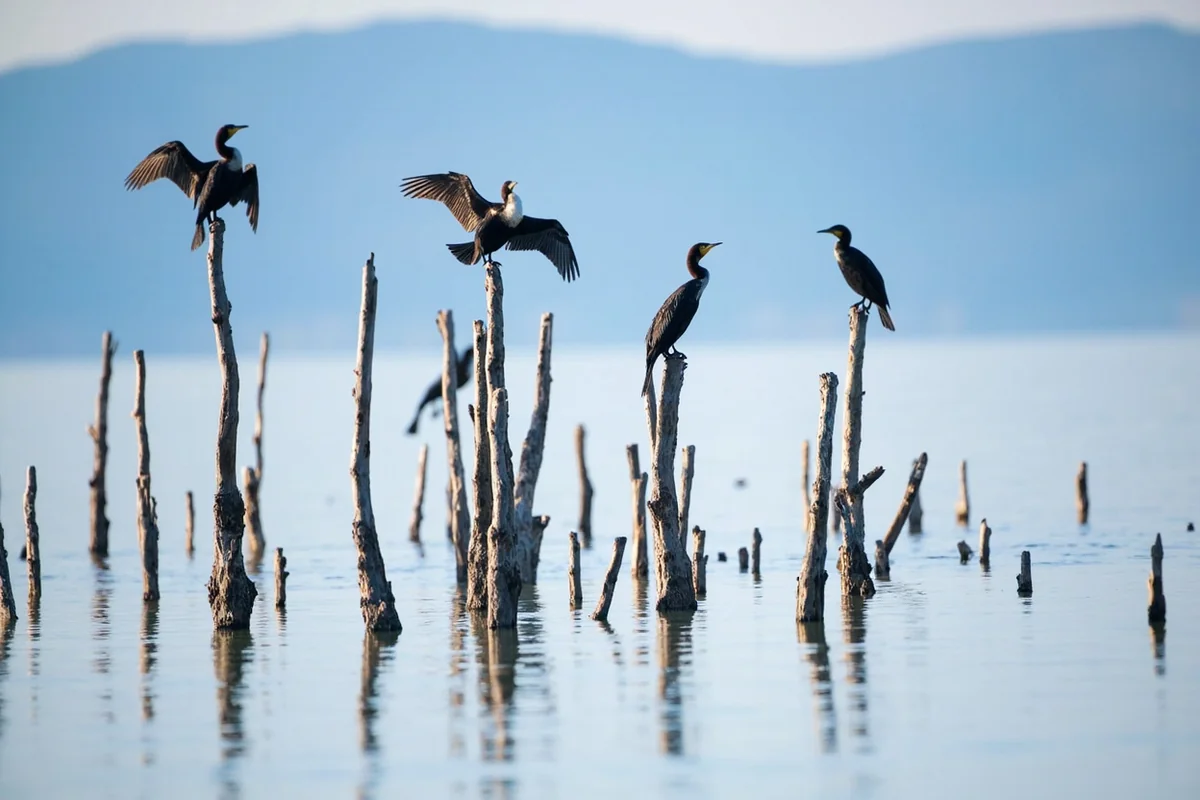
Cormorants still perch on dead tree snags jutting out of this lake, more than 65 years after those trees drowned overnight.
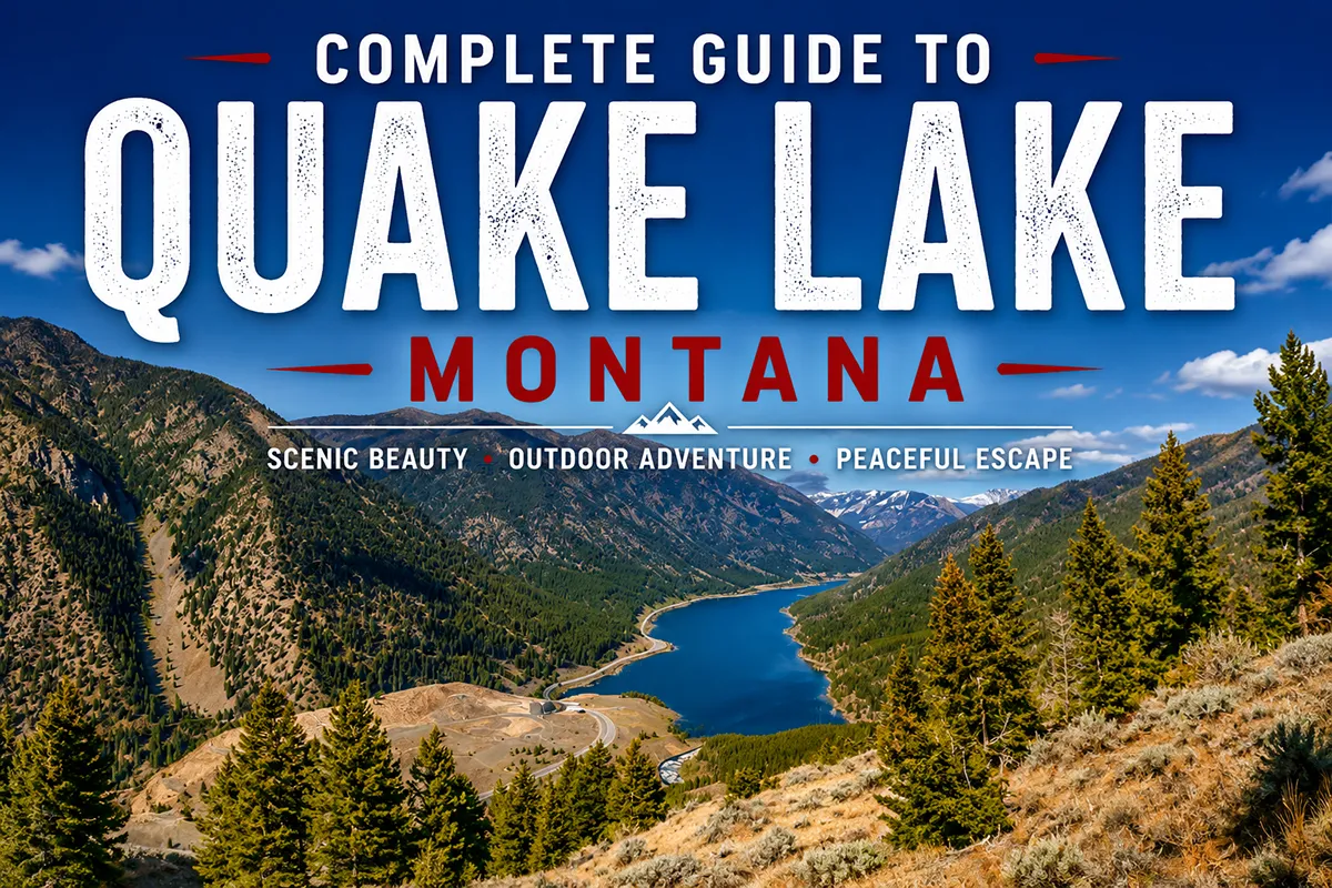
- Quake Lake formed in less than a month in August 1959, after an earthquake triggered an 80-million-ton landslide that blocked the Madison River
- It’s about 24 miles from West Yellowstone on Highway 287, roughly 6 miles long and up to 190 feet deep depending on the source
- This guide covers the Earthquake Lake Visitor Center, the eerie “tree cemetery” fishing conditions, boating hazards, and nearby trails
- A memorial boulder near the visitor center lists the names of the 28 people who died the night this lake was born
Liked this article?
Add Roaming Montana as a preferred source so you see more of our articles and guides on Google.
The Night This Lake Was Born
At 11:37 p.m. on August 17, 1959, the largest earthquake in Montana’s recorded history struck near Hebgen Lake. Roughly 80 million tons of rock broke loose from Sheep Mountain and slid across the Madison River canyon at an estimated 100 miles per hour.
The slide blocked the river completely, and within less than a month, rising water had created what’s now called Quake Lake. Twenty-eight people died that night, most of them campers along the river below Hebgen Dam, caught between the dam upstream and the new landslide dam downstream.
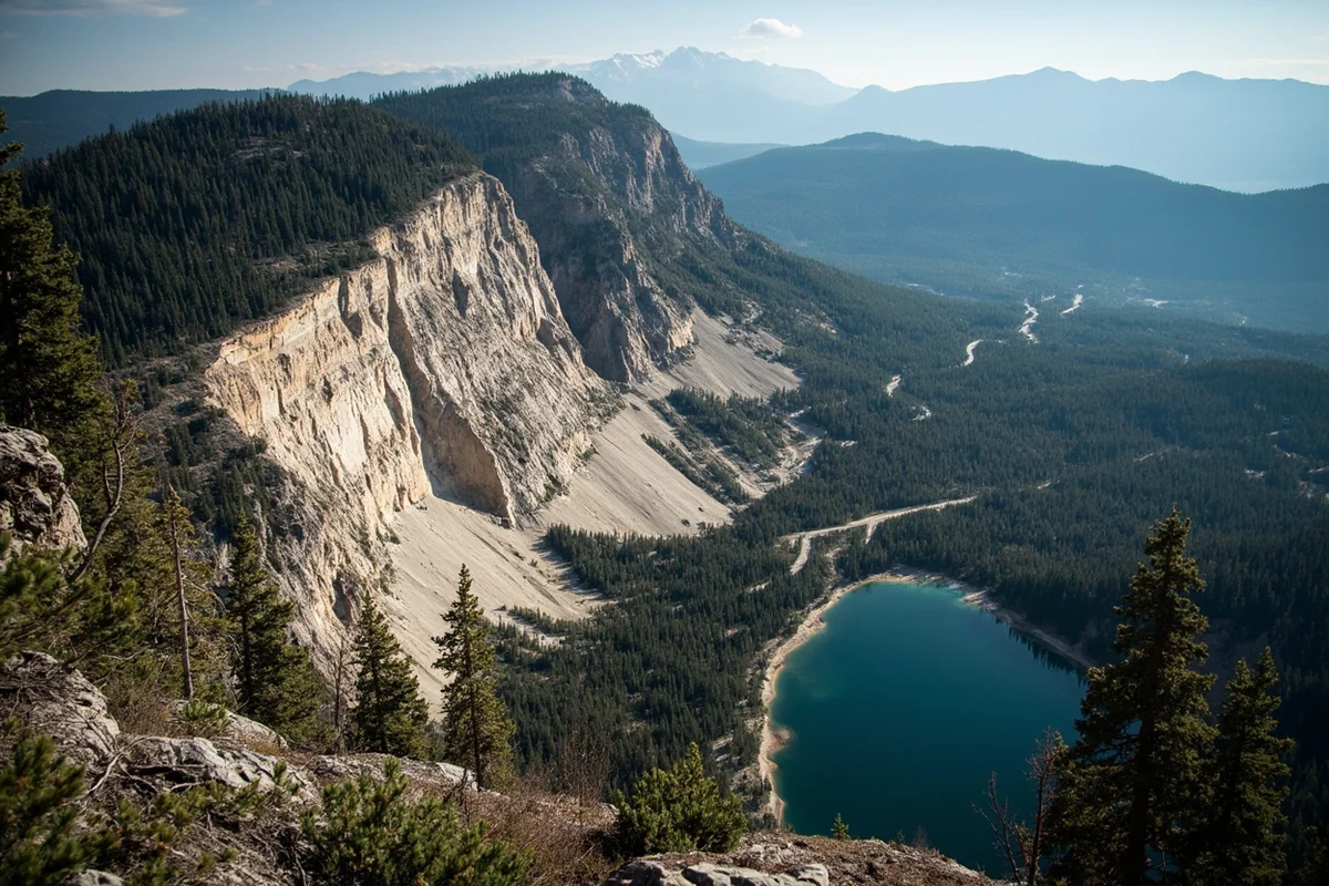
I’ve driven Highway 287 through this canyon more times than I can count, and the scar the landslide left on the mountainside is still clearly visible today. It’s one of the more sobering pieces of scenery in the entire state.
The Race to Build a Spillway
With the Madison River completely blocked and water rising fast, the U.S. Army Corps of Engineers launched one of the largest emergency mobilizations in the western United States at the time. Water was rising by as much as nine feet a day.
Engineers raced to cut a spillway through the landslide debris before the natural dam could fail catastrophically and flood the valley below. They finished in just 22 days, an achievement that still strikes me as remarkable given the terrain and the scale of the slide they were cutting through.
The Earthquake Lake Visitor Center
The U.S. Forest Service opened this center in 1967, and it now welcomes more than 50,000 visitors annually. It sits 27 miles northwest of West Yellowstone along Highway 287, positioned to give panoramic views across the exact terrain where the mountain fell and the lake formed.
Inside, exhibits cover the earthquake’s science, the rescue efforts, and the human stories of that night. Outside, a road tour lets you get close to some of the boulders the landslide hurled across the canyon, including one marked with a memorial plaque.
The visitor center typically operates from Memorial Day through mid-September, roughly 10 a.m. to 5 p.m. [verify current hours and seasonal dates before visiting].
The Memorial Boulder
Near the visitor center, Memorial Boulder carries a plaque listing the names of the 28 people who died in the earthquake and landslide. I’d recommend stopping here even if you’re short on time elsewhere along the drive.
Reading actual names rather than just a casualty count changes how the whole site lands. This wasn’t an abstract geological event — it was a specific tragedy that happened to specific families camping along this exact stretch of river on an ordinary August night.
Fishing the Tree Cemetery
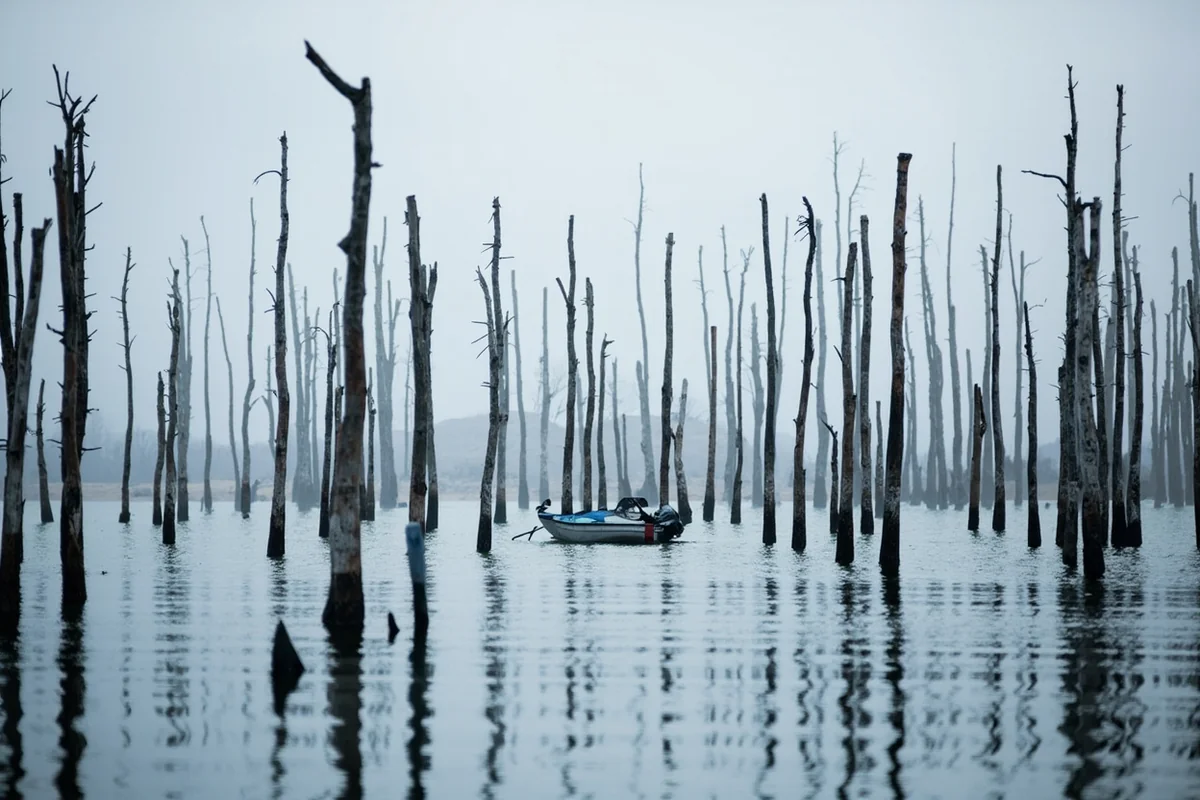
This is genuinely one of the strangest and most memorable fishing experiences in Montana. Countless standing dead trees, drowned when the lake rose over what used to be forest, still rise from the water today.
Those submerged trunks create real hazards for boat propellers, but they also create outstanding fish habitat. Rainbow and brown trout use the structure extensively, and dry fly fishing here can be genuinely excellent precisely because of all that submerged wood.
Float tube fishing isn’t recommended, both because of the timber hazard and because winds can pick up quickly across this exposed canyon. I’d stick to a boat or fish from shore if you’re set on visiting without serious watercraft experience.
Boating Hazards Worth Taking Seriously
I want to be direct about this: Quake Lake is not a beginner-friendly boating destination. Beyond the submerged timber, wind combined with current can create genuinely challenging conditions with little warning.
Three marinas serve the lake, with rentals and guided tours available at some locations. If you’re not experienced navigating hazard-filled water, I’d strongly consider a guided trip rather than heading out solo, at least on your first visit.
A boat ramp about halfway down the lake from the highway provides access for both motorized boats and canoes. Inflatable flatwater kayaks and pontoon boats work reasonably well when winds stay calm, and there’s something genuinely unique about paddling slowly through this drowned forest.
Hiking Near Quake Lake
Several trails in the Custer-Gallatin National Forest reward a stop here beyond just the lake and visitor center.
Beaver Creek Overlook runs about 2.5 miles, offering views from above the lake’s upper point along with a wildlife viewing spot across Beaver Creek. I’d rate this a moderate hike, and the surrounding terrain regularly hosts bighorn sheep, antelope, bison, and moose.
Coffin Lakes Trail covers a more demanding 11.3 miles out and back, passing creeks, waterfalls, and a lake along the way. This is a bigger day commitment but delivers considerably more solitude than the roadside stops.
The Broader Earthquake Story
Montana sits atop the Intermountain Seismic Belt, a roughly 60-mile-wide band of earthquake-prone geology running from Flathead Lake down through Nevada.
That geology puts Montana among the top 10 most seismically active states in the country, with 7 to 10 small tremors happening most days, almost all unnoticed.
The 1959 quake remains the largest ever recorded here, felt as far away as Salt Lake City and strong enough to temporarily muddy hot springs and trigger geyser eruptions in Yellowstone National Park. I find that regional context genuinely useful for understanding why this specific canyon looks the way it does.
What Time of Year to Visit
I’d point most visitors toward late June through September, when the visitor center is fully open and road conditions are reliable. September specifically offers a nice combination of thinner crowds and still-comfortable weather for exploring the outdoor boulder tour.
Winter access along Highway 287 is possible but considerably less rewarding, since the visitor center closes and the drama of the landslide scar is harder to appreciate under snow cover.
For broader seasonal planning across this part of the state, my Montana in September guide covers what else changes as summer winds down.
A Stop That Changes How You See the Region
I think Quake Lake fundamentally changes how visitors experience the rest of a Yellowstone-area trip once they’ve stopped here. Understanding that this whole region sits on genuinely active, dangerous geology adds a layer of respect to the landscape that’s easy to miss if you drive straight through to the park without stopping.
I’ve noticed this shift in my own thinking every time I make this drive. The mountains stop being purely scenic backdrop and start feeling like what they actually are: a landscape still very much in motion, geologically speaking, even on a quiet summer afternoon with barely a breeze.
Personal Tips / What I Wish I Knew
Read the Memorial Boulder plaque, don’t just glance at it. Taking the time to read actual names changes how the whole site feels, in a way I wasn’t expecting the first time I stopped here.
Don’t underestimate the boating hazards. I’d genuinely recommend a guided tour or at minimum serious caution on your first visit, given the combination of submerged timber and unpredictable wind.
Combine it with Hebgen Lake. Since both lakes trace back to the same night, visiting them together gives a much fuller picture of what happened here than either stop alone, and the short drive between them makes it an easy addition to the same day.
Visit the visitor center before exploring the lake itself. Understanding the story first makes everything you see afterward — the scarred mountainside, the drowned trees, the boulders — land with considerably more weight.
Practical Info: Quake Lake
| Length | About 6 miles |
| Depth | Estimates range from 120 to 190 feet depending on the source |
| Location | About 24 miles northwest of West Yellowstone on Highway 287 |
| Visitor center hours | Memorial Day through mid-September, roughly 10 a.m.–5 p.m. [verify current hours] |
| Fishing | Rainbow and brown trout; excellent dry fly fishing around submerged timber |
| Boating | Genuine hazards from submerged trees and wind; guided tours available |
Frequently Asked Questions
How was Quake Lake formed?
An 80-million-ton landslide, triggered by a magnitude 7.3–7.5 earthquake on August 17, 1959, blocked the Madison River. The lake formed within weeks as water backed up behind the natural landslide dam.
How many people died in the 1959 earthquake?
Twenty-eight people died, most of them campers along the Madison River below Hebgen Dam, caught between the dam and the new landslide.
Can you still see effects of the earthquake today?
Yes, the landslide scar remains clearly visible on the mountainside, and dead standing trees drowned by the rising lake still rise from the water.
Is Quake Lake good for fishing?
Yes, particularly dry fly fishing, thanks to the extensive submerged timber that creates excellent trout habitat, though the same timber poses hazards for boats.
How far is Quake Lake from West Yellowstone?
About 24 miles via Highway 287, making it an easy stop for anyone visiting Yellowstone National Park’s west entrance.
Comparing Quake Lake to Hebgen Lake
Since both lakes trace back to the exact same night, I get asked often how they compare as destinations. Hebgen Lake offers world-class stillwater fly fishing and a resort-style atmosphere with multiple campgrounds and services.
Quake Lake offers something more specific: a direct, tangible connection to the earthquake itself, through the visitor center, the memorial, and that eerie submerged forest. I’d visit Hebgen for a fishing-focused trip and Quake Lake for the historical and geological experience, though most visitors to this region end up doing both in the same day given how close they sit to each other.
The Cormorants and Other Wildlife
I mentioned cormorants perching on the dead snags earlier, and it’s worth expanding on why this spot has become such a magnet for them. The standing dead timber creates ideal perching structure directly over productive fishing water, giving these birds an efficient combination of shelter and food access.
Beyond cormorants, ospreys and bald eagles work this stretch of water regularly, and the surrounding Gallatin National Forest supports elk, mule deer, and occasional moose. I’d bring binoculars regardless of your main reason for stopping here.
A Geological Study Site
Beyond the human tragedy and recovery story, Quake Lake has become a legitimate site for geological study. The visible effects of the strongest earthquake ever recorded in the Rocky Mountains have made this an outstanding location for understanding landslide dynamics and fault mechanics in the field rather than just a textbook.
I’ve brought people here who study geology professionally, and they’ve pointed out details in the landslide debris and fault scarps that I’d never have noticed on my own. If you have any interest in earth science, I’d genuinely consider hiring a local guide or joining a ranger program for a deeper explanation of what you’re looking at.
Final Thoughts
Quake Lake is one of the few places in Montana where you can stand at the edge of a genuinely significant historical event and still see its physical evidence, largely unchanged, more than six decades later. Between the visitor center, the memorial, and that eerie forest of drowned trees, this stop delivers something far more memorable than scenery alone.
For the lake formed the same night just upstream, see my guide to Hebgen Lake, or check out the complete guide to Montana’s best lakes for the rest of the region.
For broader context on Montana’s seismic history, my Montana natural disasters guide covers other events worth knowing about, and my Montana history guide provides additional mid-century context.
If you’re staying in West Yellowstone or Ennis, both make convenient home bases for exploring this whole stretch of Highway 287.