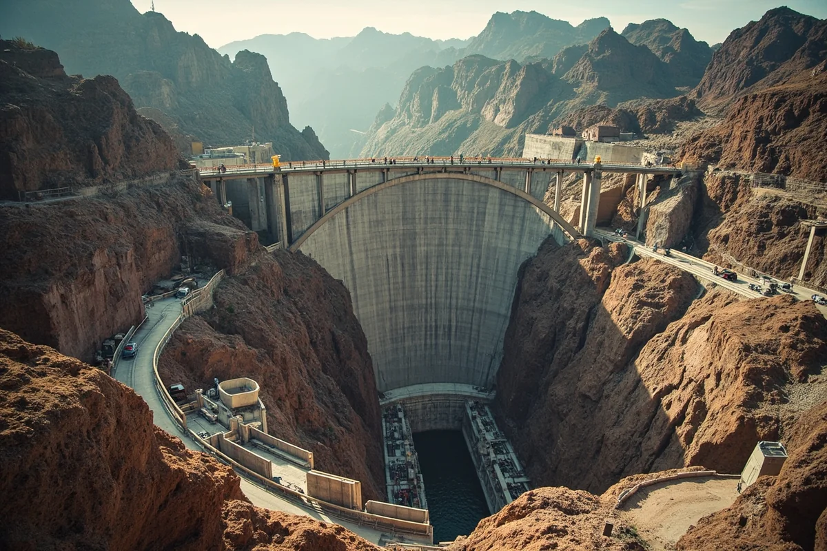
During the Cold War, U.S. intelligence uncovered a real KGB and Stasi plan to sabotage this exact dam’s turbines and spillways. I think about that every time I drive across it.
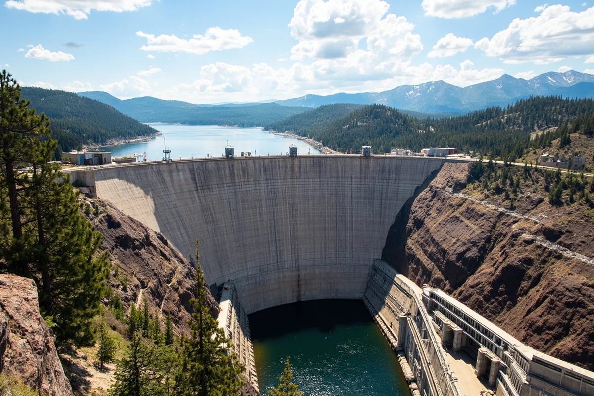
- Hungry Horse Reservoir sits about 15 miles south of Glacier National Park’s west entrance, formed by a 564-foot dam
- The dam is the 10th highest in the U.S. and holds the world’s highest morning-glory spillway
- This guide covers the dam’s genuinely wild history, camping around the 34-mile-long reservoir, fishing, and the scenic loop drive
- The name comes from two freight horses that survived a month lost in deep snow in 1900
Where the Name Actually Comes From
I’ve heard people guess at all kinds of explanations for a name this unusual. The real story involves two freight horses named Jerry and Tex, working in the area during the winter of 1900-01.
They wandered away from their sleigh during a severe winter storm and weren’t found for a full month. When loggers finally located them, they were belly-deep in snow and starved down to almost nothing.
The amazed rescuers nursed them back to health, and the survivors went on to genuinely useful second careers — one later pulled a fire wagon in Kalispell, the other worked for a mercantile company.
The name Hungry Horse stuck to the mountain, creek, and eventually the dam and reservoir built decades later.
A Dam Built for Power, Not Irrigation
Construction began in 1948 and finished in 1953, a five-year project that shut down every winter due to conditions. Crews had to clear thousands of trees from the reservoir site first, in an operation workers nicknamed “Operation Highball.”
That clearing job used a genuinely inventive method: chaining a 4.5-ton steel ball to tractors and dragging it through dead timber and stumps left by earlier logging operations. One contractor even built a custom iron drag shaped like an umbrella just to gather debris for burning.
Unlike many Bureau of Reclamation dams built for irrigation, Hungry Horse was built specifically to store water for increasing hydroelectric power production downstream at Grand Coulee and Bonneville dams on the Columbia River.
No irrigation facilities were ever built here, despite that originally being part of the authorized purpose.
The Cold War Sabotage Plot
This is the detail I find genuinely most fascinating about this dam, and it rarely makes it into standard travel guides. During the Cold War, U.S. intelligence uncovered a real KGB and East German Stasi plan targeting major American infrastructure, including Hungry Horse Dam.
According to declassified reports, the plan involved damaging the power grid and water management system by sabotaging the dam’s turbines or spillways.
It never happened, but the fact that a dam in rural northwest Montana was considered significant enough to target says something about how critical this infrastructure was to the broader Columbia River power system.
Standing on the dam crest today, surrounded by quiet mountains and recreational boaters, that Cold War history feels almost impossible to square with the peaceful scene in front of you.
The World’s Highest Morning-Glory Spillway
Hungry Horse Dam’s spillway works like a giant drain, funneling excess water down in a shape that resembles a morning glory flower from above. Water drops 490 feet through this structure, making it the highest morning-glory spillway in the world.
I’d time a visit around a period of higher water flow if you want to see this feature in dramatic action, since flow rates vary by season and reservoir management needs [verify current spillway activity before a special trip to see it].
Visiting the Dam and Visitor Center
The visitor center offers exhibits covering the dam’s role in flood control, power supply, and regional recreation. Free guided tours of the dam’s crest run daily from Memorial Day weekend through Labor Day under normal conditions.
The outdoor walking tour covers about 1.5 miles and takes roughly an hour, running up to four times daily on a first-come, first-served basis for groups up to 12 people. I’d arrive early if you want a guaranteed spot during peak summer.
Along the tour, you’ll see the gantry crane, water tower, the old cableway location, and get a close look at that record-setting spillway.
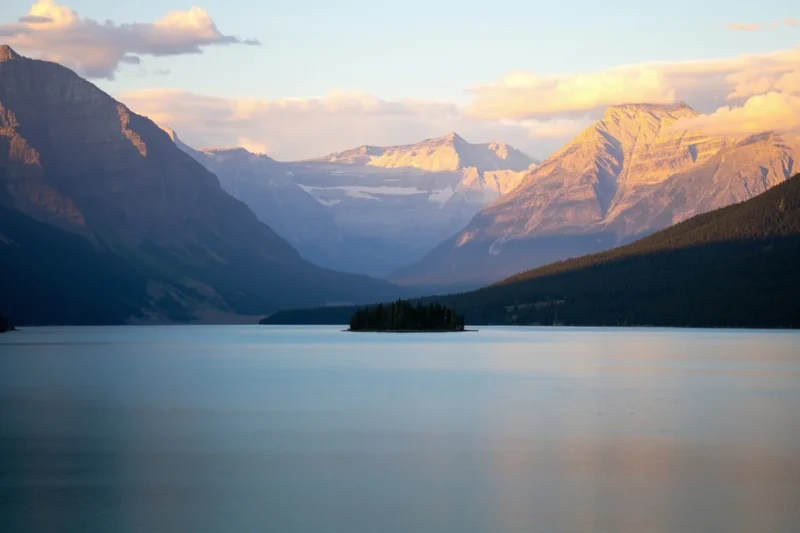
Hungry Horse Reservoir by the Numbers
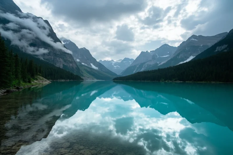
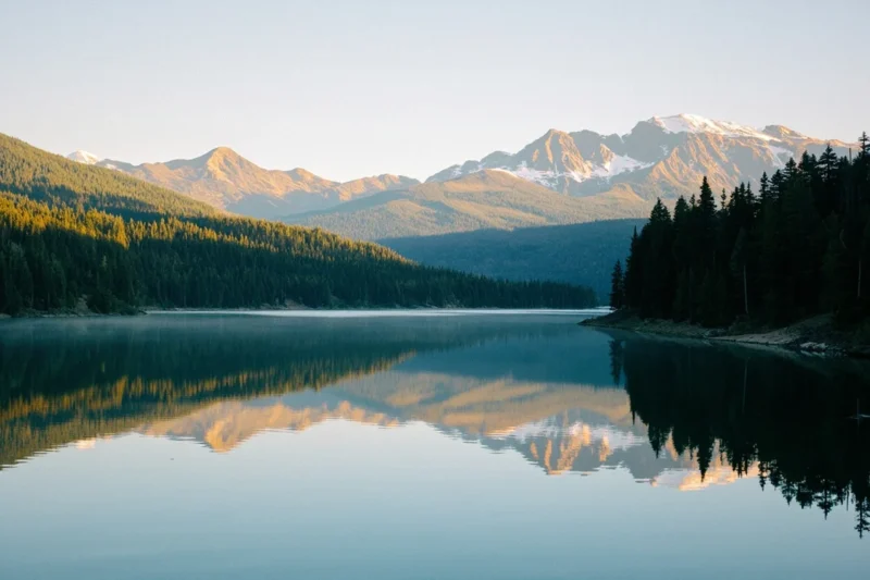
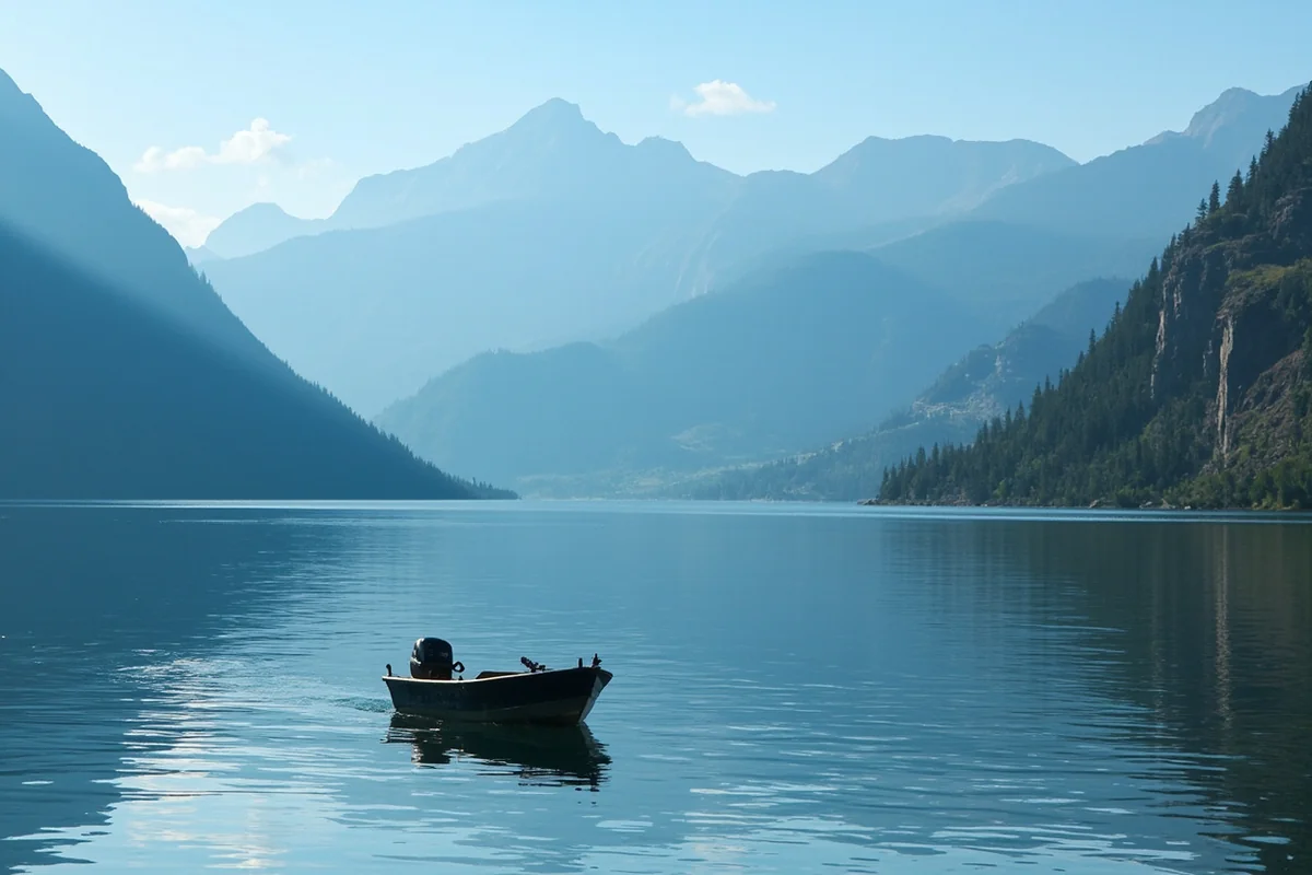
The reservoir stretches about 34 miles long with roughly 170 miles of shoreline, covering approximately 23,800 acres. It sits high in the Rockies, less than 30 miles from the Continental Divide, surrounded by more than 25 mountain peaks.
At 564 feet, the dam ranks as the 10th highest in the United States and the highest in Montana. The reservoir holds back roughly 3.5 million acre-feet of water.
Fishing Hungry Horse Reservoir
Unlike many Montana reservoirs, Hungry Horse isn’t actively stocked, which changes the fishing dynamic here. Cutthroat trout, bull trout, and whitefish make up the primary catch, relying on natural reproduction rather than hatchery support.
I’d set realistic expectations if trophy numbers matter to your trip — this isn’t necessarily one of the state’s prime fishing destinations, but the scenery alone makes time on the water worthwhile.
Camping Around the Reservoir
More than a dozen campgrounds ring Hungry Horse Reservoir, plus additional pull-in areas for those wanting extra privacy. Lost Johnny Point Campground offers 21 sites with tables, fire rings, vault toilets, and available water, with a stay limit of 16 consecutive days.
Several other campgrounds provide first-come, first-served tent and RV sites, though drinking water isn’t guaranteed everywhere — check specific site details before you go. Adventurous campers with their own boats can even camp on Elk Island and Fire Island within the reservoir itself.
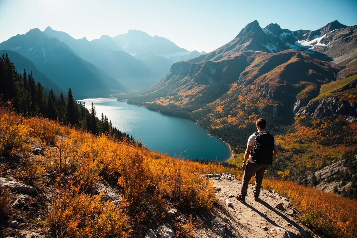
The Scenic Loop Drive
A full loop around the reservoir covers roughly 112 miles, mostly on gravel road, and takes 3 to 4 hours to complete without stops. I’d budget significantly more time if you plan to stop at overlooks, which you should.
The loop can be accessed year-round from the east and west sides, though in winter, vehicles can only cross via the west side road over the dam. Cell phone service is unreliable for most of the route, so I’d download offline maps and let someone know your general plans before setting out.
Fall offers what I’d call the single best window for this drive. Larch trees turning gold against the reservoir and any early mountain snow creates a genuinely spectacular photography opportunity that few visitors plan around.
Boat Inspection Requirements
Montana Fish, Wildlife and Parks requires boats entering the Flathead Basin that have been used on outside waters to pass inspection before launching, as part of the state’s effort to prevent aquatic invasive species.
I’d build this into your timeline if you’re trailering a boat in from elsewhere [verify current inspection station locations and hours].
Wildlife Around Hungry Horse Reservoir
The surrounding Flathead National Forest supports deer, elk, black bears, grizzlies, and bald eagles. I’ve had some of my best wildlife sightings in this whole region on the loop drive, particularly early morning along the quieter west side road.
Given the grizzly presence, standard bear safety practices apply throughout the area, especially on hiking trails branching off from the main loop — see my Montana bear guide for the specifics before you head out.
Personal Tips / What I Wish I Knew
Bring a full tank of gas and your own food and water for the loop drive. Services are essentially nonexistent once you leave the main visitor center area.
Visit in October for the best photography. Larch gold against the water and mountains is genuinely one of the best fall scenes in northwest Montana.
Don’t expect trophy fishing here. Come for the scenery and a relaxed day on the water rather than a serious fishing trip.
Check the dam tour schedule before you arrive. Free tours run on a first-come, first-served basis with limited daily capacity.
Practical Info: Hungry Horse Reservoir
| Reservoir length | About 34 miles, 170 miles of shoreline |
| Dam height | 564 feet, 10th highest in the U.S. |
| Location | About 15 miles south of Glacier’s west entrance |
| Visitor center | Open Memorial Day through Labor Day [verify current hours] |
| Fishing | Cutthroat trout, bull trout, whitefish; not actively stocked |
| Scenic loop | About 112 miles, mostly gravel, 3–4 hours minimum |
Frequently Asked Questions
Why is it called Hungry Horse Reservoir?
It’s named after two freight horses, Jerry and Tex, who survived a month lost in deep snow during the winter of 1900-01 near the South Fork Flathead River.
How tall is Hungry Horse Dam?
564 feet, making it the 10th highest dam in the United States and the highest in Montana.
Was Hungry Horse Dam ever actually sabotaged?
No, but declassified Cold War intelligence revealed a real KGB and Stasi plan to target the dam’s turbines and spillways as part of a broader infrastructure sabotage plot.
Is Hungry Horse Reservoir good for fishing?
It holds cutthroat trout, bull trout, and whitefish, but since it isn’t actively stocked, it’s not considered one of Montana’s premier fishing destinations.
How long does the scenic loop drive take?
About 3 to 4 hours for the roughly 112-mile loop without stops, though I’d budget significantly more time for overlooks and photography.
Why Building This Dam Was So Difficult
The canyon where Hungry Horse Dam sits is deep and narrow, which created genuine engineering challenges beyond just pouring concrete. Crews strung floodlights across the canyon to allow round-the-clock work during the construction season.
The General-Shea-Morrison Company won the original construction contract, building an entire temporary town to house workers — dormitories, a warehouse, a schoolhouse, a grocery store, and even a hospital.
That kind of self-contained construction camp was standard for major infrastructure projects of this era, but it’s easy to forget standing at the visitor center today that an entire small community once existed here purely to build this dam.
Engineers also pioneered techniques here that hadn’t been widely used before. Air-entrained concrete, designed to reduce damage from freeze-thaw cycles, made its debut at Hungry Horse before becoming standard practice elsewhere.
The Dam’s Role in the Wider Power System
Understanding why this dam exists at all requires zooming out to the broader Columbia River Basin. Hungry Horse doesn’t provide power directly to homes in the way you might assume from a local dam.
Instead, it stores water that increases hydroelectric generation capacity at Grand Coulee and Bonneville dams, much further downstream in Washington State.
The four generators here produce roughly one billion kilowatt-hours annually, powering communities including Kalispell, Whitefish, and Columbia Falls directly, while the stored water benefits the wider regional grid.
I find this kind of interconnected infrastructure genuinely fascinating. A decision made in rural Montana in the 1940s continues shaping electricity availability across an entire multi-state river system today.
Exploring the Reservoir by Water
Beyond the loop drive, exploring Hungry Horse Reservoir by boat opens up a different perspective entirely. The reservoir’s many arms and inlets create secluded spots that feel genuinely private even during busy summer weekends.
I’ve anchored in quiet coves here that felt worlds away from the visitor center crowds, despite being only a short boat ride from the main access points.
If you have your own watercraft, I’d prioritize exploring beyond the immediate dam area rather than staying close to the most convenient boat ramps.
Hiking Trails Near the Reservoir
Three trails near the dam serve moderate to expert hikers, all passing through genuinely remote sections of Flathead National Forest.
The Great Northern hike stands out as a serious 8-mile trek through forest and along goat trails, demanding real conditioning but rewarding hikers with breathtaking scenery.
I’d pack a plant identification guide and a container for berries if you’re hiking here in late summer, since huckleberry season overlaps nicely with the best hiking weather.
Doris Creek Trail offers a somewhat gentler alternative for those wanting forest scenery without quite the same physical demands.
Paddling the South Fork Flathead River
Above the reservoir, the South Fork Flathead River offers excellent paddling opportunities, with mostly manageable Class I rapids near the reservoir’s upper reaches. Further upstream, more experienced paddlers can find genuine Class II, III, and IV whitewater.
I’d treat the upper river as a separate trip requiring real whitewater experience, distinct from the calmer recreational paddling most visitors do directly on the reservoir itself.
Combining a Visit With Glacier National Park
Given its location just 15 miles from Glacier’s west entrance, Hungry Horse Reservoir works naturally as either a warm-up or wind-down for a Glacier trip. I’ve stopped here on the way into the park specifically to break up a long drive and stretch my legs on the dam crest walk.
For lodging options if you’re combining both destinations, see my Glacier National Park lodging guide, which covers options on both sides of the park closest to this reservoir.
Final Thoughts
Hungry Horse Reservoir carries a genuinely remarkable amount of history for a lake most Glacier-bound travelers drive right past. Between the survival story behind its name and the Cold War plot targeting its dam, there’s more going on here than the peaceful mountain scenery lets on.
For nearby lakes worth combining with a visit, see my guide to Flathead Lake, or check out the complete guide to Montana’s best lakes for the rest of the region. If you’re based out of Kalispell, the reservoir is an easy add-on to a bigger Glacier Country itinerary.
For the historical backdrop of dam-building projects like this one, see my Montana history guide, and for the best time to catch fall colors on the loop drive, my Montana in October guide covers what to expect.