I’ve stood waist-deep in the Smith River in a hailstorm, watched the Missouri go from a clear tailwater trickle to a chocolate-milk flood in about six hours during spring runoff, and once got so sunburned floating the Bitterroot on a July afternoon that I couldn’t wear a backpack for three days. Rivers in this state don’t ask your permission before they teach you something.
Montana has thousands of miles of rivers, but a handful stand above the rest depending on what you’re after — the Madison and Missouri for fly fishing, the Clark Fork and Blackfoot for floating, the Middle Fork of the Flathead for whitewater, and the Smith River for the single best multi-day wilderness float in the state, if you can get the permit. This guide breaks rivers down by what they’re actually good for, walks through the Montana Stream Access Law that governs where you can legally be on the water, and flags the seasonal timing and safety realities that most “top 10” lists skip entirely. I’ll also tell you which river the other big Montana travel sites completely leave off their lists — and why that’s a mistake.
Liked this article?
Add Roaming Montana as a preferred source so you see more of our articles and guides on Google.
Why Montana’s Rivers Deserve Their Own Guide
Most “best rivers in Montana” lists I’ve read rank rivers by one thing: length. That tells you almost nothing useful. The Milk River is the second-longest river in the state, and I’d bet most Montanans have never floated a foot of it — it’s a slow, muddy plains river valued mostly for irrigation, not recreation.
Meanwhile, the Smith River, arguably the single most sought-after float trip in Montana — the one that requires a lottery permit just to attempt — doesn’t even crack some competitors’ top ten. One doesn’t even mention it exists.
That’s the gap I want to fill here. I’ve organized this guide around what you’re actually trying to do on the water: fish, float, run whitewater, or just stand on a bank and take in some of the best scenery in the American West.
Rivers are just one piece of the state’s broader outdoor activities, but I’d argue they’re the single most underrated entry on most visitors’ Montana bucket lists.
I’ve personally fished or floated every river in this list, most of them more than once and across different seasons, because the same stretch of the Madison in June looks nothing like it does in September.
I’ll also cover something almost no travel guide mentions clearly: Montana’s Stream Access Law, which is the actual legal reality that determines whether you can be standing where you’re standing.
It matters more than any “best of” ranking, because it’s the difference between a great day on the water and an uncomfortable conversation with a landowner.
If you’re still building out the rest of your itinerary, I’ve also put together guides to 21 essential Montana attractions and things to do across the state that pair naturally with a river-focused trip.
Understanding Montana’s Rivers: Two Oceans, One Divide
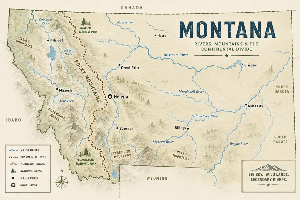
Before I get into individual rivers, it helps to understand why Montana’s water behaves the way it does. The Continental Divide runs north to south through the western third of the state, and it splits Montana’s rivers into two completely different destinies.
Water that falls west of the divide eventually reaches the Pacific Ocean by way of the Columbia River system — that’s the Clark Fork, the Flathead, the Bitterroot, the Blackfoot.
Water that falls east of the divide heads toward the Gulf of Mexico by way of the Missouri and Mississippi — that’s the Missouri, the Yellowstone, the Madison, the Gallatin, the Jefferson.
There’s a third, stranger piece of this puzzle that most people never learn about. Triple Divide Peak, inside Glacier National Park, is one of the only true hydrological triple points in North America — rain that falls on its slopes can end up in the Pacific, the Gulf of Mexico, or Hudson Bay in the Arctic Ocean, depending on which side of the mountain it lands on.
I hiked toward that area on a clear September morning a few years back, on the same trip where I covered several of the best hikes in Glacier National Park, and kept thinking about how strange it is that a single afternoon rainstorm up there gets split three ways across the entire continent.
If you’re driving through the park, the Going-to-the-Sun Road crosses this same divide near Logan Pass.
This geography is why standing at Missouri Headwaters State Park near Three Forks feels like watching something being born.
The Jefferson, Madison, and Gallatin Rivers converge there to officially form the Missouri — and from that exact spot, the water in front of you is beginning a journey of roughly 2,341 miles to St. Louis.
But here’s a fact that gets muddled on other sites: only about 1,000 miles of that total actually flow through Montana before crossing into North Dakota.
The “longest river in Montana” title refers to the whole Missouri-Mississippi system’s total length, not the portion that’s actually within our state borders — a distinction most travel guides gloss over entirely.
If you want to understand the state’s topography in more depth, I’ve also written a full Montana elevation guide that covers how the Divide shapes everything from weather to watersheds.
The Best Rivers for Fly Fishing in Montana
Madison River
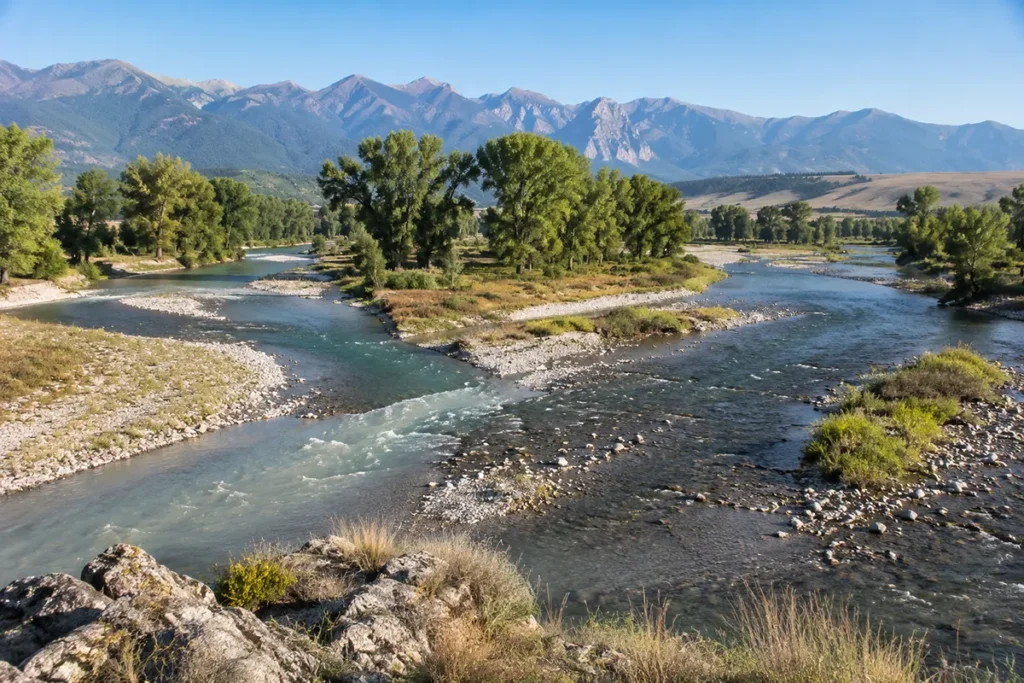
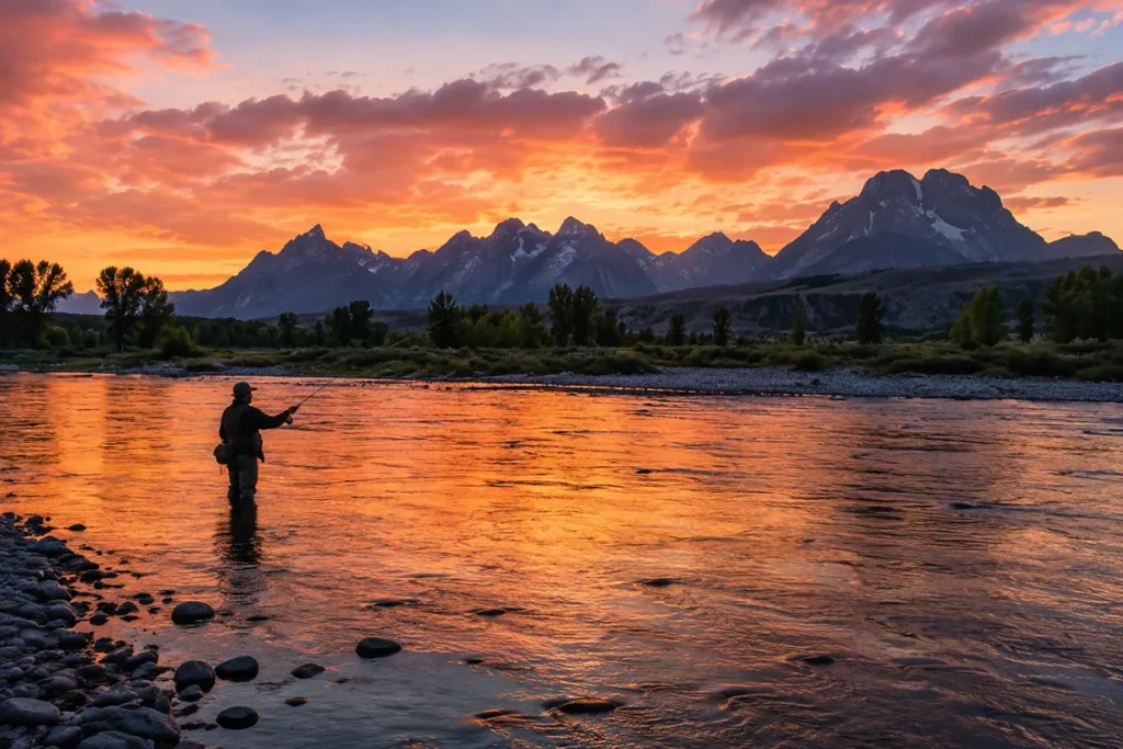
I’ve fished the Madison in both June, right after runoff cleared, and again in September when the hopper bite was still going strong, and it’s a genuinely different river each time.
It runs from Yellowstone National Park north through Hebgen Lake near West Yellowstone, Quake Lake, and Ennis Lake before flowing to Three Forks, and the stretch below Ennis — the “50-mile riffle” — is some of the most consistently wadeable water I’ve fished anywhere in the state.
Ennis itself basically exists because of this river; the whole town orients around fishing season, and it’s no accident that Montana’s state fish, the westslope cutthroat trout, shares this water with wild rainbows and browns — you can read more on our Montana state fish page.
Missouri River
The tailwater stretch below Holter Dam near Cascade is the section everyone talks about, and for good reason — the trout density there is staggering.
I floated it on an overcast day in early July and watched three different guide boats hook fish within casting distance of each other in the same fifteen minutes.
It’s a big, technical river to wade, so if you’re newer to fly fishing, I’d recommend a guided drift boat trip here over trying to wade blind.
Downstream near Great Falls, the river’s history as a Gold Rush-era transportation route is still visible if you know where to look — some stretches remain open to recreational panning under Montana’s gold panning laws.
Yellowstone River
The Yellowstone holds a title that matters more than most people realize: it’s the longest undammed river in the contiguous United States, running free from its source in Yellowstone National Park all the way to its confluence with the Missouri.
I’ve fished the Paradise Valley stretch near Livingston in early autumn, when the cottonwoods along the banks turn gold and the crowds thin out substantially compared to peak summer.
Because it’s a freestone river without a dam controlling its flow, conditions change fast with weather and runoff — check current flows before you go, especially in early summer.
If you want to turn a day of fishing into an overnight trip, Chico Hot Springs sits right in Paradise Valley along this same stretch.
Bighorn River
The Bighorn, near Hardin in south-central Montana, is a tailwater below Yellowtail Dam with some of the highest trout-per-mile numbers in the state.
It’s a bit of a haul from the Bozeman-Missoula corridor most travelers stick to, which is exactly why I’d treat it as its own dedicated trip rather than a day-float add-on.
Interestingly, the river’s name comes from an 1805 sighting by fur trader François Larocque, who spotted bighorn sheep along its banks — a detail almost no visitor guide mentions.
Boulder and Stillwater Rivers
These two smaller rivers, both flowing out of the Absaroka-Beartooth Wilderness toward the Yellowstone near Big Timber and Columbus, get overlooked because they’re not as famous as the Madison or the Bighorn.
I like them precisely for that reason — I’ve had entire runs of the Stillwater to myself on a weekday afternoon in August near Absarokee, casting to willing rainbows in aquarium-clear water.
Both rivers run through a mix of public and heavily private land, so plan your access points before you go. After a long day of wading, Potosi Hot Springs and Elkhorn Hot Springs are both within reach in this part of southwest Montana.
Big Hole River
This is the river I send anglers to when they ask what makes Montana’s fisheries genuinely unique. The Big Hole, near the small town of Wisdom, is the last habitat in the entire Lower 48 for native, river-dwelling Arctic grayling — not a stocked population, the actual last wild one.
A proposed dam nearly ended that story in the 1960s before a coalition of ranchers and conservationists defeated it. I’ve read more about this river’s near-miss with disaster than almost any other water in the state, and it’s covered in full in our Big Hole River guide.
“It’s also one of the few places in the lower 48 where native fluvial Arctic grayling still survive.”
Rock Creek
If you ask a Missoula local where they learned to fish, there’s a good chance the answer is this narrow, bumpy road alongside a “creek” most other states would call a real river.
Rock Creek holds roughly 2,000 wild trout per mile and what many guides consider the best salmonfly hatch in the American West.
I’ve covered the float-fishing cutoff that catches visitors off guard, along with the rest of what makes this Missoula’s home river, in our Rock Creek guide.
Ruby River
Quietest of everything covered in this guide, the Ruby has carried four different names across two centuries and holds a genuinely underrated tailwater fishery below Ruby Dam near Alder.
I’d send you here if the crowds on the Beaverhead or Big Hole wear you down. Full details, including a popular outlaw-hideout story I don’t think holds up to scrutiny, are in our Ruby River guide.
The Best Rivers for Floating and Rafting
Clark Fork River
By volume, the Clark Fork is the largest river in Montana — bigger than the Missouri or Yellowstone in terms of actual water flow, even though it’s not the longest. It’s also the headwaters of the entire Columbia River Basin.
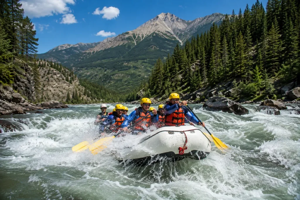
The stretch through Alberton Gorge, west of Missoula, is where I’d send anyone looking for real whitewater without needing a guide’s license — Class II and III rapids that are exciting but manageable for an experienced paddler.
I ran it in a raft on a mid-July afternoon and hit standing waves big enough to soak everyone in the boat within the first mile.
For general safety rules that apply here and on every other floatable river in the state, it’s worth skimming our overview of boating in Montana.
Farther downstream toward Paradise, Quinn’s Hot Springs sits directly on the Clark Fork — one of the few hot springs in the state with true riverfront soaking pools.
Blackfoot River
If the name rings a bell, it’s because the Blackfoot is the river from Norman Maclean’s “A River Runs Through It,” and floating it feels a little like stepping into that book — it winds through high alpine meadows and steep, timbered slopes between Lincoln and Bonner.
I need to be honest about something most tourism sites skip: this river was heavily contaminated by upstream mining pollution for decades, particularly around the old Milltown Dam site, which was eventually removed as part of a major Superfund cleanup.
It’s a healthy trout fishery today, but that industrial history is part of the river’s real story, not just its Hollywood one — and it connects directly to the broader story I’ve told in our Montana Gold Rush history piece.
Bitterroot River
The Bitterroot is where I take people who want an easy, scenic float without technical rapids.
It runs about 80 miles from near Hamilton and Darby north to its confluence with the Clark Fork near Missoula, largely paralleling Highway 93, with the Bitterroot Mountains rising on one side and the Sapphires on the other.
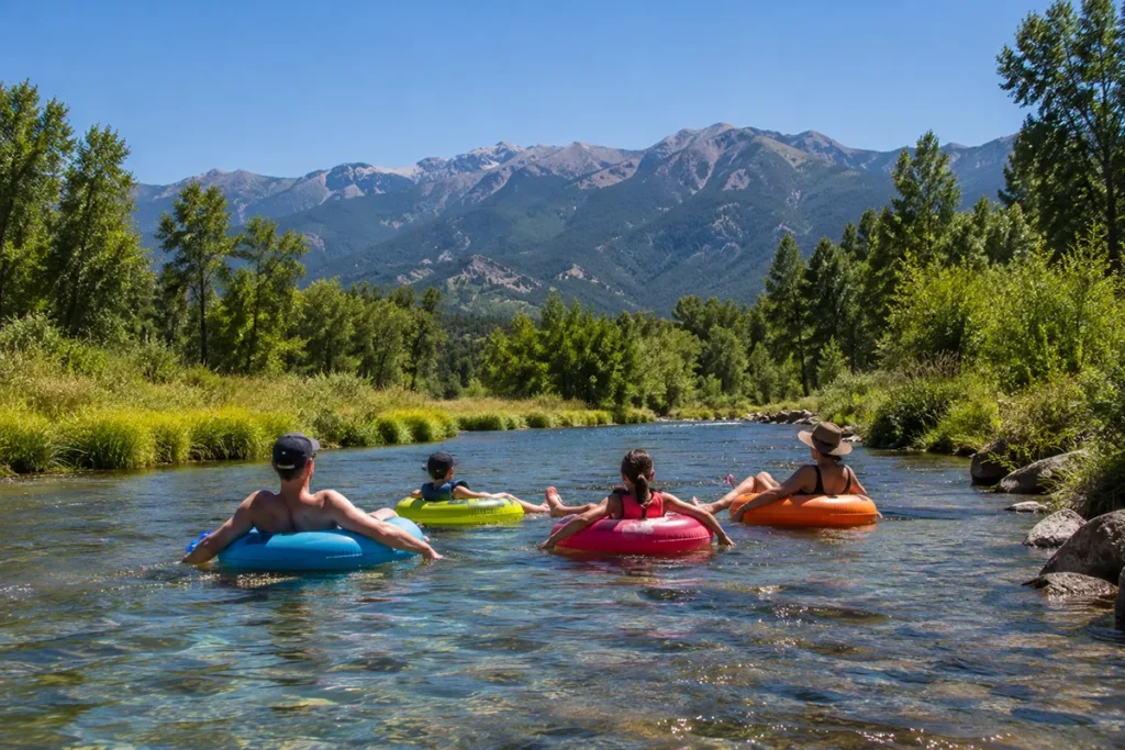
I’ve done lazy inner-tube floats here in late July with a cooler strapped to a second tube — about as low-stakes as river recreation gets in this state.
Middle Fork of the Flathead
This is Montana’s best true whitewater river, and it’s not close. Originating in the Bob Marshall Wilderness and forming the southern boundary of Glacier National Park, the Middle Fork carries a Wild and Scenic designation and rapids with names like Jaws and Bonecrusher.
I would not recommend running this one without a licensed guide unless you have serious whitewater experience — the upper stretches are genuinely remote, and help is not close by if something goes wrong.
If you’re basing a trip around this river, our guide to where to stay in Glacier National Park covers lodging on this side of the park, and RV parks near Columbia Falls and West Glacier are the closest camping option to most put-ins.
The Smith River: Montana’s Only Permit-Only Wilderness Float
This is the river most competing guides leave out entirely, and it’s the biggest omission on any “best rivers in Montana” list.
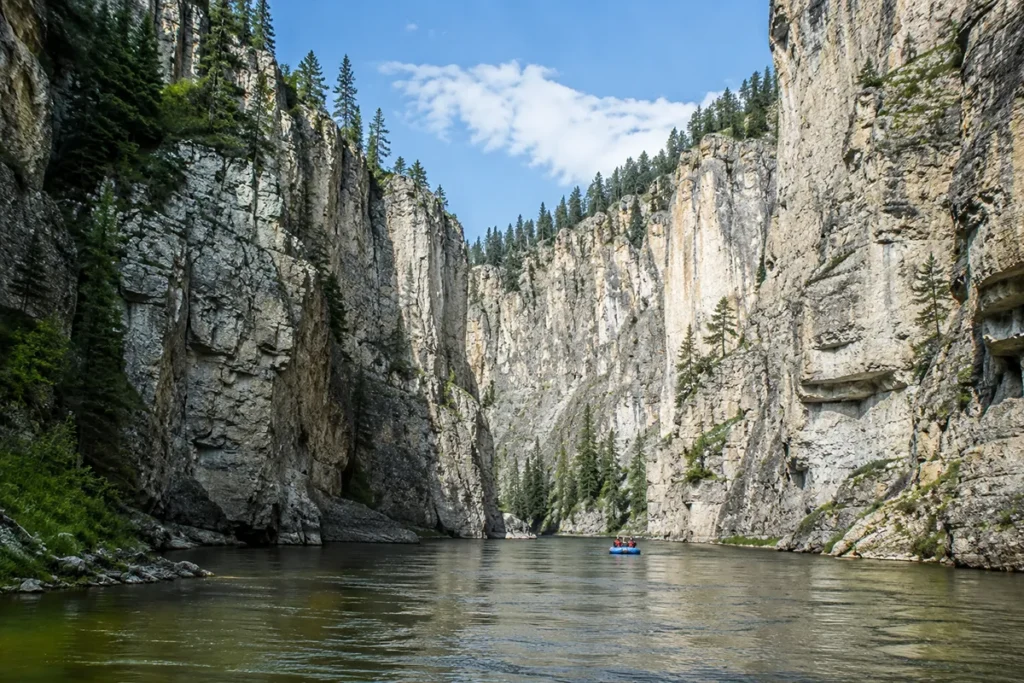
The Smith runs about 59 miles through a limestone canyon between Camp Baker and Eden Bridge, and Montana Fish, Wildlife and Parks controls access through an annual lottery permit system — you can’t just show up with a raft.
Demand consistently outstrips the number of permits issued by a wide margin, so most people who want to float it apply months ahead of the season and simply hope, or book through one of the limited number of outfitter-held permits.
I floated the Smith over four days in mid-June a few years ago, and it remains one of the best multi-day trips I’ve done anywhere, let alone in Montana.
The canyon walls close in tight in places, there’s no road access once you launch, and the fishing along the way is genuinely excellent.
The tradeoff is real commitment: once you’re in, you’re committed to finishing the float — there’s no easy bailout point partway through.
What I wish someone had told me before I applied: the lottery results come out in the winter, well before you’d naturally start planning a summer trip, so if the Smith is on your list, start the application process the year before you actually want to go. [Verify current application dates and fees before applying, as they change from season to season.] The put-in at Camp Baker sits near White Sulphur Springs, and several working Montana ranches in the area offer lodging if you’re arriving the night before your launch.
If the Smith River lottery doesn’t go your way, the nearby Dearborn River offers a genuinely wild, scenic canyon float with no permit required at all — its lower canyon cuts through shonkinite, a volcanic rock found in only three major locations on the planet. I’ve covered the full float and its short spring season in our Dearborn River guide.
Dearborn River: Spring Floating Along the Rocky Mountain Front
While the Smith gets most of the attention in central Montana, it’s not the only river worth planning a trip around. The nearby Dearborn River, flowing east from the Rocky Mountain Front to the Missouri near Craig, offers one of the state’s classic spring floats.
I’ve always thought of it as a river that’s all about timing—catch it during snowmelt and you’ll find a fast-moving, scenic float through rugged canyon country; wait a few weeks too long and much of it becomes too shallow to paddle.
It doesn’t have the permit system or national reputation of the Smith, but for experienced boaters looking to explore beyond Montana’s best-known rivers, it’s well worth keeping on the radar.
Rivers Steeped in History
The Missouri and the Lewis and Clark Trail
The stretch of the Missouri designated as Wild and Scenic, beginning near Fort Benton, runs through the same canyons and badlands that Lewis and Clark documented in their journals in 1805.
I camped along this stretch one September and could still recognize rock formations described in expedition accounts nearly two centuries earlier — a genuinely rare kind of continuity in American landscape history.
This same stretch borders the American Prairie Reserve, and it’s covered in more depth in our broader look at key historical events in Montana and Montana history.
The Yellowstone as a Native Transportation Corridor
Long before it was a fly-fishing destination, the Yellowstone River served as a major transportation and trade route for Indigenous peoples, including the Crow (Apsáalooke) Nation, whose traditional homeland encompasses much of the river’s course through south-central Montana.
That history doesn’t disappear just because the river’s modern reputation is built around trout counts — it’s worth knowing whose land you’re recreating on.
The Blackfoot’s 10,000-Year Legacy
The Blackfoot River corridor has been used by Indigenous peoples for more than 10,000 years, primarily as a travel route connecting the Great Plains to territory west of the Continental Divide, and as a seasonal hunting ground.
That deep human history sits alongside the more recent industrial contamination I mentioned earlier — both are part of understanding this river honestly, not just as a scenic backdrop for a movie.
The Marias River and the Lewis & Clark Expedition
The Marias River holds an important place in Montana history because it marked the northern extent of the Lewis and Clark Expedition’s exploration in 1805.
Captain Meriwether Lewis followed the river upstream believing it might be the true headwaters of the Missouri before eventually turning back.
Today the river remains far quieter than the Missouri itself, winding through prairie breaks and cottonwood bottoms that look remarkably similar to the landscape the Corps of Discovery described more than two centuries ago.
Family-Friendly and Easy-Access Rivers
If you’re traveling with kids or just want a low-effort river day, a few options stand out.
Clark Fork River
The Clark Fork running directly through downtown Missoula includes Brennan’s Wave, a constructed whitewater feature where you can watch kayakers surf a standing wave from a riverside park bench — no boat required to enjoy it, and it’s an easy stop if you’re already checking out things to do in Missoula or grabbing a pint at one of the Missoula breweries afterward.
Bitterroot River
The Bitterroot near Hamilton is about as gentle as Montana floating gets, and the Gallatin River running alongside Highway 191 between Bozeman and Big Sky offers dozens of easy pull-off access points if you just want to wade in and cool off on a hot July drive — pair it with a night at one of the RV parks in Bozeman or RV parks in Big Sky if you’re road-tripping through.
Swan River
For families looking to escape the crowds around Flathead Lake, the Swan River is worth considering.
Flowing north through the Swan Valley between the Mission and Swan mountain ranges, it offers calm stretches ideal for wildlife viewing, kayaking, and easy paddling.
I’ve watched loons, bald eagles, and even river otters along this corridor without venturing far from the road, making it one of northwest Montana’s quieter outdoor experiences.
Sun River
The Sun River west of Great Falls provides another excellent option for visitors who simply want a peaceful afternoon beside the water.
Fed by snowmelt from the Rocky Mountain Front, the river offers scenic picnic areas, fishing access, and gentle sections perfect for wading during summer.
It also makes an easy detour for anyone visiting nearby Giant Springs State Park or exploring the Great Falls area.
Families visiting northwest Montana can easily combine the Swan River with Flathead Lake, while those exploring central Montana often pair the Sun River with Giant Springs State Park and the Missouri River near Great Falls.
Wildlife You Might See Along Montana’s Rivers
River corridors are where I’ve had some of my best wildlife sightings in the state, and it’s worth watching the banks as much as the water.
Ospreys nest in cottonwoods along nearly every major river I’ve fished, diving for fish in a way that’s genuinely fun to watch between casts — I’ve got a full breakdown of their nesting habits on our Montana osprey page.
River otters show up more often than people expect on quieter stretches like the upper Blackfoot and the Stillwater; I spotted a family of them sliding down a mud bank on the Stillwater one August morning, which is covered in more detail in our Montana otters guide.
Riverside willow thickets are also prime grizzly and black bear habitat, especially in berry season on rivers like the Middle Fork of the Flathead — review our Montana bear guide before any trip that involves camping along a riverbank.
Mountain lions favor the same brushy river corridors for cover while hunting deer, though sightings are rare; our mountain lion page covers what to do if you encounter one.
And if you’re floating at dawn or dusk, keep an ear out for great horned owls calling from the cottonwoods — details on our Montana owls page.
If birdwatching from the water sounds appealing, I’d also point you toward our roundup of Montana birding tours, several of which run specifically along river corridors.
The Benton Lake Wildlife Refuge near Great Falls and the National Bison Range near the Flathead River are both worth combining with a river day if wildlife is the priority.
If you’d rather experience a river without fishing gear or a paddle in hand, several outfitters run scenic float and wildlife-watching trips — our guide to the best boat tours in Montana covers the guided, no-experience-necessary options.
Rivers by Region: A Quick Breakdown
Montana is a big state, and which river makes sense for your trip depends heavily on which part of it you’re visiting.
Northwest Montana
In the northwest, near Kalispell, Bigfork, and Polson, the Flathead River system dominates, feeding into Flathead Lake. Farther northwest still, near Troy, Eureka, and the Libby area, the Kootenai River carves through some of the state’s most dramatic canyon country — including Kootenai Falls, one of the largest undammed waterfalls in Montana, which I’ve covered separately in our Montana waterfalls guide.
Southwest Montana
In southwest Montana, around Butte, Whitehall, Twin Bridges, and Townsend, you’re in Jefferson, Beaverhead, and upper Missouri country — classic blue-ribbon trout water.
Central Montana
Central Montana, near Great Falls and White Sulphur Springs, is Missouri and Smith River territory, and it’s also where the Sun and Marias Rivers meet the Missouri — I’ve covered the honest tradeoffs of the Sun’s heavily irrigated valley and the Marias’s remarkable Lewis and Clark history in their own dedicated guides.
Southeastern Montana
Southeast Montana gets skipped by most river guides entirely, but the Tongue River near Miles City and Decker holds three Montana state fish records in a single reservoir, alongside an overlooked cold tailwater trout stretch most visitors never realize exists. It’s covered in full in our Tongue River guide, and it’s worth the detour if you’re already exploring this corner of the state.
Yellowstone Country
Around Livingston, Gardiner, and West Yellowstone, the Yellowstone, Madison, and Gallatin Rivers are the main event.
Explore Every River in This Guide
This pillar guide covers the highlights, but each river below gets its own in-depth post with detailed access points, float logistics, seasonal fishing reports, and specific put-ins and take-outs.
I’ll be publishing these over the coming weeks — bookmark this page, since it’s the master directory for the whole Montana Rivers series.
Rivers for Fly Fishing
- Madison River: A Complete Fishing and Floating Guide
- Missouri River, Montana: The Complete Tailwater Guide
- Yellowstone River: Floating, Fishing, and History
- Bighorn River: Montana’s Tailwater Trout Factory
- Boulder River, Montana: A Guide to the Absaroka-Beartooth’s Best-Kept Secret
- Stillwater River: Whitewater, Wading, and Wild Trout
- Jefferson River: Montana’s Quietest Blue-Ribbon Water
- Beaverhead River: A Guide for Dillon-Area Anglers
- Big Hole River: America’s Last Wild River Grayling Water
- Rock Creek: Missoula’s Best Trout Stream
- Ruby River: A River With Four Names
Rivers for Floating and Rafting
- Clark Fork River: Alberton Gorge and Beyond
- Blackfoot River: Floating “A River Runs Through It” Country
- Bitterroot River: The Best Easy Float in Montana
- Middle Fork of the Flathead River: Montana’s Best Whitewater
Special Access and Off-the-Beaten-Path Rivers
- Smith River Permit Guide: How to Actually Draw One
- Dearborn River: Montana’s Rarest Rock, No Permit Required
- Kootenai River: Canyon Country in Northwest Montana
- Flathead River: Floating Montana’s Glacier Country Gateway
- Gallatin River: Roadside Access Between Bozeman and Big Sky
Scenic and Regional Rivers
- Sun River: The Honest Story of a Working Valley
- Marias River: Decision Point and a Harder History
- Swan River: Wild Water Between Two Mountain Ranges
- Tongue River: Southeast Montana’s Record-Holding Water
Personal Tips / What I Wish I Knew
Learn the Stream Access Law before you go. Montana’s 1985 Stream Access Law is one of the most river-friendly laws in the country — it allows the public to use any river or stream up to the ordinary high-water mark for recreation, even where the streambed is privately owned, as long as you access the water from a public entry point. This is the single most important legal fact for anyone floating or fishing in this state, and it’s the reason Montana rivers feel so open compared to rivers in states with more restrictive access laws. It does not, however, give you the right to walk across private land to reach the water — you still need a legal public access point.
Felt-soled wading boots are banned statewide. Montana prohibited felt soles on wading boots back in 2011 because they were spreading invasive species like didymo (“rock snot”) between river systems. If you’re bringing gear from another state, check your boot soles before you pack.
Runoff season changes everything. Late May through June, snowmelt from the mountains turns most Montana rivers high, cold, and often muddy — not ideal for fishing, and genuinely dangerous for inexperienced floaters and swimmers. I’ve watched the Missouri go from calm and clear to a fast brown flood within a single afternoon of warm weather hitting the high country. If you’re not experienced reading river conditions, plan trips for July through September instead — our Montana summer guide and spring vacation planning guide both go into more seasonal detail if you’re mapping out timing for a bigger trip.
The water is colder than it looks, even in August. Most of these rivers are fed by snowmelt or cold groundwater. I’ve jumped into the Boulder River on a 90-degree afternoon and had the wind knocked out of me by how cold it actually was. Cold water shock is a real risk, especially for kids.
A conservation license is required for most public access. Anyone age 12 or older needs a Montana conservation license to access most state lands used for fishing and river recreation, including many fishing access sites — this is separate from an actual fishing license. Check current requirements with Montana Fish, Wildlife and Parks before you go, and see our full rundown of Montana laws for other rules that trip up out-of-state visitors.
Practical Info: Montana Rivers at a Glance
Whether you’re planning a single afternoon float or a multi-day trip like the Smith, it’s worth cross-referencing this table against our broader guide to boating in Montana and general things to do in Montana before you finalize an itinerary.
| River | Best For | Best Season | Difficulty | Permit Needed | Nearest Town |
|---|---|---|---|---|---|
| Madison River | Fly fishing | June–September | Easy–moderate wading | No | Ennis / West Yellowstone |
| Missouri River (Craig stretch) | Fly fishing | May–October | Moderate, guided float recommended | No | Craig / Great Falls |
| Yellowstone River | Fly fishing, scenery | July–September | Moderate, freestone | No | Livingston |
| Bighorn River | Fly fishing | Year-round tailwater | Moderate | No | Fort Smith / Hardin |
| Clark Fork River (Alberton Gorge) | Whitewater rafting | June–August | Class II–III | No | Missoula |
| Blackfoot River | Floating, fishing | June–September | Easy–moderate | No | Missoula / Lincoln |
| Bitterroot River | Family floating, tubing | July–August | Easy | No | Hamilton |
| Middle Fork Flathead | Whitewater rafting | June–August | Class III–IV, guide recommended | No (guide required for upper stretches) | West Glacier |
| Smith River | Multi-day wilderness float | Mid-May–early September | Moderate, remote | Yes — lottery permit | White Sulphur Springs |
| Gallatin River | Easy wading, roadside access | June–September | Easy | No | Bozeman / Big Sky |
| Big Hole River | Fly fishing | July–September | Moderate | No | Wisdom / Twin Bridges |
| Rock Creek | Dry-fly fishing | June–September | Easy–Moderate | No | Philipsburg / Clinton |
| Ruby River | Small-stream fishing | Summer | Easy | No | Sheridan / Twin Bridges |
| Sun River | Family recreation | Summer | Easy | No | Augusta / Great Falls |
| Tongue River | Boating | Summer | Easy | No | Miles City |
[Verify current permit fees, license costs, and application windows directly with Montana Fish, Wildlife and Parks before planning your trip, as these details change annually.]
Frequently Asked Questions
What is the longest river in Montana?
The Missouri River holds the title, though it’s worth knowing that figure typically refers to its full length of about 2,341 miles from Three Forks to its mouth near St. Louis — only roughly 1,000 of those miles actually run through Montana itself.
Do you need a permit to float rivers in Montana?
Most rivers require no permit at all. The major exception is the Smith River, which requires a lottery-issued permit from Montana Fish, Wildlife and Parks due to its limited, controlled wilderness float season.
What is the Montana Stream Access Law?
It’s a 1985 state law that allows the public to use any river or stream for recreation up to the ordinary high-water mark, even where the surrounding land is privately owned, as long as you enter the water from a legal public access point.
Which Montana river is best for beginners?
The Bitterroot River near Hamilton and the Clark Fork through downtown Missoula are both gentle, well-marked, and easy to access without technical rafting skills.
When is spring runoff season in Montana, and should I avoid it?
Runoff typically runs from late May through June, depending on snowpack and temperatures. Rivers during this window run high, cold, fast, and often muddy — not ideal for beginners, fishing, or families with young kids.
Can I fish Montana’s rivers without hiring a guide?
Yes, with a Montana fishing license and (for most public land access) a conservation license, but I’d recommend a guided drift boat trip on bigger technical water like the Missouri or Bighorn if you’re new to fly fishing.
Which Montana river has the best whitewater?
The Middle Fork of the Flathead is the state’s premier whitewater river, with Class III–IV rapids and a Wild and Scenic designation. The Clark Fork through Alberton Gorge is the better choice if you want real rapids without needing a professional guide.
Is the Smith River worth the effort of applying for a permit?
In my experience, yes. It’s a genuinely different kind of trip from anything else on this list — a multi-day, no-bailout wilderness float through a limestone canyon with excellent fishing along the way. The odds of drawing a permit aren’t great in any given year, so I’d recommend applying annually and treating a successful draw as a bonus trip rather than something to build an entire summer around.
Which river is best for tubing in Montana?
The Bitterroot River near Hamilton and calmer stretches of the Clark Fork around Missoula are among the most popular tubing rivers during summer because of their gentle current and easy public access.
What river forms the Missouri River?
The Missouri officially begins at Missouri Headwaters State Park, where the Jefferson, Madison, and Gallatin Rivers meet near Three Forks.
How I Approached This List
I want to be upfront about my method here, since it’s different from how most “best rivers” content gets written. I didn’t rank these by length, by search volume, or by which ones show up most often on other sites.
I grouped them by activity first — fishing, floating, whitewater, family-friendly — because that’s genuinely how people decide which river to visit.
Within each category, I only included rivers I’ve personally fished, floated, or waded, in more than one season where possible, so the seasonal notes reflect actual conditions rather than a generic “best time to visit” guess.
Where a river has a real downside — cold water, private land access issues, a lottery permit system, or an industrial contamination history — I’ve said so, because I’d rather you know that before you show up than find out the hard way.
Final Thoughts
Montana’s rivers aren’t a single experience — they’re dozens of completely different ones, depending on which one you choose and what time of year you show up.
I’ve spent enough seasons on this state’s water to know that the “best” river genuinely depends on whether you’re chasing trout, whitewater, a lazy afternoon float, or a once-in-a-lifetime permitted wilderness trip like the Smith.
Start with what you actually want to do out there, match it to the right river and season using this guide, and you’ll skip the frustration of showing up to the wrong stretch at the wrong time of year.
Pin this guide before your trip, and if you’ve got questions about a specific river, drop them in the comments — I’ve probably fished or floated it.