Baker, Montana sits near the North Dakota border on US Highway 12, a few miles west of where the plains stop being Montana and start being something else.
It’s a practical town with a surprising number of things going for it — a real lake with a sandy beach right in town, a drive-in theater that’s been running since the 1960s, the world’s largest steer outside the local museum, and direct access to some of the most open country left in the lower 48.
Most travelers blow through on the way to Carter County or North Dakota. The ones who stop find more than they expected.
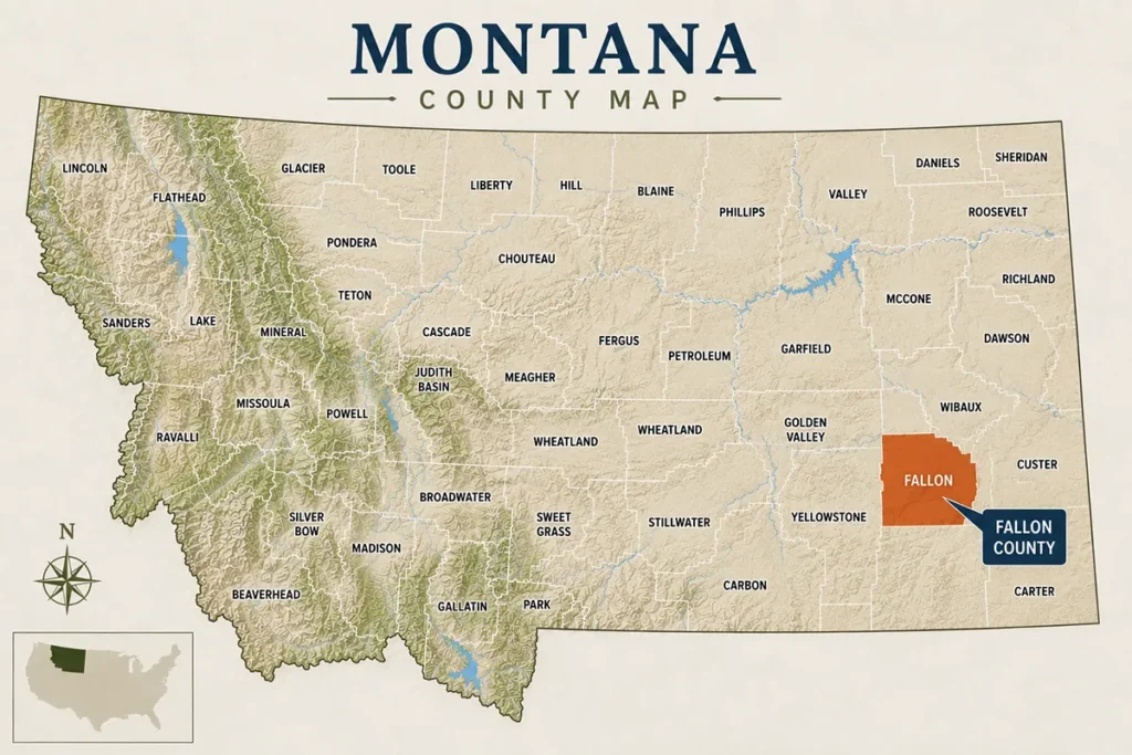
- Fallon County covers 1,620 square miles in Montana’s far east, bordering North Dakota to the east and Carter County to the south
- The county seat is Baker (~1,800) — a gateway town on US-12 with a working downtown, a sandy beach lake, and access to two state parks
- Baker Lake is the town’s main recreation hub — swimming beach, kayaking, paddleboarding, fishing for bass and pike, and a scenic lakeside walking path
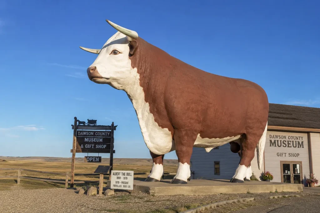
- The O’Fallon Historical Museum is free and houses the world’s largest steer — “Steer Montana” — a nearly 4,000-pound fiberglass icon
- Medicine Rocks State Park sits on the Fallon-Carter county line, 25 miles south of Baker — the International Dark Sky Sanctuary covered in depth in the Carter County guide
- In 1915, a driller seeking water accidentally struck natural gas — the well burned for years and launched Baker’s oil and gas economy
- The Big K Drive-In has been serving burgers and running films since the 1960s — one of the few operational drive-ins left in Montana
- The Pioneer Apple Orchard planted by early homesteaders more than a century ago opens to the public for apple picking each fall
- Baker is the primary services hub and last full fuel stop before entering Carter County from the north
- ⚠️ One competitor guide incorrectly places Pirogue Island State Park near Baker — it’s actually near Miles City in Custer County, roughly 100 miles west
Liked this article?
Add Roaming Montana as a preferred source so you see more of our articles and guides on Google.
Fallon County at a Glance
Fallon County was established in 1913, carved from Custer County.
It’s named for Benjamin F. Fallon — an early settler from New York who was among the first farmers to break ground in this part of eastern Montana.
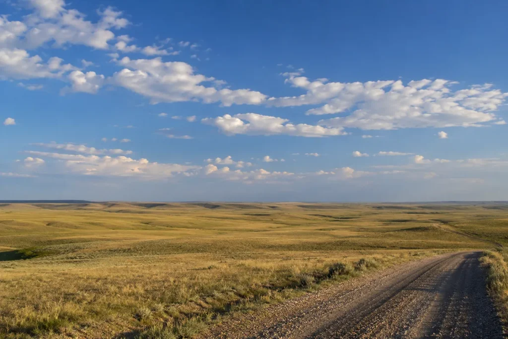
The county covers 1,620 square miles of rolling shortgrass prairie, coulees, and scattered badland terrain in Montana’s far southeast corner. The Yellowstone River runs well to the north; within Fallon County itself the main water features are smaller — Baker Lake, South Sandstone Reservoir, and a network of seasonal creeks.
The county borders North Dakota to the east, Carter County to the south, Prairie County to the northwest, Wibaux County to the northeast, and Custer County to the west.
Population is around 3,011 — a mix of ranching families, agricultural workers, and people tied to the oil and gas industry.
Baker, on US-12, handles nearly all of the county’s services. US-12 connects Baker westward toward Miles City (105 miles) and eastward toward Bowman, North Dakota.
For broader Montana context, see the complete guide to all 56 Montana counties.
Baker: County Seat and Eastern Gateway
Baker (~1,800) is a working plains town — not a tourist destination by design, but functional enough for a multi-day base and more interesting than a quick pass-through reveals.
The town originally went by the name Lorraine. It was renamed Baker in 1908 for A.G. Baker, a construction engineer who worked on the Milwaukee Road mainline that passed through the county.
The Milwaukee Road — one of the transcontinental railroads — ran through this stretch of southern Montana before eventually abandoning the line in 1980. The railroad shaped Baker’s early commercial development and gave it better connectivity than many comparable plains towns.
Baker sits next to Baker Lake, which gives it an unusual amenity for a small eastern Montana city — a real recreational lake right at the edge of downtown.
For the full Baker visitor guide, see Baker, Montana.
The 1915 Gas Well: Baker’s Accidental Origin Story
If you want to understand Fallon County’s economy, start here.
In 1915, a driller was searching for water near Baker. Instead of water, he hit a pocket of natural gas.
The well ignited.
It burned for years — a sustained flame from the earth that became a local landmark and eventually a controlled resource. That accidental discovery launched Baker’s relationship with the oil and gas industry that continues to this day.
The Fallon County economy runs on three legs: agriculture (wheat, cattle, and sheep ranching), oil and gas extraction (on the western edge of the Bakken formation), and the services that support both.
That 1915 gas well changed the calculus of what this county was. A farming community became a farming-and-energy community, with the stability and tax revenue that oil and gas provide.
The O’Fallon Historical Museum covers this transition in its exhibits on Baker’s economic history.
O’Fallon Historical Museum and Steer Montana
The O’Fallon Historical Museum is Baker’s primary historical institution and home to one of Montana’s most beloved roadside curiosities.
“Steer Montana” — a fiberglass replica steer weighing nearly 4,000 pounds — stands outside the museum and has been drawing road-trippers and their cameras since the 1970s.
It’s enormous. The proportions are genuinely disorienting. Posing next to it is a Montana rite of passage.
Inside the museum, housed in buildings dating to 1916, the collection covers:
- Fallon County pioneer and homestead history
- Native American artifacts and heritage
- The railroad era and Milwaukee Road connection
- Oil and gas history, including the 1915 gas well discovery
- Agricultural tools and equipment from the settlement era
- Fossils from the surrounding badland terrain
The museum is free to visit and staffed by knowledgeable local volunteers.
[Verify current hours at falloncountymt.gov or the Baker Visitor Center]
Baker Lake
Baker Lake sits directly at the edge of downtown — and for a town of 1,800 in the Montana plains, having a sandy beach lake within walking distance of Main Street is a genuine civic asset.
The lake has a swimming beach with sand, a paved walking path with benches around the perimeter, picnic areas, playgrounds, and a kayak and paddleboard launch.
Fishing from the shore and off docks is productive — baker Lake holds largemouth bass, yellow perch, and northern pike.
Iron Horse Park adjacent to the lake has a splash pad for young children, a skate park, and additional fishing access. It’s the main family destination in Baker during summer months.
The annual Lake Day celebration brings the town together each summer with sand castle contests, beach volleyball, sack races, a live band, and a fireworks display after dark.
Watching that fireworks show reflect over the lake from a folding chair on the beach, surrounded by Fallon County families who’ve been doing this every summer for generations, is one of those quietly particular Montana experiences.
Medicine Rocks State Park
Medicine Rocks State Park sits on the Fallon-Carter county line — 25 miles south of Baker, 14 miles north of Ekalaka.
Because it straddles the county boundary, both Fallon and Carter counties can legitimately claim it. Most visitor logistics, however, flow through Baker (Fallon County) when approaching from the north and through Ekalaka (Carter County) when approaching from the south.
For the full Medicine Rocks guide — the sandstone formations, petroglyphs, Dark Sky Sanctuary designation, camping details, and “Dinosaurs & Dark Skies” programming — see the Carter County guide.
From a Fallon County perspective: Medicine Rocks is 25 miles of paved highway south of Baker on Montana Highway 7. Baker has the last reliable fuel and services before the park from this direction. Plan your fuel and food accordingly.
South Sandstone Reservoir
South Sandstone Reservoir sits about 20 minutes south of Baker — a quiet water body with no-wake regulations that give it a calmer character than most public reservoirs.
Activities: fishing (perch, pike, bass), swimming, paddleboarding, camping.
The no-wake rule keeps jet skis and motorboats off the water, making it genuinely peaceful for paddlers and shore anglers.
The reservoir is lightly used by visitors from outside the area. County locals treat it as a reliable summer retreat — which is usually a reliable indicator of quality.
Hunting in Fallon County
Fallon County supports solid hunting across multiple species.
White-tailed deer are abundant in the agricultural corridor — creek bottoms, field edges, and the brushy coulees that run through the county’s rolling terrain. The deer hunting here draws out-of-state hunters who prefer a lower-pressure environment than the more heavily marketed counties.
Mule deer are present in the rougher terrain toward the Carter County border. As you move south toward the Medicine Rocks area the mule deer population increases.
Ring-necked pheasants are present in good numbers — Fallon County’s mix of grain fields, grass waterways, and creek corridors provides strong pheasant habitat.
Sharp-tailed grouse and Hungarian partridge round out the upland bird options.
Hunting access is primarily on private agricultural land and state land interspersed through the county. Montana state land maps and Hunter Access Program (HAP) information are available at fwp.mt.gov.
Historic Downtown Baker
Baker’s downtown has more going on than the population figure suggests.
The downtown self-guided history walk is a good orientation tool — pick up a pamphlet at the Baker Visitor Center, then walk Main Street scanning QR codes at each historic building to pull up the history on your phone. It covers the railroad era, the gas well discovery, the homestead families, and the evolution of the commercial district.
The Historic Fallon Hotel (1915) on Main Street was built by William Fallon and anchors the historic district. It has been updated for modern convenience while keeping the original high-ceilinged, antique-furnished character.
The Lake Theatre on Main Street — a 1918 movie house with 500-plus seats — hasn’t run films since the 1950s, but the building is a significant piece of Baker’s architectural history visible from the street.
The Pioneer Apple Orchard just outside Baker was planted by early homesteaders in the early 1900s. Some of the original trees are still productive. In autumn, the orchard opens to the public for apple picking — a heritage experience that connects visitors directly to the homestead story in a tangible way.
The Big K Drive-In
The Big K Drive-In has been serving Baker since the 1960s and is still operational — one of the few working drive-ins in eastern Montana.
Pull up, order a cheeseburger and fries through the car window, or sit at the outdoor picnic tables. The menu is classic drive-in: burgers, shakes, fried food.
It’s not fancy. That’s not the point.
The Big K Drive-In is a piece of American roadside culture that most of the country has replaced with fast food chains. In Baker, it survived.
Fallon County Fair and Rodeo
The Fallon County Fair and Rodeo runs annually in August — typically mid-August.
The fair covers the standard county fair format: livestock shows, 4-H competitions, carnival rides, agricultural exhibits, and commercial vendors. The rodeo adds PRCA-sanctioned events through the weekend.
[Verify current dates at falloncountymt.gov or the Baker Chamber of Commerce]
The Big Hill Shoots — target shooting competitions held on Big Hill outside Baker — are another recurring local tradition for firearms enthusiasts. The location gives sweeping views of the surrounding prairie. [Verify current schedule with the Baker Recreation Center]
What I Wish I Knew Before Visiting Fallon County
Baker is your last full fuel stop before Carter County. If you’re heading south to Ekalaka or Medicine Rocks from the north, fill your tank and check your supplies in Baker. There’s essentially nothing guaranteed between Baker and Ekalaka in terms of fuel availability.
Steer Montana is worth a full stop, not a drive-by photo. The scale doesn’t read from a moving car. Park the vehicle, walk around the steer, and go inside the O’Fallon Museum. The accidental gas well story alone is worth 20 minutes.
The Lake Day fireworks are a legitimate event. If you’re in Baker in midsummer and the dates align, the Baker Lake celebration is a genuine community event — not a tourist attraction, but a real small-town Montana summer gathering.
Medicine Rocks is 25 miles from Baker — not a quick detour. Plan a half-day minimum if you’re combining Baker and Medicine Rocks. See the Carter County guide for Medicine Rocks logistics and the Dark Sky Sanctuary programming.
Pirogue Island State Park is not near Baker. At least one competitor guide places Pirogue Island (a Yellowstone River island park) near Baker. Pirogue Island State Park is near Miles City in Custer County — about 100 miles west of Baker. If that’s on your list, plan accordingly.
South Sandstone Reservoir’s no-wake rule makes it ideal for paddlers. If you have a kayak or paddleboard, this is one of the quieter water bodies in the county for a peaceful morning on the water.
The Pioneer Apple Orchard is autumn-specific. The public picking opportunity happens in fall when the apples are ripe. Check current availability with the Baker Visitor Center before planning a trip specifically around this.
Practical Info
| County seat | Baker |
| Area | 1,620 sq mi |
| Population | ~3,011 (2022 est.) |
| Tourism region | Southeast Montana |
| Formed | 1913 |
| Main highways | US-12 (east-west), Montana Highway 7 (north-south toward Ekalaka) |
| O’Fallon Museum | Downtown Baker — free [verify hours] |
| Baker Lake | At the edge of downtown Baker |
| Medicine Rocks | 25 miles south on Montana Hwy 7 |
| South Sandstone | ~20 minutes south of Baker |
| Fallon County Fair | Mid-August annually [verify at falloncountymt.gov] |
| Nearest city | Miles City (~105 miles west on US-12) |
| North Dakota border | ~10 miles east of Baker |
| Nearest airport | Billings Logan International (BIL) — ~215 miles west |
| Cell service | Good in Baker; variable south toward Carter County |
| Best season | May–October; fall for apple orchard and hunting |
Getting to Fallon County
From Miles City: US-12 east — 105 miles, about 1.5 hours.
From Glendive (Dawson County): US-12 west — about 55 miles, roughly 50 minutes.
From Bowman, ND: Head west on US-12 — about 60 miles to Baker.
From Billings: I-94 east to Glendive, then US-12 west — about 215 miles, roughly 2.5–3 hours.
By air: No scheduled air service in Fallon County. Billings Logan International (BIL) is the nearest major airport at roughly 215 miles.
See Montana airports and Montana transportation guide.
Towns in Fallon County
- Baker — county seat; all services, Baker Lake, O’Fallon Museum
- Plevna — small community west of Baker on US-12; basic services
- Baker Area Rural Communities — Ismay, Baker area unincorporated communities
Adjacent Counties
- Custer County to the west — Miles City, Bucking Horse Sale
- Prairie County to the northwest — Terry, Yellowstone River
- Wibaux County to the northeast — Wibaux
- Carter County to the south — Ekalaka, Medicine Rocks, Carter County Museum
Plan Your Fallon County Trip
Fallon County works best as part of a larger eastern Montana circuit rather than as a standalone destination.
Baker makes the most sense as a one-night base for travelers heading to or from Carter County — with the O’Fallon Museum, Baker Lake, and the Big K Drive-In filling an afternoon and evening before the southern push toward Medicine Rocks and Ekalaka.
As a straight Baker day trip from Miles City: drive east on US-12, stop at Baker Lake and Iron Horse Park, visit Steer Montana and the O’Fallon Museum, drive south on Highway 7 to Medicine Rocks and back, dinner at one of Baker’s local spots.
The longer version adds an overnight in Baker and a full day exploring Carter County the next morning — see the Carter County guide for that planning.
For broader planning, see Montana trip planning guide and best time to visit Montana. Back to the complete Montana counties guide.