In November 1900, a man named Harry Kendall rode his horse into Lewistown, walked into the local bank, and dropped four gold bars on the teller’s counter — and the teller reportedly fainted.
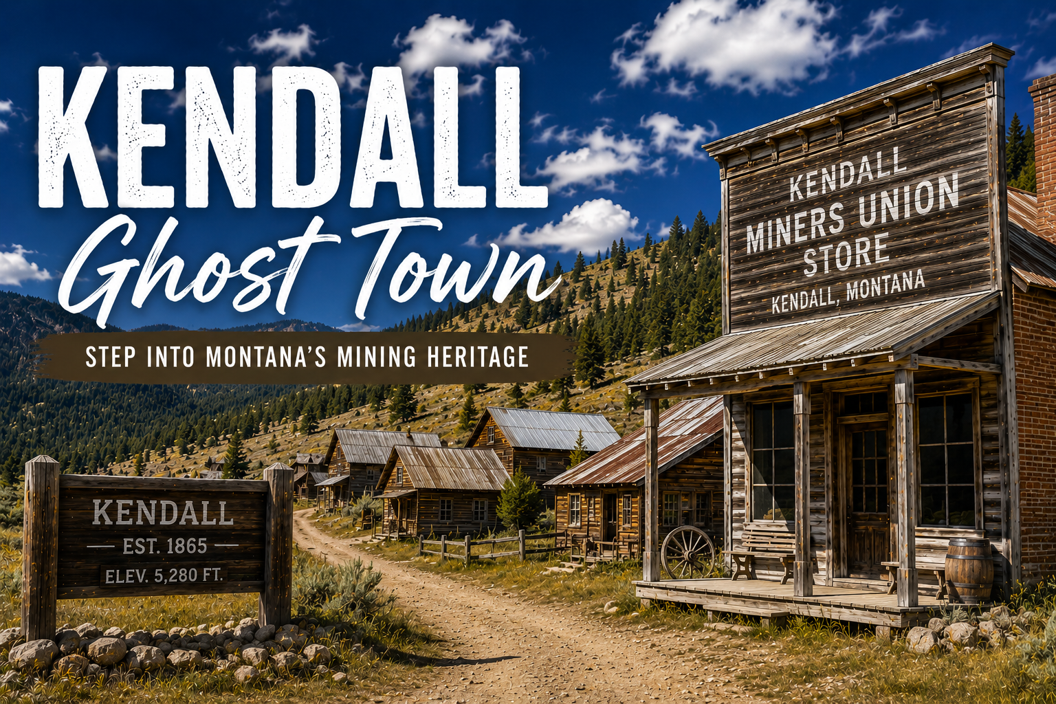
Kendall is a small ghost town in the North Moccasin Mountains north of Lewistown, central Montana — and the only ghost town in the world owned by the Boy Scouts of America (it’s part of the K Bar M Scout Ranch). It boomed from 1900 to 1920 around a turn-of-the-century cyanide gold-extraction breakthrough that made previously unworkable ore profitable. Peak population was around 1,500. Today the visit is mostly stone foundations, partial walls, scattered ruins, and interpretive kiosks at each major site documenting what each building was. Boy Scouts of America maintains the property. Access is free but visitors should respect the Scout use. Below: Harry Kendall’s full story, the cyanide-mining angle, the Boy Scout connection, and how to combine Kendall with other Fergus County ghost towns.
Liked this article?
Add Roaming Montana as a preferred source so you see more of our articles and guides on Google.
Why Kendall Is Unlike Any Other Montana Ghost Town
If you’ve read my Montana ghost towns guide, you’ve already seen the marquee Montana sites — Bannack, Garnet, Virginia City, and the silver-era towns of Granite and Elkhorn. Kendall doesn’t compete with those on scale or preservation. It has something none of them have.
Kendall is the only ghost town in the world owned and maintained by the Boy Scouts of America.
The 489-acre K Bar M Scout Ranch, encompassing the Kendall town site, was deeded to the Montana Council of the Boy Scouts between the 1960s and 1980s by pioneer resident Glenn Morton, the estate of Margharite McLean, the Munski brothers (Bill, Joe, and Stan), and the Methodist Church.
The “K” stands for Kendall; the “M” memorializes the four gifts of land. Scouts have used the site since 1968, camping in the shadows of the gold-rush ruins.
That’s the first reason to visit Kendall. The second is the story behind it.
This isn’t a gold rush town. Kendall existed because of a technological breakthrough — the early 1900s development of practical cyanide gold extraction — that suddenly made decades of previously unworkable ore profitable. The story of Kendall is the story of how a man named Harry T. Kendall arrived in the North Moccasin Mountains with new chemistry and built a town in a year.
The third reason is what happened to it. Most Montana ghost towns died when their mines closed. Kendall’s residents did something different — they physically dragged their houses to nearby Hilger when the mining ended. Some of those houses are still in Hilger today.
I visited Kendall in late summer 2024 [verify]. This guide is built from that visit, the Lewistown Chamber of Commerce’s “Ghost Towns & Gold Mines” tour brochure, and the deep documentation in Raised in the West magazine and the Montana DEQ archives. As always, anything time-sensitive is marked [verify].
The Harry T. Kendall Story — The Man Who Made Bars and Made the Teller Faint
Most Montana ghost-town founders were placer miners who got lucky with a creek strike. Harry T. Kendall was different.
A chemistry guy, not a prospector
Harry T. Kendall arrived in the North Moccasin Mountains in the late 1890s with a specific interest: the cyanide gold extraction process. Gold had been found in the North Moccasins since the 1880s, but the ore was difficult.
Placer mining had been attempted in Iron Gulch but failed due to lack of water. Lode mining had produced some gold but most ore was too low-grade or too fine to recover economically with traditional stamp-and-amalgamation processes.
The cyanide process changed the math. Crushed ore is soaked in a cyanide solution; the cyanide dissolves the gold; the gold is then precipitated out. Recovery rates on previously unworkable ore could exceed 90%. The Kendall area’s gold was so fine that it was “often undetectable to the human eye,” yet cyanide could pull it out at industrial scale.
The 1900 mill and the gold bar legend
Kendall purchased two mining claims in the North Moccasins and built a cyanide mill in 1900. The operation worked. According to local legend documented in Raised in the West magazine, Harry Kendall produced his first four gold bars in November 1900 and personally rode his horse into Lewistown to deposit them at the bank.
When he reached the bank, he reportedly walked up to the teller, opened his saddlebags, and plunked the four gold bars onto the counter. The teller reportedly fainted on the spot. The bank president ushered Kendall into a private office. The bars were valued at $2,400 — roughly $78,000 in today’s money for what was effectively a few weeks’ production from a brand-new operation.
Word of Kendall’s success spread quickly. The North Moccasin Mountains, dormant for years, were suddenly the most active gold district in central Montana.
Kendall the millionaire
Within a year, Harry Kendall sold his operation for what reportedly made him a millionaire. He left Montana and settled in California, never returning to the town that still bears his name. He had figured out the cyanide process locally, demonstrated it, and cashed out. The town itself was just getting started.
For broader context on Montana’s mining heritage, see my Montana gold rush and key historical events in Montana pieces.
A Quick History — From Cyanide to Collapse in 20 Years
1880s — False starts
Placer gold discovered in Iron Gulch and other North Moccasin gulches, but lack of water made placer mining impractical. Some pyrite lode deposits worked briefly. All abandoned.
1893 — Lode discoveries
Larger gold-bearing lode deposits identified. Treatment of the ore remained the problem — too low-grade and too fine for traditional processes.
1899–1900 — Cyanide arrives
Harry T. Kendall arrives, sets up a cyanide mill, demonstrates the process works.
1901 — Boomtown
Townsite platted and named Kendall. By October of that year, the town has two hotels, five saloons, two livery stables, three stores, a restaurant, a brothel, an assay office, a butcher shop, and two stagecoach lines running daily to Lewistown.
1903 — Statewide gold leader
The Kendall district is leading Montana in gold production. By 1910, the town peaks at approximately 1,500 residents with electricity provided by the Kendall Power Plant.
By peak, the town included:
- Two hotels and multiple boarding houses
- Several saloons
- A two-story schoolhouse
- The Jones Opera House
- A hospital
- A bank
- A newspaper
- An assay office, butcher, tailor, bakery
- Multiple stores and restaurants
- Most buildings illuminated by electricity from the local power plant
Major mines
- Kendall Mine (original)
- Santiago Mine
- Barnes-King Mine (eventually the largest)
- Horse Shoe Mine
Total district production reached approximately $15 million in gold.
1908 — Major fire
A devastating fire burns down a substantial portion of the business district. Some buildings rebuilt; others not.
1911–1912 — More fires and declining ore
Additional fires destroy more buildings. Gold ore begins to diminish in quality.
1911 — Hilger founded
Hilger, a new town a few miles east, is platted along a new railroad spur. Unlike Kendall, Hilger is on the train line, which gives it permanent advantages in supply costs and personal mobility. Residents begin relocating.
1918 — Population collapses
Kendall’s population drops to about 200 people as most miners and families move to Hilger or elsewhere.
1920 — The Barnes-King closes
The largest remaining mine in the district closes. This is effectively the death blow. Smaller mines follow within years.
The unique decline — houses moved to Hilger
What happened next sets Kendall apart from other Montana ghost towns. Rather than abandoning their homes, Kendall residents physically dismantled or hauled their houses to Hilger and other nearby towns. Wagons, sleds, and eventually trucks pulled entire structures across the prairie.
Lumber was salvaged from stone foundations that couldn’t be moved. The former Hilger School building, still standing in Hilger today, was originally a Kendall building.
This is why Kendall today is mostly foundations and ruins — not because the residents simply walked away, but because they took most of the buildings with them.
1960s–present — The Boy Scouts era
Between the 1960s and 1980s, the K Bar M Scout Ranch is created through land donations from local families and institutions, totaling 489 acres including the original Kendall town site. Boy Scouts of America has maintained the property since 1968. Scouts camp at the site multiple times per year, and the organization has installed interpretive kiosks at each major ruin with historical photos and information.
What’s Left at Kendall Today
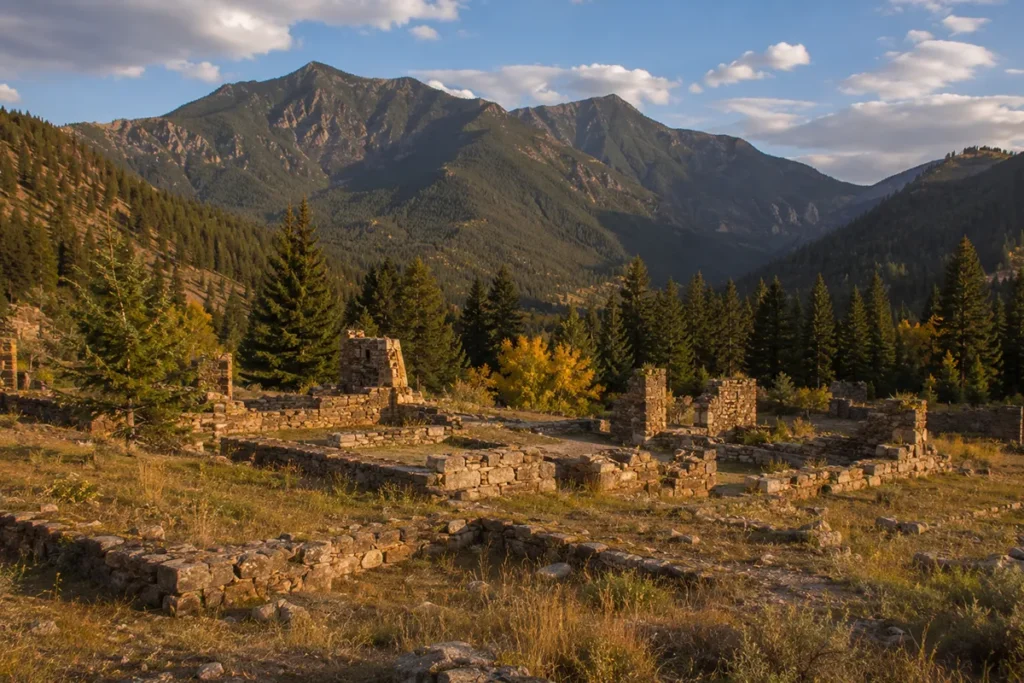
Don’t go expecting Bannack or Virginia City. Kendall is mostly foundations, partial walls, and scattered ruins. What it does have, uniquely, is excellent interpretation — each major site has its own kiosk with historical documentation.
Building foundations
Throughout the town site, rectangular stone foundations outline where buildings once stood — hotels, the schoolhouse, the Jones Opera House, the bank, the businesses of the main street. Walking among them, you can read the kiosk signage and understand what existed where.
The bandstand
Kendall had a bandstand in its main public area. Remnants survive and the kiosk explains the role of music in mining-town culture. A surprisingly intact piece of evidence about what daily life in 1905 Kendall actually felt like.
The drilling-contest boulder
Mining towns held competitive drilling contests where pairs of miners would compete to drive a steel drill bit into solid rock as deep as possible in a fixed time. Kendall has a surviving boulder used in these drilling contests, with hole impressions still visible in the stone. One of the most unusual surviving artifacts at any Montana ghost town.
Stone walls and partial structures
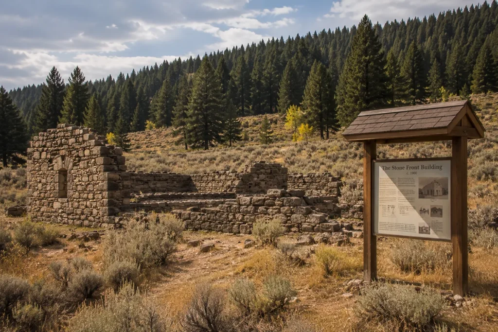
A few buildings retain partial stone walls — not full structures, but enough to give a sense of scale and material. Mining-era stone construction looks different from modern work; the kiosks help interpret what you’re seeing.
Mining ruins
On the slopes around the town site, mill foundations, ore-processing equipment fragments, and waste rock piles remain from the cyanide milling operations. Some of this is on the K Bar M property; some extends onto adjacent land.
The interpretive kiosks (the real visitor experience)
This is what differentiates Kendall from sites like Castle Town or Comet. The Boy Scouts have installed interpretive signage with historical photos at major ruin sites. You can stand in front of a stone foundation and see what the building looked like in 1905, who occupied it, and what happened to it.
Getting There
Kendall is in the North Moccasin Mountains, north of Lewistown in central Montana — a long drive from anywhere that isn’t Lewistown.
From Lewistown (~25 minutes)
- From Lewistown, take Highway 87 north for approximately 13 miles to Hilger
- In Hilger, turn west onto North Kendall Road
- Continue about 7 miles north along Last Chance Creek to the Kendall town site
From Helena (~3 hours)
East via Highway 12 to Harlowton, then north through White Sulphur Springs and east to Lewistown, then north via Highway 87 to Hilger.
From Great Falls (~2 hours)
Southeast on Highway 87 to Lewistown, then north to Hilger.
From Billings (~2.5 hours)
Northwest via Highway 191 and Highway 87 to Lewistown.
Road conditions
| Factor | Detail |
|---|---|
| Distance from Lewistown | ~20 miles |
| Drive time from Lewistown | ~25 minutes |
| Surface | Paved Highway 87 from Lewistown to Hilger; gravel North Kendall Road from Hilger to the town site |
| Gravel mileage | ~7 miles |
| Vehicle requirement | High-clearance recommended for the gravel section; standard cars manage in dry conditions |
| Avoid when | Wet or recently muddied; the road becomes slick |
| Season | Late spring through fall; winter access difficult |
| Cell service | Spotty to none |
Practical Visitor Info
| Topic | Details |
|---|---|
| Location | North Moccasin Mountains, ~20 miles north of Lewistown, Fergus County, MT |
| Coordinates | Approximately 47.3°N, 109.4°W [verify exact] |
| Owned by | Boy Scouts of America (Montana Council) — K Bar M Scout Ranch |
| Entry fee | Free — but visitors should respect Scout use of the property |
| Visitor center | None on site |
| Restrooms | None reliably public |
| Drinking water | None — bring everything |
| Cell service | None |
| Pets | Allowed on leash; pack out everything |
| Camping | Reserved for Boy Scouts; public camping not allowed at the town site |
| Accessibility | Limited — uneven terrain, dirt paths, no paved walkways |
| Best info source | Lewistown Chamber of Commerce (~408 NE Main, Lewistown) — request the free “Ghost Towns & Gold Mines” brochure |
Visiting a Boy Scout Property — Etiquette Notes
The K Bar M Scout Ranch is active Boy Scouts of America property. Visitors are generally welcome but should remember:
- Don’t camp on the property — camping is reserved for Scout use
- Don’t enter buildings or structures — most are unsafe and respect for the property is expected
- Don’t take artifacts — pieces of brick, metal, glass, or wood from the site stay on the site
- Don’t drone without checking — Scout activities may be in progress
- If Scouts are present, don’t disrupt their programming — give them the space their organization has earned
- Pack out everything you pack in
Treat Kendall like a small museum maintained by a volunteer organization, because that’s essentially what it is.
Combining Kendall With Other Stops — The Fergus County Ghost Town Cluster
Kendall is one of four major ghost towns in Fergus County, and the Lewistown Chamber of Commerce publishes a free brochure called “Ghost Towns & Gold Mines” that maps all four with historical details. The full cluster:
Kendall (this guide)
North Moccasin Mountains, ~25 minutes north of Lewistown via Hilger.
Maiden
A bustling town in the 1880s, peaking at 1,200 residents and 154 buildings. Located in the Judith Mountains east of Lewistown.
Giltedge
On the east slopes of the Judith Mountains, gold discovered 1883, first or second site in Montana to use cyanide processing (1892). Mining ended 1991. Visible cuts and tailings northwest of Giltedge today.
Fort Maginnis
Military post (1880–1890) on the Judith River, established to protect miners and settlers from Native American conflicts. Some foundations and historical markers remain.
A two-day Fergus County itinerary
Day 1: Lewistown morning → Kendall in early afternoon → Maiden in late afternoon → overnight in Lewistown Day 2: Giltedge in the morning → Fort Maginnis in the afternoon → return
Combined with Lewistown as your base, this is one of the most underrated 2-day road trips in Montana — and you’ll see almost no other tourists.
When to Visit
| Season | Experience | My Take |
|---|---|---|
| Spring (April–May) | Wet conditions possible, road may be muddy | Variable |
| Summer (June–Aug) | Best access, warmest weather | Most reliable |
| Early fall (Sept–Oct) | Cool weather, aspens turning, very few visitors, golden grasses | My favorite. Late September is exceptional. |
| Late fall (Nov) | Cold, road may be impassable after snow | Risky |
| Winter (Dec–March) | Road typically impassable, Scout property closed to most use | Don’t try it |
What I Wish I’d Known Before My First Visit
Stop in Lewistown first. Pick up the free “Ghost Towns & Gold Mines” brochure from the Lewistown Chamber of Commerce at 408 NE Main [verify address]. It transforms the visit. The brochure has the map, the history, and the context you can’t easily find online.
Allow 60-90 minutes at the site. Kendall is small and most of what’s there is foundations rather than buildings. The interpretive kiosks make 60-90 minutes feel right; less and you’ll miss the context.
Read the Harry Kendall story before you go. The whole town hits differently once you understand it was built around a single technological breakthrough by one chemistry-minded entrepreneur who took his first gold bars to Lewistown and made the teller faint.
Check whether Boy Scouts are using the property. Most of the year the site is open and undisturbed. During Scout events, give the organization space.
Don’t expect a Bannack-style visit. Kendall is foundations, partial walls, and kiosks. If you arrive expecting standing buildings to walk through, you’ll be disappointed. If you arrive expecting interpretation of how a town vanished, you’ll be impressed.
Combine with Lewistown. Lewistown is genuinely one of central Montana’s best small towns — Big Spring Creek runs through it, the historic downtown is well-preserved, and the Central Montana Museum (next to the Chamber of Commerce) has excellent regional history.
Bring everything. Water, lunch, sunscreen, layers, a real camera if you want photographs. Hilger is a small town with no real services for visitors.
Don’t try winter access. The North Kendall Road becomes impassable when wet or snowed-in, and even the Boy Scouts limit their use of the property in winter.
Photography Tips
A few notes from my visit:
Best overall light: Late afternoon. The North Moccasins are at relatively low elevation for Montana mining sites (~5,400 feet) and the late-day side light works beautifully on the stone foundations and scattered wood.
Best subjects:
- The drilling-contest boulder with its surviving hole impressions
- The bandstand remnants
- Stone foundations against the autumn grasses
- The interpretive kiosks themselves (they’re well-designed and document something rare)
Best vantage point for the town: From the small rise on the south side of the town site, looking back across the foundations toward the North Moccasin slopes.
Gear: A 24-35mm lens for foundations and landscapes, a 50mm for detail shots, a polarizer for the central Montana sky.
What to avoid: Mid-day light from June through August. The site is largely treeless and the harsh overhead light flattens everything.
Frequently Asked Questions
Where is Kendall Montana ghost town?
Kendall is located in the North Moccasin Mountains of Fergus County, Montana — approximately 20 miles north of Lewistown via Highway 87 to Hilger, then northwest on North Kendall Road for about 7 miles. The town site sits at roughly 5,400 feet elevation.
Is Kendall really owned by the Boy Scouts?
Yes. Kendall is part of the K Bar M Scout Ranch, 489 acres deeded to the Montana Council of the Boy Scouts of America between the 1960s and 1980s. It is reportedly the only ghost town in the world owned by Boy Scouts of America.
Is Kendall worth visiting?
Yes, especially for history travelers interested in central Montana, cyanide-era mining, or the unique Boy Scout ownership story. Kendall doesn’t have the dramatic preserved buildings of Bannack or Virginia City — most of what remains is foundations and ruins with excellent interpretive signage.
How much does it cost to visit Kendall?
Free. There is no entry fee at Kendall. The site is maintained by Boy Scouts of America as an open historic site.
Who was Harry T. Kendall?
Harry T. Kendall was a turn-of-the-century entrepreneur and gold miner who developed the cyanide gold extraction operations in the North Moccasin Mountains. He built a cyanide mill in 1900, demonstrated profitable gold production on previously unworkable ore, and according to local legend, deposited his first four gold bars at a Lewistown bank in November 1900 — making the teller faint. He sold his operation in 1901, reportedly as a millionaire, and moved to California.
Why did Kendall die?
Three reasons. Fires in 1908 and 1911 destroyed parts of the business district. Gold ore began to decline after 1912. And the founding of nearby Hilger on a railroad line in 1911 gave residents a better economic option. By 1920, when the largest remaining mine (Barnes-King) closed, Kendall was effectively over.
What’s unique about how Kendall declined?
Most Montana ghost towns died because residents abandoned their homes. Kendall residents physically dragged their houses to nearby Hilger, using wagons, sleds, and trucks to move entire buildings. Some of those structures still stand in Hilger today, including what is now the former Hilger School building.
Can you camp at Kendall?
No — camping at the Kendall town site is reserved for Boy Scouts of America activities. Public camping is not permitted. The nearest dispersed camping options are on Bureau of Land Management or Forest Service land in the surrounding area.
What’s left to see at Kendall?
Stone building foundations, partial walls, mining-era ruins, a surviving bandstand, a drilling-contest boulder used in 1900s mining competitions, and interpretive kiosks with historical photos at each major site. The visit is largely about reading what’s left through the kiosk signage.
How long does it take to visit Kendall?
60-90 minutes on site is typical. Combined with the drive from Lewistown, plan 3 hours round trip. Combine with other Fergus County ghost towns (Maiden, Giltedge, Fort Maginnis) for a full day.
Is Kendall family-friendly?
Generally yes — the site is small, flat enough to walk easily, and the interpretive kiosks engage kids with photos. The drive in is moderate but not difficult. Younger kids may find it less visually engaging than larger ghost towns with standing buildings.
What other ghost towns are near Kendall?
Three other major Fergus County ghost towns are within 30-60 minutes: Maiden (peaked at 1,200 residents and 154 buildings), Giltedge (notable for being one of the first sites in Montana to use cyanide processing), and Fort Maginnis (an 1880s military post). The Lewistown Chamber of Commerce publishes a free “Ghost Towns & Gold Mines” brochure mapping all four.
Final Thoughts
Kendall is the Montana ghost town for travelers who’ve already seen the famous ones and want something different. It’s small. It’s mostly foundations. It’s tucked deep into the North Moccasin Mountains in a part of Montana most tourists never visit.
What makes it work is the specificity of the story. A man named Harry T. Kendall arrived around 1900 with cyanide chemistry that suddenly made decades of dormant gold workable.
He built a town in a year, sold his operation in another year, and disappeared to California. The town he left behind boomed for a decade, declined as the ore played out, and then — uniquely in American ghost town history — the residents loaded their houses onto wagons and dragged them to Hilger when the trains came through.
Today the Boy Scouts maintain what’s left. The interpretive kiosks are the best you’ll find at any Montana ghost town. The drilling-contest boulder is one of the strangest historical artifacts in the state. And the whole site sits in some of the most beautiful and least-visited country in central Montana.
If you’re planning a visit, my recommendation: pick a mid-September Tuesday. Drive to Lewistown the night before, stay at one of the historic hotels, walk to the Chamber of Commerce in the morning, pick up the brochure, get coffee, then drive north via Hilger. Spend 90 minutes at Kendall. Have lunch back in Lewistown. Hit Maiden or Giltedge in the afternoon. Drive back at golden hour with the prairie glowing.
Drop your questions in the comments. And don’t forget to check my full Montana ghost towns guide if you want to combine Kendall with the marquee ghost towns of southwest Montana.