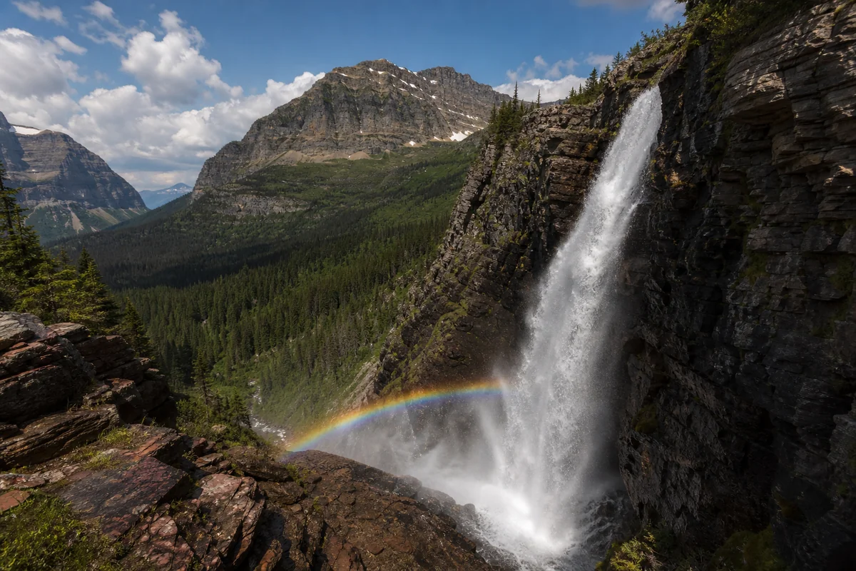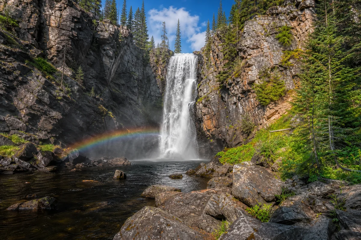
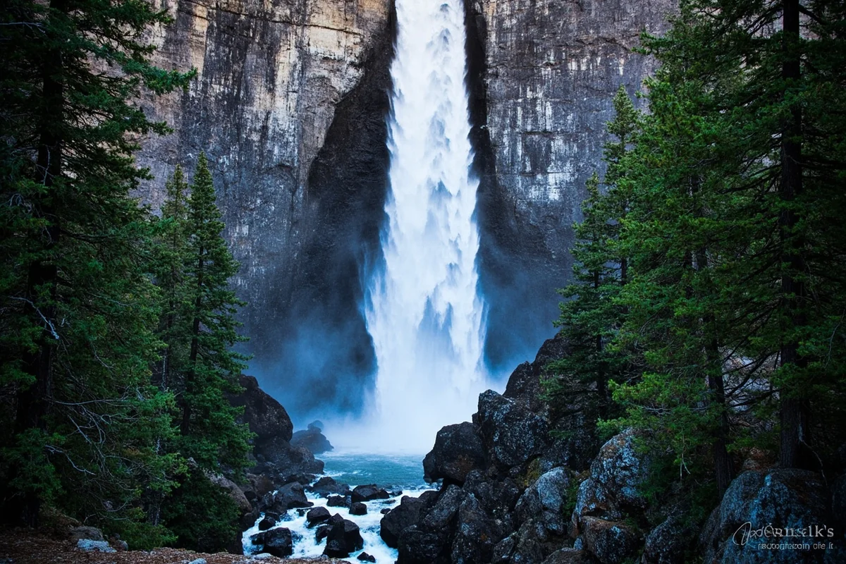
Standing at the base of Pintler Falls last August, I watched the late afternoon sun catch the mist and throw tiny rainbows across the granite walls—and I had the entire place to myself for nearly an hour.
In a state blessed with countless Montana waterfalls, Pintler Falls remains one of those quietly spectacular destinations that most visitors simply don’t know exists, tucked away in the rugged Anaconda-Pintler Wilderness where the crowds thin out and the wilderness feels genuinely wild.
- Pintler Falls is located in the Anaconda-Pintler Wilderness, accessible via the East Fork Trail (#29)
- Round-trip distance: approximately 8 miles with 1,200 feet elevation gain
- Best time to visit: late June through early September for optimal water flow and trail conditions
- No permit required for day hiking, but wilderness regulations apply
- Bring bear spray, plenty of water, and sturdy hiking boots—this isn’t a casual stroll
- Cell service is nonexistent past the trailhead; download offline maps before you go
What Makes Pintler Falls Worth the Trek
I’ll be honest with you—Pintler Falls isn’t the tallest waterfall in Montana, nor is it the most accessible. But that’s precisely what makes it special.
When I made the hike during my visit last summer, I passed exactly three other hikers on the entire trail. Compare that to popular spots like Ousel Falls near Big Sky or Kootenai Falls in the northwest, which can feel almost crowded on summer weekends.
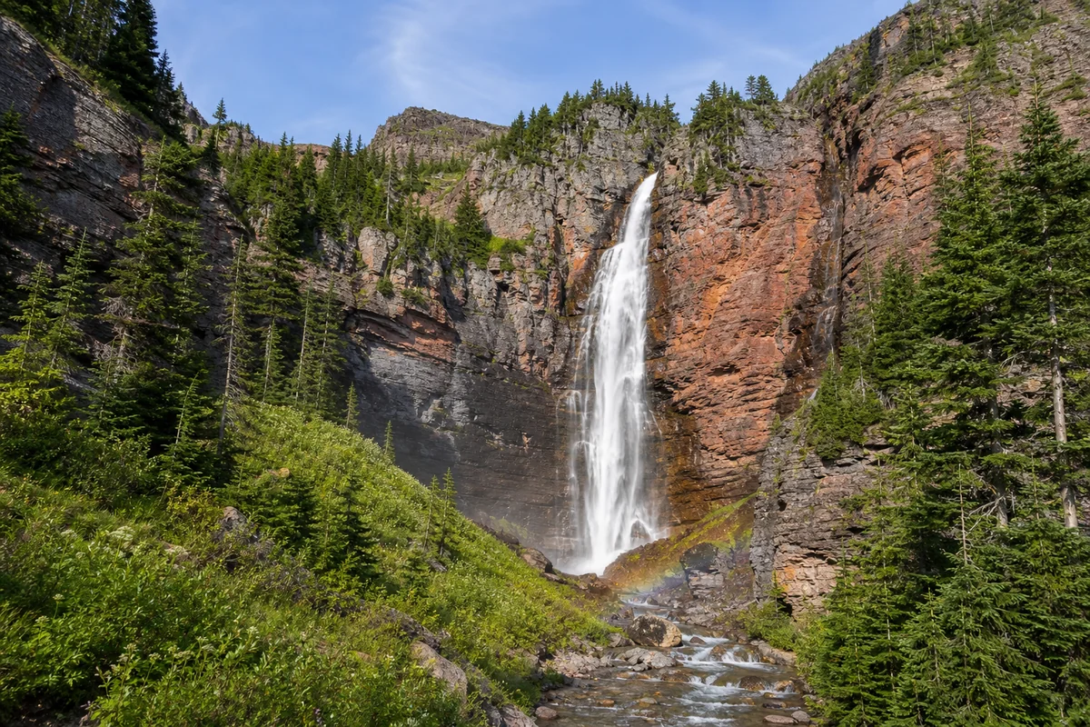
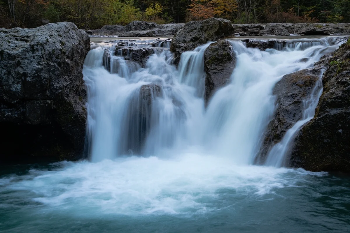
The falls themselves drop roughly 40 feet in a dramatic, multi-tiered cascade that tumbles over ancient metamorphic rock. What struck me most wasn’t the height—it was the setting.
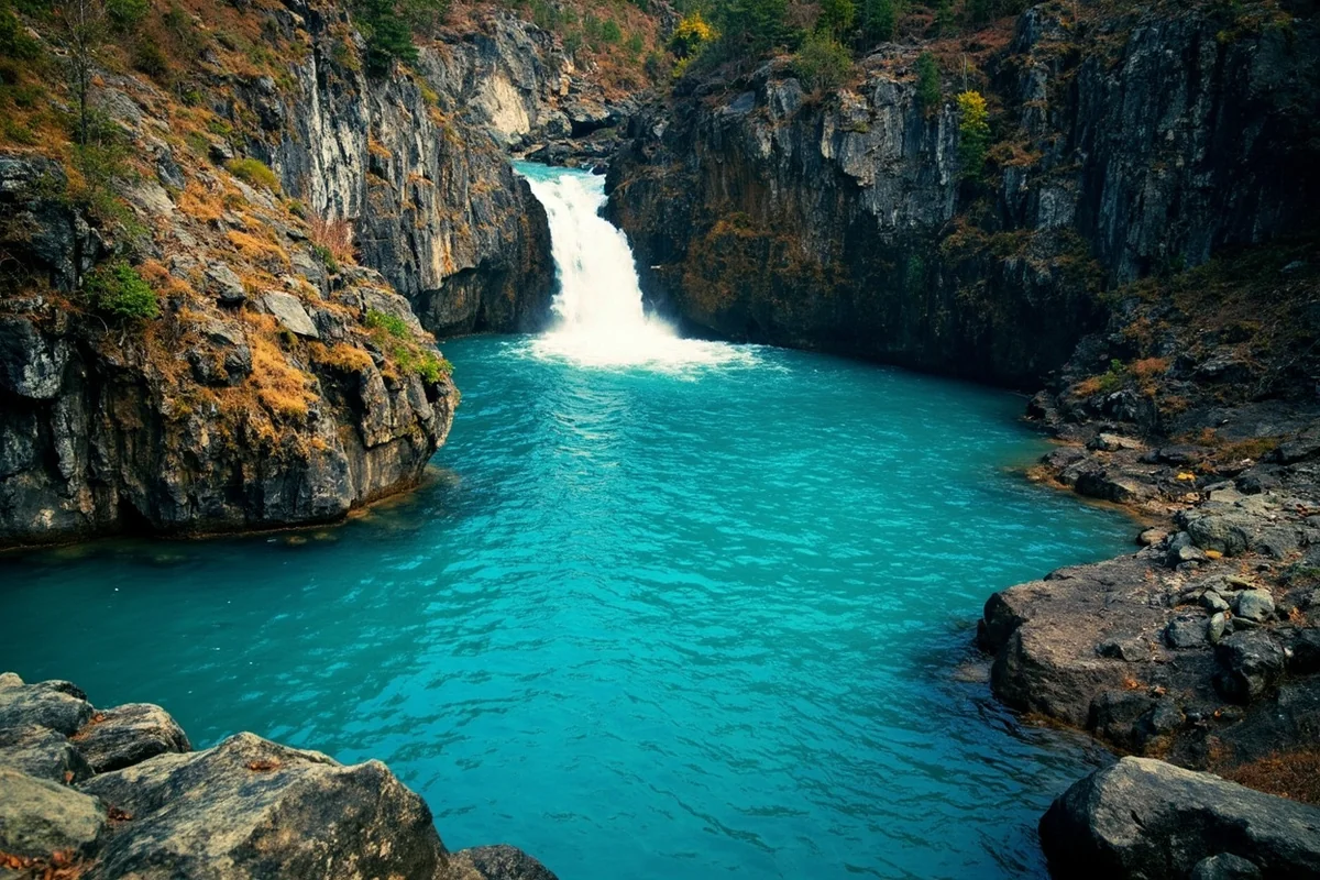
The pool at the base is deep enough that the water takes on that distinctive turquoise color you see in glacially-fed streams. The surrounding forest of Engelmann spruce and subalpine fir creates a natural amphitheater that somehow amplifies the sound of rushing water while simultaneously muffling everything else.
Getting to the Trailhead: Directions and Road Conditions
The journey to Pintler Falls starts from Anaconda, a historic smelting town about 25 miles northwest of Butte. I recommend topping off your gas tank in Anaconda—there’s nothing out at the trailhead, and you’ll use more fuel than you’d expect on the forest roads.
Step-by-Step Driving Directions
From Anaconda, head south on Montana Highway 1 for approximately 11 miles. You’ll pass Georgetown Lake on your right—if you’re making an early morning start like I did, the lake often has a layer of mist hovering over it that’s worth pulling over to photograph.
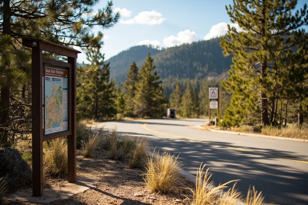
Turn right onto Forest Road 1299 (also marked as the East Fork Road). This turnoff is easy to miss if you’re not paying attention—look for the brown Forest Service sign indicating “East Fork Recreation Area.”
Follow FR 1299 for roughly 7 miles to the East Fork Reservoir and the trailhead parking area. The road is gravel but generally well-maintained from June through October. My Subaru Outback handled it without any issues, though I wouldn’t want to attempt it in a low-clearance sedan after heavy rain.
| Starting Point | Distance to Trailhead | Estimated Drive Time |
|---|---|---|
| Anaconda, MT | 18 miles | 35-45 minutes |
| Butte, MT | 43 miles | 1 hour 15 minutes |
| Missoula, MT | 95 miles | 2 hours 15 minutes |
| Helena, MT | 82 miles | 1 hour 45 minutes |
Trailhead Facilities and Parking
The East Fork Trailhead has a gravel parking area that can accommodate maybe 15-20 vehicles. During my visit on a Saturday in August, I arrived around 8:30 AM and found only four other cars there.
There’s a basic vault toilet at the trailhead—nothing fancy, but appreciated. No running water, so fill up your bottles before you leave town.
The trailhead sits at approximately 6,800 feet elevation, so even in summer, mornings can be chilly. I’d left my fleece in the car thinking I wouldn’t need it, and I regretted that decision for the first mile or so.
The Hike to Pintler Falls: What to Expect Mile by Mile
The trail to Pintler Falls follows the East Fork Trail (#29) through some of the most pristine wilderness in southwest Montana. Let me walk you through what I encountered on my hike so you know exactly what you’re getting into.
Mile 0-1: Entering the Wilderness
The trail starts with an easy, relatively flat section that follows alongside the East Fork of Rock Creek. Within the first half-mile, you’ll cross into the official Anaconda-Pintler Wilderness boundary—there’s a wooden sign marking the transition.
What I noticed immediately was the change in atmosphere. The forest here is dense and old, with some spruce trees that have clearly been growing for centuries. The trail is well-defined but not overly groomed—you’re on a wilderness trail now, and it feels like it.
The creek stays close to your left for this first section, and I spotted several brook trout holding in the deeper pools. If you’re a fly fisher (which I am, though I wasn’t prepared that day), this stretch looks absolutely productive.
Mile 1-2: Starting the Climb
Around the one-mile mark, the trail begins ascending more noticeably. The grade isn’t brutal—maybe 8-10% on average—but it’s sustained, and you’ll feel it in your legs if you’re not used to hiking at altitude.
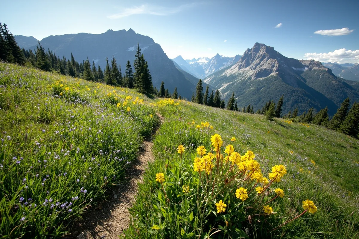
This section passes through a mix of subalpine meadows and forest. During my late August visit, the meadows were carpeted with late-season wildflowers—mostly purple asters and golden arnica. In July, I imagine the display would be even more impressive.
I encountered my first wildlife here: a cow moose and her calf browsing in a willow thicket about 100 yards off trail. I stopped, watched for a few minutes, and gave them plenty of space. Moose are common in this drainage, and while they’re generally not aggressive, a cow with a calf demands respect.
Mile 2-3: Into the Heart of the Wilderness
The middle section of the hike is where things get interesting. The trail climbs more steeply through a series of switchbacks, gaining most of its elevation in this stretch.
Here’s something I wish I’d known before: there are several creek crossings in this section, and depending on the time of year and recent precipitation, they can range from “easy rock hop” to “take off your boots and wade.”
During my August hike, the crossings were manageable but not completely dry. I was glad I’d worn my waterproof hiking boots rather than trail runners. If you’re visiting earlier in the summer—say, late June or early July—expect higher water and potentially more challenging crossings.
The forest transitions noticeably as you gain elevation. The spruce and fir give way to more open terrain with scattered whitebark pine, and you start getting glimpses of the Pintler peaks rising ahead.
Mile 3-4: The Final Push to the Falls
The last mile to Pintler Falls is both the most challenging and the most rewarding. The trail steepens considerably, and you’ll gain the final 400 feet or so of elevation in a relatively short distance.
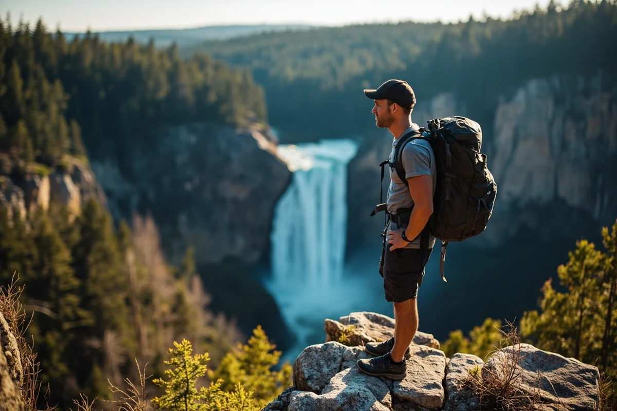
But here’s the payoff: as you approach the falls, the sound reaches you before the view does. That building anticipation—hearing the rush of water grow louder with each step—is part of what makes wilderness waterfalls so much more satisfying than roadside pullouts.
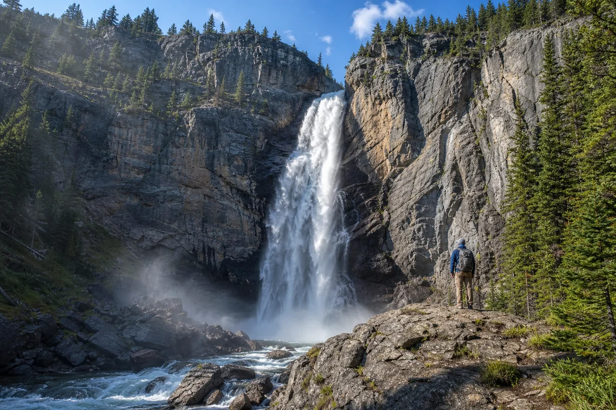
When I finally rounded the last bend and saw Pintler Falls for the first time, I immediately understood why people make this trek. The falls split into two main chutes before reuniting halfway down, creating a complex pattern of white water against dark rock.
I dropped my pack, found a comfortable spot on a large boulder near the base, and just sat there for probably 45 minutes. No other hikers. No drone noise. Just me, the waterfall, and a Clark’s nutcracker calling from somewhere in the pines.
Best Time to Visit Pintler Falls
Timing matters more than you might think when planning a trip to Pintler Falls. I’ve gathered insights from multiple visits and conversations with other hikers who know this area well.
Late June Through Mid-July: Peak Water Flow
If you want to see Pintler Falls at its most dramatic, aim for late June or early July. This is when snowmelt from the high peaks of the Anaconda Range is at its peak, and the falls run absolutely full.
The tradeoff? Trail conditions can be more challenging. Creek crossings will be higher and colder, and you may encounter snow patches on the upper sections of the trail. I’ve talked to hikers who’ve visited in late June and needed microspikes for one icy traverse.
Late July Through August: The Sweet Spot
This is when I made my visit, and I’d call it the ideal window for most people. The water flow is still impressive—not quite as thundering as early summer, but substantial. Trail conditions are generally excellent, with creek crossings at their most manageable.
Weather tends to be most stable during this window, though afternoon thunderstorms are always possible in Montana’s mountains. I always plan to start early and aim to be heading back down by early afternoon to avoid getting caught above treeline if storms roll in.
The wildflowers are past their peak by late August, but there’s still plenty of color, and the huckleberries along the trail are usually ripe. I picked a handful on my way out and ate them one by one—they were phenomenal.
September: Fall Colors and Solitude
Early September can be magical at Pintler Falls. The larches in the higher elevations start turning gold, the crowds (such as they are) thin out even further, and the water is still flowing nicely.
However, be prepared for colder temperatures and potentially shorter days. I haven’t personally done this hike in September, but a friend who visited last fall said he encountered frost on the trail and needed full winter layers in the morning.
After mid-September, you’re rolling the dice on weather. The first significant snowfall can come any time, and the access road may close.
Essential Gear and Preparation
I’ve learned through experience (some of it the hard way) what you actually need for a successful day hike to Pintler Falls. Here’s my honest gear list.
The Non-Negotiables
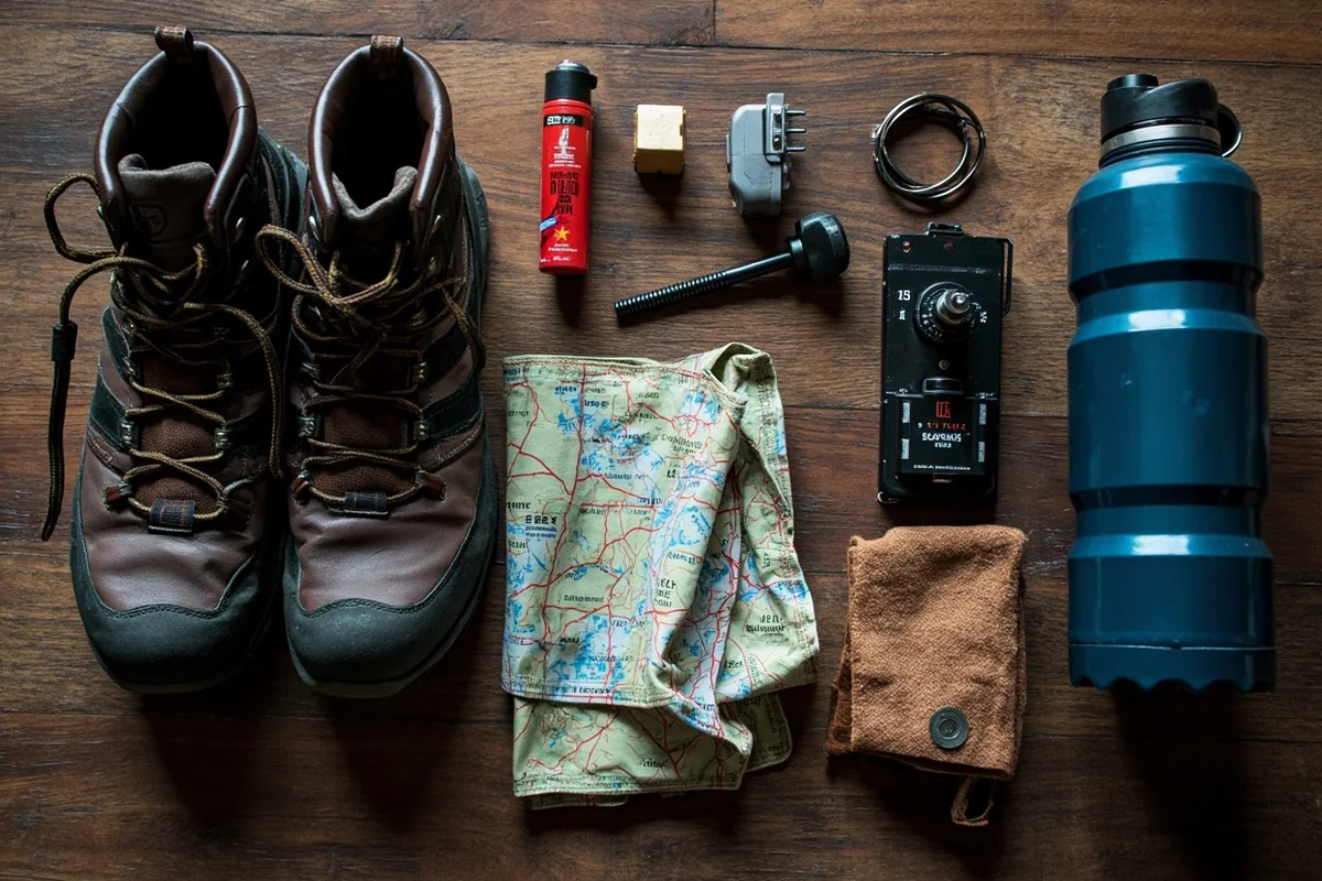
- Bear spray: This is grizzly country. Period. I carry a canister on my hip belt where I can reach it in seconds, not buried in my pack. During my hike, I didn’t see any bear sign, but I saw plenty of moose, which can also be dangerous. Know how to use your bear spray before you need it.
- Navigation: Download offline maps before you go. I use both Gaia GPS and AllTrails, and I always carry a paper topo map as backup. Cell service dies well before the trailhead.
- Water and filtration: I carry 2.5 liters and a Sawyer Mini filter. You’ll pass plenty of clean-looking streams, but giardia is real, so treat everything.
- Extra layers: Weather can change rapidly at 8,000+ feet. I bring a rain shell, a fleece, and a lightweight puffy even in August.
- Proper footwear: This isn’t a trail for sandals or casual sneakers. I wore waterproof hiking boots and was glad for the ankle support and dry feet during creek crossings.
Nice to Have
- Trekking poles: Not essential, but they really help with the steeper sections and stream crossings. My knees thanked me on the descent.
- Camera with wide-angle lens: The setting at Pintler Falls is dramatic, and a smartphone might not capture the full scope.
- Binoculars: Wildlife viewing opportunities abound. I wished I’d had them to get a better look at what I think was a mountain goat on a distant ridge.
- Snacks and lunch: You’ll be out for 4-6 hours depending on your pace and how long you linger at the falls. I brought way more food than I needed, but that’s never really a problem.
Wildlife You Might Encounter
The Anaconda-Pintler Wilderness is home to some of Montana’s most impressive wildlife, and the East Fork drainage is prime habitat. Here’s what I saw and what you should watch for.
Large Mammals
Moose are probably the most common large animal you’ll see in this area. The riparian habitat along the East Fork is perfect for them, and I’ve seen them on both visits I’ve made to this general area. Give them at least 100 yards of space—more if they have calves.
Black bears are present throughout the drainage. I didn’t see any during my Pintler Falls hike, but I’ve encountered them on other trails in the Anaconda Range. Make noise on the trail, especially when approaching blind corners or dense brush.
Grizzly bears have been expanding their range in Montana and have been documented in the Pintler area. While sightings are less common than in places like Glacier National Park (where you might visit Grotto Falls or Ptarmigan Falls), you should always be bear aware here.
Mountain goats frequent the high peaks above the falls. Bring binoculars and scan the rocky slopes—their white coats stand out against the gray granite.
Birds and Smaller Wildlife
I’m a casual birder, and this trail didn’t disappoint. Clark’s nutcrackers and Steller’s jays were everywhere, their harsh calls echoing through the forest. I also spotted several American dippers bobbing on rocks in the stream—always a treat to watch them dive underwater for insects.
Golden-mantled ground squirrels were abundant near the trailhead, and I saw a short-tailed weasel dart across the trail around mile two. The weasel was so fast I almost thought I’d imagined it.
Photography Tips for Pintler Falls
If you’re planning to photograph Pintler Falls, here’s what I learned from my experience.
Best Light and Timing
The falls face roughly northeast, which means direct morning light can be harsh and create challenging contrast. I arrived around midday when the falls were in soft shadow, and I actually preferred this lighting for capturing the water’s movement.
That said, golden hour (the last hour before sunset) would probably be spectacular here if you’re willing to hike out in the dark—which I wasn’t, given the bear situation and unfamiliar terrain.
Technical Suggestions
Bring a tripod if you want silky water shots. I used a 1/4-second exposure with my camera on a small Joby GorillaPod, and the results were much better than my handheld attempts.
The mist from the falls can coat your lens quickly when you’re close. I wiped my filter probably a dozen times while shooting from the base. A microfiber cloth is essential.
For composition, I found the best shots came from slightly off-center positions. Walking 50 feet to the left of the main viewing area gave me a great angle that included both tiers of the falls and some foreground rocks.
Combining Pintler Falls with Other Adventures
If you’re making the trip to southwest Montana for Pintler Falls, there’s plenty more to explore in the region.
Nearby Waterfalls
While you’re in the Anaconda area, Skalkaho Falls is about an hour’s drive to the northwest along the scenic Skalkaho Pass road. It’s a roadside waterfall with minimal hiking required—a nice contrast to the effort Pintler Falls demands.
If you’re heading north toward the Seeley-Swan Valley, consider Holland Lake Falls or Morrell Falls. Both offer moderate hikes to impressive cascades and are well worth the detour.
For those willing to venture into Glacier National Park, falls like Running Eagle Falls, Saint Mary Falls, and Redrock Falls are among the most photogenic in the state. McDonald Falls offers easy access right off Going-to-the-Sun Road.
Other Activities in the Area
Georgetown Lake, which you’ll pass on the drive in, is a popular destination for fishing, boating, and camping. I’ve fished here for rainbow and brook trout with decent success—it’s a beautiful mountain lake with great mountain views.
The town of Anaconda itself has an interesting history related to copper smelting. The Anaconda Stack, a massive brick smokestack that’s the tallest surviving masonry structure in the world, is visible from miles away and worth a quick stop.
For more ambitious hikers, the Anaconda-Pintler Wilderness offers extensive backpacking opportunities. The East Fork Trail continues past Pintler Falls toward Pintler Pass and eventually connects with trails leading to the Continental Divide.
Practical Information for Planning Your Trip
Here’s the nitty-gritty information you need to make this trip happen.
Permits and Regulations
No permit is required for day hiking in the Anaconda-Pintler Wilderness. However, standard wilderness regulations apply:
- No motorized or mechanized vehicles (including mountain bikes)
- No drones
- Group size limited to 15 people and 25 stock animals
- Practice Leave No Trace principles—pack out everything you pack in
- Campfires are permitted but discouraged due to fire danger; use established fire rings if you must have one
Nearby Services
Anaconda has everything you need: gas, groceries, restaurants, and basic lodging. I stayed at a no-frills motel the night before my hike and got an early start to avoid the heat of the day.
Butte offers more options if you want a larger town with more dining and hotel choices. It’s about 45 minutes from the trailhead.
There’s no cell service at the trailhead or on the trail. Let someone know your hiking plan before you go, and stick to it.
Emergency Information
The nearest hospital with emergency services is St. James Healthcare in Butte, approximately 45 miles from the trailhead. In the event of an emergency in the wilderness, you’ll need to self-rescue to the trailhead or send someone for help—there’s no way to call out once you’re on the trail.
The Beaverhead-Deerlodge National Forest office in Dillon or the Pintler Ranger District can provide updated trail conditions: (406) 859-3211.
Honest Assessment: Is Pintler Falls Worth It?
I’ll give you my straight take: Pintler Falls isn’t for everyone.
If you’re looking for an easy, family-friendly waterfall that you can see from your car or reach in a 15-minute stroll, this isn’t it. Check out Palisade Falls near Bozeman or Memorial Falls near Great Falls instead.
But if you want a genuine wilderness experience—one where you earn the view through effort and solitude—Pintler Falls delivers. The 8-mile round trip with significant elevation gain filters out casual visitors and rewards you with a pristine destination that feels truly remote.
During my visit, I spent over an hour at the falls and didn’t see another soul. I ate my lunch on a sun-warmed boulder, watched the water thunder down, and felt that particular kind of peace you only find in wild places.
When I finally shouldered my pack and started the hike out, I felt the satisfying tiredness of a day well spent. My legs were sore the next morning, but my spirit was refreshed in a way that easier destinations simply can’t match.
That’s the trade-off with places like Pintler Falls. You pay for the beauty with sweat and effort—and in my book, that makes it more valuable, not less.
Planning Checklist
Before you go, make sure you’ve handled these essentials:
- Downloaded offline maps (cell service ends well before the trailhead)
- Checked recent trail conditions with the Ranger District
- Filled your gas tank in Anaconda or Butte
- Packed bear spray and know how to use it
- Notified someone of your hiking plan and expected return time
- Checked weather forecast and packed appropriate layers
- Started early enough to avoid afternoon thunderstorms
- Brought enough water and a filtration system
If you’re building a Montana waterfall bucket list, Pintler Falls deserves a spot alongside better-known destinations like Hidden Falls, Pioneer Falls, and Rock Creek Falls. It may not have the name recognition, but for wilderness lovers, that’s exactly the point.
The best waterfall isn’t always the tallest or the most accessible—sometimes it’s the one that asks something of you before revealing its beauty. Pintler Falls is that kind of place, and I’m already planning my return trip for next summer.
Frequently Asked Questions
Where is Pintler Falls located in Montana and how do I get there?
Pintler Falls is located in the Anaconda-Pintler Wilderness area of southwestern Montana, accessible via the East Fork Trail near Georgetown Lake. From Anaconda, you’ll drive about 15 miles west on Highway 1 to the trailhead parking area. The hike to the falls is approximately 2 miles one way along a well-marked forest trail.
How difficult is the hike to Pintler Falls Montana?
The Pintler Falls hike is considered easy to moderate, with roughly 400 feet of elevation gain over the 2-mile trail. I found the path mostly well-maintained with some rocky sections near the falls, making it suitable for families with older children and casual hikers. Plan for about 1.5 to 2 hours round trip depending on your pace and time spent at the waterfall.
What is the best time of year to visit Pintler Falls?
The best time to visit Pintler Falls is late May through early July when snowmelt creates the most powerful water flow. I recommend visiting on weekday mornings to avoid crowds and get the best lighting for photos. The trail typically remains accessible through October, though water volume decreases significantly by late summer.
Is there a fee to visit Pintler Falls and do I need a permit?
There is no entrance fee or permit required to hike to Pintler Falls since it’s located within the Anaconda-Pintler Wilderness on national forest land. However, you’ll want to bring cash for any day-use parking areas, which occasionally charge $5-10 during peak season. Always check with the Beaverhead-Deerlodge National Forest office for current conditions before your trip.
What should I bring for the Pintler Falls hike in Montana?
Pack sturdy hiking boots with ankle support since the trail can be muddy and rocky, especially near the falls. I always bring layers because Montana mountain weather changes quickly, plus bear spray, plenty of water, and snacks. Don’t forget your camera and consider trekking poles for the steeper sections if you have sensitive knees.
Can you swim at Pintler Falls Montana?
Swimming at Pintler Falls is not recommended due to cold water temperatures, slippery rocks, and strong currents during peak flow. The pool at the base is shallow in most areas and the water remains frigid even in summer months, typically staying around 40-50°F. You can safely wade near the edges during low water periods in late summer, but always exercise extreme caution.
Are dogs allowed on the Pintler Falls trail?
Yes, dogs are permitted on the trail to Pintler Falls but must be kept under control at all times in the wilderness area. I recommend keeping your dog leashed due to wildlife encounters including moose, bears, and mountain lions in the Anaconda-Pintler Wilderness. Bring extra water for your pup and pack out all waste to help preserve this beautiful Montana hiking destination.
Sources